Nevada Cities Map
Navigate Nevada Map, Nevada states map, satellite images of the Nevada, Nevada largest cities maps, political map of Nevada, driving directions and traffic maps.
Nevada Map
MAP OF NEVADA
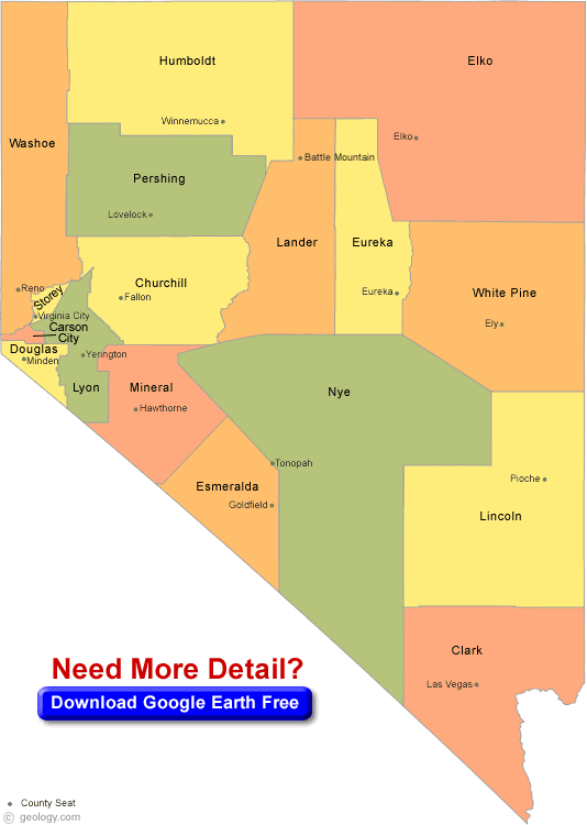
NEVADA COUNTY MAP
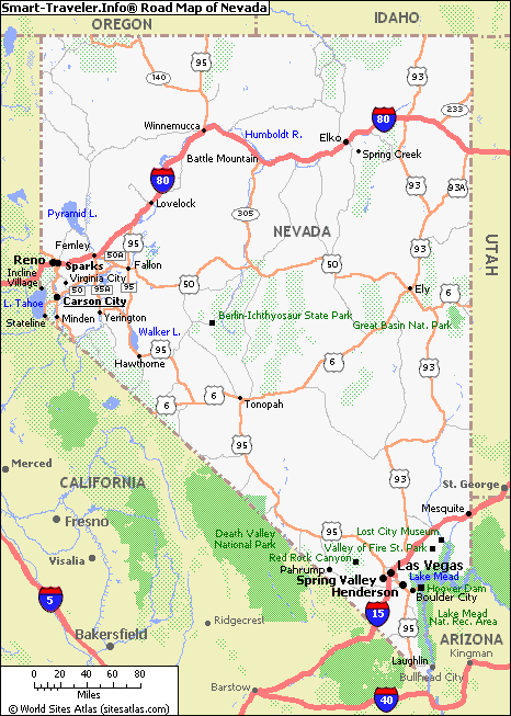
NEVADA CITY MAP
Las Vegas Vibes: Unleashing the Top 10 Experiences in Sin City
Please subscribe on "World Guide" channnel on Youtube at youtube.com/c/WorldGuide
All Nevada Cities Maps by Population
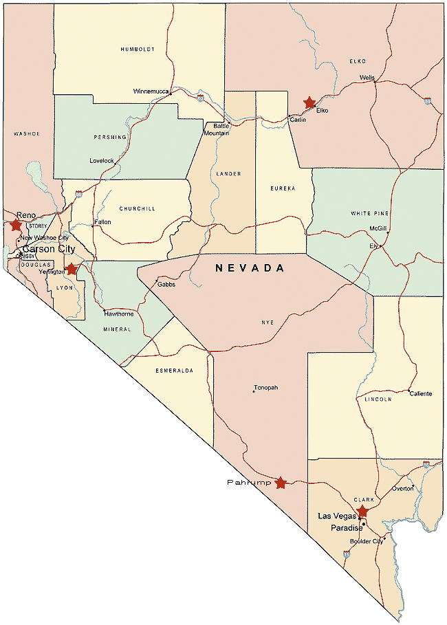
Largest Nevada cities map
United StatesLargest Cities Map by Population
New York City Map Los Angeles Map Chicago Map Brooklyn Map Houston Map Philadelphia Map Manhattan Map Phoenix Map San Antonio Map San Diego Map Dallas Map San Jose Map Jacksonville Map Indianapolis Map San Francisco Map Austin Map Columbus Map Fort Worth Map Charlotte Map Detroit Map El Paso Map Memphis Map Baltimore Map Boston Map Seattle Map Nashville Map Denver Map Louisville Map Milwaukee Map Portland Map Las Vegas Map Oklahoma City Map Albuquerque Map Tucson Map Fresno Map Sacramento Map Long Beach Map Kansas City Map Mesa Map Virginia Beach Map Atlanta Map Colorado Springs Map Omaha Map Raleigh Map Miami Map Cleveland Map Tulsa Map Oakland Map Honolulu Map Minneapolis Map Wichita Map Arlington Map Bakersfield Map New Orleans Map Anaheim Map Tampa Map Aurora Map Santa Ana Map St. Louis Map Pittsburgh Map Corpus Christi Map Riverside Map Cincinnati Map Lexington Fayette Map Anchorage Map Stockton Map Toledo Map St. Paul Map Newark Map Greensboro Map Buffalo Map Plano Map Lincoln Map Henderson Map Fort Wayne Map Jersey City Map St. Petersburg Map Chualar Map Norfolk Map Orlando Map Chandler Map Laredo Map Madison Map Winston Salem Map Lubbock Map Baton Rouge Map Durham Map Garland Map Glendale Map Reno Map Hialeah Map Paradise Map Chesapeake Map Scottsdale Map North Las Vegas Map Irving Map Fremont Map Irvine Map Birmingham Map Rochester MapCopyright Turkey Travel Guide - 2005 - 2026. All rights reserved. Privacy Policy | Disclaimer