Nevada Map
Navigate Nevada map, Nevada state map, satellite images of the Nevada, Nevada largest cities maps, political map of Nevada, driving directions and traffic maps.
For all Nevada Cities Map
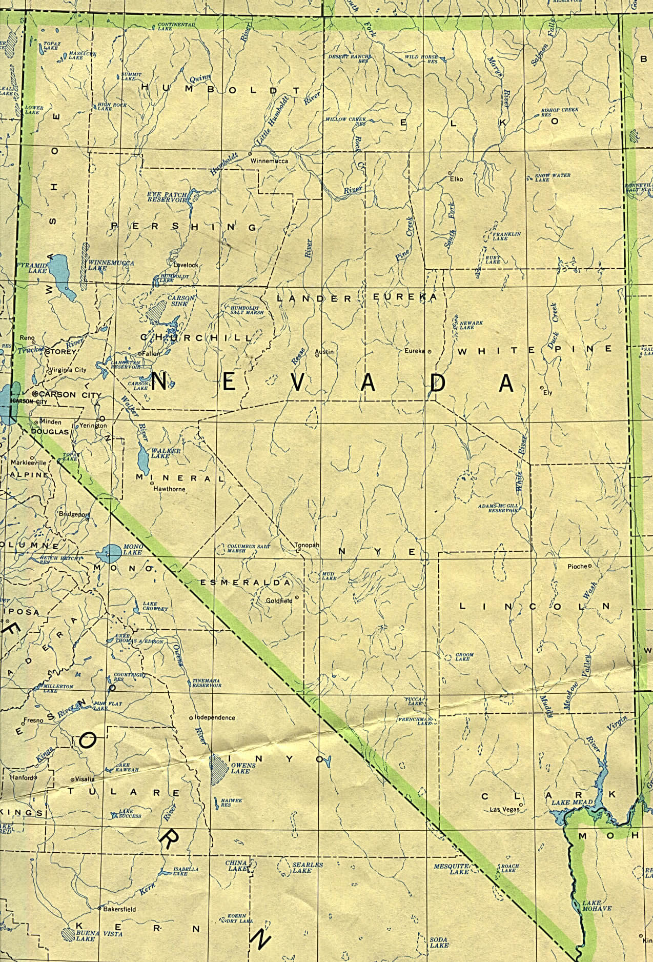
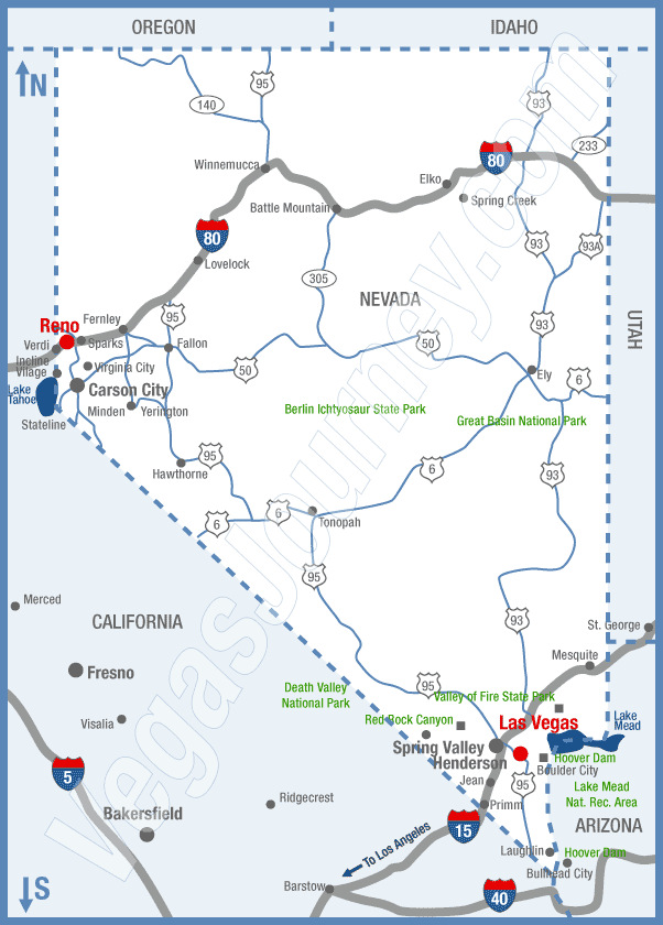
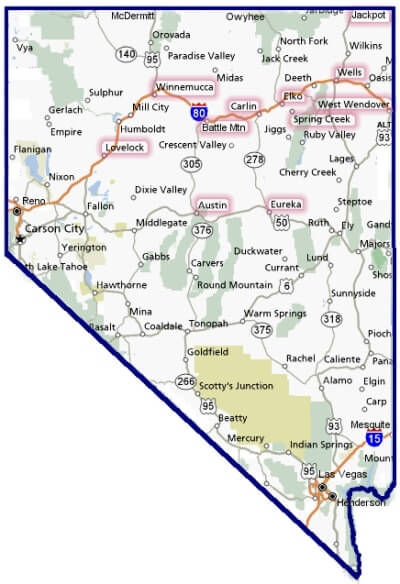
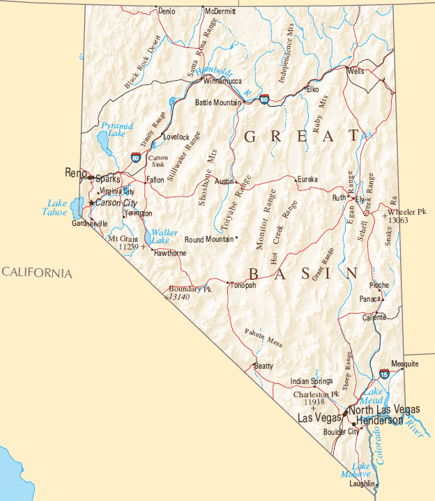
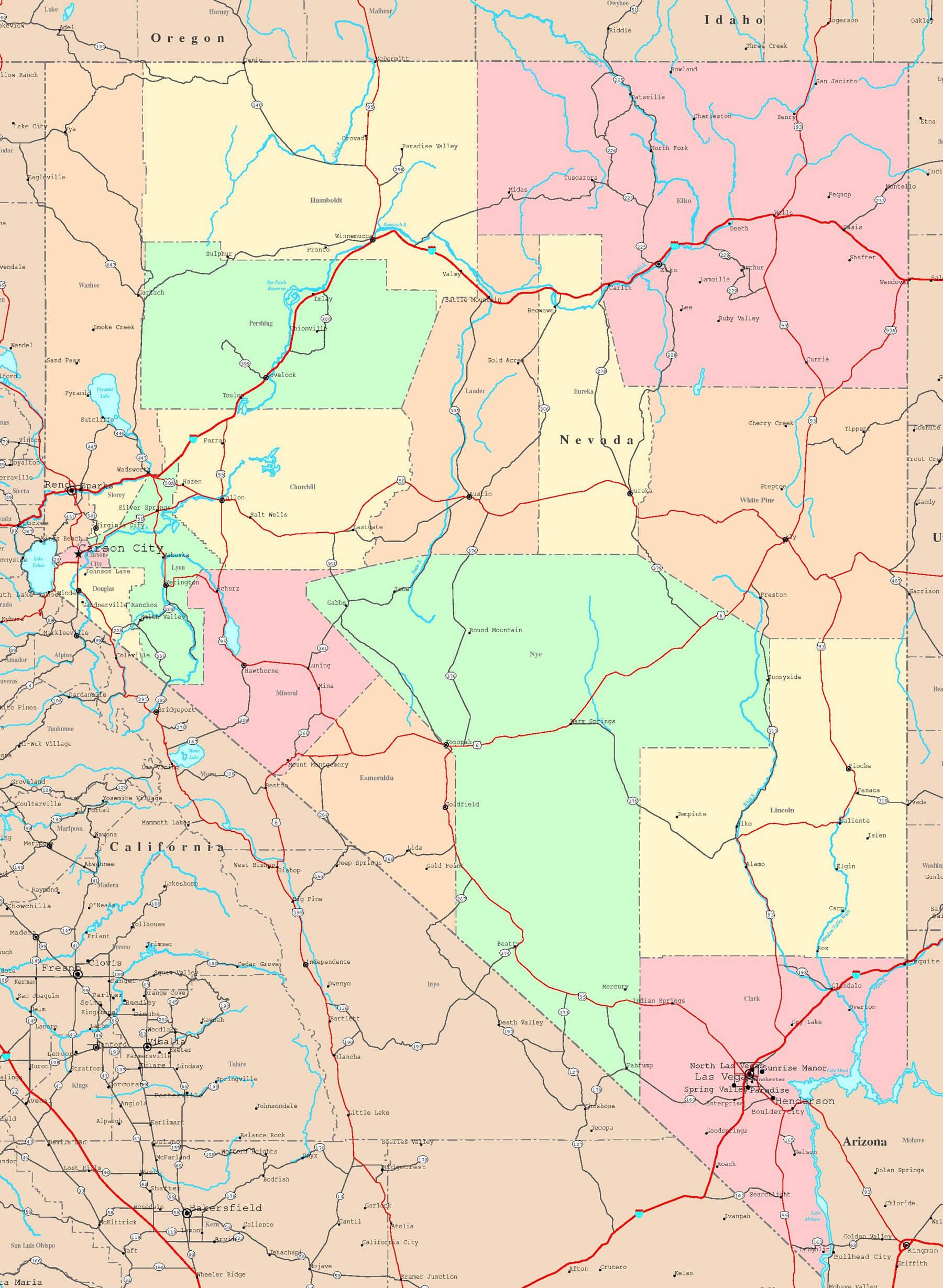
MAP OF NEVADA

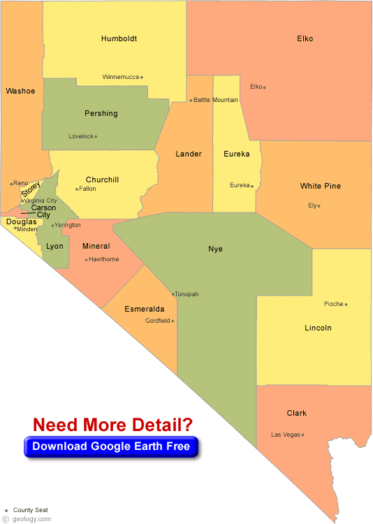
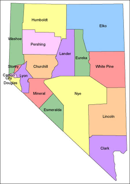
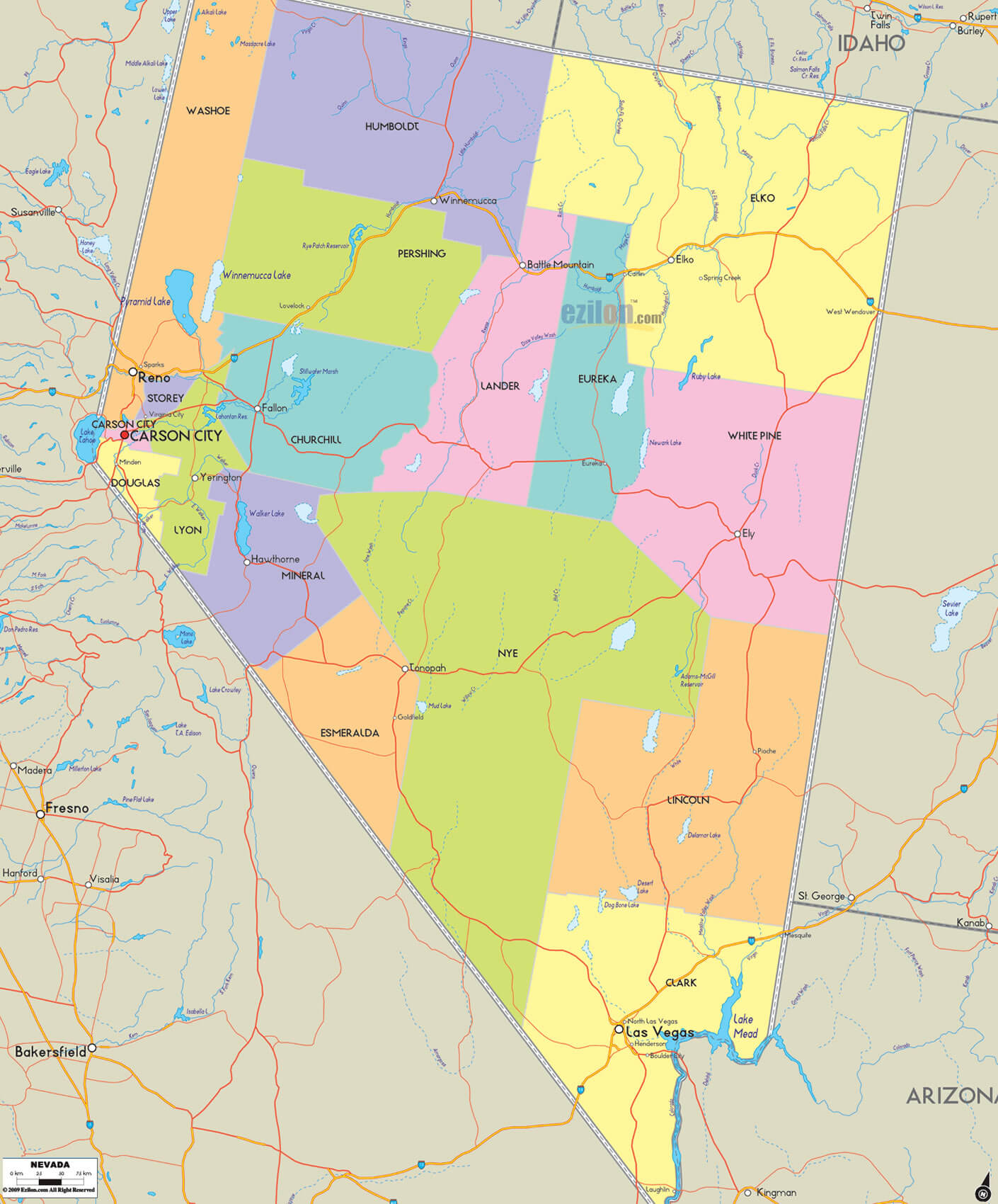
NEVADA COUNTY MAP
Brief information about Nevada, US
Nevada is a state located in the western region of the United States. It covers an area of approximately 110,577 square miles (286,380 square kilometers) and has an estimated population of around 3.1 million people as of 2020. The largest city in Nevada is Las Vegas, which is known for its world-famous casinos, hotels, and entertainment. The capital city is Carson City.Area and Population:
- Nevada covers an area of approximately 110,577 square miles (286,380 square kilometers).
- As of 2020, the estimated population of Nevada is around 3.1 million people.
- The state has a population density of about 28 people per square mile (11 per square kilometer).
Demographics:
- The racial makeup of Nevada is diverse, with 49% of the population identifying as White alone, 29% identifying as Hispanic or Latino, 10% as Black or African American, 8% as Asian, and 4% as two or more races.
- About 28% of the population speaks a language other than English at home.
- The largest ancestry groups in Nevada are German, Irish, English, Mexican, and Italian.
History:
- Nevada was admitted to the United States as the 36th state on October 31, 1864.
- It became a center for silver mining in the late 19th century, leading to a population boom and the establishment of several major cities.
- Las Vegas, which is now the largest city in the state, began as a small railroad town in the early 1900s and grew into a major tourist destination in the mid-20th century.
Economy:
- Nevada's economy is largely driven by tourism, with the state attracting millions of visitors each year to its casinos, hotels, and entertainment industry.
- Other major industries in Nevada include mining, primarily of gold and silver, and aerospace and defense manufacturing.
- The state has a relatively low unemployment rate of around 4.8% as of 2021.
- The median household income in Nevada is approximately $63,276, which is slightly lower than the national median.
A Collection of Nevada Maps and Nevada Satellite Images
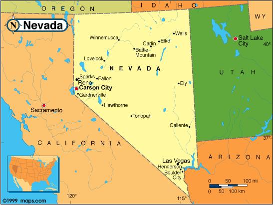
Map Of Nevada
Map Of Nevada
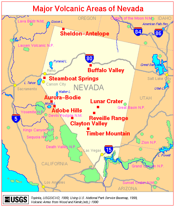
Map Nevada Volcanics
Nevada County Map
Nevada Map
Nevada City Map
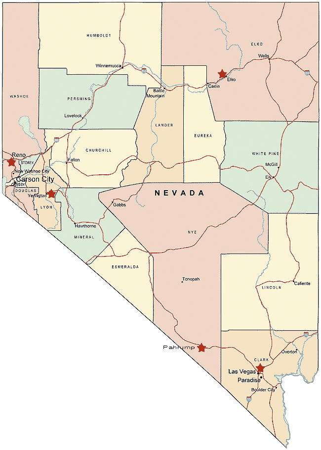
Nevada County Map

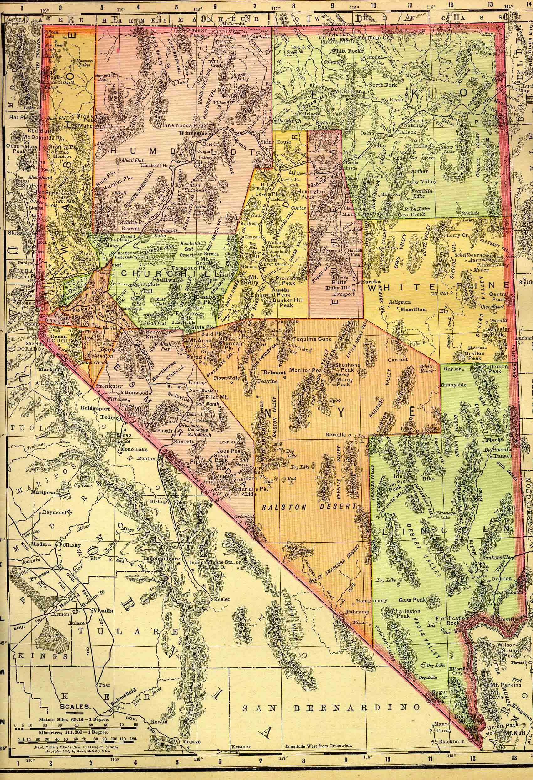
Nevada Historical Map 1895
Nevada Land Map
Nevada Map
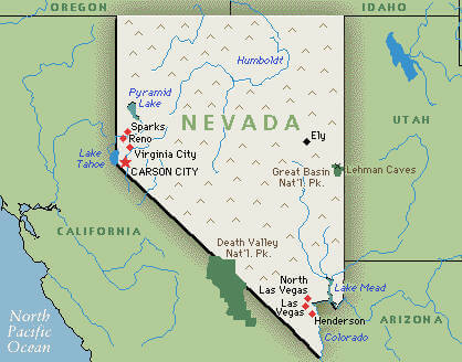
Nevada Map Great Basin

Nevada Map Historical
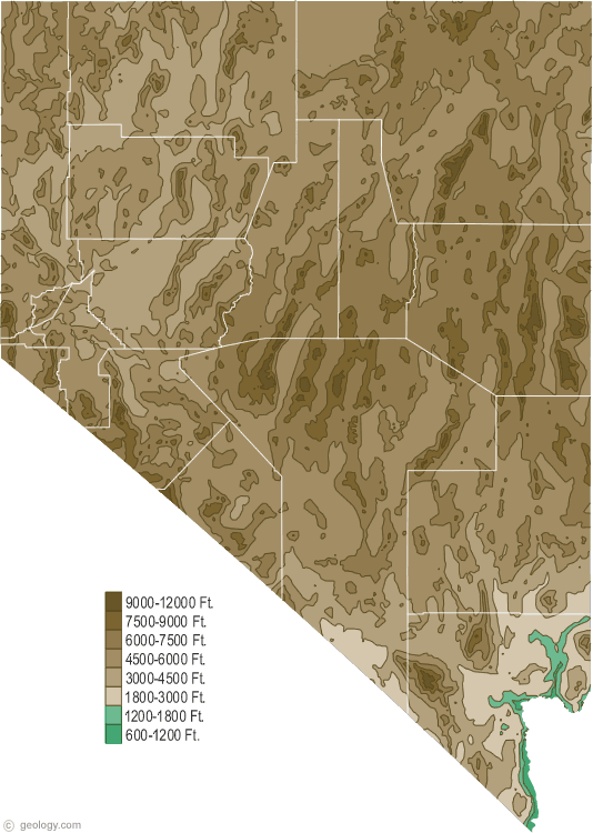
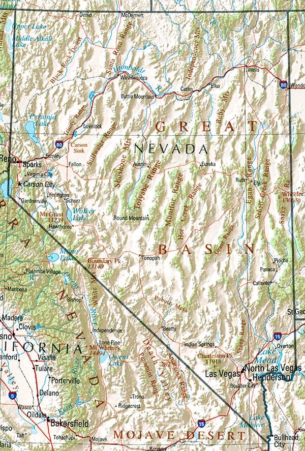
Nevada Physical Map
Nevada Political Map

Nevada Printable Map
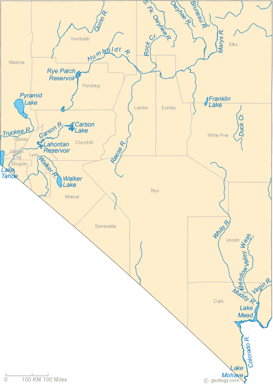
Nevada Rivers Map
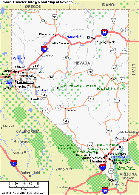
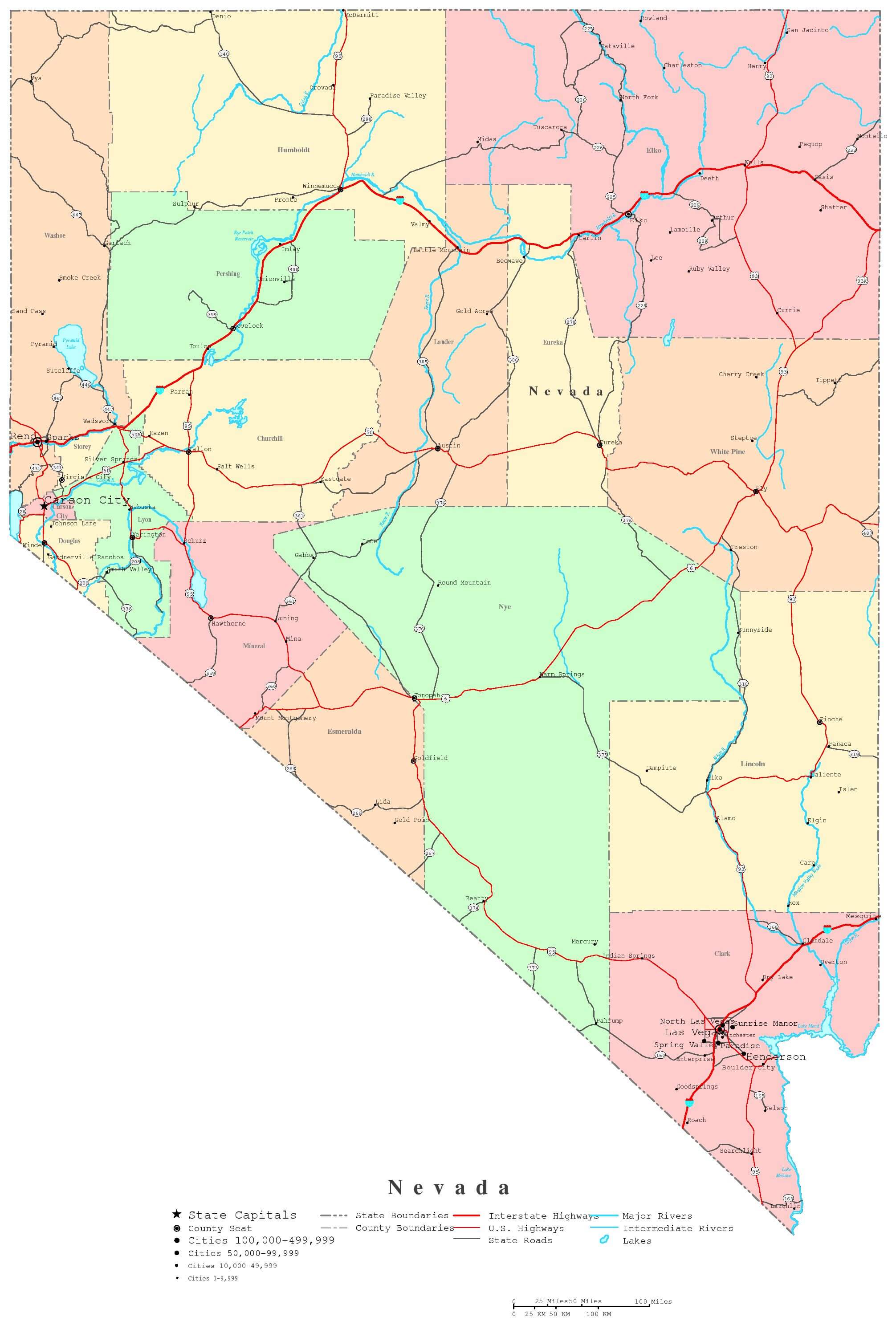
Nevada Road Map
Nevada State Map

Nevada State Map California
A collection of Nevada Maps


Las Vegas Vibes: Unleashing the Top 10 Experiences in Sin City
Please subscribe on "World Guide" channnel on Youtube at youtube.com/c/WorldGuide
Largest Cities Map of Nevada and Population
Las Vegas Map - 583,756 Henderson Map - 257,729 Reno Map - 225,221 Paradise Map - 223,167 North Las Vegas Map - 216,961 Sunrise Manor Map - 189,372 Spring Valley Map - 178,395 Enterprise Map - 108,481 Sparks Map - 90,264 Carson City Map - 55,274 Whitney Map - 38,585 Pahrump Map - 36,441 Winchester Map - 27,978 Summerlin South Map - 24,085 Fernley Map - 19,368Copyright Turkey Travel Guide - 2005 - 2026. All rights reserved. Privacy Policy | Disclaimer