Berlin Map
Navigate Berlin Map, Berlin city map, satellite images of Berlin, Berlin towns map, political map of Berlin, driving directions and traffic maps.
For more >> Germany Maps
For more info >> Germany
Berlin Map - Political, Physical, Touristic City Maps and Satellite Images
MAP OF BERLIN
A Collection of Berlin and Satellite Images
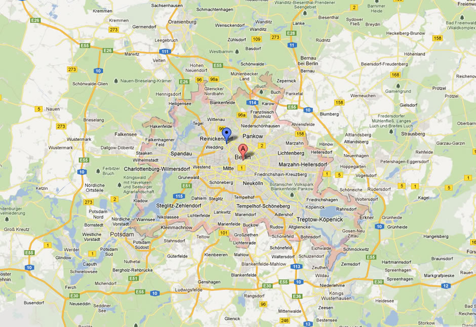
Map Of Berlin
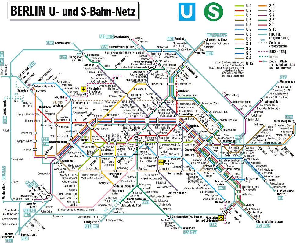
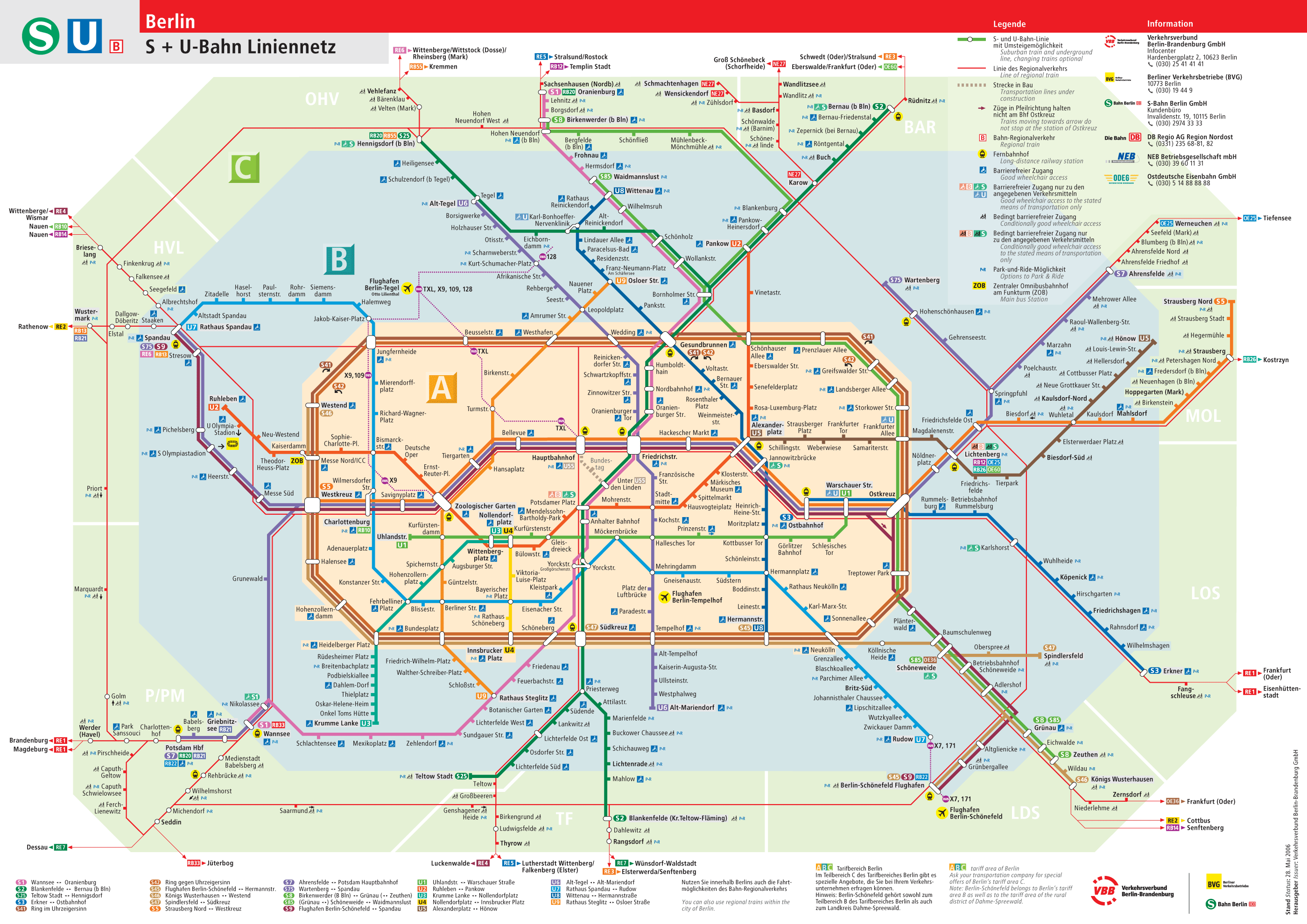
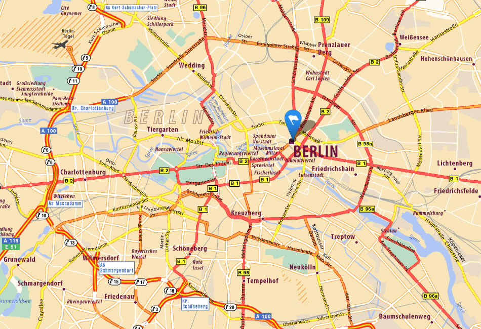
Berlin Bahn Map
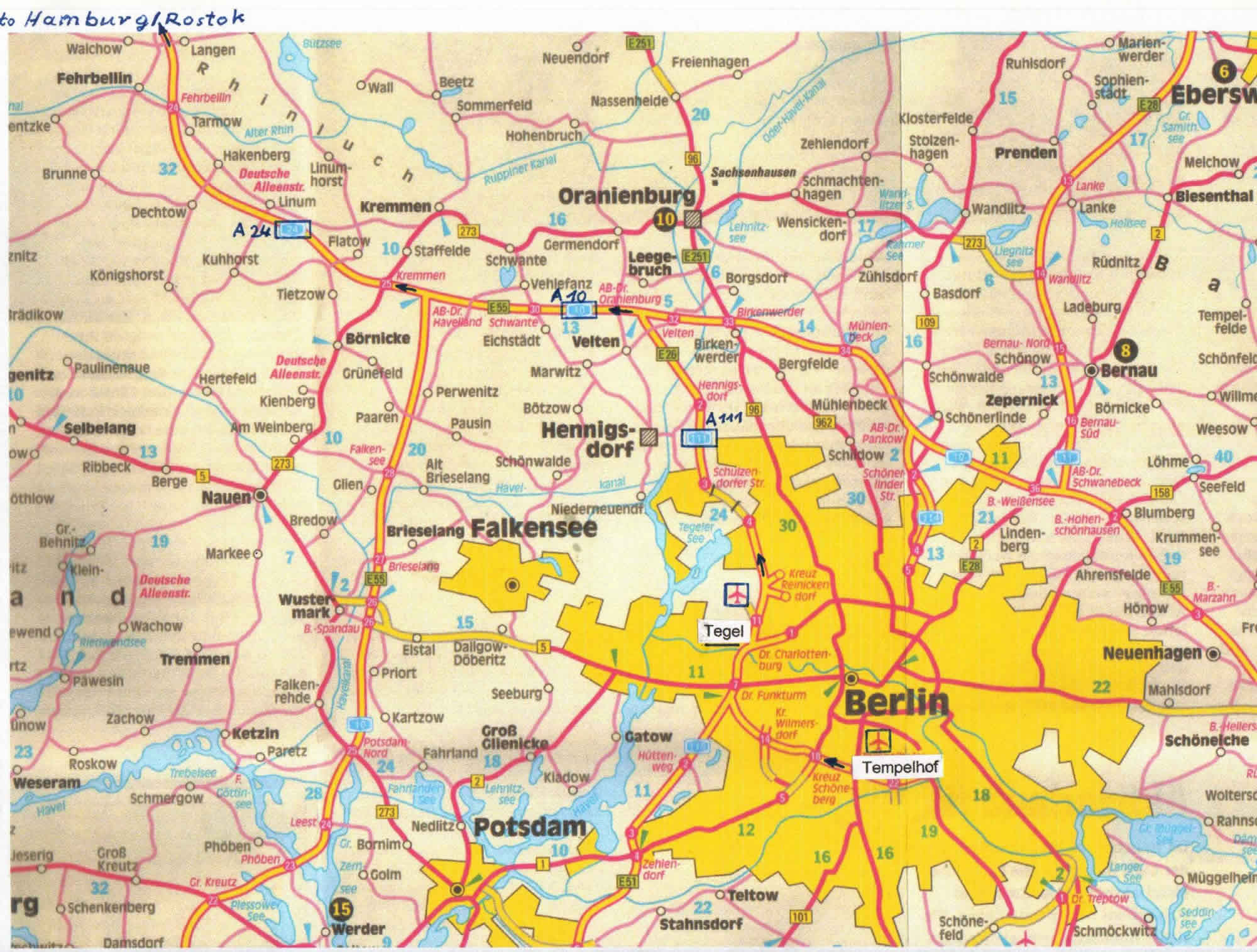
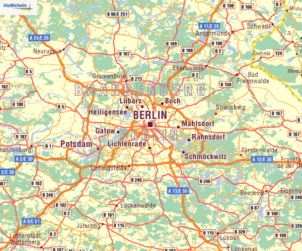
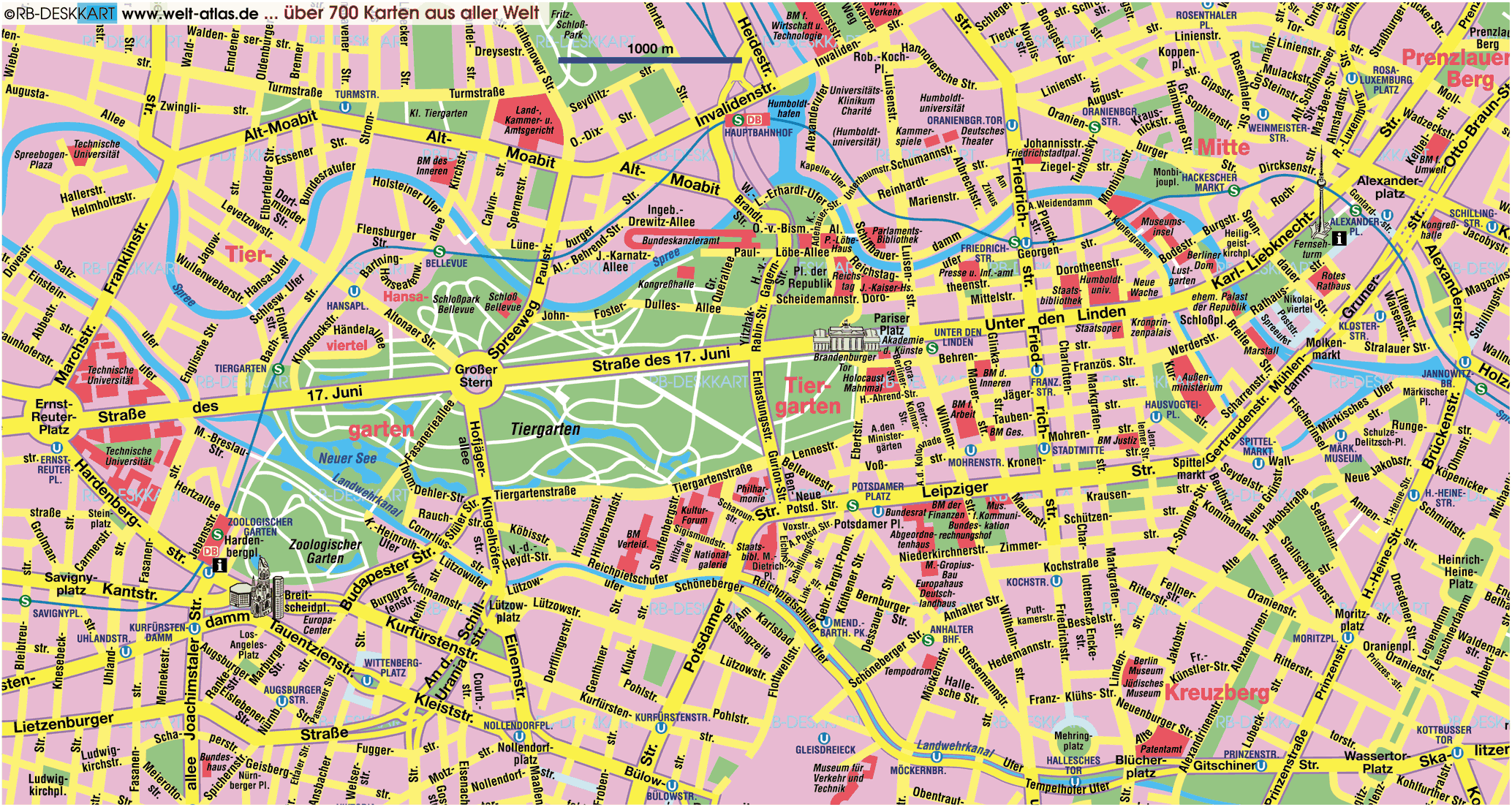
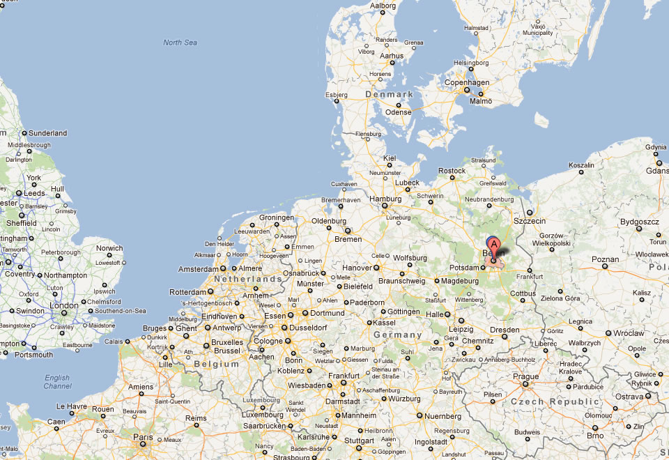
Berlin Brandenburg Map
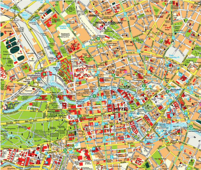
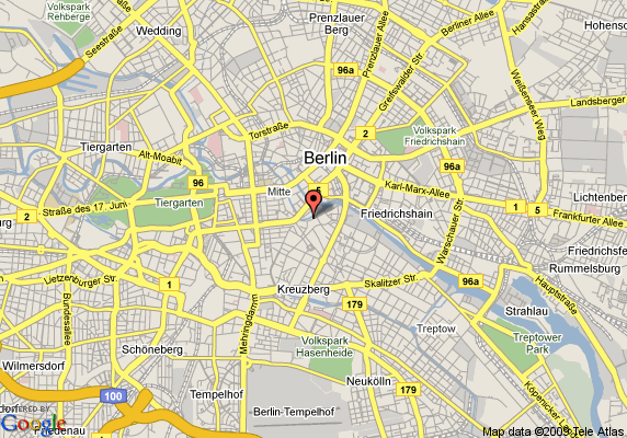
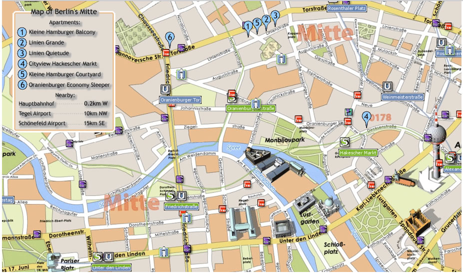
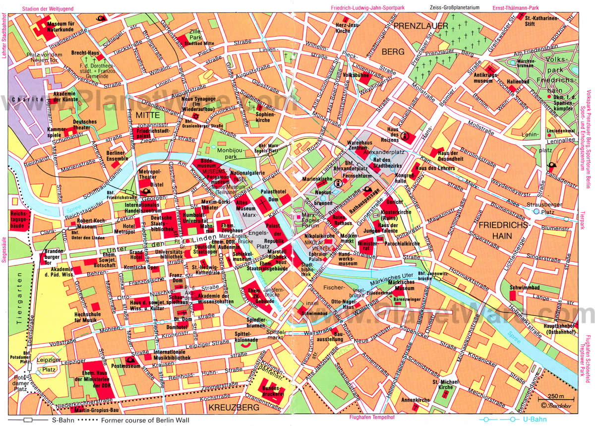
Berlin City Center Map
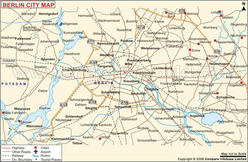
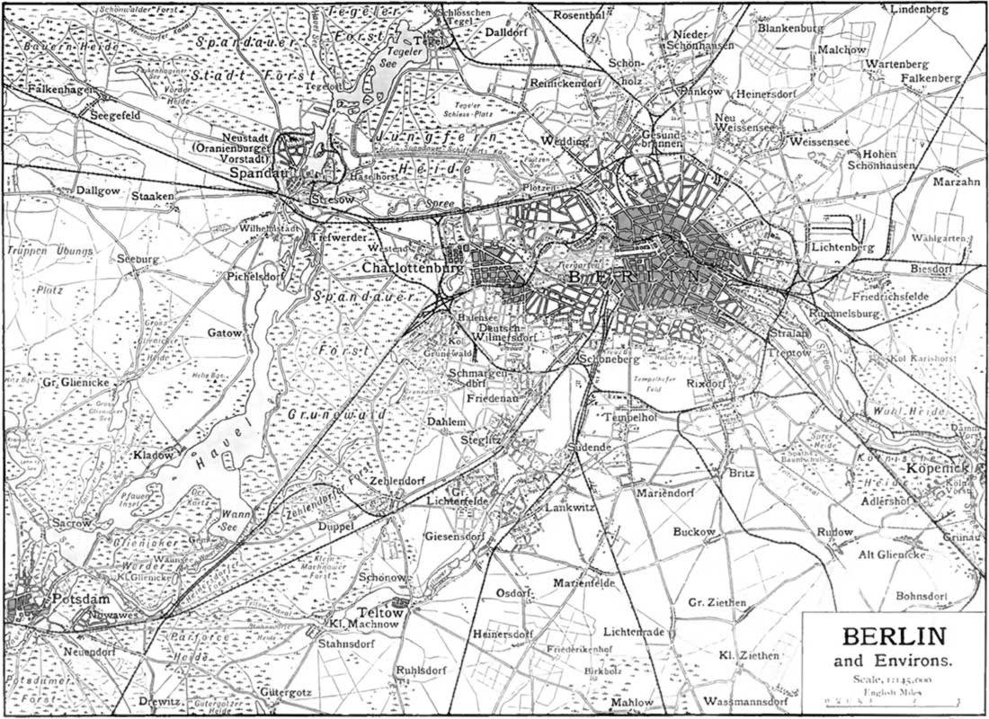
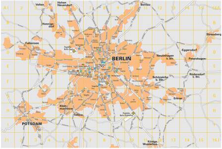
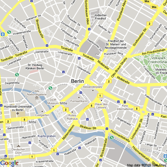
Berlin City Map
Berlin Map
Berlin Province Map
Berlin Tourist Map
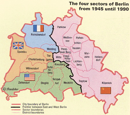
Berlin Wall Map
Berlin City Map
Berlin Map
Berlin City Map
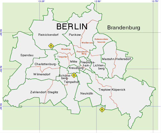
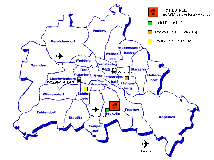
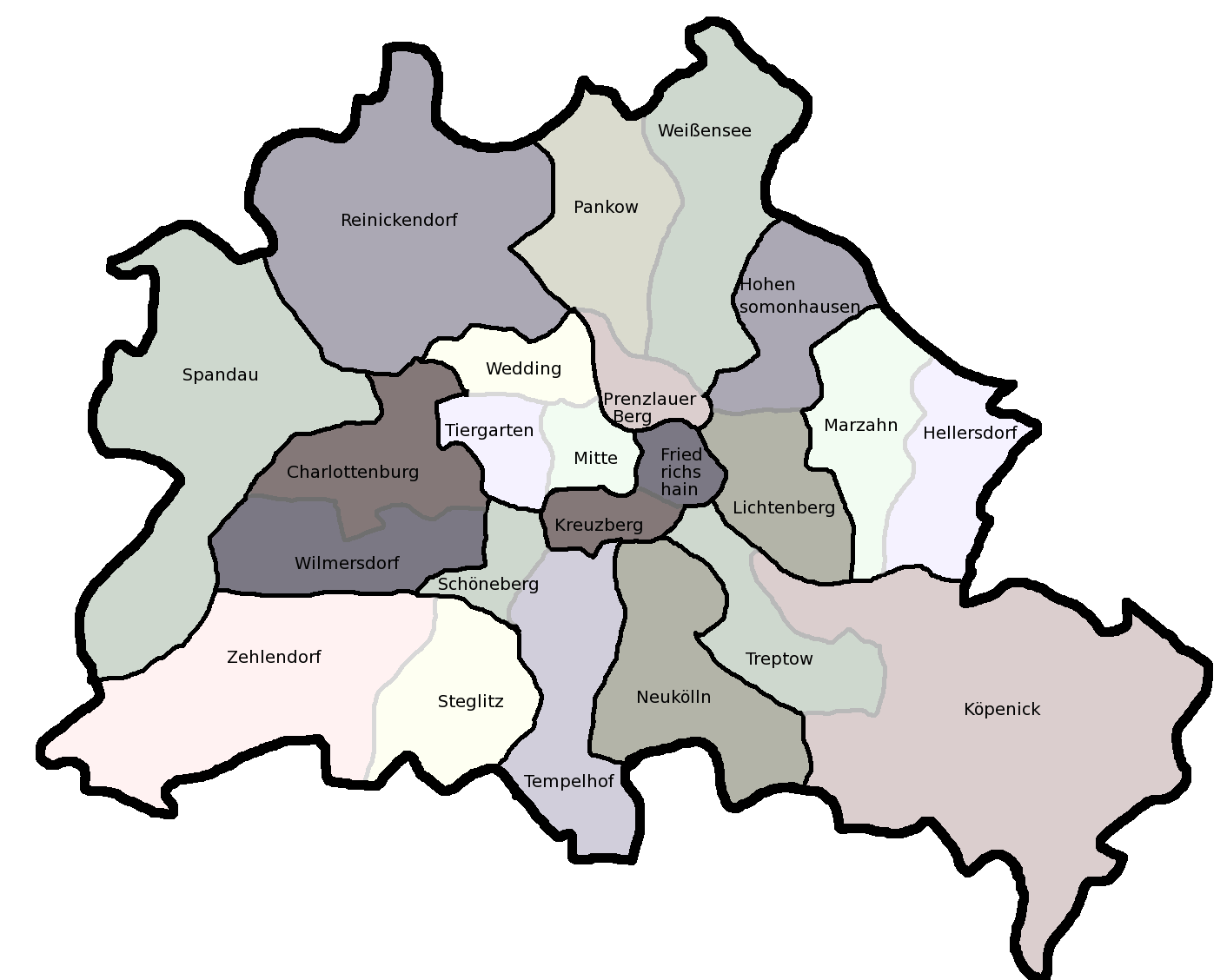
Berlin District Map
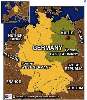
Berlin Germany Map
Berlin Map
Berlin Metro Map
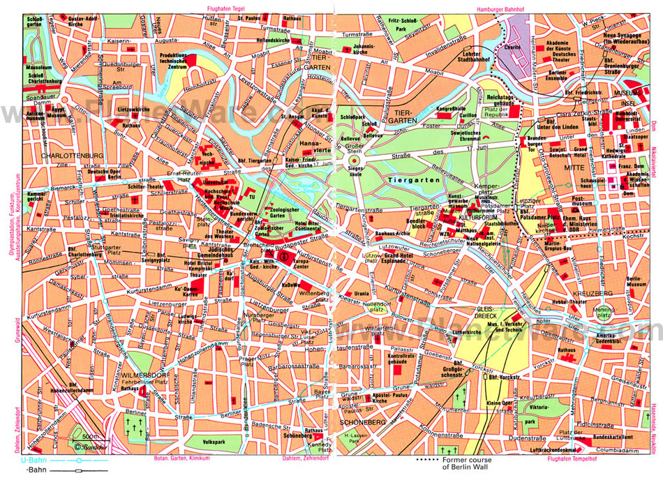
City Center Map Of Berlin
Downtown Map Of Berlin
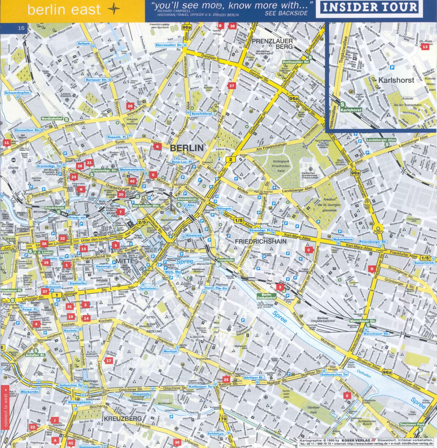
East Berlin Map
Four Sectors Of Berlin 1945 1990 Map
Map Of Berlin Germany
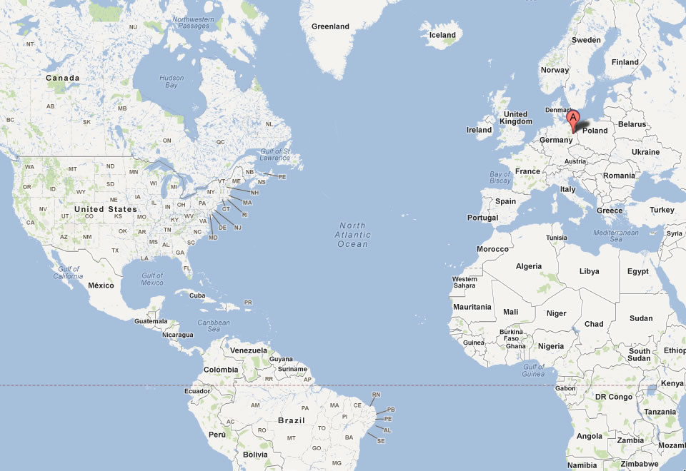
Map Of Berlin World
Map Berlin
West Berlin Map
Entdecken Sie die Wunder Berlins: Die 10 beliebtesten Sehenswürdigkeiten
Bitte abonnieren Sie den "World Guide"-Kanal auf Youtube unter youtube.com/c/WorldGuide
Top 10 der besten Sehenswürdigkeiten in Frankfurt
See Also
Berlin Google Map, Street Views, Maps Directions, Satellite Images
turkey-visit.com offers a collection of Berlin map, google map, Berlin atlas, political, physical, satellite view, country infos, cities map and more map of Berlin.
Largest Cities' Map of Germany
Essen Map Aachen Map Brandenburg Map Dessau Map Gera Map Hildesheim Map Kiel Map Lubeck Map Mulheim Map Osnabruck Map Siegen Map Wurzburg Map Berlin Map Koln Map Frankfurt Map Bielefeld Map Bochum Map Hamm Map Hanau Map Mainz Map Mannheim Map Potsdam Map Recklinghausen Map Rostock Map Nurnberg Map Augsburg Map Bremerhaven Map Darmstadt Map Koblenz Map Leverkusen Map Monchengladbach Map Munster Map Wuppertal Map Zwickau Map Bremen Map Leipzig Map Duisburg Map Erlangen Map Kaiserslautern Map Kassel Map Herne Map Offenbach Map Ulm Map Witten Map Stuttgart Map Bergisch Gladbach Map Cottbus Map Furth Map Iserlohn Map Krefeld Map Moers Map Pforzheim Map Salzgitter Map Wolfsburg Map Hamburg Map Munchen Map Bonn Map Braunschweig Map Hagen Map Heidelberg Map Ludwigshafen Map Magdeburg Map Regensburg Map Remscheid Map Dortmund Map Dusseldorf Map Gelsenkirchen Map Gottingen Map Heilbronn Map Ingolstadt Map Oldenburg Map Paderborn Map Saarbrucken Map Schwerin Map Hannover Map Dresden Map Erfurt Map Freiburg Map Jena Map Karlsruhe Map Neuss Map Oberhausen Map Solingen Map Wiesbaden MapCopyright Turkey Travel Guide - 2005 - 2026. All rights reserved. Privacy Policy | Disclaimer