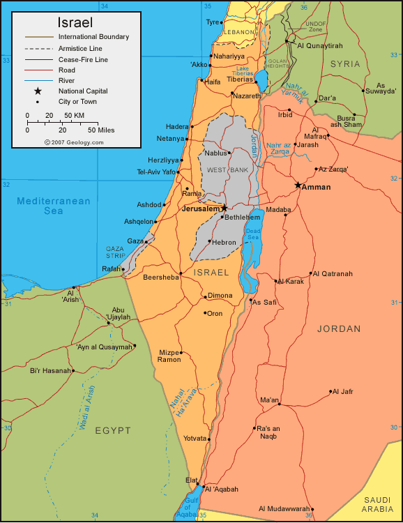
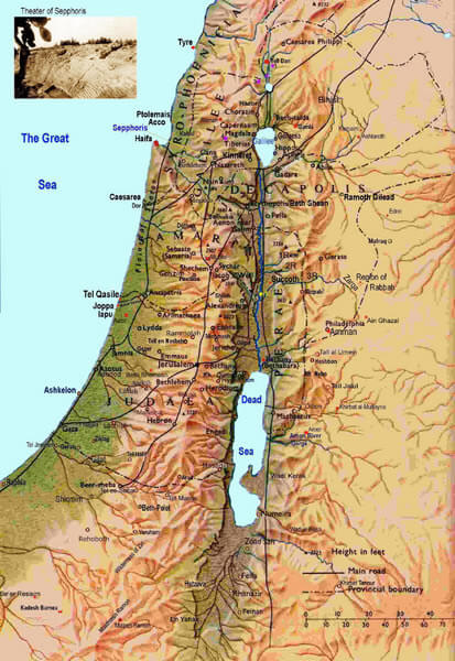
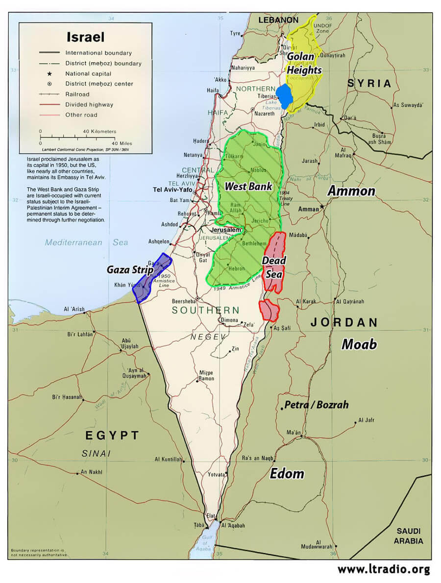
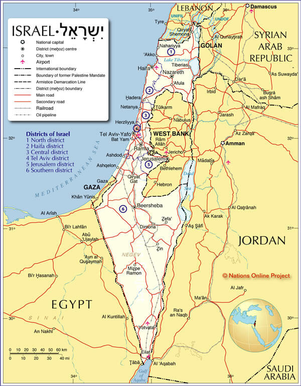
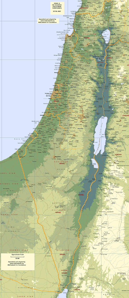
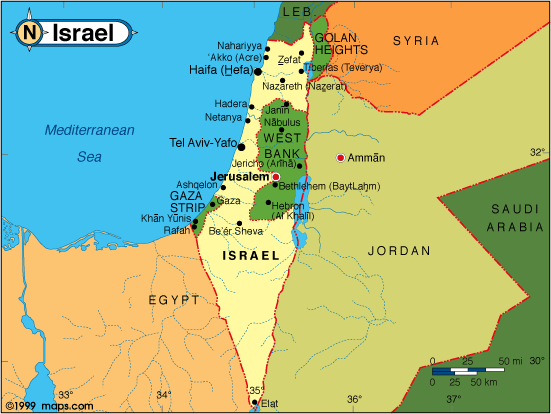
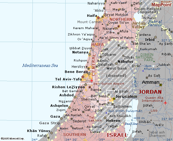
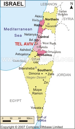
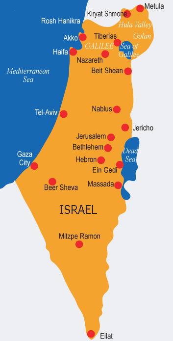
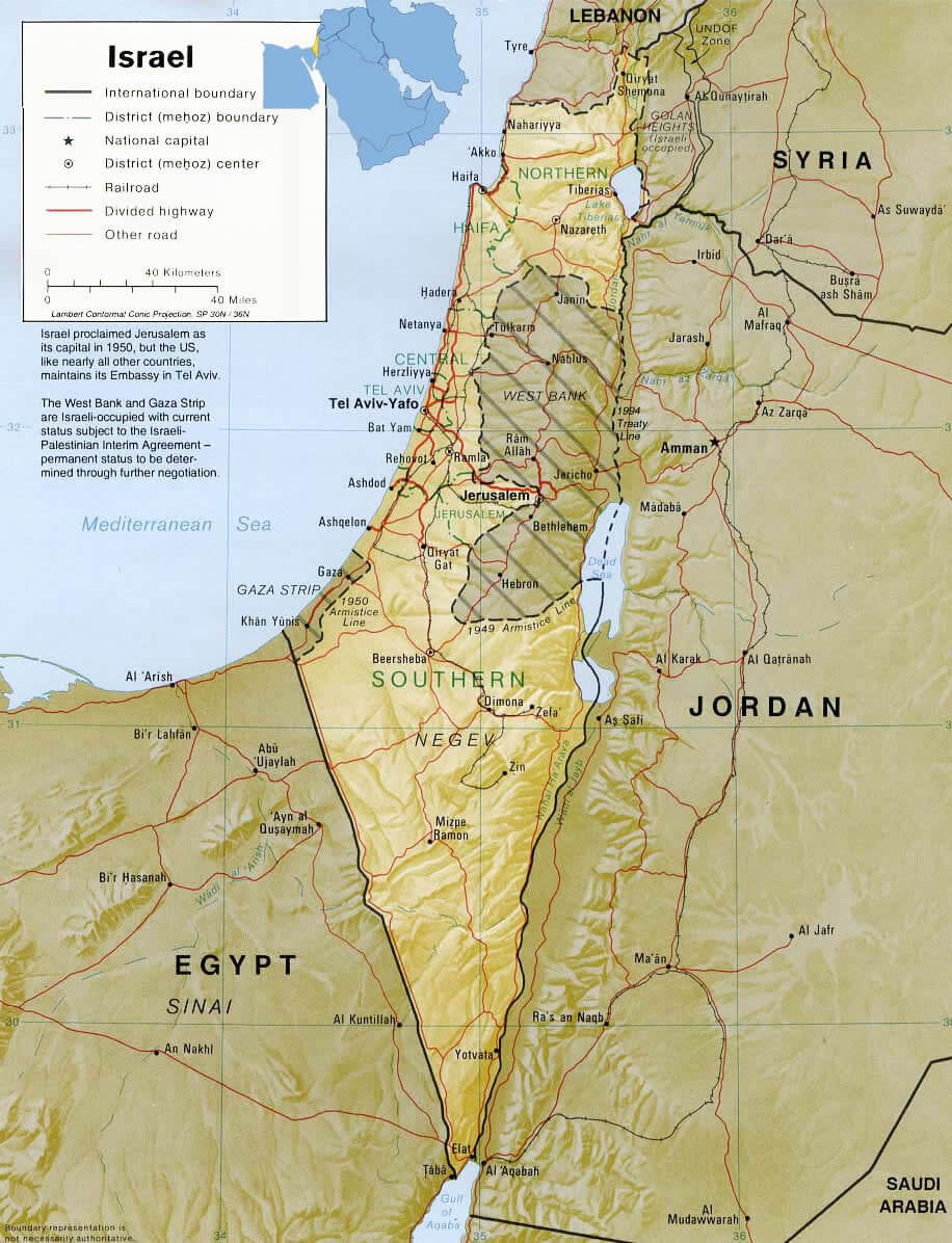
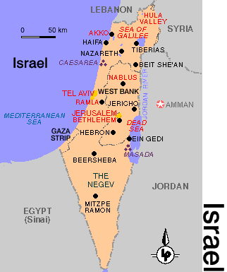
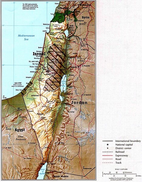
Israel Map
Navigate Israel map, satellite images of the Israel, states, largest cities, political map, capitals and physical maps.
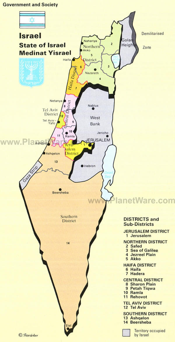
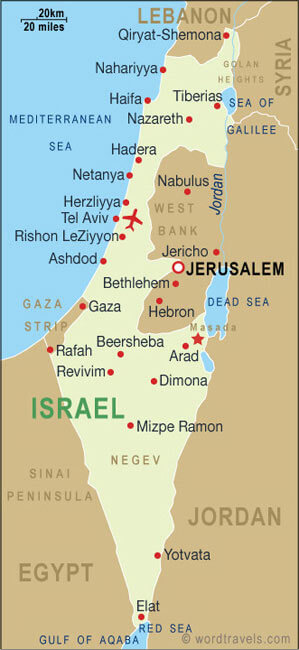
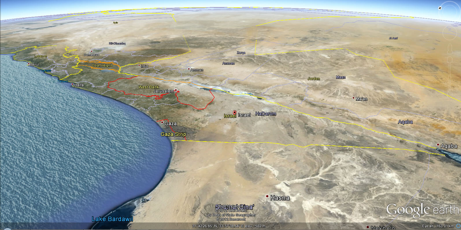
- Capital : Jerusalem
- Population : 7,968,300
- GDP : $243.654 billion (41st)
- Per Capita : $32,351 (27th)
- Calling Code : +972
- Jobless Rate : 6.90%
- Time Zone : +2
Israel Map & Israel Satellite Images

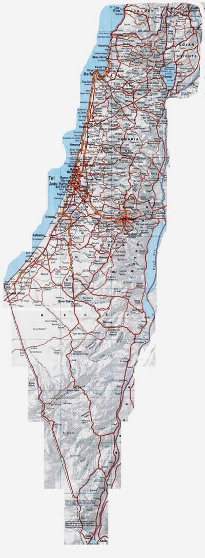
Largest Cities Map of Israel
Ashdod Map - Ashkelon Map - Bat Yam Map - Be'er Sheva Map - Bene Beraq Map - Haifa Map - Holon Map - Netanya Map - Petah Tiqwa Map - Ramat Gan Map - Rehovot Map - Tel Aviv Yafo Map - Jerusalem Map -Related Israel Maps and Israel Satellite Images


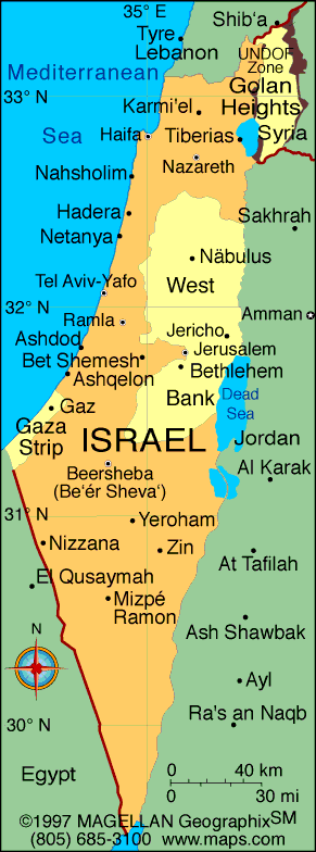
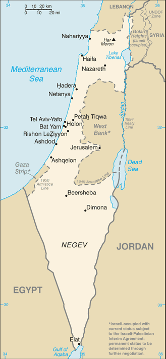
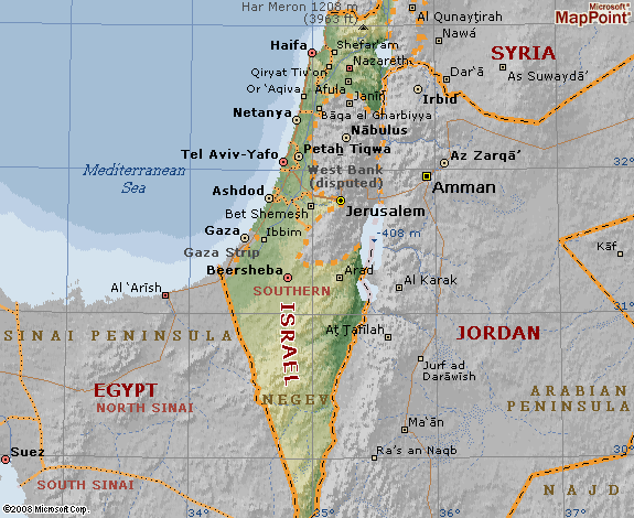
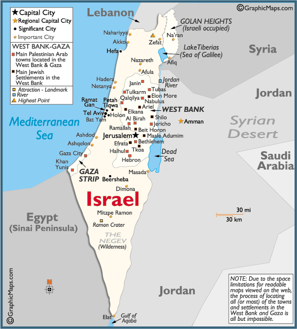

Alphabetically Cities Map of Israel & Population of Israel Cities
Ashdod Map - Ashkelon Map - Bat Yam Map - Be'er Sheva Map - Bene Beraq Map - Haifa Map - Holon Map - Netanya Map - Petah Tiqwa Map - Ramat Gan Map - Rehovot Map - Tel Aviv Yafo Map - Jerusalem Map -Israel Google Map, Street Views, Maps Directions, Satellite Images
Please Not : You can find local businesses, public places, tourist attractions via map view, satellite image, hybrid view, driving directions in Israel Map. You'll also find a varity map of Israel such as political, administrative, transportation, demographics maps following Google map.
Submit URL to Israel :
Please feel free share your comments and questions :
Please feel free share your comments and questions :
"Israel" related content to share on social media;


Copyright Turkey Travel Guide - 2005 - 2026. All rights reserved. Privacy Policy | Disclaimer