Dublin Map
Navigate Dublin Map, Dublin city map, satellite images of Dublin, Dublin towns map, political map of Dublin, driving directions and traffic maps.
For more >> Ireland Maps
For more info >> Ireland
Dublin Map - Political, Physical, Touristic City Maps and Satellite Images
DUBLIN MAP

A Collection of Dublin and Satellite Images
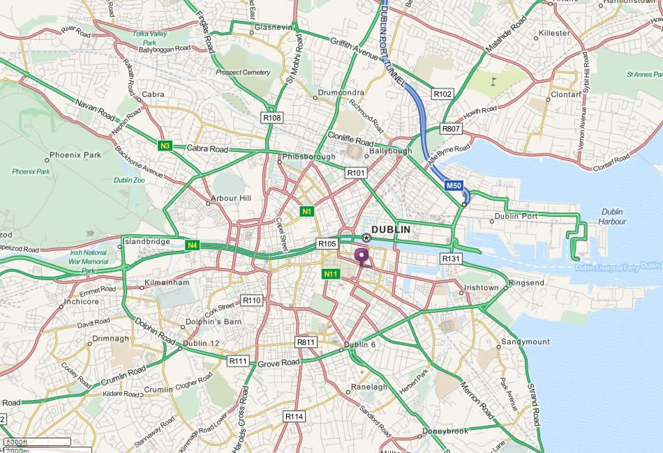
Dublin Map
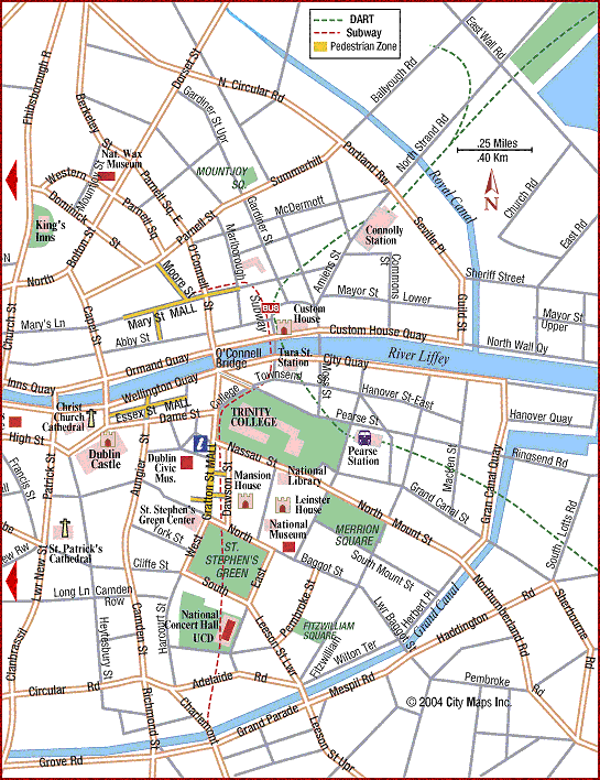
City Center Map Of Dublin
Dublin Area Map
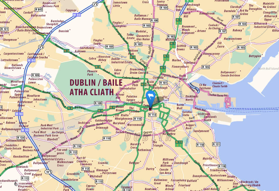
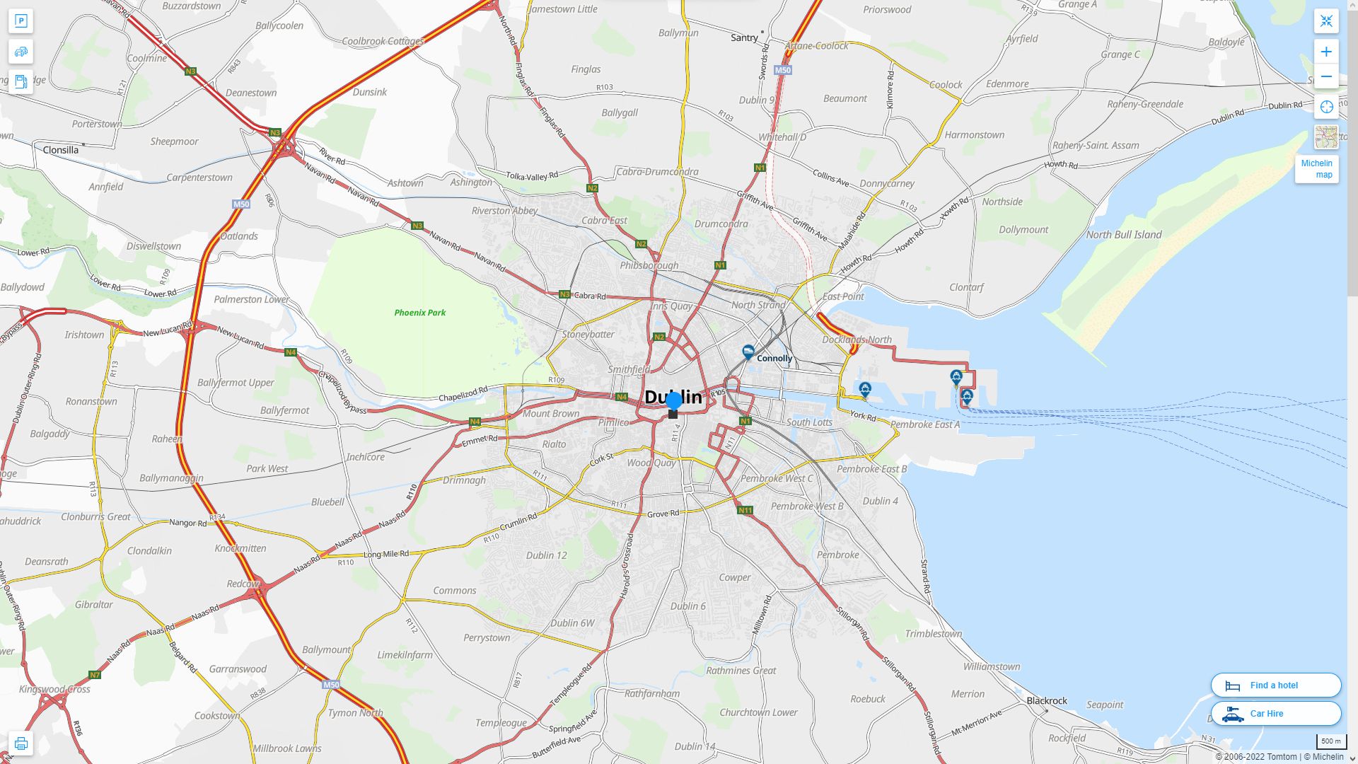
Dublin Regional Map
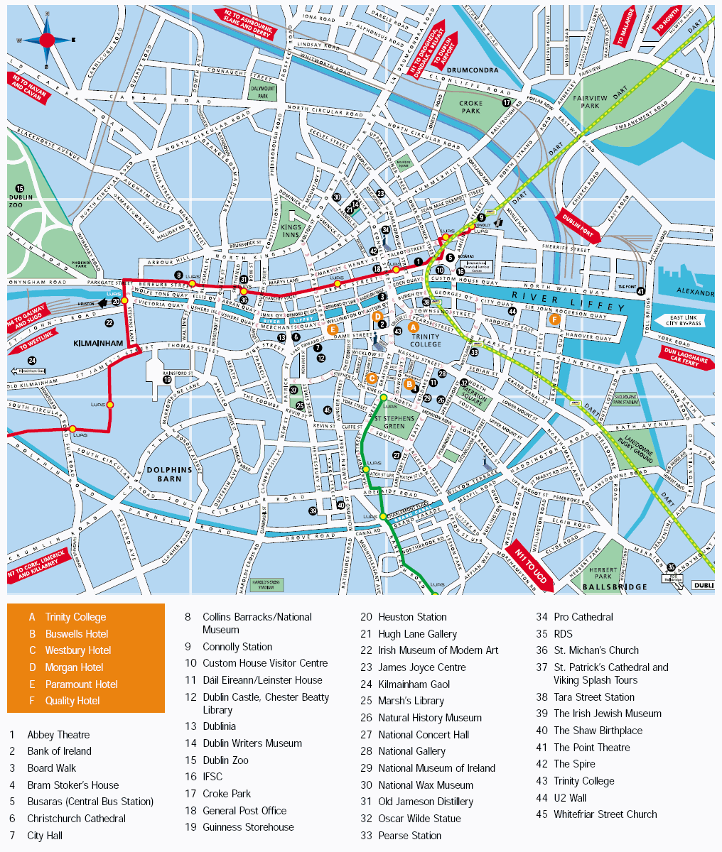
Dublin Tourist Map
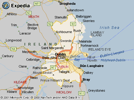
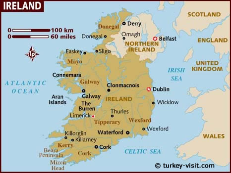
Ireland Map Dublin
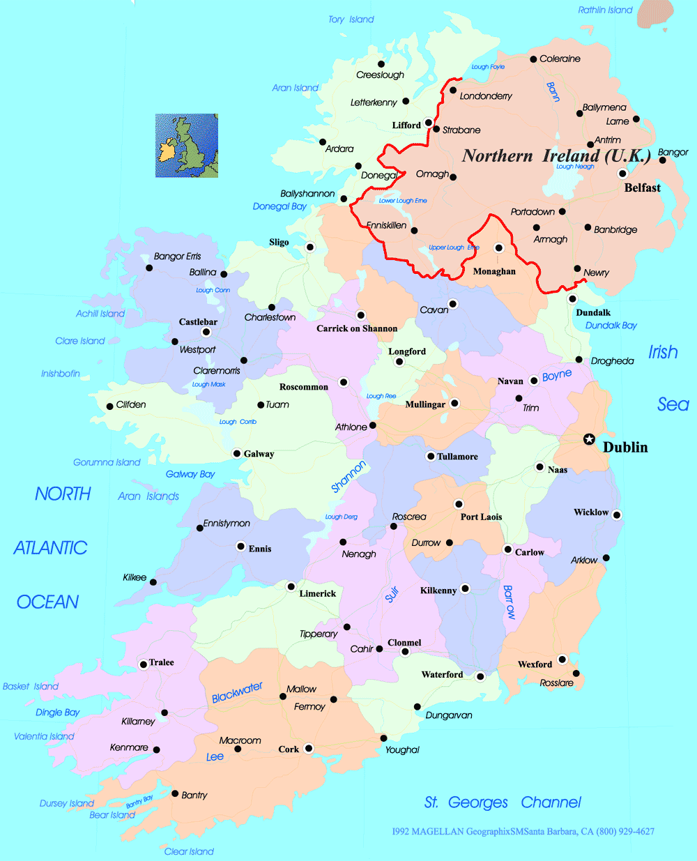
Ireland Cities Map Dublin
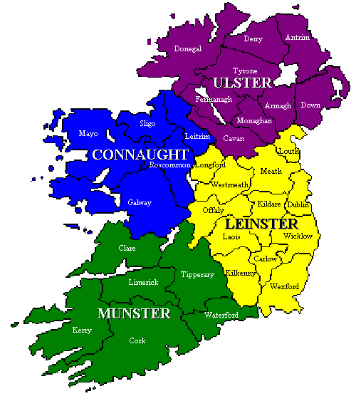
Ireland County Map Dublin
Ireland Dublin Map

Ireland Satellite Map Dublin
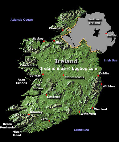
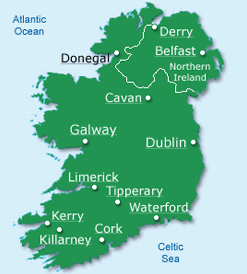
Map Of Ireland
West Dublin Map
Dublin Highway And Road Map With Satellite View
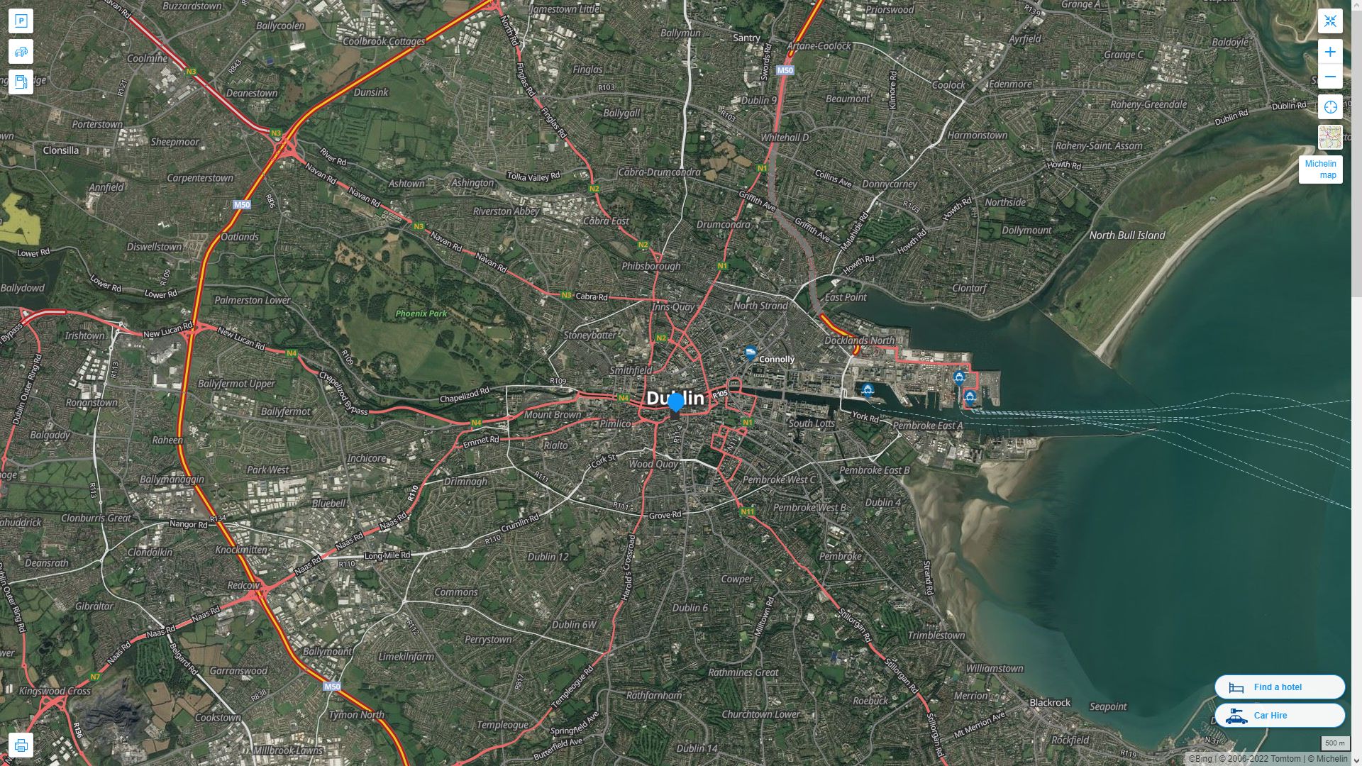
Dublin Highway And Road Map
Belfast: Where Every Cobblestone Holds a Story
Please subscribe on "World Guide" channnel on Youtube at youtube.com/c/WorldGuide
Mapping the Majesty: A Deep Dive into the UK's Geographic Tapestry
See Also
Dublin Google Map, Street Views, Maps Directions, Satellite Images
turkey-visit.com offers a collection of Dublin map, google map, Dublin atlas, political, physical, satellite view, country infos, cities map and more map of Dublin.
Largest Cities' Map of Ireland
Dublin Map Belfast Map Cork Map Limerick Map Derry Map Galway Map Craigavon Map Waterford Map Drogheda Map Dundalk Map Lucan Map Wexford MapCopyright Turkey Travel Guide - 2005 - 2026. All rights reserved. Privacy Policy | Disclaimer