- world map
- oceania map
- australia map
Map Australia
Navigate Australia Map, countries map, satellite images of the Australia, largest cities maps, political map, capitals and physical maps.
A Collection of Australia Maps
Australia Shaded relief map with major urban areas
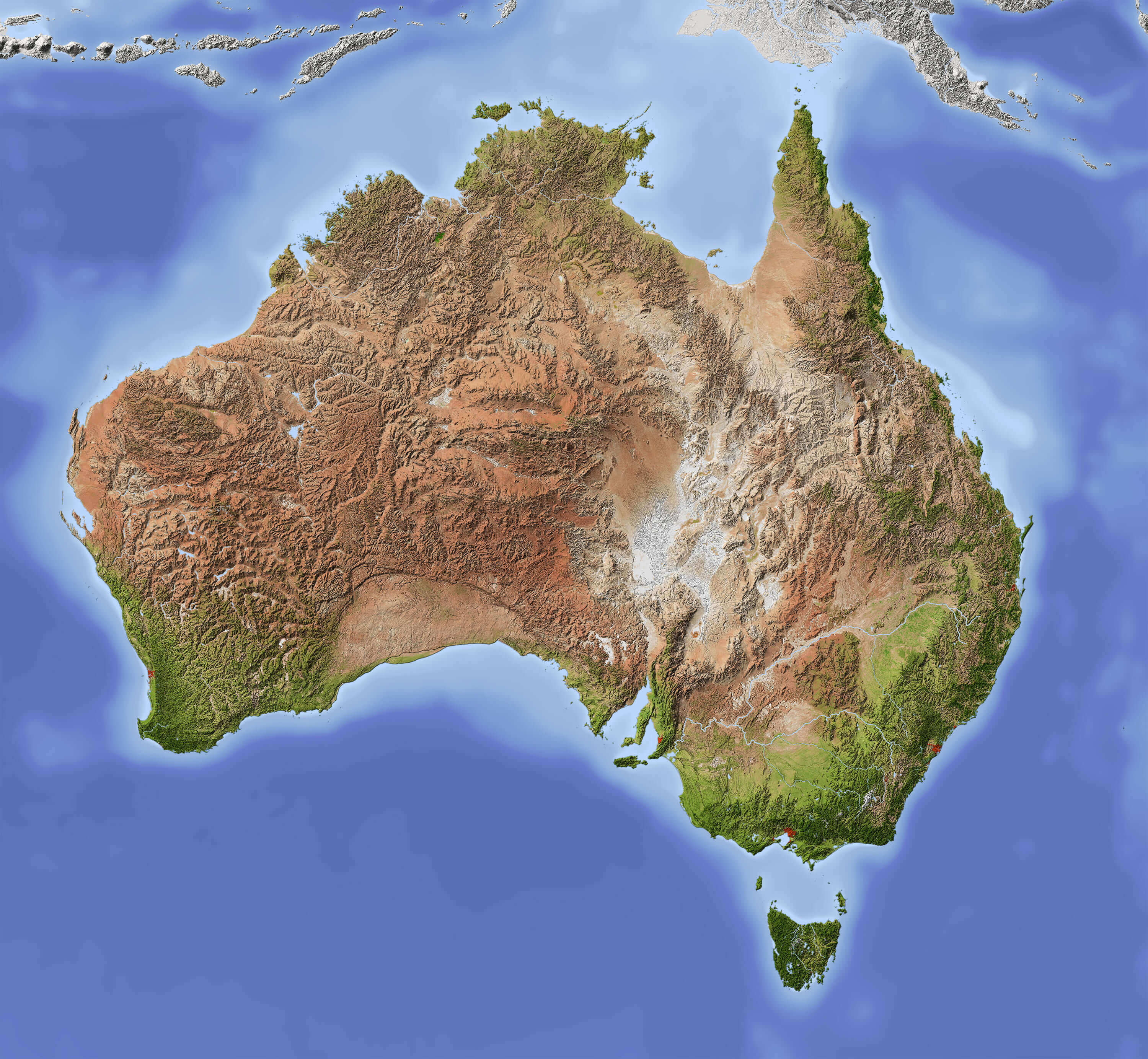 Australia Shaded relief map with major urban areas. Colored according to vegetation. Includes clip path for the state area
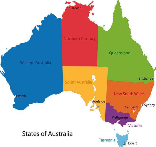
Australia Map Color with Regions
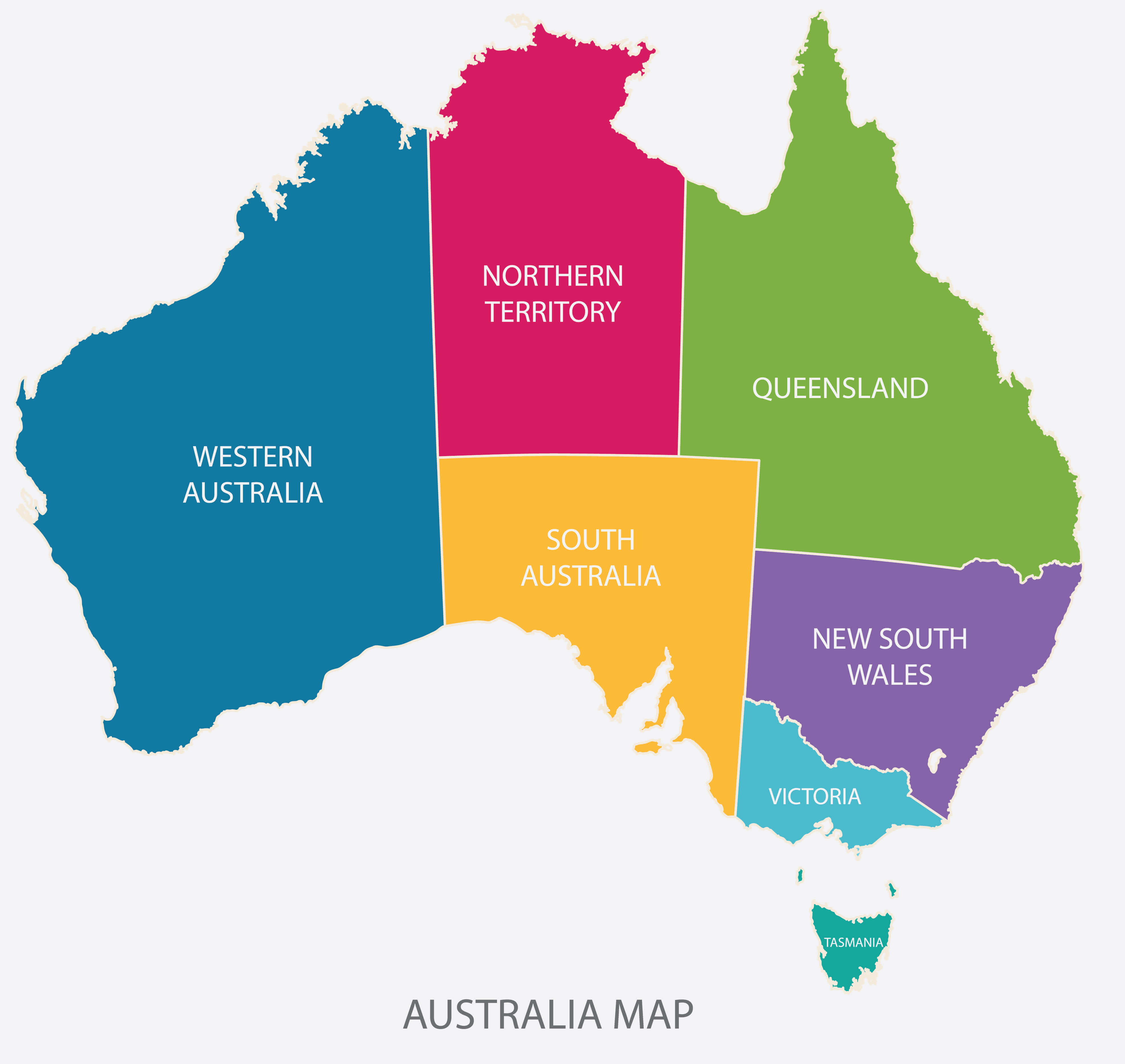 Australia Map Color with Regions flat design illustration vector.
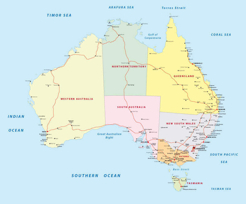
Australia Road Map
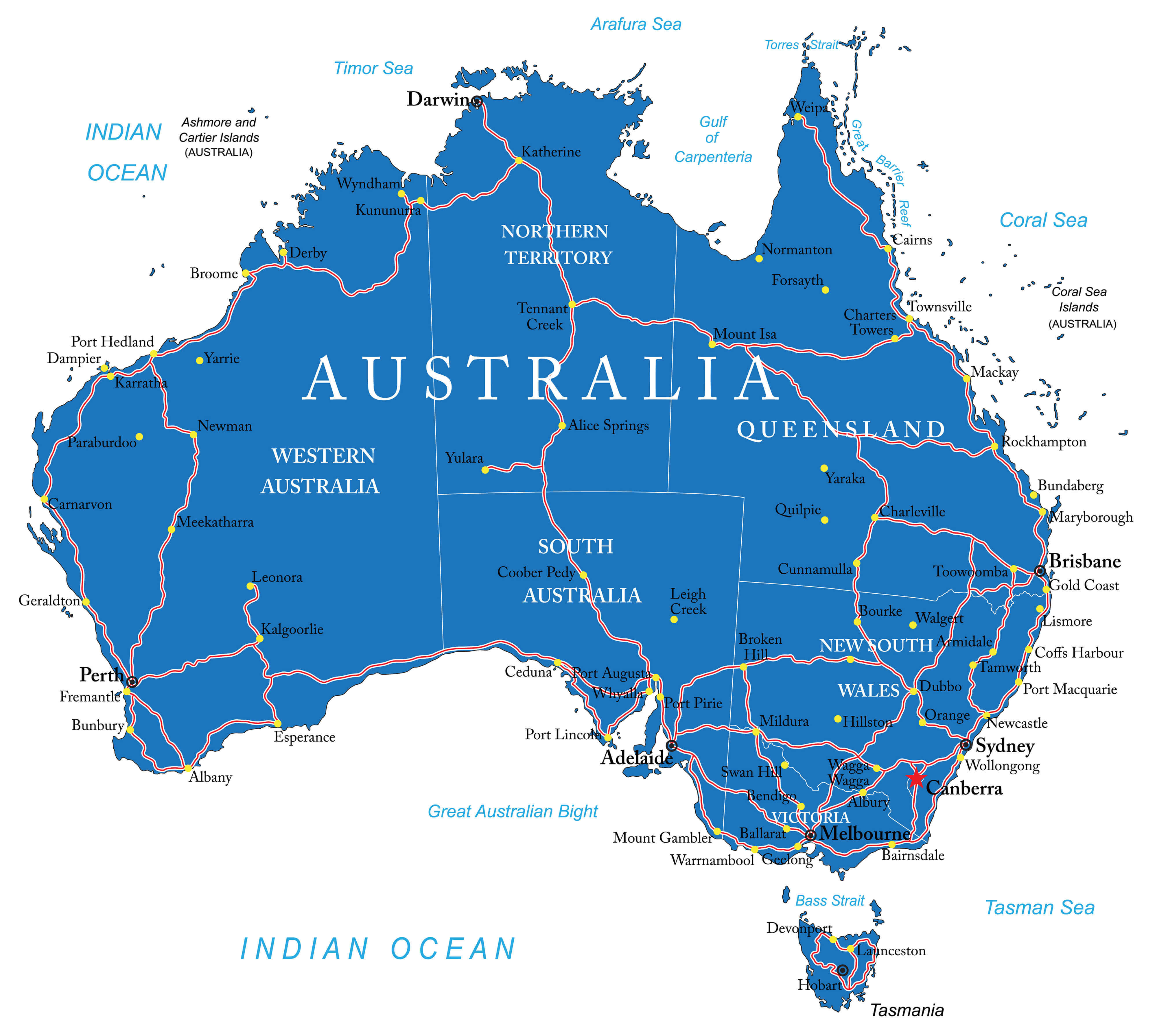 Australia Road Map with states and major cities.
Australia 3D Topography Map
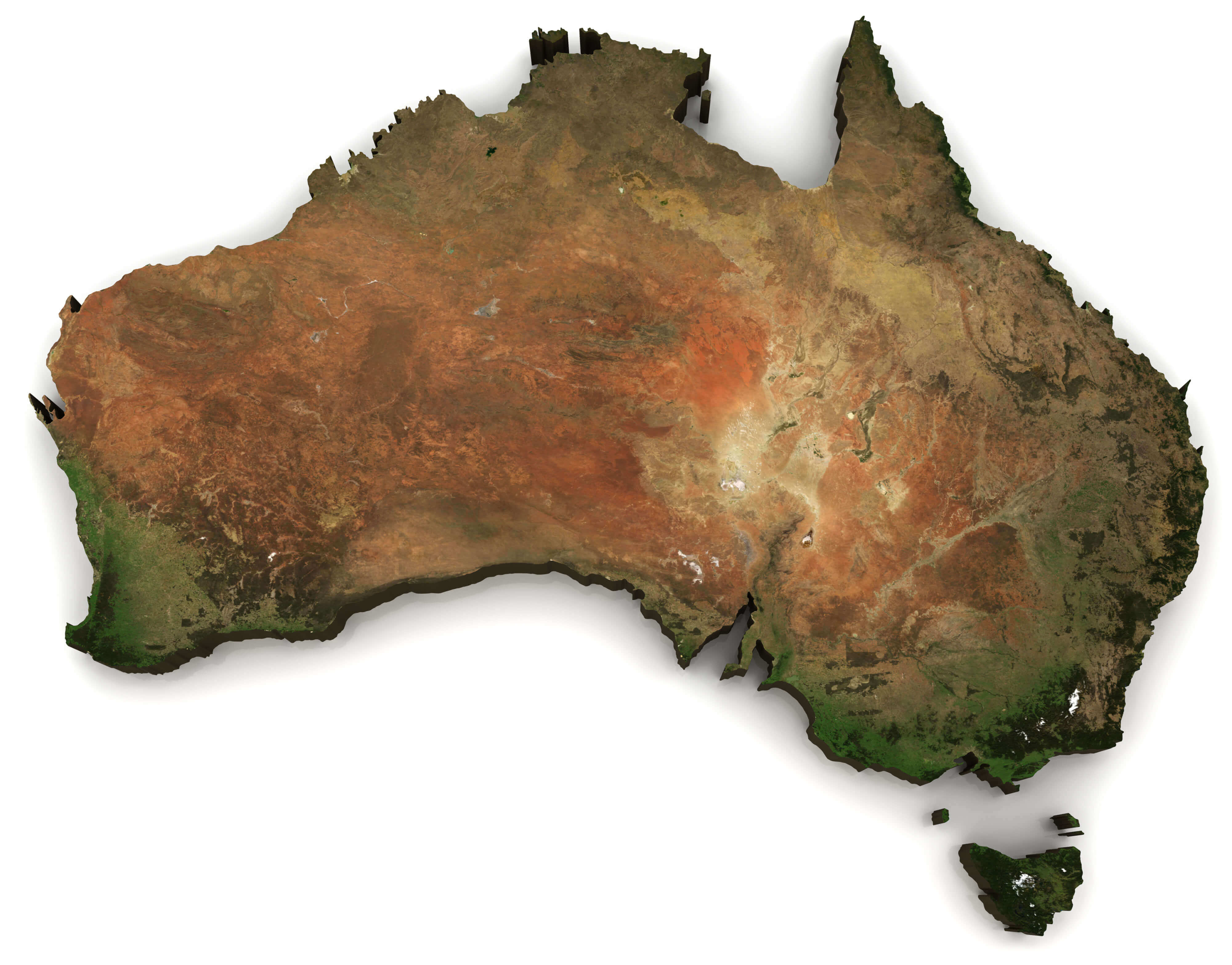 Australia 3D (Topography map comes from earthobervatory / NASA)
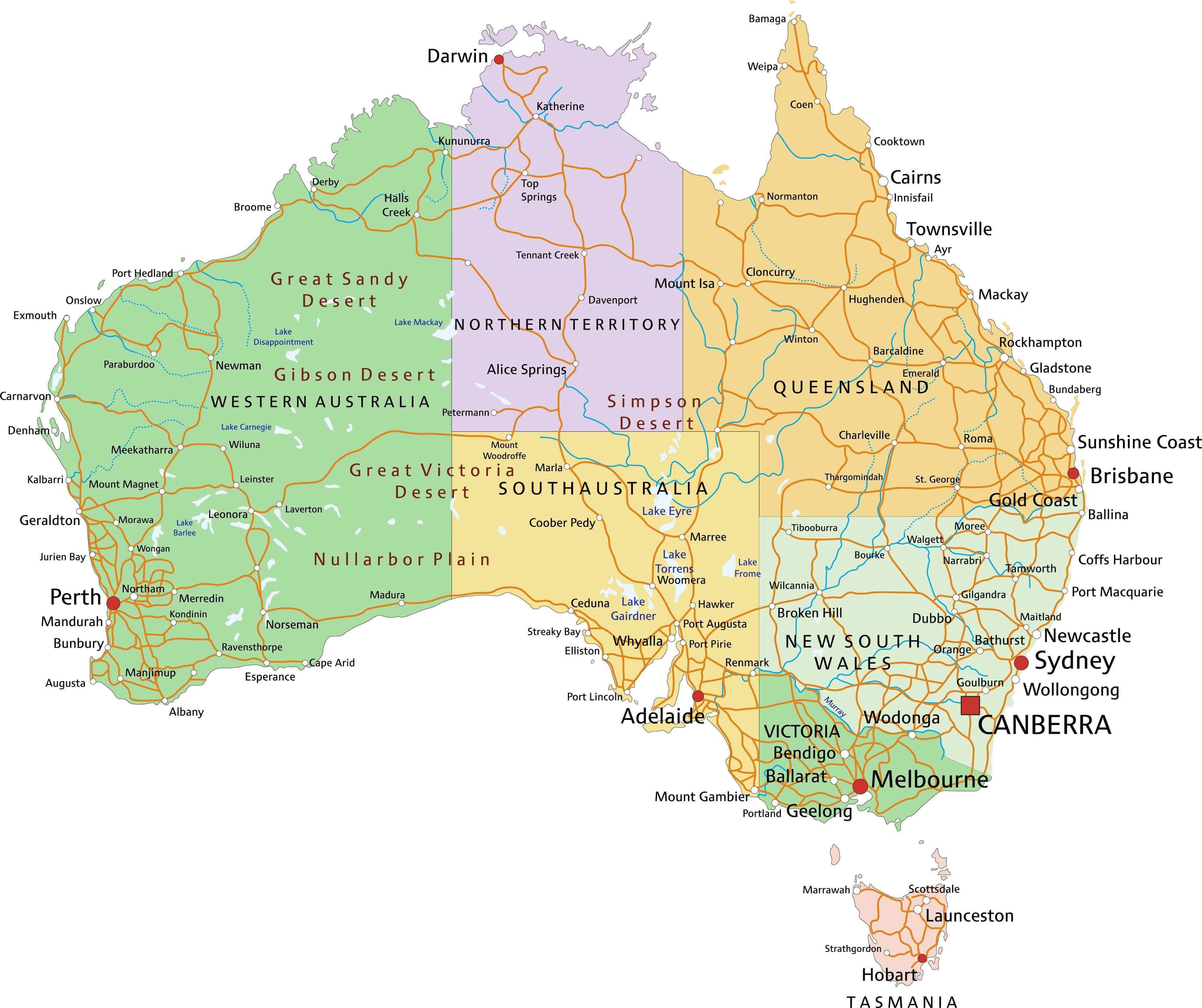
Australia Regions and Major Cities Map
 Colorful Australia map with regions and main cities
Australia Physical Map 1894 Paris
 Australia physical map. By Paul Vidal de Lablache, Atlas Classique, Librerie Colin, Paris, 1894 (first edition)
Australia Highly Detailed Map
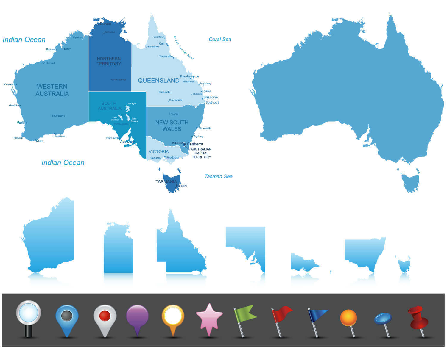 Australia highly detailed map. All elements are separated in editable layers clearly labeled.
Australia Road Map with Cities
 Australia Road Map with Cities.
High detailed Australia physical map
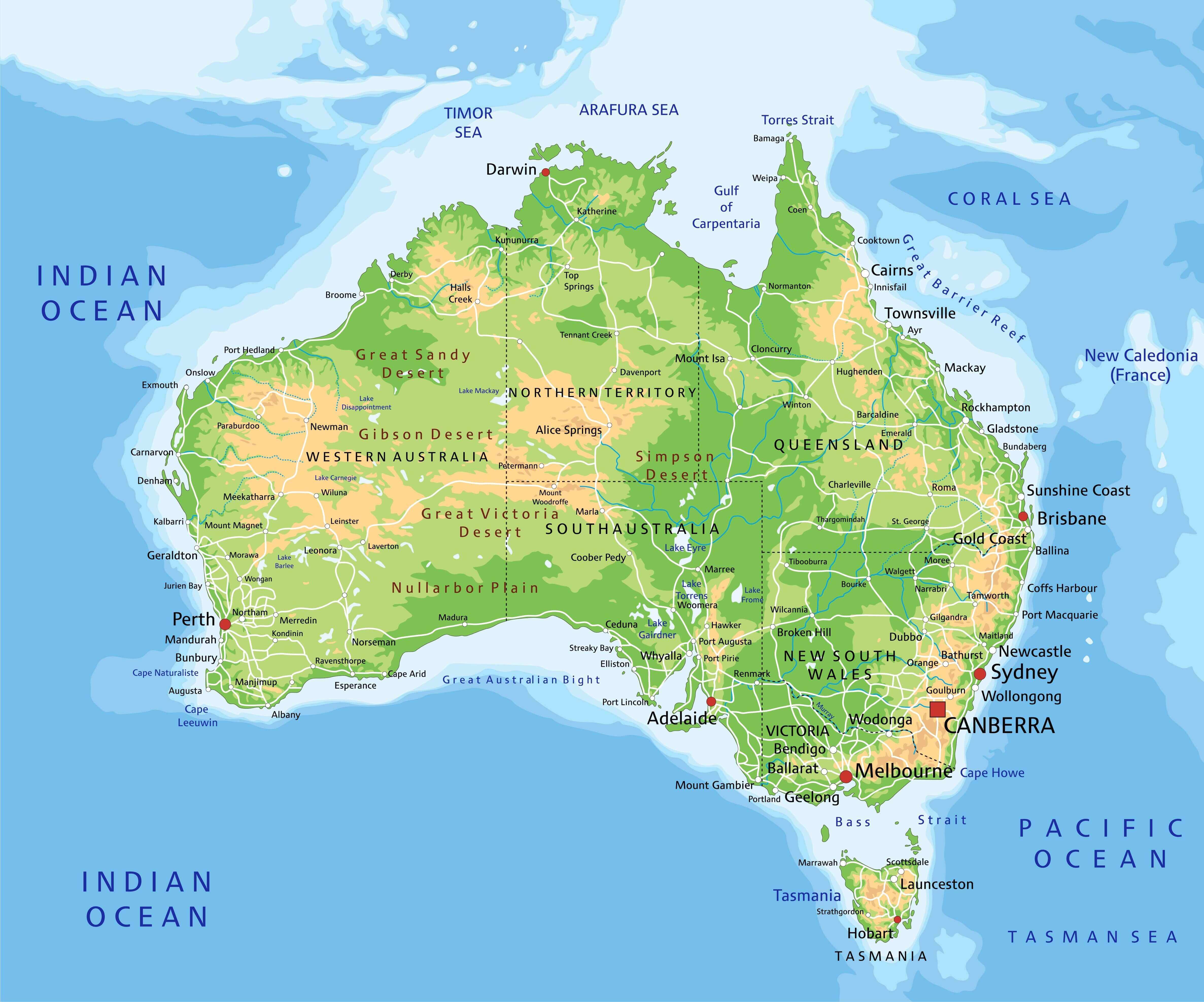 High detailed Australia physical map with labeling.
Australia detailed political map with cities, regions and states
 Australia highly detailed editable political map with cities, regions and states.
Australia with embedded flag Map
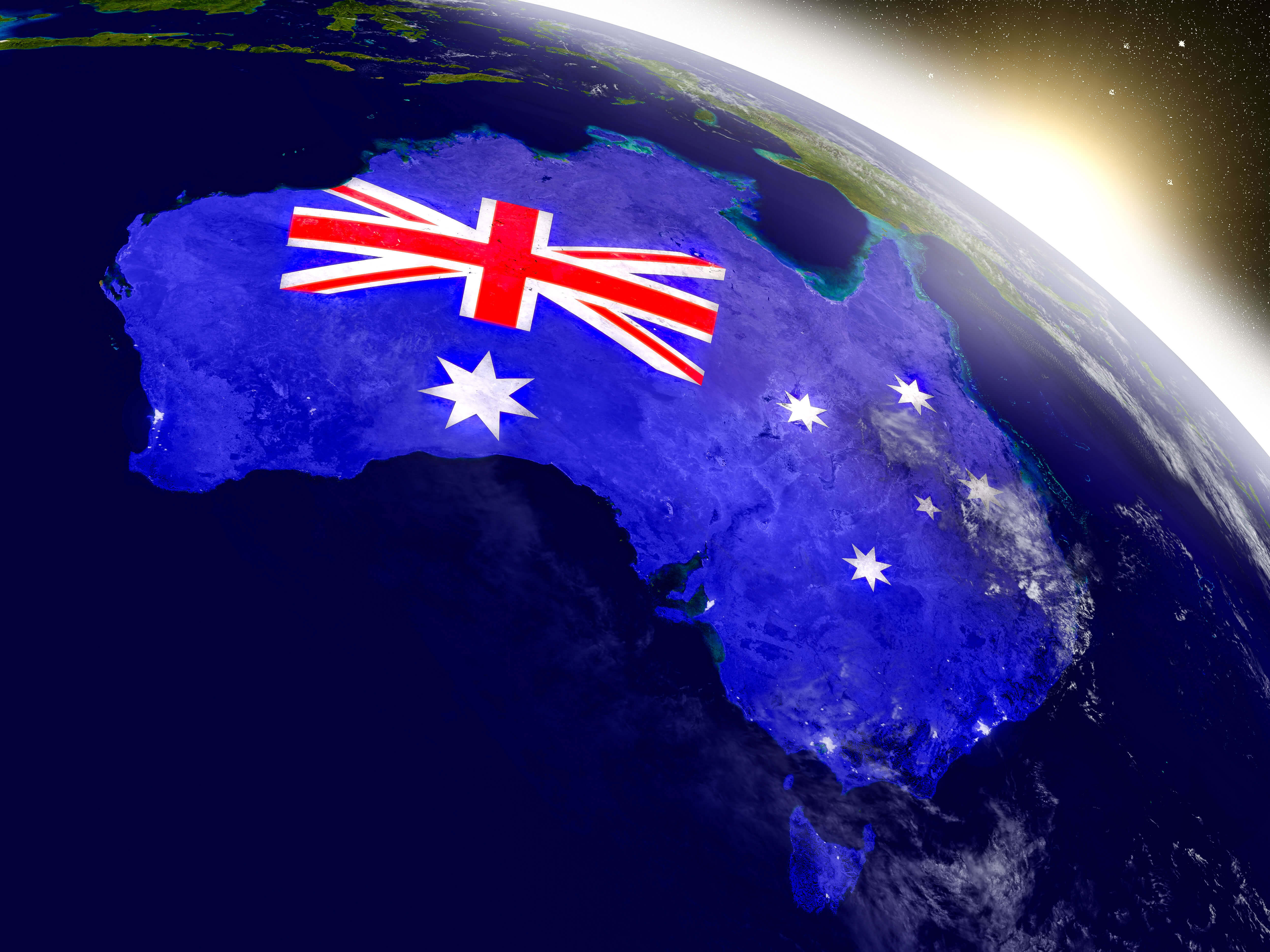 Australia with embedded flag on planet surface during sunrise. 3D illustration with highly detailed realistic planet surface and visible city lights. Elements of this image furnished by NASA
Alphabetically Cities Map of Australia & Population of Australia Cities
Sydney Map - 3,641,422 Melbourne Map - 3,371,888 Brisbane Map - 1,676,389 Perth Map - 1,256,035 Adelaide Map - 1,040,719 Gold Coast Map - 454,436 Canberra Map - 356,120 Newcastle Australia Map - 288,732 Central Coast Map - 282,726 Wollongong Map - 234,482 Sunshine Coast Map - 184,662 Gosford Map - 155,271 Geelong Map - 137,220 Townsville Map - 128,808 Hobart Map - 128,557 Cairns Map - 98,349 Toowoomba Map - 95,265 Ballarat Map - 78,221 Bendigo Map - 76,051 Albury Map - 73,497 Launceston Map - 71,395 Mandurah Map - 67,813 Rockingham Map - 67,520 Mackay Map - 66,874 Darwin Map - 66,291 Maitland Map - 61,431 Rockhampton Map - 60,827 Bunbury Map - 54,482 Bundaberg Map - 46,961 Wagga Wagga Map - 46,735 Hervey Bay Map - 41,225 Port Macquarie Map - 39,219 Shepparton Map - 38,773 Melton Map - 35,490 Tamworth Map - 33,475 Orange Map - 31,544 Dubbo Map - 30,574 Mildura Map - 30,016 Sunbury Map - 29,566 Bathurst Map - 28,992 Gladstone Map - 28,808 Kalgoorlie Map - 28,242 Warrnambool Map - 28,150 Nowra Map - 27,478 Geraldton Map - 27,420 Lismore Map - 27,069 Coffs Harbour Map - 26,353 Albany Map - 25,196 Richmond Map - 25,011 Palmerston Map - 23,614 Mount Gambier Map - 23,494 Karratha Map - 11,728 Port Hedland Map - 11,557 Broome Map - 11,547Australia Google Map, Street Views, Maps Directions, Satellite Images
Please Not : You can find local businesses, public places, tourist attractions via map view, satellite image, hybrid view, driving directions in Australia Map. You'll also find a varity map of Australia such as political, administrative, transportation, demographics maps following Google map.
Submit URL to Australia :
Copyright Turkey Travel Guide - 2005 - 2026. All rights reserved. Privacy Policy | Disclaimer