Copenhagen Map
Navigate Copenhagen Map, Copenhagen city map, satellite images of Copenhagen, Copenhagen towns map, political map of Copenhagen, driving directions and traffic maps.
For more >> Denmark Maps
For more info >> Denmark
Copenhagen Map - Political, Physical, Touristic City Maps and Satellite Images
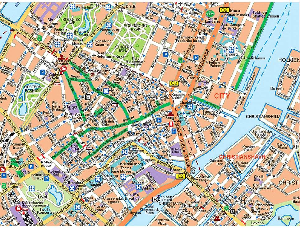
CITY MAP OF COPENHAGEN
A Collection of Copenhagen and Satellite Images
City Map Of Copenhagen
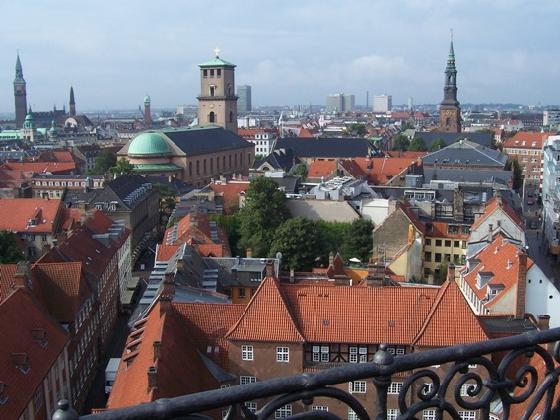
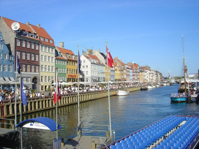
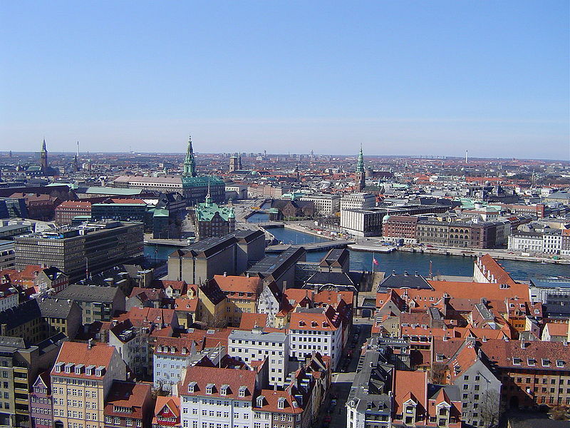
Copenhagen Denmark
Copenhagen Map
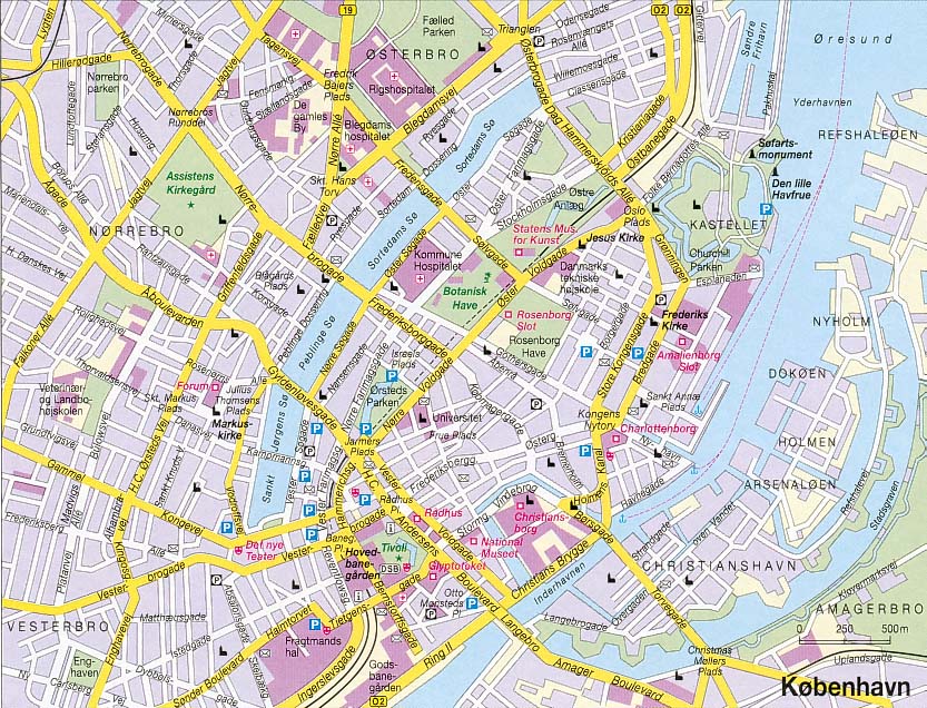
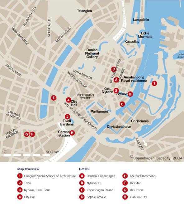
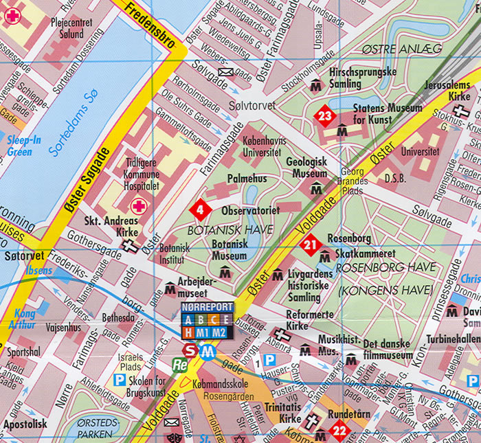
Copenhagen City Center Map
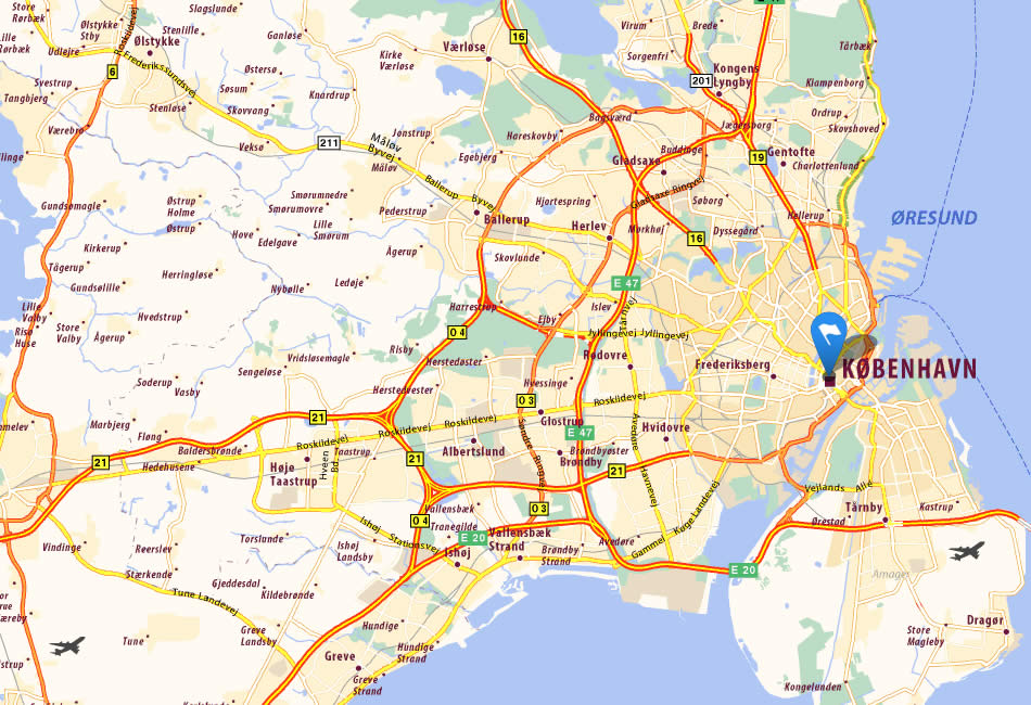
Copenhagen City Map
Copenhagen Map
Copenhagen Map
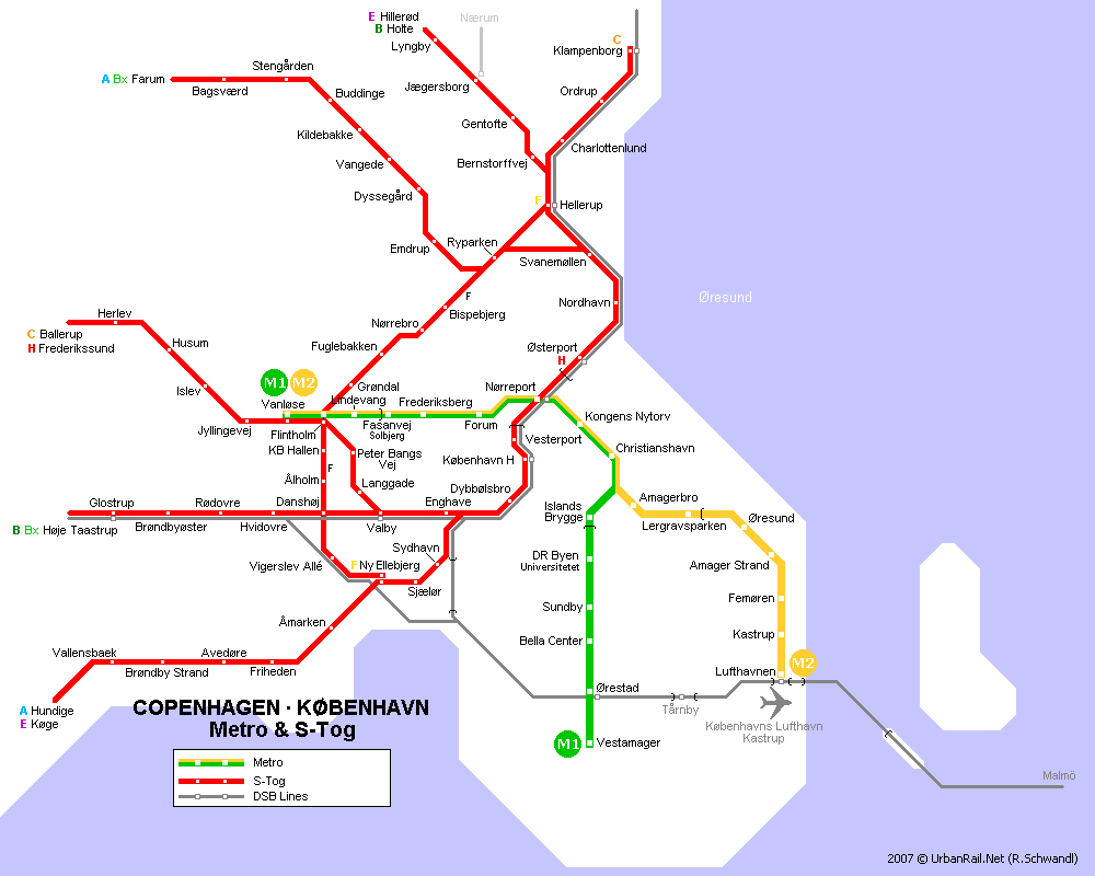
Copenhagen Metro Map
Copenhagen
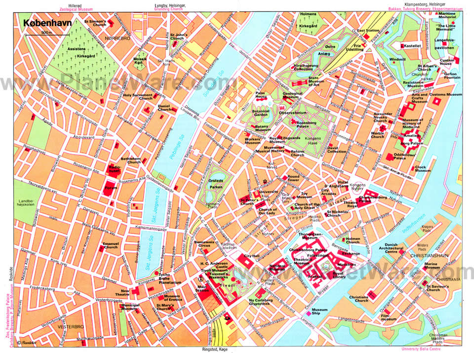
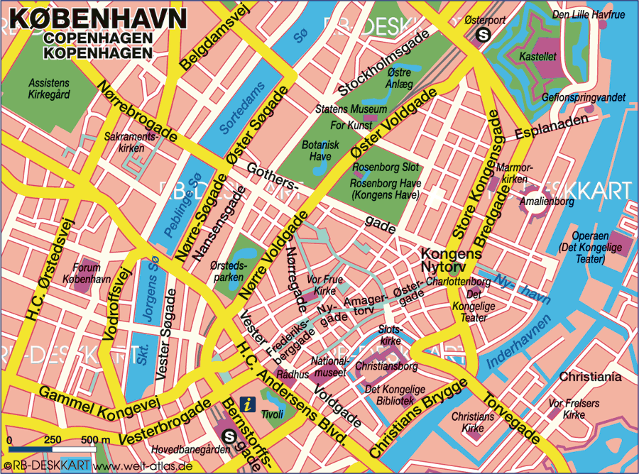
Copenhagen Center Map
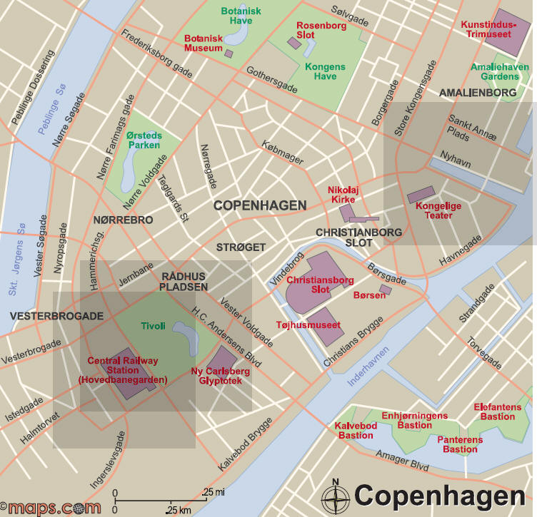
Copenhagen Map
Copenhagen Plan
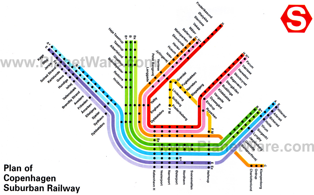
Copenhagen Subway Map

Copenhagen Tourist Map
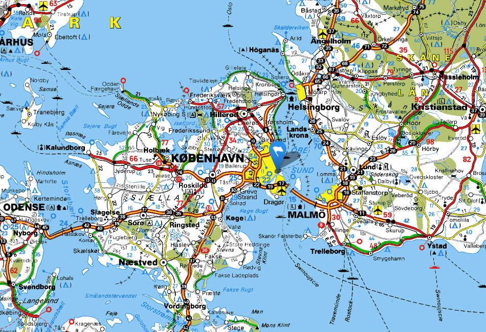
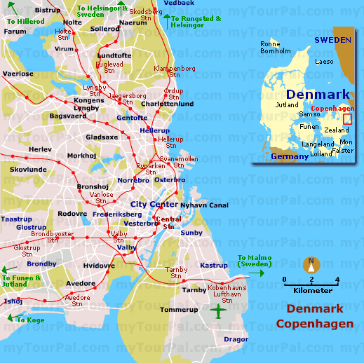
Denmark Copenhagen Map
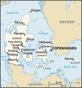
Denmark Map Copenhagen
Downtown Map Of Copenhagen
Kopenhagen
Map Of Copenhagen
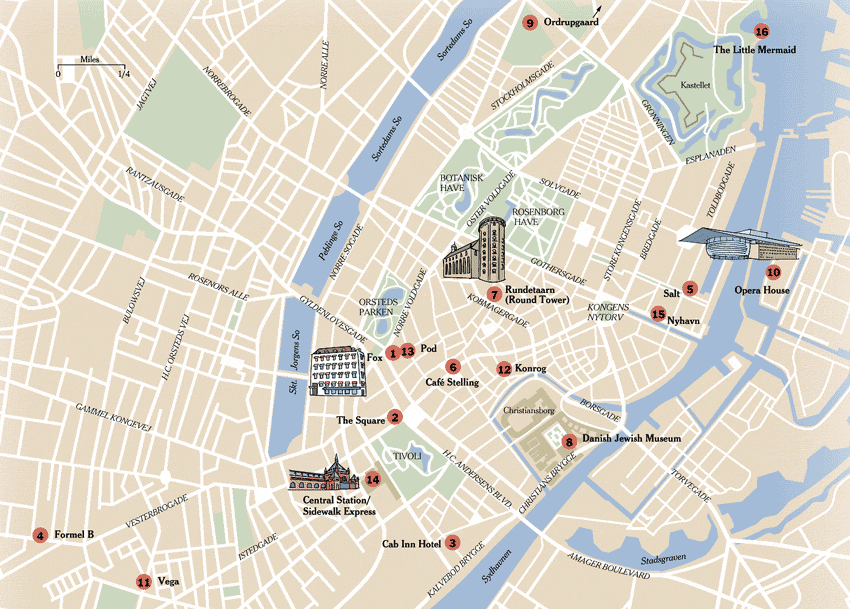
Exploring the Heart of Denmark: Copenhagen's 10 Best Spots
Please subscribe on "World Guide" channnel on Youtube at youtube.com/c/WorldGuide
See Also
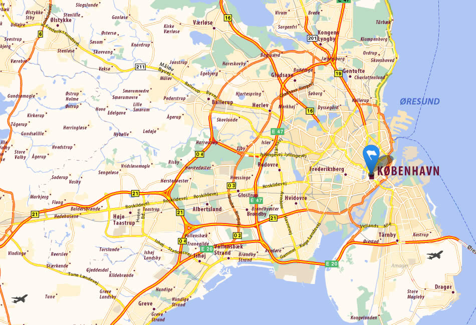
Copenhagen Google Map, Street Views, Maps Directions, Satellite Images
turkey-visit.com offers a collection of Copenhagen map, google map, Copenhagen atlas, political, physical, satellite view, country infos, cities map and more map of Copenhagen.
Largest Cities' Map of Denmark
Copenhagen Map Arhus Map Odense Map Aalborg Map Frederiksberg Map Esbjerg Map Gentofte Map Gladsaxe Map Randers Map Kolding Map Horsens Map Lyngby Taarbaek Map Vejle Map Hvidovre Map Roskilde Map Helsingor Map Herning Map Silkeborg Map Naestved Map Greve Strand Map Tarnby Map Fredericia Map Ballerup Map Rodovre Map Viborg Map Koge Map Holstebro Map Brondby Map Taastrup Map Slagelse Map Hillerod Map Albertslund Map Sonderborg Map Holbak Map Svendborg Map Herlev Map Hjorring Map Horsholm Map Frederikshavn Map Glostrup Map Haderslev Map Norresundby Map Ringsted Map Olstykke Stenlose Map Skive MapCopyright Turkey Travel Guide - 2005 - 2026. All rights reserved. Privacy Policy | Disclaimer