Detailed Maps of the United States: States, Geography & Regions
Discover detailed maps of the United States including political, physical, population, road, climate, and state maps. Explore informative USA maps for travel, education, research, and geography enthusiasts.
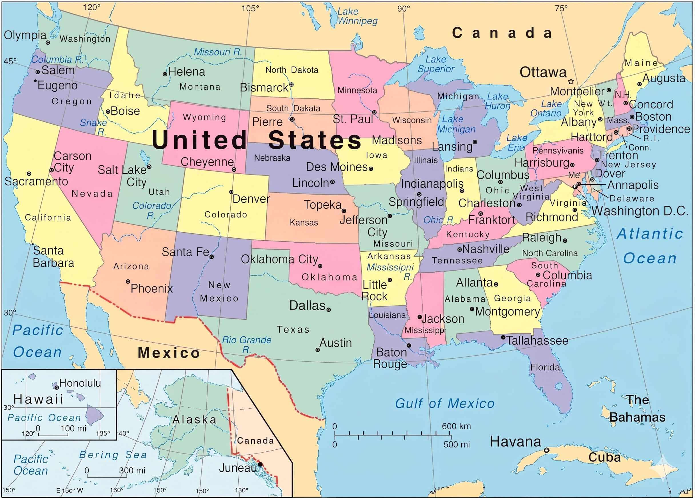
Detailed map of the United States
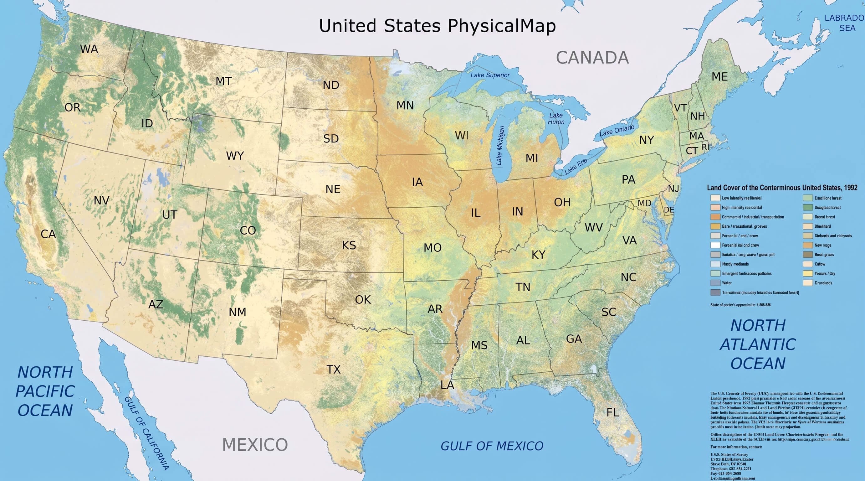
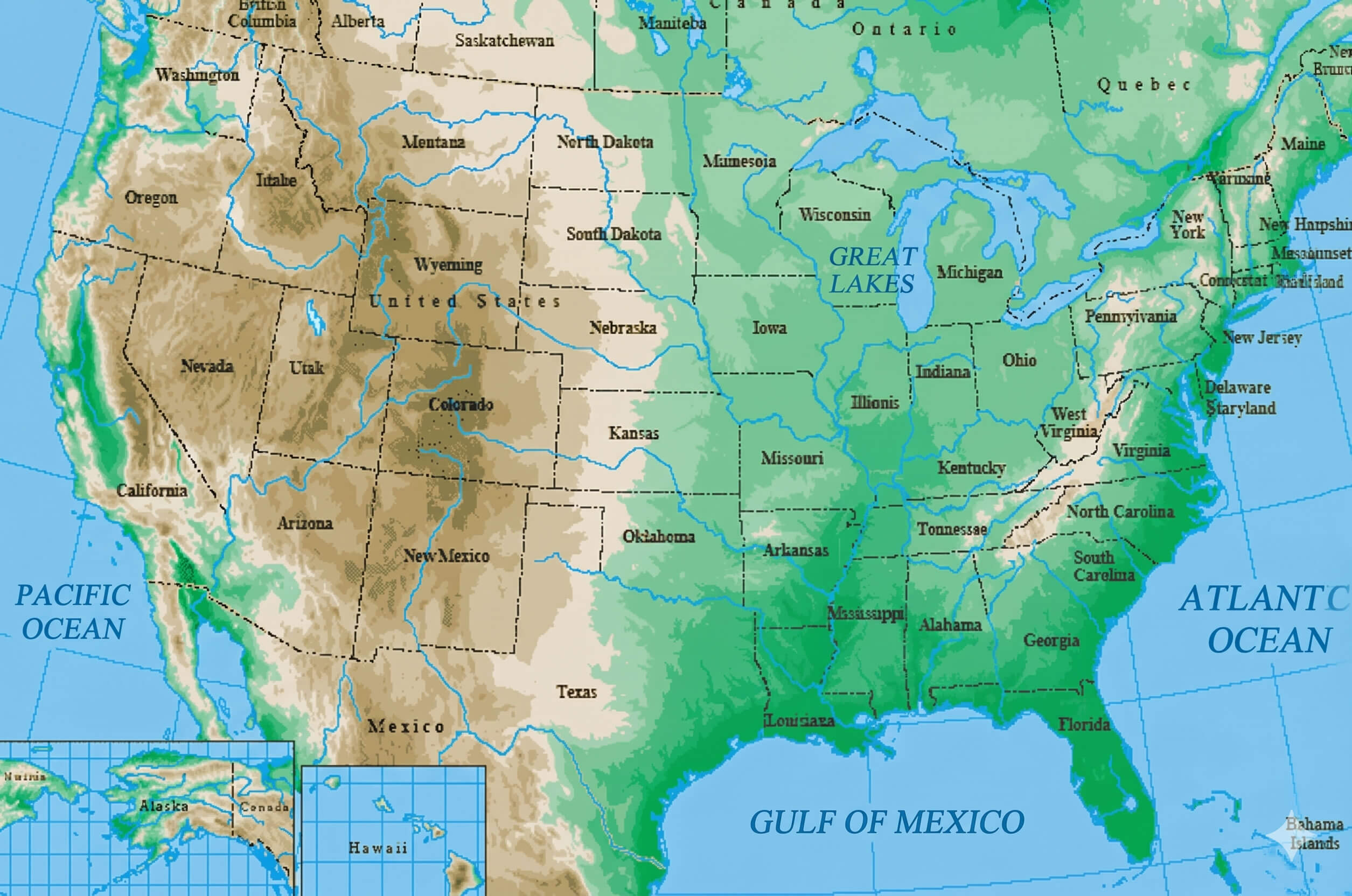
United States map physical
United States annual precipitation map
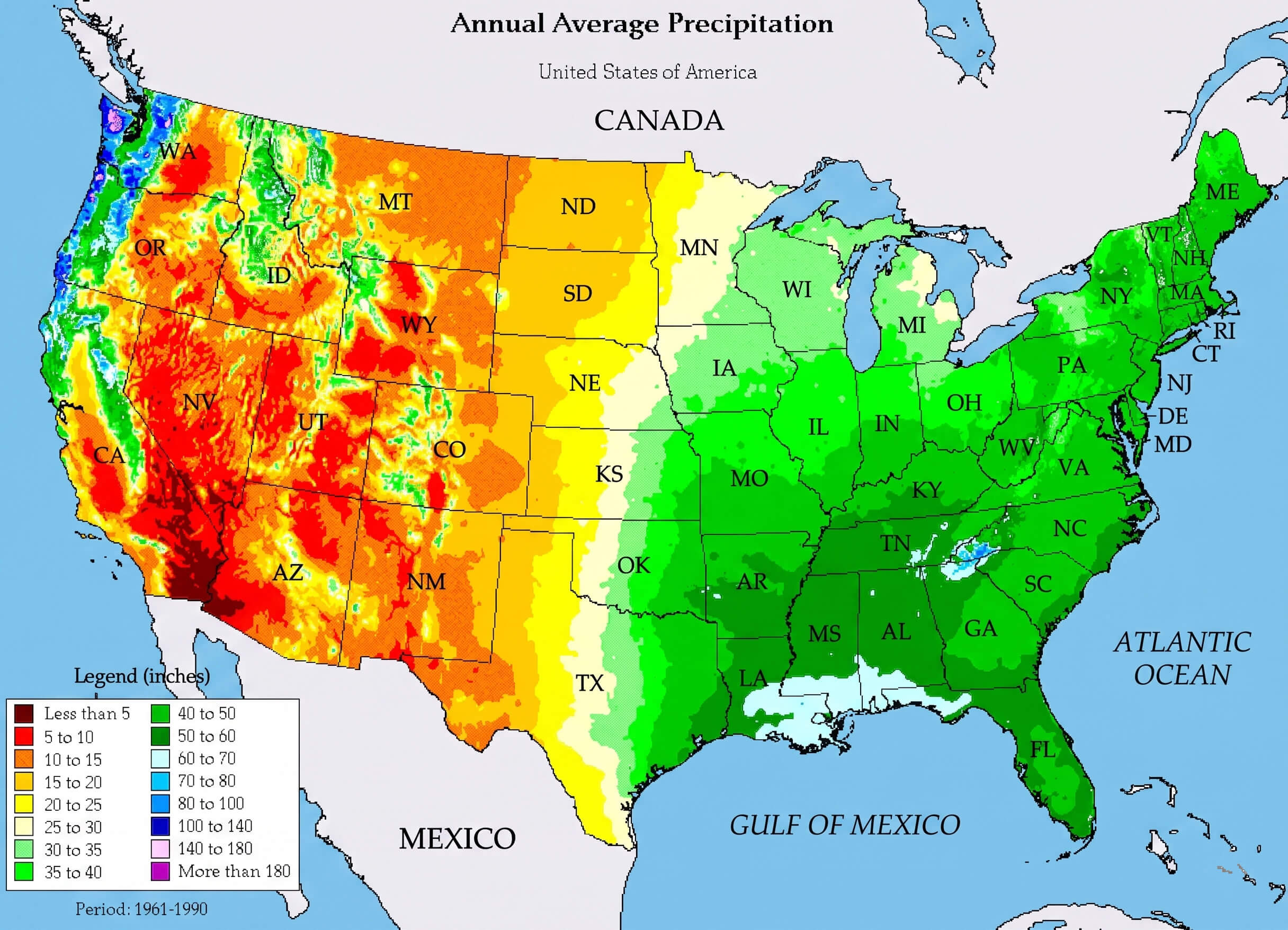
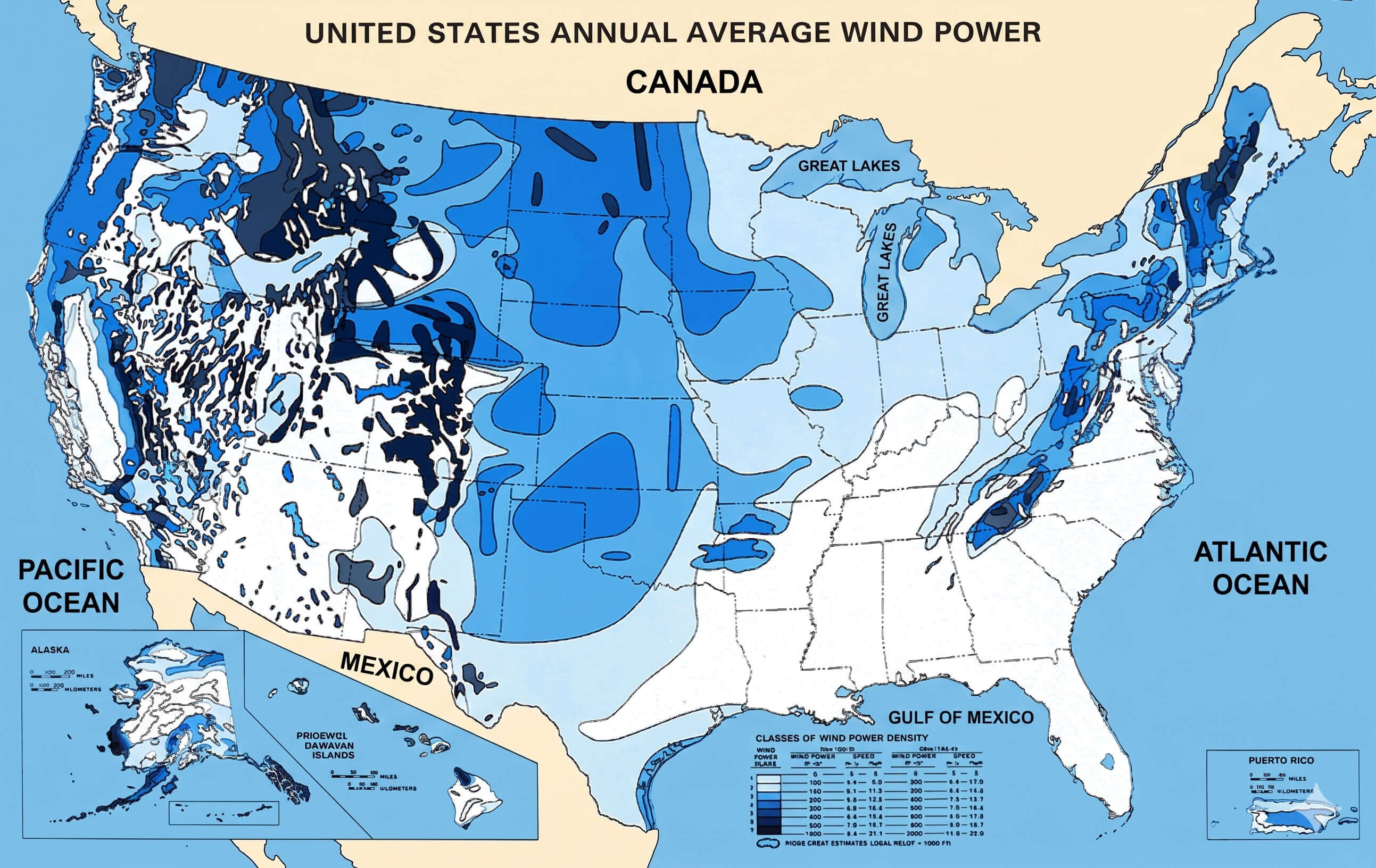
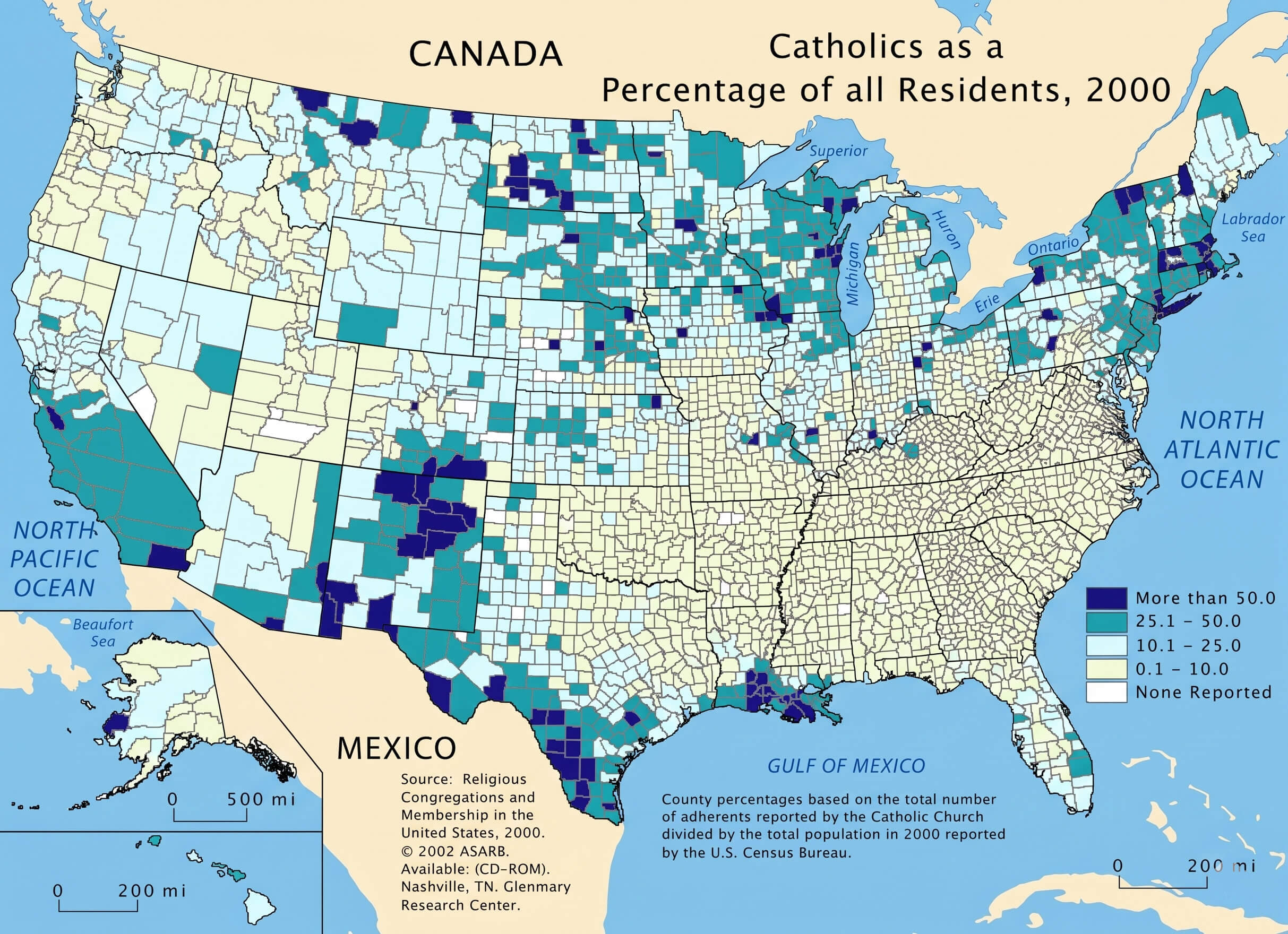
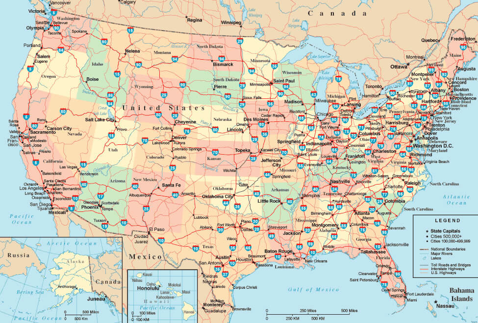
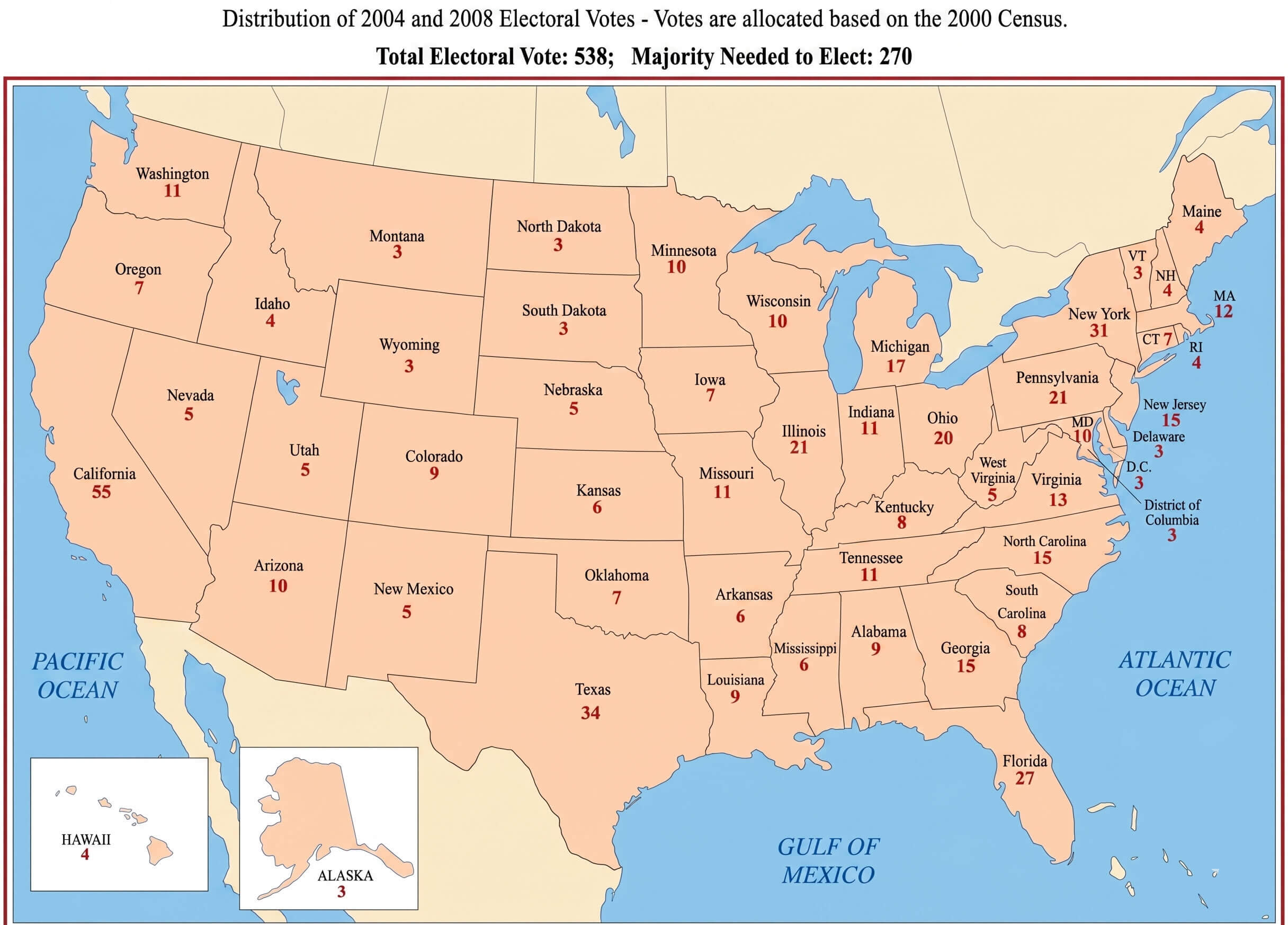
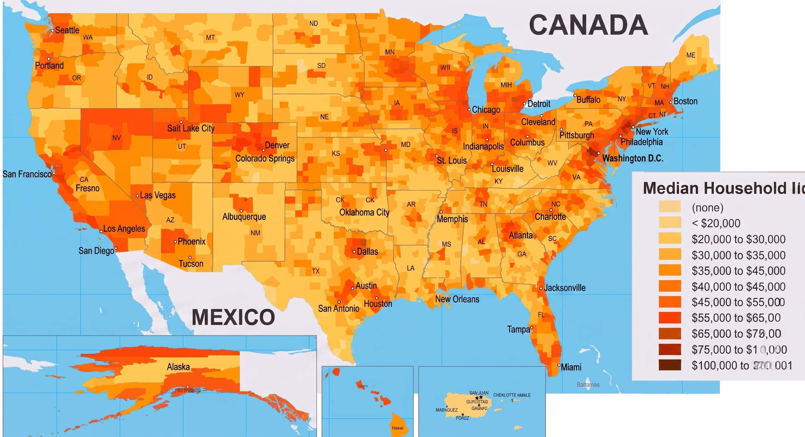
Visitors can also discover environmental and geographic resources including the United States annual precipitation map, United States average wind power map, United States terrain relief map, and United States map physical for a deeper understanding of America’s natural landscape. In addition, practical maps like the United States road and highway map, United States electoral votes map, United States catholic population map, and United States insular territories map provide valuable insights for travelers, researchers, students, and anyone interested in learning more about the diverse regions of the country.
United States average wind power map
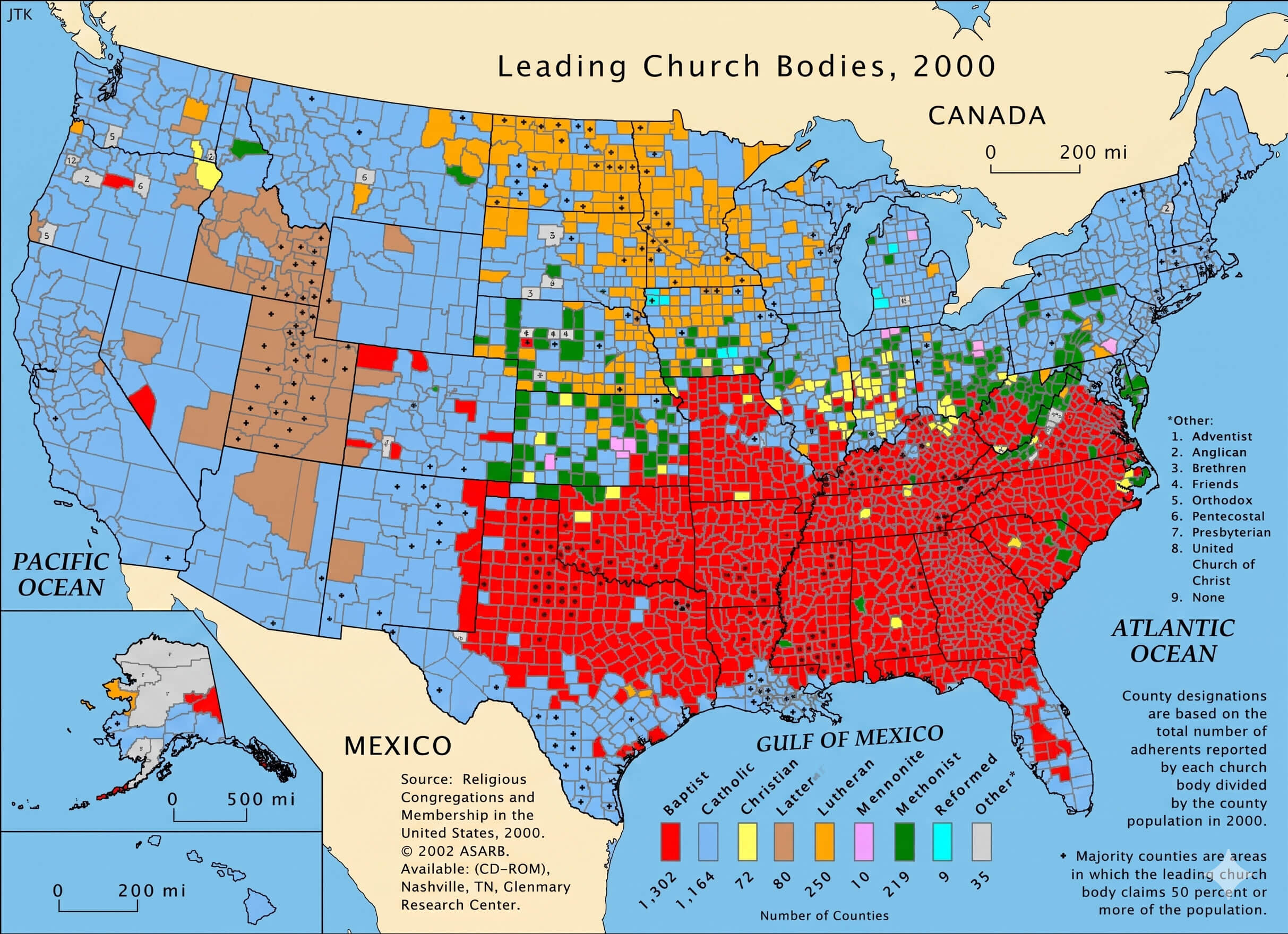
United States catholic population map
United States road and highway map
United States electoral votes map
United States income distribution map
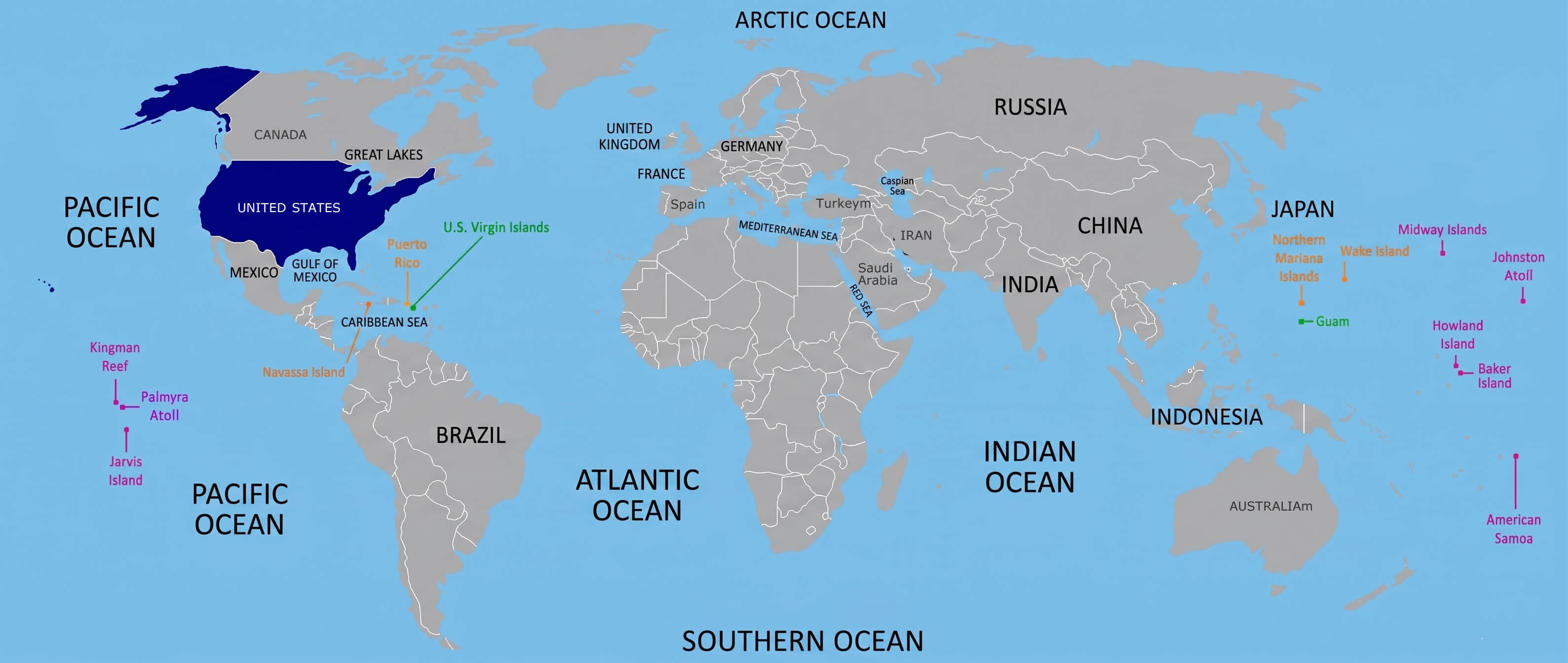
United States insular territories map
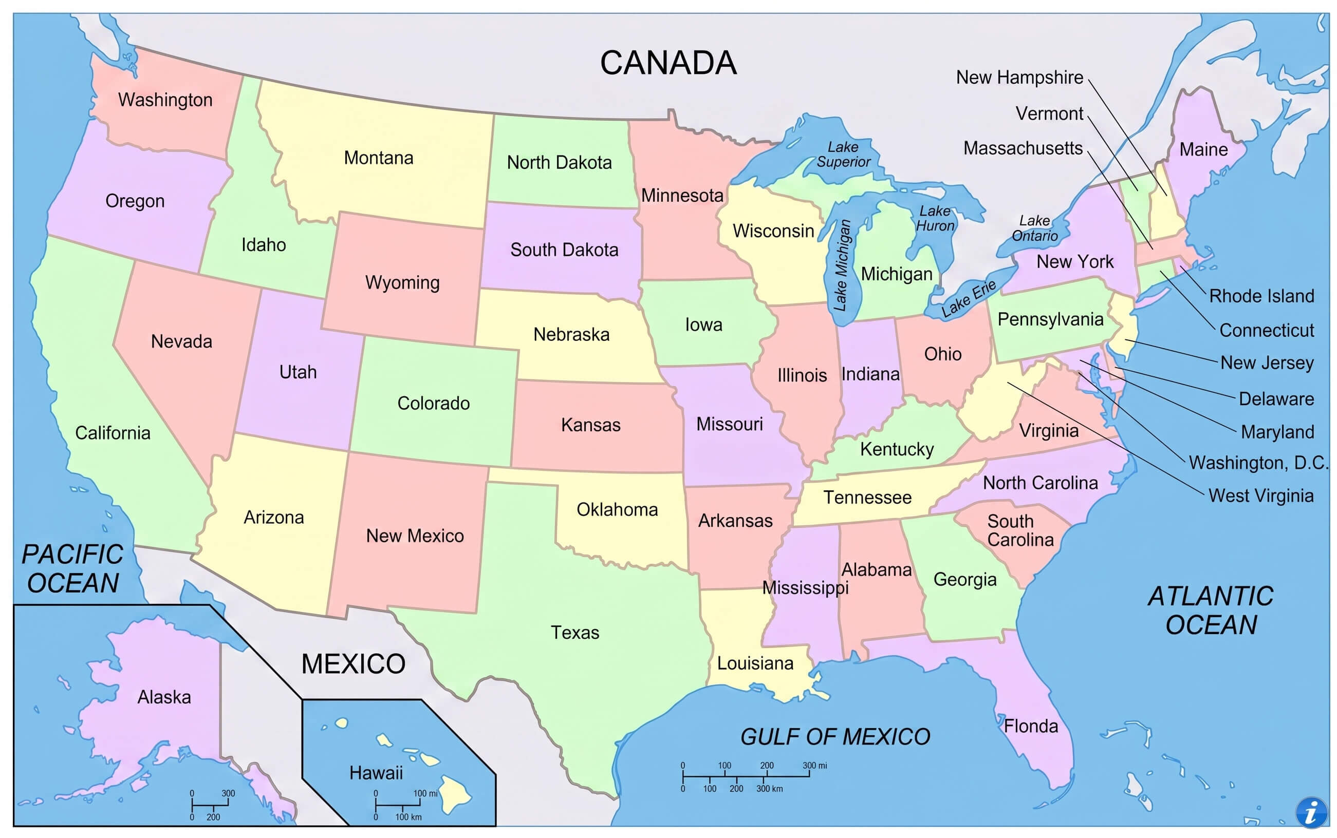
United States political boundaries map with states
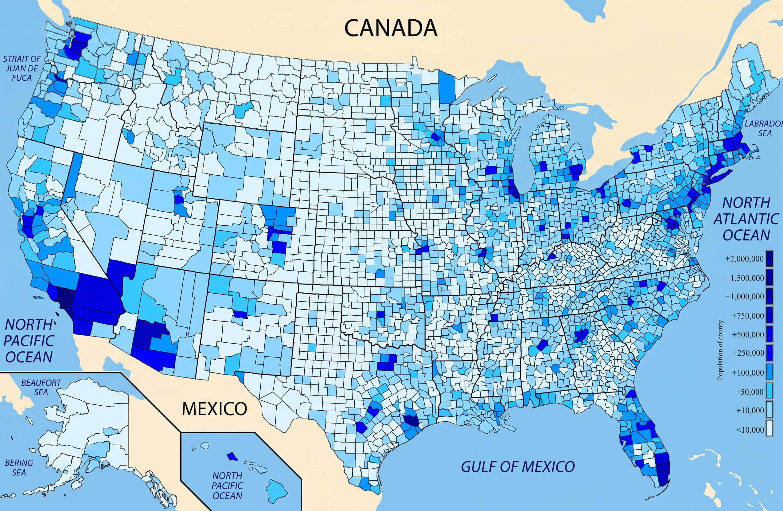
United States population density map
United States religious distribution map
United States terrain relief map
Feel free to explore these pages as well:
Copyright Turkey Travel Guide - 2005 - 2026. All rights reserved. Privacy Policy | Disclaimer