Sweden Map
Navigate Sweden Map, Sweden countries map, satellite images of the Sweden, Sweden largest cities maps, political map of Sweden, driving directions and traffic maps.
- Capital : Stockholm
- Population : 9,540,065
- GDP : $538.237 billion
- Per Capita : $56,956
- Calling Code : +46
- Jobless Rate : 7.40%
- Time Zone : +1
Stockholm's Top 10 Attractions and Secret Corners
Please subscribe on "World Guide" channnel on Youtube at youtube.com/c/WorldGuide
Where is Sweden in Europe, Is Sweden in NATO and EU
With interactive Sweden Map, view regional highways maps, road situations, transportation, lodging guide, geographical map, physical maps and more information. On Sweden Map, you can view all states, regions, cities, towns, districts, avenues, streets and popular centers' satellite, sketch and terrain maps.
For more about Sweden >>
Sweden Map & Sweden Satellite Images

A Collection of Sweden Maps and Sweden Satellite Images
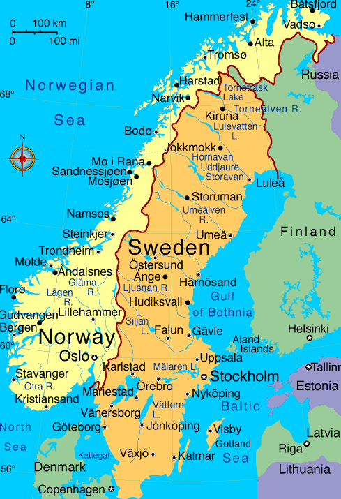
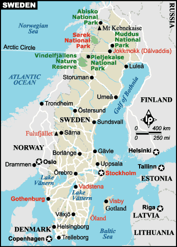
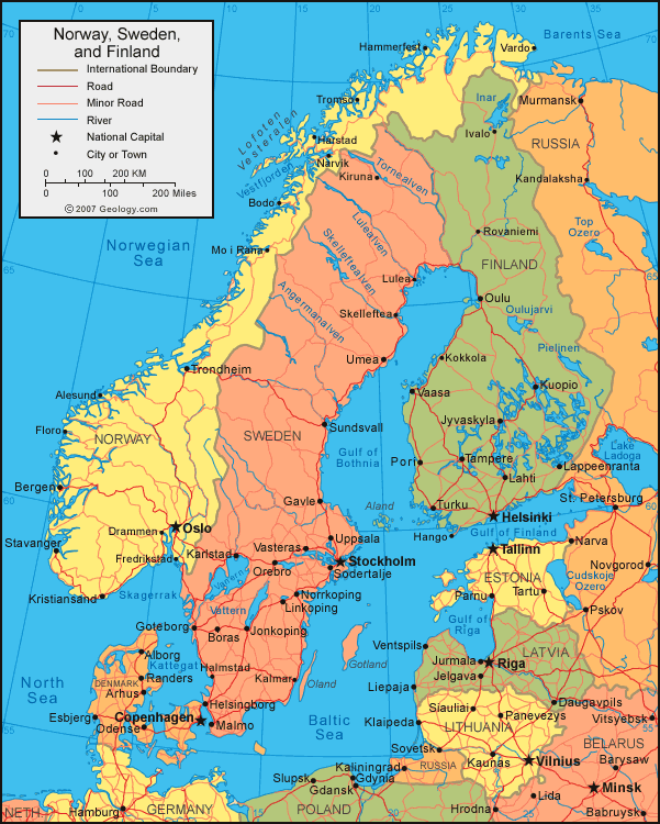
MAP OF SWEDEN

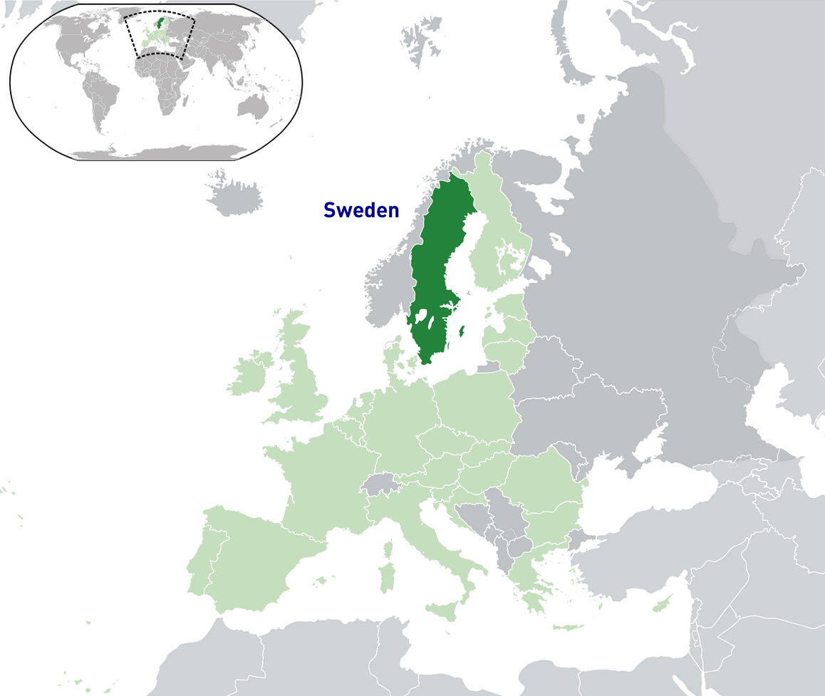
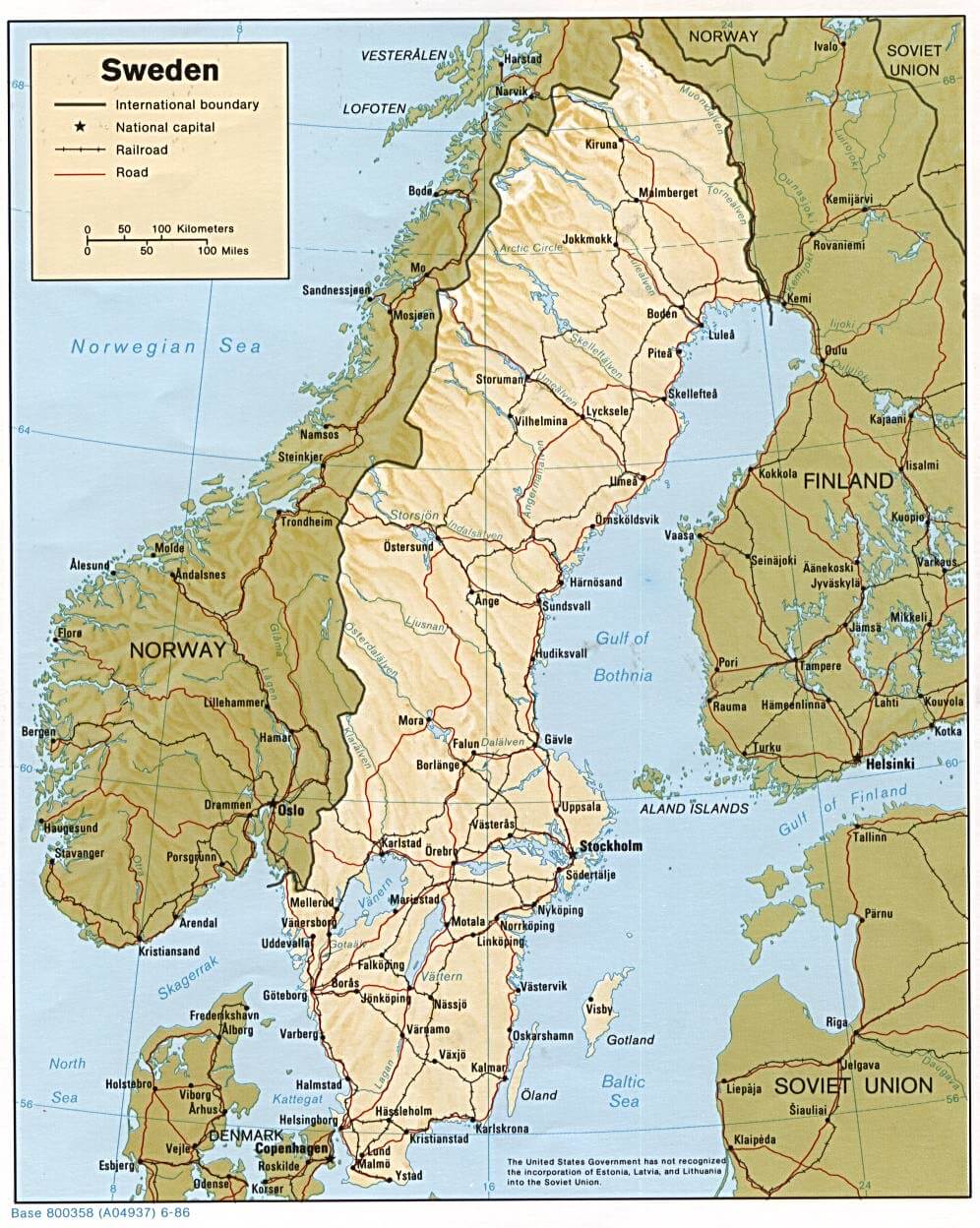
SWEDEN LOCATION MAP
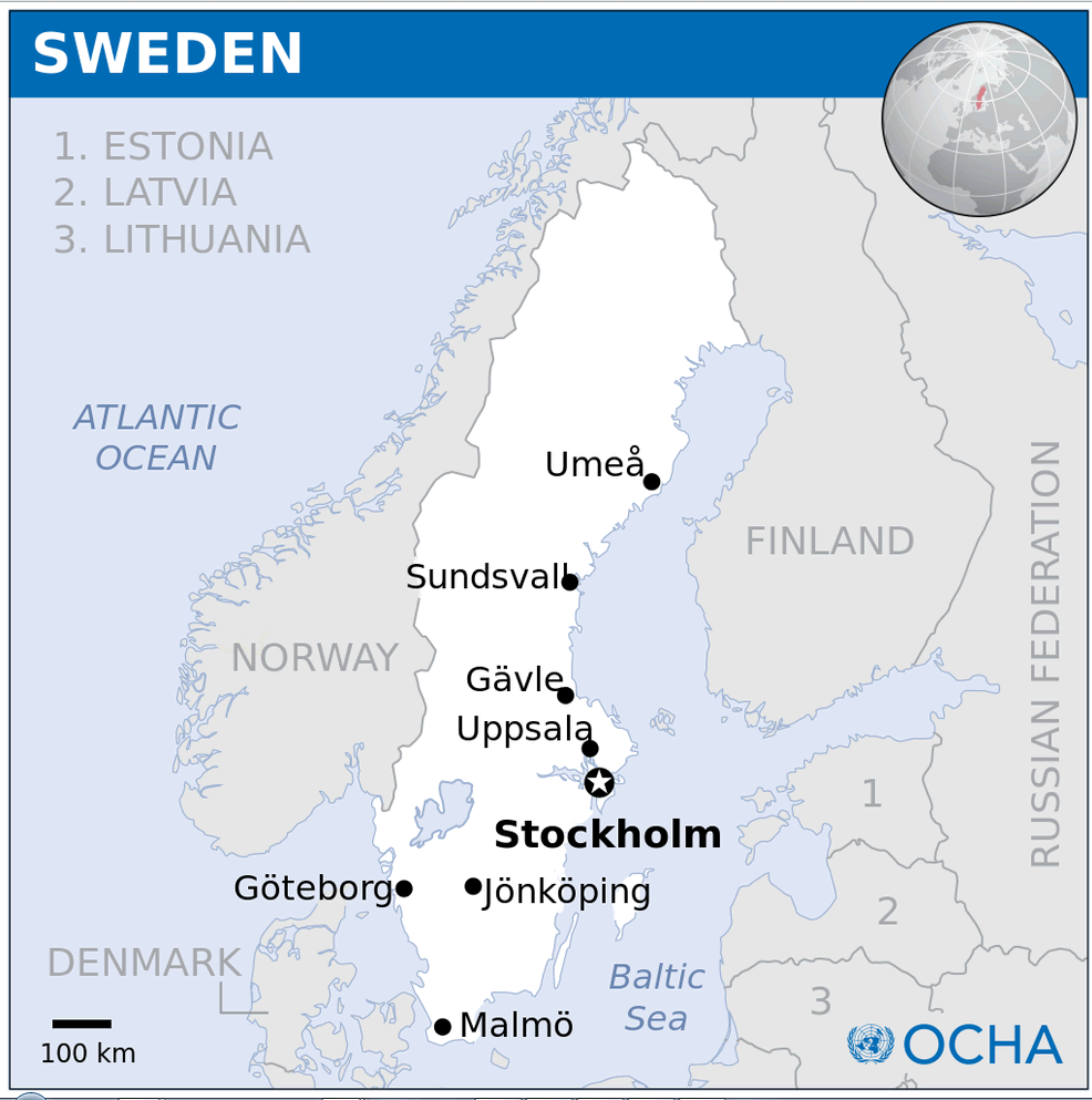
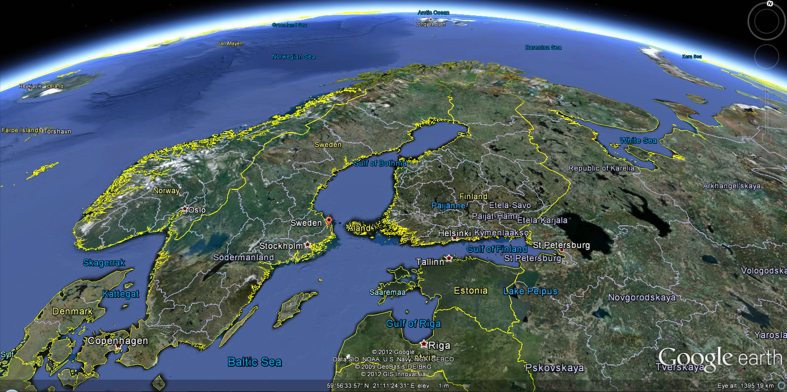
WHERE IS SWEDEN IN THE WORLD
MAP OF SWEDEN
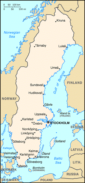
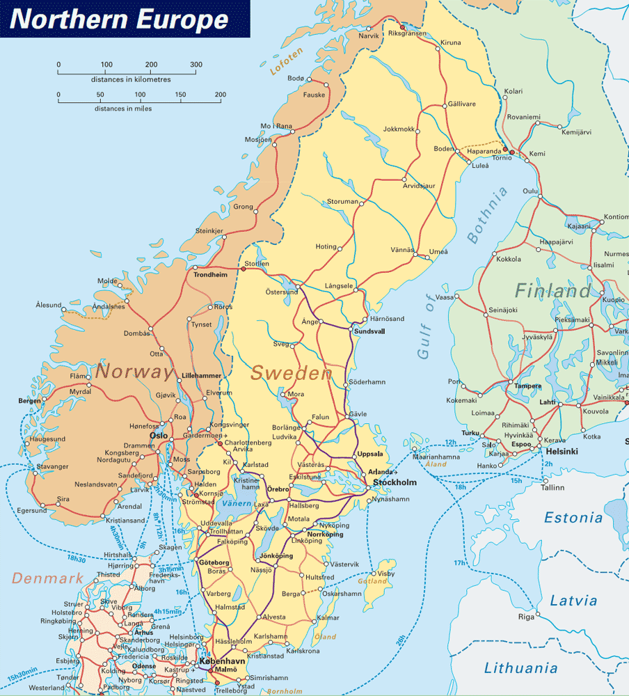
MAPS OF SWEDEN
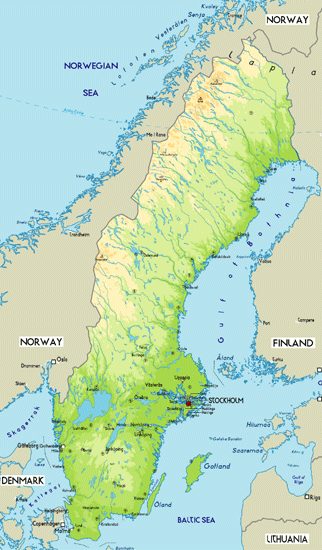
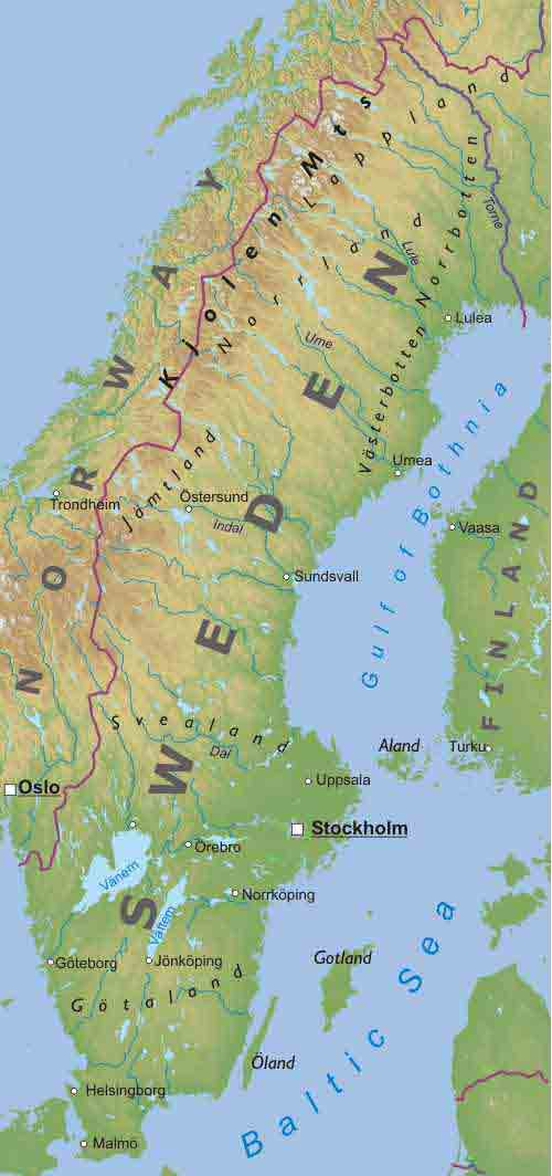
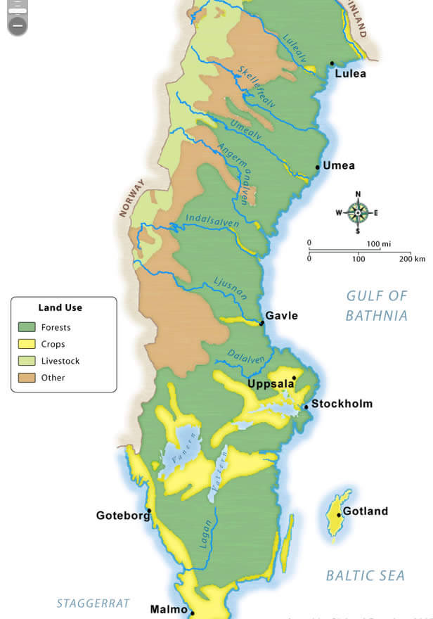
PHYSICAL MAP SWEDEN
POLITICAL MAP OF SWEDEN
PROVINCES MAP OF SWEDEN
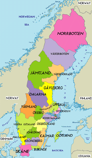
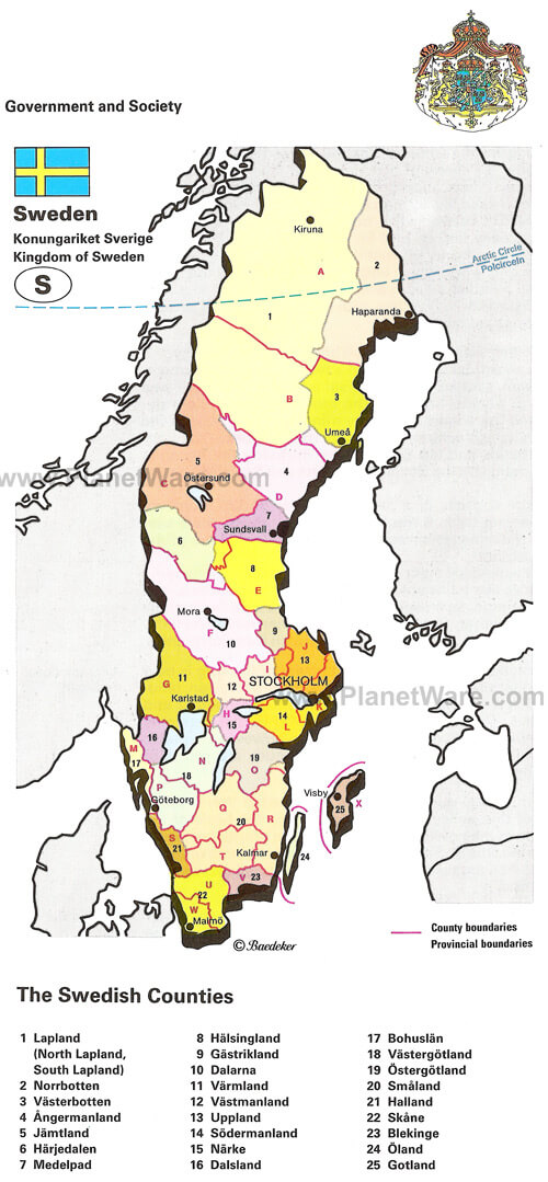
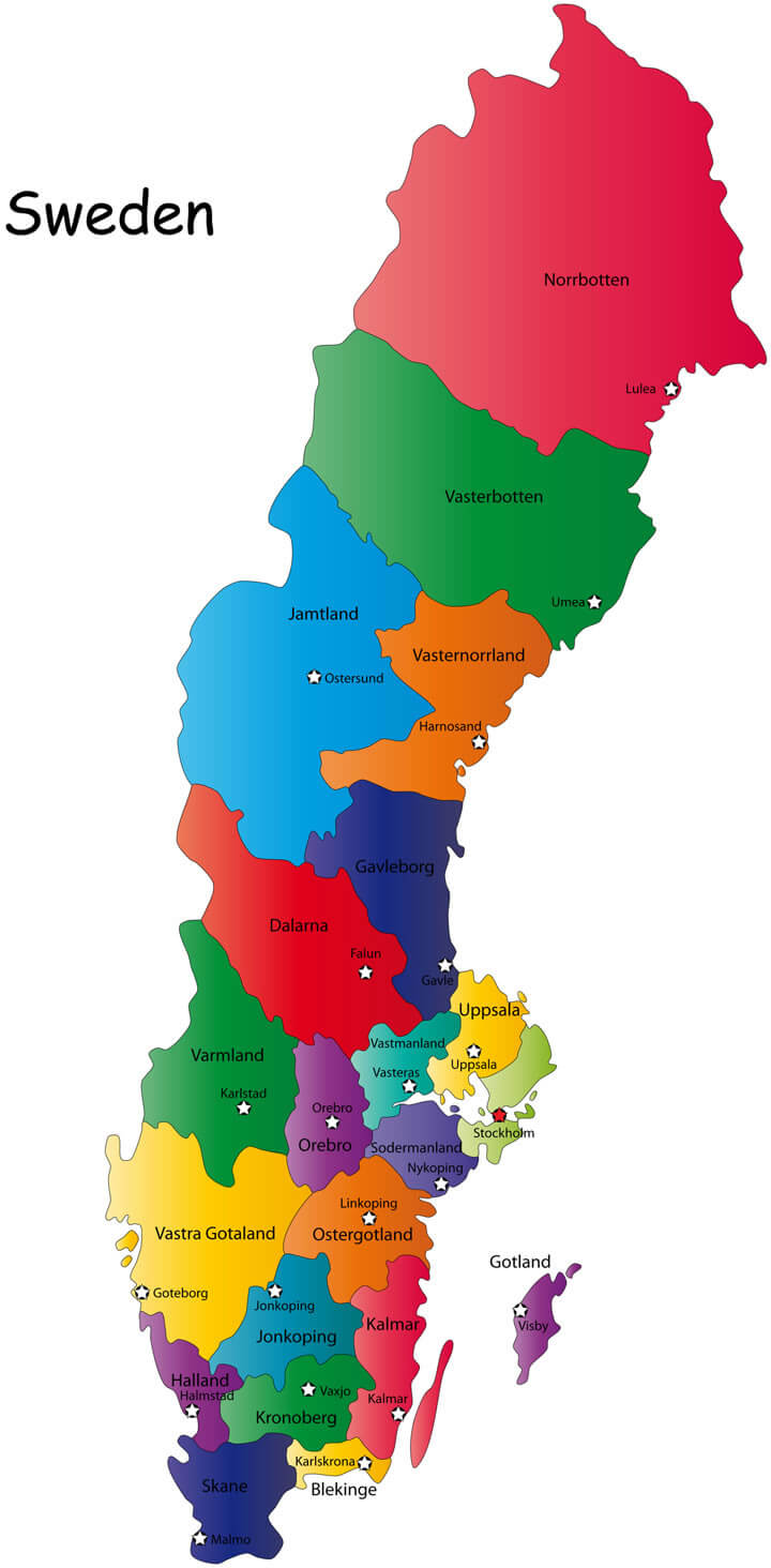
SWEDEN COUNTIES MAP
SWEDEN COUNTRY MAP
SWEDEN MAP
SWEDEN PHYSICAL MAP
SWEDEN REGIONS MAP
SWEDEN FOREST MAP
SWEDEN MAP
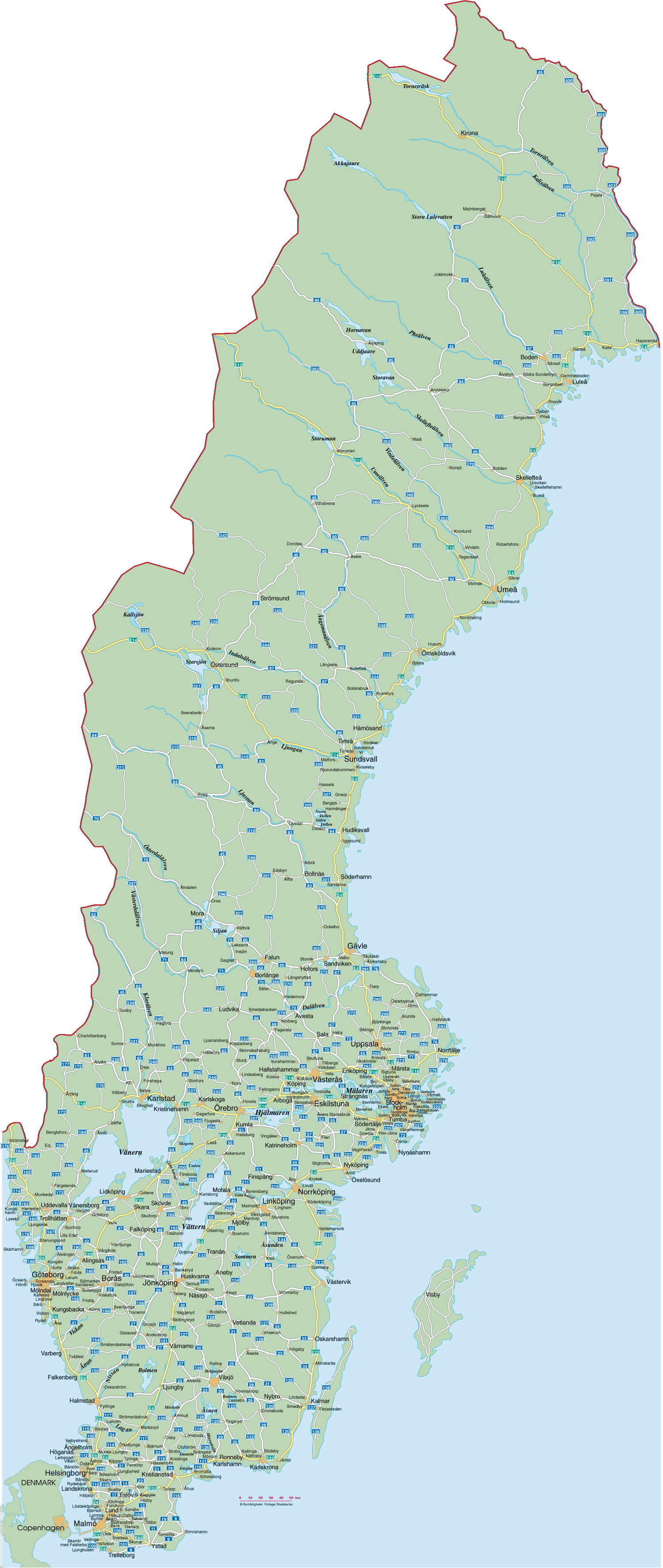
SWEDEN MAP
SWEDEN PHYSICAL MAP
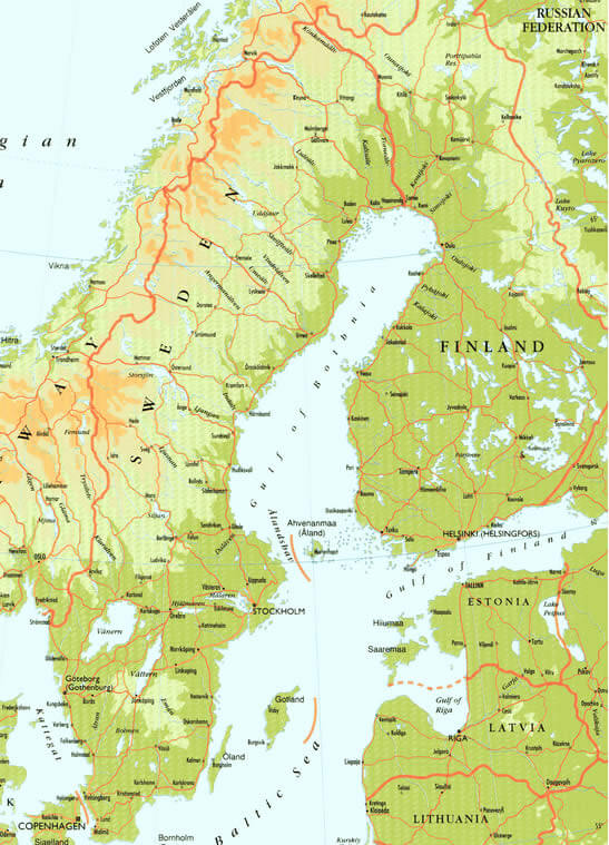
SWEDEN EARTH MAP
Largest Cities Map of Sweden
Boras Map - Goteborg Map - Helsingborg Map - Jonkopin Map - Linkoping Map - Lund Map - Malmo Map - Norrkoping Map - Orebro Map - Stockholm Map - Umea Map - Uppsala Map - Vasteras Map -Sweden Google Map, Street Views, Maps Directions, Satellite Images
Please Not : You can find local businesses, public places, tourist attractions via map view, satellite image, hybrid view, driving directions in Sweden Map. You'll also find a varity map of Sweden such as political, administrative, transportation, demographics maps following Google map.
Submit URL to Sweden :
Alphabetically Cities Map of Sweden & Population of Sweden Cities
Boras Map - Goteborg Map - Helsingborg Map - Jonkopin Map - Linkoping Map - Lund Map - Malmo Map - Norrkoping Map - Orebro Map - Stockholm Map - Umea Map - Uppsala Map - Vasteras Map -Please feel free share your comments and questions :
Please feel free share your comments and questions :
"Sweden" related content to share on social media;


Copyright Turkey Travel Guide - 2005 - 2026. All rights reserved. Privacy Policy | Disclaimer