Norway Map
Navigate Norway Map, Norway countries map, satellite images of the Norway, Norway largest cities maps, political map of Norway, driving directions and traffic maps.
- Capital : Oslo
- Population : 5,033,675
- GDP : $483.650 billion
- Per Capita : $97,254
- Calling Code : +47
- Jobless Rate : 3.50%
- Time Zone : +1
Where is Located Norway in Europe, Is Norway Member of NATO and EU?
Please subscribe on "World Guide" channnel on Youtube at youtube.com/c/WorldGuide
With interactive Norway Map, view regional highways maps, road situations, transportation, lodging guide, geographical map, physical maps and more information. On Norway Map, you can view all states, regions, cities, towns, districts, avenues, streets and popular centers' satellite, sketch and terrain maps.For more about Norway >>
Norway Map & Norway Satellite Images
A Collection of Norway Maps and Norway Satellite Images
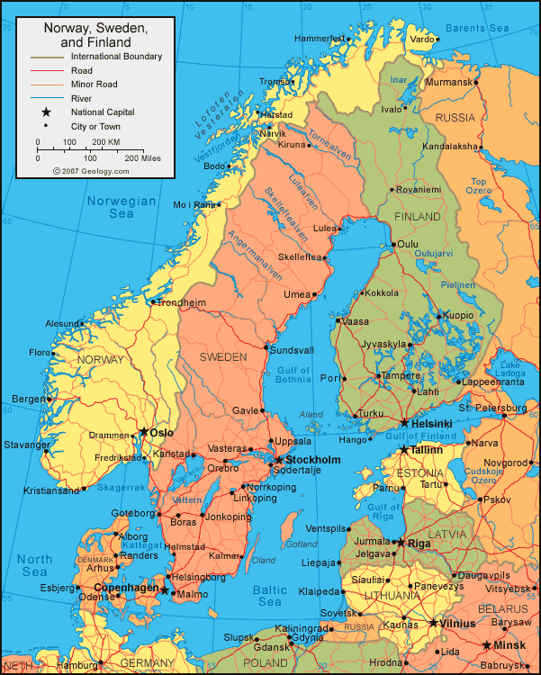
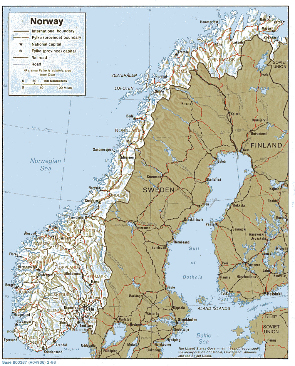
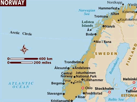
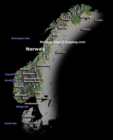
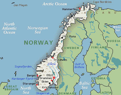
MAP OF NORWAY

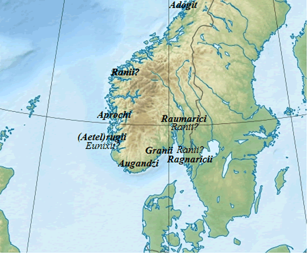
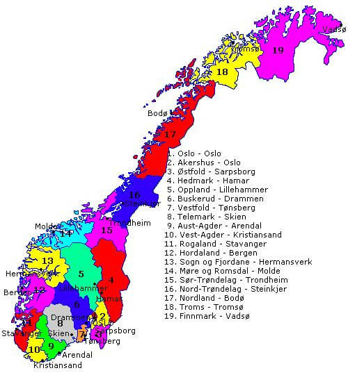
NORWAY TRIBES MAP
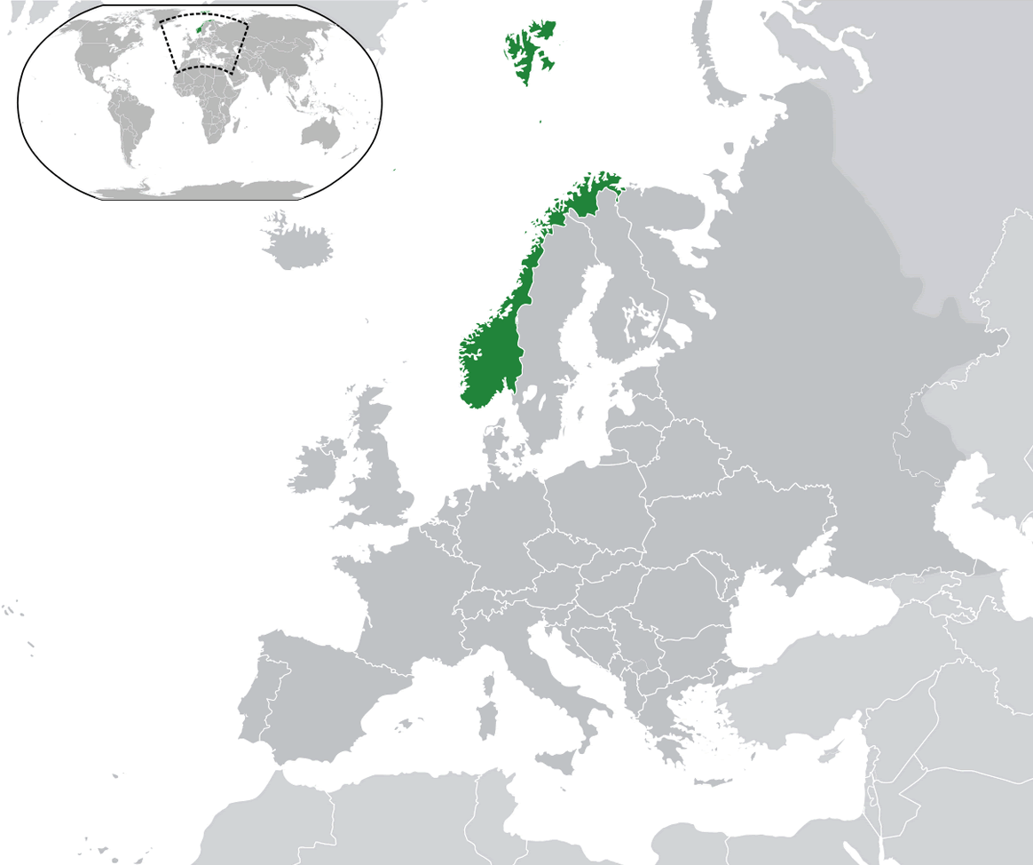
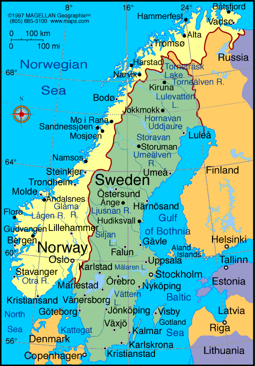
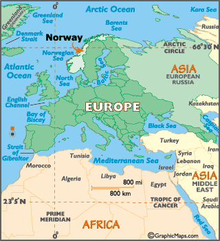
WHERE IS NORWAY IN THE WORLD
MAP NORWAY
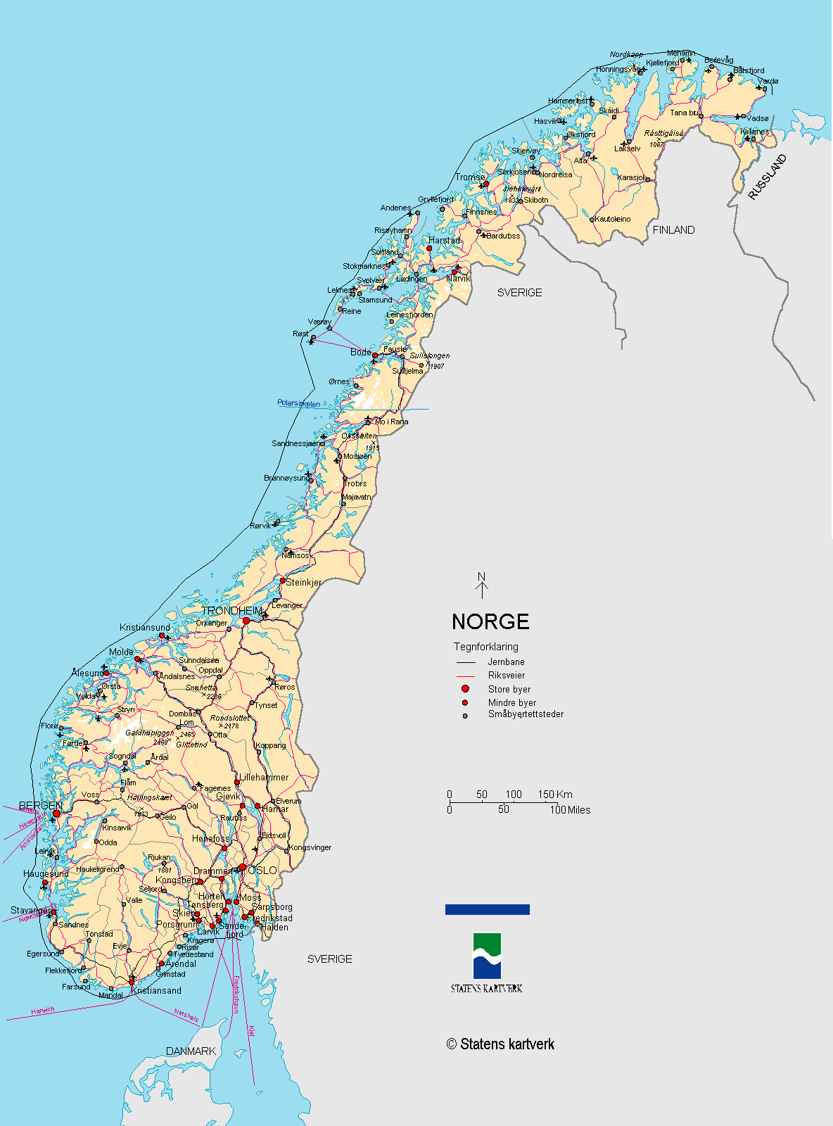
MAP OF NORWAY
NORWAY CITIES MAP
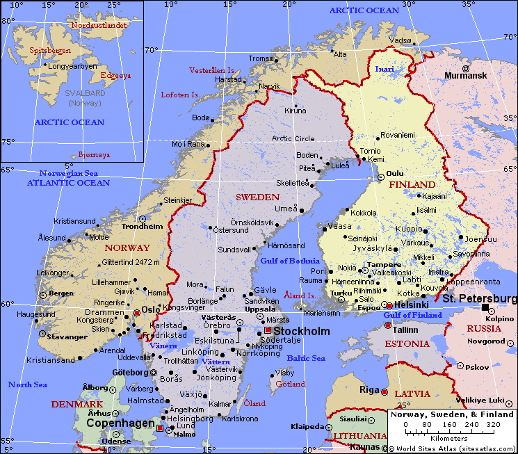
NORWAY MAP

NORWAY MAPS

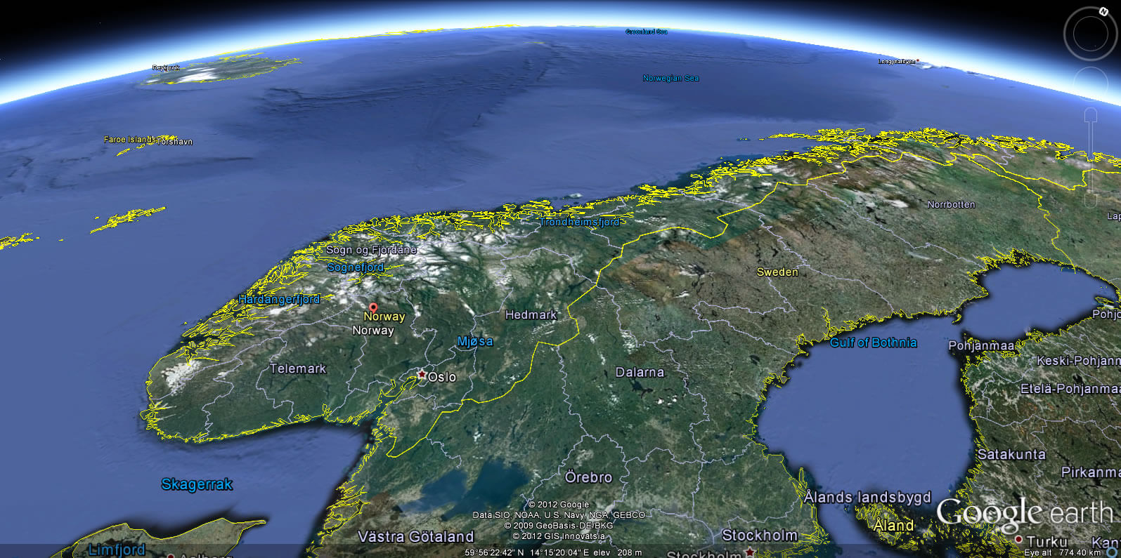
NORWAY SATELLITE MAP
NORWAY CITIES MAP
NORWAY CITY MAP
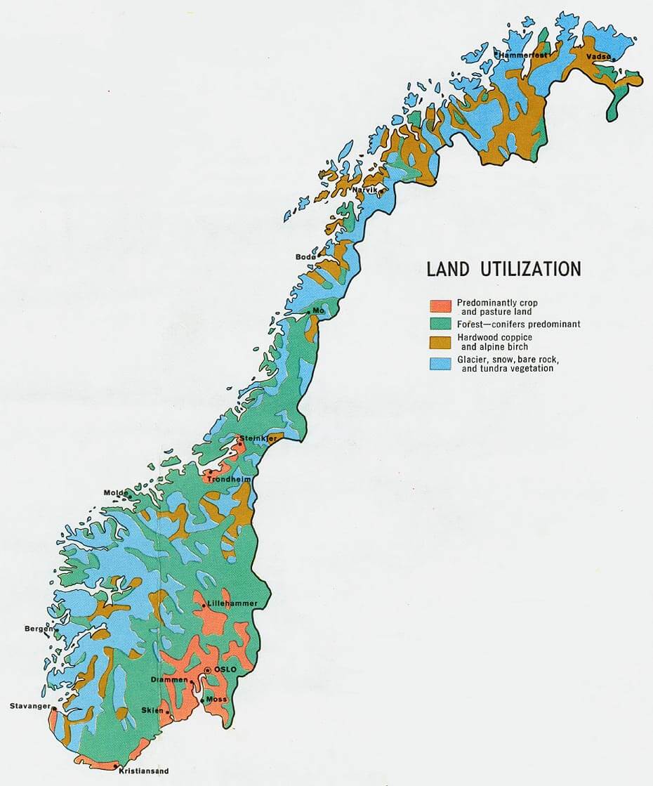
NORWAY LAND MAP
NORWAY MAP
NORWAY MAP EUROPE
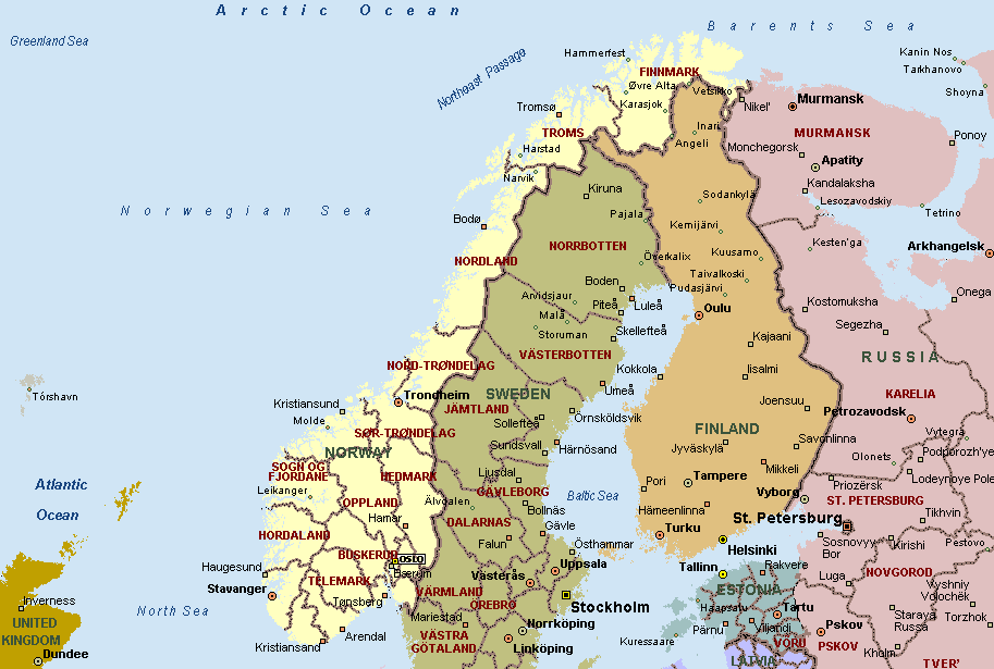
NORWAY MAP SCANDINAVIA
NORWAY MAPS
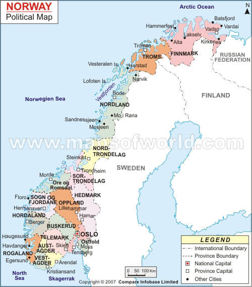
NORWAY POLITICAL MAP
NORWAY POPULATION MAP

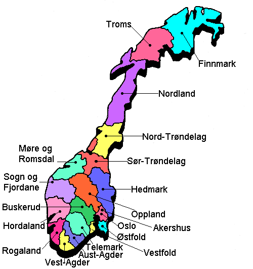
NORWAY PROVINCES MAP
NORWAY MAP
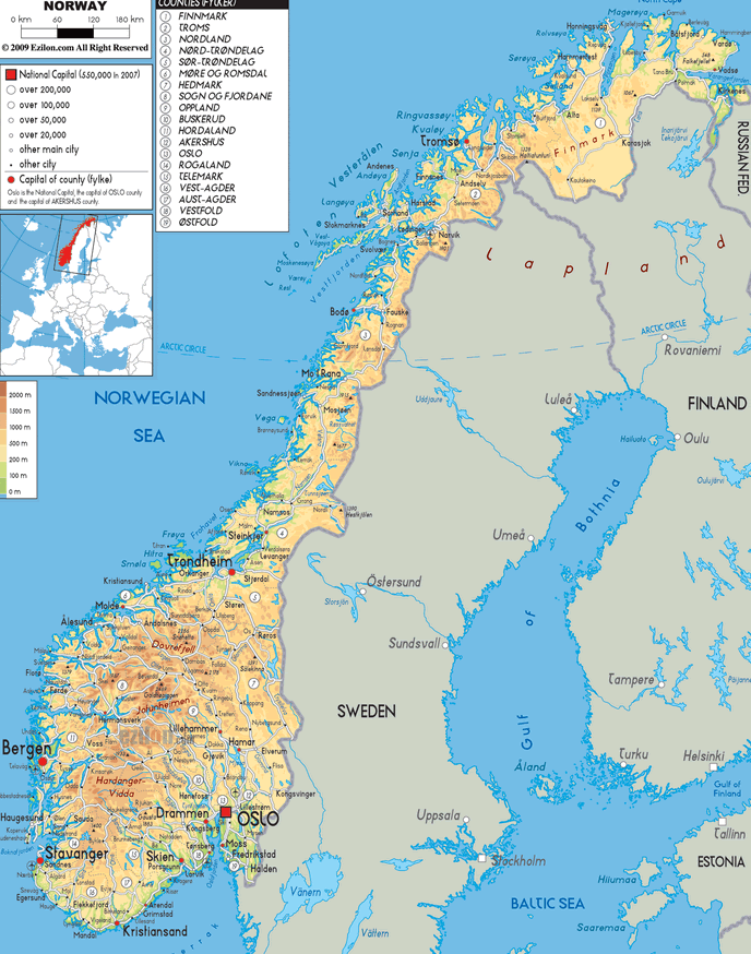
NORWAY EARTH MAP
Largest Cities Map of Norway
Oslo Map - 584,292 Bergen Map - 252,051 Trondheim Map - 168,257 Stavanger Map - 121,610 Baerum Map - 113,659 Kristiansand Map - 80,000 Fredrikstad Map - 71,976 Tromso Map - 64,782 Sandnes Map - 63,032 Skien Map - 62,537 Drammen Map - 60,145 Sarpsborg Map - 50,115 Bodo Map - 46,049 Sandefjord Map - 42,333 Alesund Map - 41,385 Larvik Map - 41,221 Arendal Map - 39,826 Tonsberg Map - 38,914 Porsgrunn Map - 33,550 Haugesund Map - 31,738 Hamar Map - 31,593 Moss Map - 28,800 Halden Map - 28,063 Gjovik Map - 27,500 Lillehammer Map - 25,070 Horten Map - 24,671 Molde Map - 24,421 Kongsberg Map - 23,997 Harstad Map - 23,242 Kristiansund Map - 22,661 Steinkjer Map - 20,672 Grimstad Map - 19,809 Narvik Map - 18,512 Kongsvinger Map - 17,380 Honefoss Map - 13,930 Mandal Map - 13,840 Egersund Map - 13,418 Namsos Map - 12,426 Notodden Map - 12,359 Holmestrand Map - 9,515 Farsund Map - 9,392 Hammerfest Map - 9,261 Flekkefjord Map - 8,918 Floro Map - 8,296 Risor Map - 6,938 Vadso Map - 6,187 Vardo Map - 2,396Norway Google Map, Street Views, Maps Directions, Satellite Images
Please Not : You can find local businesses, public places, tourist attractions via map view, satellite image, hybrid view, driving directions in Norway Map. You'll also find a varity map of Norway such as political, administrative, transportation, demographics maps following Google map.
Submit URL to Norway :
Alphabetically Cities Map of Norway & Population of Norway Cities
Oslo Map - 584,292 Bergen Map - 252,051 Trondheim Map - 168,257 Stavanger Map - 121,610 Baerum Map - 113,659 Kristiansand Map - 80,000 Fredrikstad Map - 71,976 Tromso Map - 64,782 Sandnes Map - 63,032 Skien Map - 62,537 Drammen Map - 60,145 Sarpsborg Map - 50,115 Bodo Map - 46,049 Sandefjord Map - 42,333 Alesund Map - 41,385 Larvik Map - 41,221 Arendal Map - 39,826 Tonsberg Map - 38,914 Porsgrunn Map - 33,550 Haugesund Map - 31,738 Hamar Map - 31,593 Moss Map - 28,800 Halden Map - 28,063 Gjovik Map - 27,500 Lillehammer Map - 25,070 Horten Map - 24,671 Molde Map - 24,421 Kongsberg Map - 23,997 Harstad Map - 23,242 Kristiansund Map - 22,661 Steinkjer Map - 20,672 Grimstad Map - 19,809 Narvik Map - 18,512 Kongsvinger Map - 17,380 Honefoss Map - 13,930 Mandal Map - 13,840 Egersund Map - 13,418 Namsos Map - 12,426 Notodden Map - 12,359 Holmestrand Map - 9,515 Farsund Map - 9,392 Hammerfest Map - 9,261 Flekkefjord Map - 8,918 Floro Map - 8,296 Risor Map - 6,938 Vadso Map - 6,187 Vardo Map - 2,396Copyright Turkey Travel Guide - 2005 - 2026. All rights reserved. Privacy Policy | Disclaimer