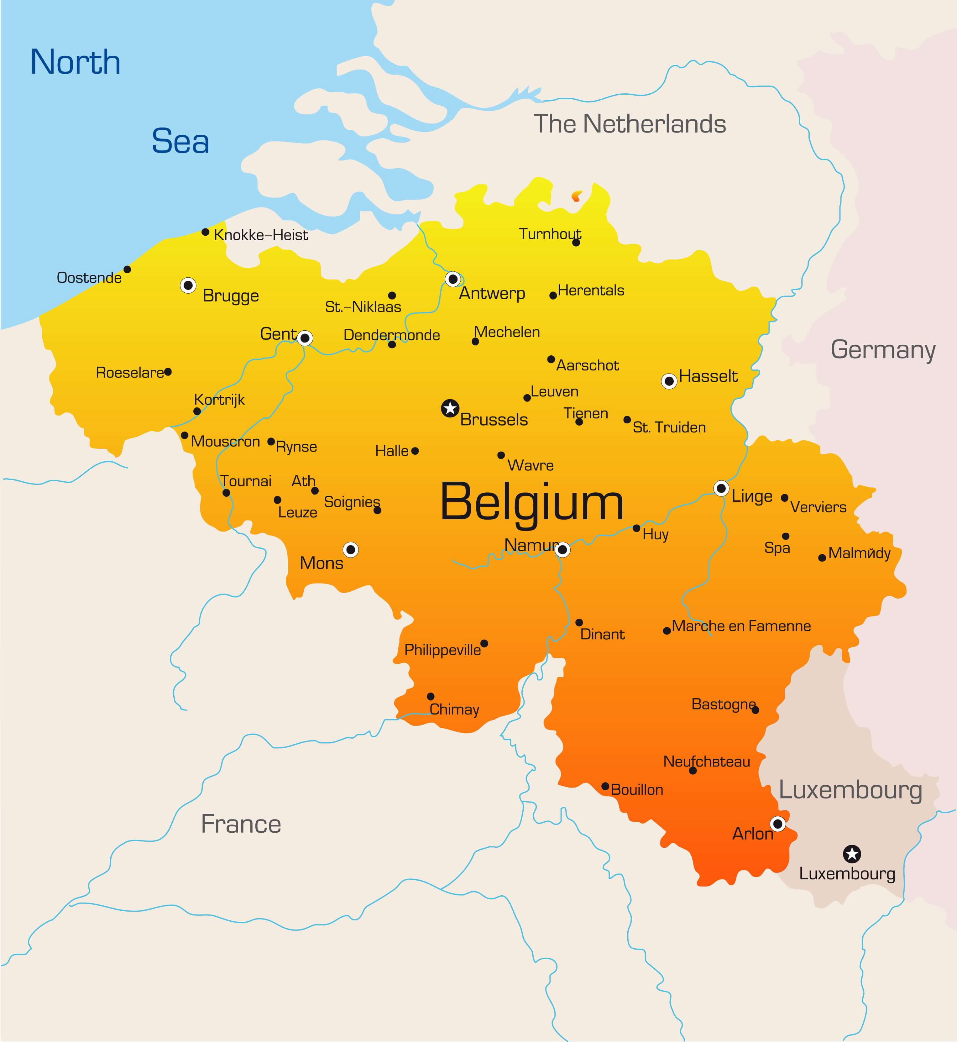
Belgium Map
Navigate Belgium map, satellite images of the Belgium, states, largest cities, political map, capitals and physical maps.

- Capital : Brussels
- Population : 11,041,266
- GDP : $513.396 billion (21st)
- Per Capita : $46,878 (16th)
- Calling Code : +32
- Jobless Rate : 7.40%
- Time Zone : +1
A Collection of Belgium Maps
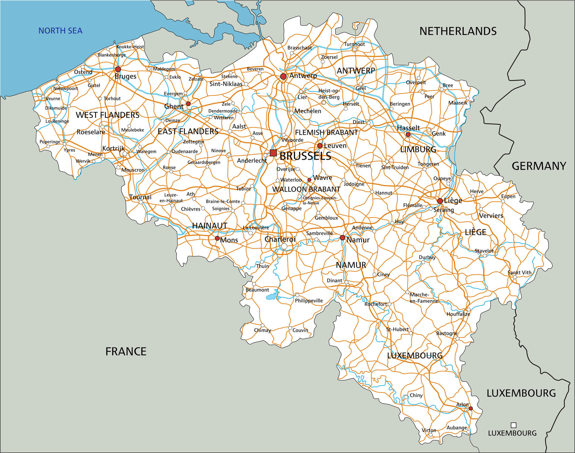
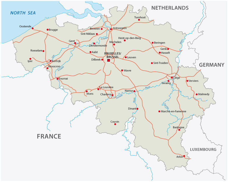
Belgium Road Map
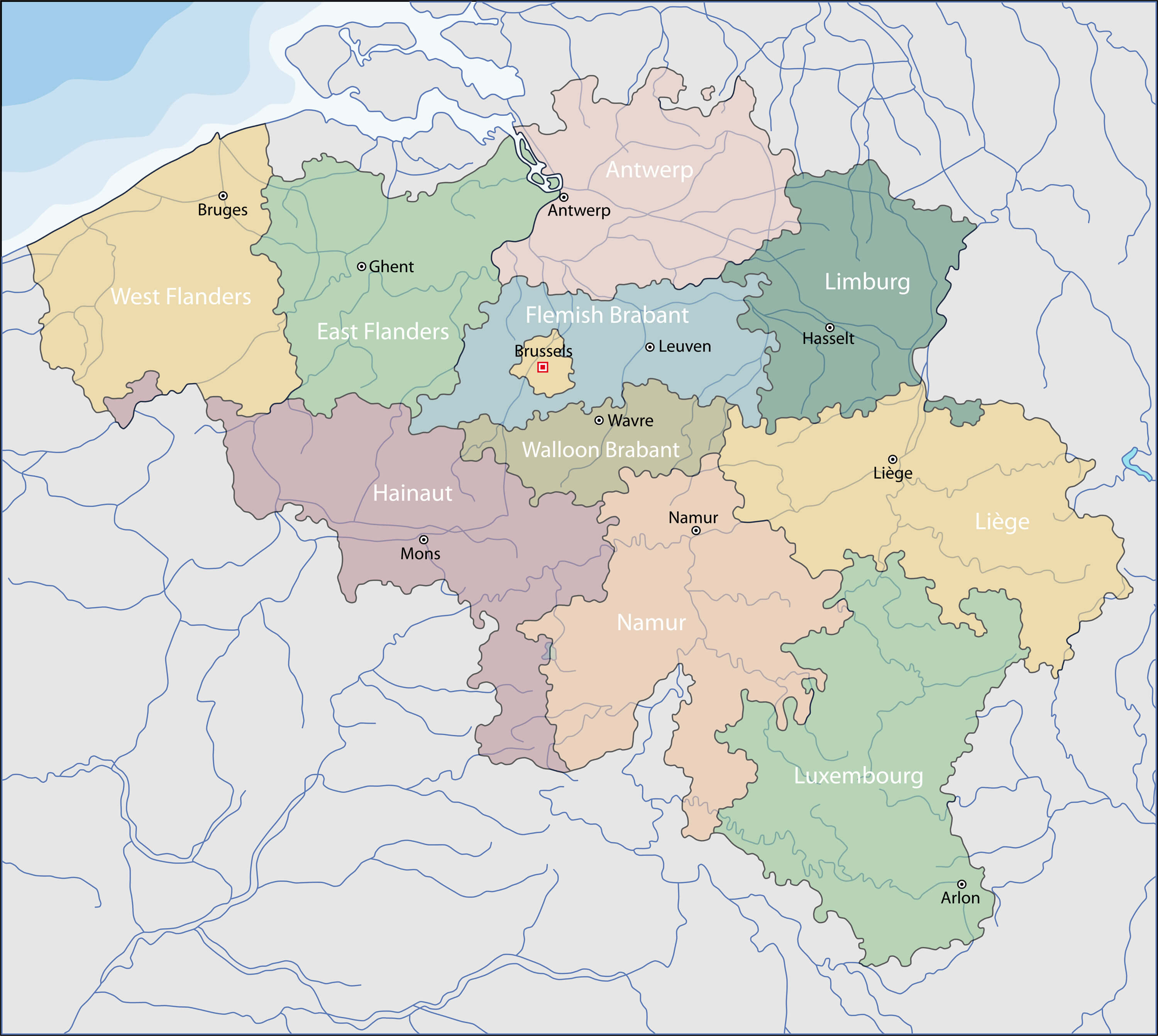
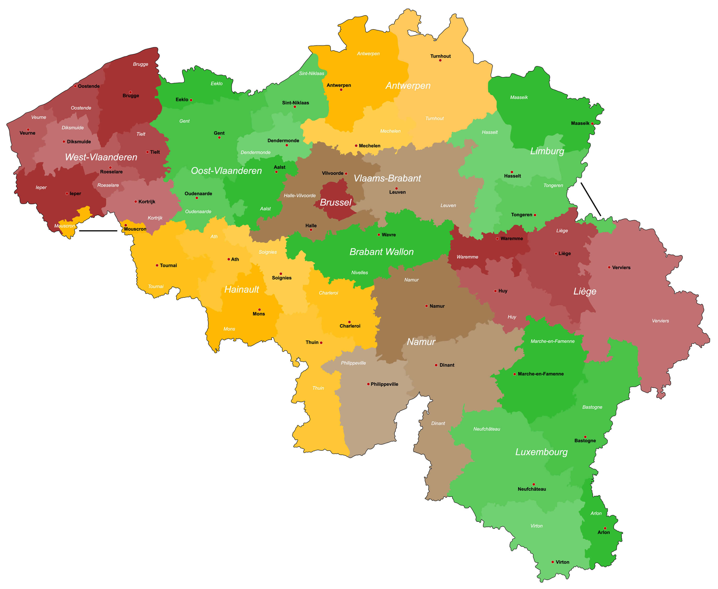
Belgium Provinces Map
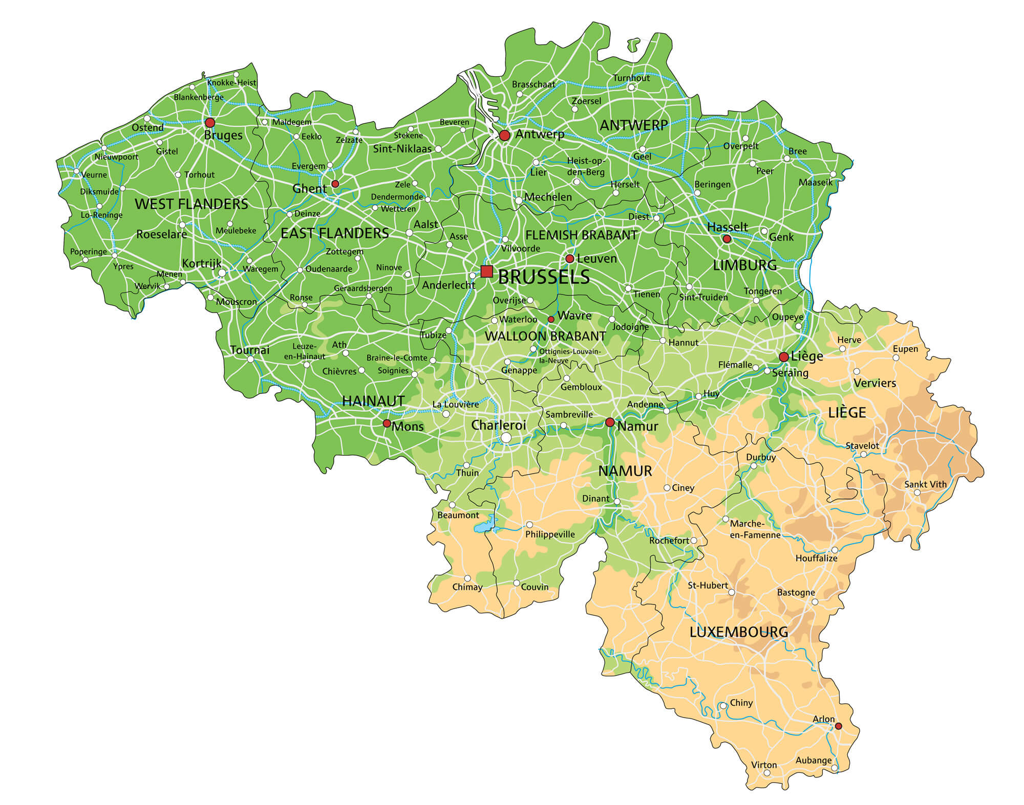
Belgium Physical Map
Belgium Map
Belgium Country Map
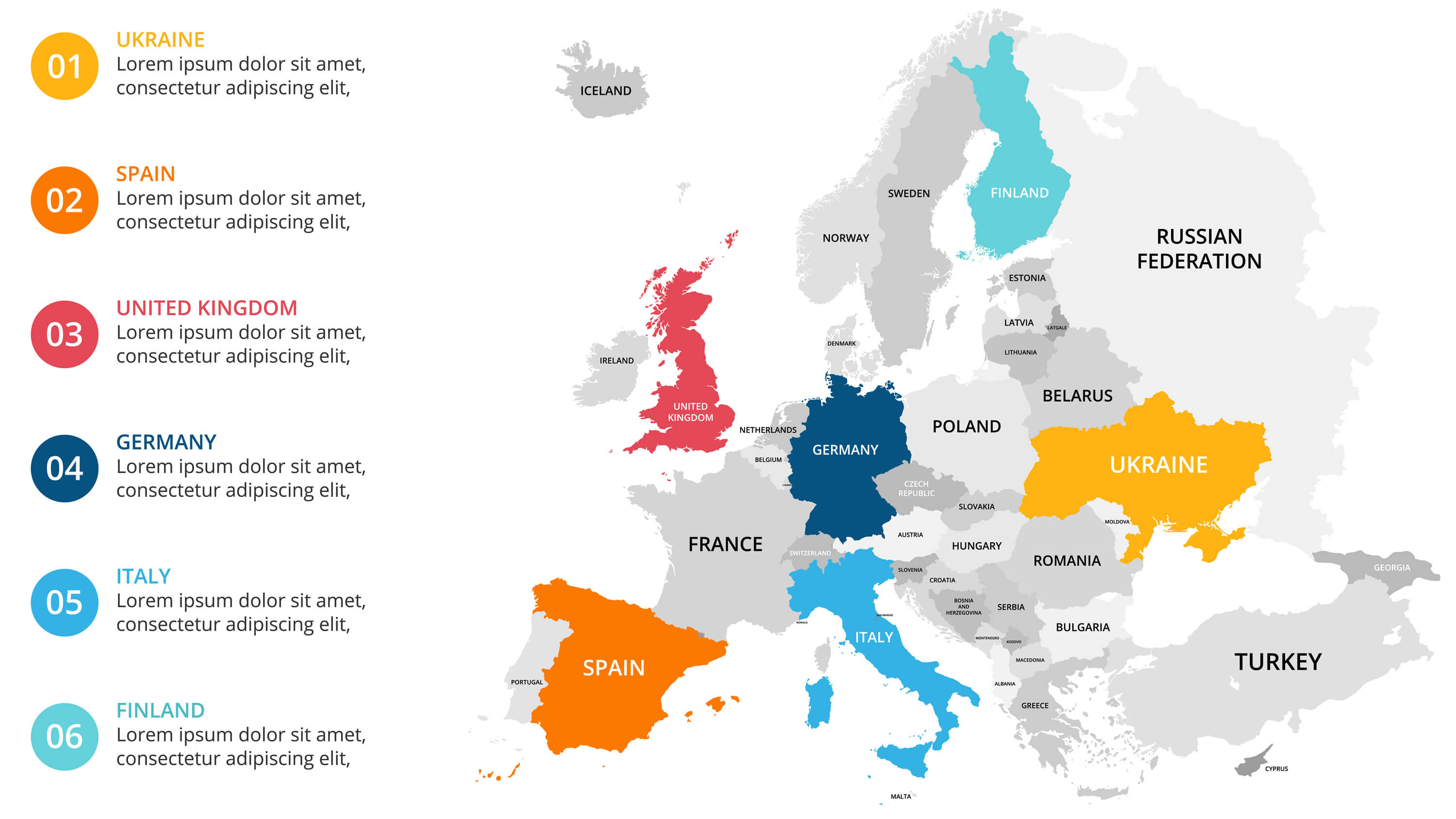
Belgium Europe Infographic Map
Detailed Map of Belgium
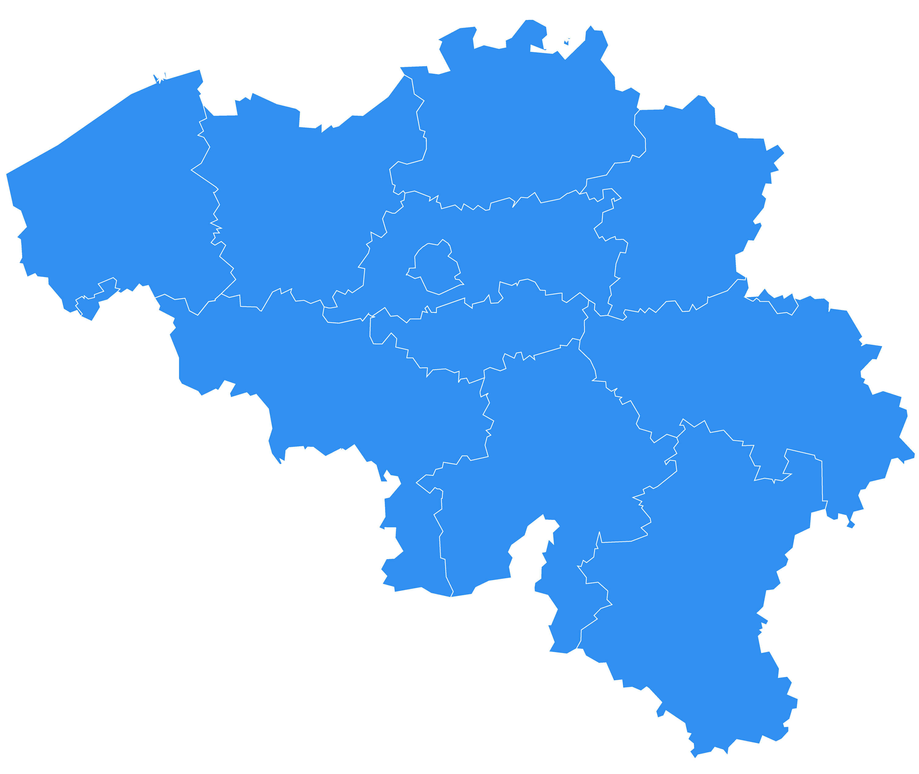
Belgium Blank Map
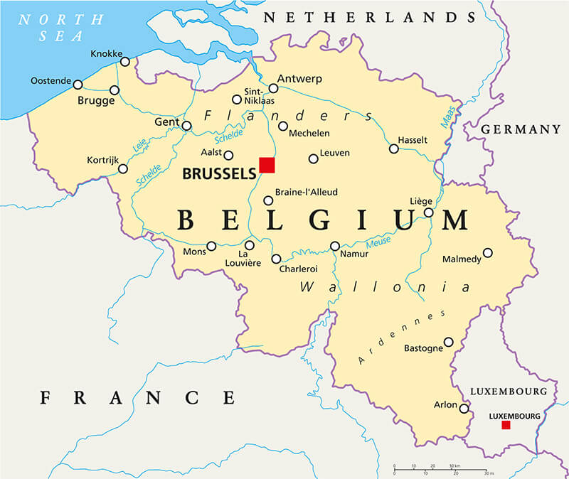
Belgium Political Map
Belgium Map with Main Cities
Belgium Highway Map
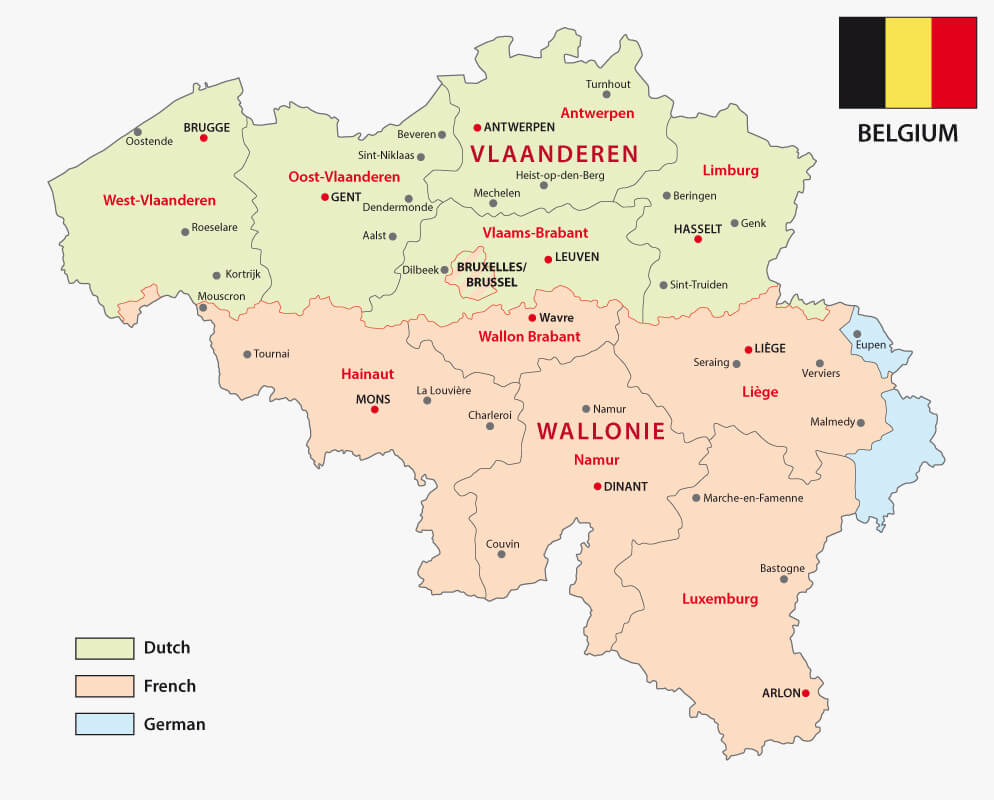
Belgian Regions Language Map
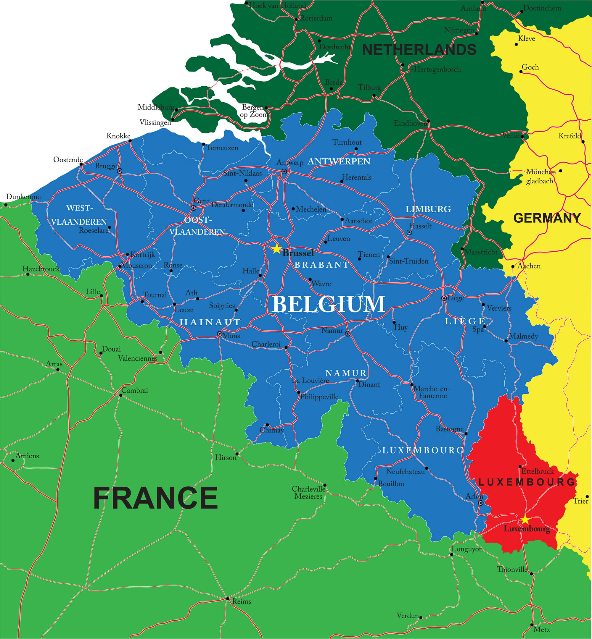
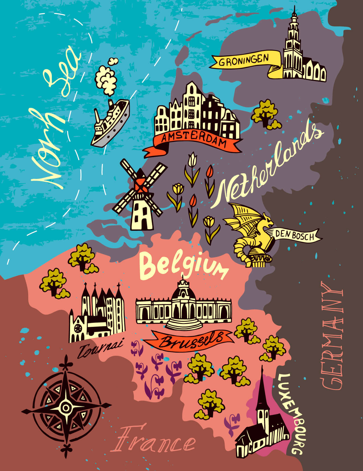
Netherlands, Belgium, Luxembourg Map
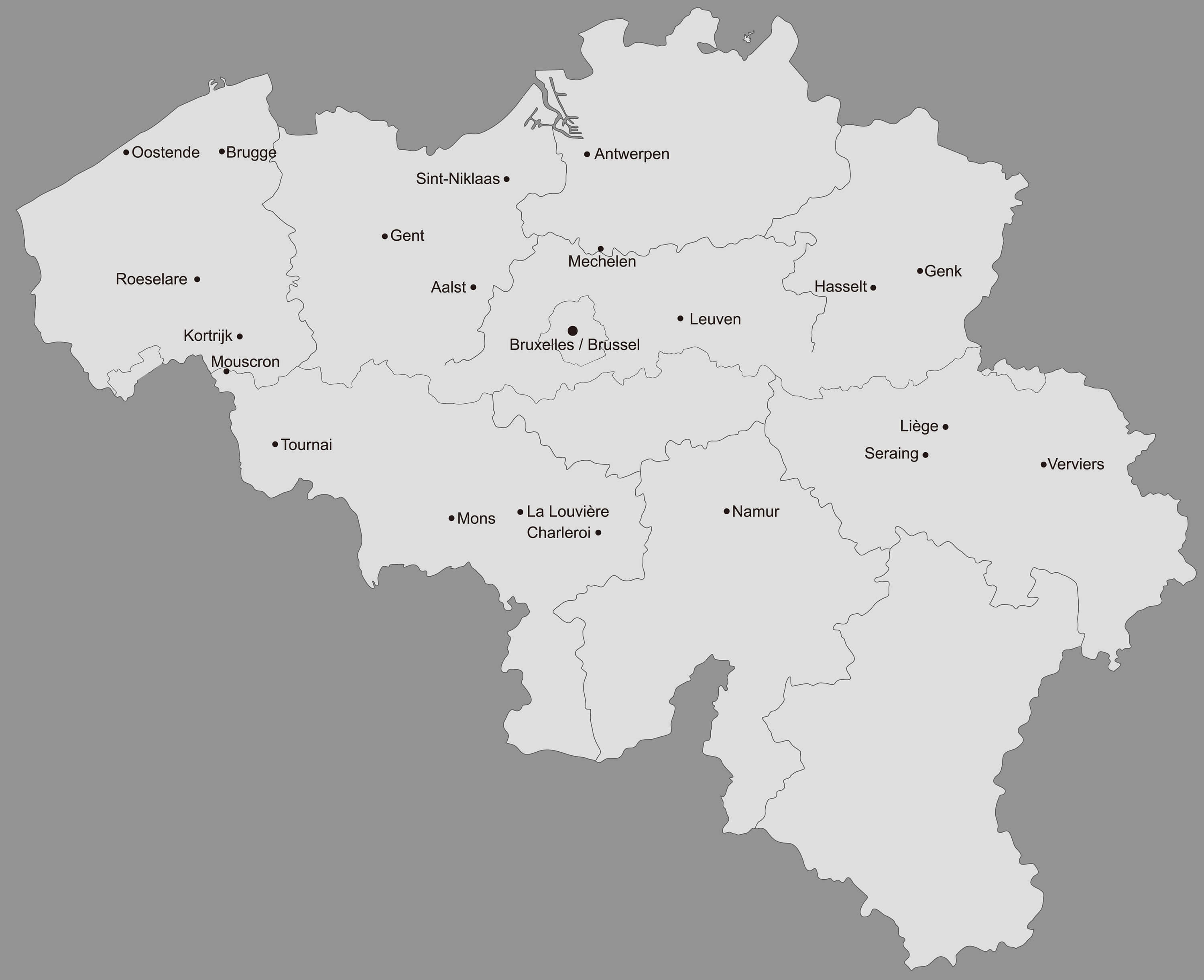
Largest Cities Map of Belgium
Antwerpen Map - Gent Map - Charleroi Map - Brugge Map - Bruxelles Map - Liege Map - Schaerbeek Map - Namur Map - Anderlecht Map - Leuven Map - Mons Map - Halle Map - Aalst Map - Roubaix Map - Tournai Map - Ath Map - Huy Map - Mechelen Map - Oostende Map - Verviers Map - Turnhout Map - Kortrijk Map -Belgium Google Map, Street Views, Maps Directions, Satellite Images
Please Not : You can find local businesses, public places, tourist attractions via map view, satellite image, hybrid view, driving directions in Belgium Map. You'll also find a varity map of Belgium such as political, administrative, transportation, demographics maps following Google map.
Submit URL to Belgium :
turkey-visit.com offers a collection of Belgium map, google map, Europe map, political, physical, satellite view, country infos, cities map and more map of Belgium.
Please feel free share your comments and questions :
Please feel free share your comments and questions :
"Belgium" related content to share on social media;


Copyright Turkey Travel Guide - 2005 - 2026. All rights reserved. Privacy Policy | Disclaimer