State Map of Ohio, USA
Ohio has the nation's 10th largest highway network, and is within a one-day drive of 50% of North America's population and 70% of North America's manufacturing capacity. To the north, Lake Erie gives Ohio 312 miles (502 km) of coastline, which allows for numerous cargo ports.
For State Map of Ohio, USA Map, Direction, Location and Where Addresse
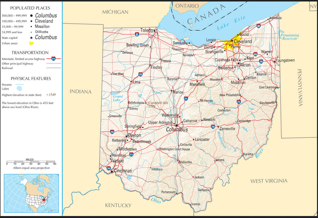
Largest Cities Map of Ohio and Population
- Columbus Map - 787.033 - (39.961,-82.999)
- Cleveland Map - 396.815 - (41.499,-81.695)
- Cincinnati Map - 296.943 - (39.162,-84.457)
- Toledo Map - 287.208 - (41.664,-83.555)
- Akron Map - 199.110 - (41.081,-81.519)
- Dayton Map - 141.527 - (39.759,-84.192)
- Parma Map - 81.601 - (41.405,-81.723)
- Canton Map - 73.007 - (40.799,-81.378)
- Youngstown Map - 66.982 - (41.1,-80.65)
- Lorain Map - 64.097 - (41.453,-82.182)
- Hamilton Map - 62.477 - (39.399501, -84.561335)
- Springfield Map - 60.608 - (39.924227, -83.808817)
- Kettering Map - 56.163 - (39.689504, -84.168827)
- Elyria Map - 54.533 - (41.368380, -82.107649)
- Lakewood Map - 52.131 - (41.481993, -81.798191)
- Cuyahoga Falls Map - 49.652 - (41.133945, -81.484559)
- Euclid Map - 48.920 - (41.593105, -81.526787)
- Middletown Map - 48.694 - (39.515058, -84.398276)
- Mansfield Map - 47.821 - (40.758390, -82.515447)
- Newark Map - 47.573 - (40.058121, -82.401264)
Click for State Map of Ohio, USA Direction »
Click for State Map of Ohio, USA Street View »
Copyright Turkey Travel Guide - 2005 - 2026. All rights reserved. Privacy Policy | Disclaimer