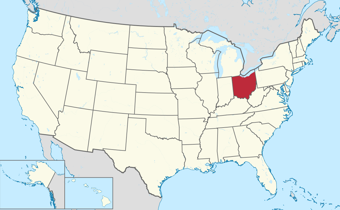
Ohio Map in United States
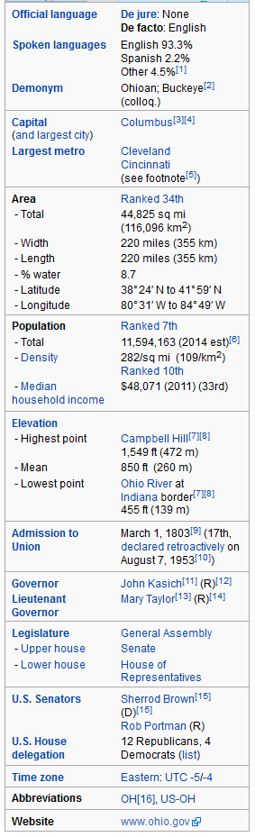
Ohio is a state in the Midwestern United States. Ohio is the 34th largest (by area), the 7th most populous USA state, and the 10th most densely populated of the 50 United States. Ohio's capital and largest city is Columbus.
For Ohio Map in United States Map, Direction, Location and Where Addresse
Largest Cities Map of Ohio and Population
- Columbus Map - 787.033 - (39.961,-82.999)
- Cleveland Map - 396.815 - (41.499,-81.695)
- Cincinnati Map - 296.943 - (39.162,-84.457)
- Toledo Map - 287.208 - (41.664,-83.555)
- Akron Map - 199.110 - (41.081,-81.519)
- Dayton Map - 141.527 - (39.759,-84.192)
- Parma Map - 81.601 - (41.405,-81.723)
- Canton Map - 73.007 - (40.799,-81.378)
- Youngstown Map - 66.982 - (41.1,-80.65)
- Lorain Map - 64.097 - (41.453,-82.182)
- Hamilton Map - 62.477 - (39.399501, -84.561335)
- Springfield Map - 60.608 - (39.924227, -83.808817)
- Kettering Map - 56.163 - (39.689504, -84.168827)
- Elyria Map - 54.533 - (41.368380, -82.107649)
- Lakewood Map - 52.131 - (41.481993, -81.798191)
- Cuyahoga Falls Map - 49.652 - (41.133945, -81.484559)
- Euclid Map - 48.920 - (41.593105, -81.526787)
- Middletown Map - 48.694 - (39.515058, -84.398276)
- Mansfield Map - 47.821 - (40.758390, -82.515447)
- Newark Map - 47.573 - (40.058121, -82.401264)
Click for Ohio Map in United States Direction »
Click for Ohio Map in United States Street View »
Copyright Turkey Travel Guide - 2005 - 2026. All rights reserved. Privacy Policy | Disclaimer