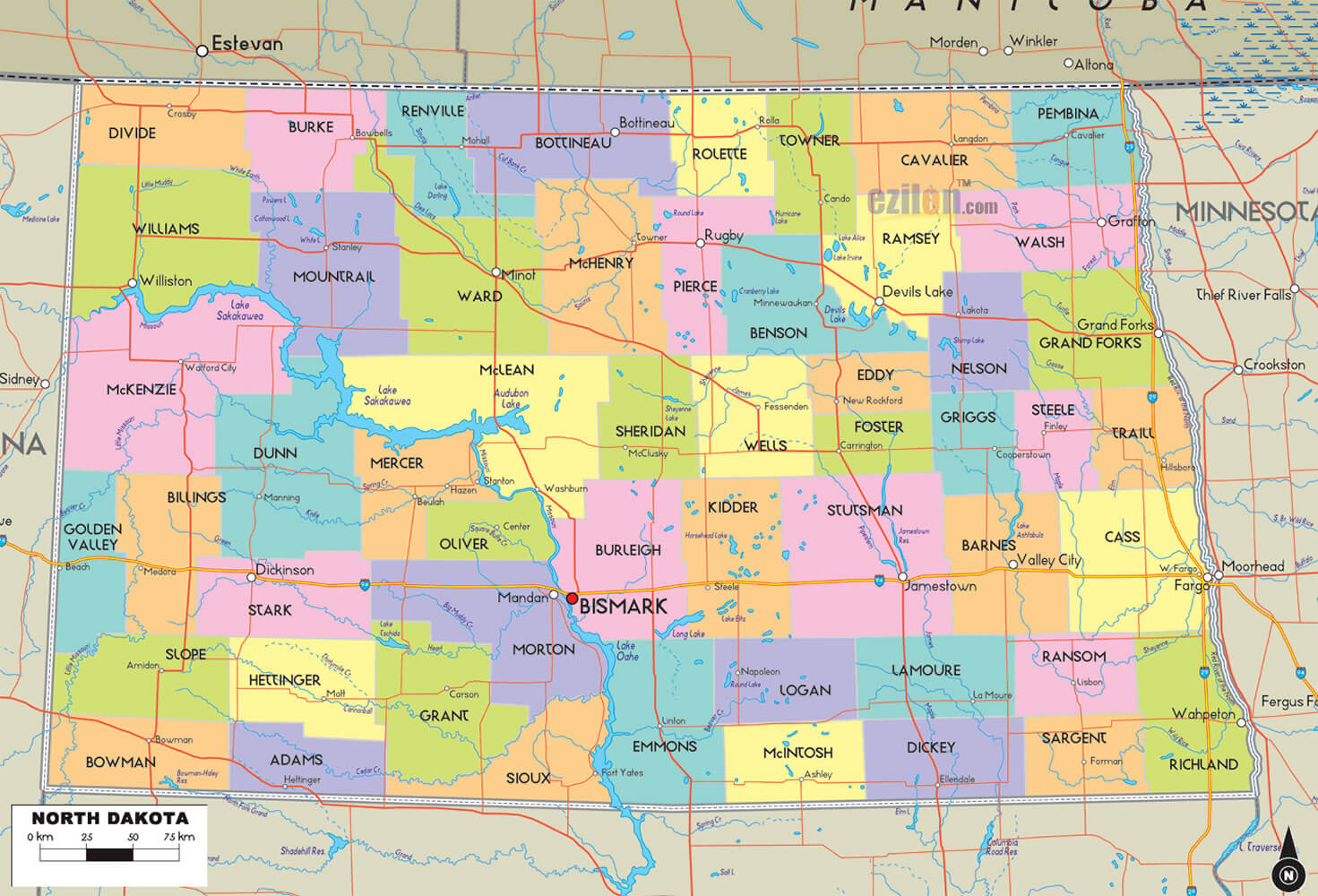
North Dakota Map
Navigate North Dakota map, North Dakota state map, satellite images of the North Dakota, North Dakota largest cities maps, political map of North Dakota, driving directions and traffic maps. Plan your trip and navigate through the state's roads and highways with ease using our detailed map.
With our easy-to-use map, you can navigate through the state's roads and highways, find the nearest gas station, hotel, or restaurant, and plan your trip with ease. From the rugged landscapes of Theodore Roosevelt National Park to the bustling city of Fargo, our map has everything you need to make your North Dakota adventure unforgettable. So, start exploring North Dakota today and discover why it is truly the Land of the Dakota.
For all North Dakota Cities Map
MAP OF NORTH DAKOTA
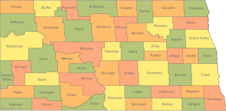
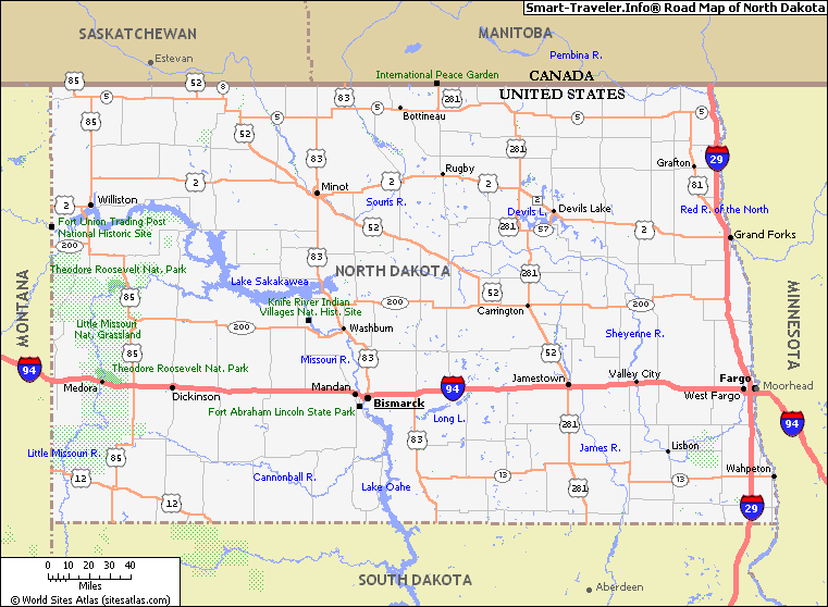
NORTH DAKOTA HIGHWAYS MAP
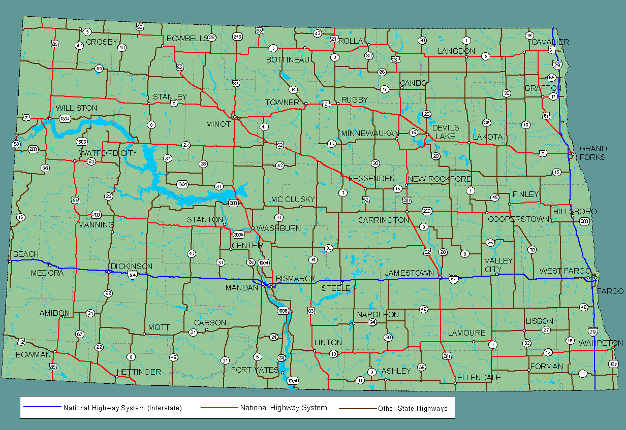
Brief information about North Dakota, US
North Dakota is a state located in the Upper Midwest region of the United States. North Dakota is known for its vast prairies, rolling hills, and the stunning Badlands, which make it a popular destination for outdoor enthusiasts.A Collection of North Dakota Maps and North Dakota Satellite Images
MAP OF NORTH DAKOTA

NORTH DAKOTA MAP
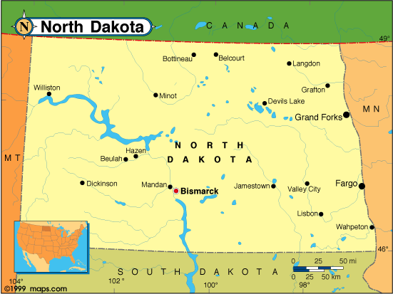
NORTH DAKOTA CITY MAP
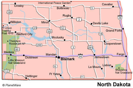
NORTH DAKOTA HIGHWAYS MAP

NORTH DAKOTA HISTORICAL MAP
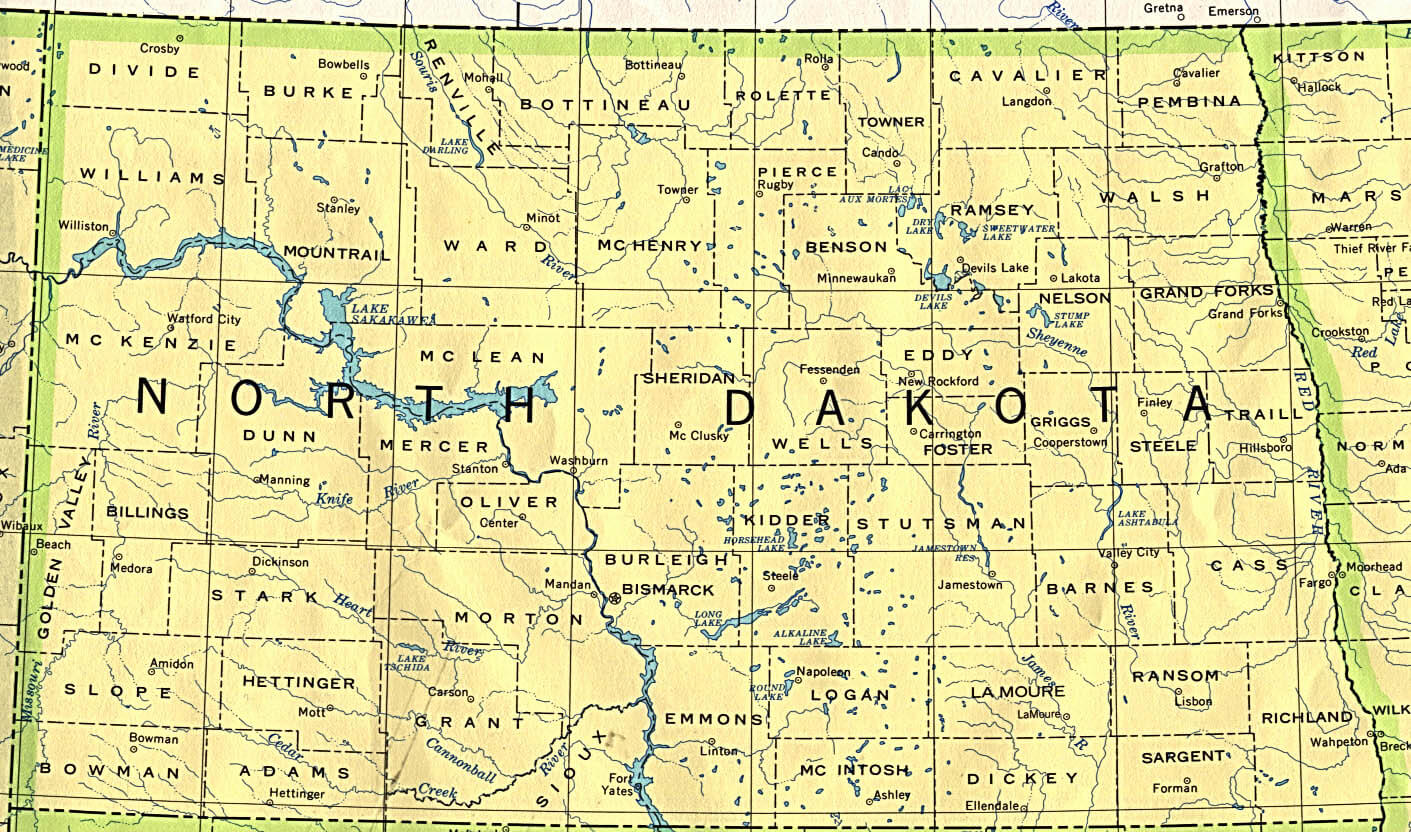
NORTH DAKOTA HISTORICAL MAP 1895
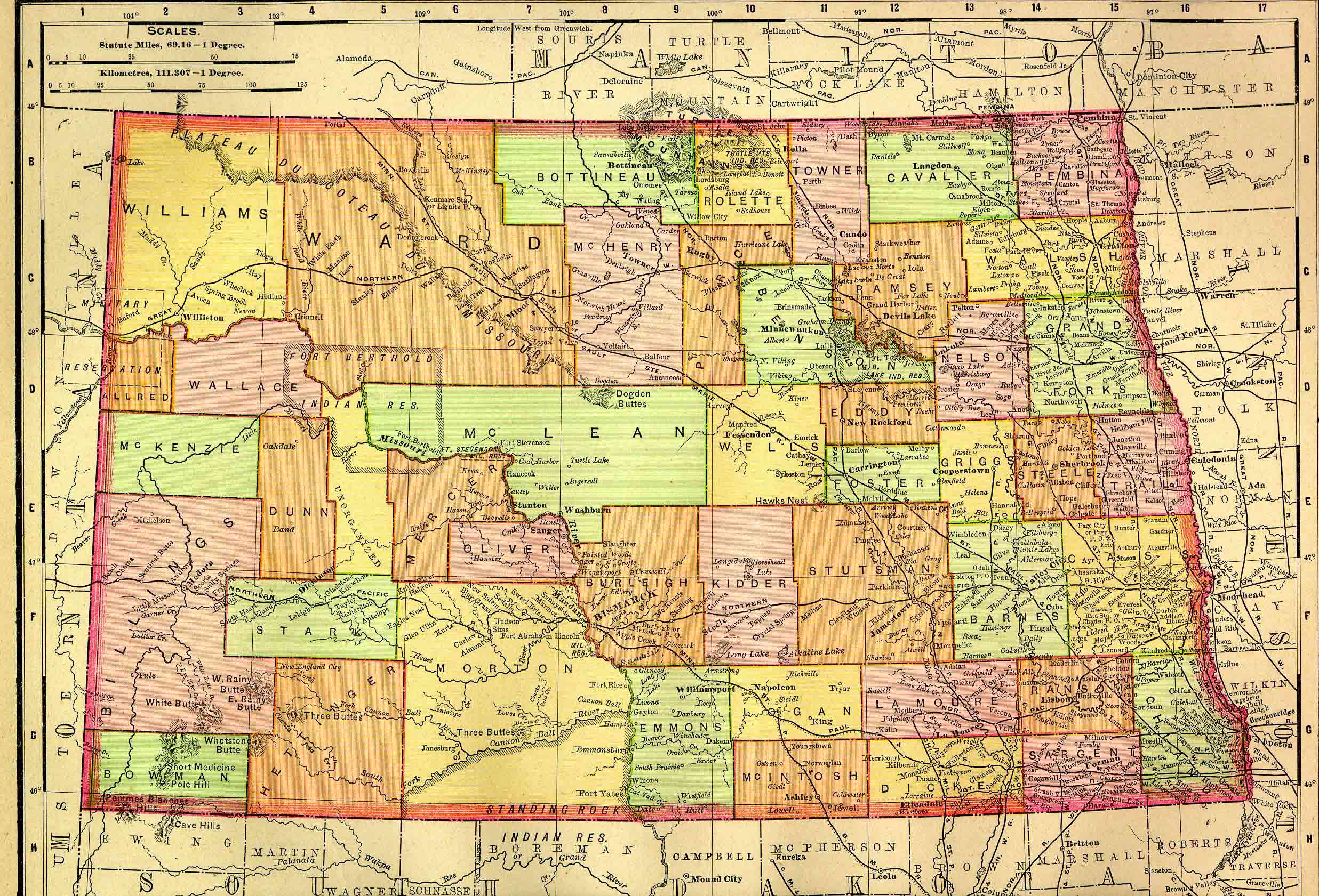
NORTH DAKOTA MAP
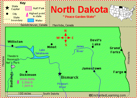
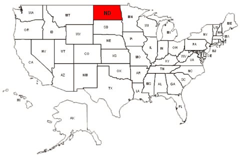
NORTH DAKOTA MAP USA
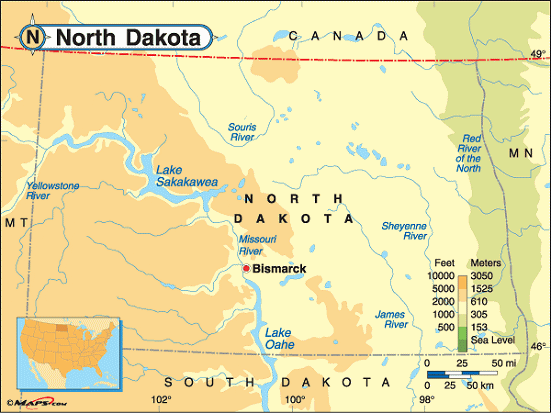
NORTH DAKOTA MAPS
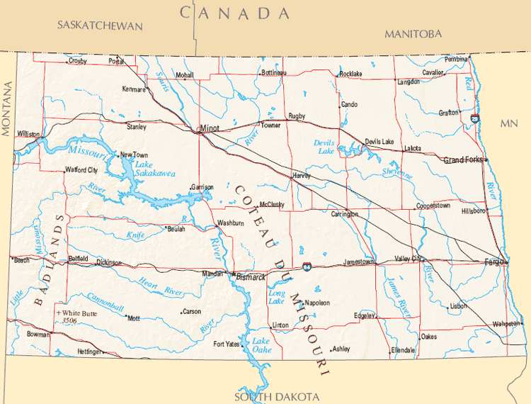
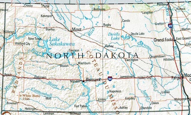
NORTH DAKOTA PHYSICAL MAP

NORTH DAKOTA RIVERS MAP

NORTH DAKOTA ROAD MAP
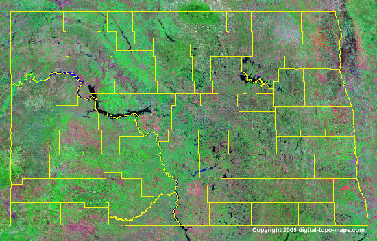
NORTH DAKOTA SATELLITE IMAGES
NORTH DAKOTA STATE MAP
NORTH DAKOTA USA MAP
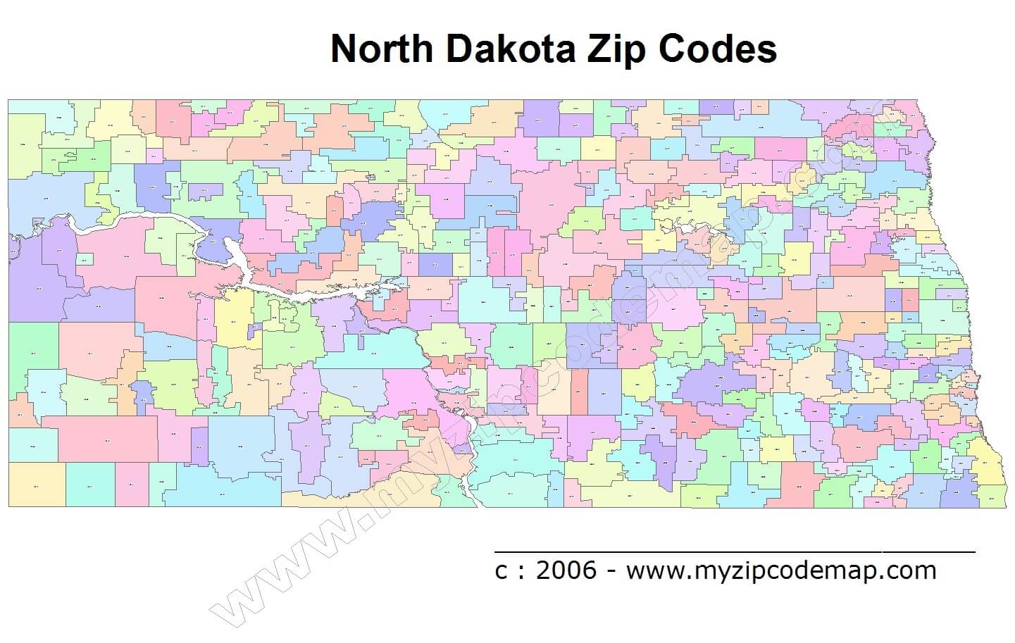
NORTH DAKOTA ZIP CODE MAP
ROAD MAP OF NORTH DAKOTA

A collection of North Dakota Maps
- Head of Performance Marketing
- Head of SEO
- Linkedin Profile: linkedin.com/in/arifcagrici
Largest Cities Map of North Dakota and Population
Fargo Map - 105,549 Bismarck Map - 61,272 Grand Forks Map - 52,838 Minot Map - 40,888 West Fargo Map - 25,830 Mandan Map - 18,331 Dickinson Map - 17,787 Jamestown Map - 15,427 Williston Map - 14,716 Wahpeton Map - 7,766 Devils Lake Map - 7,141 Valley City Map - 6,585 Minot AFB Map - 5,521 Grafton Map - 4,284 Beulah Map - 3,121Copyright Turkey Travel Guide - 2005 - 2025. All rights reserved. Privacy Policy | Disclaimer


