- world map
- europe map
- netherlands map
Map Netherlands
Navigate Netherlands map, satellite images of the Netherlands, states, largest cities, political map, capitals and physical maps.

- Capital : Amsterdam
- Population : 16,751,323
- GDP : $840.433 billion
- Per Capita : $50,355
- Calling Code : +31
- Jobless Rate : 7.20%
- Time Zone : +1
A Collection of Netherlands Maps
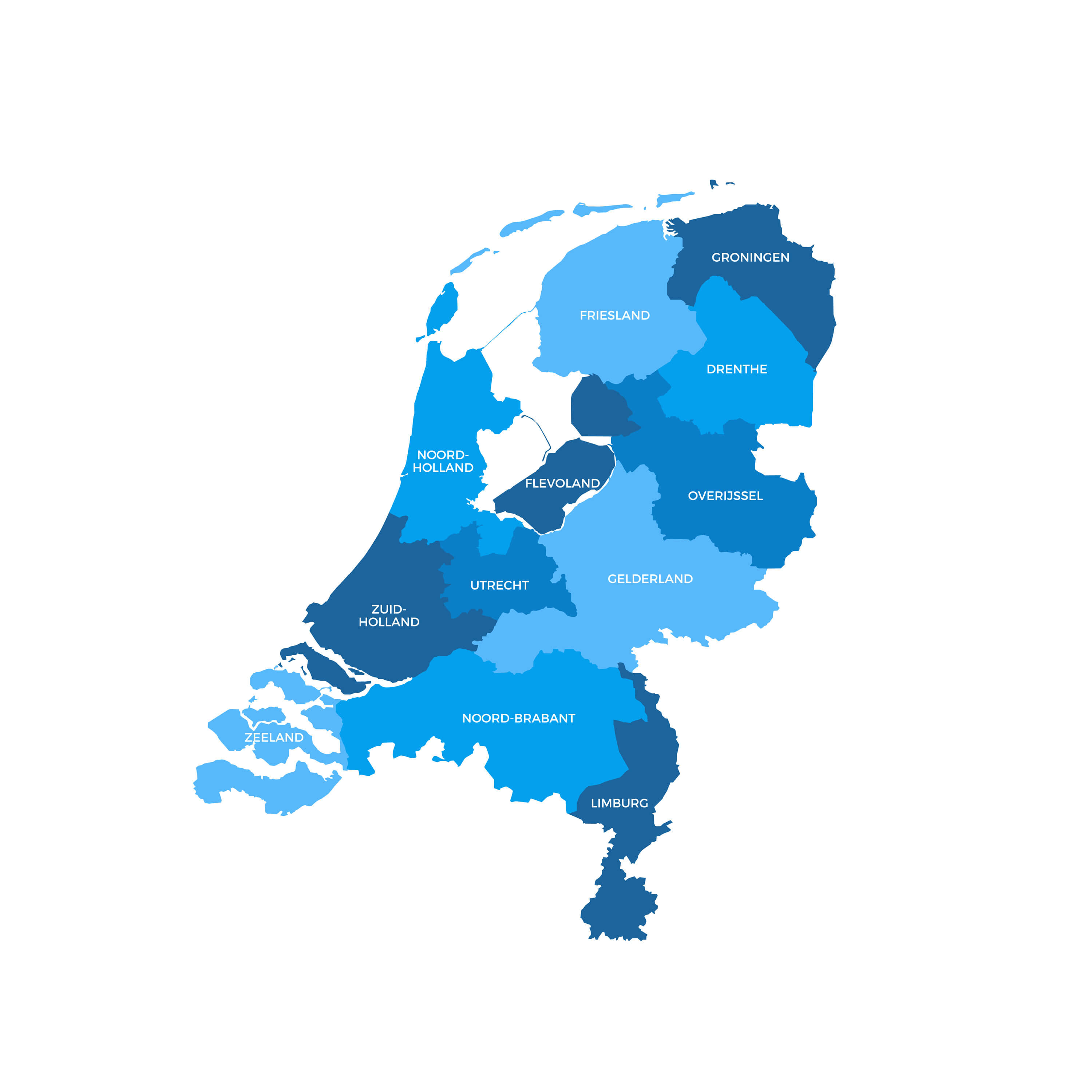
Colorful Netherlands Map
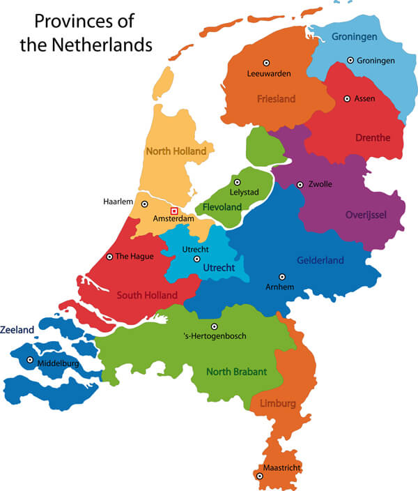 Colorful Netherlands map with regions and main cities.
Netherlands Road Map
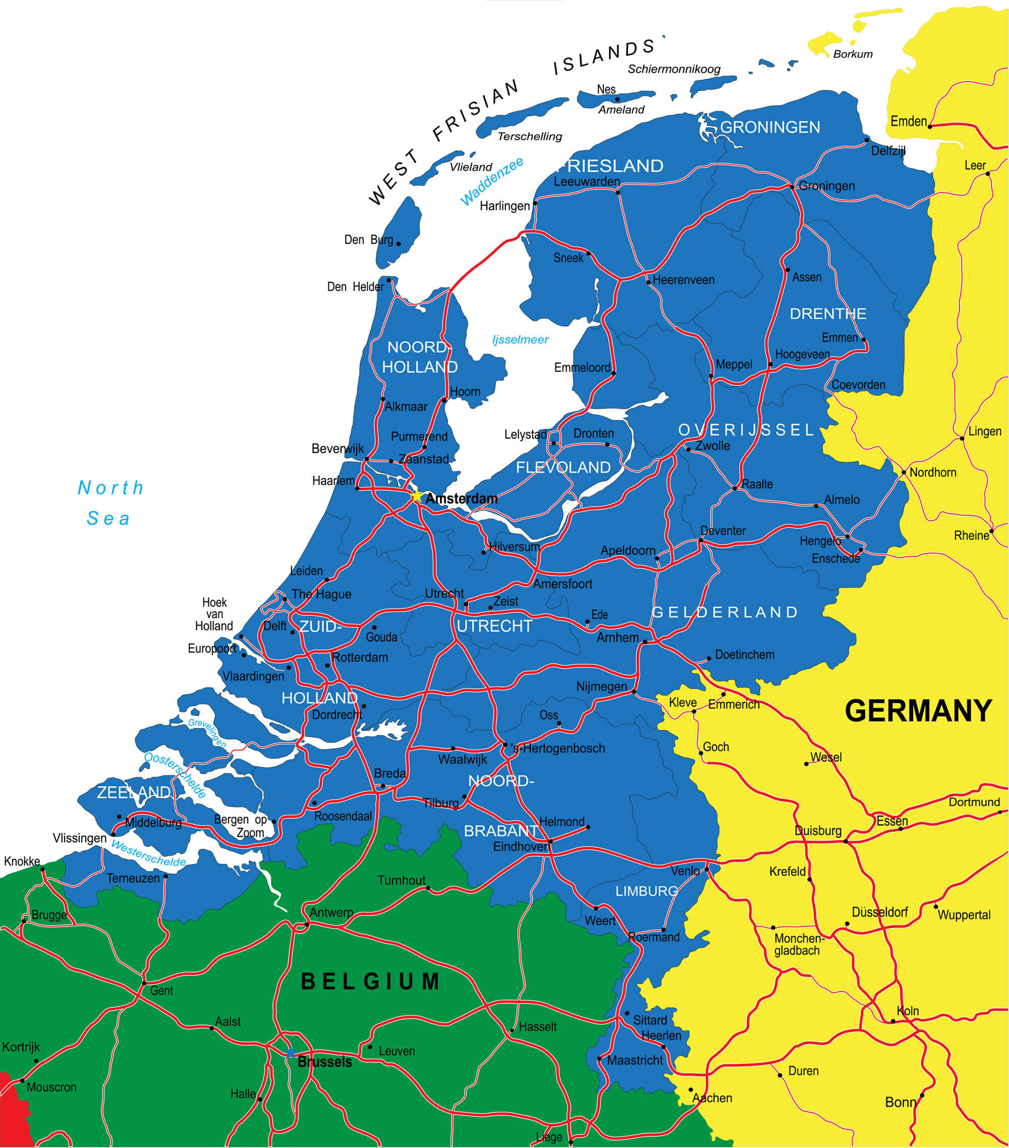 Netherlands Road map with major cities.
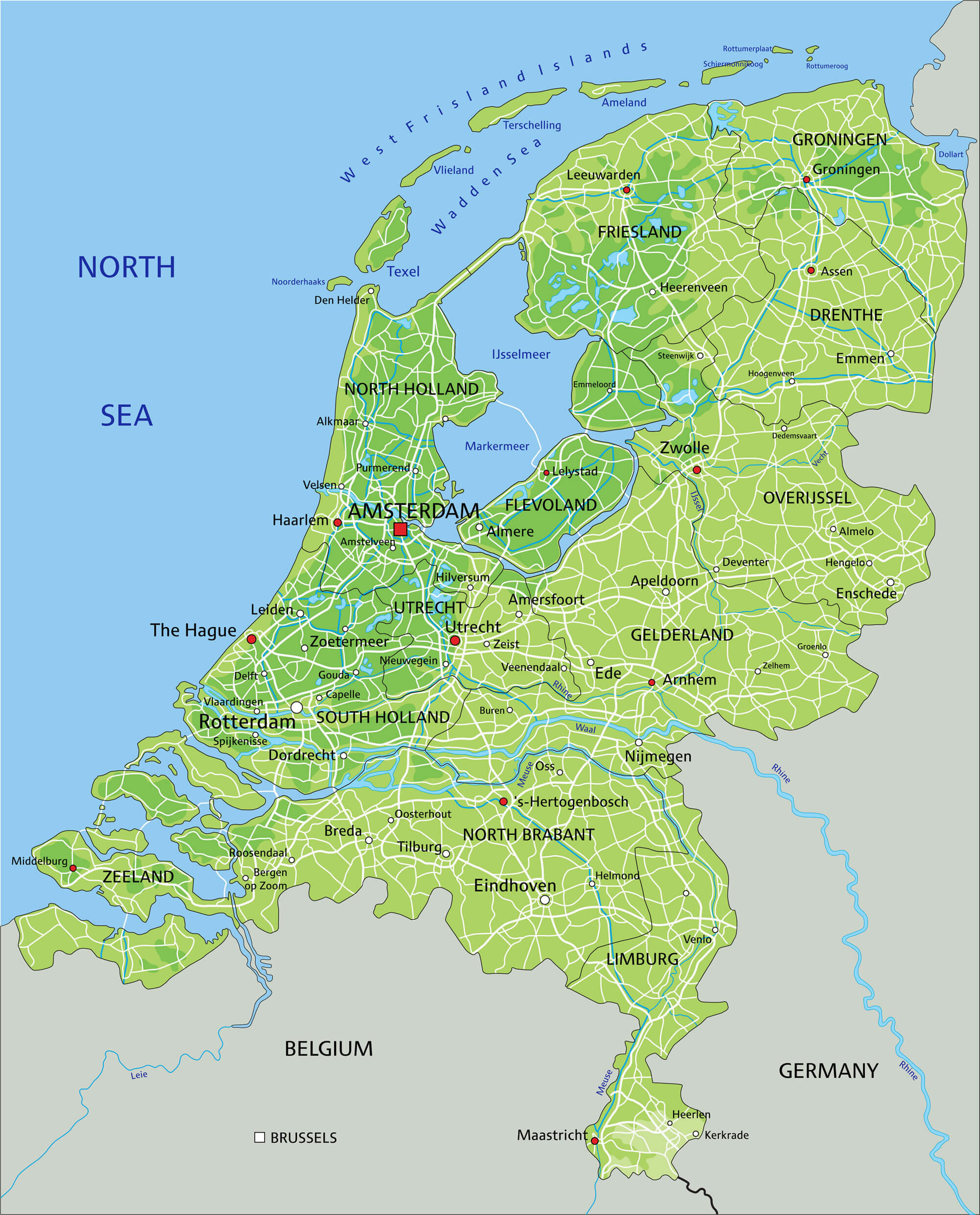
Netherlands Political Map
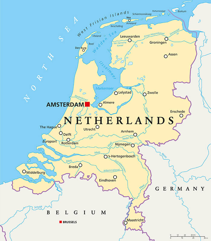 Netherlands Political Map with capital Amsterdam, national borders, most important cities, rivers and lakes. English labeling and scaling
Netherlands Administrative Map
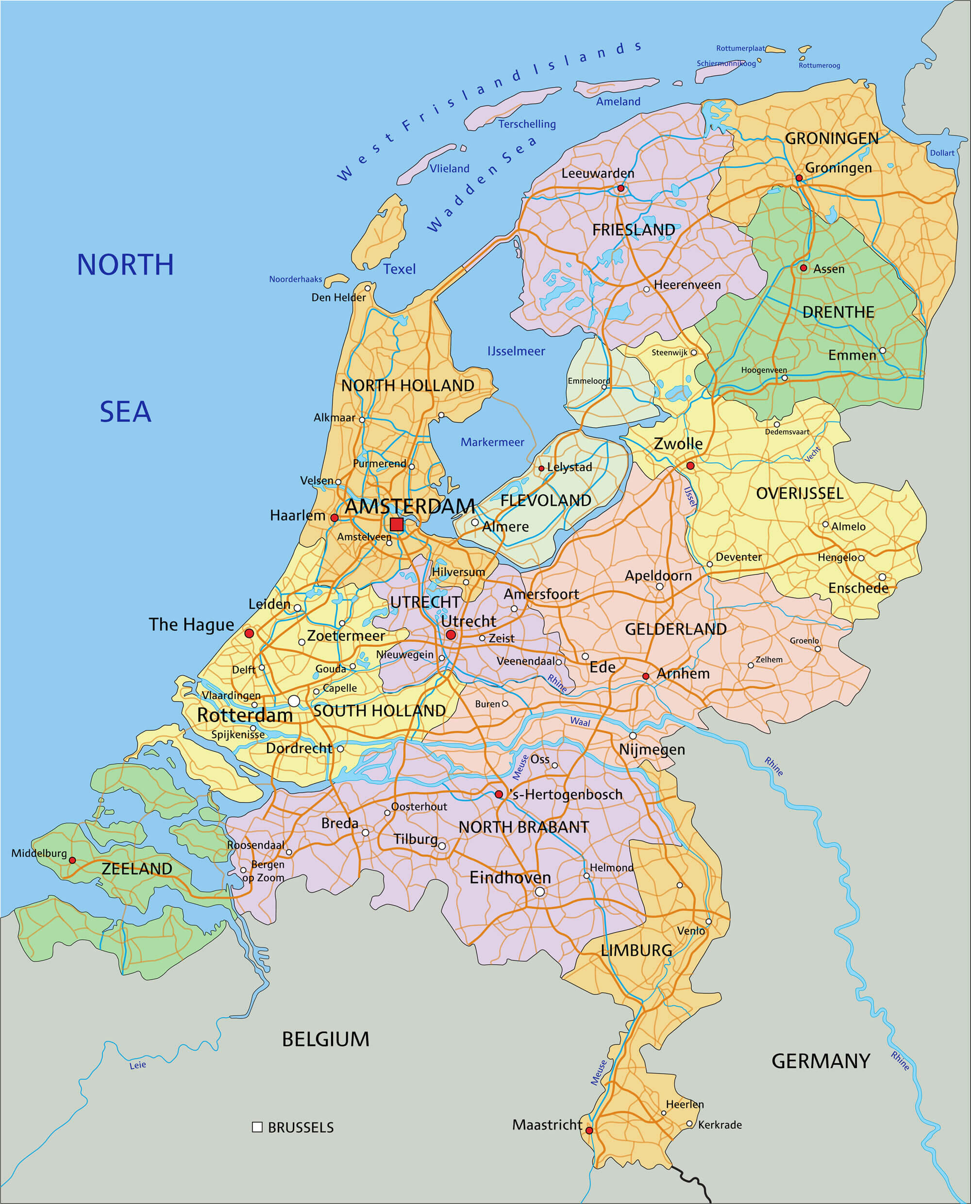 Netherlands Administrative Map - Highly detailed editable political map with separated layers and provinces.
Netherlands Regions Map
 Netherlands Regions Map - Highly detailed editable political map with separated layers and provinces.
Netherlands Physical Map
 High detailed Netherlands physical map with labeling.
Netherlands Satellite Map
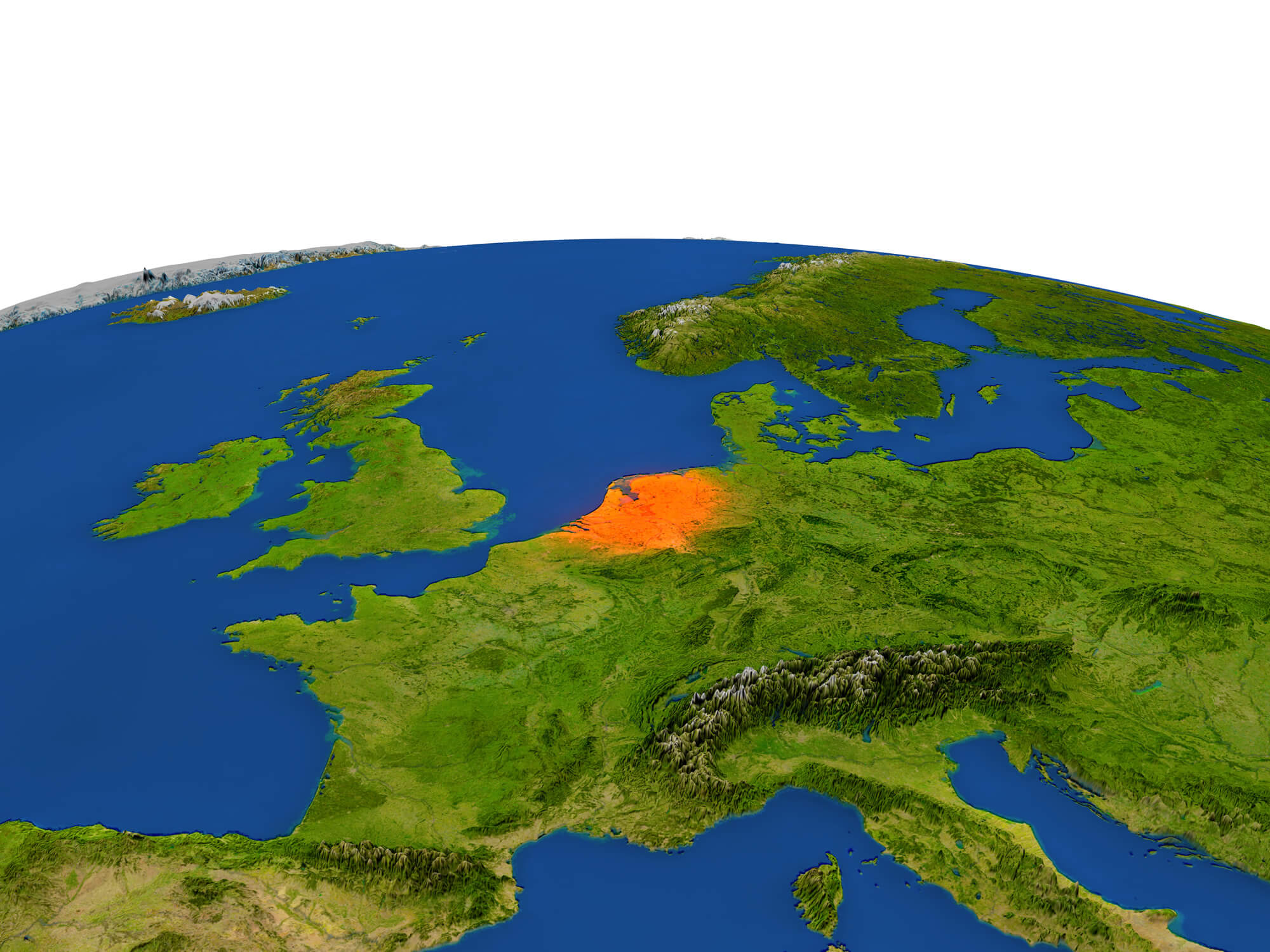 Netherlands from Earth's orbit in space highlighted in red color. 3D illustration with highly detailed realistic planet surface. Elements of this image furnished by NASA.
Largest Cities Map of Netherlands
Almere Map - Amersfoort Map - Amsterdam Map - Apeldoorn Map - Arnhem Map - Breda Map - Delft Map - Deventer Map - Dordrecht Map - Ede Map - Eindhoven Map - Emmen Map - Enschede Map - Groningen Map - Haarlem Map - Haarlemmermeer Map - Heerlen Map - Helmond Map - Hengelo Map - Leeuwarden Map - Leiden Map - Maastricht Map - Nijmegen Map - Rotterdam Map - The Hague Map - Hertogenbosch Map - Sittard Geleen Map - Tilburg Map - Utrecht Map - Venlo Map - Zaanstad Map - Zoetermeer Map - Zwolle Map -Netherlands Google Map, Street Views, Maps Directions, Satellite Images
Please Not : You can find local businesses, public places, tourist attractions via map view, satellite image, hybrid view, driving directions in Netherlands Map. You'll also find a varity map of Netherlands such as political, administrative, transportation, demographics maps following Google map.
Submit URL to Netherlands :
turkey-visit.com offers a collection of Netherlands map, google map, Europe map, political, physical, satellite view, country infos, cities map and more map of Netherlands.
Copyright Turkey Travel Guide - 2005 - 2026. All rights reserved. Privacy Policy | Disclaimer