Discover Satellite World Maps: Political Boundaries, Religions, Satellite and Weather Maps
Discover our comprehensive collection of World Maps, featuring a diverse range of political, physical, environmental, and thematic maps created for students, travelers, researchers, and geography enthusiasts. This collection includes World Per Capita Income Maps, World Physical Maps, World Political Maps, World Population Density Maps, and World Precipitation Maps, making it easier to explore global geography, economic conditions, political boundaries, and climate systems. These maps provide valuable insights into the world’s physical landscapes and socio-economic structures.
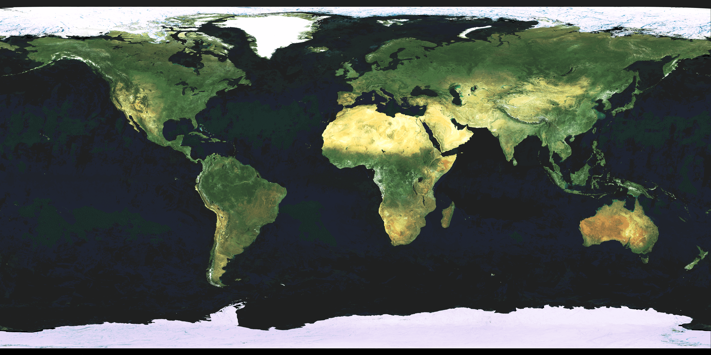
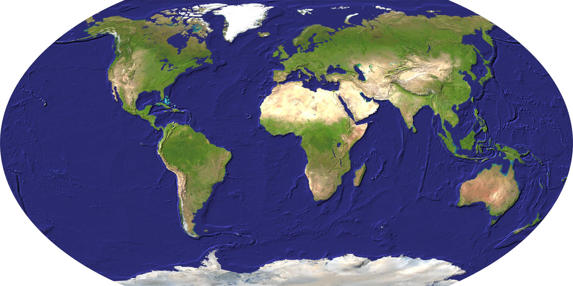
World Satellite Map
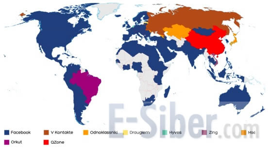
World Social Network Map
World Satellite Image 2014
Whether you are searching for a detailed World Physical Map for education, a World Political Map for research, or a World Population Density Map for demographic analysis, our collection offers reliable and high-quality resources. From precipitation patterns and income distribution to country borders and environmental features, these world maps serve as essential tools for learning, travel planning, and understanding the world from multiple perspectives.
World Political Map English
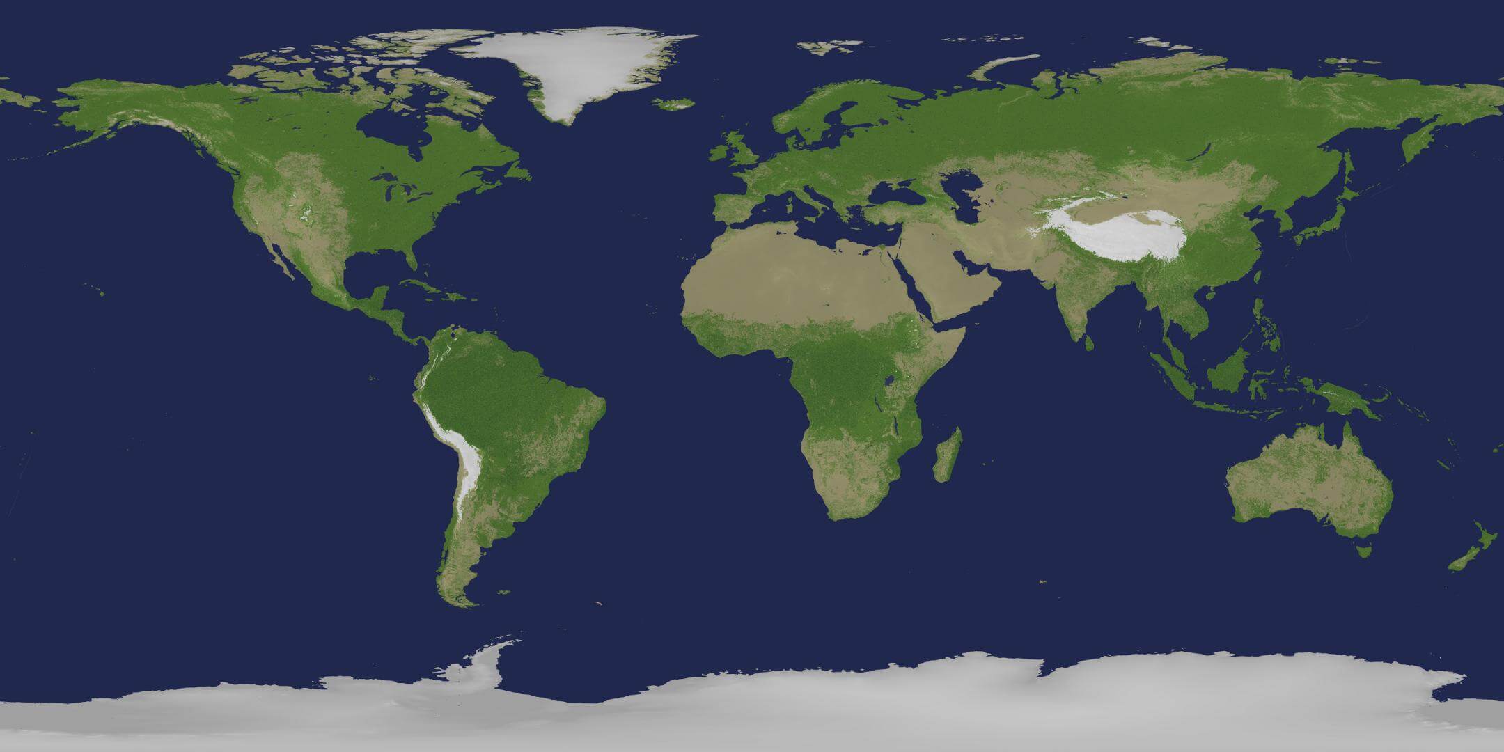
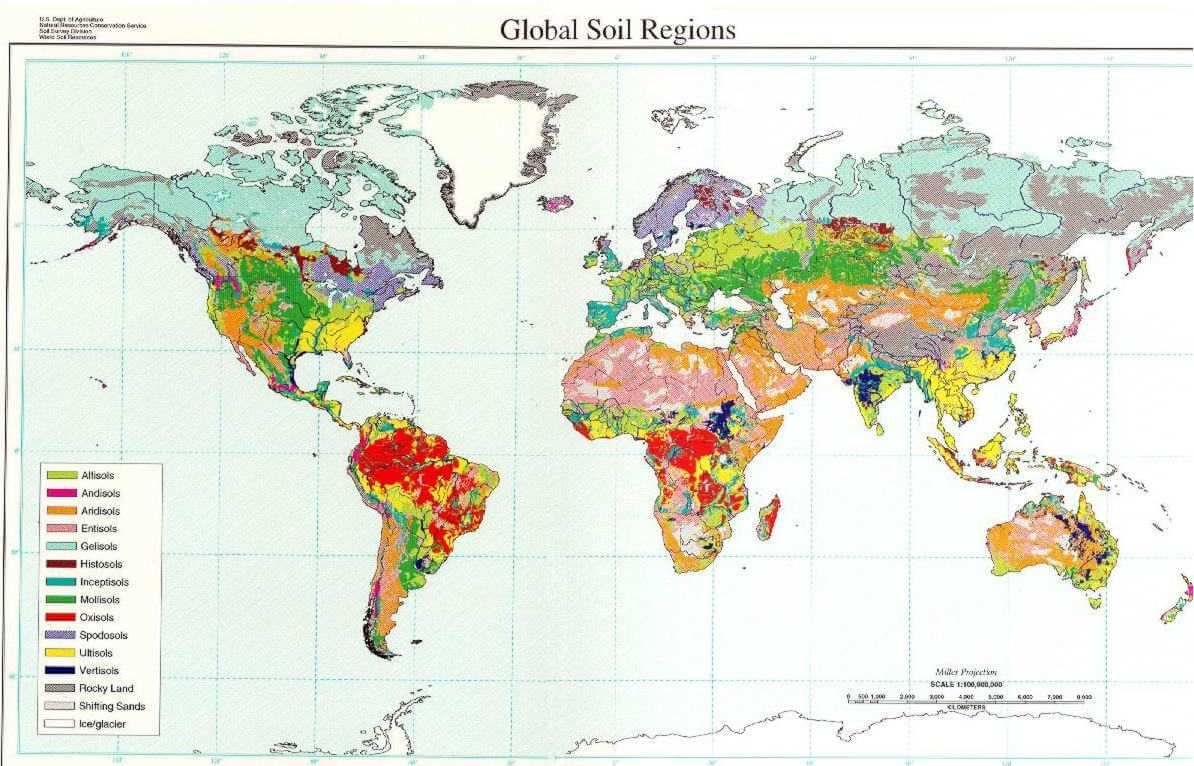
World Soil Map
World Satellite Map Detailed
Discover specialized world maps such as the World Rainfall Map 2009, World Religions Maps, World Satellite Maps, World Soil Maps, and World Standard Time Zones Maps, offering valuable insights into weather systems, religion distribution, satellite imagery, land resources, and global time differences. Our collection also includes thematic resources like World Social Network Maps and historical satellite imagery such as the World Satellite Image 2014, making it a comprehensive source for exploring the world’s physical, political, and social structures.
World Per Capita Income Map
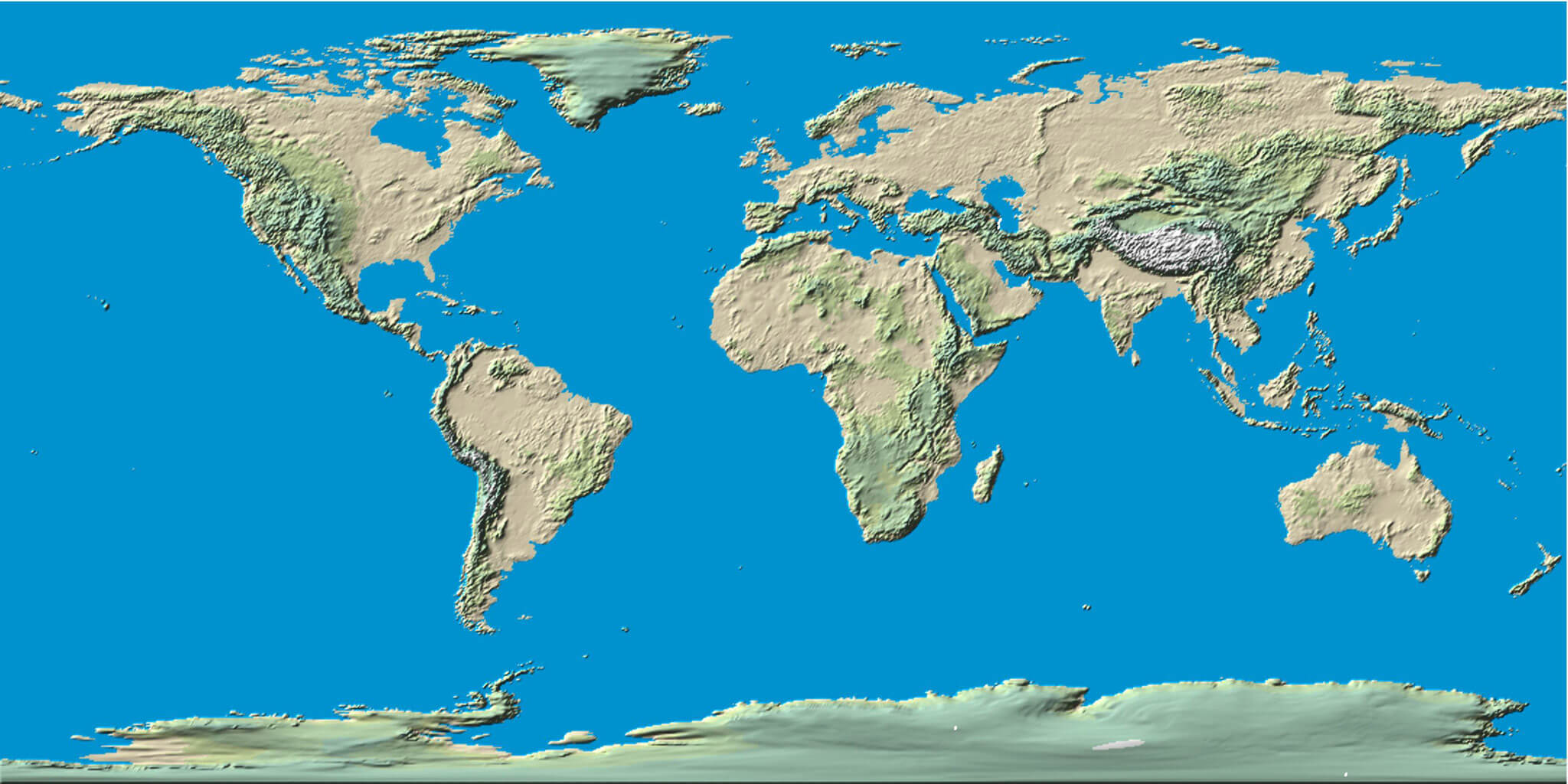
World Physical Map
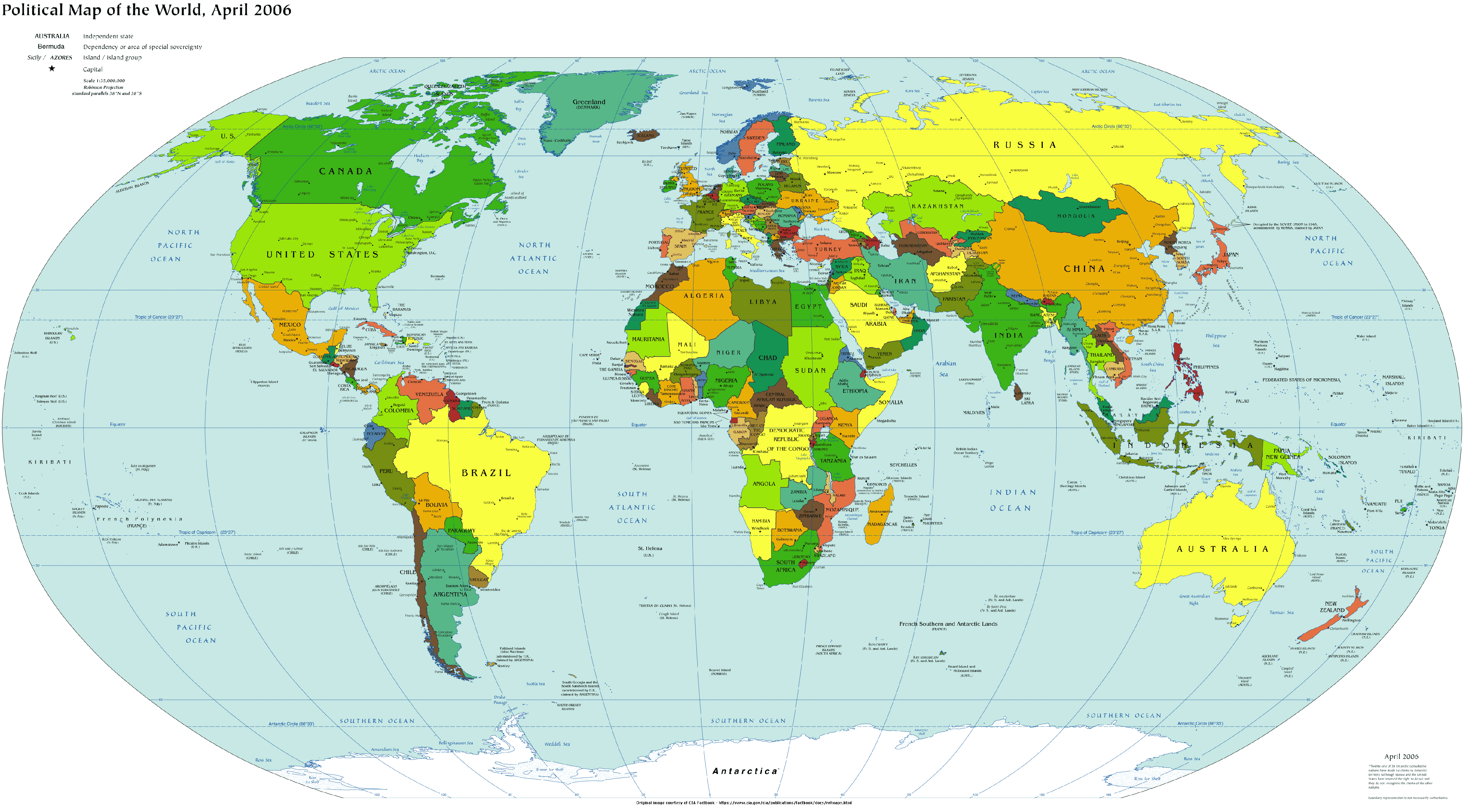
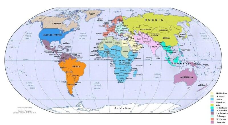
World Political Map
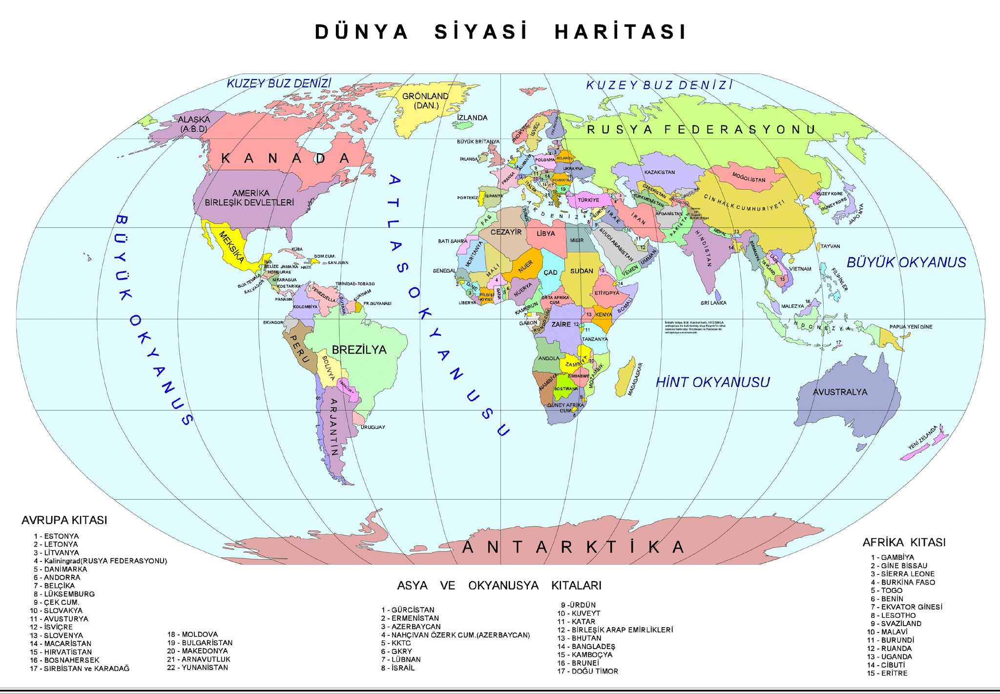
World Political Map Turkish
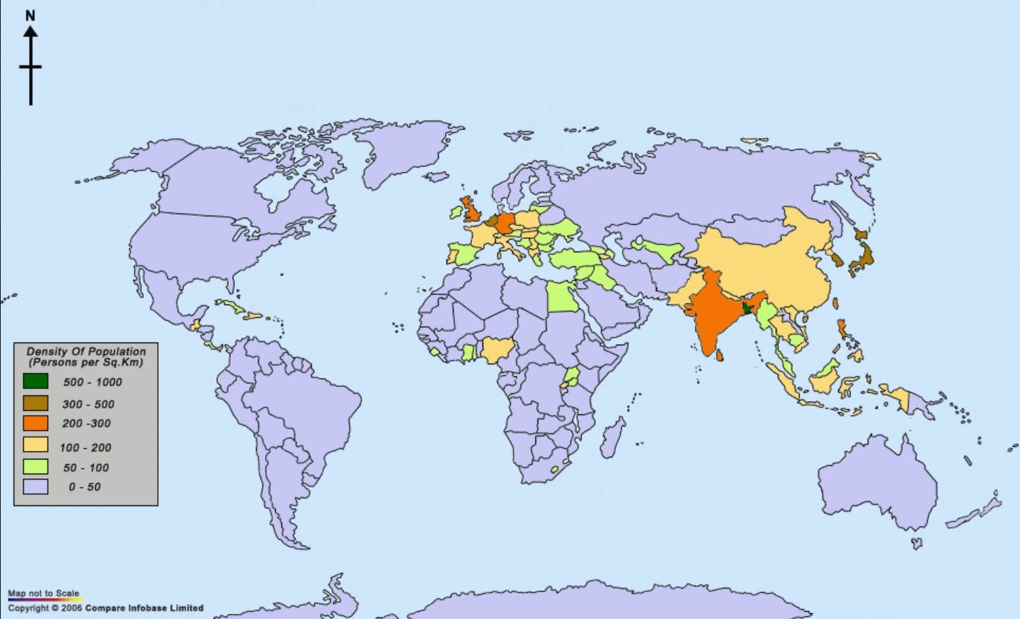
World Population Density Map
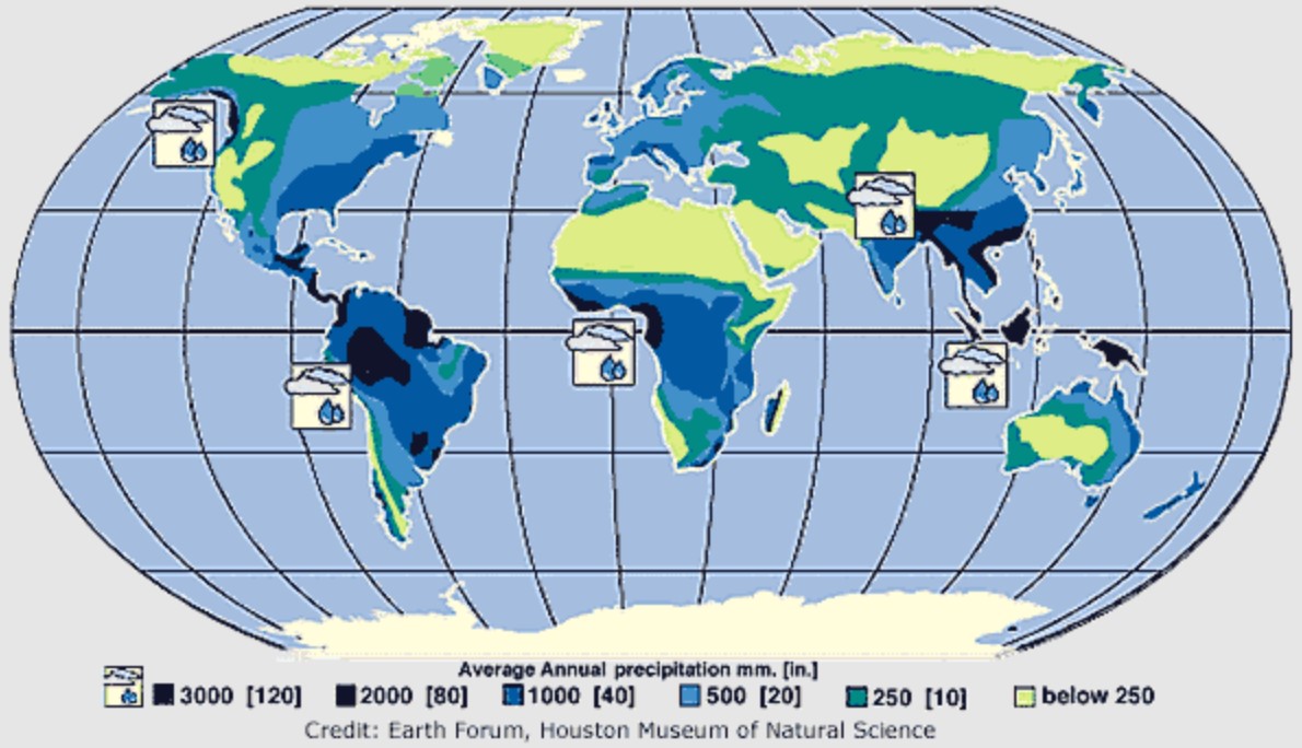
World Precipitation Map
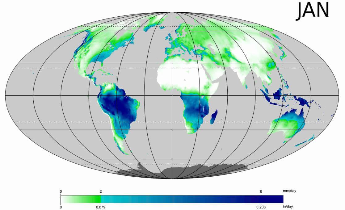
World Rainfall Map 2009
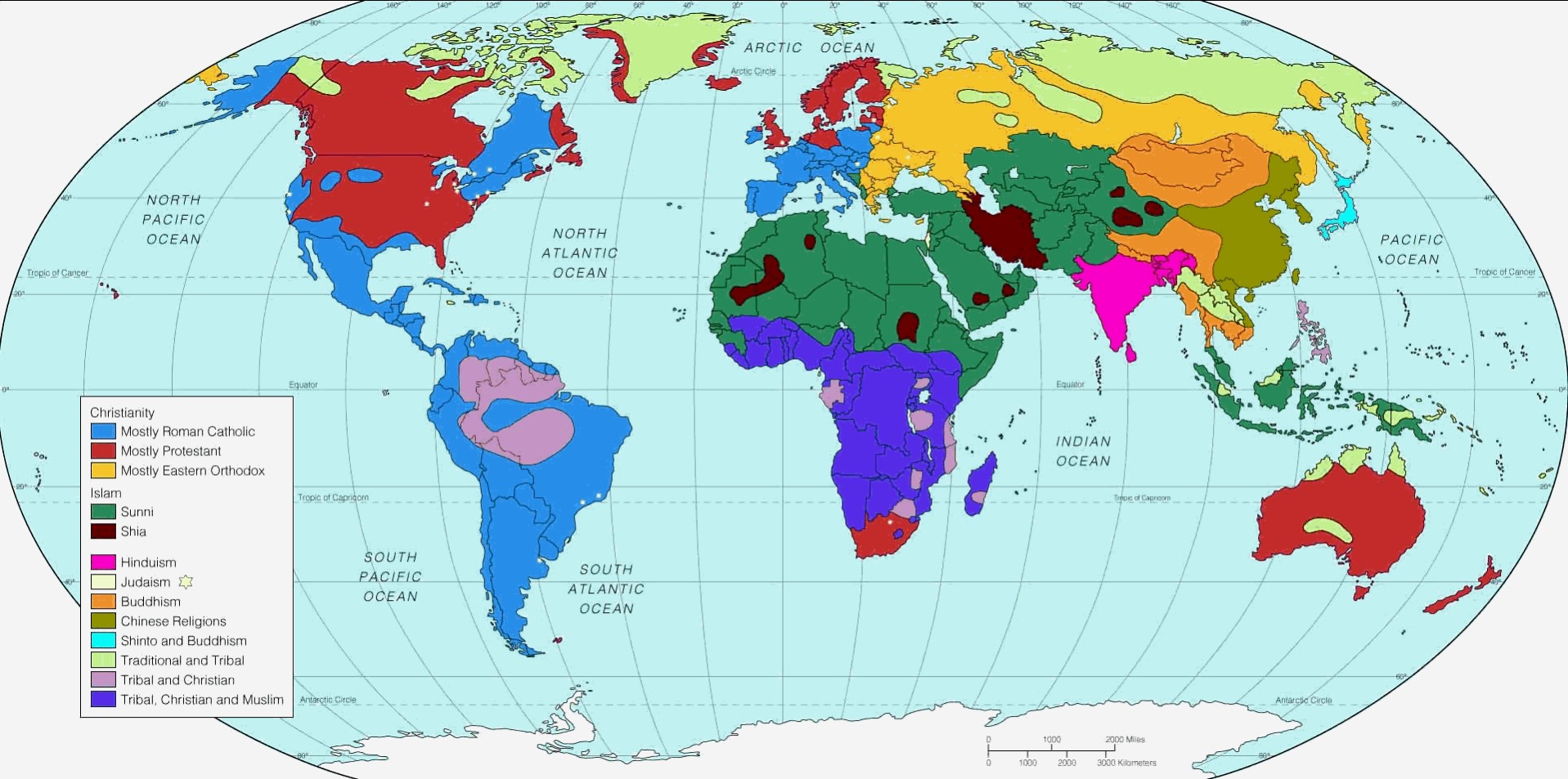
World Religions Map
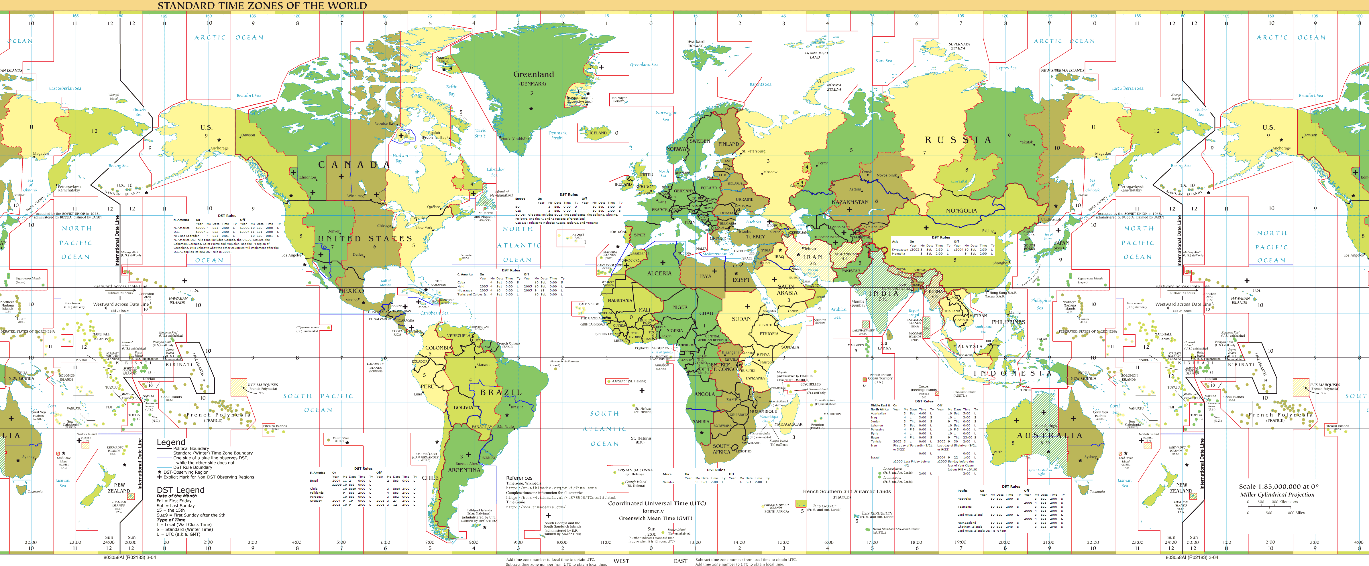
World Standard Time Zones Map
 ilgililinkerleriekle
Copyright Turkey Travel Guide - 2005 - 2026. All rights reserved. Privacy Policy | Disclaimer