Explore Detailed Maps of Europe and European Countries
Explore detailed Europe maps including Europe GDP per capita maps, Europe population density maps, Europe topographic relief maps, Europe vegetation zones maps, and Europe unemployment rate maps. Discover historical Europe maps such as the Europe map 1430 medieval period, Europe map after World War One, and Europe map World War Two 1941–1942, along with Europe national borders maps, Europe location on world globe maps, and maps with Wales highlighted for geography, education, travel, and historical research.
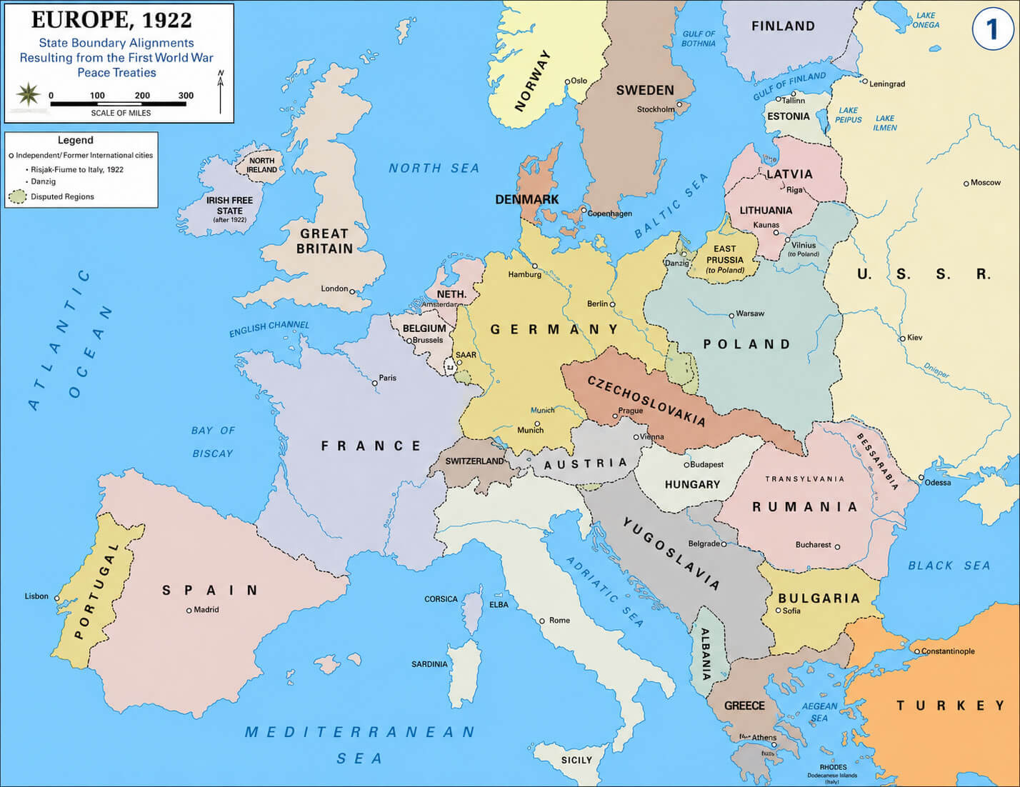
Europe map after World war one
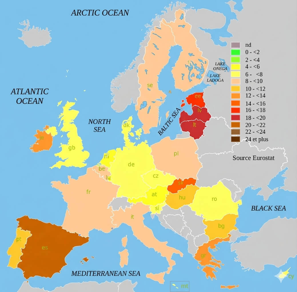
Europe population density map 2006.png
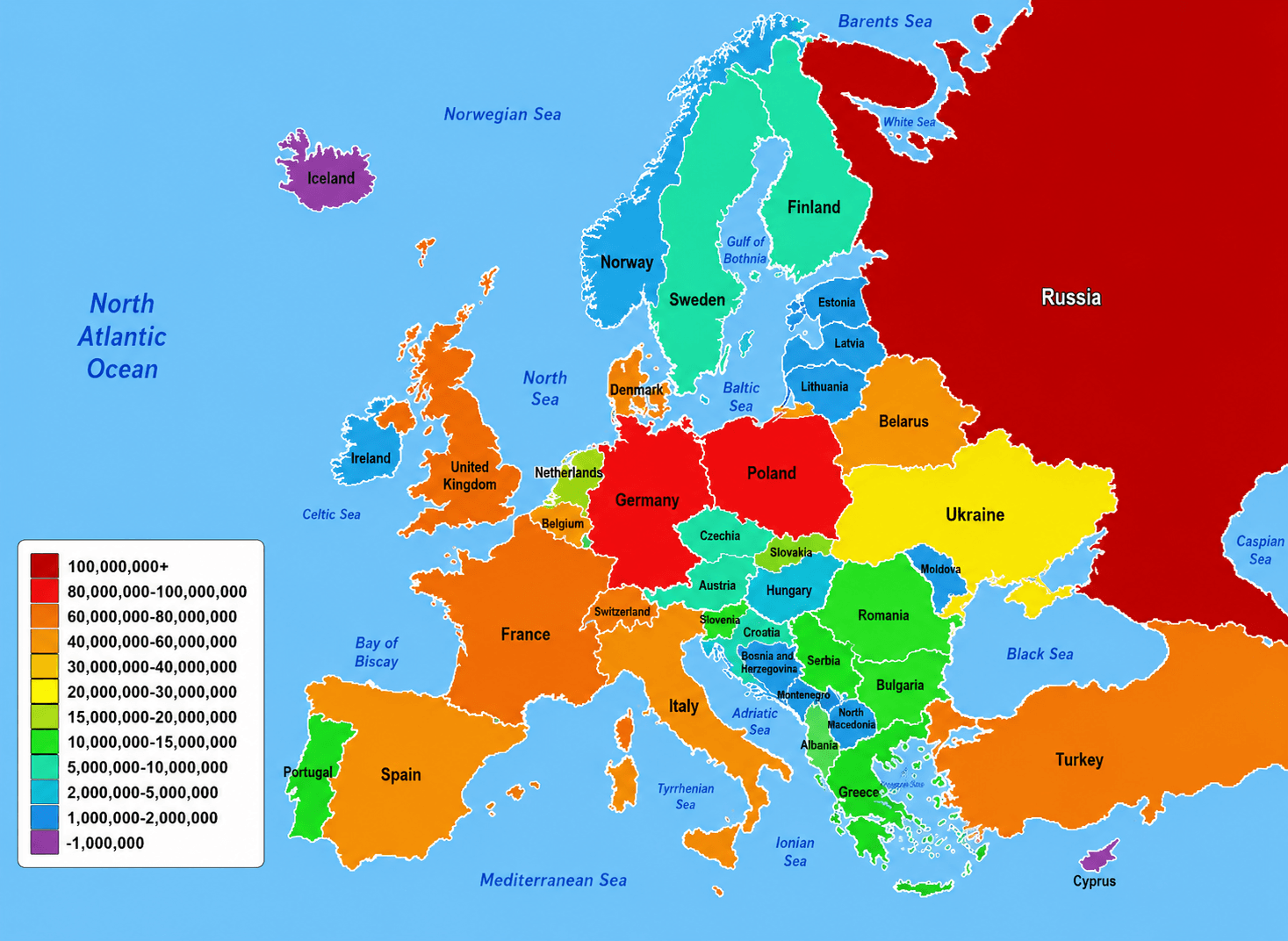
Europe GDP per capita map
This Europe maps archive also includes practical and educational resources such as the Europe national borders map, Europe map with Wales highlighted, and Europe location on World globe map. Researchers, students, travelers, and educators can use these high-quality maps for presentations, school projects, travel planning, and geographic analysis. The collection further features thematic visuals like the Europe unemployment rate map 2010 and Europe population density map 2006, making it easier to compare social and economic conditions across European countries and regions.
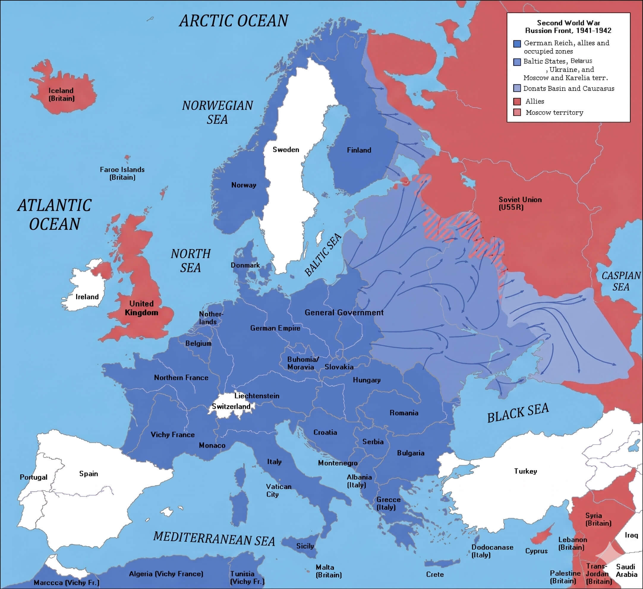
Europe map World war two 1941 1942
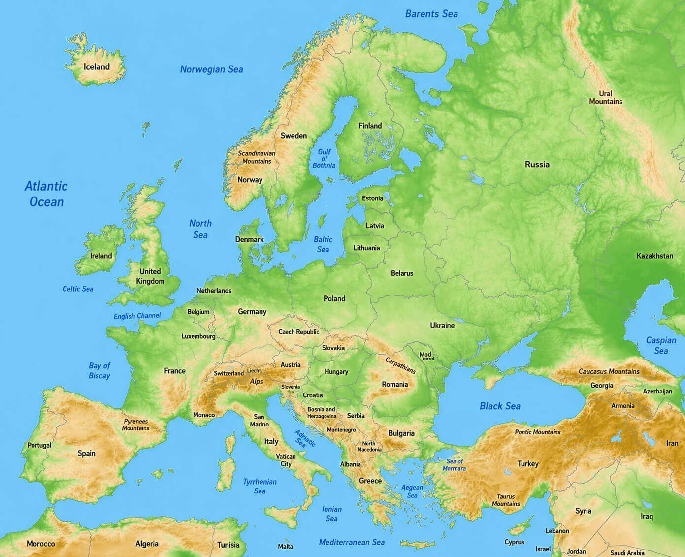
Europe topographic relief map
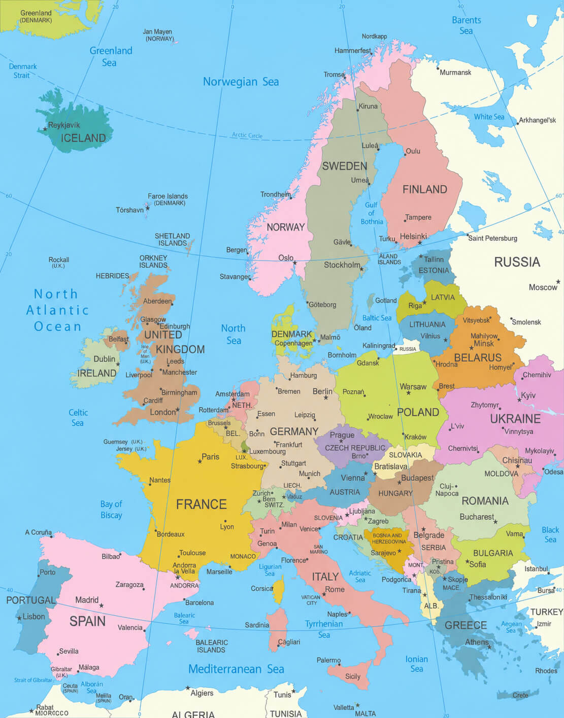
Europe national borders map
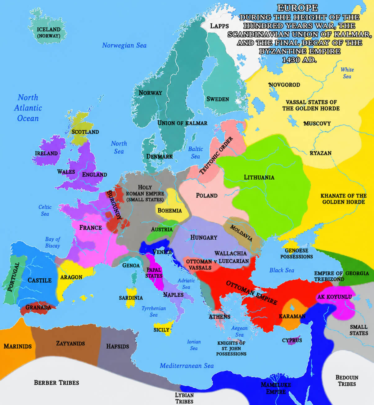
Europe map 1430 medieval period
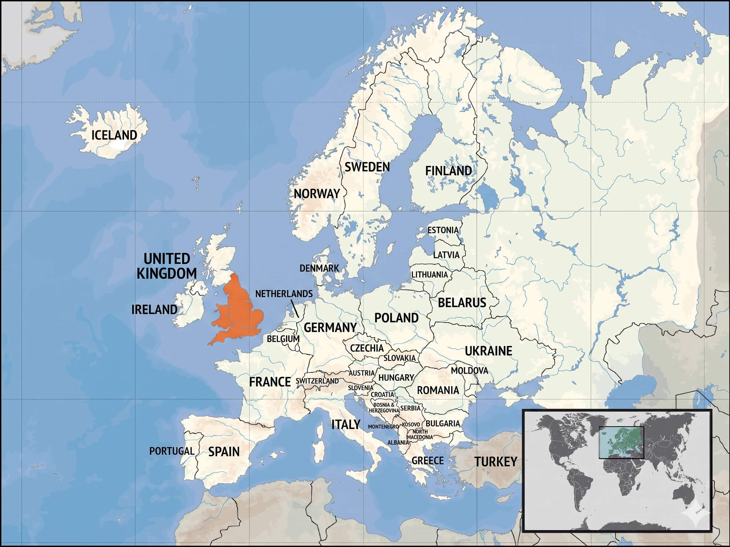
Europe map with wales highlighted
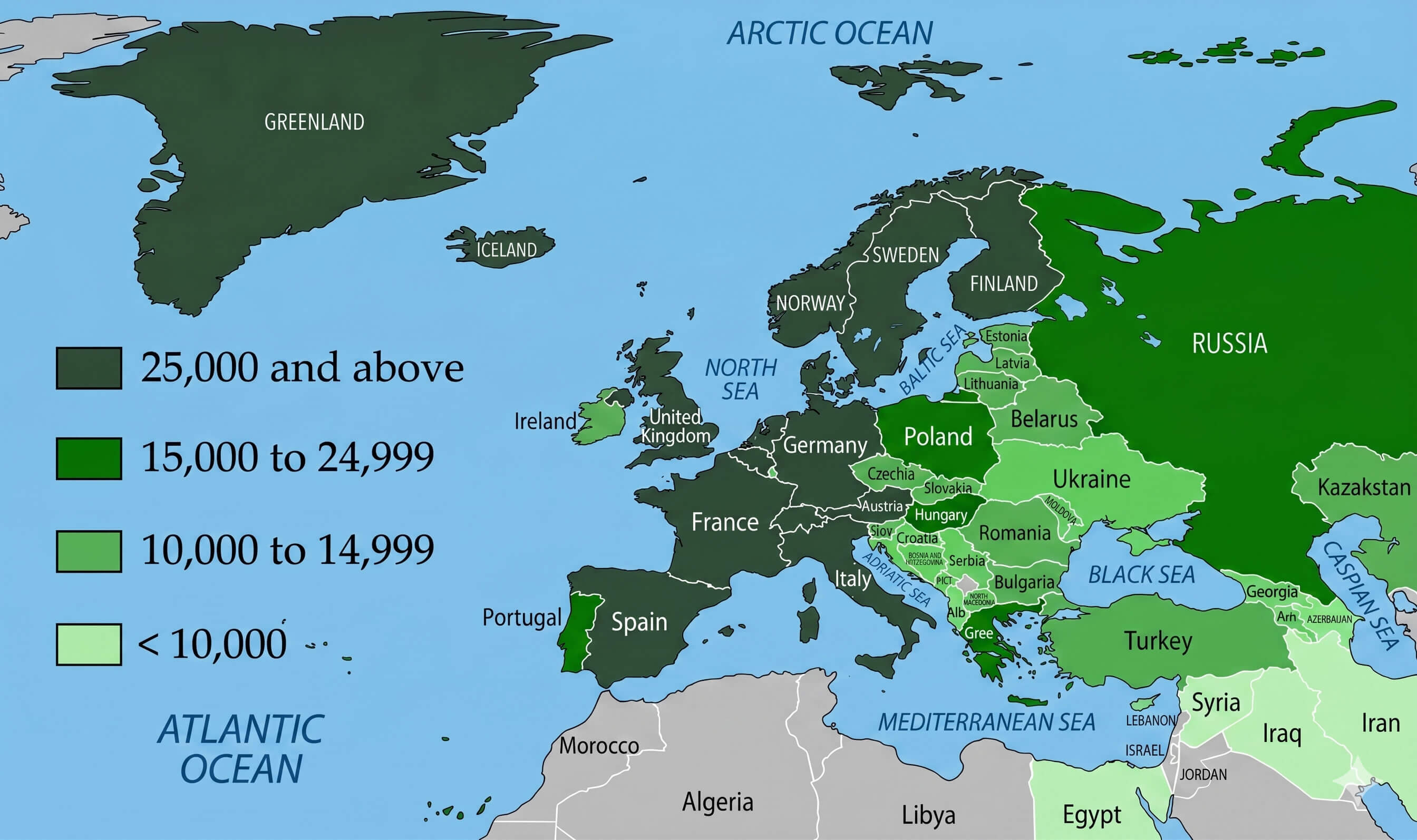
Europe population density map
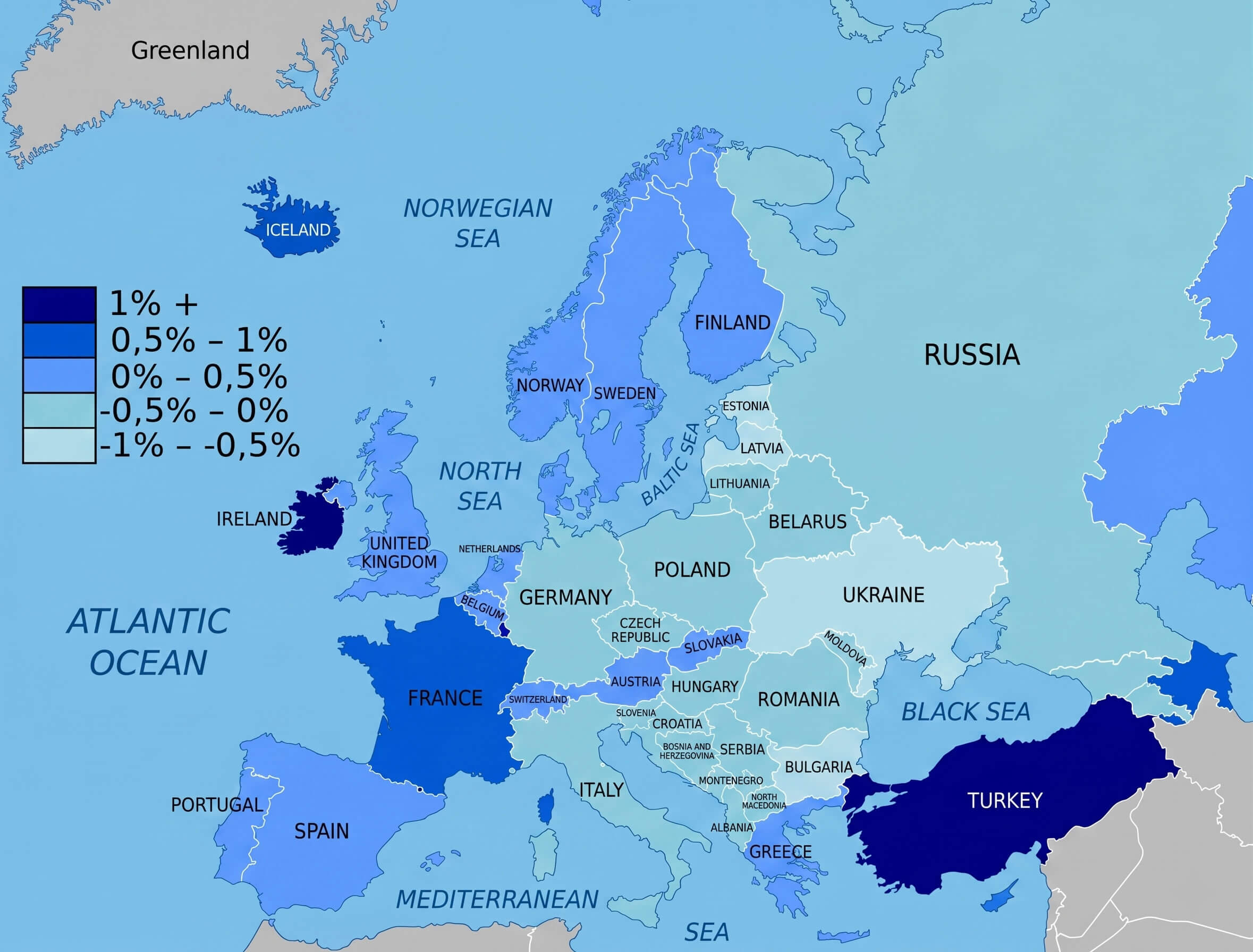
Europe unemployment rate map 2010
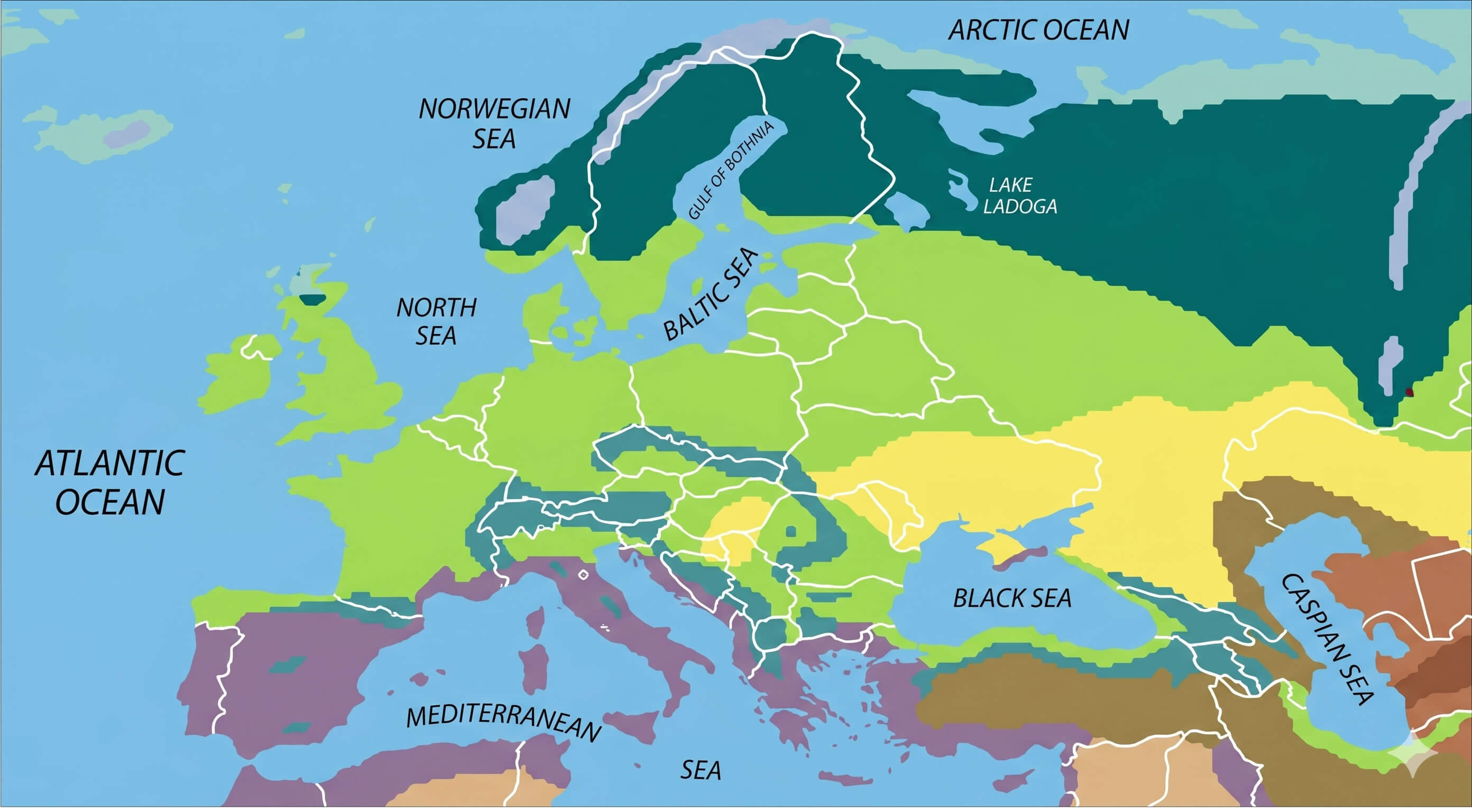
Europe vegetation zones map
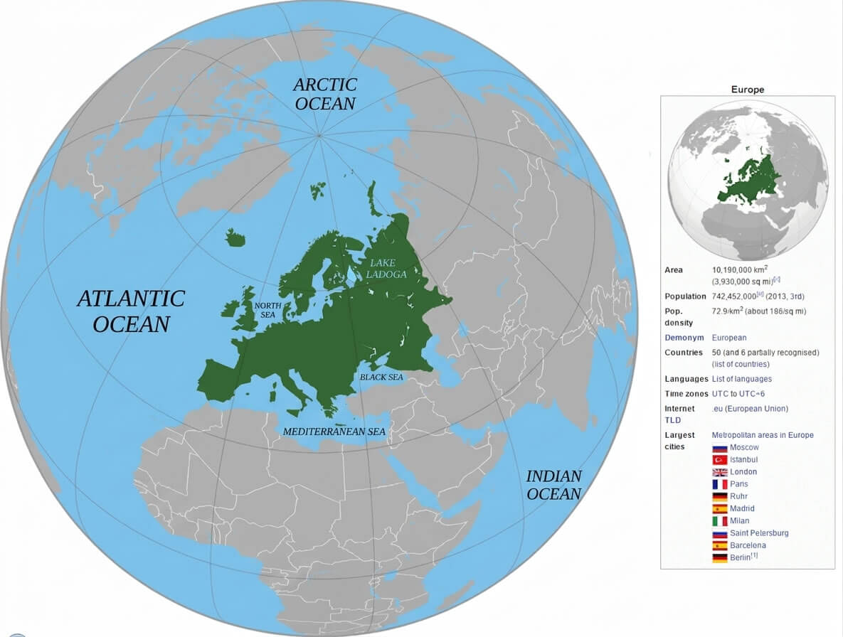
Europe location on World globe map
Feel free to explore these pages as well:
Copyright Turkey Travel Guide - 2005 - 2026. All rights reserved. Privacy Policy | Disclaimer