Europe Maps Collection: Detailed Maps of European Countries and Regions
Explore a diverse collection of Europe maps including the Europe EU and NATO members map, Frankish Empire map 481–814, German Confederation map, Holy Roman Empire map 1648, Roman Empire map 117 AD, and Medieval Europe map 814. Discover detailed political boundaries maps of Europe, major regions of Europe maps, linguistic maps of Europe, German language knowledge maps, and United Kingdom political maps for education, history, travel, and geographic research.
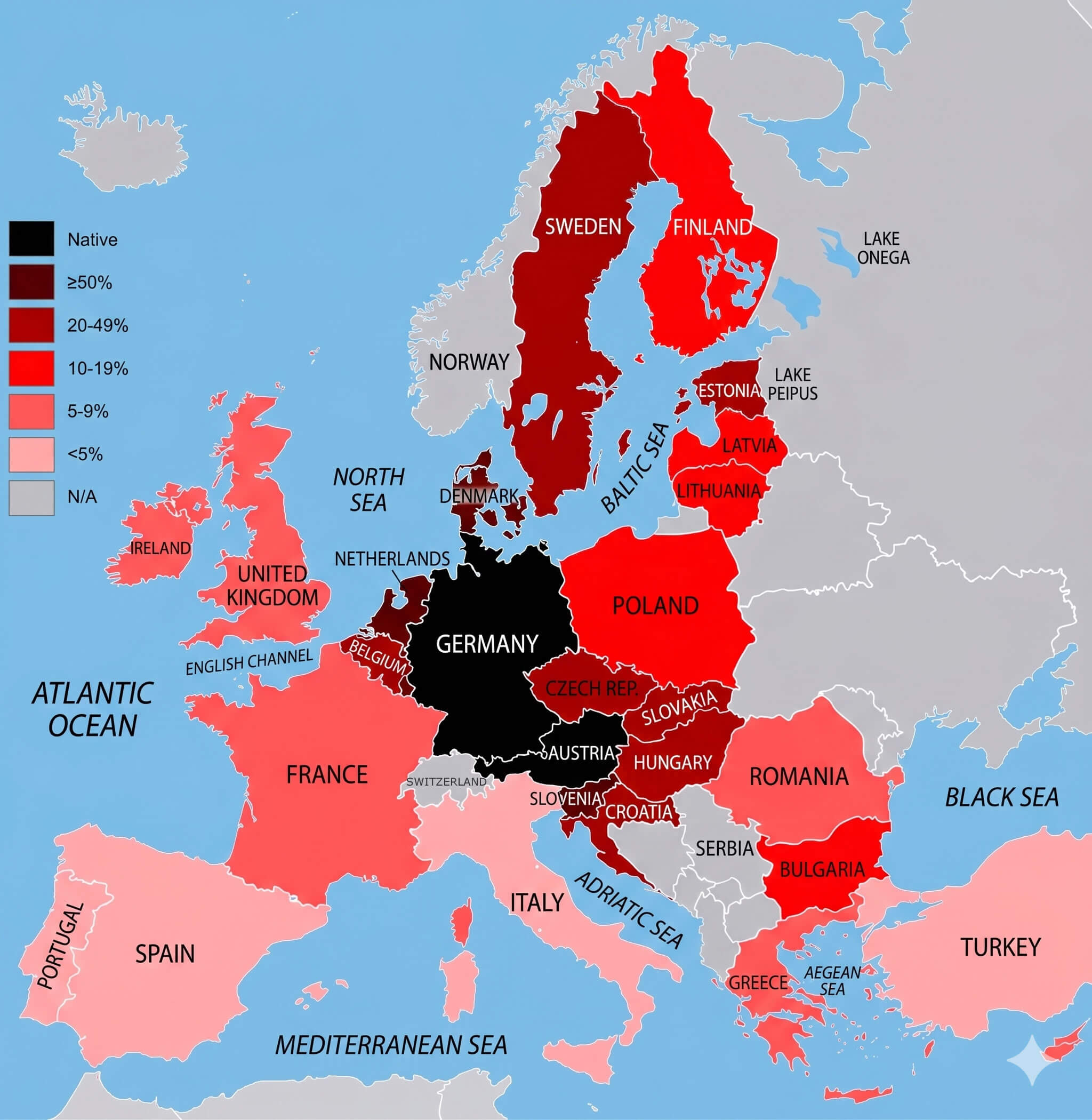
German language knowledge map Europe
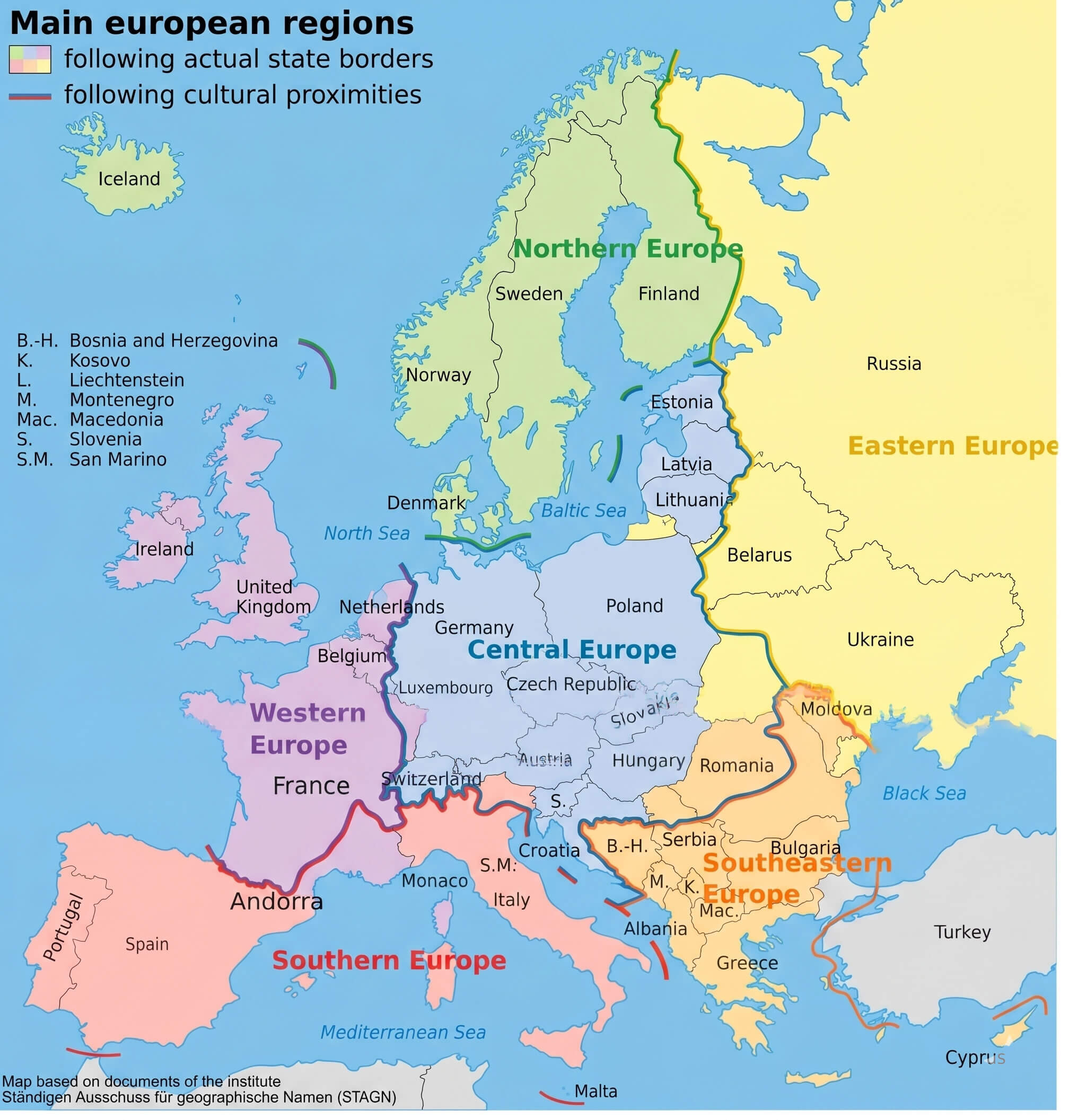
Major regions of Europe map
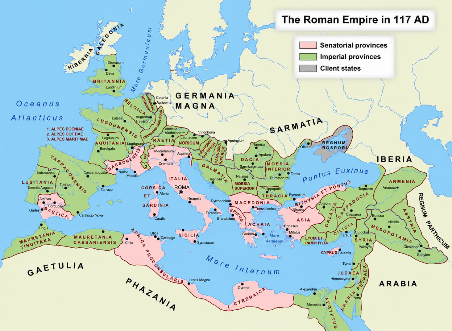
Roman Empire map 117 ad
In addition to historical and thematic content, this Europe map collection features educational and practical resources like the Europe national borders map, Europe location on World globe map, and Europe map with Wales highlighted. These high-quality Europe maps are ideal for academic research, classroom use, travel planning, genealogy studies, and business presentations. The archive also contains valuable socioeconomic visuals such as the Europe unemployment rate map 2010 and Europe population density map 2006, allowing users to compare regional trends, urban development, and economic conditions across Europe in a visually engaging way.
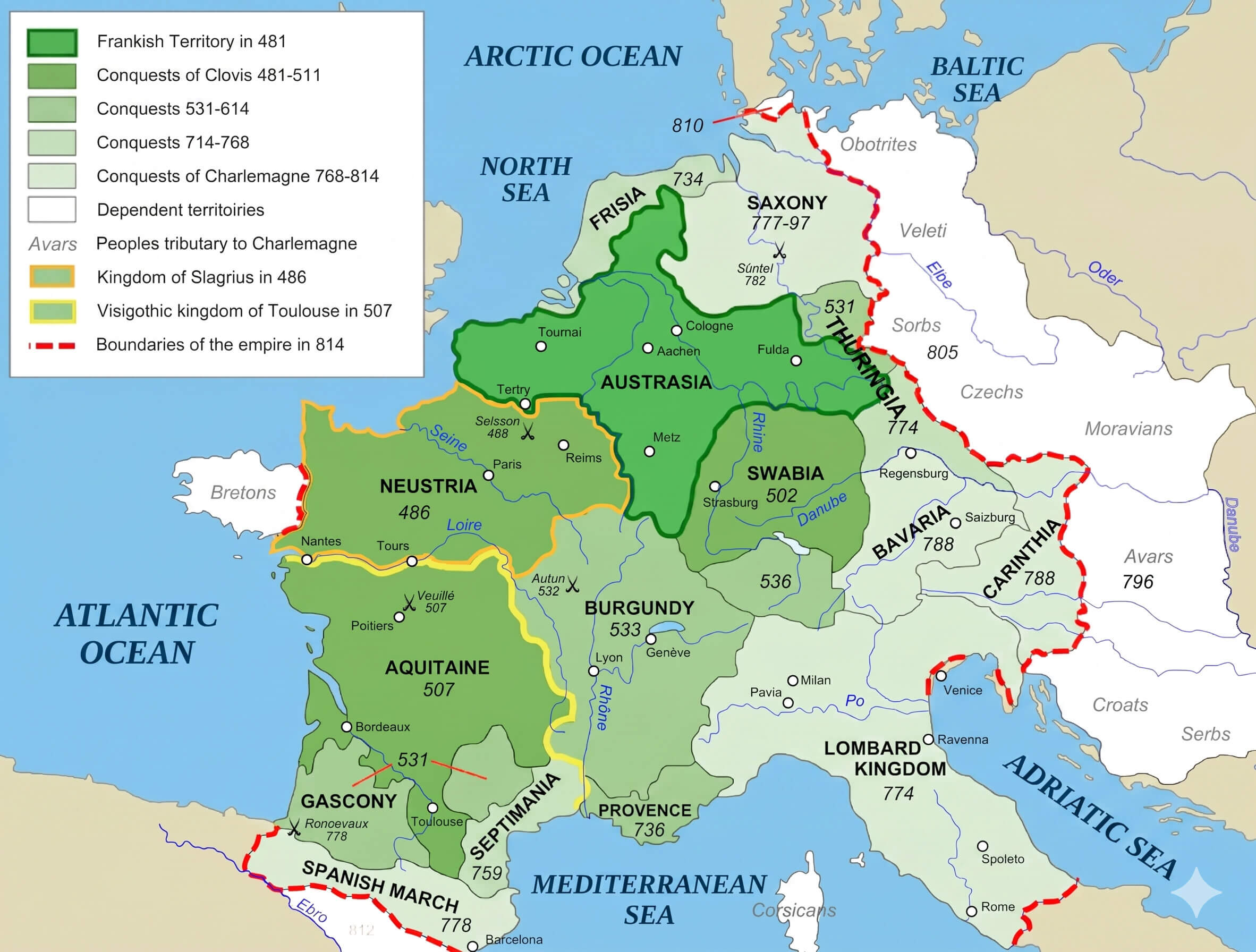
Frankish empire map 481 814
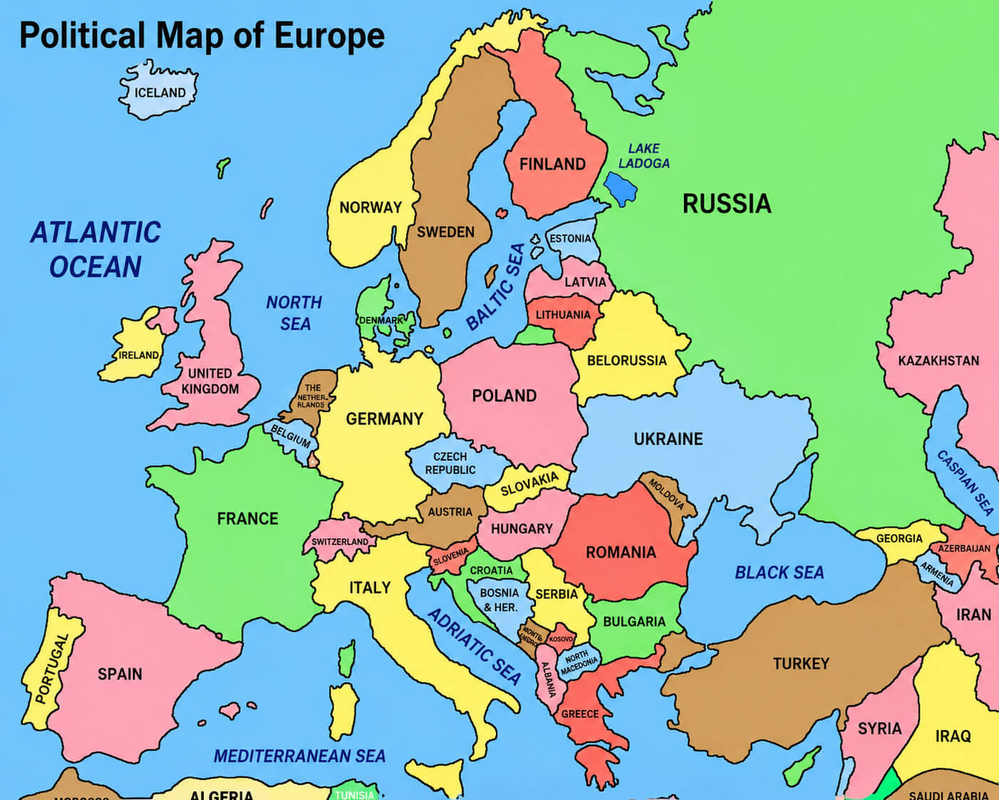
Political boundaries map of Europe
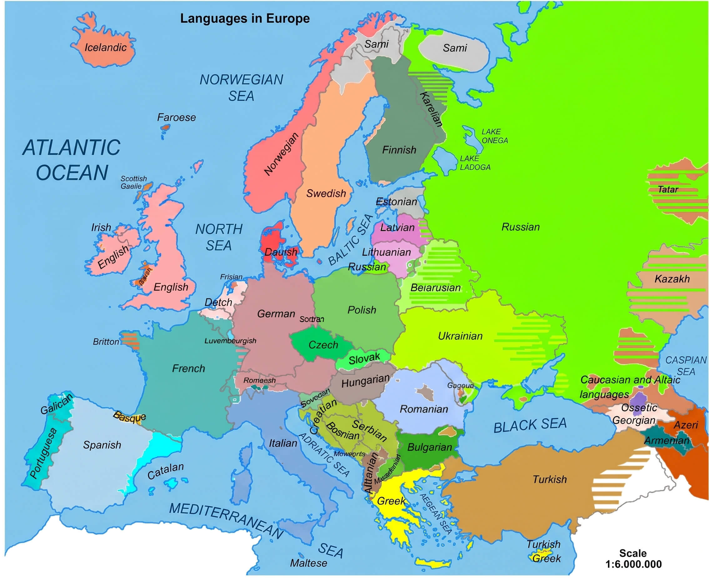
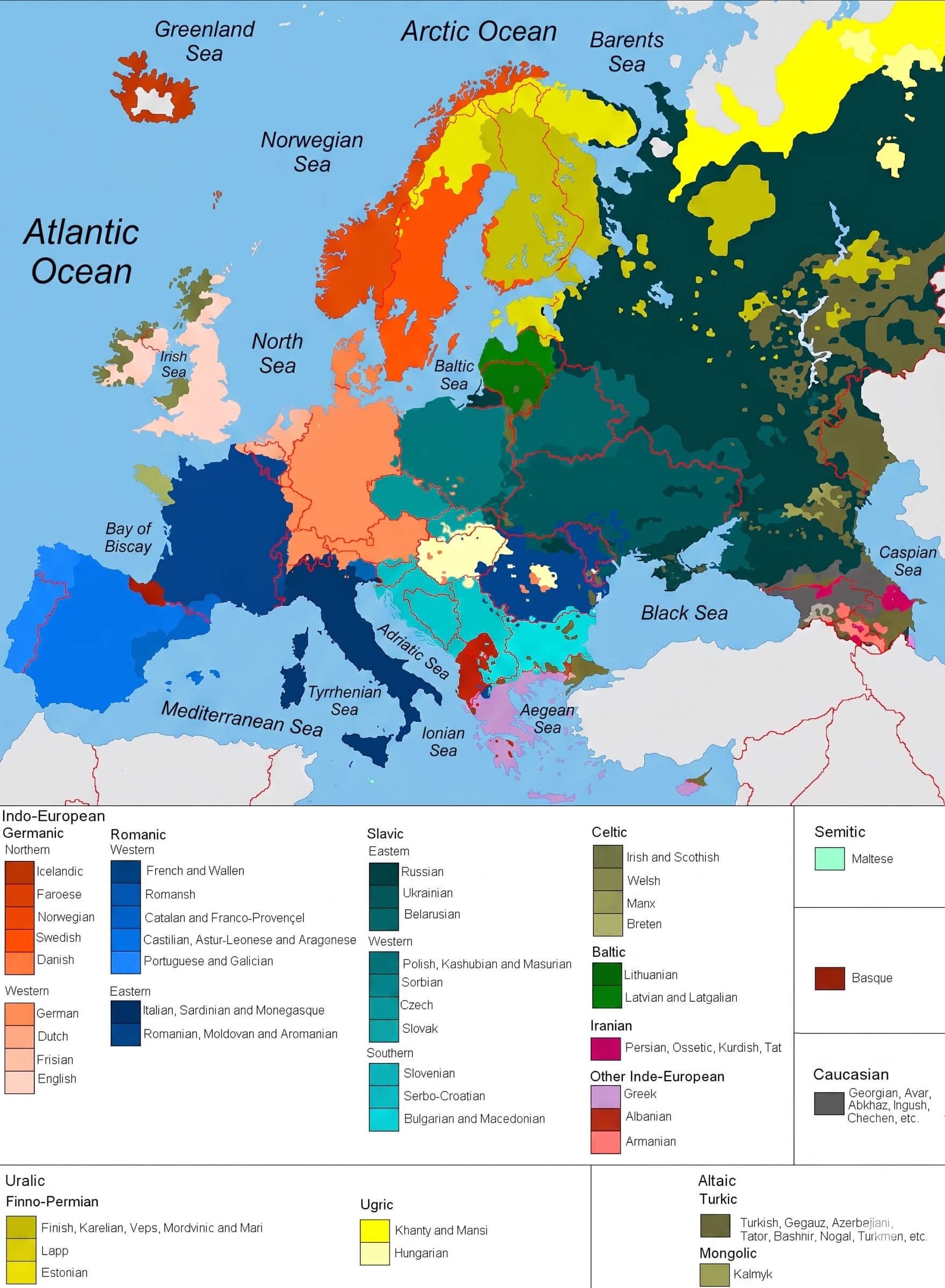
Linguistic map of Europe
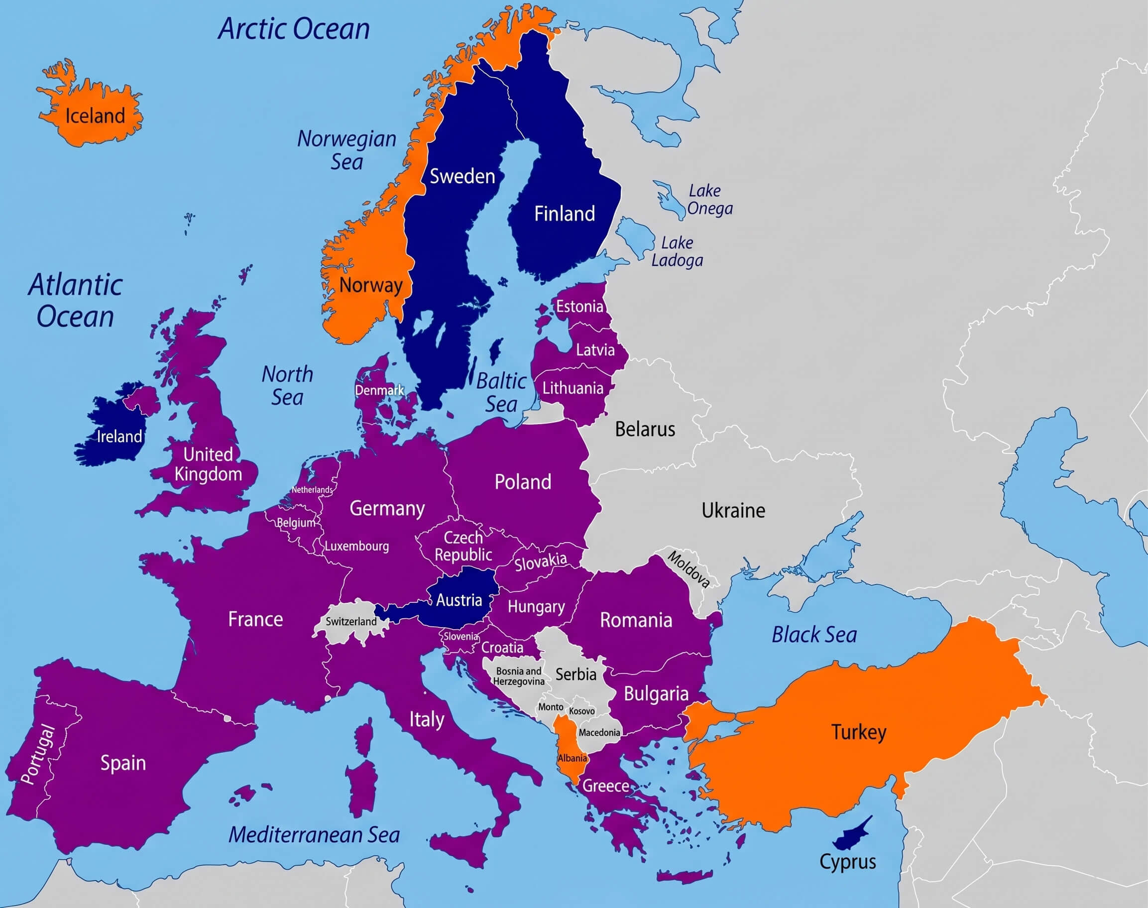
Europe eu and nato members map
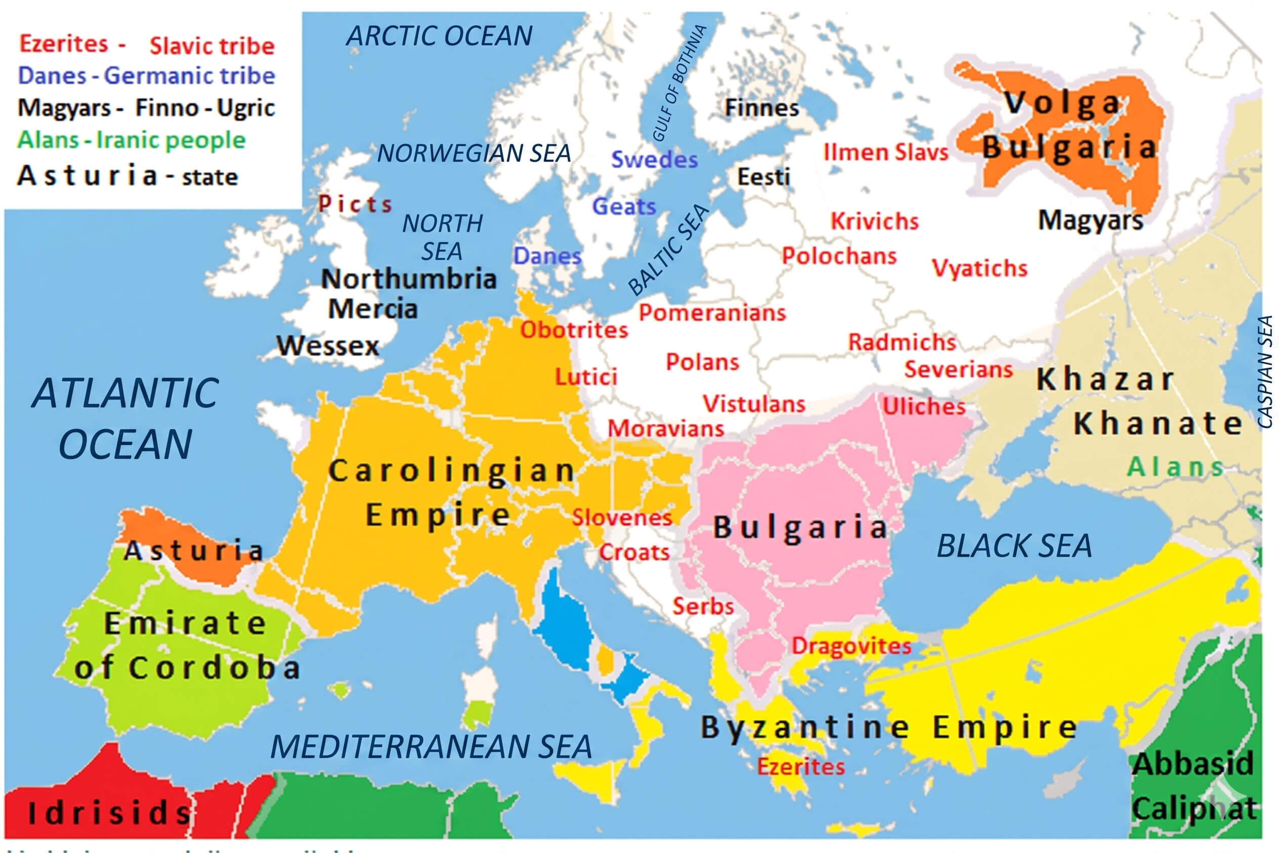
Medieval Europe map 814
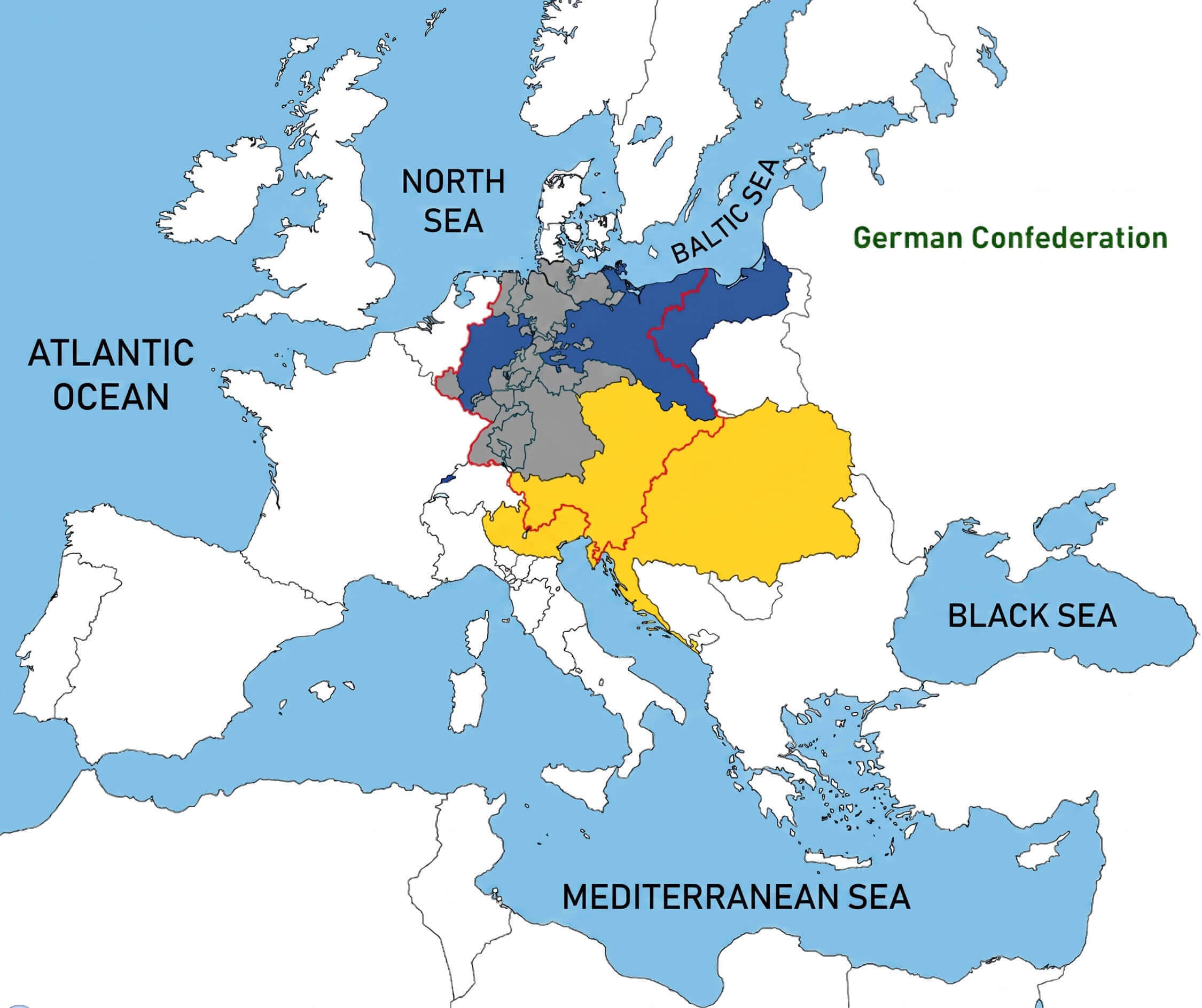
German Confederation map Europe
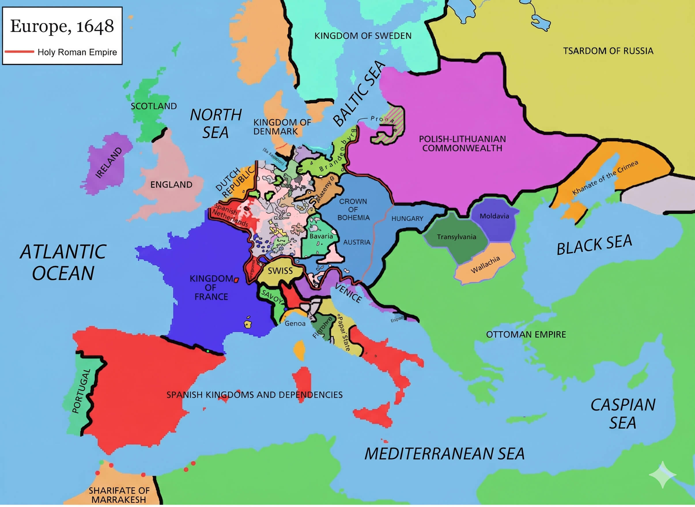
Holy Roman Empire map 1648
Languages spoken in Europe map
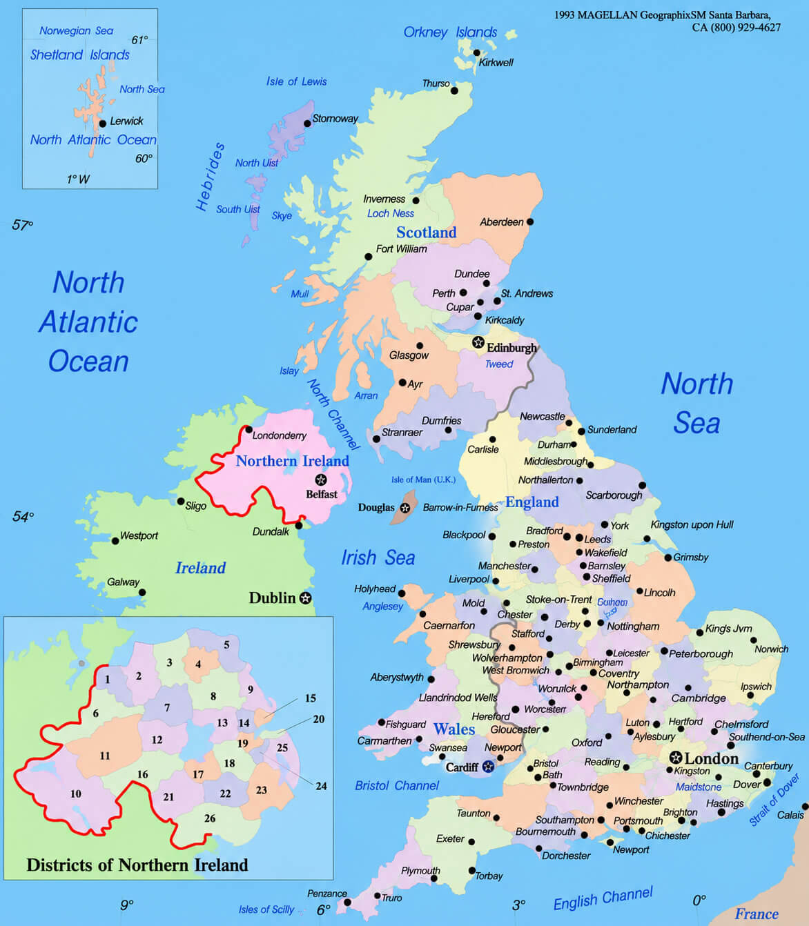
United Kingdom political map
Feel free to explore these pages as well:
Copyright Turkey Travel Guide - 2005 - 2026. All rights reserved. Privacy Policy | Disclaimer