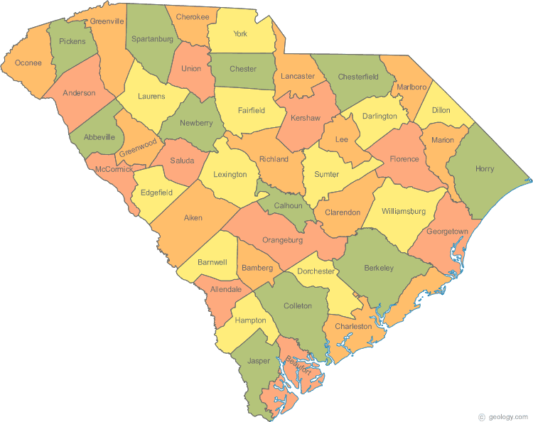
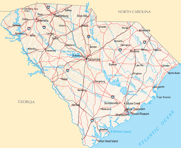
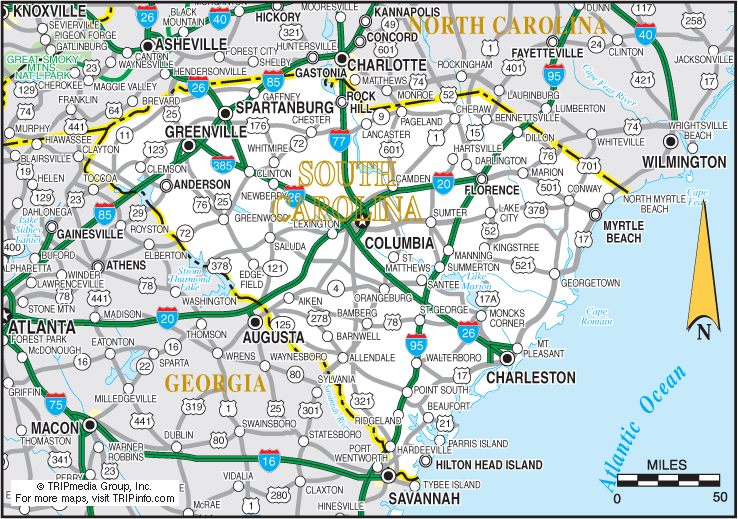
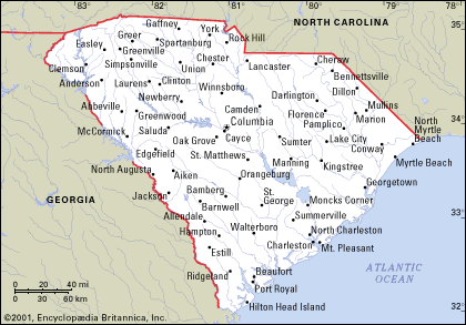
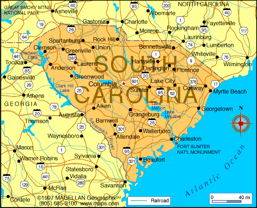
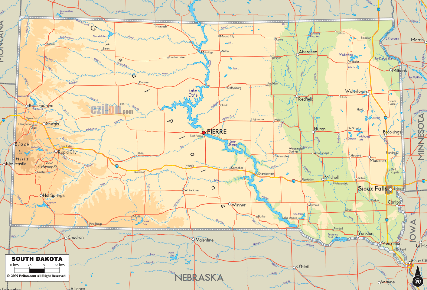
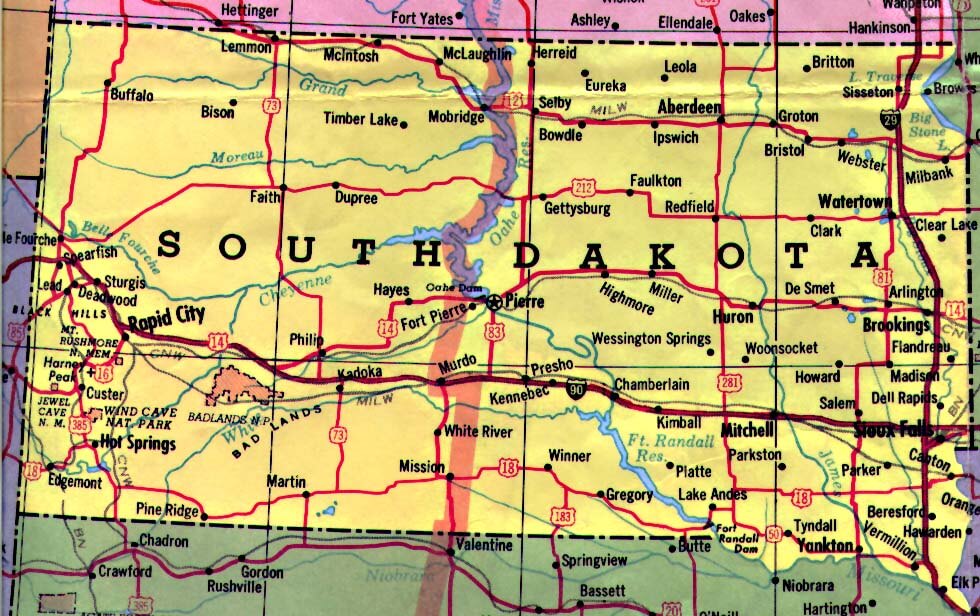
South Carolina Map
Discover the charming state of South Carolina with our map! South Carolina is known for its historic landmarks, beautiful beaches, and vibrant culture. On our South Carolina map, you can explore the state's major cities, highways, topography, and points of interest. Whether you're planning a trip to South Carolina, studying geography, or simply curious about this southern gem, our map has something for everyone. Come explore the Palmetto State today!
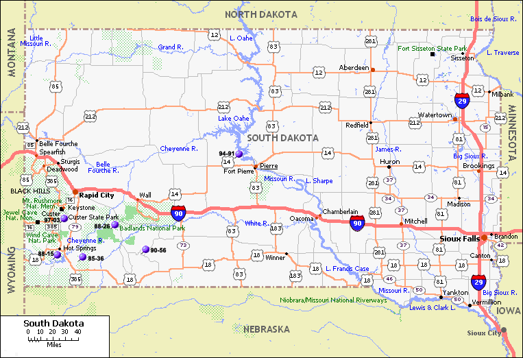
For all South Carolina Cities Map
MAP OF SOUTH CAROLINA
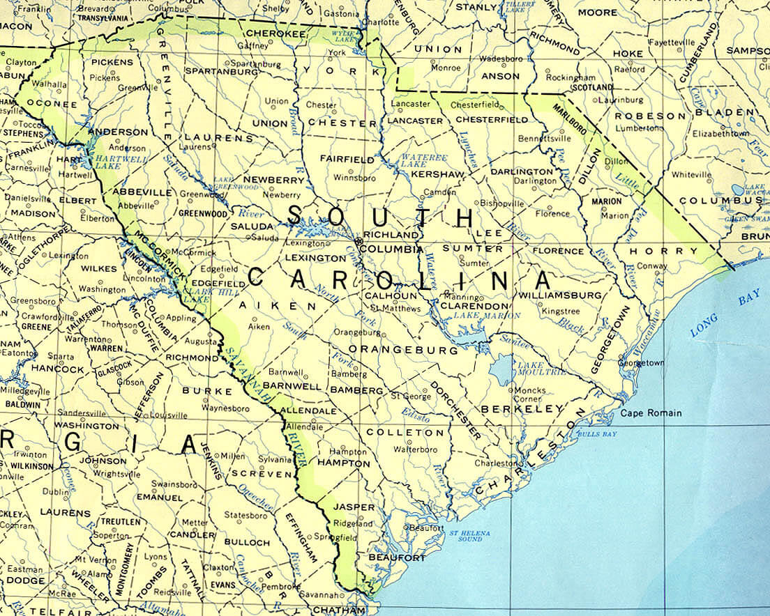
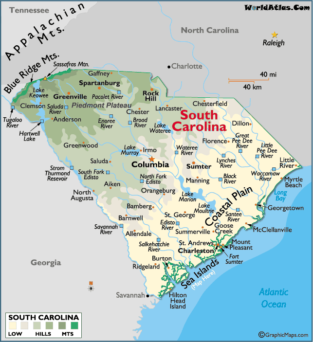
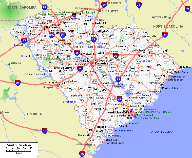
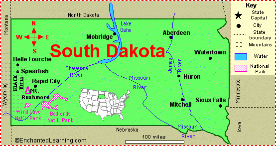
SOUTH CAROLINA REFERENCE MAP
Brief information about South Carolina, US
South Carolina is a state located in the southeastern region of the United States. It covers an area of 32,020 square miles (82,933 square kilometers) and has a population of approximately 5.1 million people as of 2020. The state is known for its beautiful beaches, historic landmarks, and vibrant culture.- Area: 32,020 square miles (82,933 square kilometers)
- Population (2020): 5.1 million
- Largest cities: Columbia (capital), Charleston, North Charleston, Mount Pleasant, Rock Hill
- Median age: 39.3 years
- Median household income: $54,306
- Major industries: Manufacturing, tourism, agriculture, healthcare, education
- State symbols: State bird - Carolina wren, State tree - palmetto tree, State flower - yellow jessamine
- South Carolina was one of the original 13 colonies that formed the United States
- The state played a key role in the American Revolution and the Civil War
- South Carolina was also a major center of the civil rights movement in the 1960s
- White: 62.8%
- African American: 27.4%
- Hispanic or Latino: 6.8%
- Asian: 2.2%
- Other: 1.4%
- South Carolina's GDP was $217 billion in 2020
- Major industries include manufacturing (including automotive and aerospace), tourism, agriculture (including cotton, tobacco, and peaches), and healthcare
- Top employers in the state include Boeing, BMW, Michelin, and the Medical University of South Carolina
- The Port of Charleston is one of the busiest ports on the East Coast, serving as a major center for international trade.
A Collection of South Carolina Maps and South Carolina Satellite Images
Map Of South Carolina
South Carolina Map
South Carolina Map
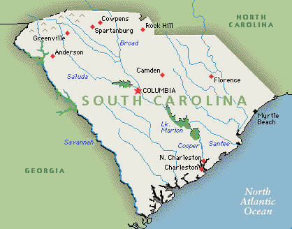
South Carolina Reference Map
South Carolina Cities Map
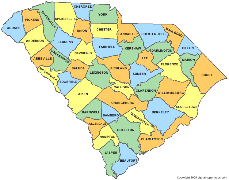
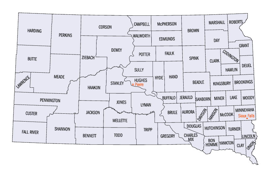
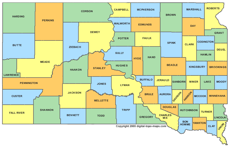
South Carolina County Map
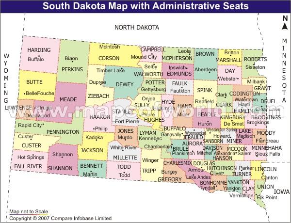
South Carolina County Seat Map

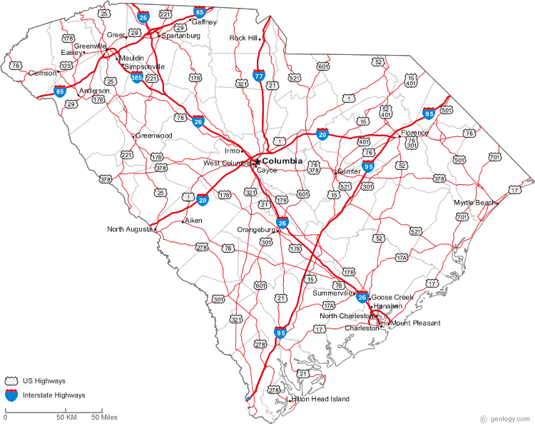
South Carolina Higways Map
South Carolina Historical Map
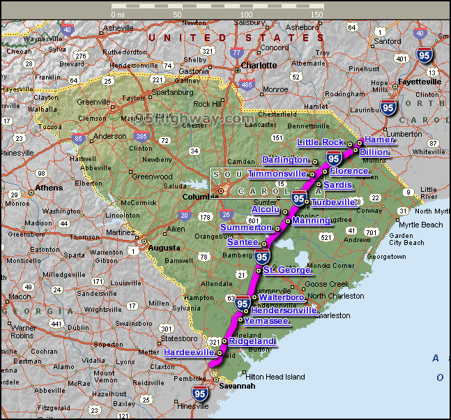
South Carolina Interstate 95 Map
South Carolina Map
South Carolina Maps
South Carolina Political Map

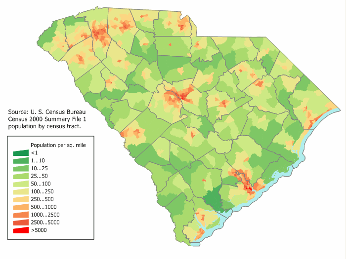
South Carolina Population Map
South Carolina Rail Road Map
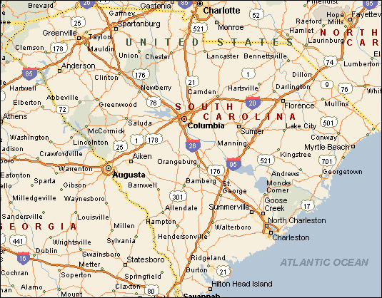
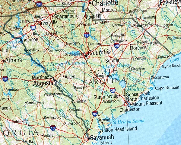
South Carolina Road Map
South Carolina Route Map

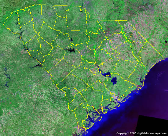
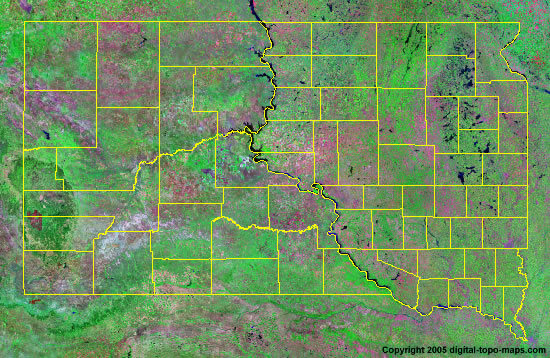
South Carolina Satellite Map
South Carolina State Map
A collection of South Carolina Maps


Largest Cities Map of South Carolina and Population
Columbia Map - 129,272 Charleston Map - 120,083 North Charleston Map - 97,471 Mount Pleasant Map - 67,843 Rock Hill Map - 66,154 Greenville Map - 58,409 Summerville Map - 43,392 Sumter Map - 40,524 Hilton Head Island Map - 37,099 Florence Map - 37,056 Spartanburg Map - 37,013 Goose Creek Map - 35,938 Aiken Map - 29,524 Myrtle Beach Map - 27,109 Anderson Map - 26,686Copyright Turkey Travel Guide - 2005 - 2026. All rights reserved. Privacy Policy | Disclaimer