Michigan Map
Navigate Michigan map, Michigan state map, satellite images of the Michigan, Michigan largest cities maps, political map of Michigan, driving directions and traffic maps. Our interactive map allows you to zoom in and out, search for specific locations, and learn about key attractions and landmarks. Start planning your Michigan adventure today!
Our interactive Michigan Map is designed to help you discover all the wonders this state has to offer. With a user-friendly interface and detailed information about key landmarks and attractions, you can plan your perfect Michigan adventure with ease. So whether you're a first-time visitor or a seasoned Michigander, let WorldMap1's Michigan Map be your guide to this amazing state!
For all Michigan Cities Map
MAP OF MICHIGAN

MICHIGAN MAP
Brief information about Michigan, US
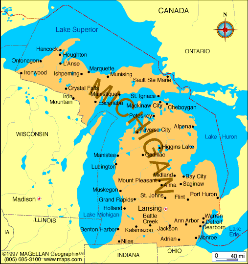
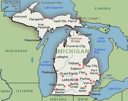
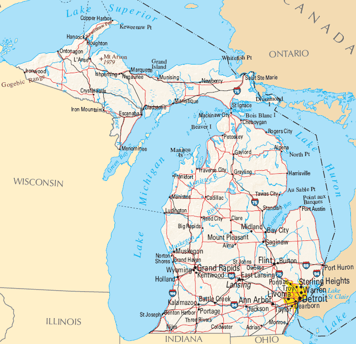
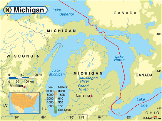
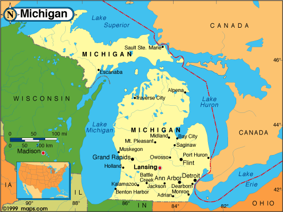
Michigan is a state located in the Great Lakes region of the United States. It is the 11th largest state in the US by area and the 10th most populous with a population of over 10 million people. The state is known for its vast freshwater coastline along the Great Lakes, particularly Lake Michigan, which is the second largest of the Great Lakes by volume.A Collection of Michigan Maps and Michigan Satellite Images
Map Of Michigan
Cities Of Michigan Map
Michigan State Map
Michigan Map
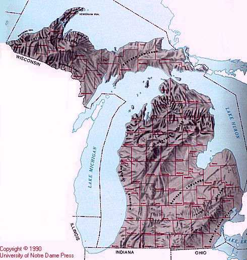
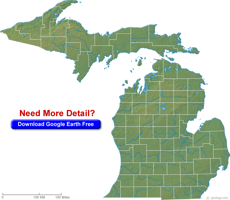
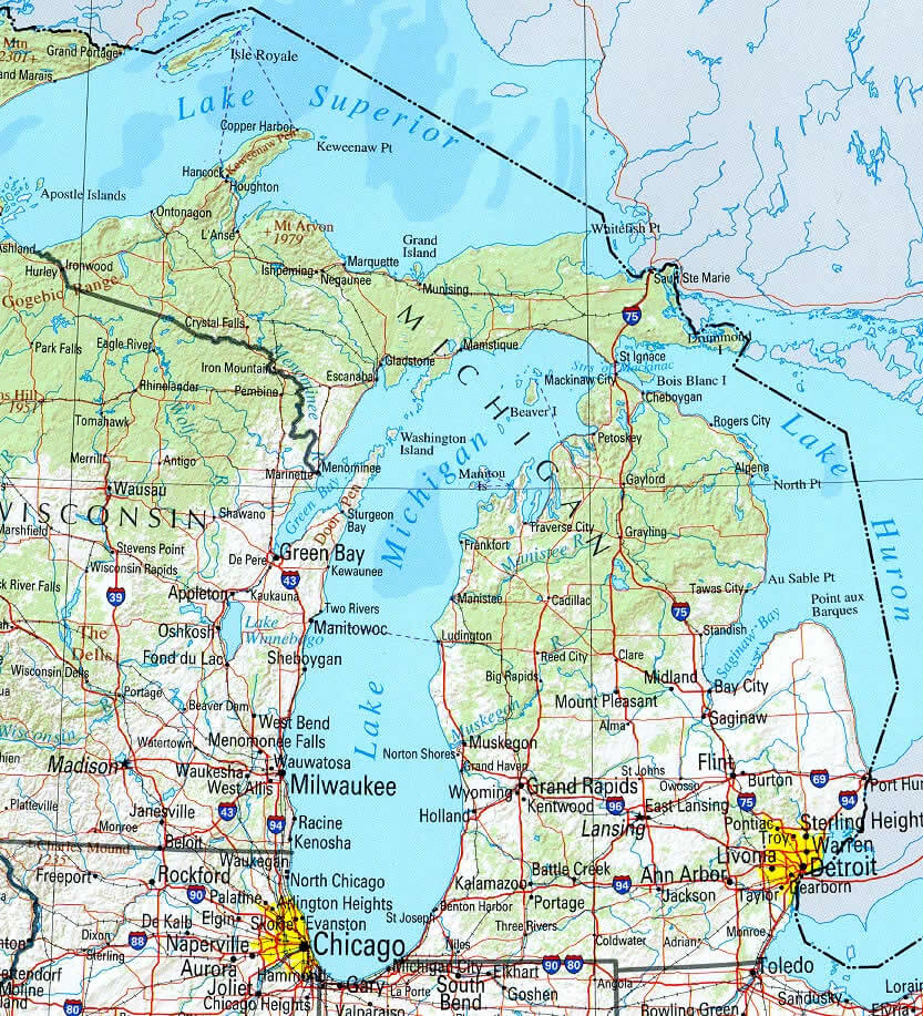
Michigan Physical Map
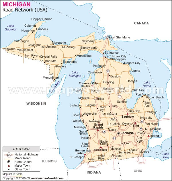
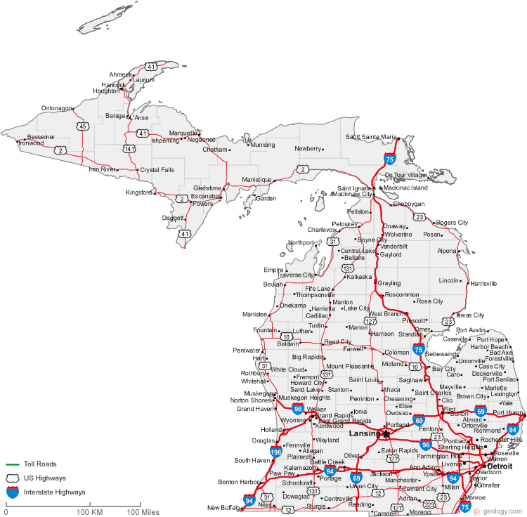
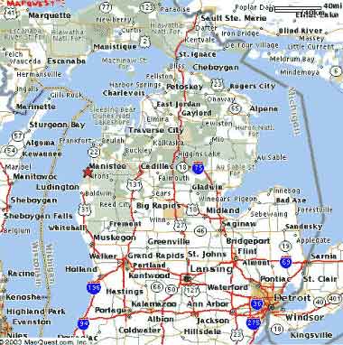
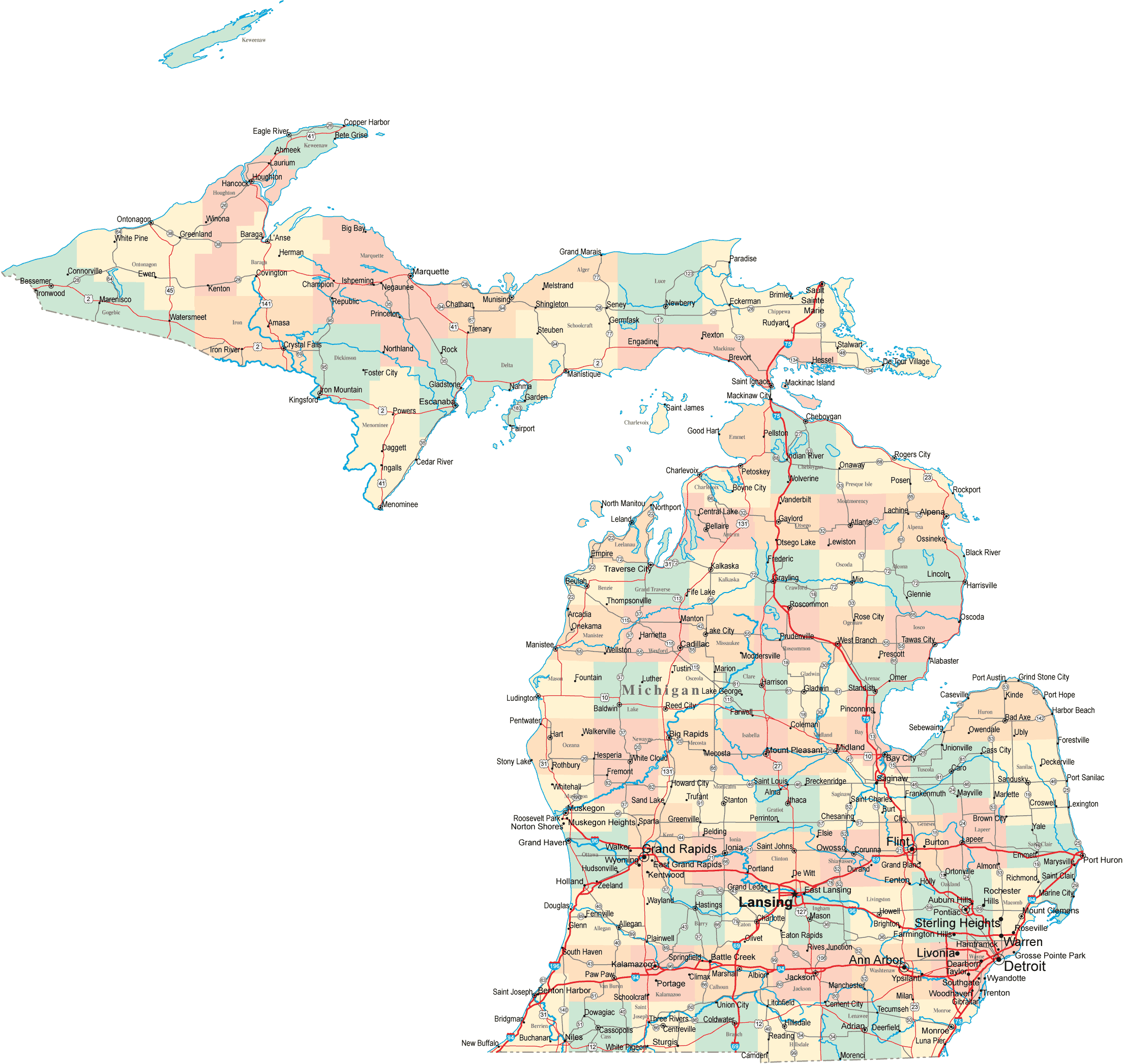
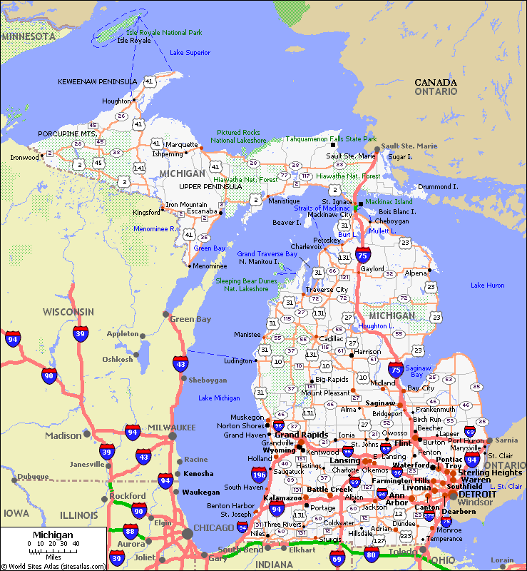
Michigan Road Map
Michigan State Map
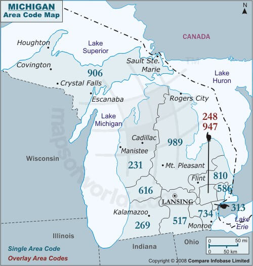
Michigan Area Code Map
Michigan Cities Map

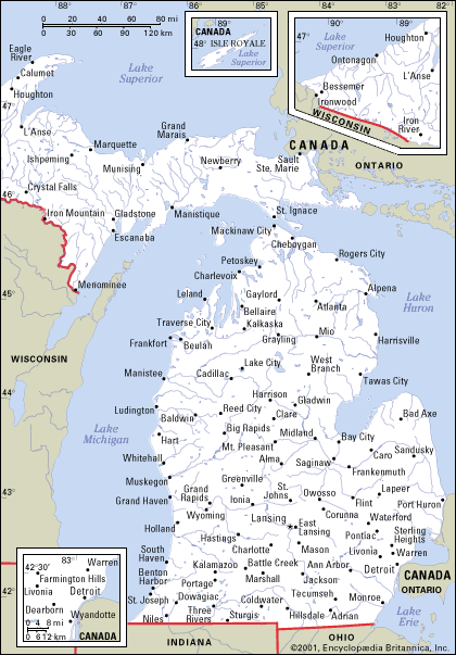
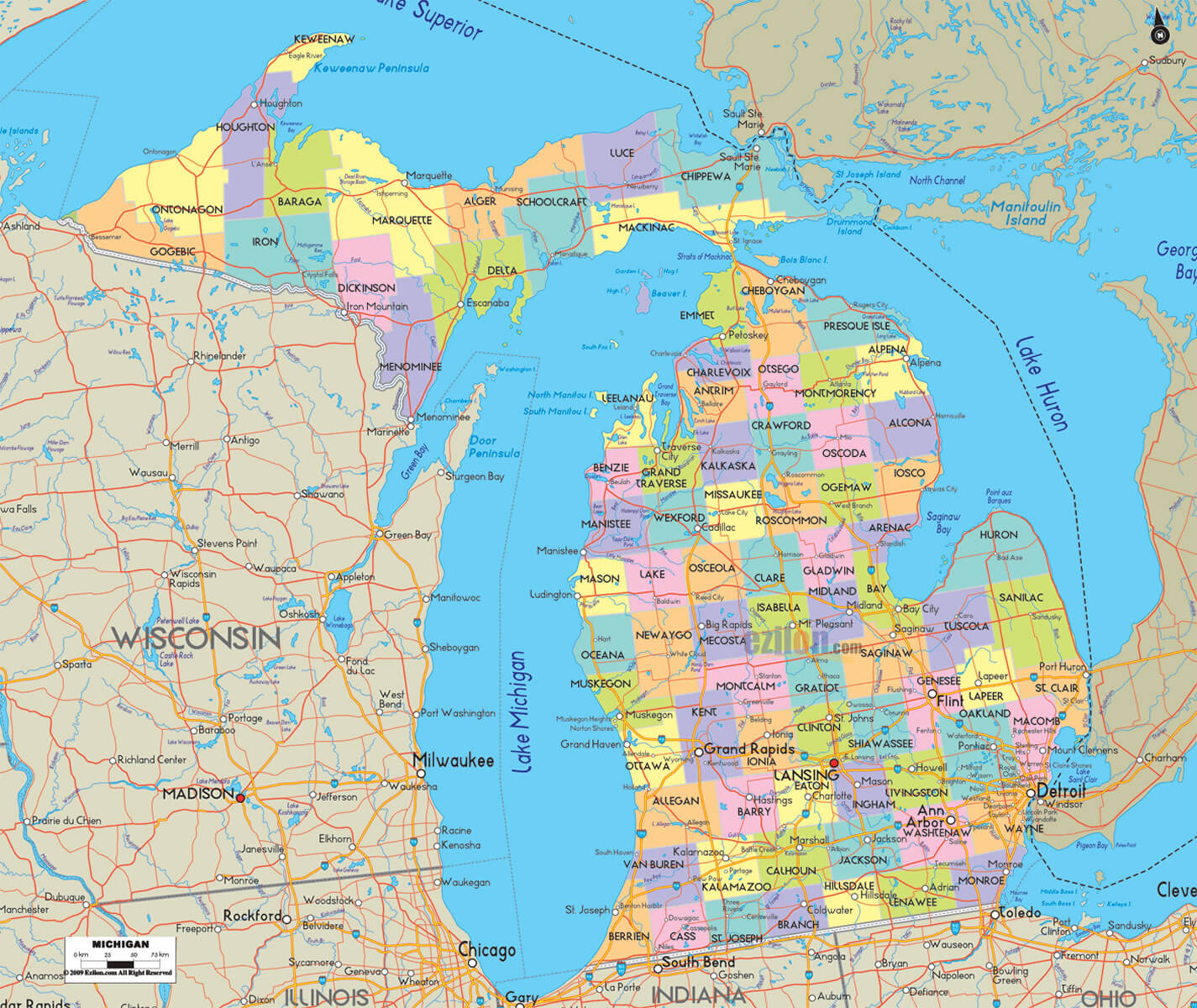
Michigan Counties Map
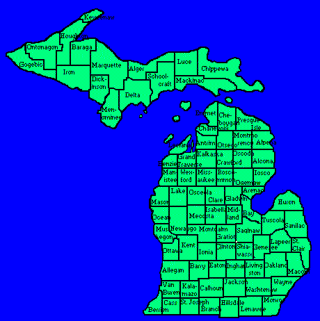
Michigan County Map

Michigan County Map

Michigan Geographic Map
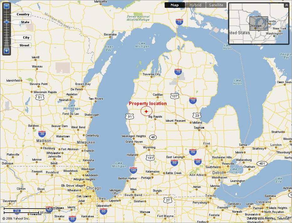
Michigan Google Map
Michigan Map
Michigan Map
Michigan Map Usa
Michigan Physical Map
Michigan Road Map
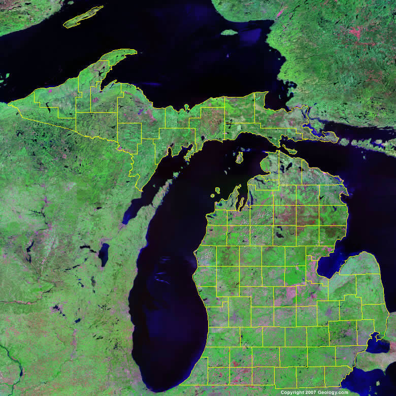
Michigan Satellite Map
Michigan State Map
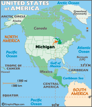
Michigan Where In Usa Map
Physical Map Of Michigan

Road Map Of Michigan
State Map Of Michigan
State Map Of Michigan

A collection of Michigan Maps

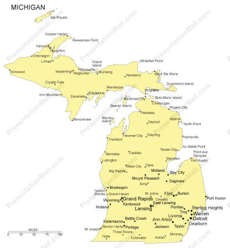
Largest Cities Map of Michigan and Population
Detroit Map - 713,777 Grand Rapids Map - 188,040 Warren Map - 134,056 Sterling Heights Map - 129,699 Lansing Map - 114,297 Ann Arbor Map - 113,934 Flint Map - 102,434 Dearborn Map - 98,153 Livonia Map - 96,942 Clinton Township Map - 96,796 Canton Township Map - 90,173 Westland Map - 84,094 Troy Map - 80,980 Farmington Hills Map - 79,740 Kalamazoo Map - 74,262 Shelby Township Map - 73,804 Wyoming Map - 72,125 Southfield Map - 71,739 Waterford Township Map - 71,707 Rochester Hills Map - 70,995 West Bloomfield Township Map - 64,690 Taylor Map - 63,131 St. Clair Shores Map - 59,715 Pontiac Map - 59,515 Dearborn Heights Map - 57,774 Royal Oak Map - 57,236 Novi Map - 55,224 Battle Creek Map - 52,347 Saginaw Map - 51,508Copyright Turkey Travel Guide - 2005 - 2026. All rights reserved. Privacy Policy | Disclaimer