Iran Map
Navigate Iran Map, Iran countries map, satellite images of the Iran, Iran largest cities maps, political map of Iran, driving directions and traffic maps.
- Capital : Tehran
- Population : 75,149,669
- GDP : $482.445 billion
- Per Capita : $6,359
- Calling Code : +98
- Jobless Rate : 7.10%
- Time Zone : +3.30
For more about Iran >>
Iran Google Map, Street Views, Maps Directions, Satellite Images
Please Not : You can find local businesses, public places, tourist attractions via map view, satellite image, hybrid view, driving directions in Iran Map. You'll also find a varity map of Iran such as political, administrative, transportation, demographics maps following Google map.
Submit URL to Iran :
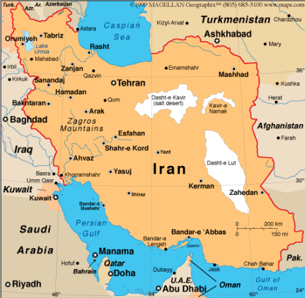
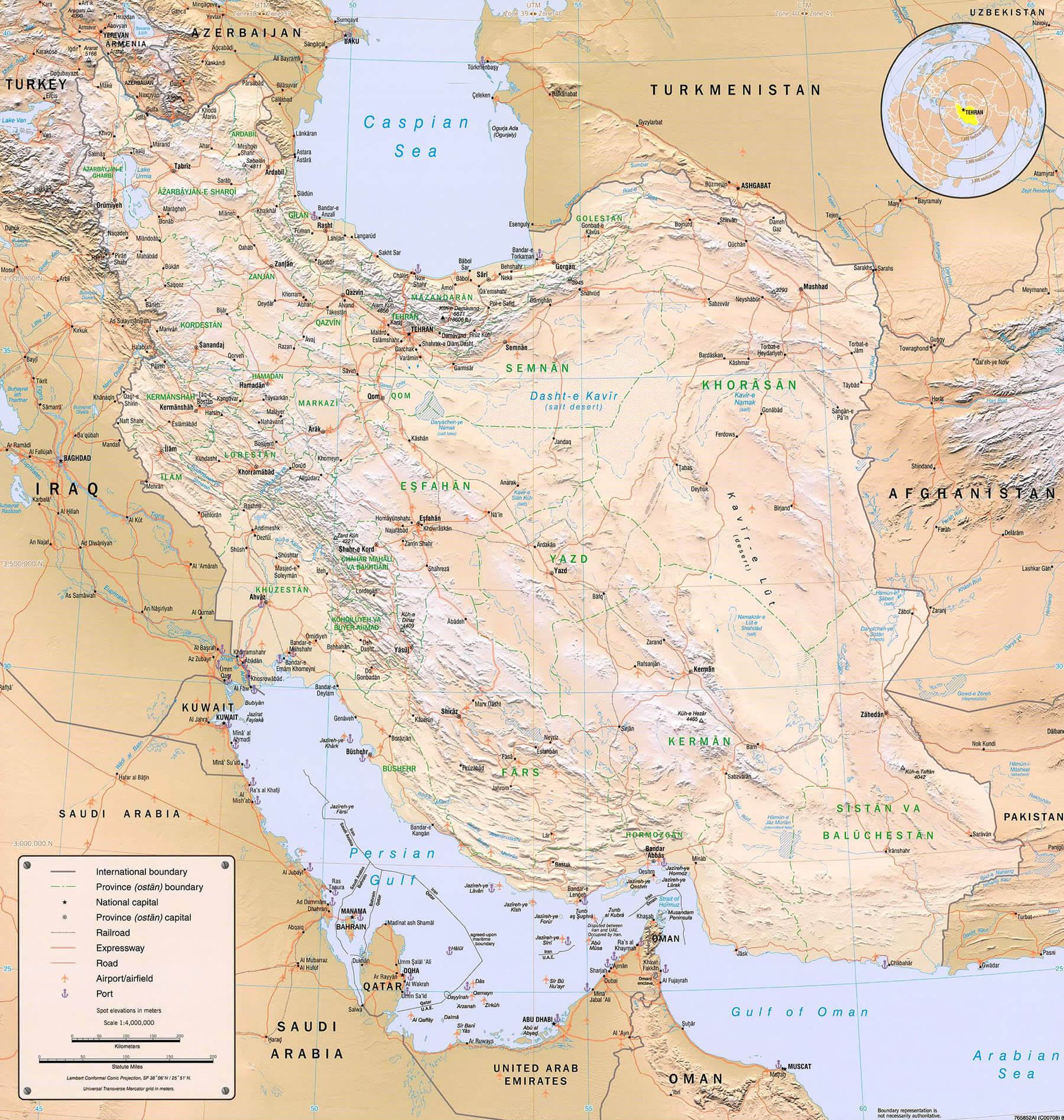
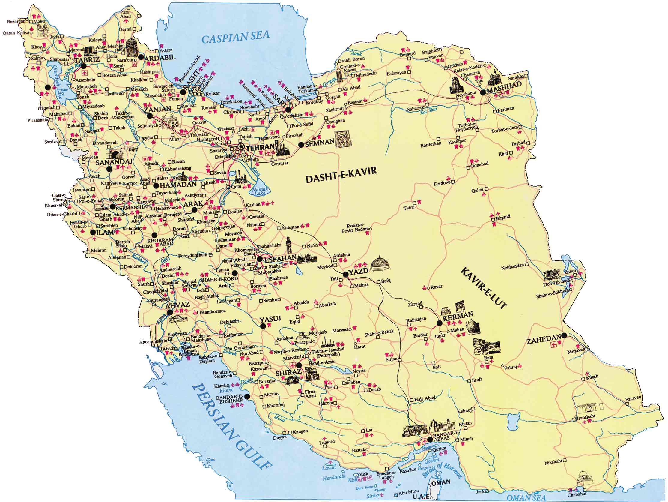
Iran Map & Iran Satellite Images
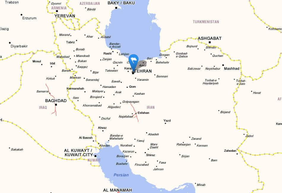
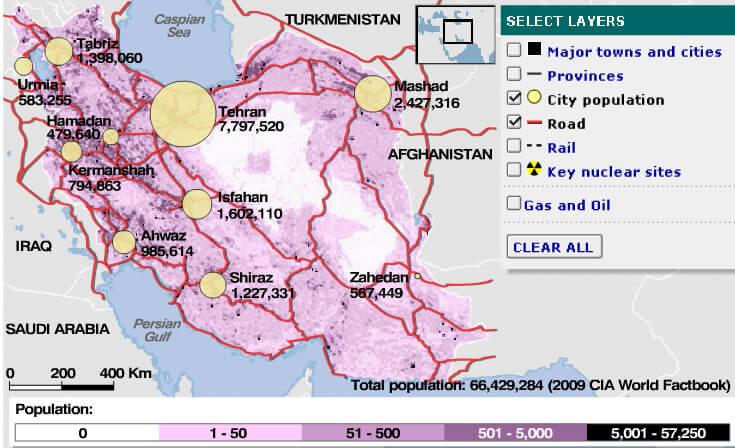
Largest Cities Map of Iran
Ahvaz Map - Isfahan Map - Karaj Map - Kerman Map - Bakhtaran Map - Mashhad Map - Orumieh Map - Qom Map - Rasht Map - Shiraz Map - Tabriz Map - Tehran Map - Zahedan Map -A Collection of Iran Maps and Iran Satellite Images
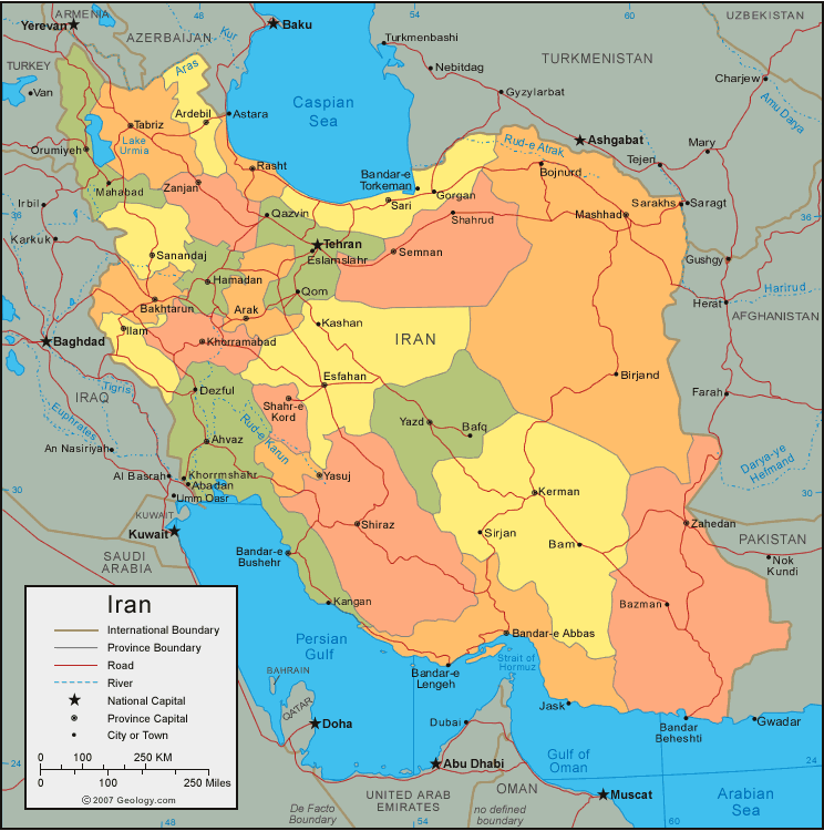
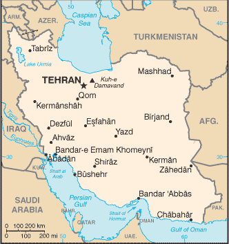
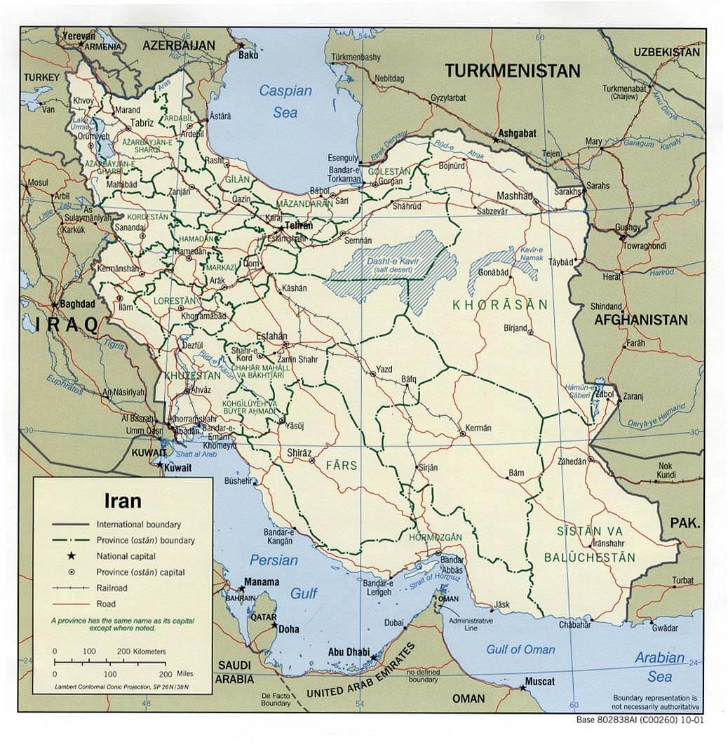
Map Of Iran

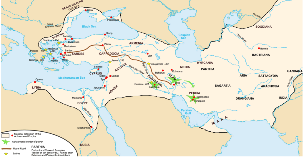
Achaemenid Empire Map Darius Iran
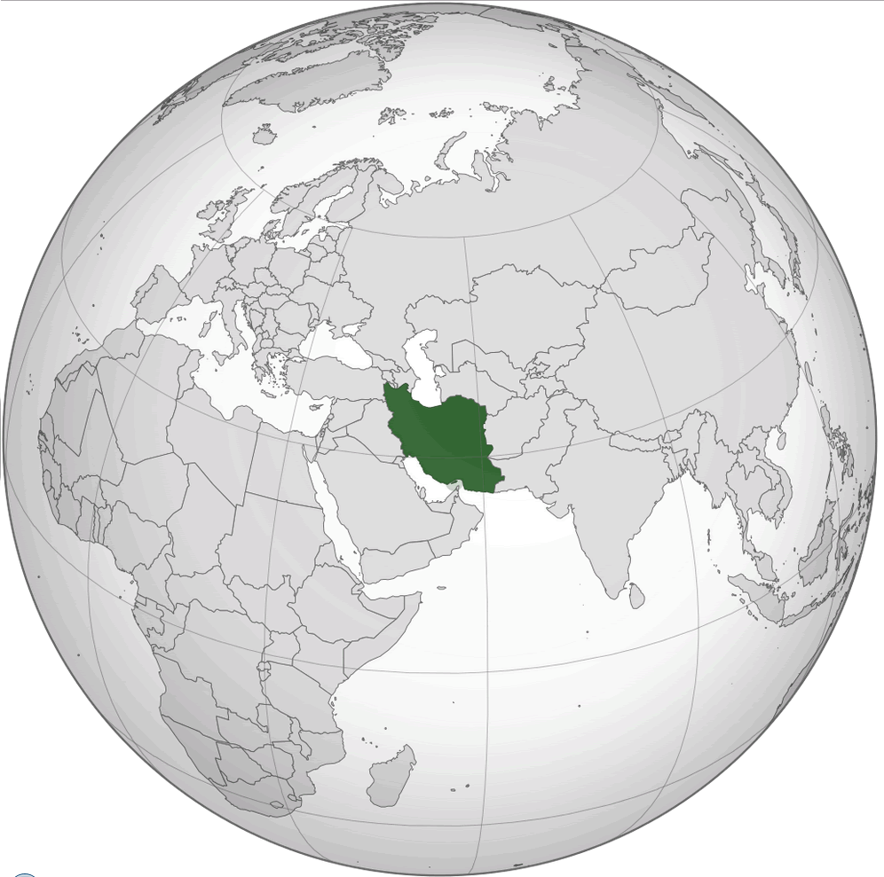
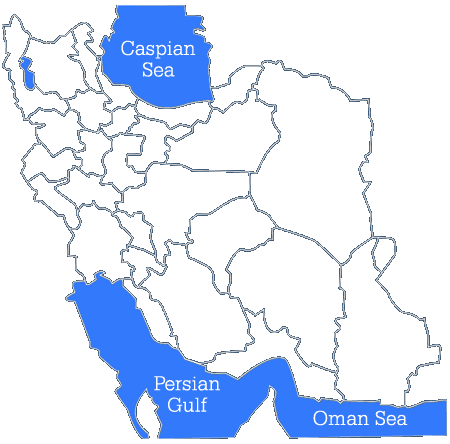
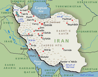
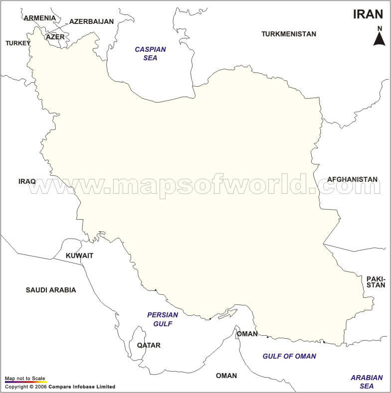
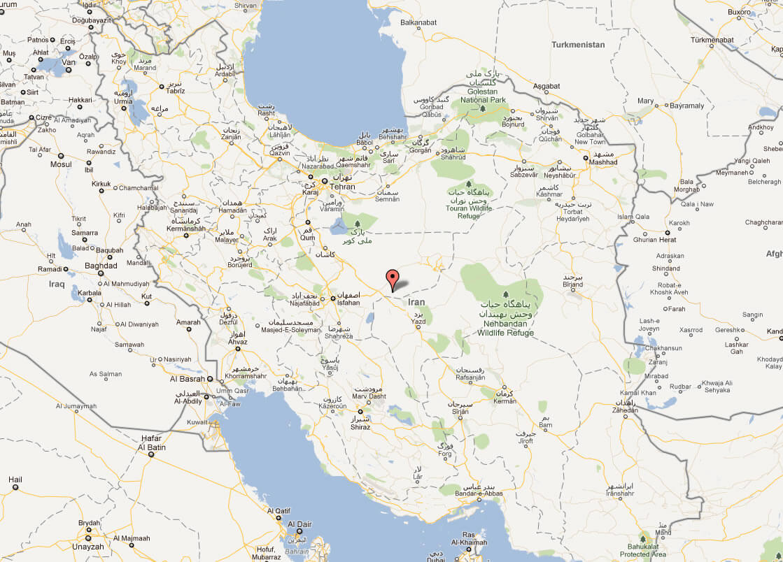
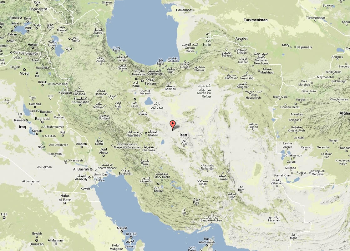
Iran Location Map
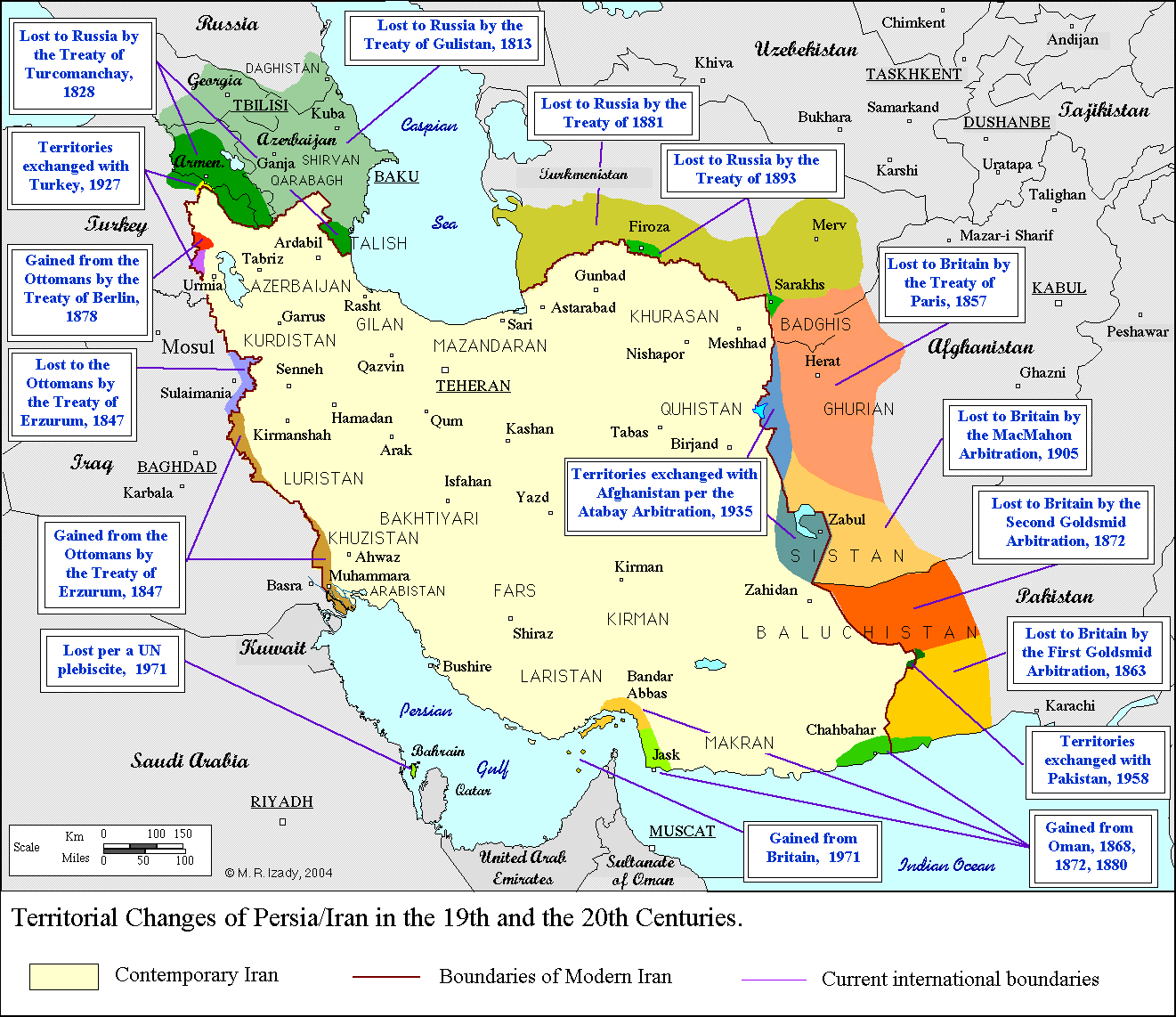
Boundaries Of Iran Map
Empty Iran Map
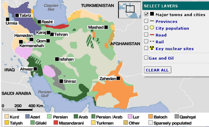
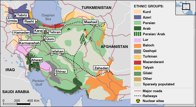
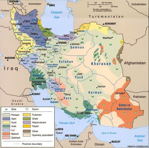
Ethnic Groups Map Of Iran
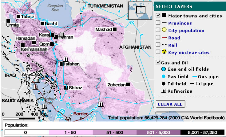
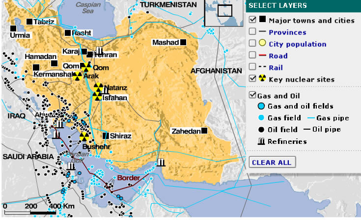
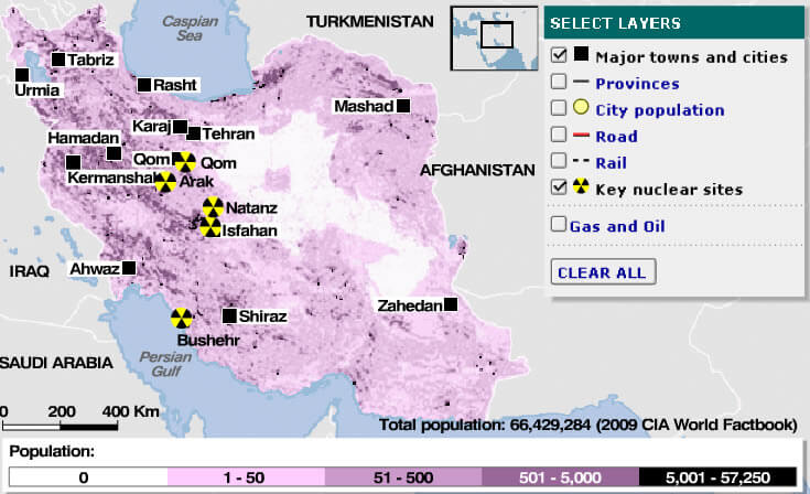
Gas Oil Map Of Iran
Iran Ethnic Groups
Iran Map
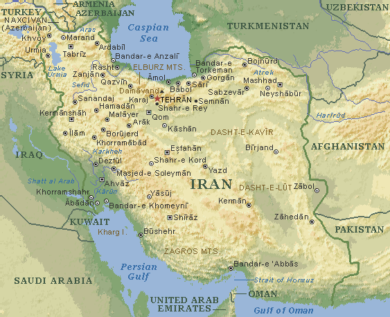
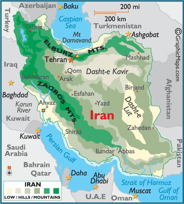
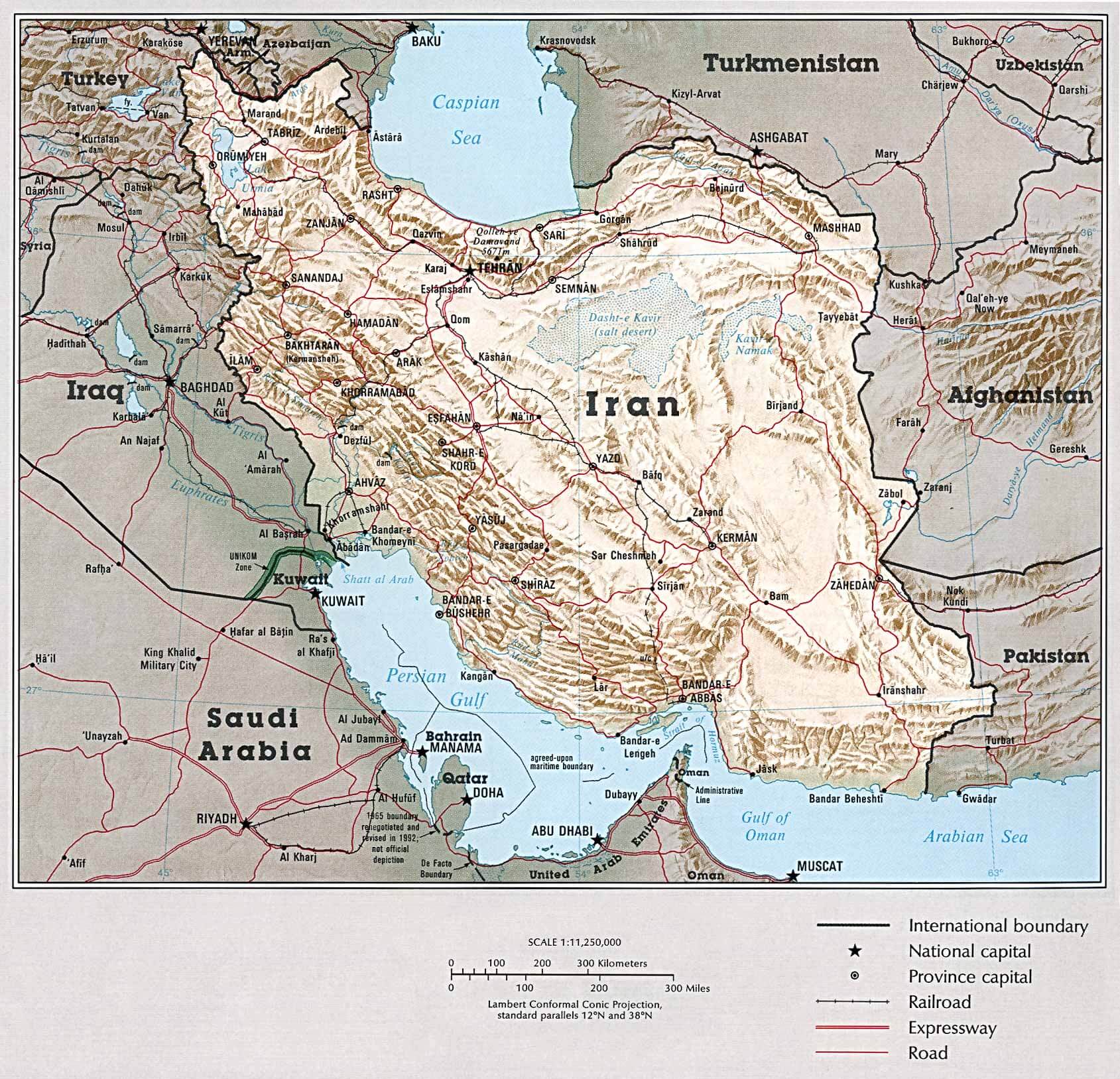
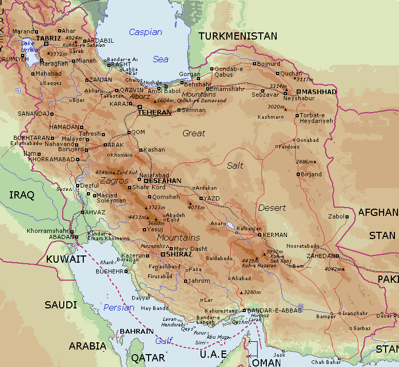
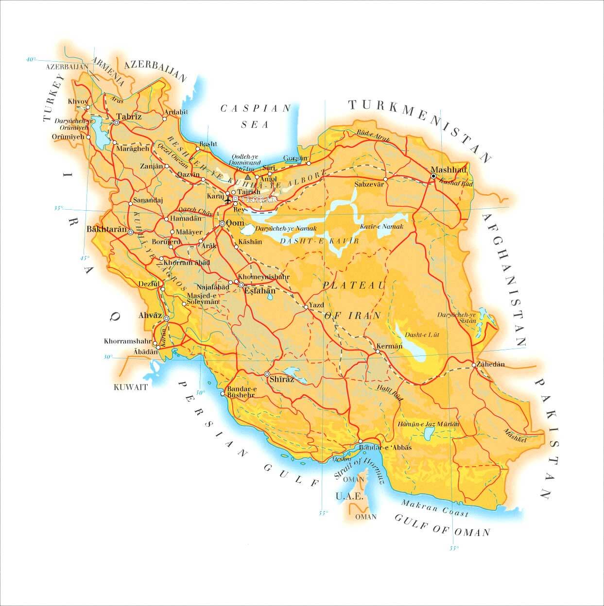
Iran Physical Map
Iran Cities Map
Iran Ethnic Groups Map
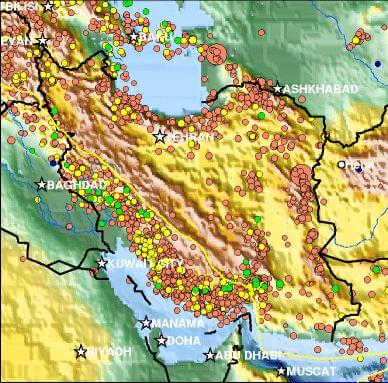
Iran Fault Activity Map
Iran Major Towns Map
Iran Map
Iran Map Colorful
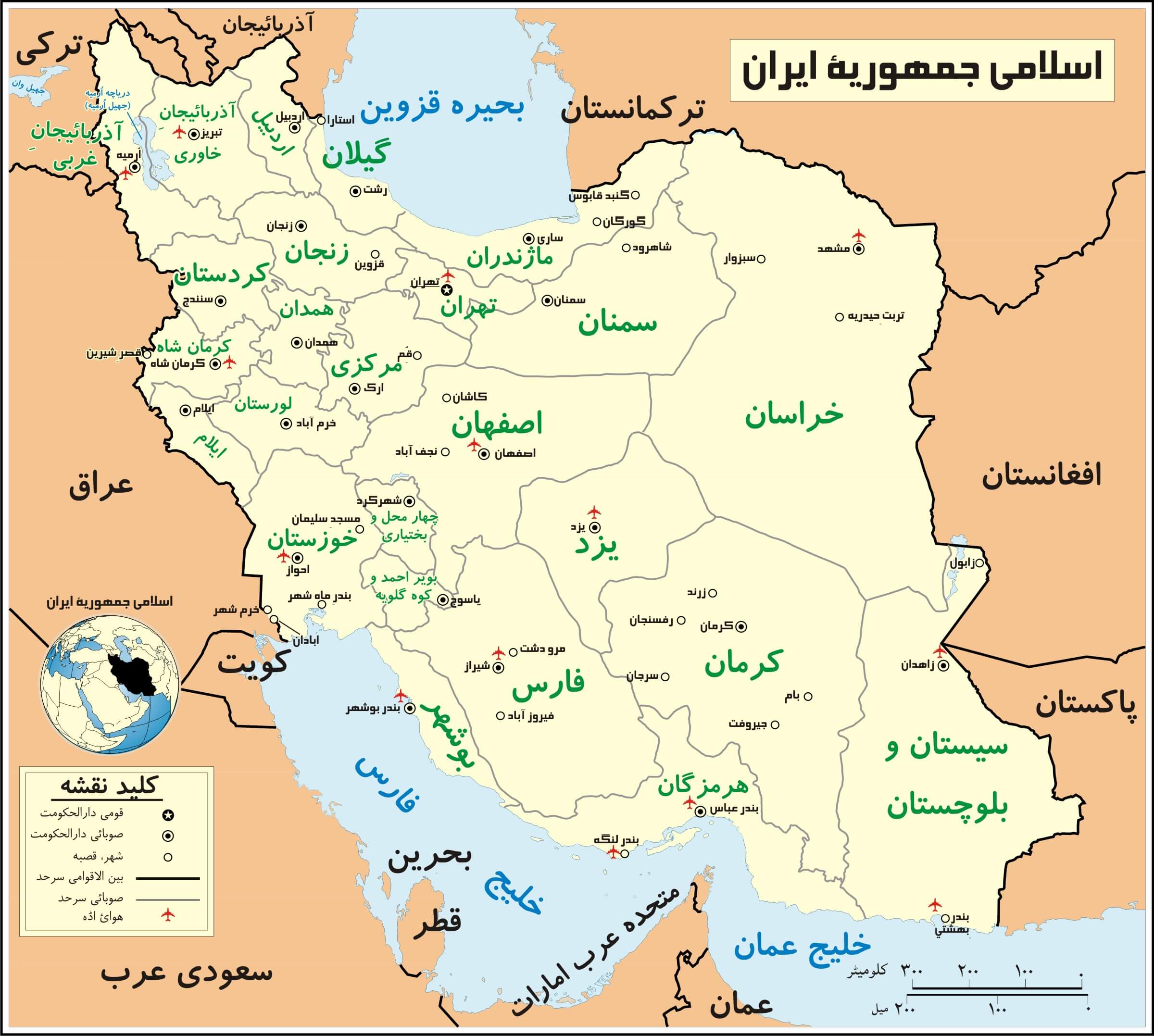
Iran Map In Persian
Iran Map In Persian B
Iran Maps
Iran Outline Map
Iran Physical Map
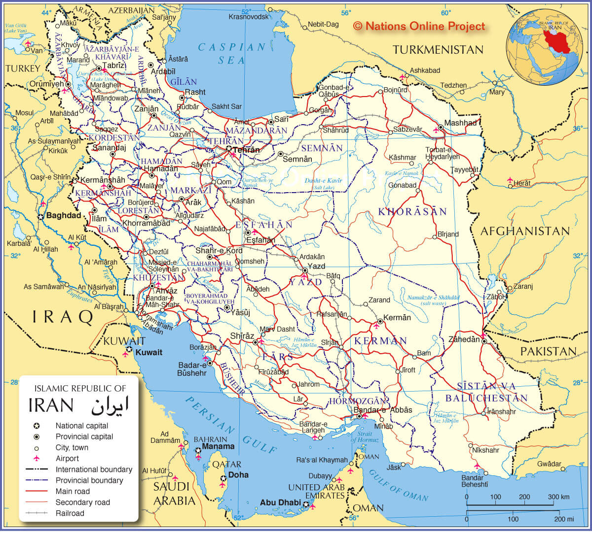
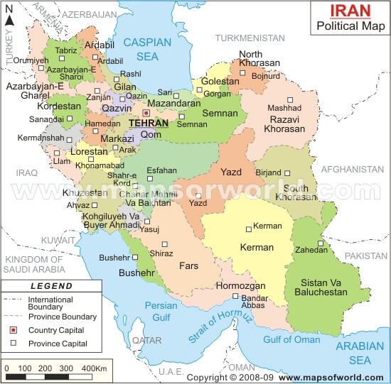
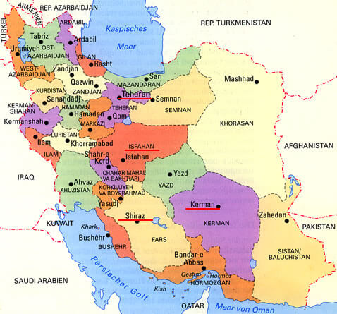
Iran Political Map
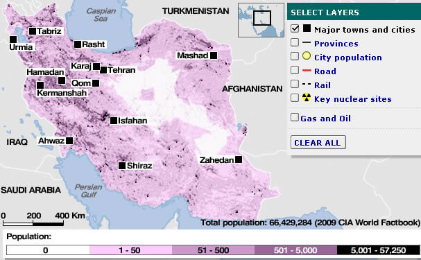
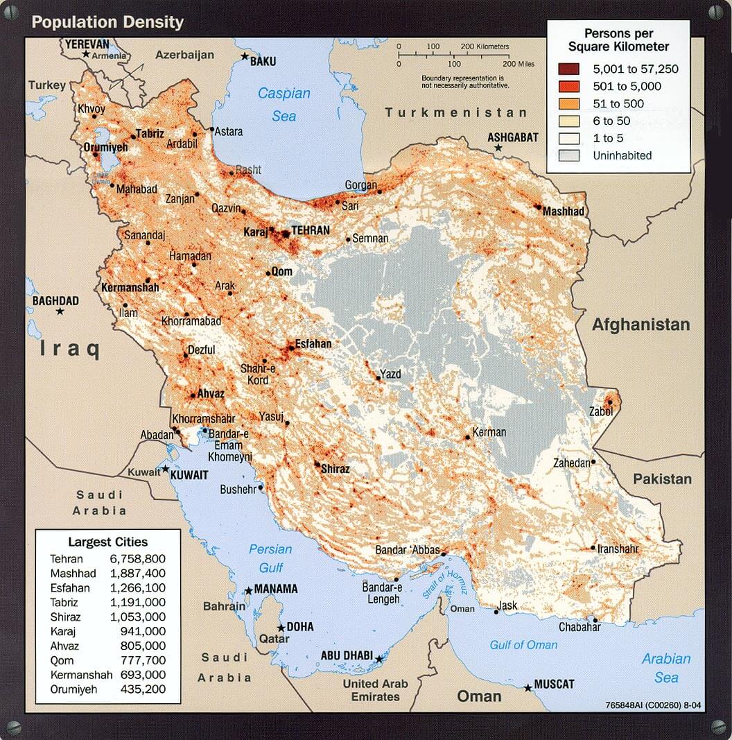
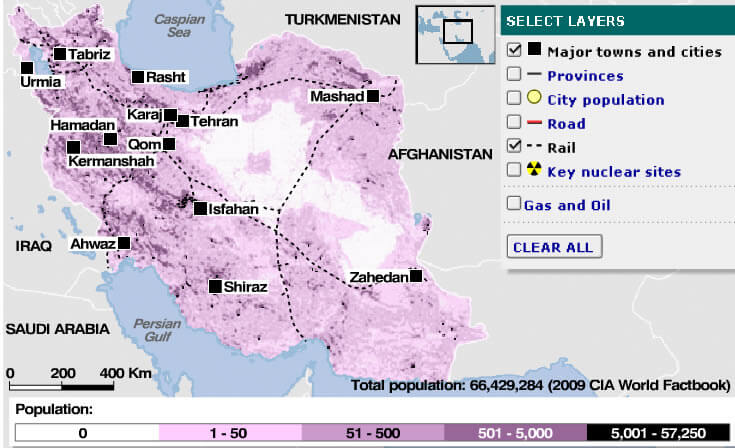
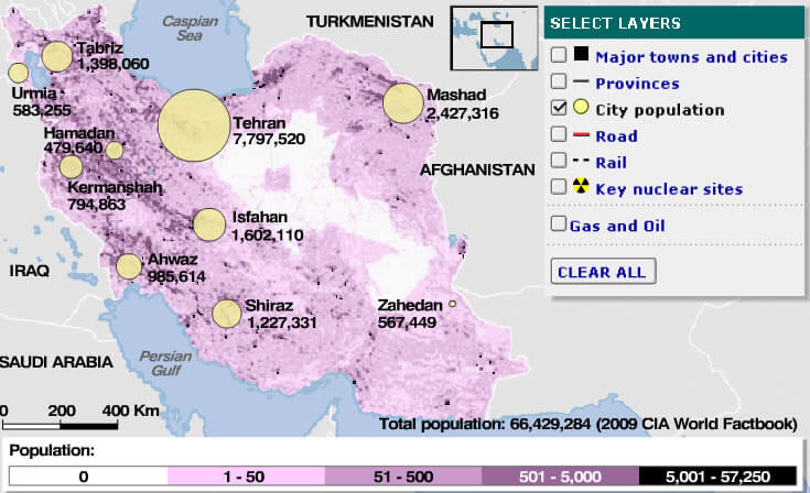
Iran Population Density Map
Iran Rail Map
Iranmap
Land Map Of Iran
Map Of Iran
Map Iran
Map Of Iran
Map Of Tehran Iran

Maps Of Iran
Nuclear Map Of Iran
Persian Iran Map
Physical Map Iran
Political Iran Map
Population Map Of Iran
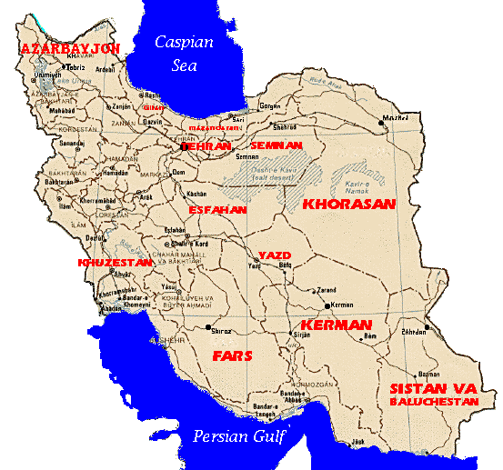
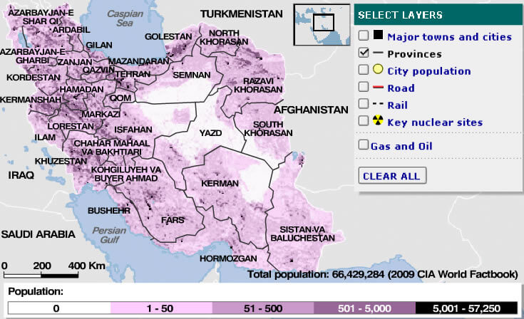
Provinces Map Of Iran
Rail Map Of Iran
Road Map Of Iran
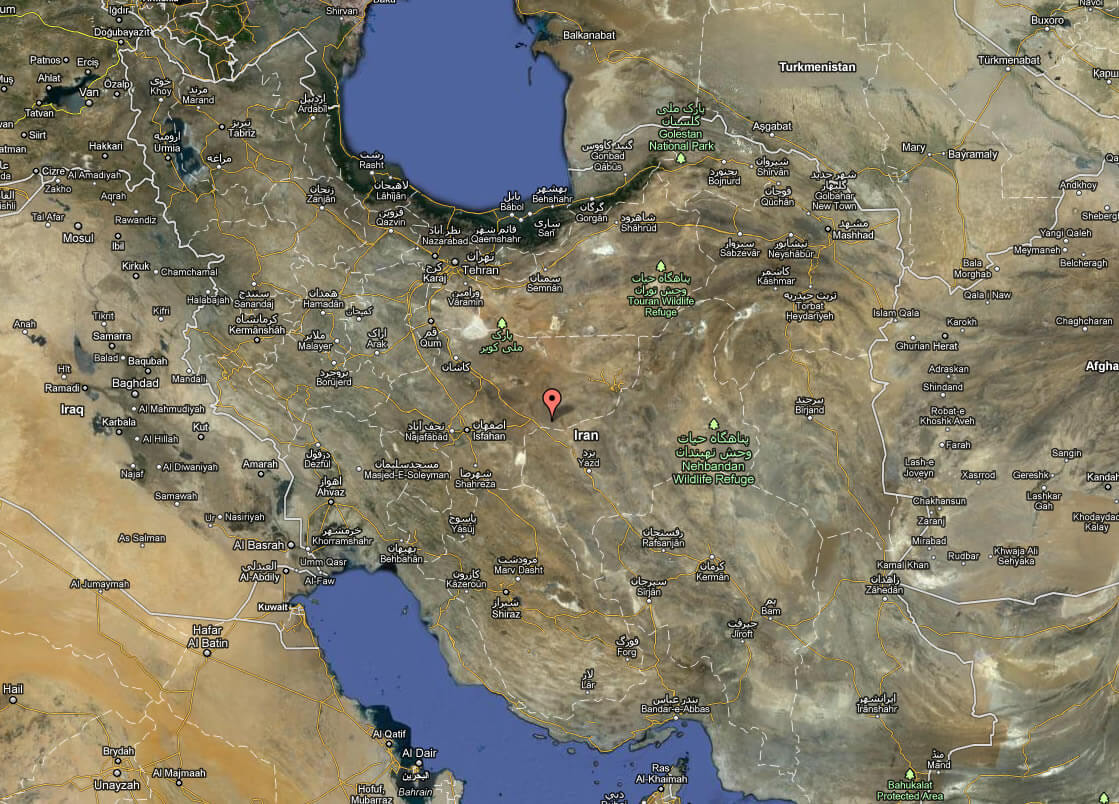
Satellite Image Of Iran
Sketch Of Iran
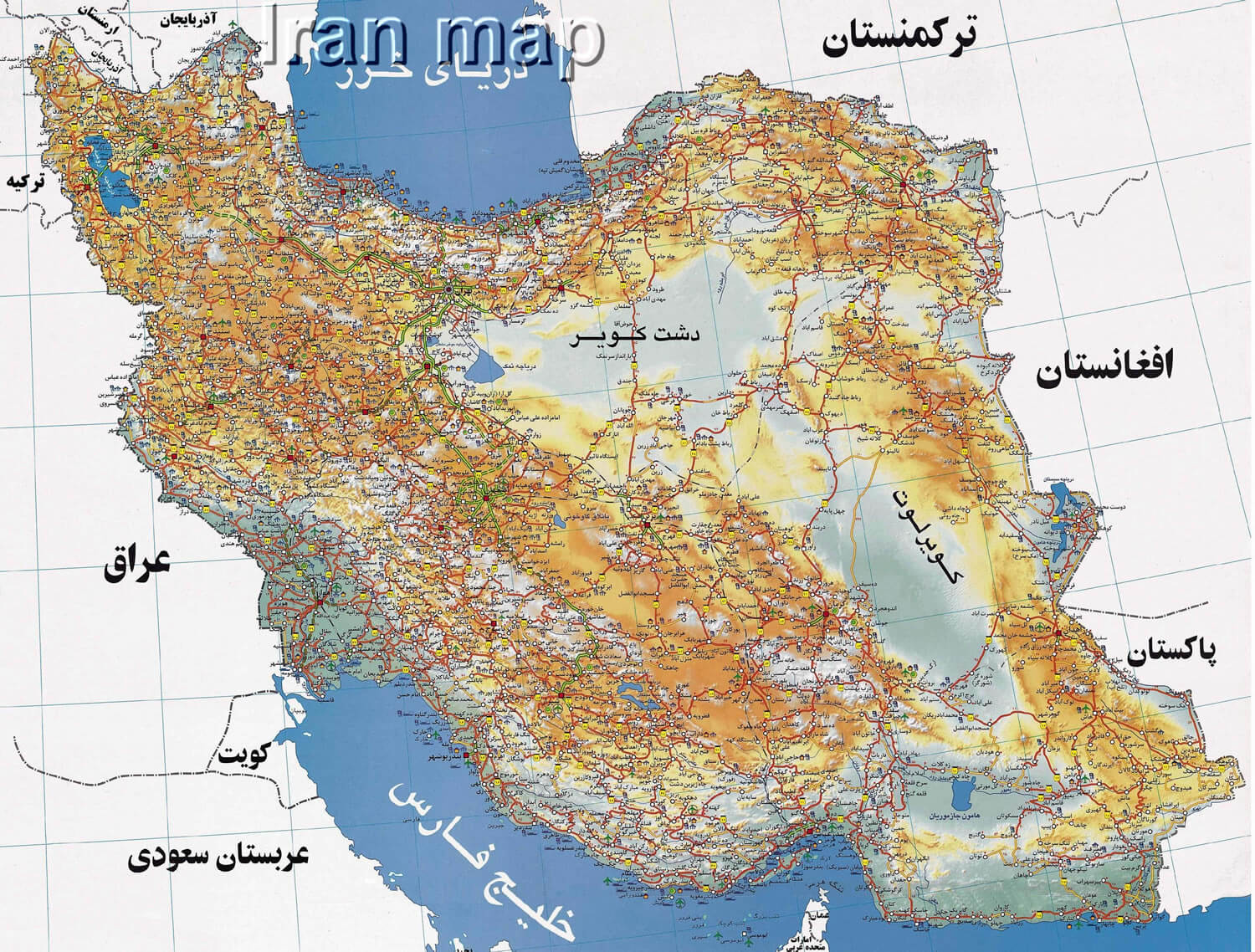
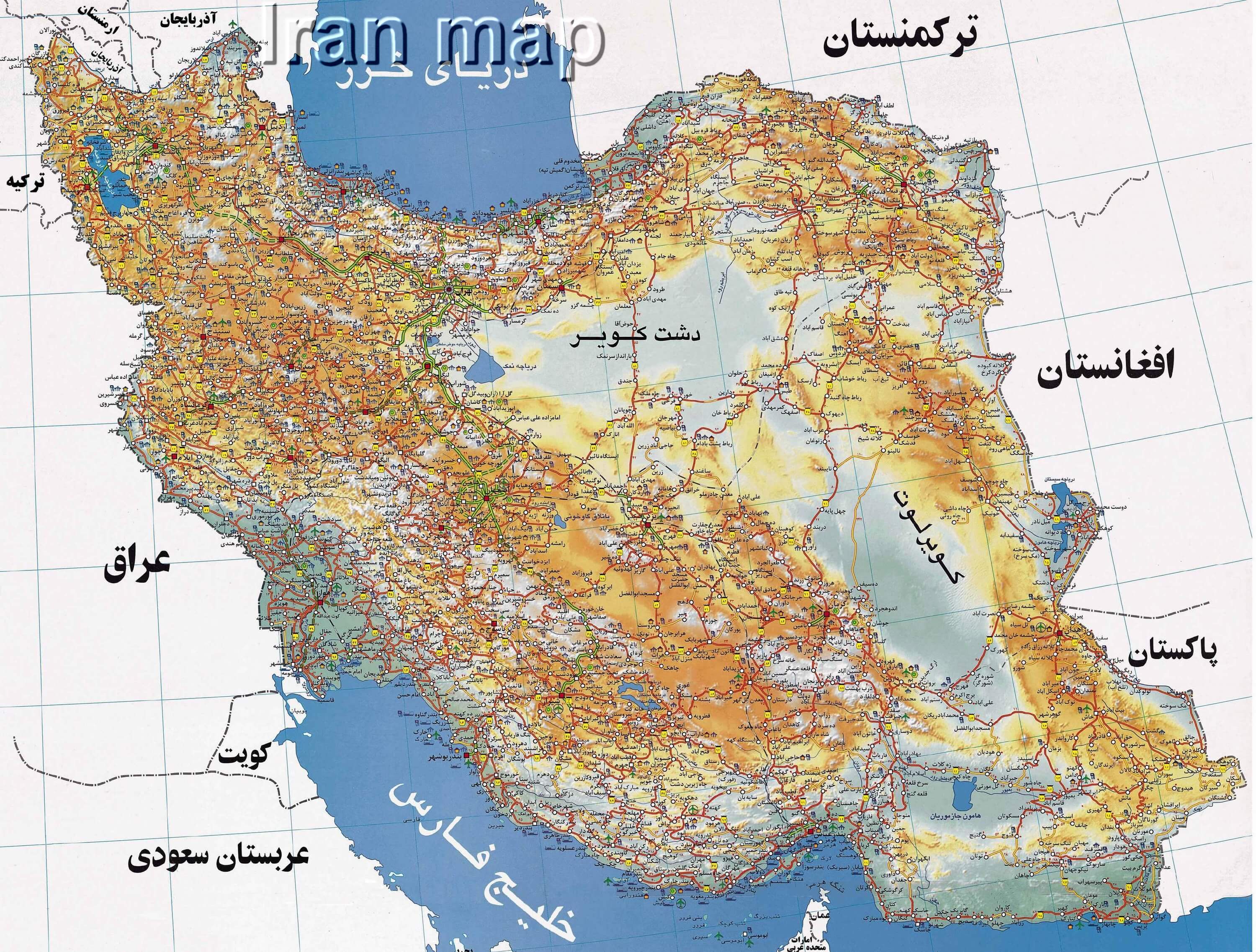
Topographic Map Of Iran
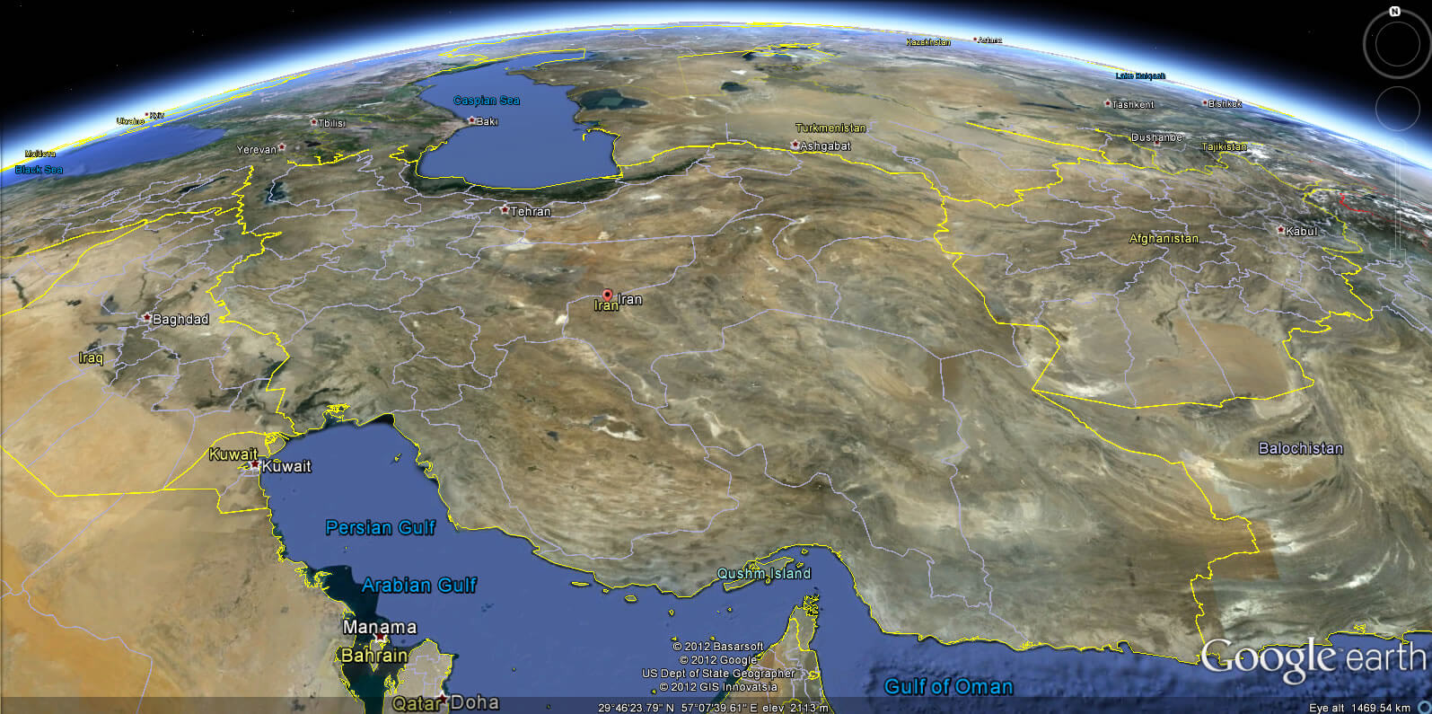
Iran Earth Map
Alphabetically Cities Map of Iran & Population of Iran Cities
Ahvaz Map - Isfahan Map - Karaj Map - Kerman Map - Bakhtaran Map - Mashhad Map - Orumieh Map - Qom Map - Rasht Map - Shiraz Map - Tabriz Map - Tehran Map - Zahedan Map -Copyright Turkey Travel Guide - 2005 - 2026. All rights reserved. Privacy Policy | Disclaimer