Czech Republic Map
Navigate Czech Republic Map, Czech Republic countries map, satellite images of the Czech Republic, Czech Republic largest cities maps, political map of Czech Republic, driving directions and traffic maps.
- Capital : Prague (Praha)
- Population : 10,513,209
- GDP : $193.513 billion
- Per Capita : $18,337
- Calling Code : +420
- Jobless Rate : 9.40%
- Time Zone : +1
Unlocking the Charms of Prague: The Ultimate Top 10 Experiences Guide
Please subscribe on "World Guide" channnel on Youtube at youtube.com/c/WorldGuide
For more about Czech Republic >>
Czech Republic Map & Czech Republic Satellite Images
A Collection of Czech Republic Maps and Czech Republic Satellite Images
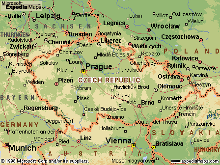
MAP OF CZECH REPUBLIC

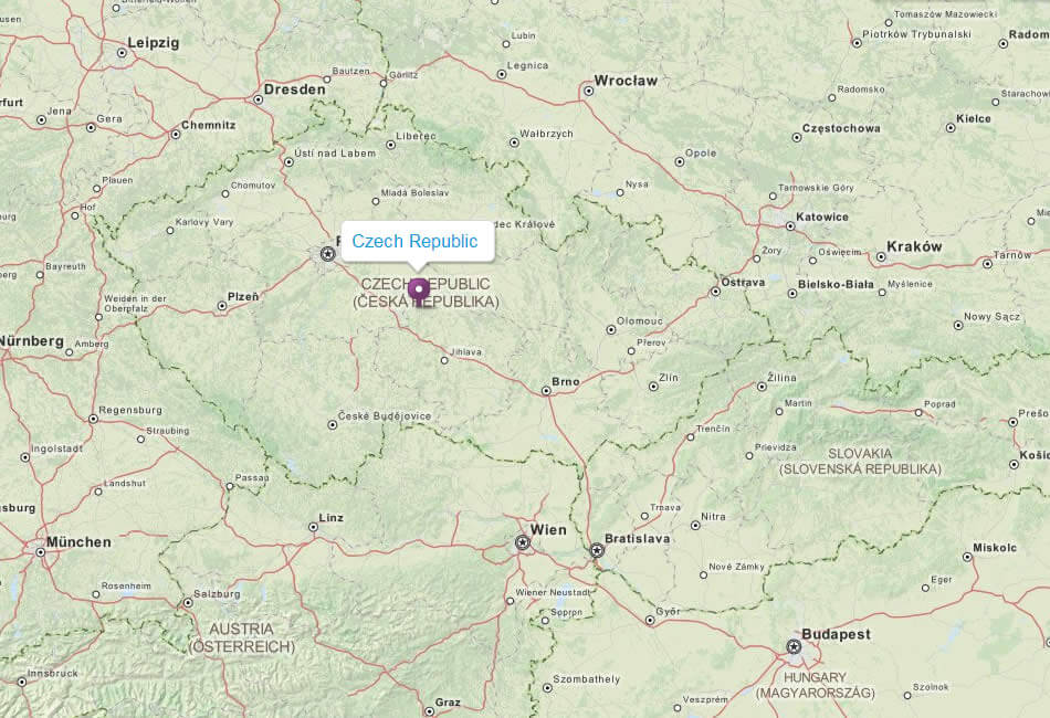
CZECH REPUBLIC LOCATION MAP
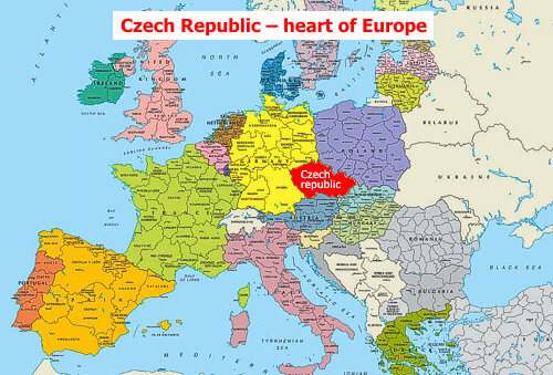
WHERE IS CZECH REPUBLIC IN THE WORLD

CZECH REPUBLIC MAP
CZECH REPUBLIC MAP

CZECH REPUBLIC MAP
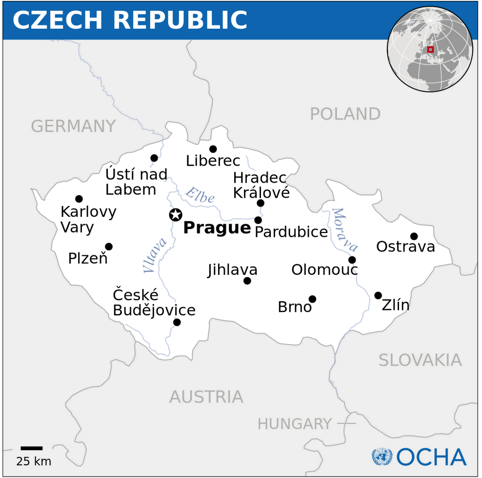
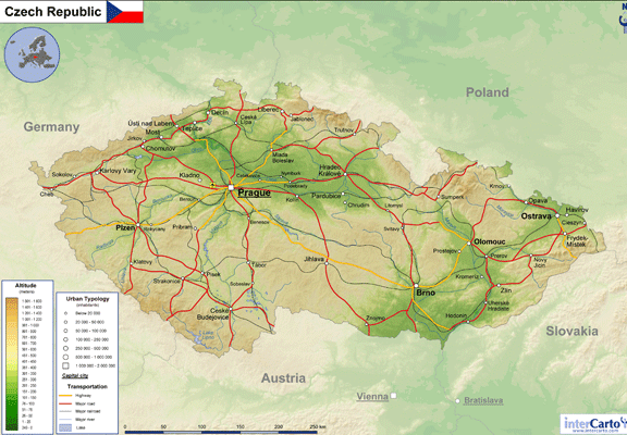
CZECH REPUBLIC PHYSICAL MAP
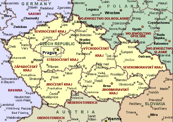
CZECH REPUBLIC POLITICAL MAP
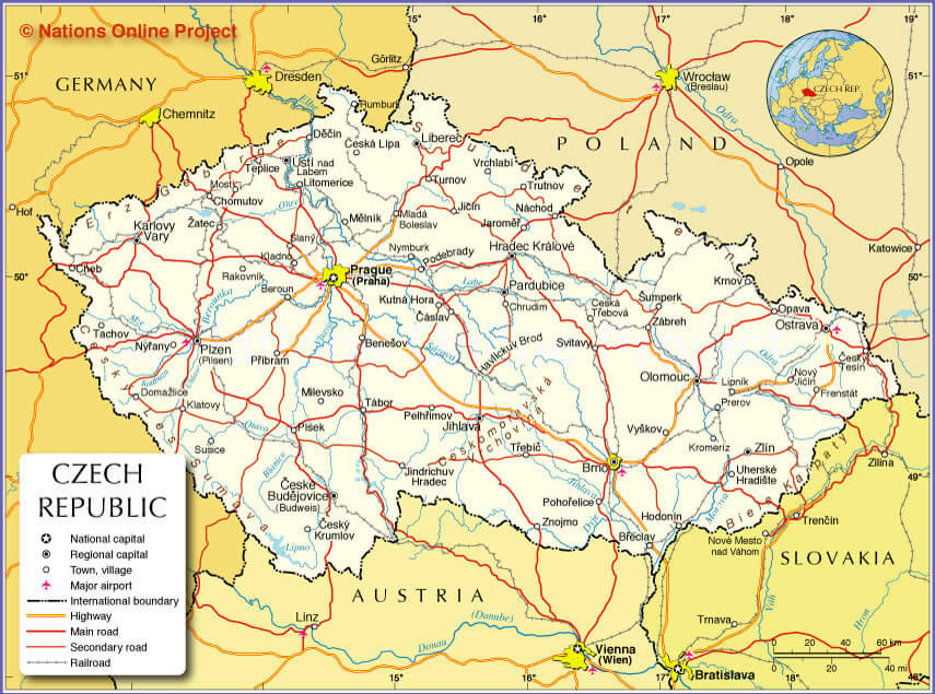
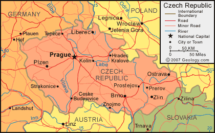
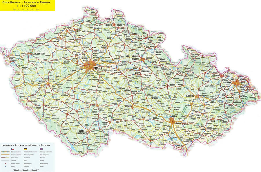
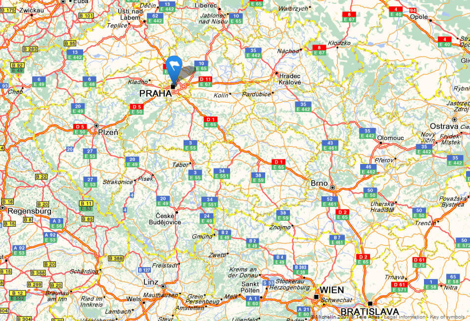
CZECH REPUBLIC ROAD MAP
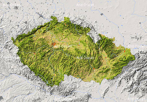
CZECHREPUBLIC RELIEF MAP
MAP OF CZECH REPUBLIC
MAP CZECH REPUBLIC

MAP CZECH REPUBLIC EUROPE
MAP OF CZECH REPUBLIC
MAPS OF CZECH REPUBLIC

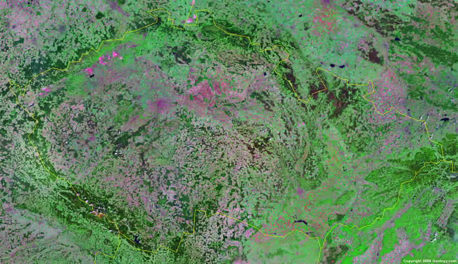
SATELLITE IMAGE OF CZECH REPUBLIC
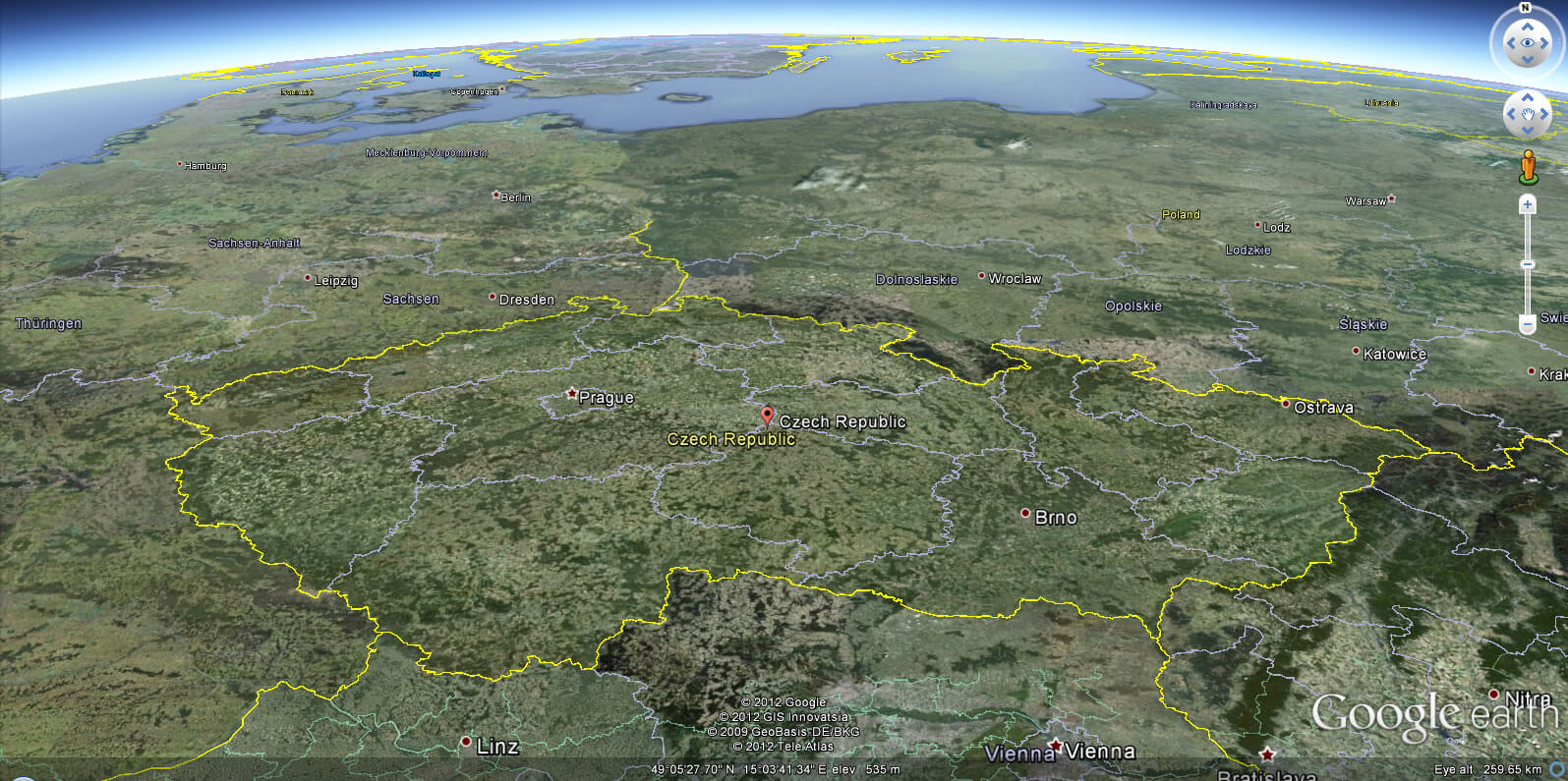
CZECH REPUBLIC EARTH MAP
Largest Cities Map of Czech Republic
Praha Map - Brno Map - Ostrava Map - Plzen Map - Olomouc Map - Liberec Map -Czech Republic Google Map, Street Views, Maps Directions, Satellite Images
Please Not : You can find local businesses, public places, tourist attractions via map view, satellite image, hybrid view, driving directions in Czech Republic Map. You'll also find a varity map of Czech Republic such as political, administrative, transportation, demographics maps following Google map.
Submit URL to Czech Republic :
Alphabetically Cities Map of Czech Republic & Population of Czech Republic Cities
Praha Map - Brno Map - Ostrava Map - Plzen Map - Olomouc Map - Liberec Map -Please feel free share your comments and questions :
Please feel free share your comments and questions :
"Czech Republic" related content to share on social media;


Copyright Turkey Travel Guide - 2005 - 2026. All rights reserved. Privacy Policy | Disclaimer