Map of Minnesota
Navigate Minnesota map, satellite images of the MinnesotaUnited States, US states, largest cities, political map of Minnesota USA, capitals and physical maps.
A Collection of Minnesota Maps
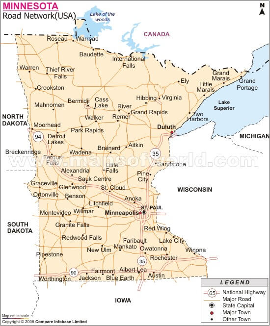
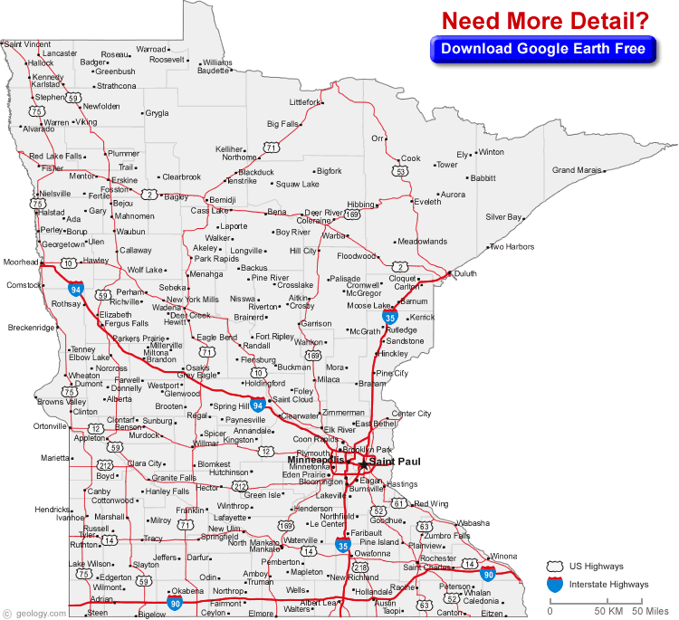
Minnesota road map
 Minnesota counties, cities and towns map.
Minnesota counties road Map USA
 Minnesota Blank Map with counties border.
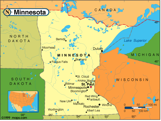
Political map of Minnesota
 Minnesota State Map with counties border.
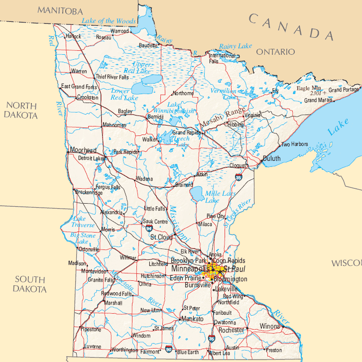
Minnesota State Map
 Poster map of United States of America with state names. Print map of USA for t-shirt, poster or geographic themes. Hand-drawn colorful map with states. Vector Illustration
Minnesota Political Map
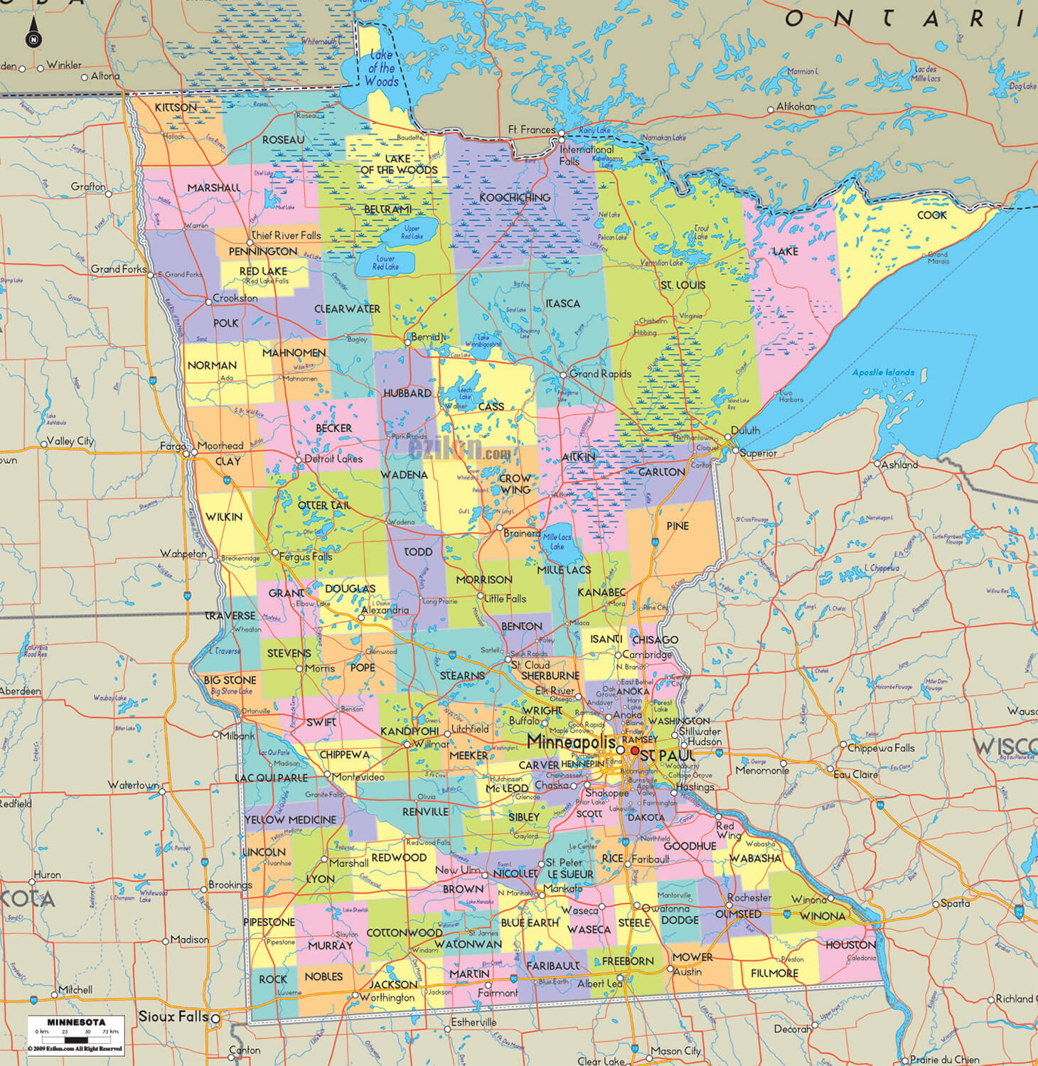
 Minnesota Counties Map with its borders.
Map of Minnesota
 Minnesota State Map with towns.
Map of Minnesota Cities
 Minnesota Map with major cities.
Minnesota Rivers Map

Largest Cities Map of Minnesota and Population
- Minneapolis Map - 382,578 - (44.98,-93.264)
- St. Paul Map - 285,068 - (44.944,-93.093)
- Rochester Map - 106,769 - (44.022,-92.47)
- Duluth Map - 86,265 - (46.783,-92.107)
- Bloomington Map - 82,893 - (44.841,-93.298)
- Brooklyn Park Map - 75,781 - (45.094,-93.356)
- Plymouth Map - 70,576 - (45.011,-93.456)
- St. Cloud Map - 65,842 - (45.561,-94.162)
- Eagan Map - 64,206 - (44.804,-93.167)
- Woodbury Map - 61,961 - (44.923855, -92.959380)
- Maple Grove Map - 61,567 - (45.072464, -93.455788)
- Coon Rapids Map - 61,476 - (45.173239, -93.303006)
- Eden Prairie Map - 60,797 - (44.854686, -93.470786)
- Burnsville Map - 60,306 - (44.767742, -93.277723)
- Blaine Map - 57,186 - (45.160799, -93.234949)
- Lakeville Map - 55,954 - (44.649687, -93.242720)
- Head of Performance Marketing
- Head of SEO
- Linkedin Profile: linkedin.com/in/arifcagrici
Largest Cities Map of Minnesota and Population
Minneapolis Map - 382,578 St. Paul Map - 285,068 Rochester Map - 106,769 Duluth Map - 86,265 Bloomington Map - 82,893 Brooklyn Park Map - 75,781 Plymouth Map - 70,576 St. Cloud Map - 65,842 Eagan Map - 64,206 Woodbury Map - 61,961 Maple Grove Map - 61,567 Coon Rapids Map - 61,476 Eden Prairie Map - 60,797 Burnsville Map - 60,306 Blaine Map - 57,186 Lakeville Map - 55,954Copyright Turkey Travel Guide - 2005 - 2025. All rights reserved. Privacy Policy | Disclaimer