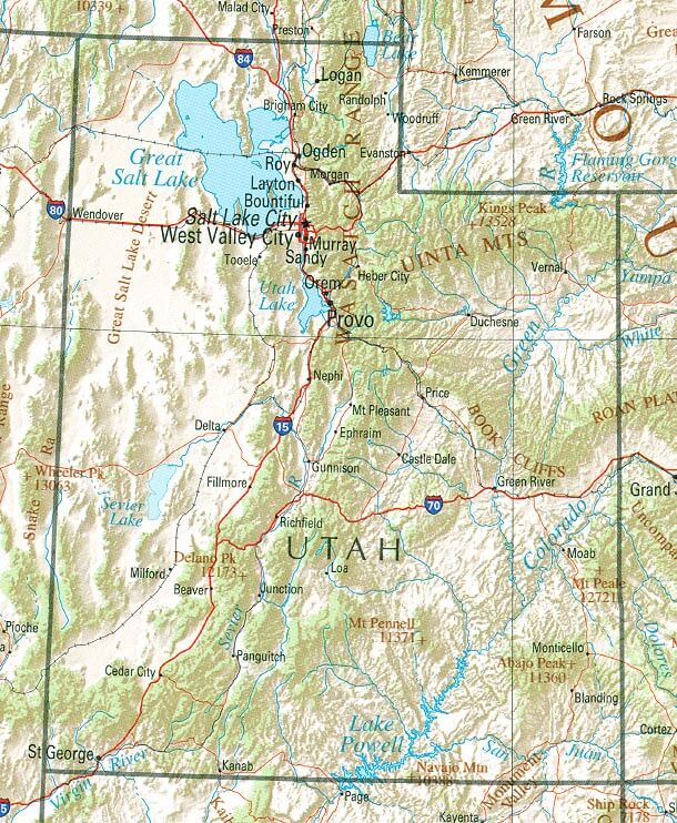
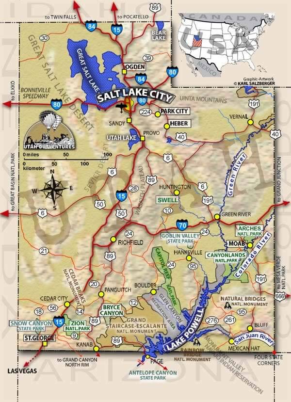
Utah Map
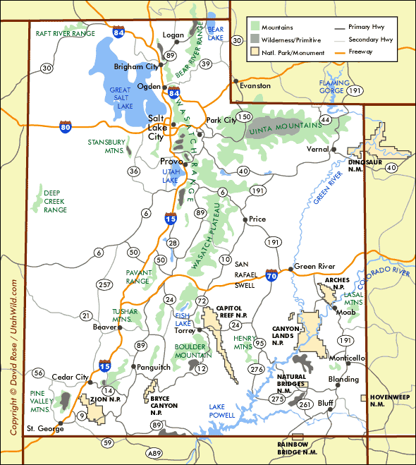
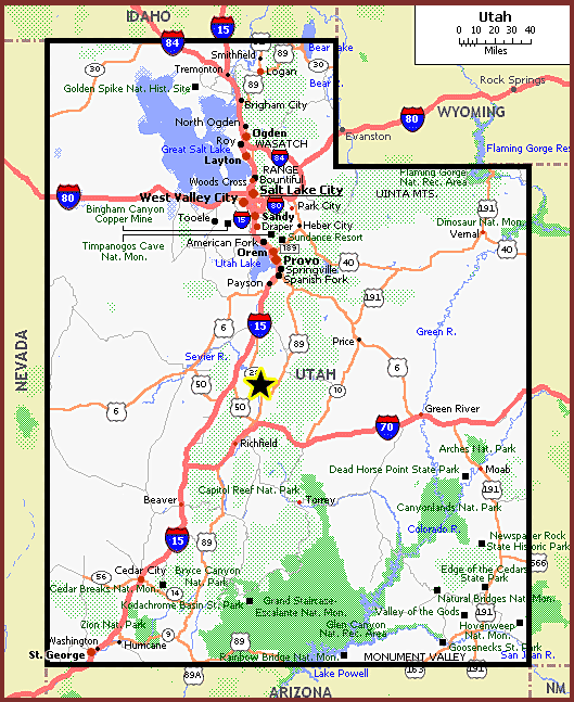
With Utah map, where you can explore the stunning beauty of Utah and plan your next adventure. Utah is a land of contrast, offering diverse landscapes from red rock formations to snow-capped mountains, vast deserts to lush forests, and everything in between. The state is home to five national parks, seven national monuments, and numerous state parks and recreation areas, making it a playground for outdoor enthusiasts.
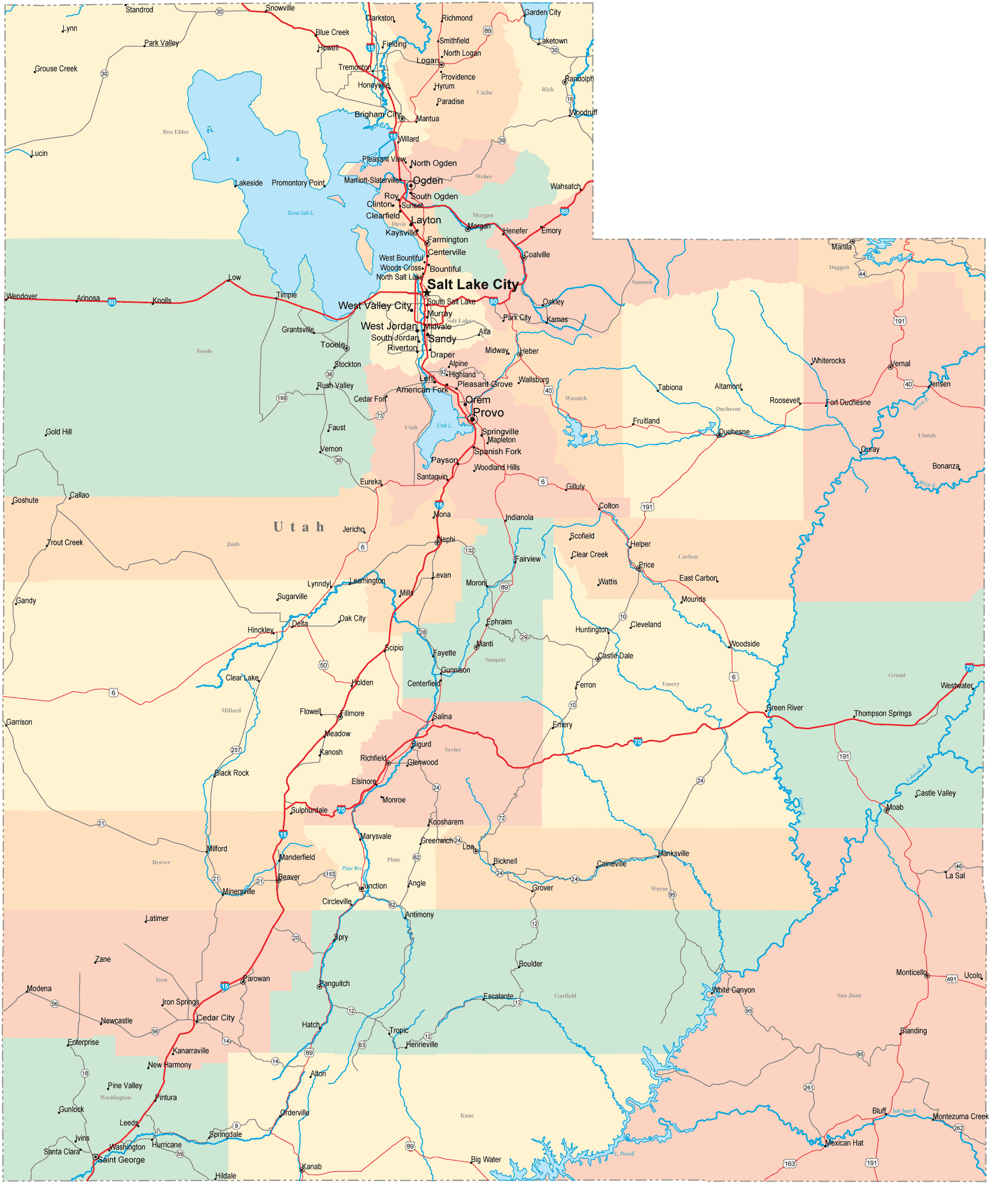
For all Utah Cities Map
MAP OF UTAH

UTAH MAP

Brief information about utah, US
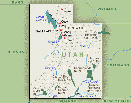
Utah is a state located in the western region of the United States. It is known for its diverse geography, with stunning natural wonders such as Zion National Park, Bryce Canyon National Park, and Arches National Park. The state is also home to the Great Salt Lake, which is the largest saltwater lake in the Western Hemisphere.A Collection of Utah Maps and Utah Satellite Images
Map Of Utah
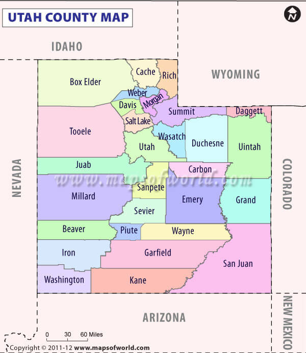
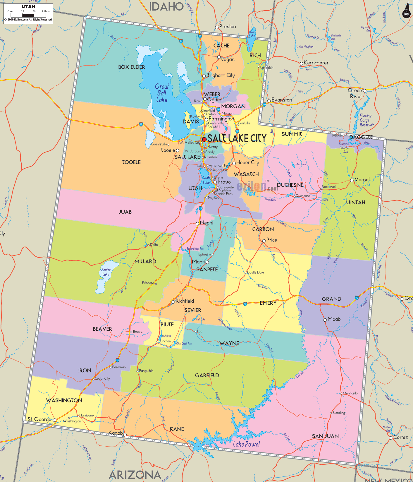
Utah County Map
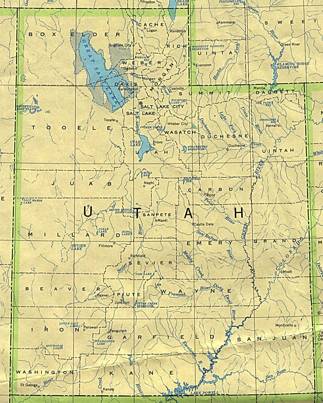
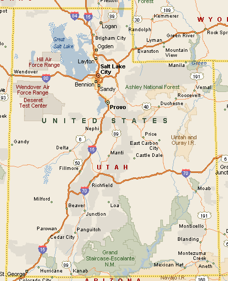
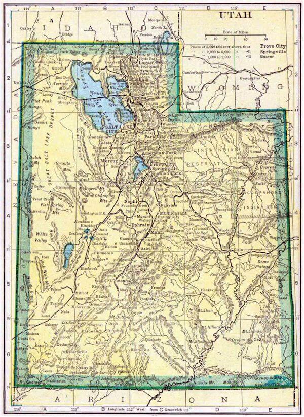
Utah Historical Map

Utah Map
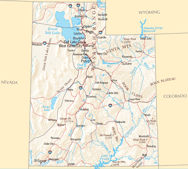
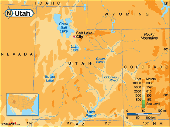
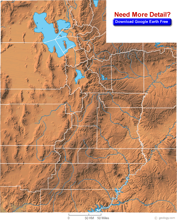
Utah Physical Map

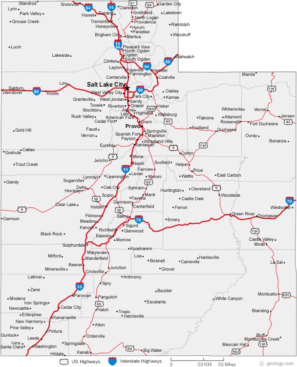
Utah Cities Map

Utah Counties Road Map Usa

Utah Country Map
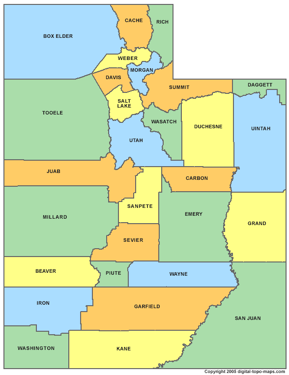
Utah County Map
Utah Elevation Map

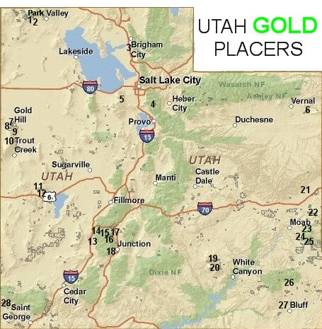
Utah Gold Map

Utah Historical Map
Utah Map
Utah Map Great Lake

Utah Map Salt Lake City
Utah Maps

Utah Physical Map

Utah Political Map

Utah Prominence Map
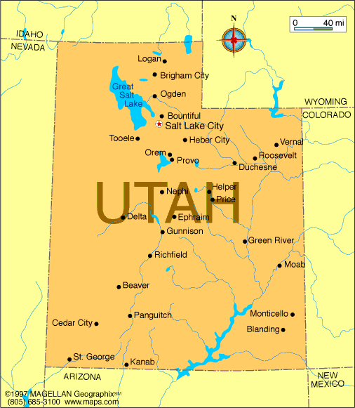
Utah Road Map
Utah Route Map
Utah Route Map

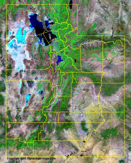
Utah Satellite Images
A collection of Utah Maps


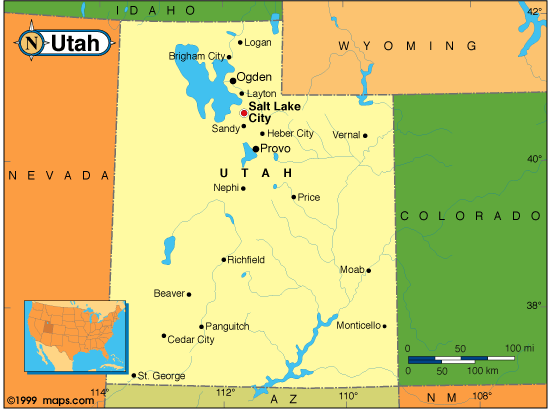


Largest Cities Map of Utah and Population
Salt Lake City Map - 186,440 West Valley City Map - 129,480 Provo Map - 112,488 West Jordan Map - 103,712 Orem Map - 88,328 Sandy Map - 87,461 Ogden Map - 82,825 St. George Map - 72,897 Layton Map - 67,311 Millcreek Map - 62,139 Taylorsville Map - 58,652 South Jordan Map - 50,418 Logan Map - 48,174 Lehi Map - 47,407 Murray Map - 46,746Copyright Turkey Travel Guide - 2005 - 2026. All rights reserved. Privacy Policy | Disclaimer