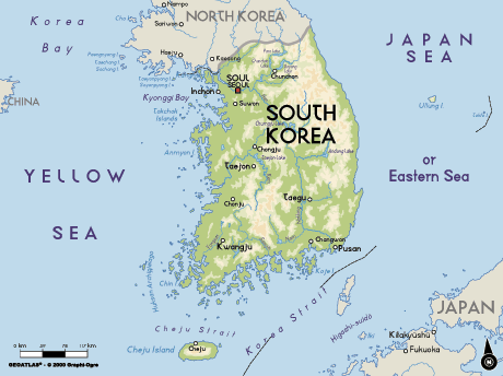
Map of South Korea, South Korea
Navigate South Korea map, South Korea country map, satellite images of South Korea, South Korea largest cities, towns maps, political map of South Korea, driving directions, physical, atlas and traffic maps in South Korea.
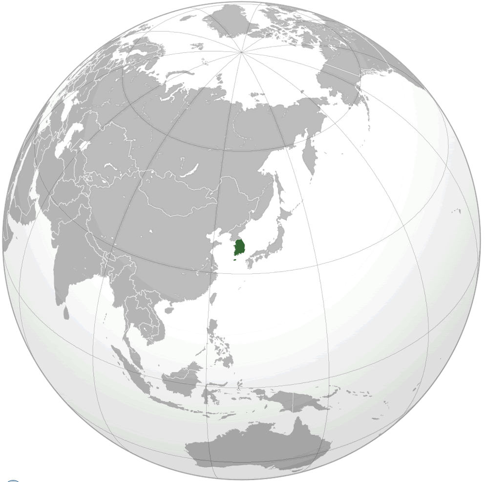
SOUTH KOREA LOCATION MAP
South Korea City Maps
Ansan Bucheon Pusan Changwon Cheonan Cheongju Taegu Taejon Kimhae Koyang Kwangju Incheon Jeonju Masan Mikum Pohang Seongnam Seoul Suweon Ulsan YonginA Collection of South Korea Maps and South Korea Satellite Images
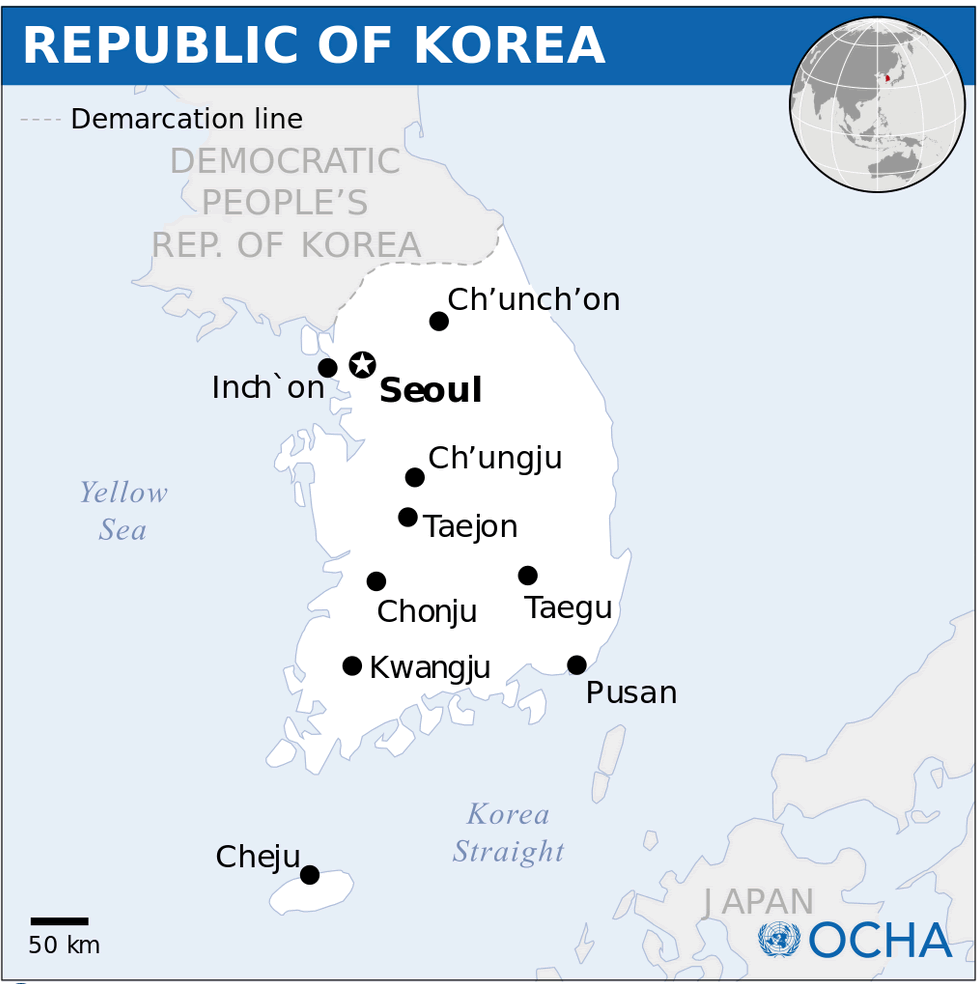
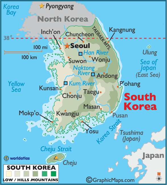
MAP OF SOUTH KOREA
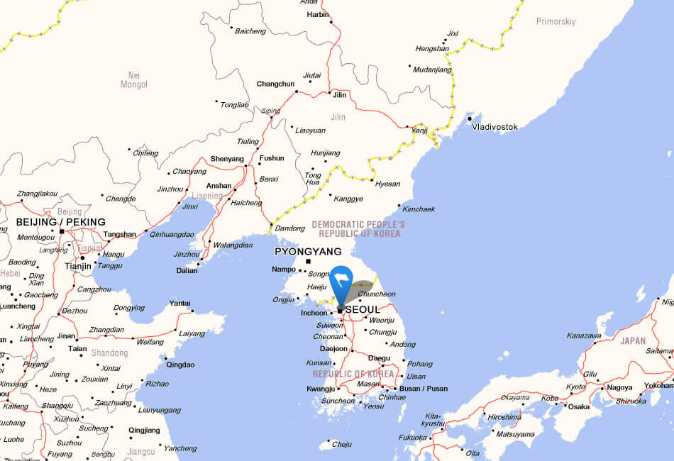
SOUTH KOREA LOCATION MAP
WHERE IS SOUTH KOREA IN THE WORLD
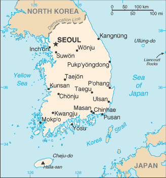
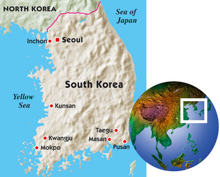
KOREA SOUTH MAP
MAP OF SOUTH KOREA
MAP OF SOUTH KOREA
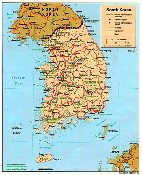
MAP SOUTH KOREA
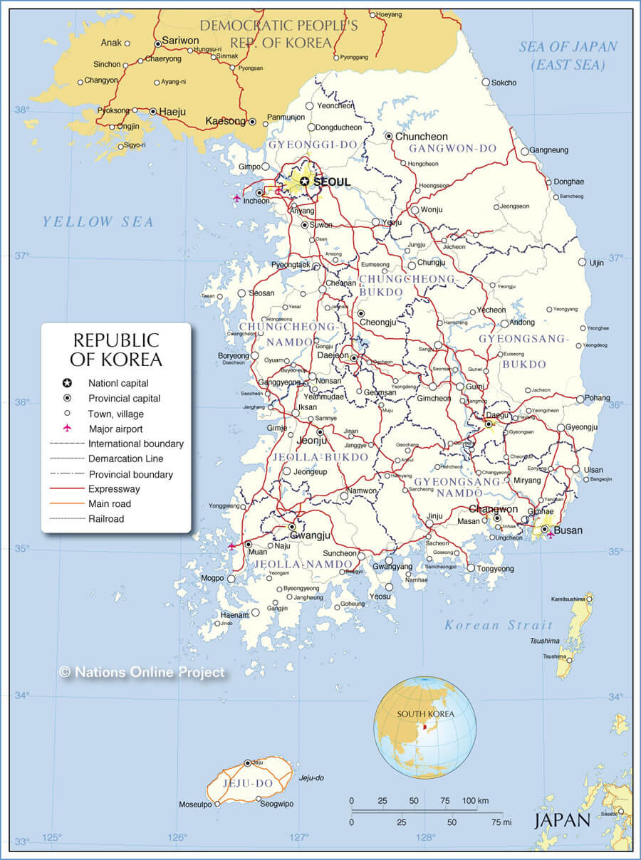
REPUBLIC OF KOREA MAP
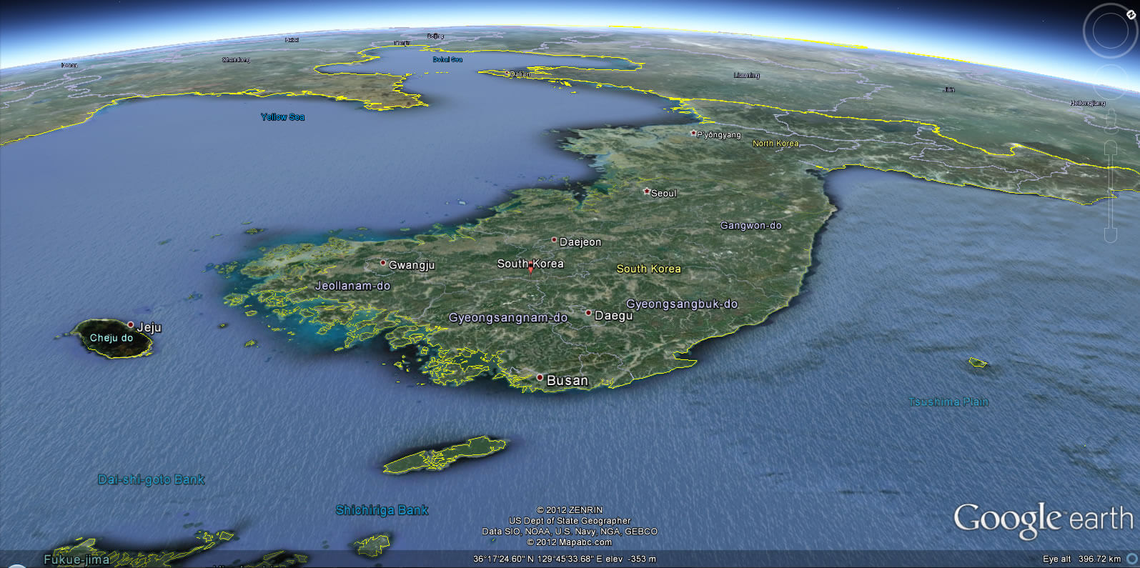
SATELLITE IMAGE OF SOUTH KOREA

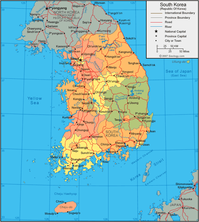
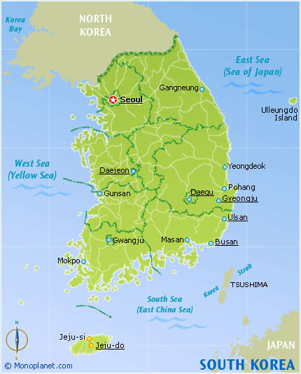
SOUTH KOREA COUNTRY MAP
SOUTH KOREA MAP WORLD
SOUTH KOREA CITIES MAP
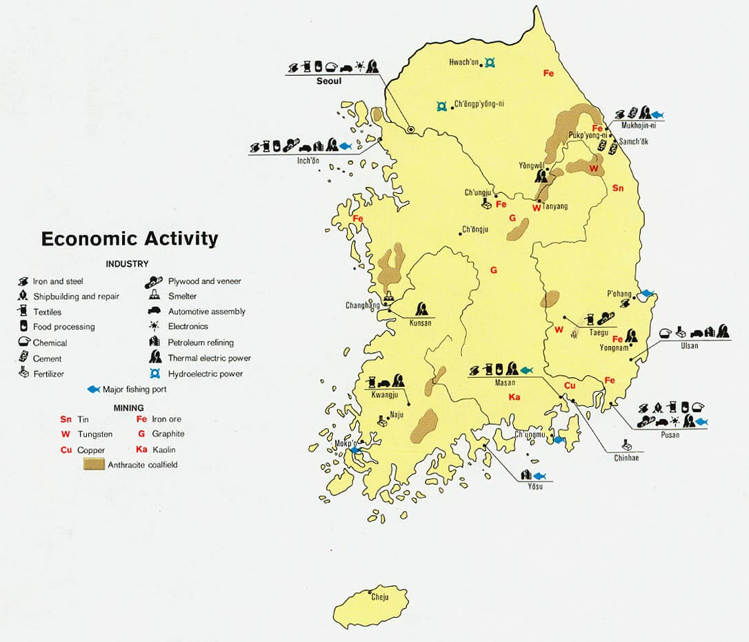
SOUTH KOREA ECONOMIC MAP
SOUTH KOREA MAP

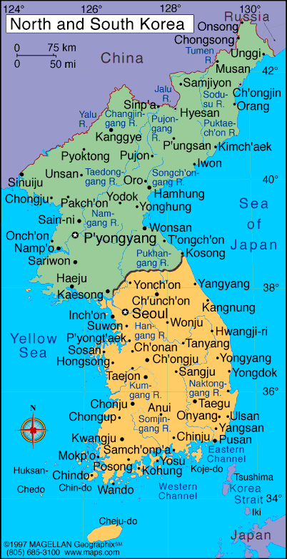
SOUTH KOREA MAP NORTH KOREA
SOUTH KOREA PHYSICAL MAP
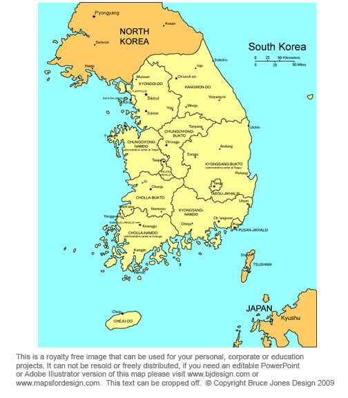
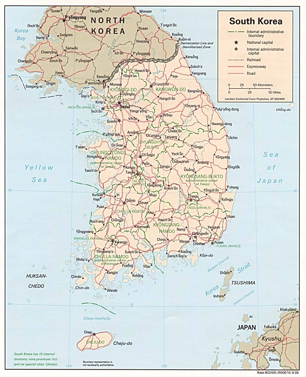
SOUTH KOREA POLITICAL MAP
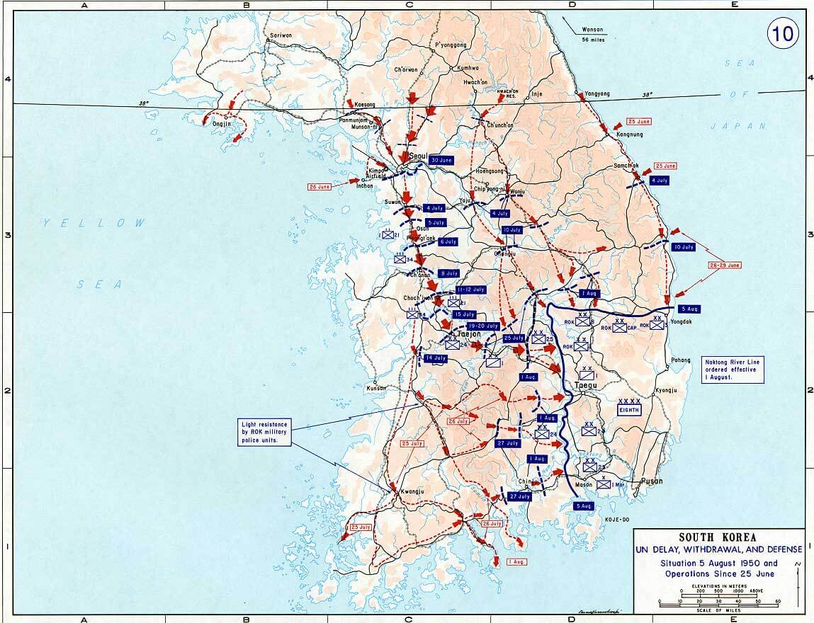
SOUTH KOREA WAR MAP 1950
SOUTHKOREAMAP
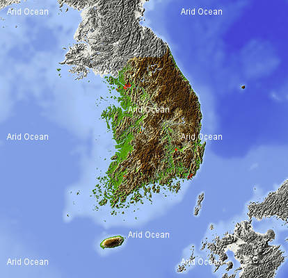
SOUTH KOREA EARTH MAP
Unveiling Seoul: Top 10 Experiences You Can't Miss
Please subscribe on "World Guide" channnel on Youtube at youtube.com/c/WorldGuide
- Head of Performance Marketing
- Head of SEO
- Linkedin Profile: linkedin.com/in/arifcagrici
See Also
South Korea Google Map, Street Views, Maps Directions, Satellite Images
turkey-visit.com offers a collection of South Korea map, google map, South Korea atlas, political, physical, satellite view, country infos, cities map and more map of South Korea.
South Korea Largest Cities Map by Population
Yongin Map Ulsan Map Suweon Map Seoul Map Seongnam Map Pohang Map Mikum Map Masan Map Jeonju Map Incheon Map Kwangju Map Koyang Map Kimhae Map Taejon Map Taegu Map Cheongju Map Cheonan Map Changwon Map Pusan Map Bucheon MapCopyright Turkey Travel Guide - 2005 - 2026. All rights reserved. Privacy Policy | Disclaimer