South Africa Map
Navigate South Africa Map, South Africa countries map, satellite images of the South Africa, South Africa largest cities maps, political map of South Africa, driving directions and traffic maps.

- Capital : Cape Town
- Population : 51,770,560
- GDP : $390.919 billion
- Per Capita : $7,635
- Calling Code : +27
- Jobless Rate : 24.90%
- Time Zone : +2
Exploring Cape Town: The 10 Ultimate Stops for Every Wanderer
Please subscribe on "World Guide" channnel on Youtube at youtube.com/c/WorldGuide
For more about South Africa >>
South Africa Map & South Africa Satellite Images
A Collection of South Africa Maps and South Africa Satellite Images
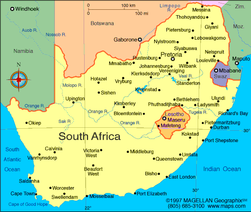
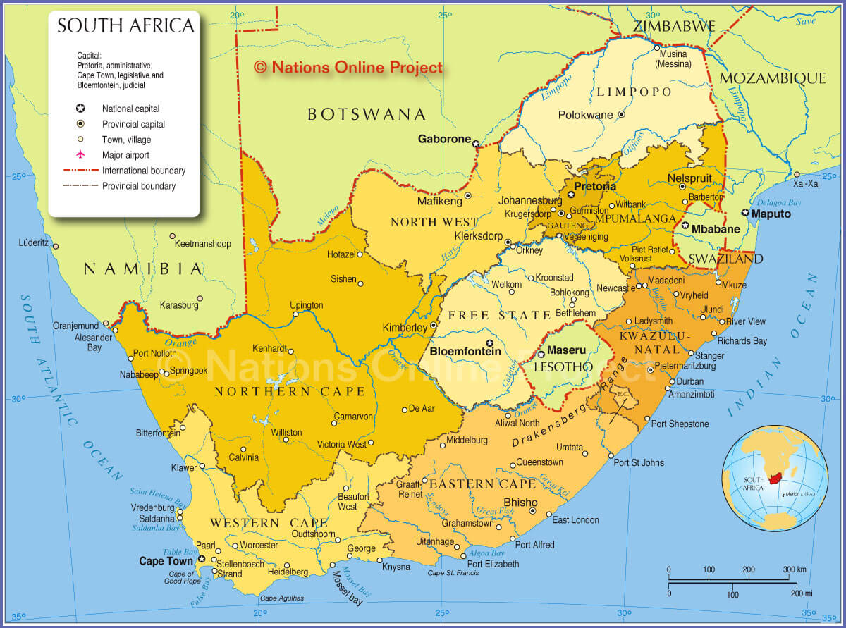
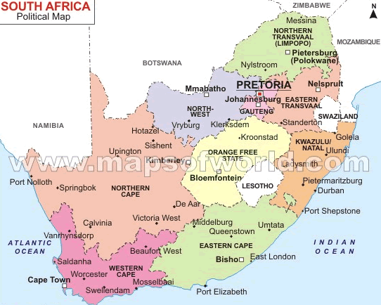
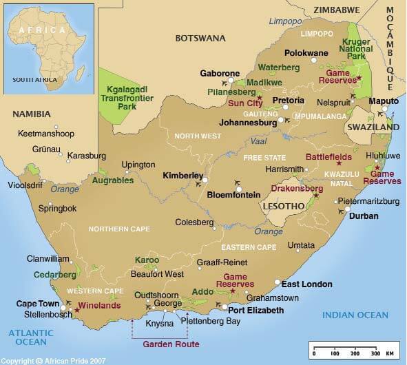
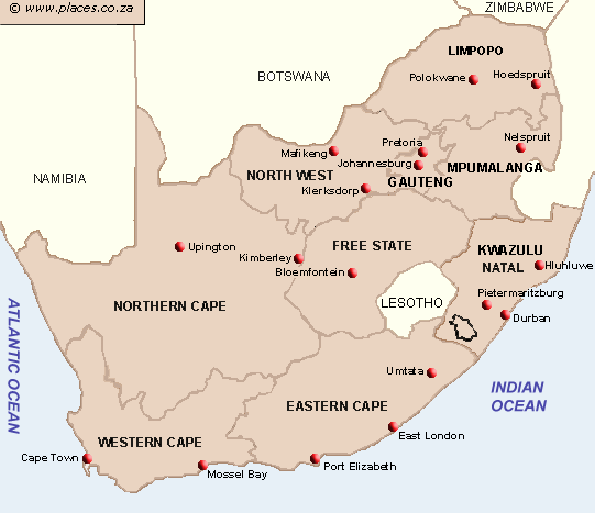
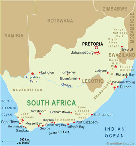
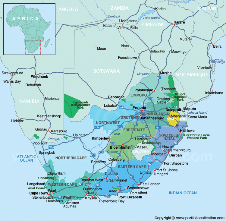
MAP OF SOUTH AFRICA

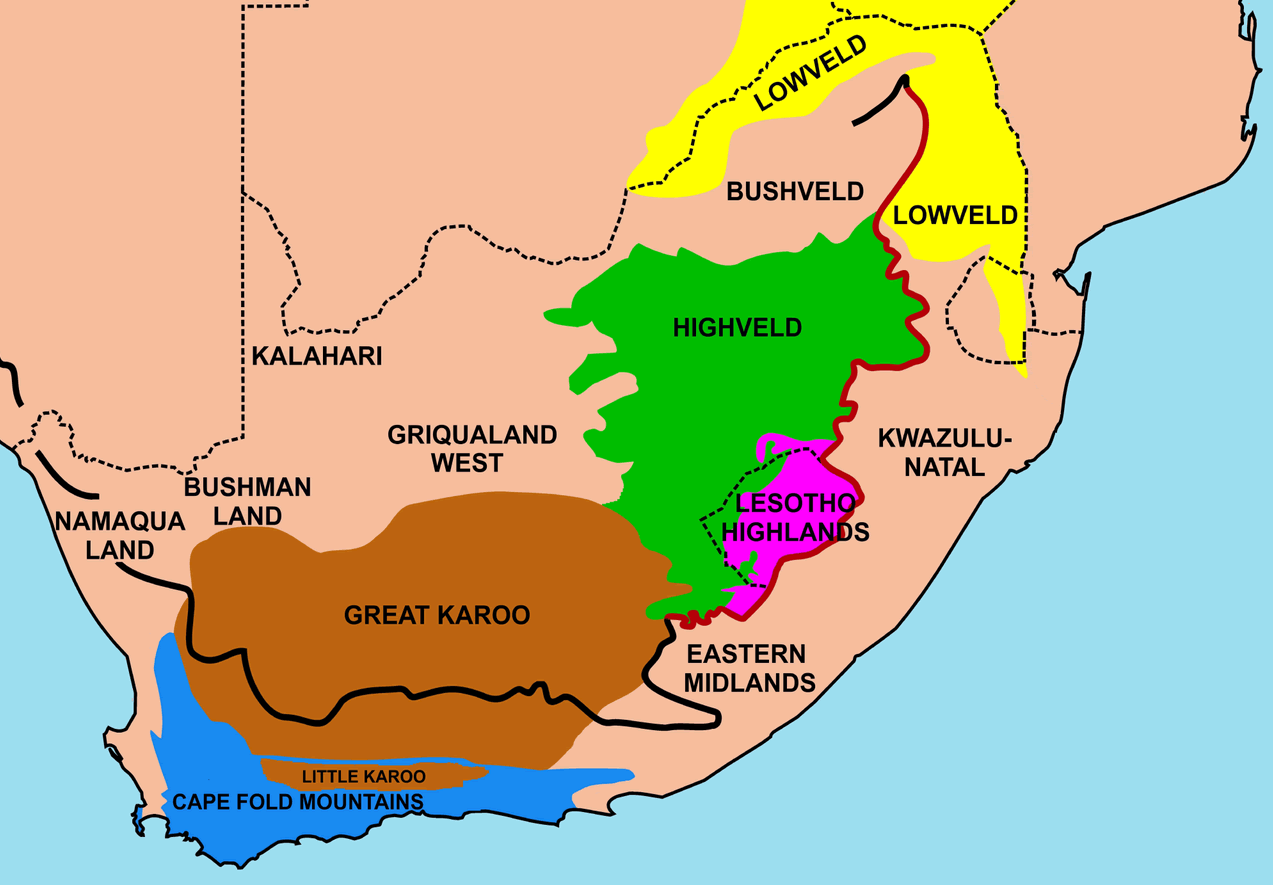
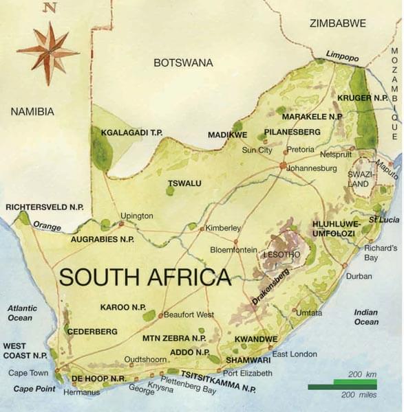
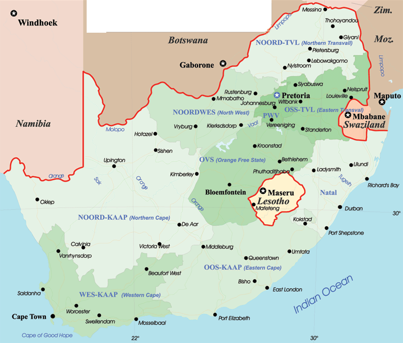
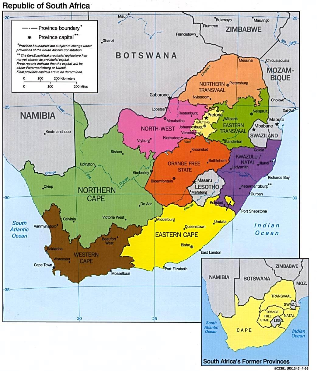
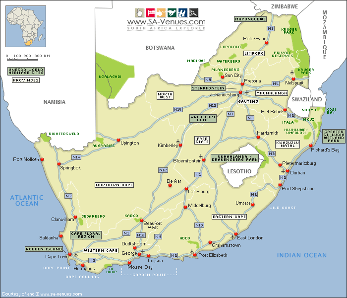
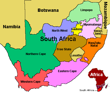
REGIONS MAP OF SOUTH AFRICA
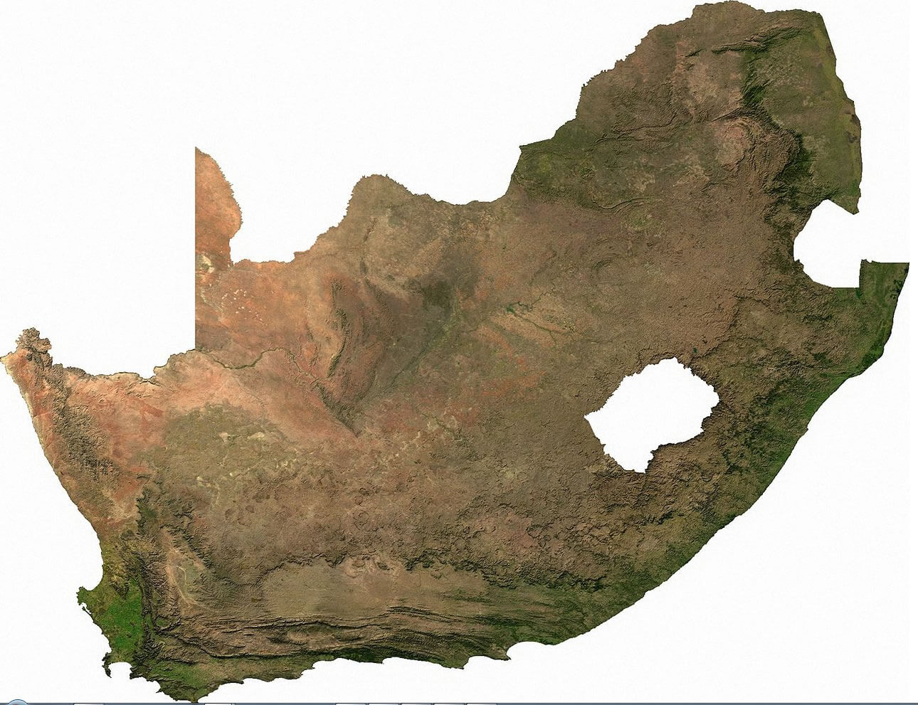
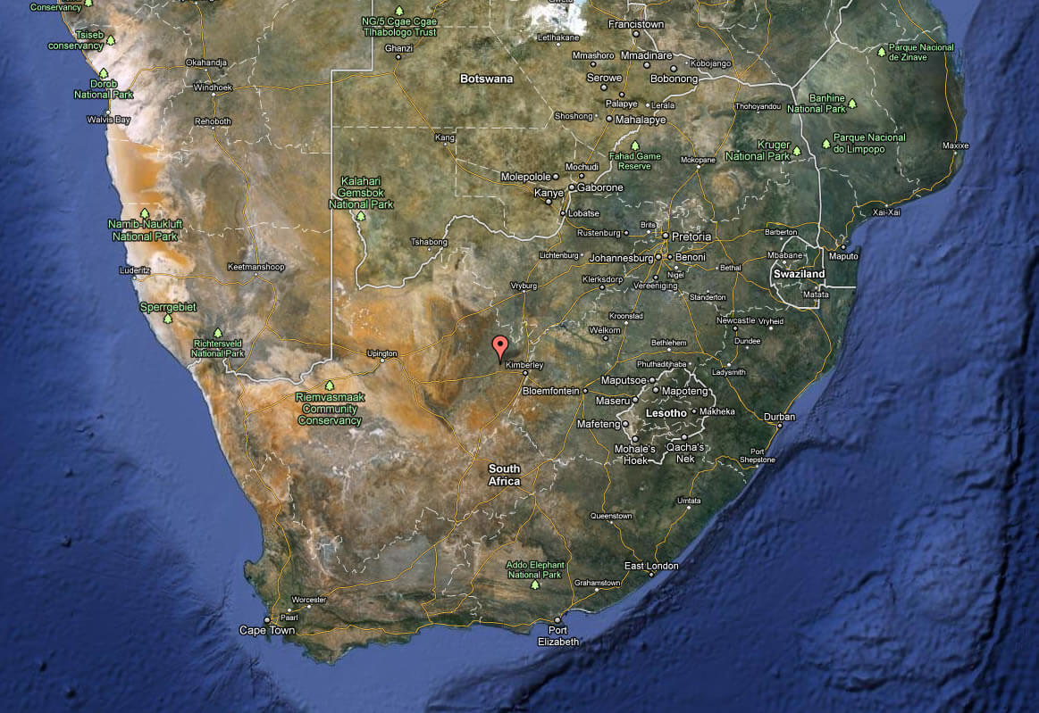
SOUTH AFRICA SATELLITE IMAGE
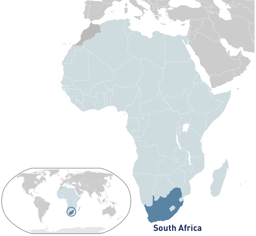
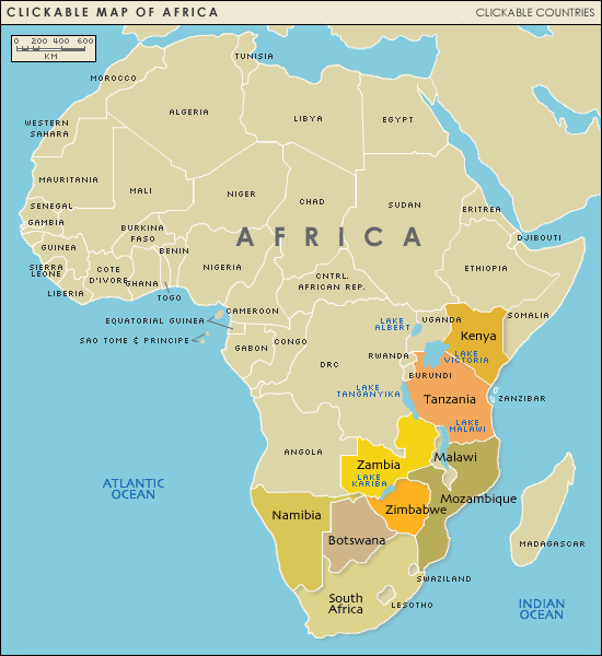
WHERE IS SOUTH AFRICA IN THE WORLD
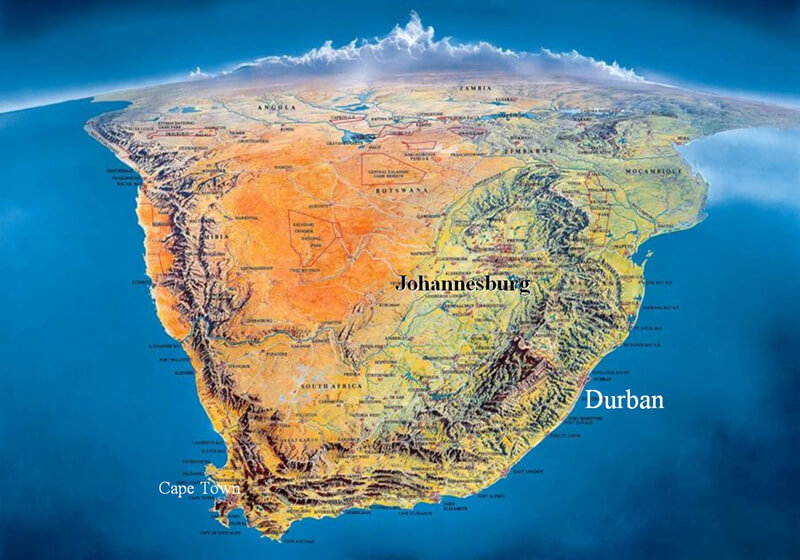
AERIAL MAP OF SOUTH AFRICA
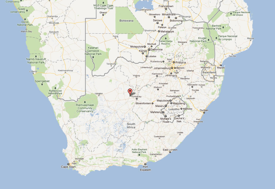
MAP OF SOUTH AFRICA
MAP SOUTH AFRICA
MAP OF SOUTH AFRICA
MAP OF SOUTH AFRICA
MAP OF SOUTH AFRICA
MAP SOUTH AFRICA
MAPS OF SOUTH AFRICA

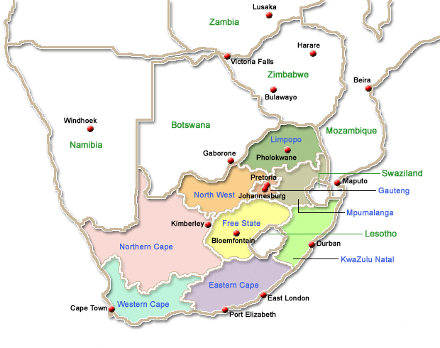
REGIONS MAP SOUTH AFRICA
SATELLITE IMAGE OF SOUTH AFRICA
SKETCH OF SOUTH AFRICA
SOUTH AFRICA CITIES MAP

SOUTH AFRICA MAP AFRICA
SOUTH AFRICA MAP
SOUTH AFRICA MAP
SOUTH AFRICA MAPS
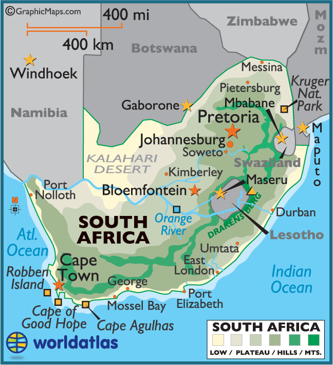
SOUTH AFRICA PHYSICAL MAP
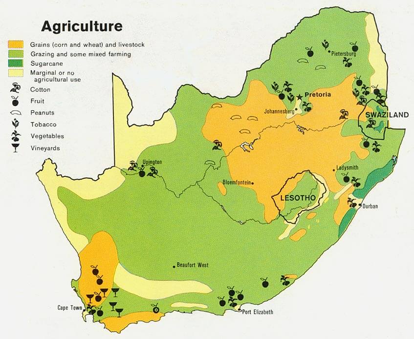
SOUTH AFRICA AGRICULTURE MAP
SOUTH AFRICA MAP
SOUTH AFRICA MAP
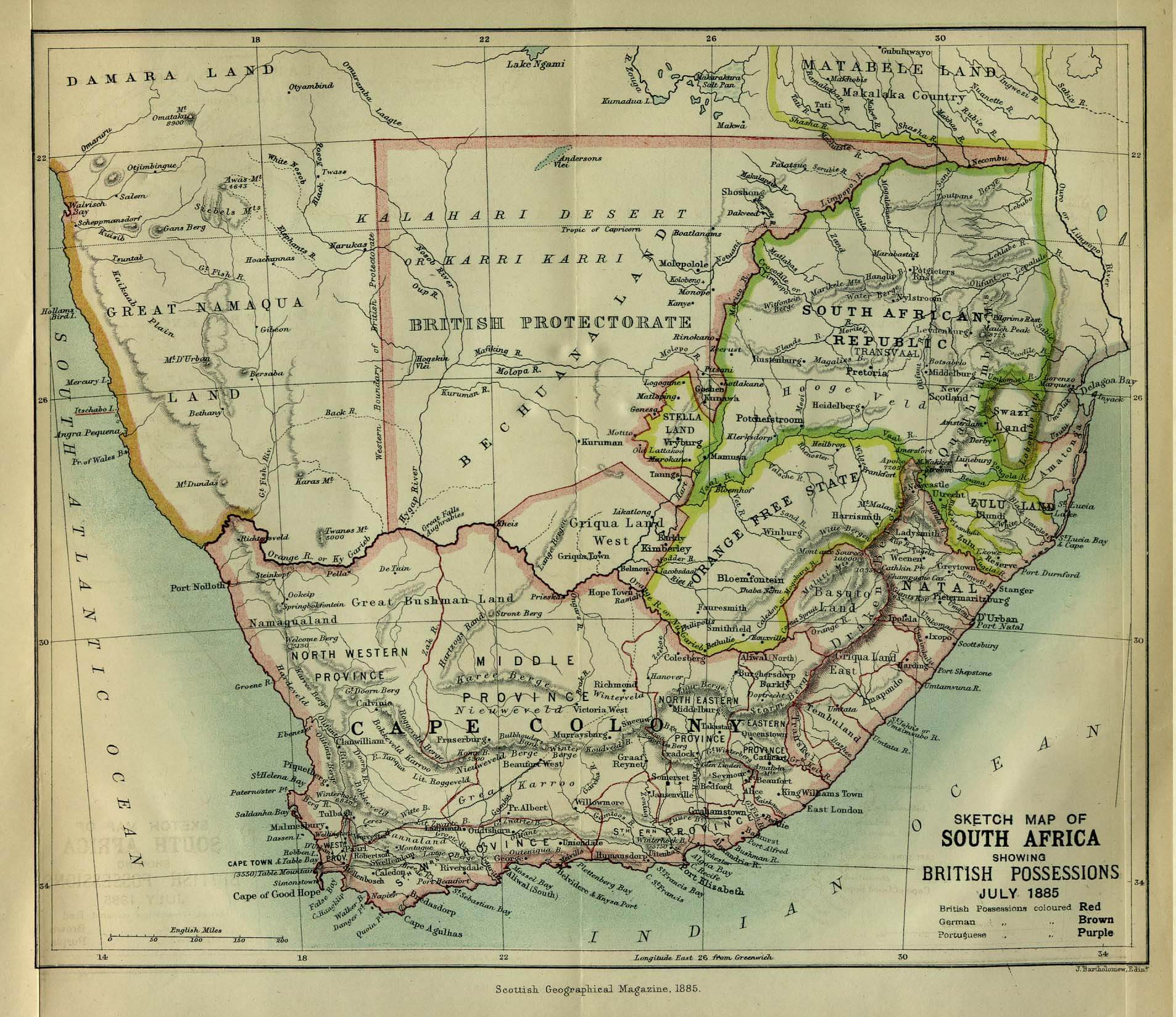
SOUTH AFRICA MAP 1885
SOUTH AFRICA MAP AFRICA
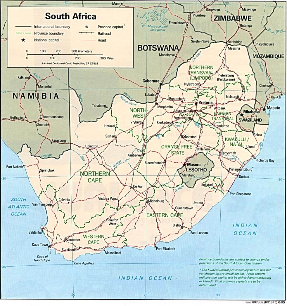
SOUTH AFRICA MAP BOUNDARIES
SOUTH AFRICA MAPS
SOUTH AFRICA MAPS
SOUTH AFRICA PHYSICAL MAP
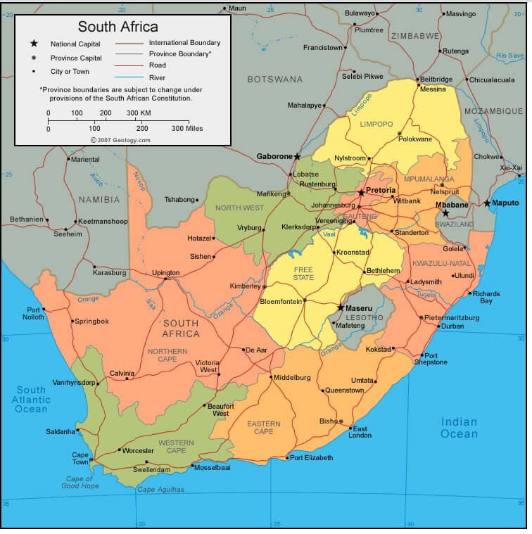
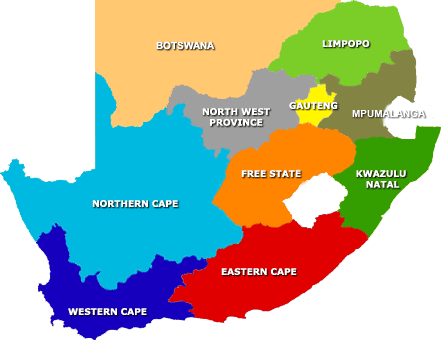
SOUTH AFRICA PROVINCES MAP
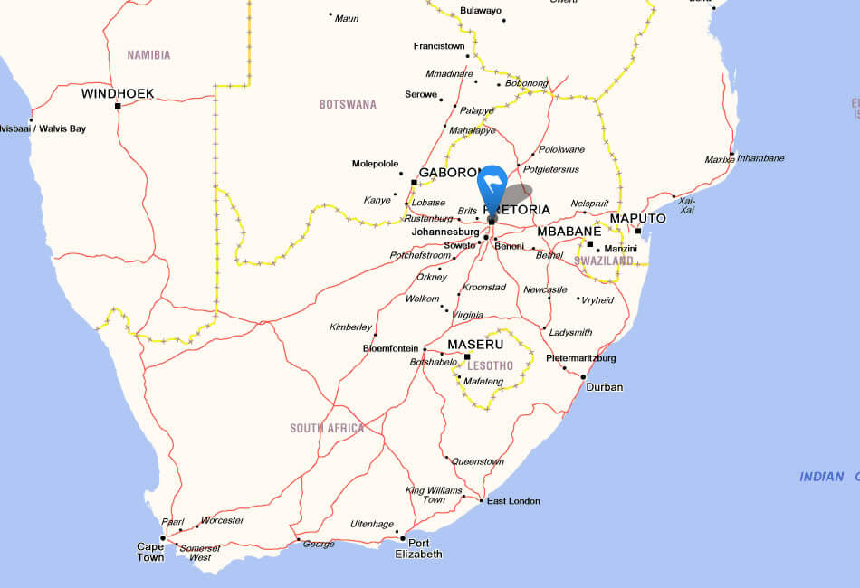
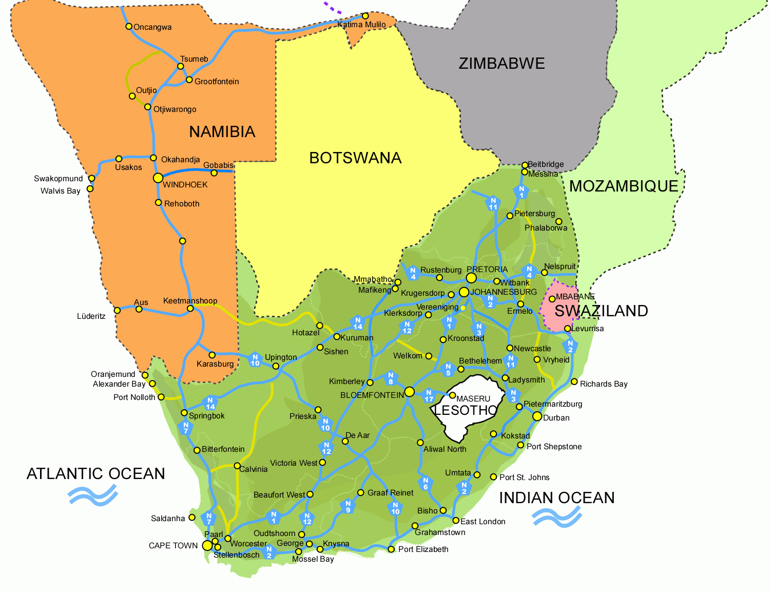
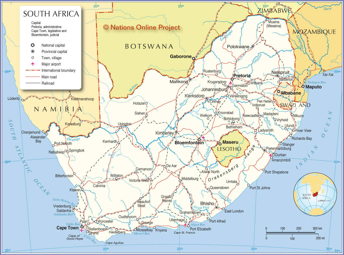
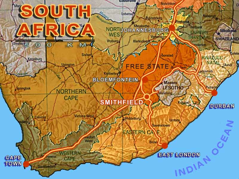
SOUTH AFRICA ROAD MAP
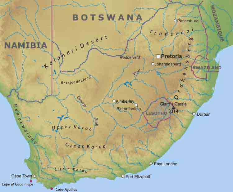
TERRAIN MAP OF SOUTH AFRICA
TERRITORIES MAP OF SOUTH AFRICA
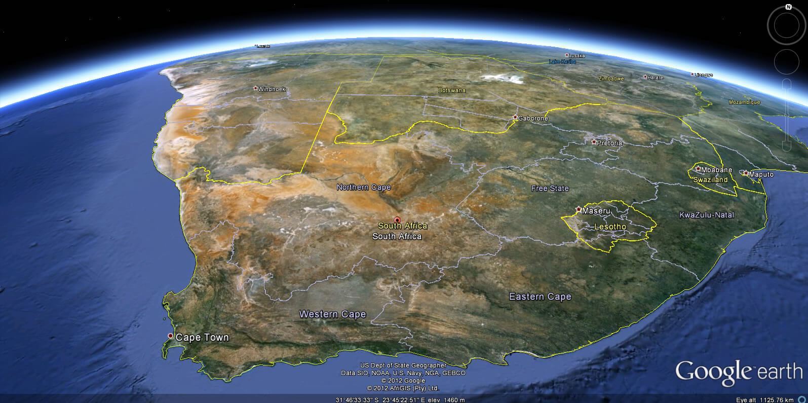
SOUTH AFRICA EARTH MAP
Largest Cities Map of South Africa
Johannesburg Map - 1,009,035 Welkom Map - 895,112 Soweto Map - 858,644 Cape Town Map - 827,218 Durban Map - 536,644 Pretoria Map - 525,387 Mitchell's Plain Map - 398,650 Umlazi Map - 388,687 Katlehong Map - 349,866 Tembisa Map - 348,693 Khayelitsha Map - 329,002 Soshanguve Map - 311,223 Mamelodi Map - 256,117 Ibhayi Map - 255,826 Port Elizabeth Map - 237,500 Tshivhase Map - 226,622 Pietermaritzburg Map - 223,519 Sebokeng Map - 222,045 Bloemfontein Map - 217,076 Mabopane Map - 192,914 Chatsworth Map - 192,166 Boksburg Map - 158,649 Benoni Map - 94,341 Lugano Map - 86,614 Vanderbijlpark Map - 80,205 Vereeniging Map - 73,283 Uitenhage Map - 71,666 Newcastle South Africa Map - 44,123South Africa Google Map, Street Views, Maps Directions, Satellite Images
Please Not : You can find local businesses, public places, tourist attractions via map view, satellite image, hybrid view, driving directions in South Africa Map. You'll also find a varity map of South Africa such as political, administrative, transportation, demographics maps following Google map.
Submit URL to South Africa :
Alphabetically Cities Map of South Africa & Population of South Africa Cities
Johannesburg Map - 1,009,035 Welkom Map - 895,112 Soweto Map - 858,644 Cape Town Map - 827,218 Durban Map - 536,644 Pretoria Map - 525,387 Mitchell's Plain Map - 398,650 Umlazi Map - 388,687 Katlehong Map - 349,866 Tembisa Map - 348,693 Khayelitsha Map - 329,002 Soshanguve Map - 311,223 Mamelodi Map - 256,117 Ibhayi Map - 255,826 Port Elizabeth Map - 237,500 Tshivhase Map - 226,622 Pietermaritzburg Map - 223,519 Sebokeng Map - 222,045 Bloemfontein Map - 217,076 Mabopane Map - 192,914 Chatsworth Map - 192,166 Boksburg Map - 158,649 Benoni Map - 94,341 Lugano Map - 86,614 Vanderbijlpark Map - 80,205 Vereeniging Map - 73,283 Uitenhage Map - 71,666 Newcastle South Africa Map - 44,123Copyright Turkey Travel Guide - 2005 - 2026. All rights reserved. Privacy Policy | Disclaimer