Map Canada
Navigate Canada map, satellite images of the Canada, states, largest cities, political map, capitals and physical maps.
- Capital : Ottawa
- Population : 33,476,688
- GDP : $1.770 trillion (10th)
- Per Capita : $50,826 (9th)
- Calling Code : +1
- Jobless Rate : 7.10%
- Time Zone : -3,5 ; -8
For more about Canada >>
Canada Map with Provinces

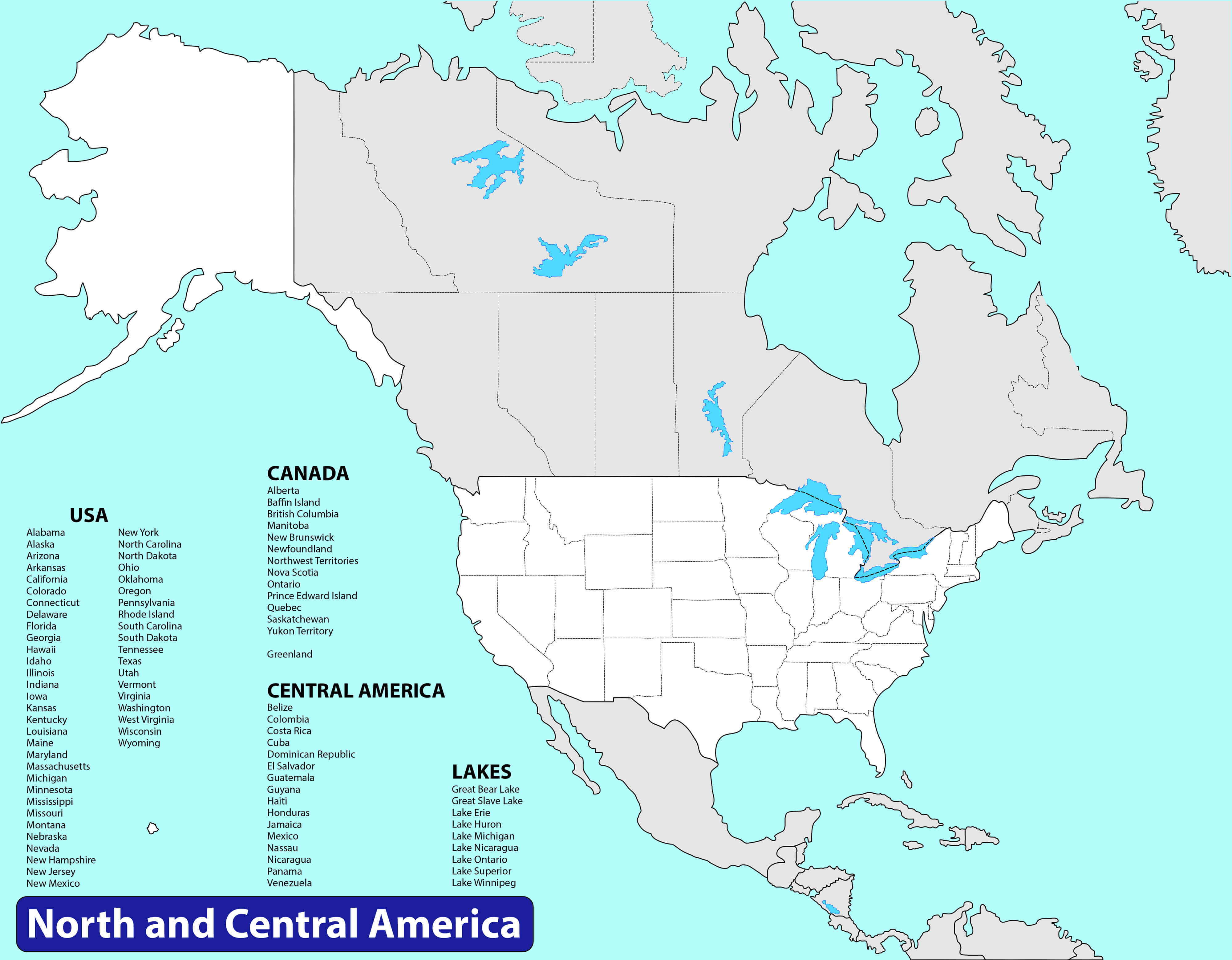
North America Map with Canada
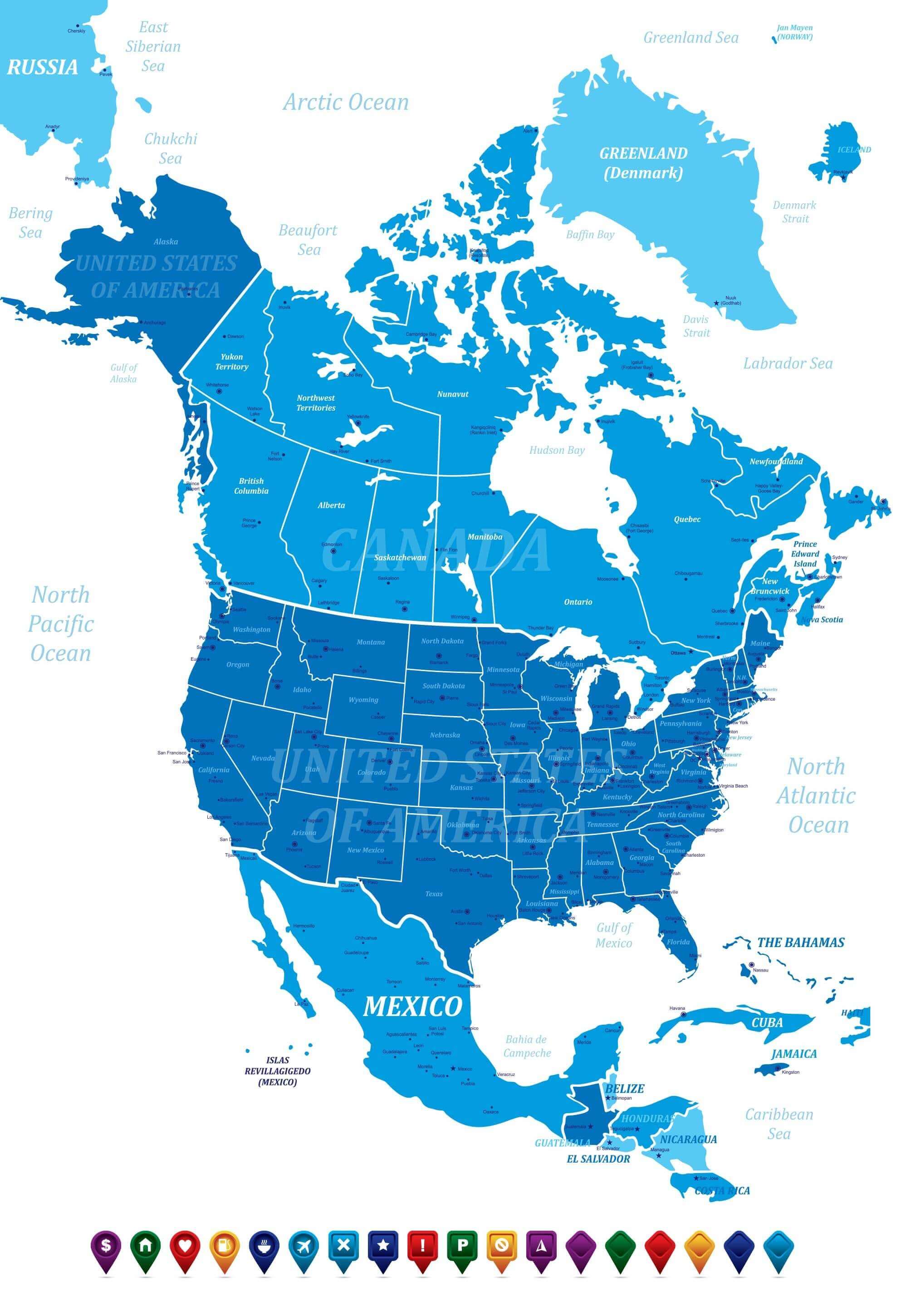 North America Map with Canada, American Countries, Cities and States
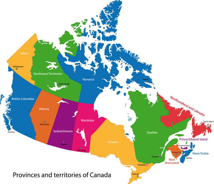
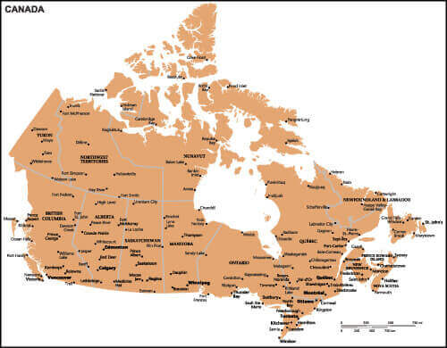
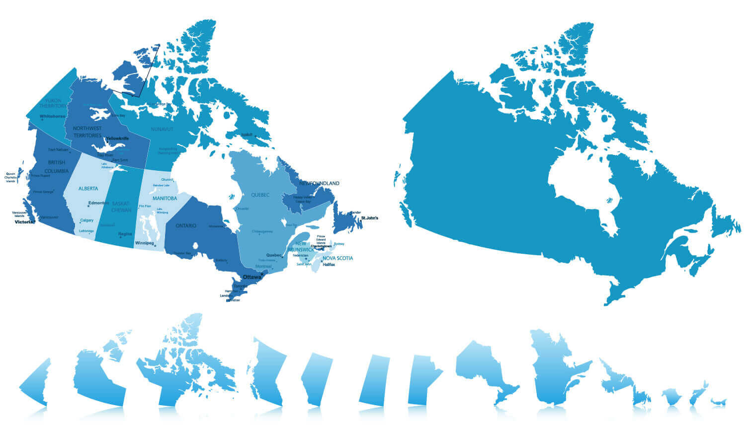
Canada Provinces Territories Map
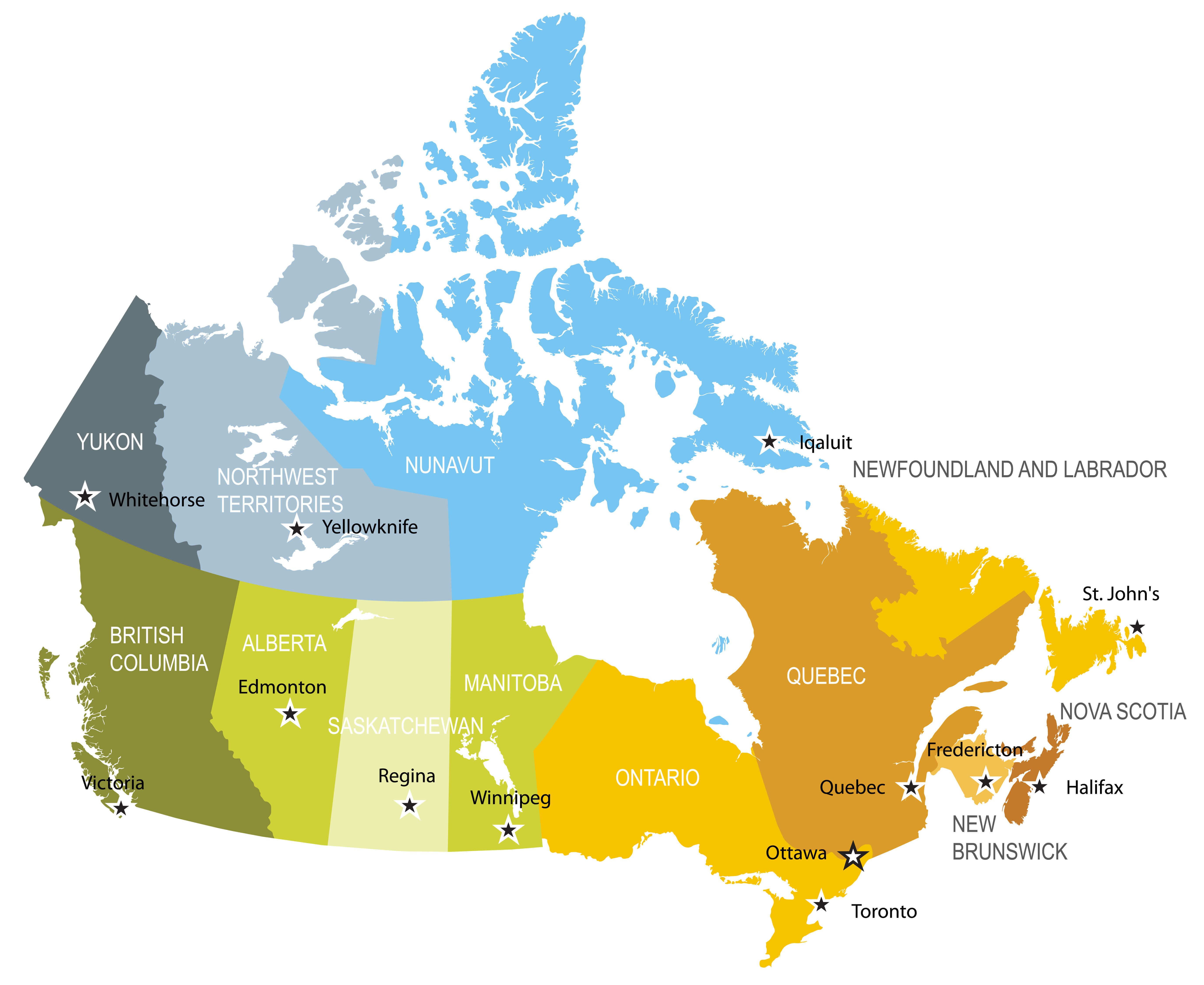 Map of provinces and territories of Canada
Canada Map USA, North America
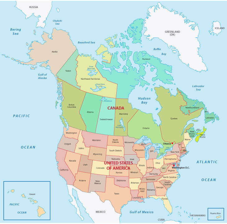 North America, USA Map with Canada
Detailed Map of Canada
 Vector detailed map of canada and provinces.
Vintage Map of Canada with flag
 Vintage Map of Canada with flag. Highly detailed vector illustration.
Canada Map
 Canada Map with states and borders.
Detailed Map of Canada
Map of Canada with detailed illustration
Canada Administrative Map
 Canada Administrative Map
Canada States Map with United States
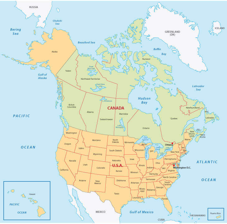 Canada States Map with United States.
Administrative map of Canada
 Administrative map of Canada
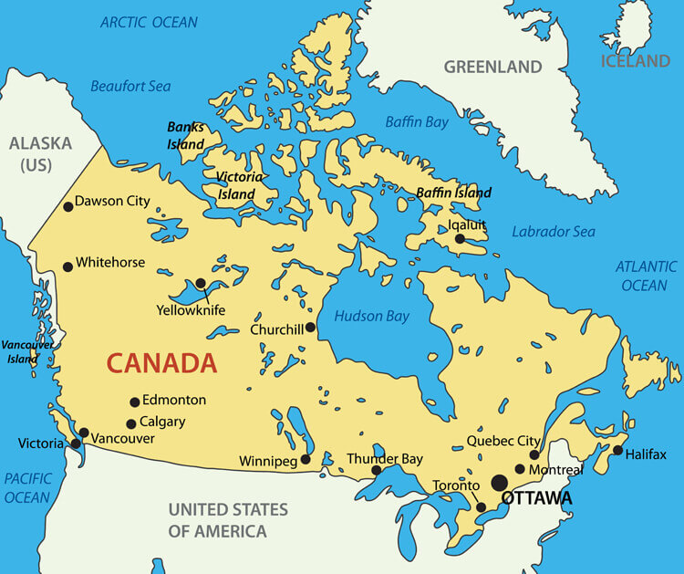
Canada Country Map
 Canada Country Map
Canada Vector Map
 Canada Vector Map with main cities.
Colorful Canada Map
 Colorful Canada map with provinces and capital cities.
Canada Country Map with Cities
 Canada Country Map with Cities
Canada Political Map
 Canada Political Map
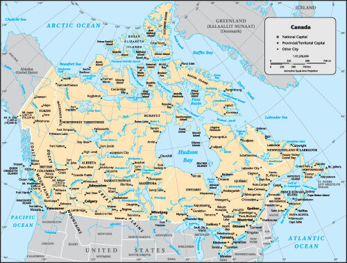
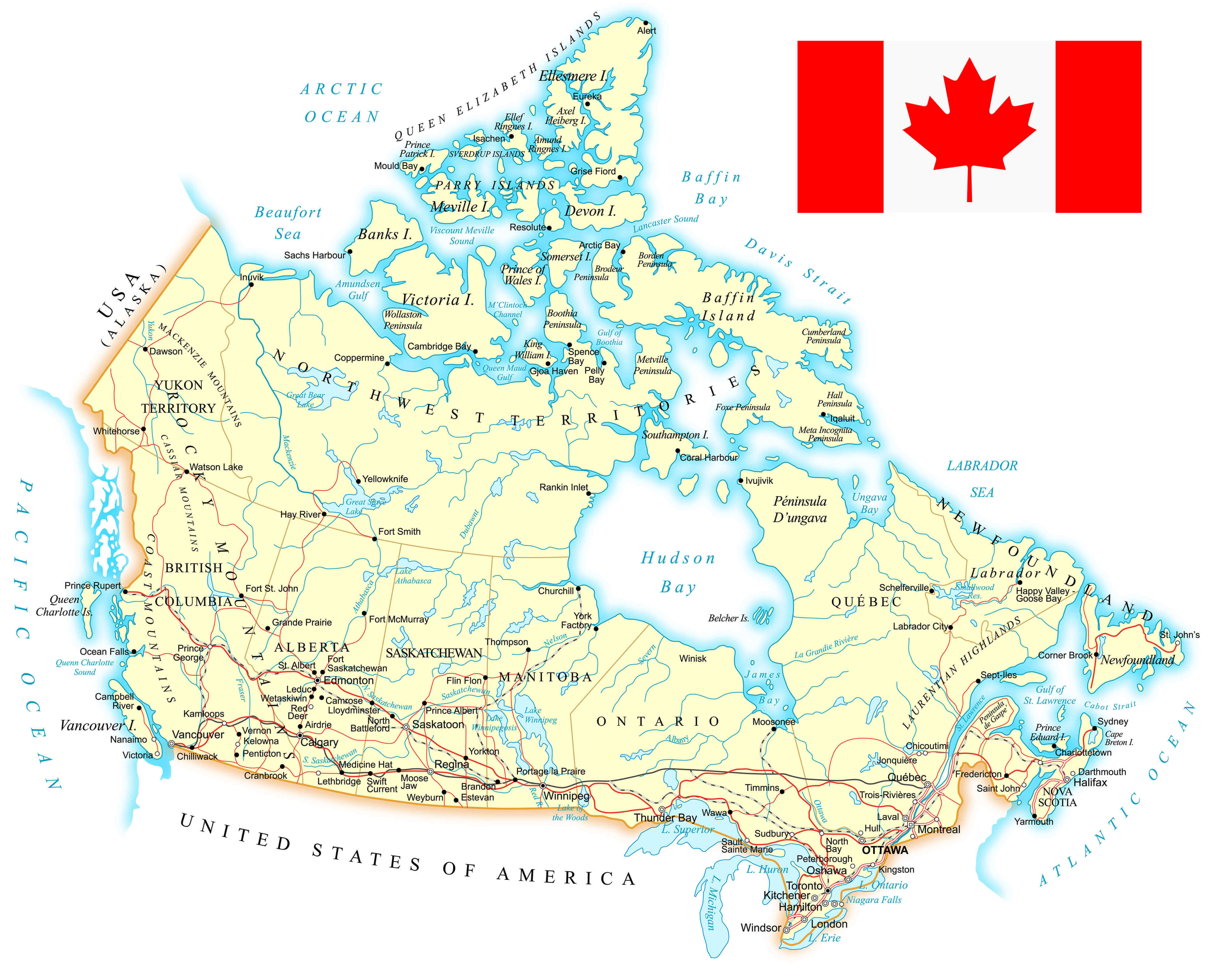
High Detailed Canada Road Map
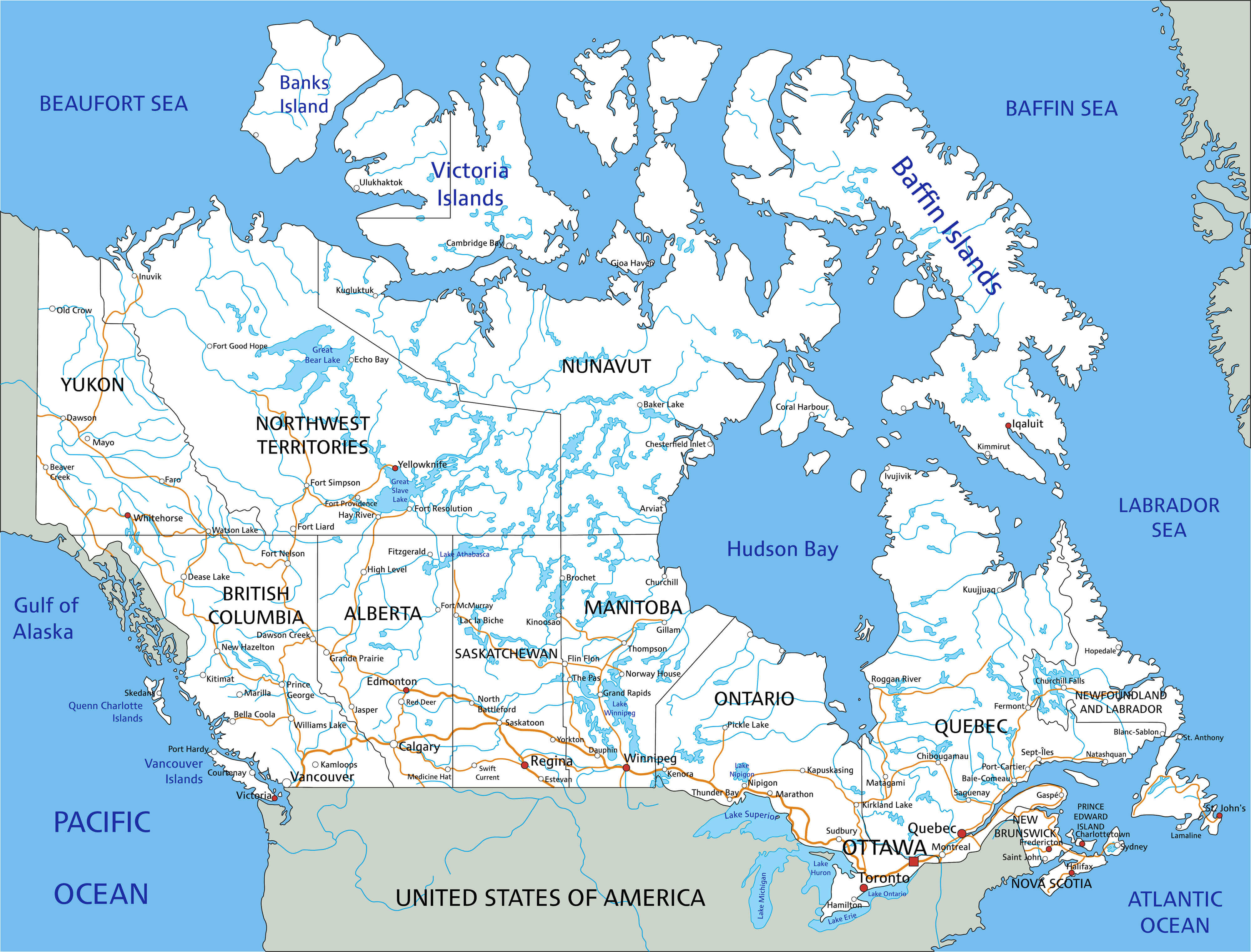 High detailed Canada road map with labeling.
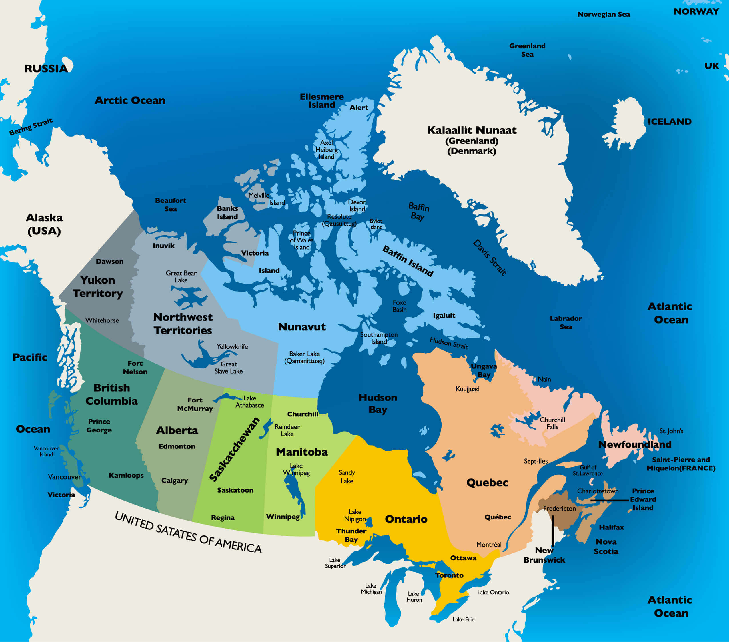
Canada Map with North and Central America
 Canada Map with North and Central America. Vector illustration.
Detailed Road Map of Canada
 Map of Canada - detailed illustration with major cities and states.
Canada Vector Blank Map
 Canada Vector highly detailed map. All elements are separated in editable layers clearly labeled.
Canada Google Map, Street Views, Maps Directions, Satellite Images
Please Not : You can find local businesses, public places, tourist attractions via map view, satellite image, hybrid view, driving directions in Canada Map. You'll also find a varity map of Canada such as political, administrative, transportation, demographics maps following Google map.
Submit URL to Canada :
turkey-visit.com offers a collection of Canada map, google map, North America map, political, physical, satellite view, country infos, cities map and more map of Canada.
Please feel free share your comments and questions :
Please feel free share your comments and questions :
"Canada" related content to share on social media;


Copyright Turkey Travel Guide - 2005 - 2026. All rights reserved. Privacy Policy | Disclaimer