France High-Resolution Map: Explore Every Region in Stunning Detail
If you are searching for the most detailed and accurate high-resolution map of France, you have come to the right place. This interactive, zoomable map allows for close inspection of all geographic details, including all major cities and regions from the rugged coastline of Brittany in the northwest down to the sun-drenched Provence in the south, and from the grand avenues of Paris to the scenic port of Bordeaux.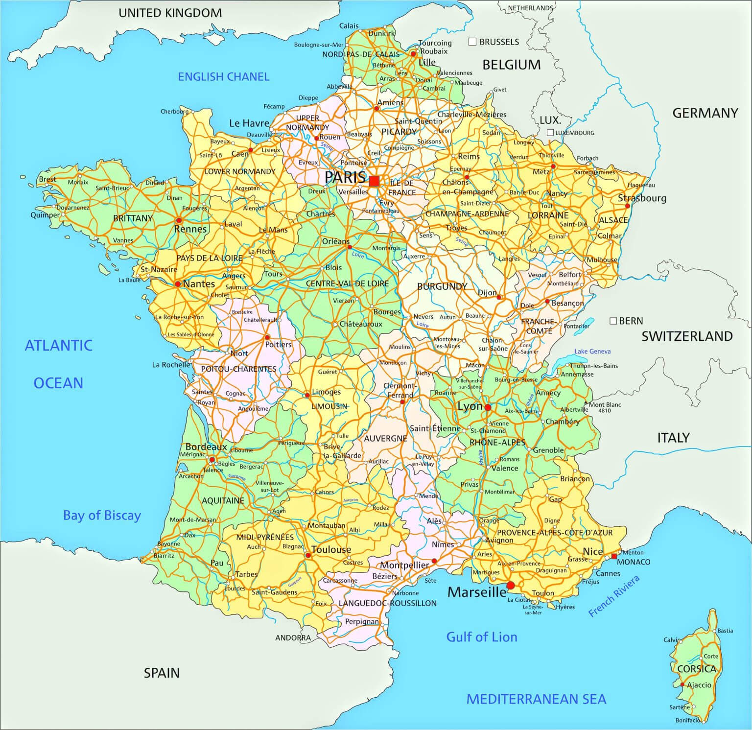
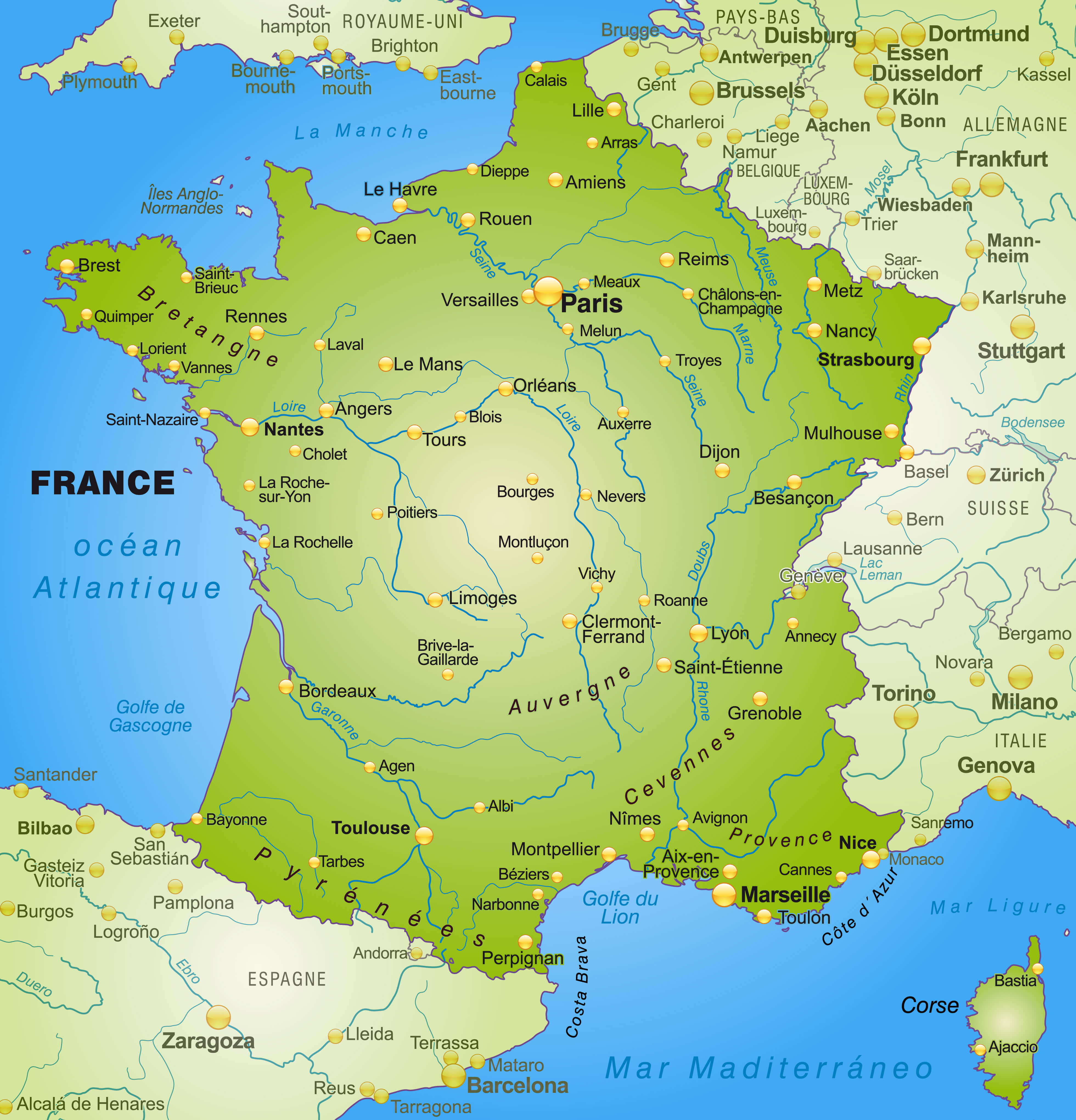
France major cities map with rivers
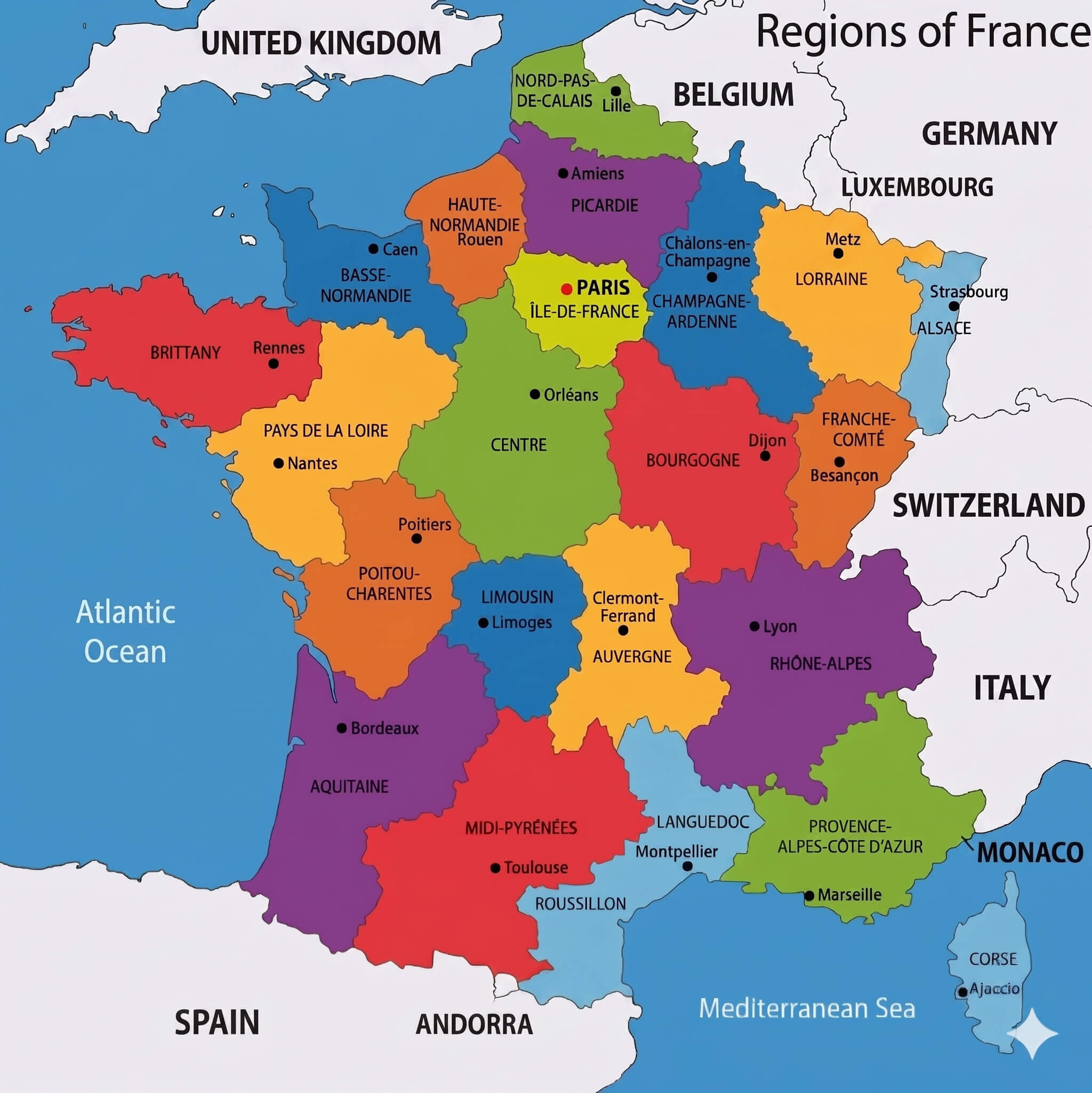
France provinces map
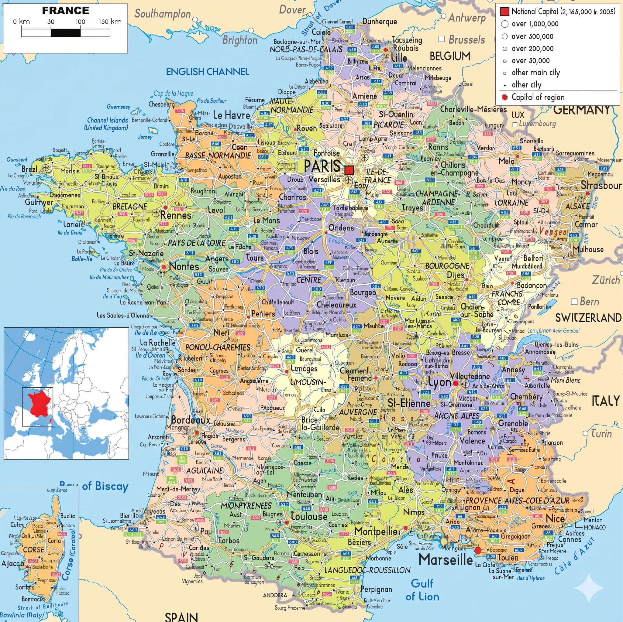
France highways map with cantons
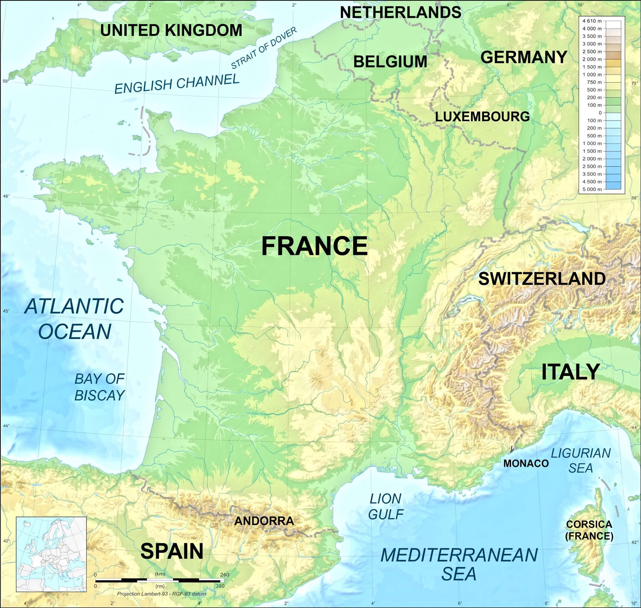
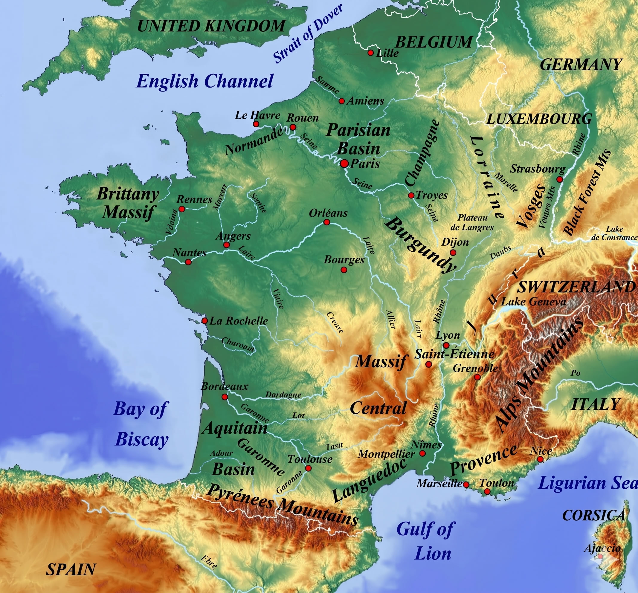
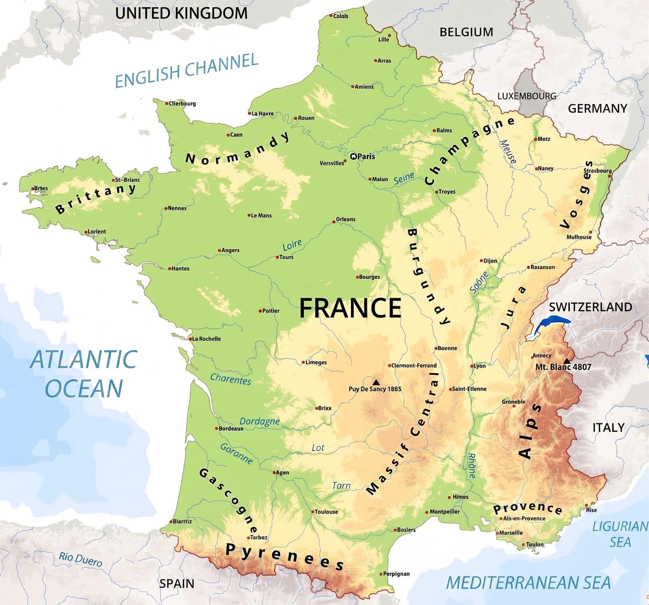
We provide extensive topographic information, labeling key mountain ranges such as the Alps—featuring the towering Mont Blanc—the Pyrenees border with Spain, and the sprawling Massif Central. Trace the full length of key rivers like the Seine, Loire, Garonne, and Rhône, or study the country’s coastal features and surrounding waters, including the Atlantic Ocean, Mediterranean Sea, and English Channel. Perfect for research, travel planning, or satisfying your curiosity about French geography, this is the ultimate detailed geography map available in high definition.
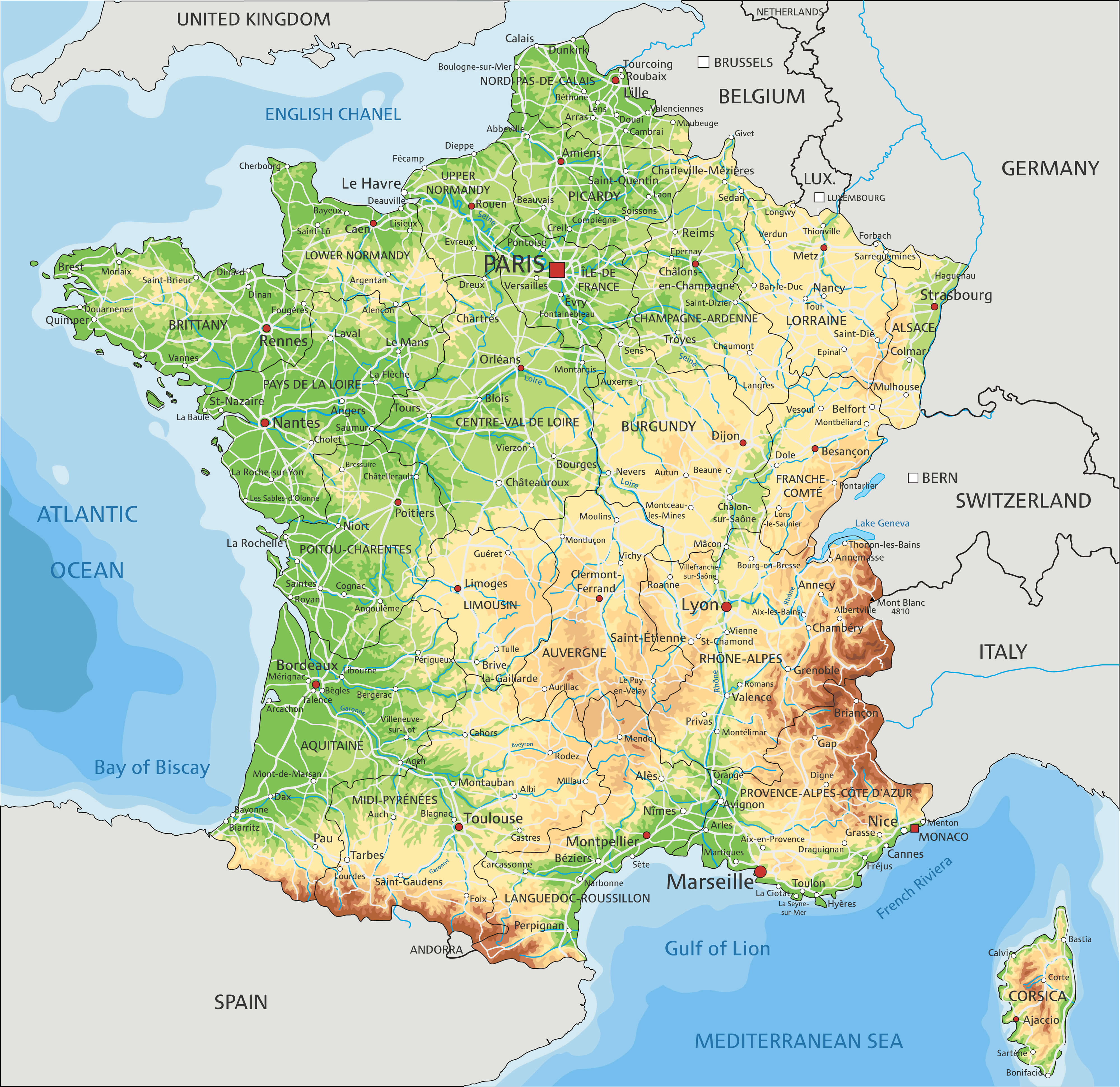
France physical map
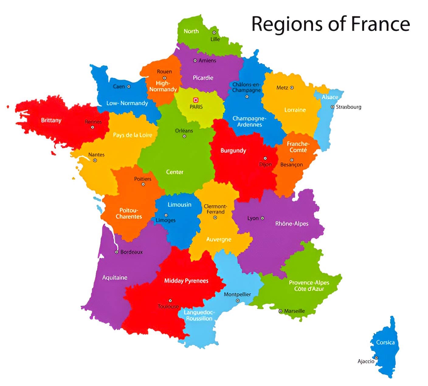
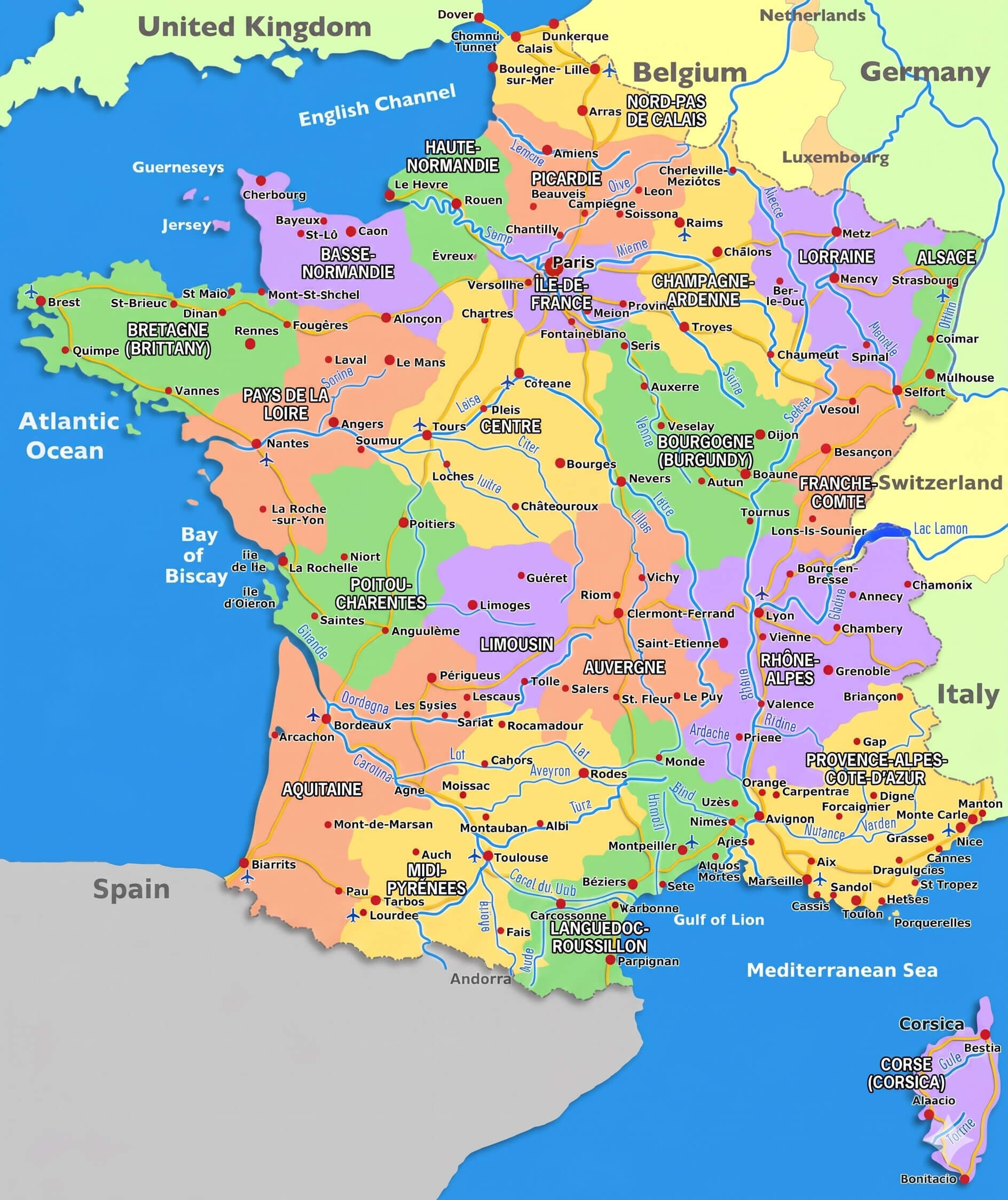
Colorful France map with regions
France satellite map
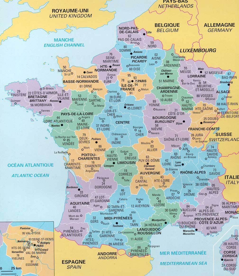
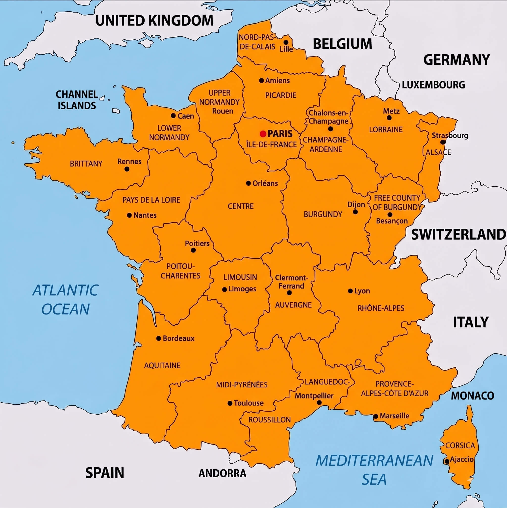
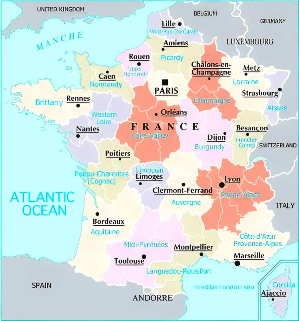
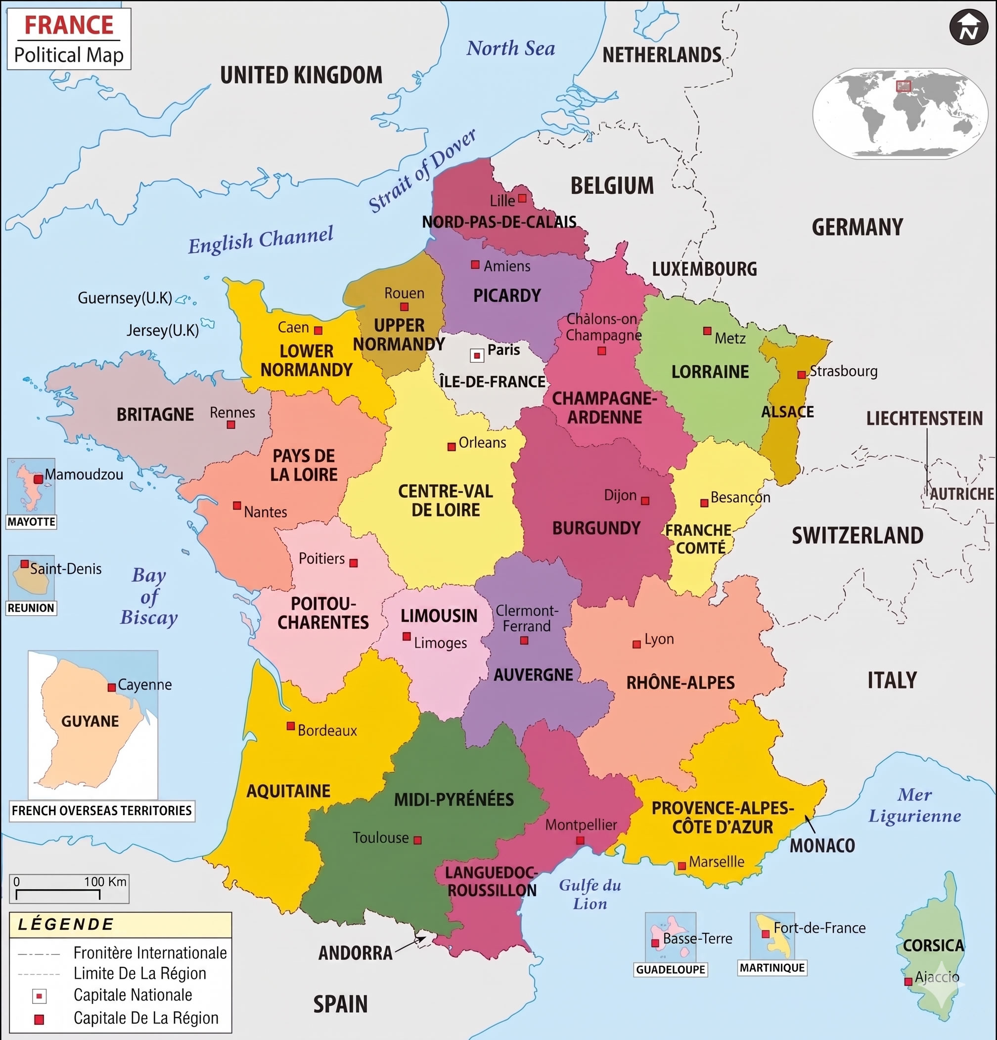
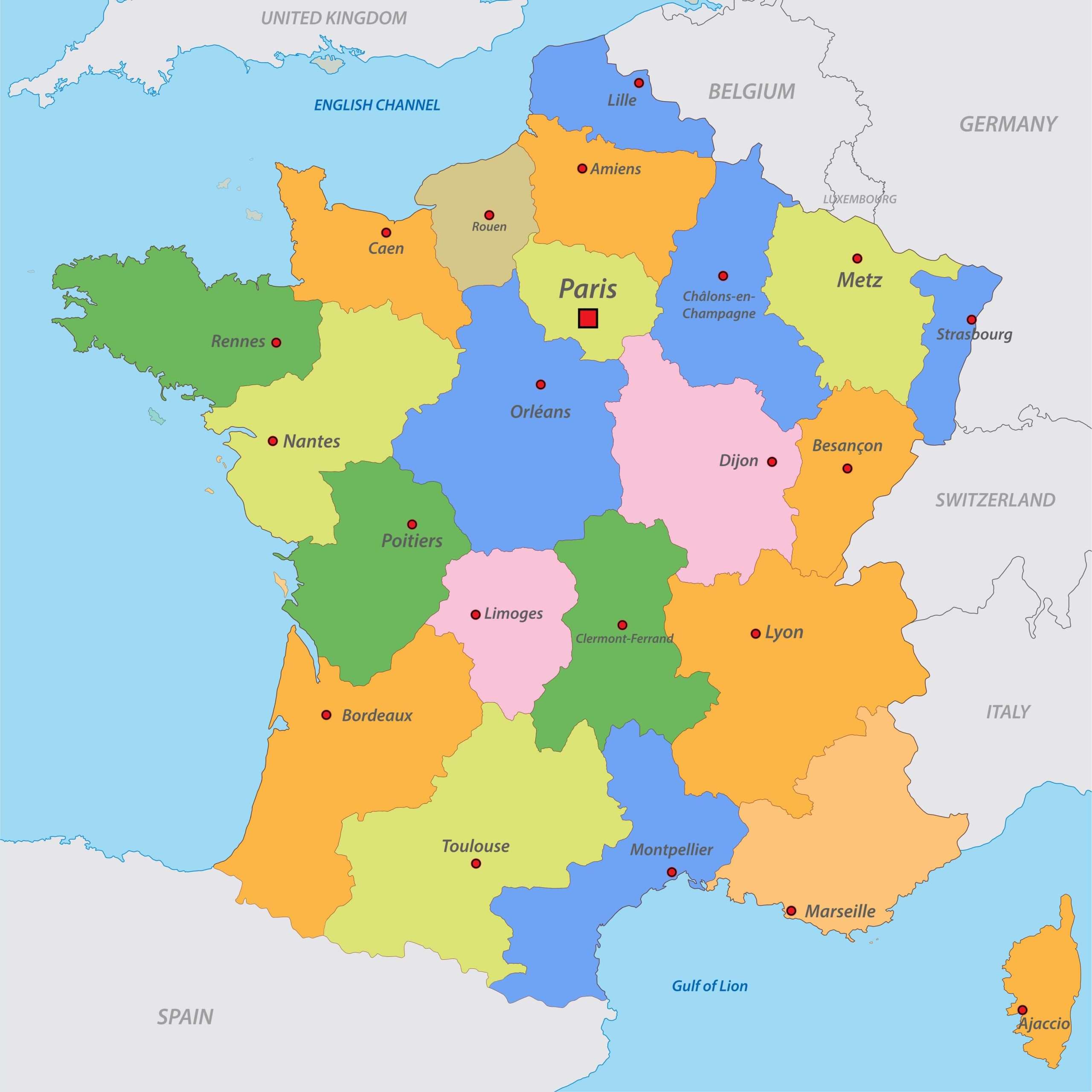
France administrative map with regions and roads
France administrative map
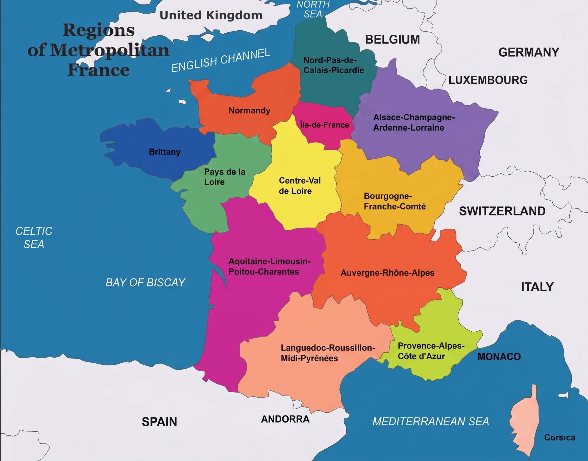
France regions map
France cantons map with major cities
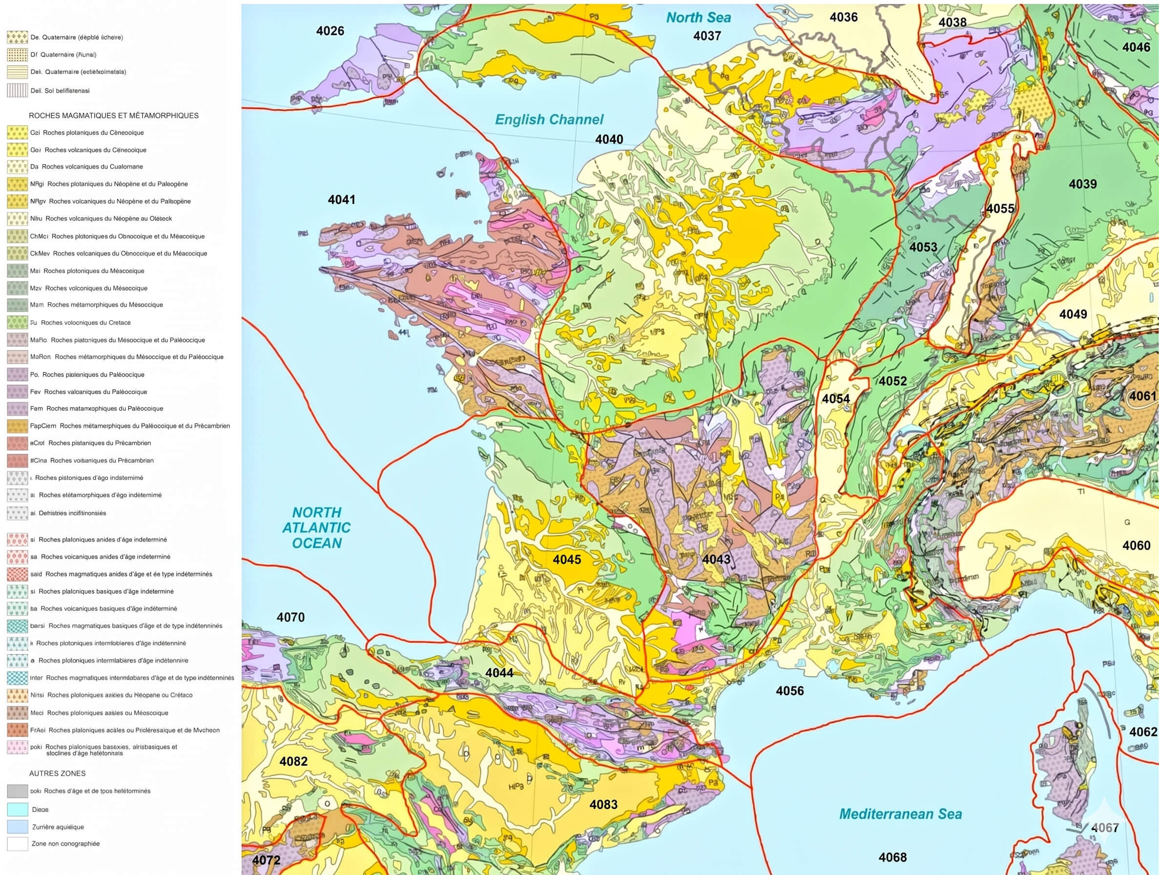
France geologic map
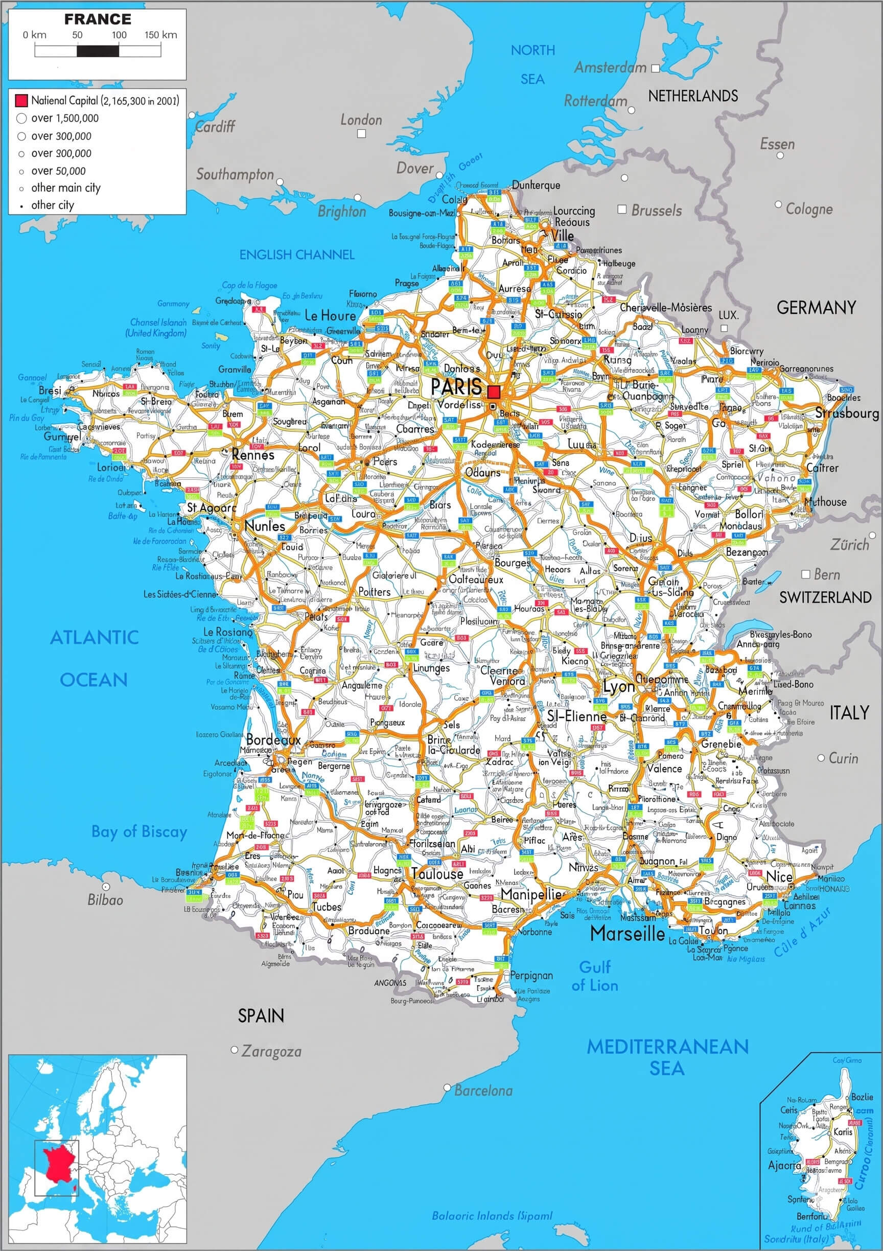
France highways map with cities
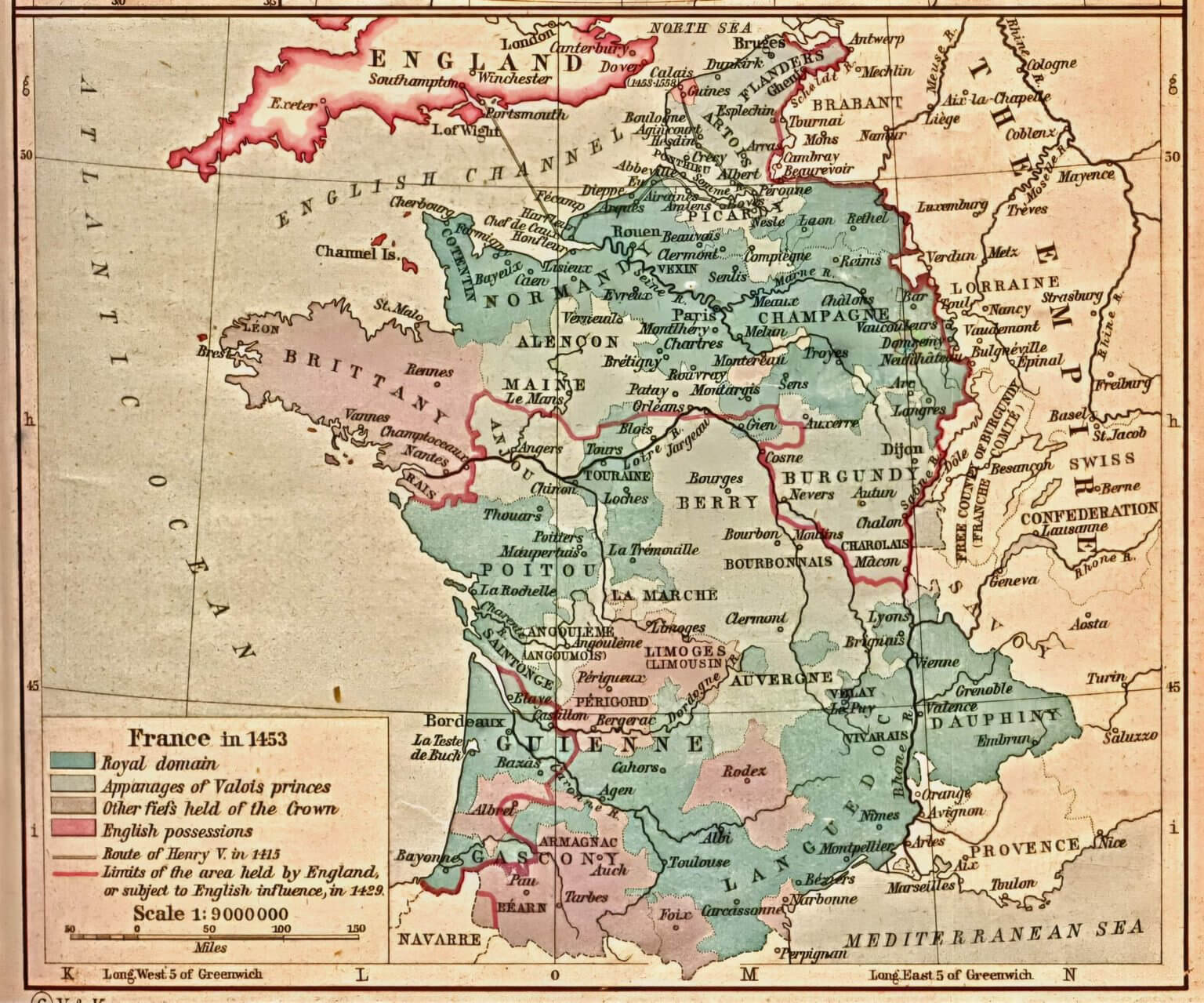
France historical map
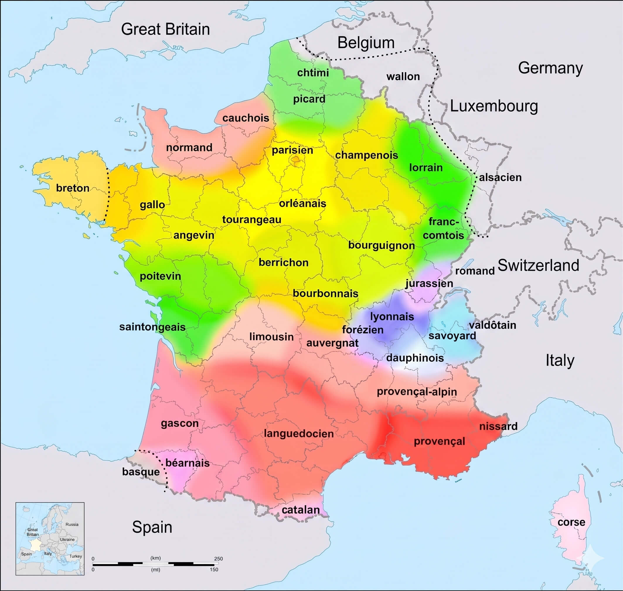
France linguistic map
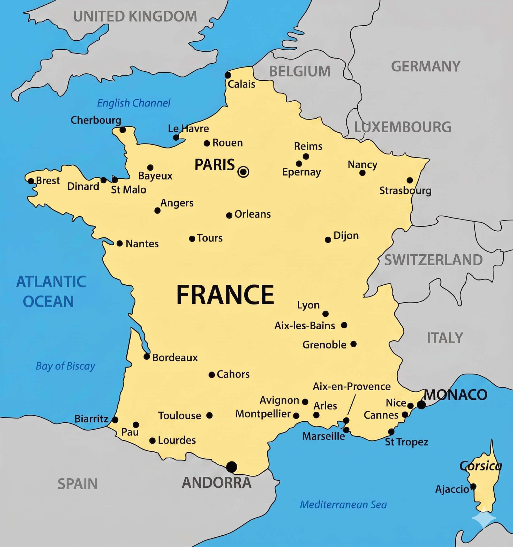
France major cities map
France political map
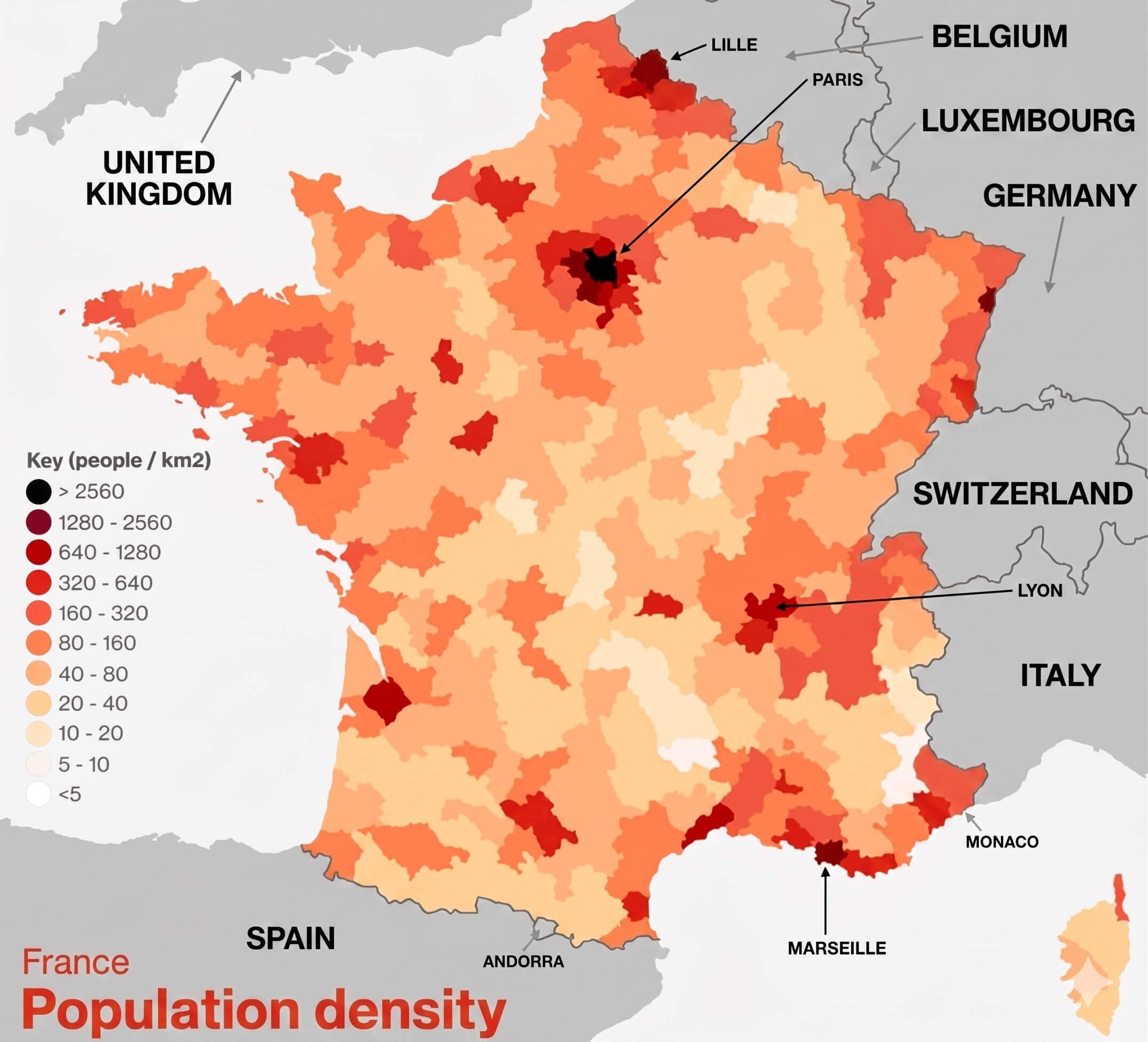
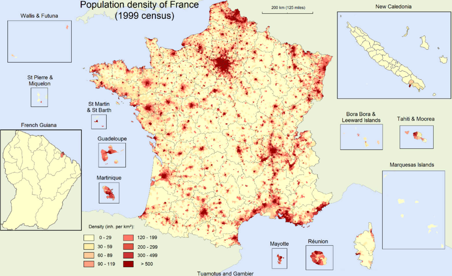
France population density map
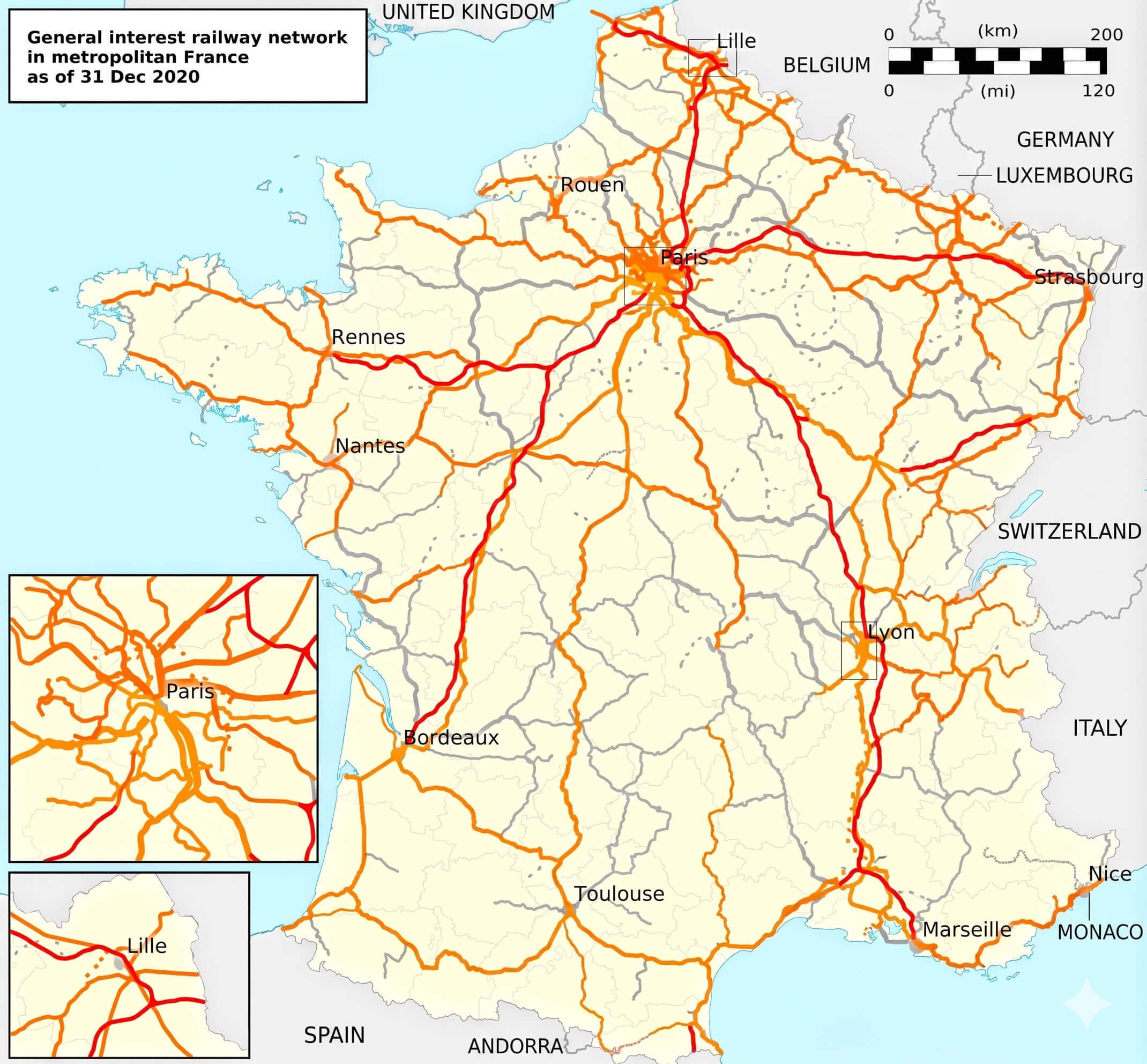
France railway network map
France relief map
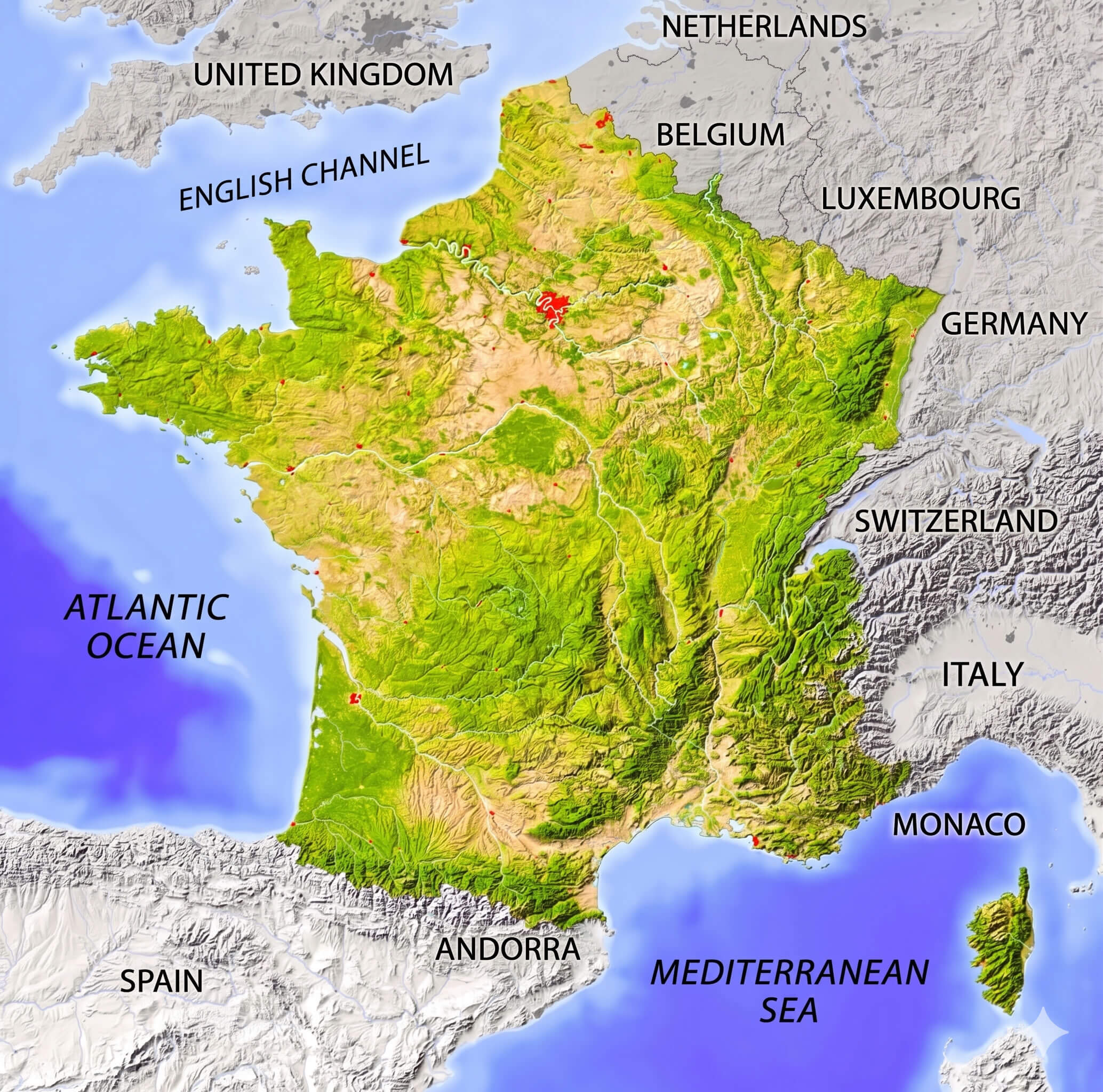
France topographic map mountains rivers
France tourism map
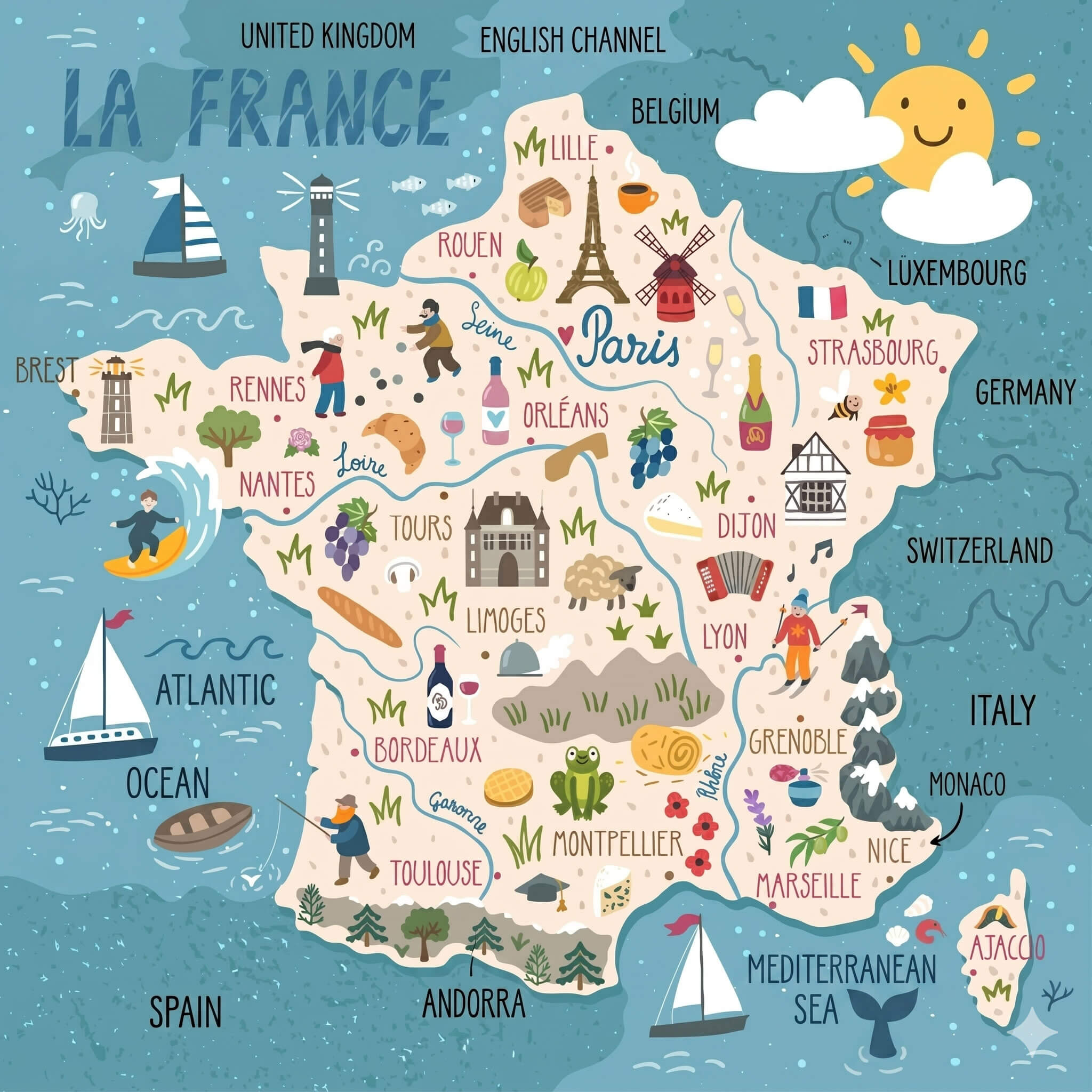
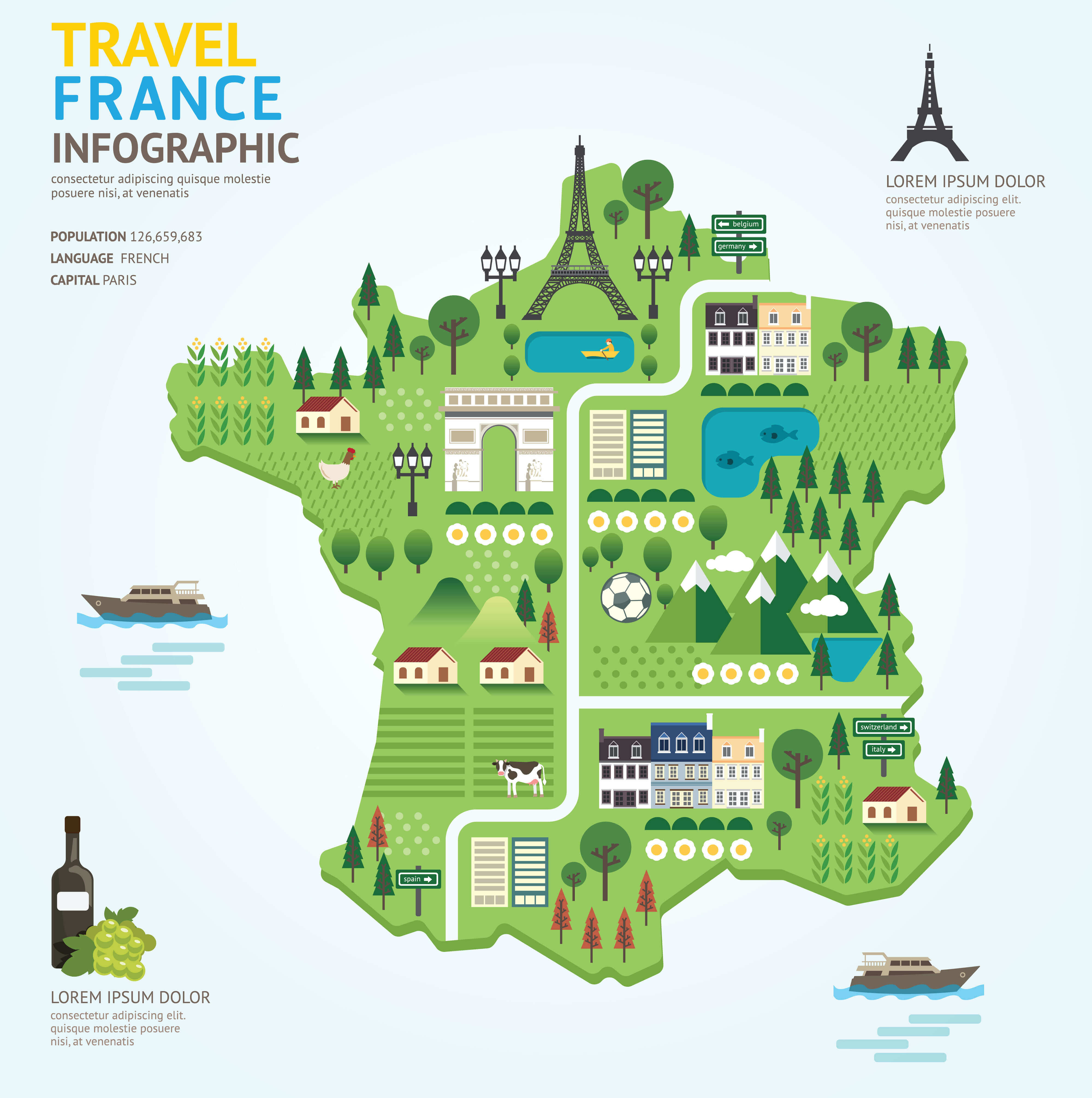
France travel map
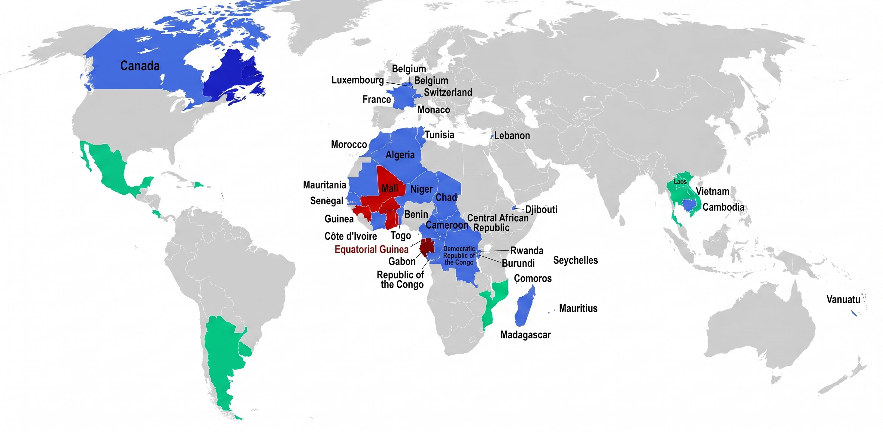
Francophone countries map in the World
Map of France with regions labeled
Map of France with rivers
Physical map of France rivers and mountains
Population density map of France
Regions of France Map
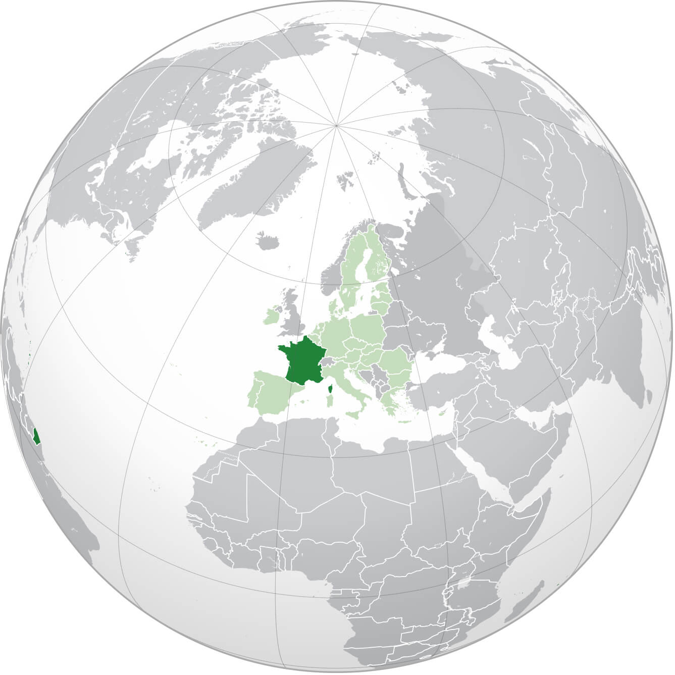
Where is France on the World map
Feel free to explore these pages as well:
Paris Map Lyon Map Marseille Map Lille Map Strasbourg Map Bordeaux Map Nice Map Saint Etienne Map Toulouse Map Montpellier Map Grenoble Map Toulon Map Rouen Map Mulhouse Map Le Havre Map Metz Map Chambery Map Annecy Map Colmar Map Besancon Map Le Mans Map Caen Map Valence Map Avignon Map Nantes Map Angers Map Nancy Map Nimes Map Rennes Map Annemasse Map Cannes Map Brest Map Dijon Map Clermont Ferrand Map Aix en Provence MapCopyright Turkey Travel Guide - 2005 - 2026. All rights reserved. Privacy Policy | Disclaimer