Detailed Canada Maps: Provinces, Borders, Cities, and Landscapes
Explore Canada Maps with detailed political, physical, regional, and satellite views. Discover Canada's provinces, territories, borders, major cities, and natural landscapes through a complete map collection.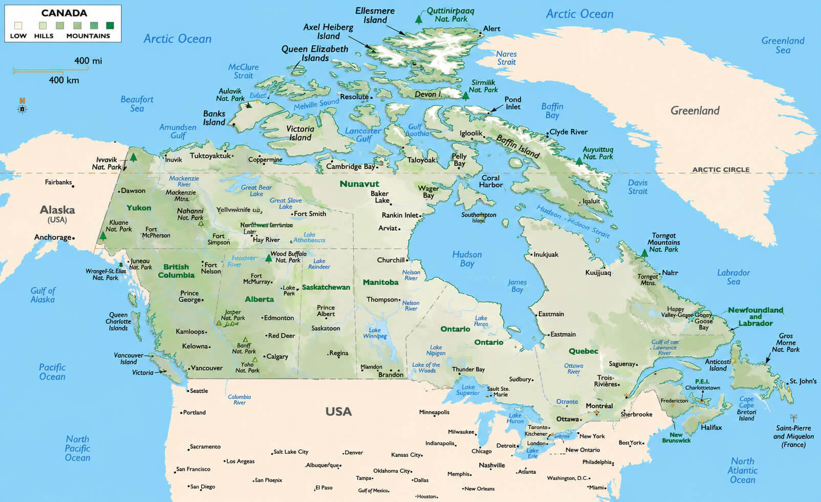
Canada country map with rivers
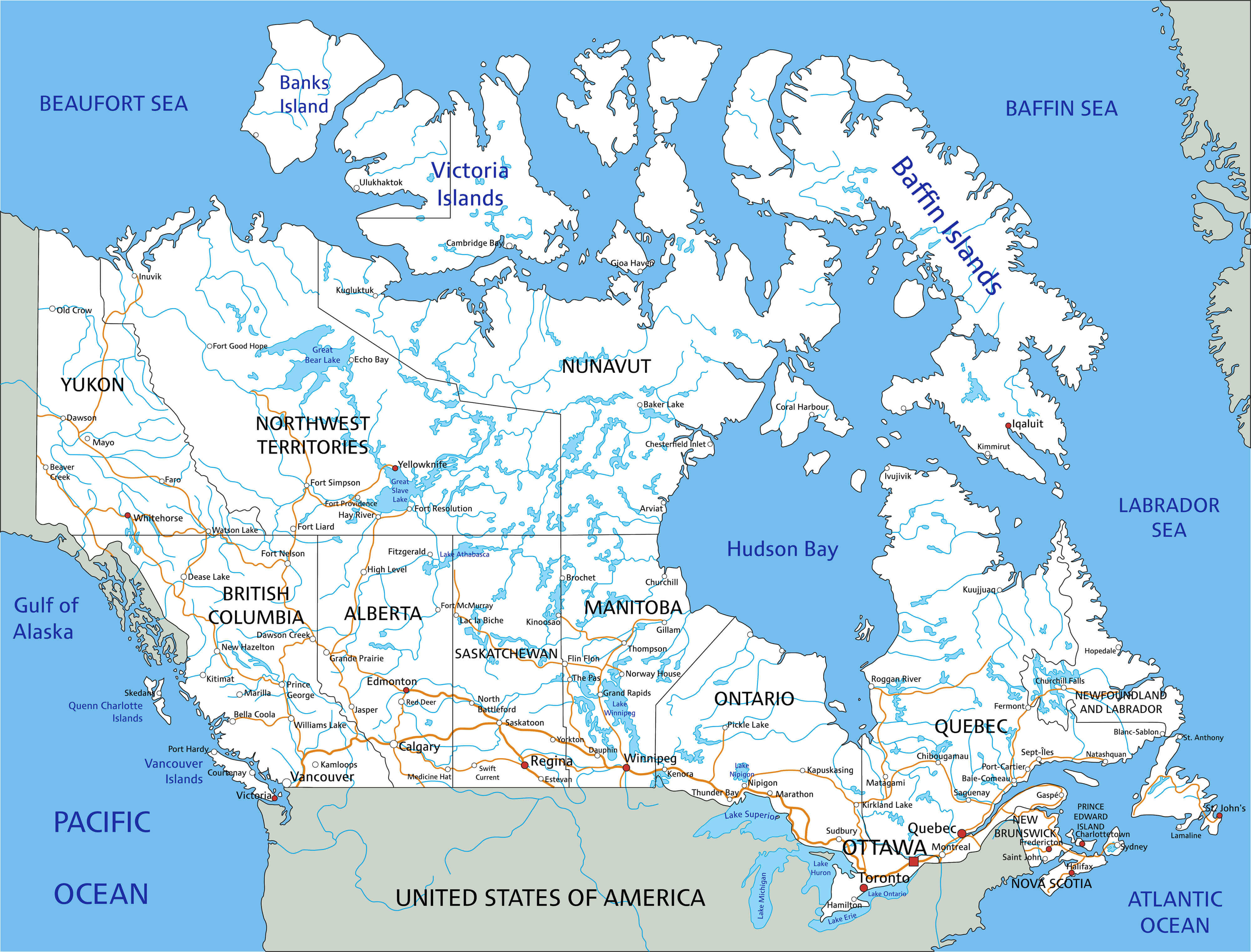
Canada physical landform map
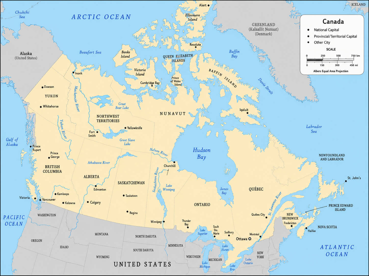
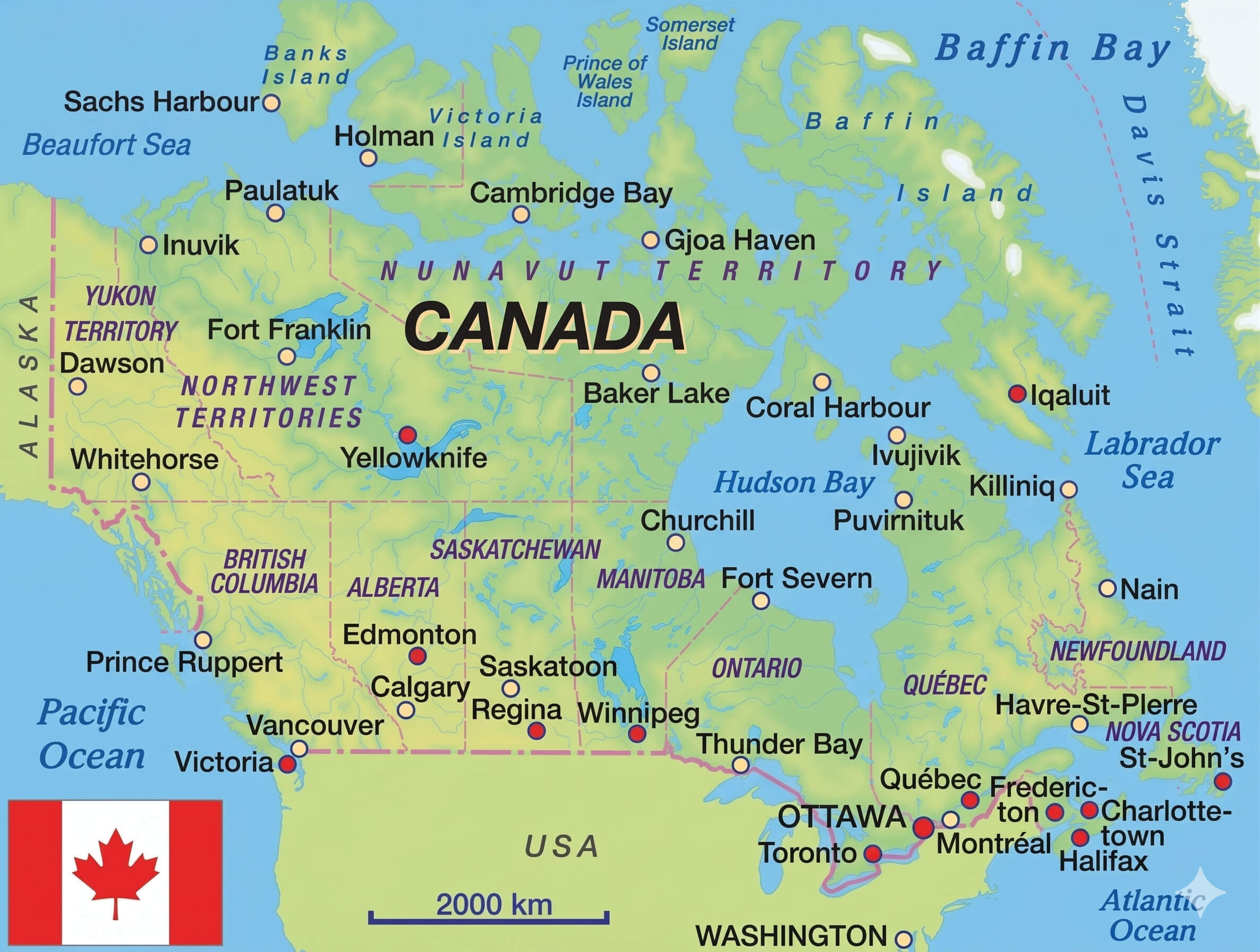
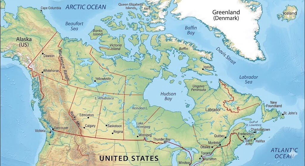
Canada atlas reference map
The collection also features a Canada provinces and territories map, Canada reference political map, and Canada regions map, offering a clear overview of Canada’s administrative divisions and regional boundaries. For more in-depth geographic study, you can access a Canada relief and topographic map, Canada satellite Earth view map, and Canada territorial boundaries map. In addition, the Canada USA border states map highlights Canada’s connection with neighboring U.S. states, while the Canada world trade agreements map provides insights into Canada’s international economic relationships, making this collection a valuable resource for students, travelers, and map enthusiasts alike.
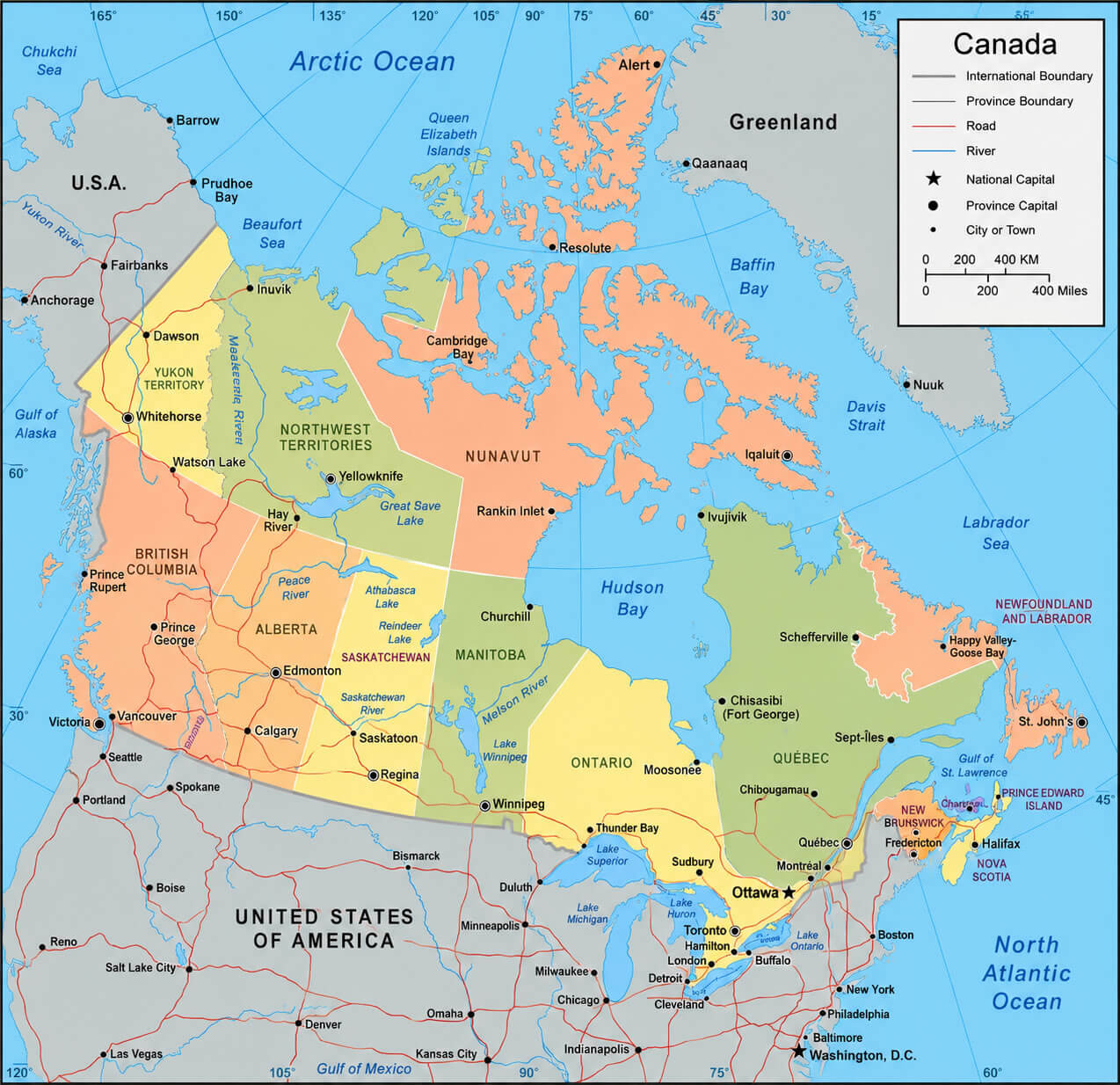
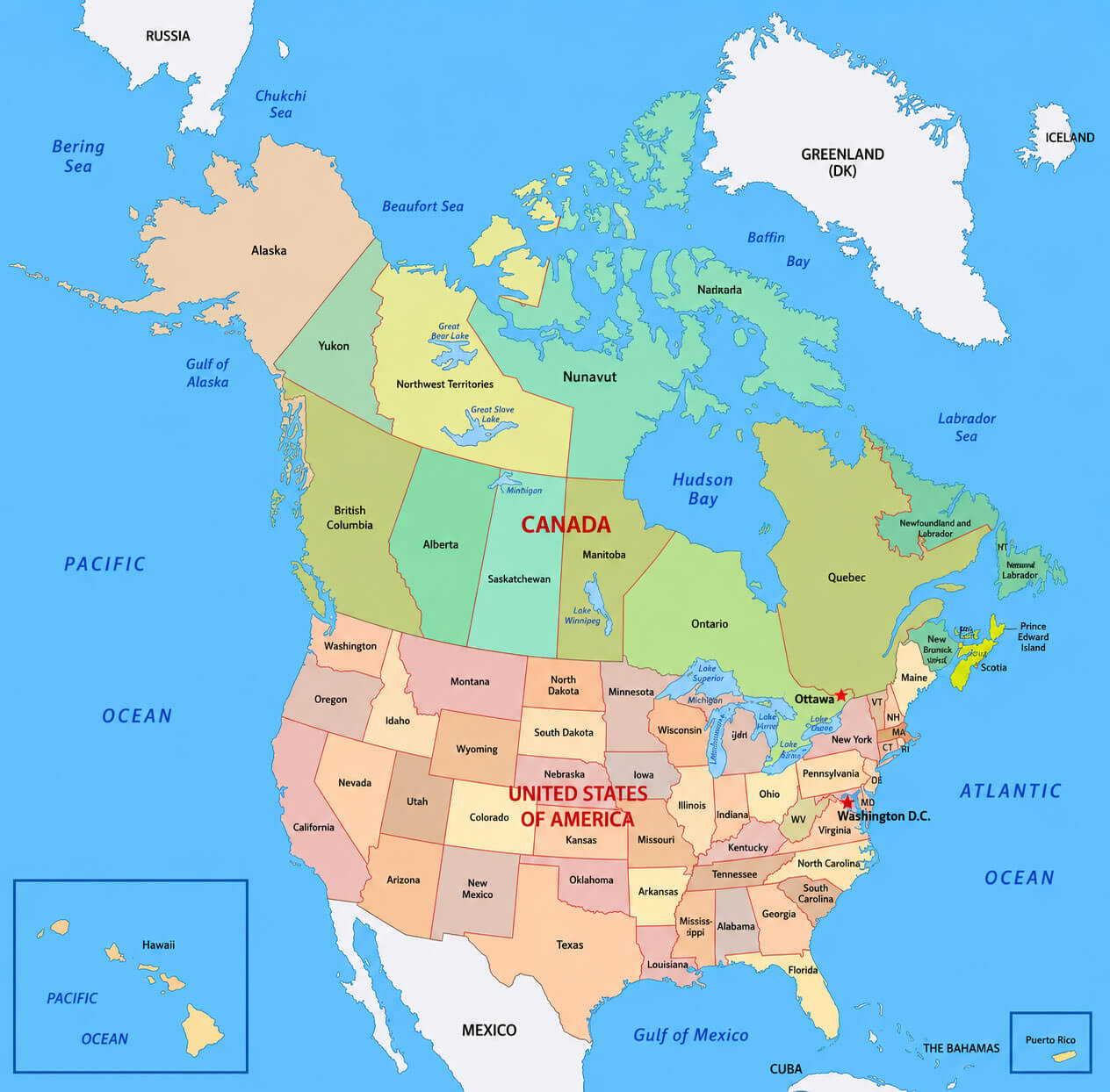
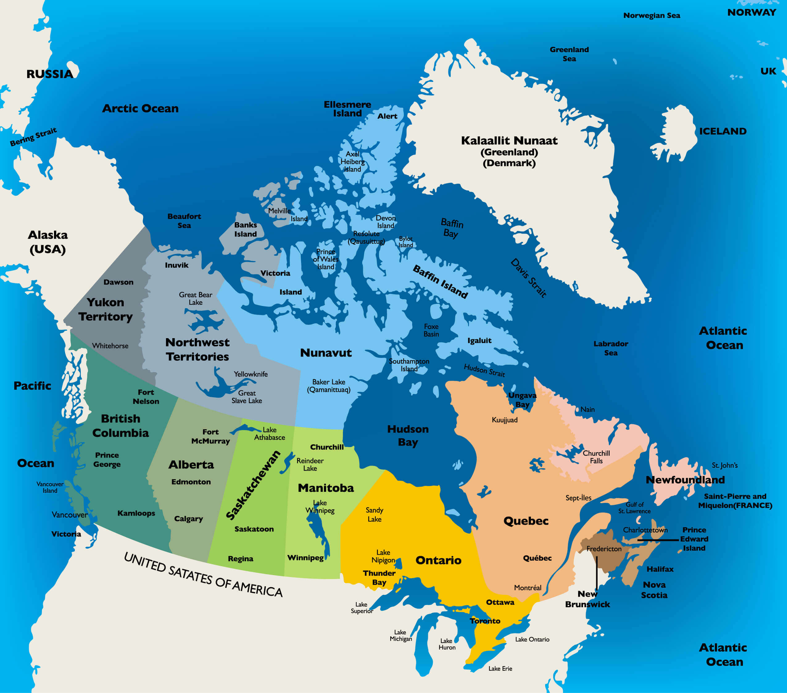
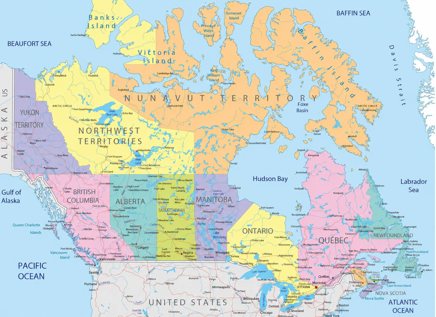
Canada administrative divisions map with US
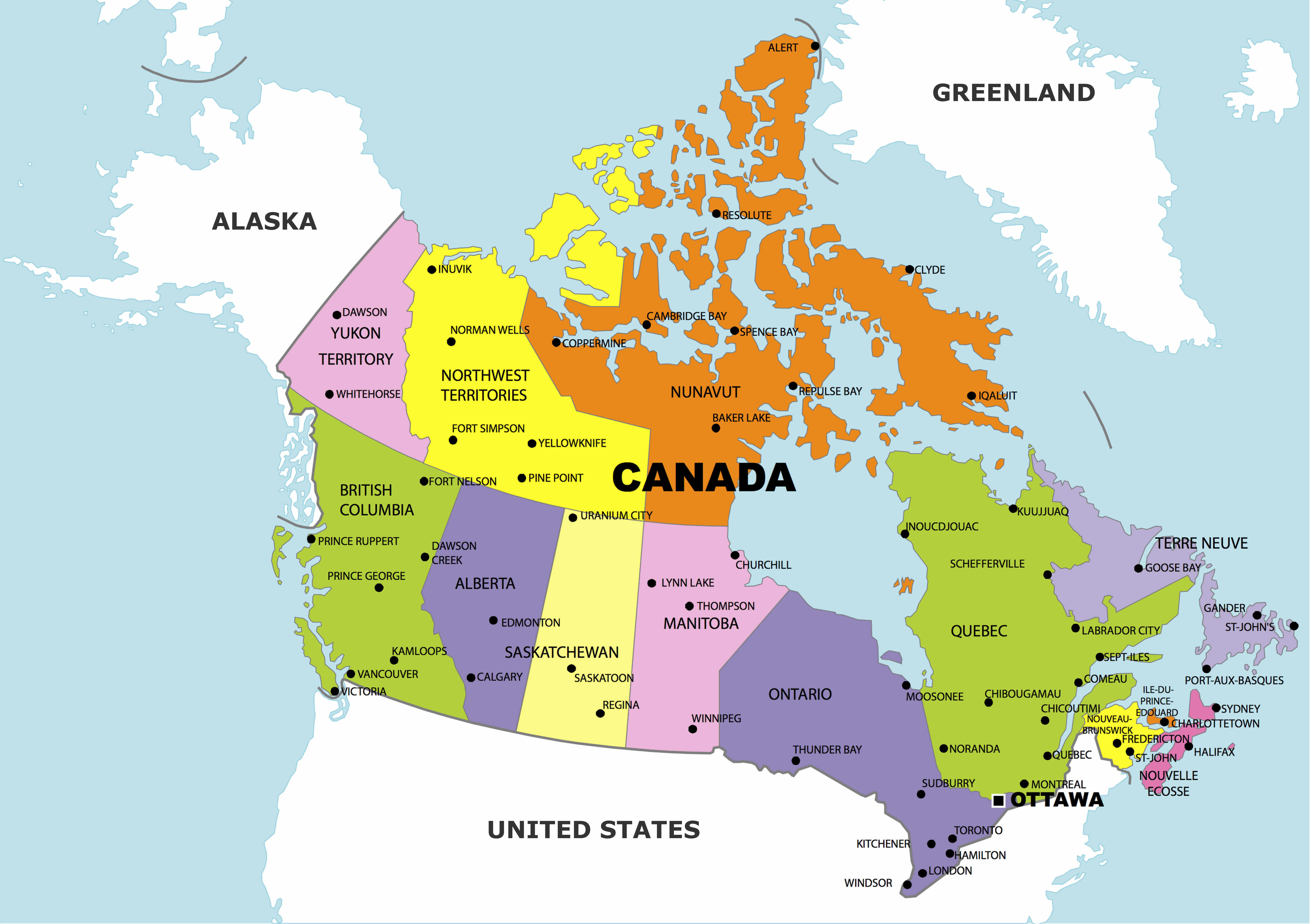
Canada administrative divisions map
The collection also offers a Canada national flag map, Canada physical map, and Canada political map, allowing users to examine the country’s administrative regions, major cities, and diverse terrain in greater detail. Whether for research, study, or general exploration, this map collection delivers a complete visual guide to Canada’s regional structure and geographic features.
Canada detailed road network map
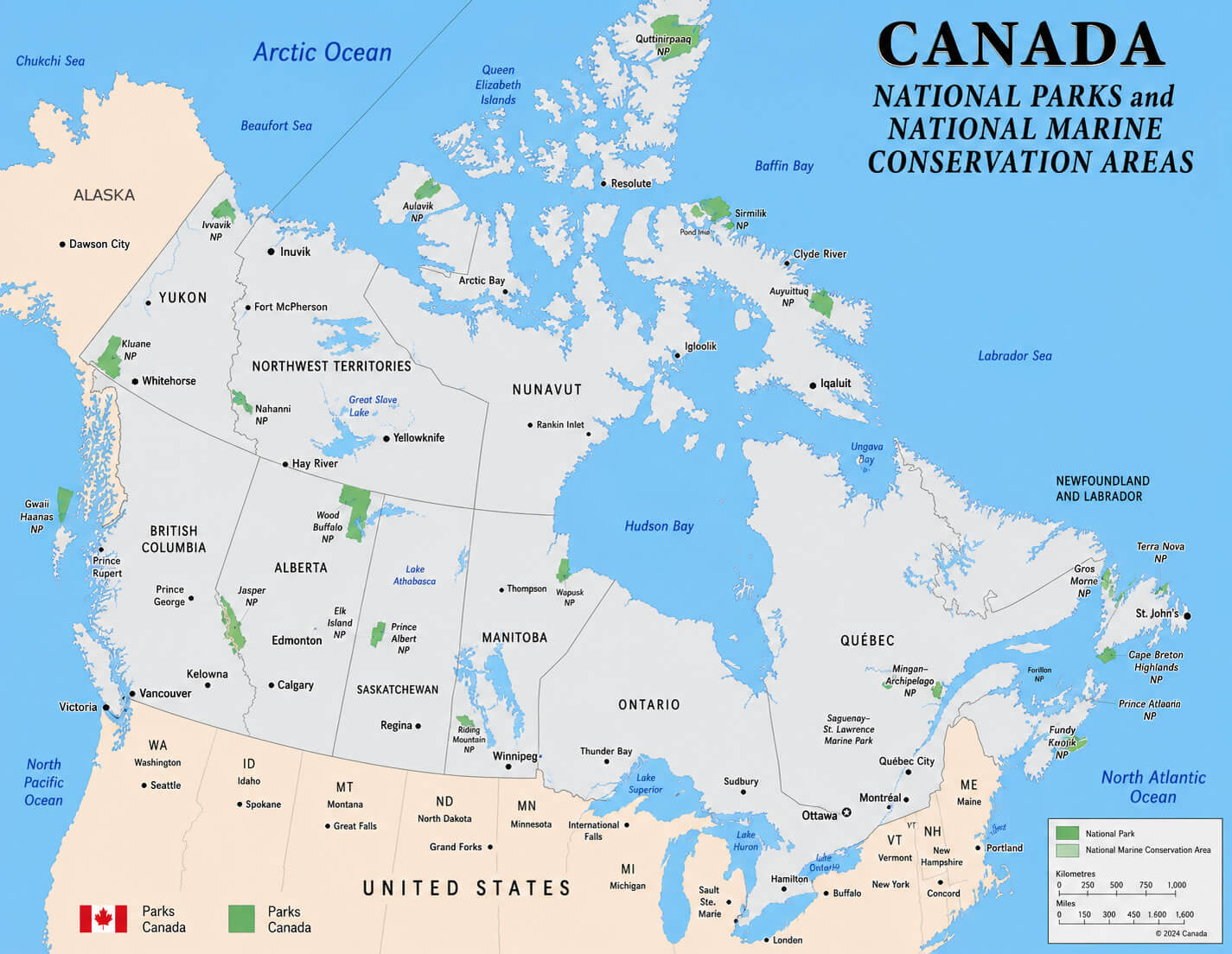
Canada national parks map
Canada major cities map with flag
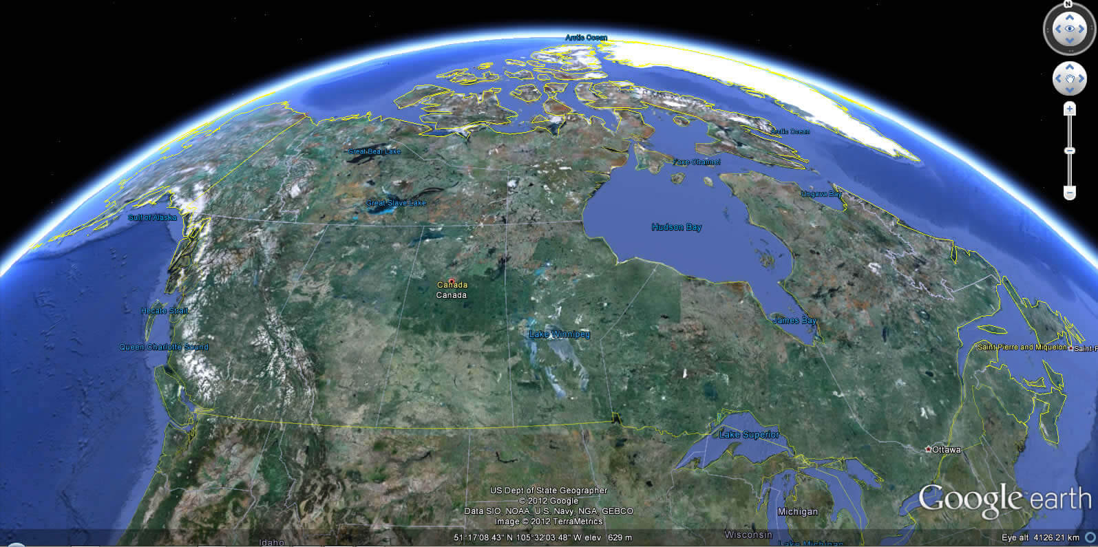
Canada Earth view map
Canada north america location map
Canada physical map with provinces
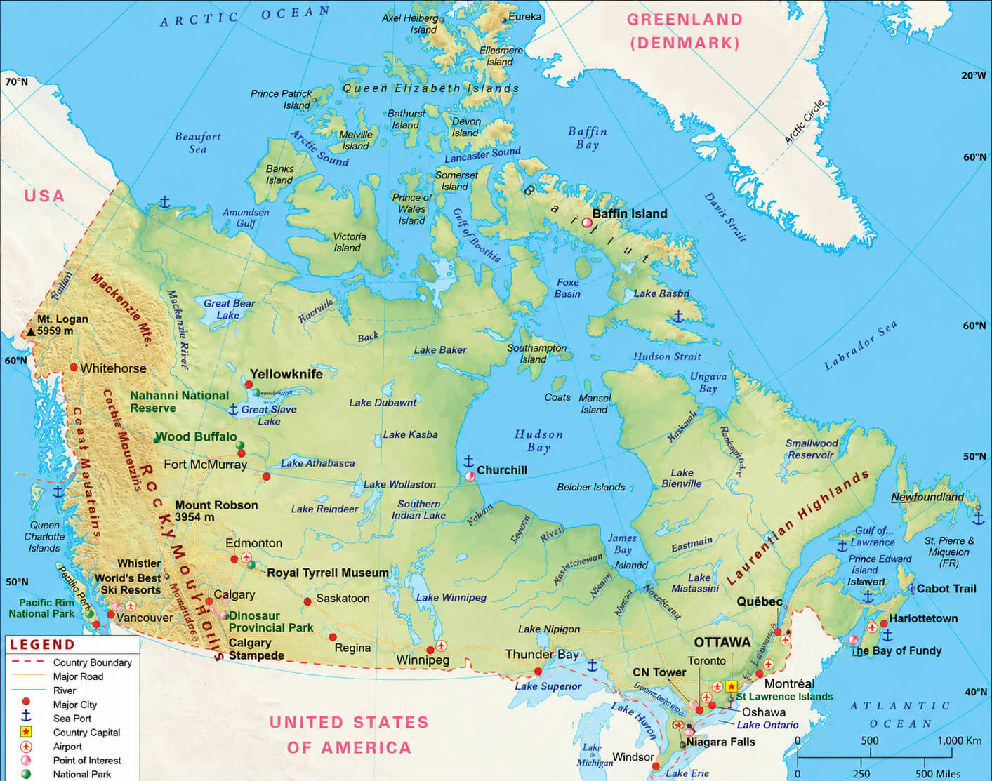
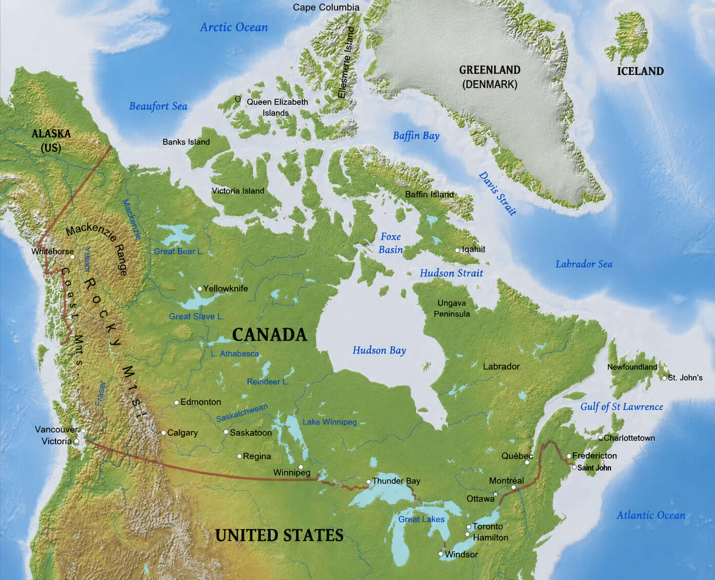
Canada physical relief map
Canada political boundaries map
Canada provinces and states map
Feel free to explore these pages as well:
Copyright Turkey Travel Guide - 2005 - 2026. All rights reserved. Privacy Policy | Disclaimer