Da Nang Map
Navigate Da Nang Map, Da Nang city map, satellite images of Da Nang, Da Nang towns map, political map of Da Nang, driving directions and traffic maps.
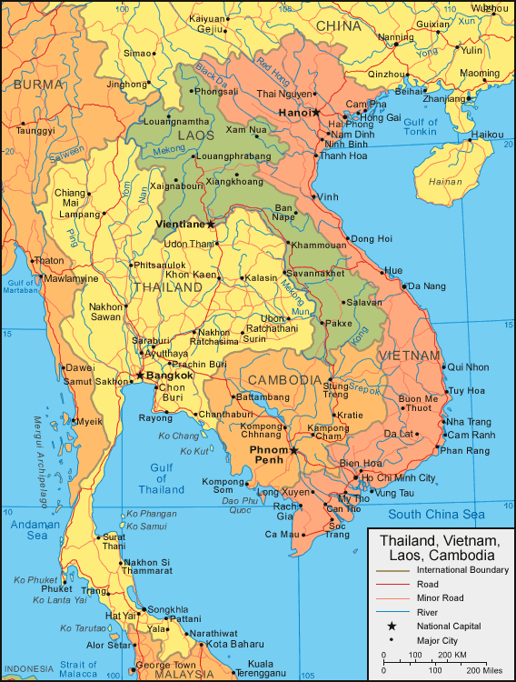
For more >> Vietnam Maps
For more info >> Vietnam
Da Nang Map - Political, Physical, Touristic City Maps and Satellite Images
DA NANG MAP
A Collection of Da Nang and Satellite Images
Da Nang Map
Dive into Vietnam: Ho Chi Minh City's Top 10 Must-See Attractions
Please subscribe on "World Guide" channnel on Youtube at youtube.com/c/WorldGuide
See Also
Da Nang Google Map, Street Views, Maps Directions, Satellite Images
turkey-visit.com offers a collection of Da Nang map, google map, Da Nang atlas, political, physical, satellite view, country infos, cities map and more map of Da Nang.
Largest Cities' Map of Vietnam
Bien Hoa Map Can Tho Map Da Nang Map Haiphong Map Hanoi Map Hue Map Nha Trang Map Phan Thiet Map Qui Nhon Map Ho Chi Minh Map Vinh Map Ba Ria MapCopyright Turkey Travel Guide - 2005 - 2026. All rights reserved. Privacy Policy | Disclaimer