Wisconsin Map
Discover the natural beauty and attractions of Wisconsin with our interactive map. From the rolling hills and forests to the picturesque lakes and vibrant cities, WorldMap1's Wisconsin Map allows you to explore the Badger State in detail. Plan your next adventure or simply satisfy your curiosity with our comprehensive map of Wisconsin.
For all Wisconsin Cities Map
MAP OF WISCONSIN
WISCONSIN CITIES MAP
Brief information about Wisconsin, US
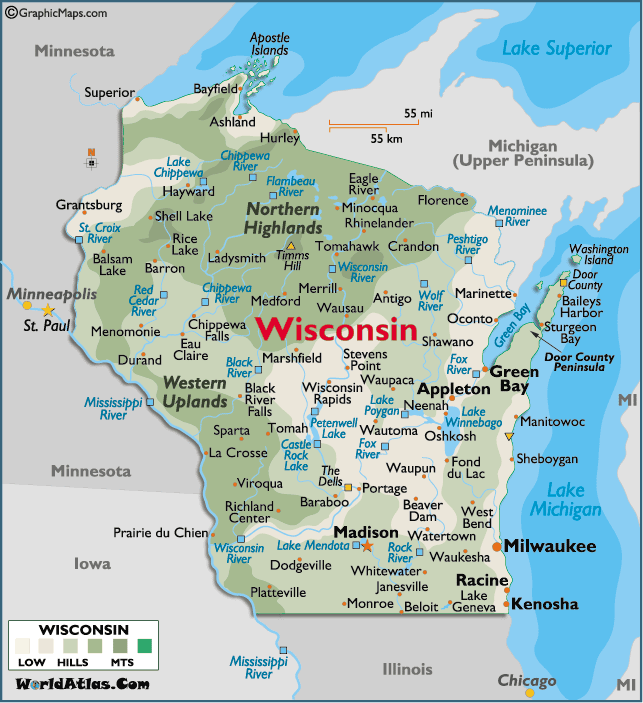
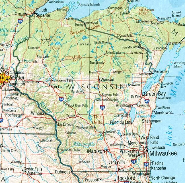
Wisconsin is a state located in the north-central region of the United States. It is known for its picturesque natural beauty, including more than 15,000 lakes and the rolling hills of the Driftless Area. The capital city is Madison, while Milwaukee is the largest city in the state. Wisconsin has a diverse economy, with major industries including manufacturing, agriculture, and tourism. The state is also home to several well-known universities, including the University of Wisconsin-Madison and Marquette University. Wisconsin is famous for its cheese production, and its residents are often referred to as "Cheeseheads".A Collection of Wisconsin Maps and Wisconsin Satellite Images
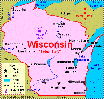
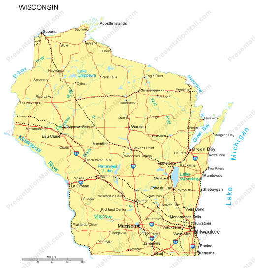
Map Of Wisconsin
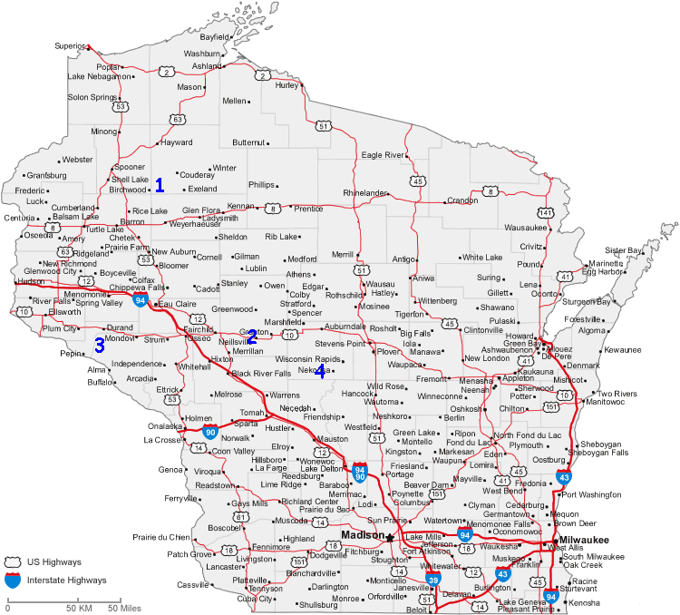
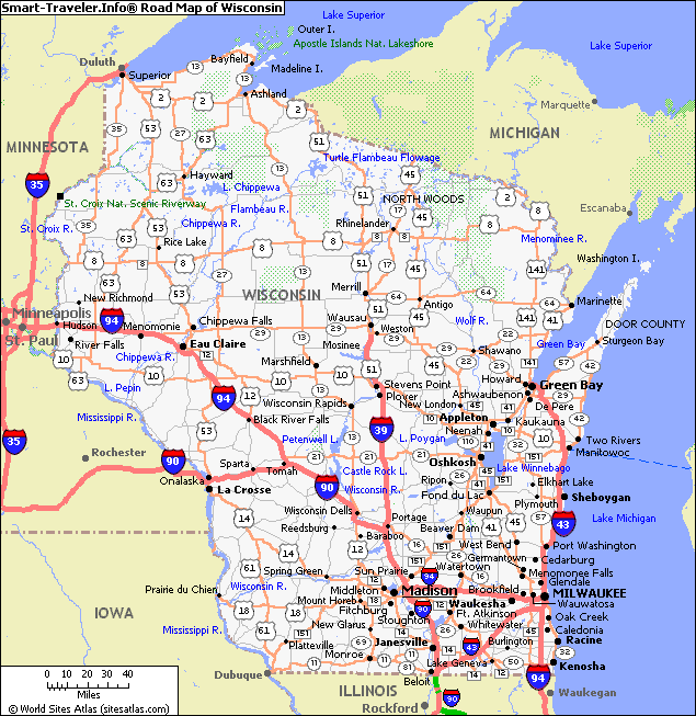
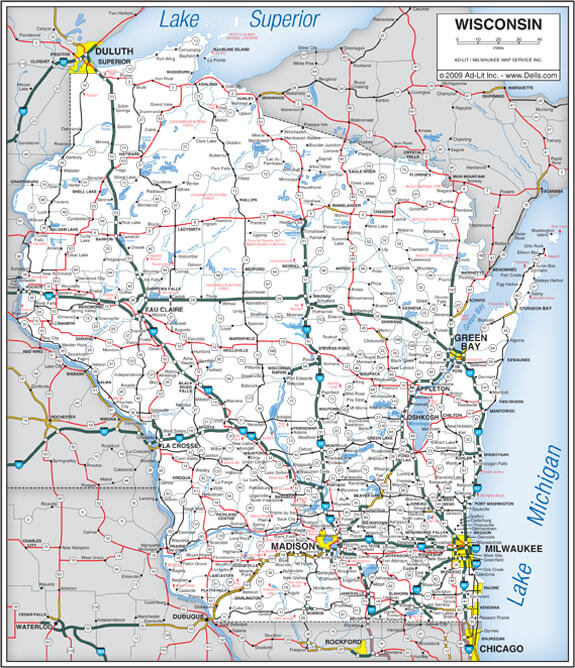
Road Map Of Wisconsin
State Map Of Wisconsin
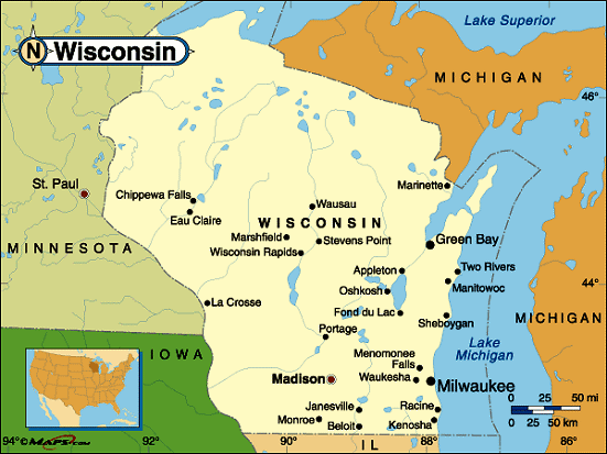
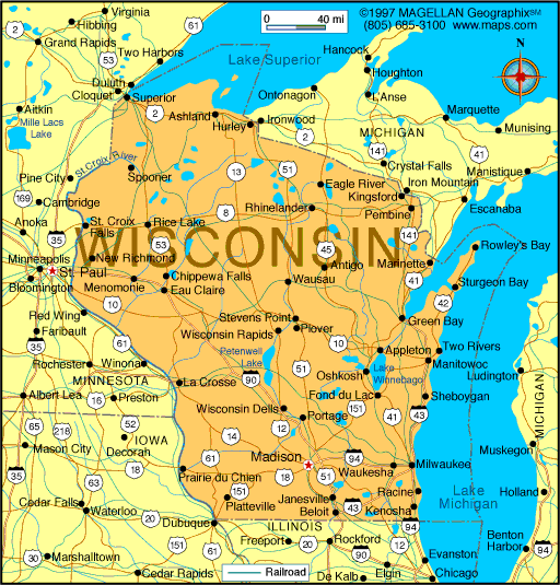
Wisconsin Cities Map
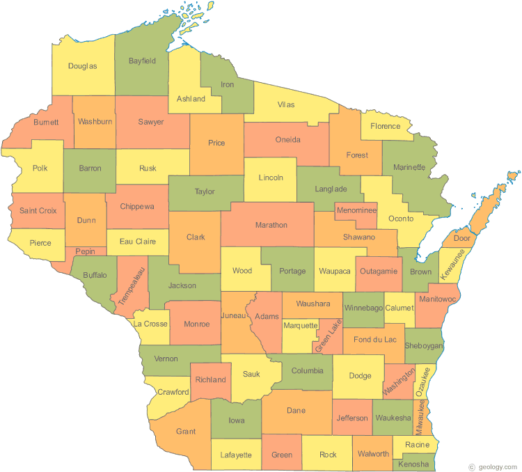
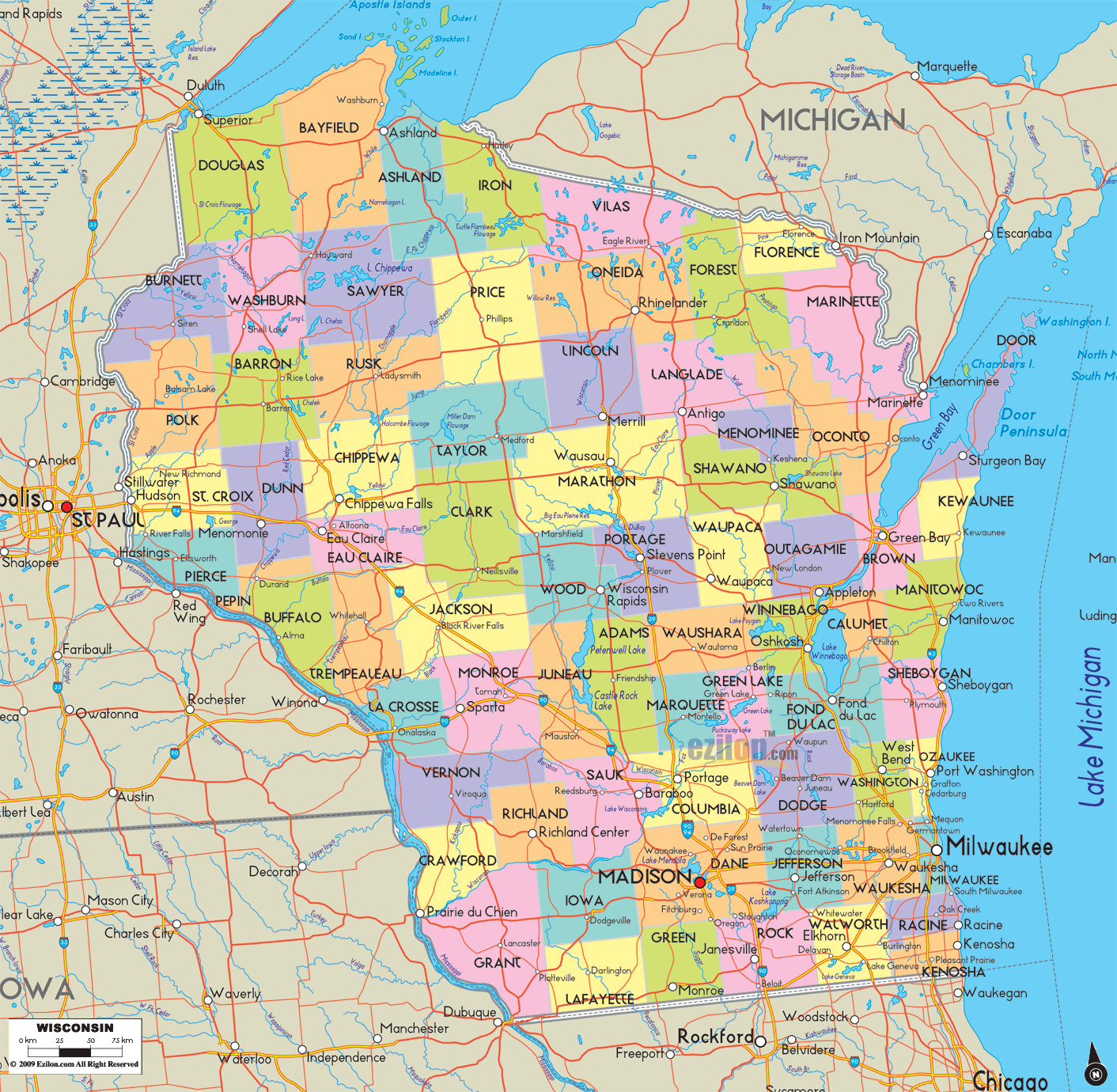
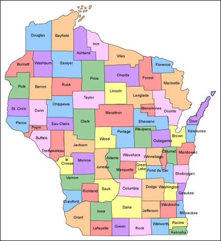
Wisconsin County Map
Wisconsin Map
Wisconsin Maps
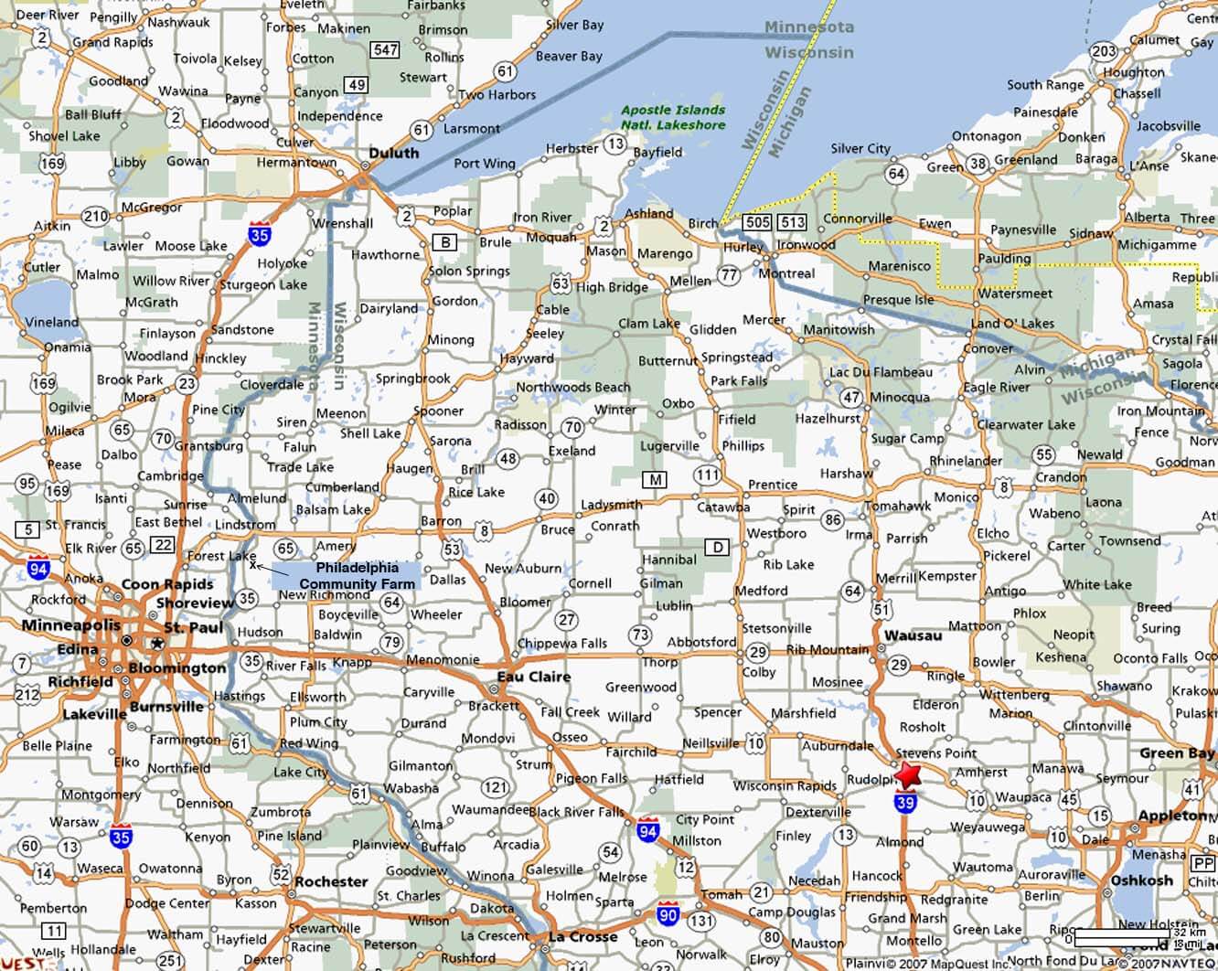
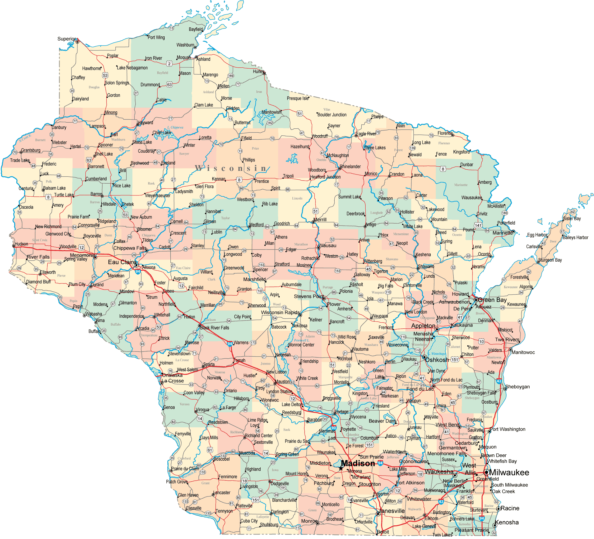
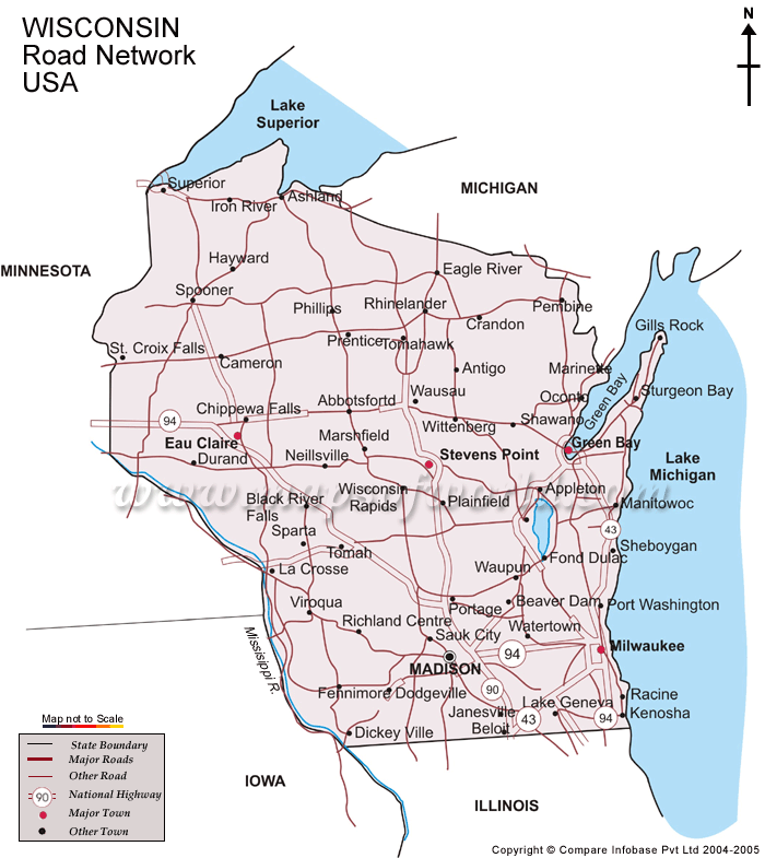
Wisconsin Road Map
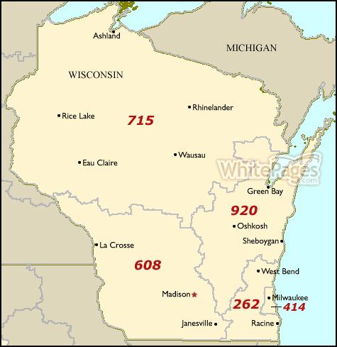
Wisconsin Area Code Map
Wisconsin Atlas 1895

Wisconsin Atlas Map

Wisconsin Cities Map
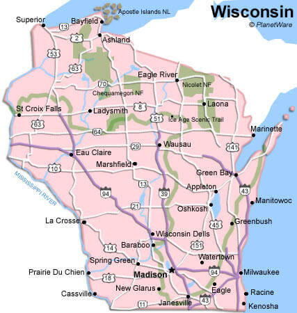
Wisconsin City Map
Wisconsin County Map
Wisconsin Historical Map

Wisconsin Land Map

Wisconsin Map
Wisconsin Map Milwaukee

Wisconsin Maps

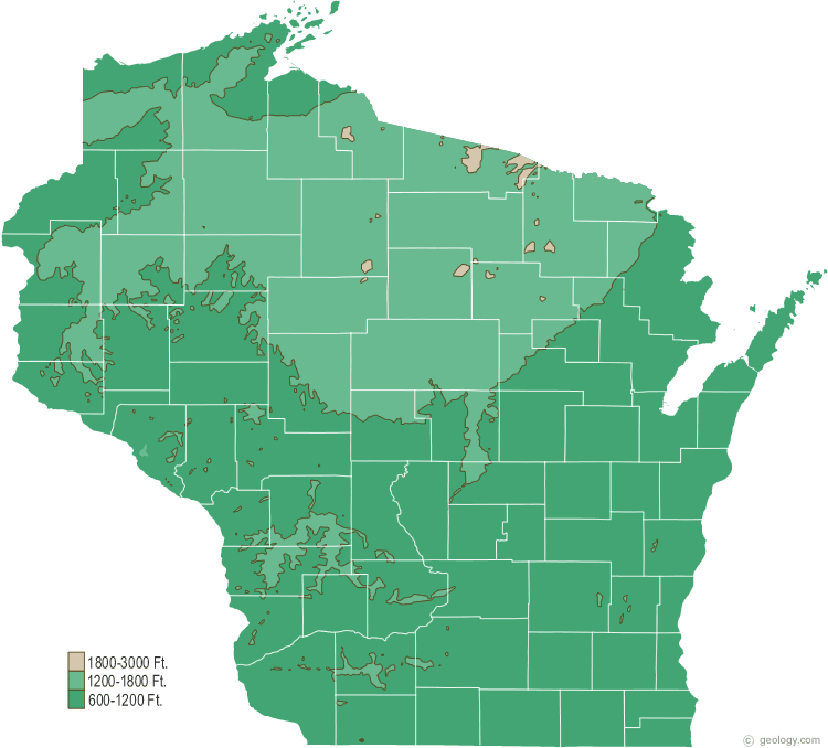
Wisconsin Physical Map

Wisconsin Political Map

Wisconsin Road Map
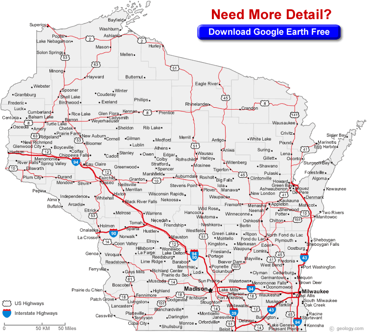
Wisconsin Route Map

Wisconsin Satellite Map

Wisconsin State Map

A collection of Wisconsin Maps


Largest Cities Map of Wisconsin and Population
Milwaukee Map - 594,833 Madison Map - 233,209 Green Bay Map - 104,057 Kenosha Map - 99,218 Racine Map - 78,860 Appleton Map - 72,623 Waukesha Map - 70,718 Oshkosh Map - 66,083 Eau Claire Map - 65,883 Janesville Map - 63,575 West Allis Map - 60,411 La Crosse Map - 51,320 Sheboygan Map - 49,288 Wauwatosa Map - 46,396 Fond du Lac Map - 43,021Copyright Turkey Travel Guide - 2005 - 2026. All rights reserved. Privacy Policy | Disclaimer