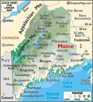
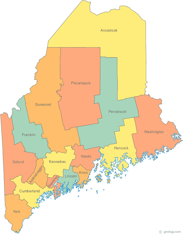
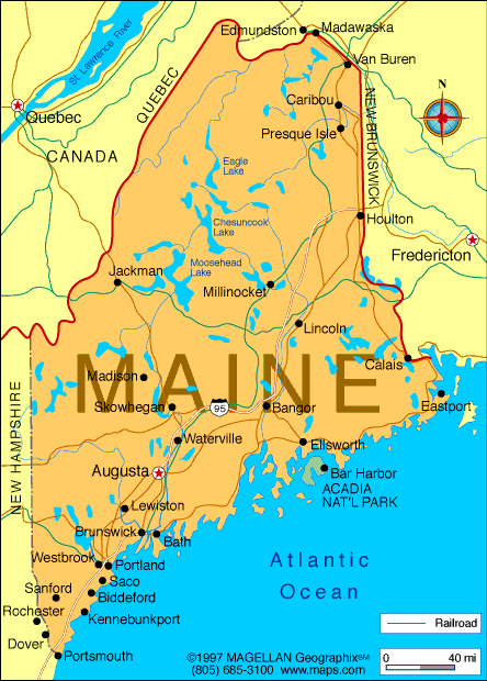
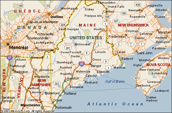
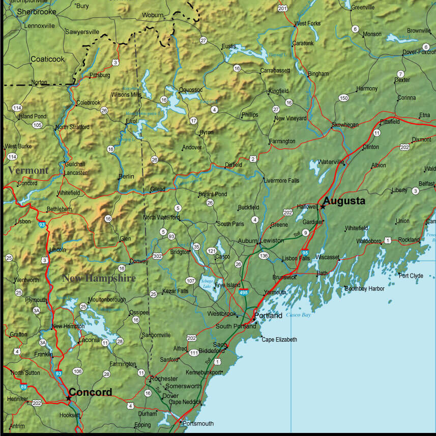
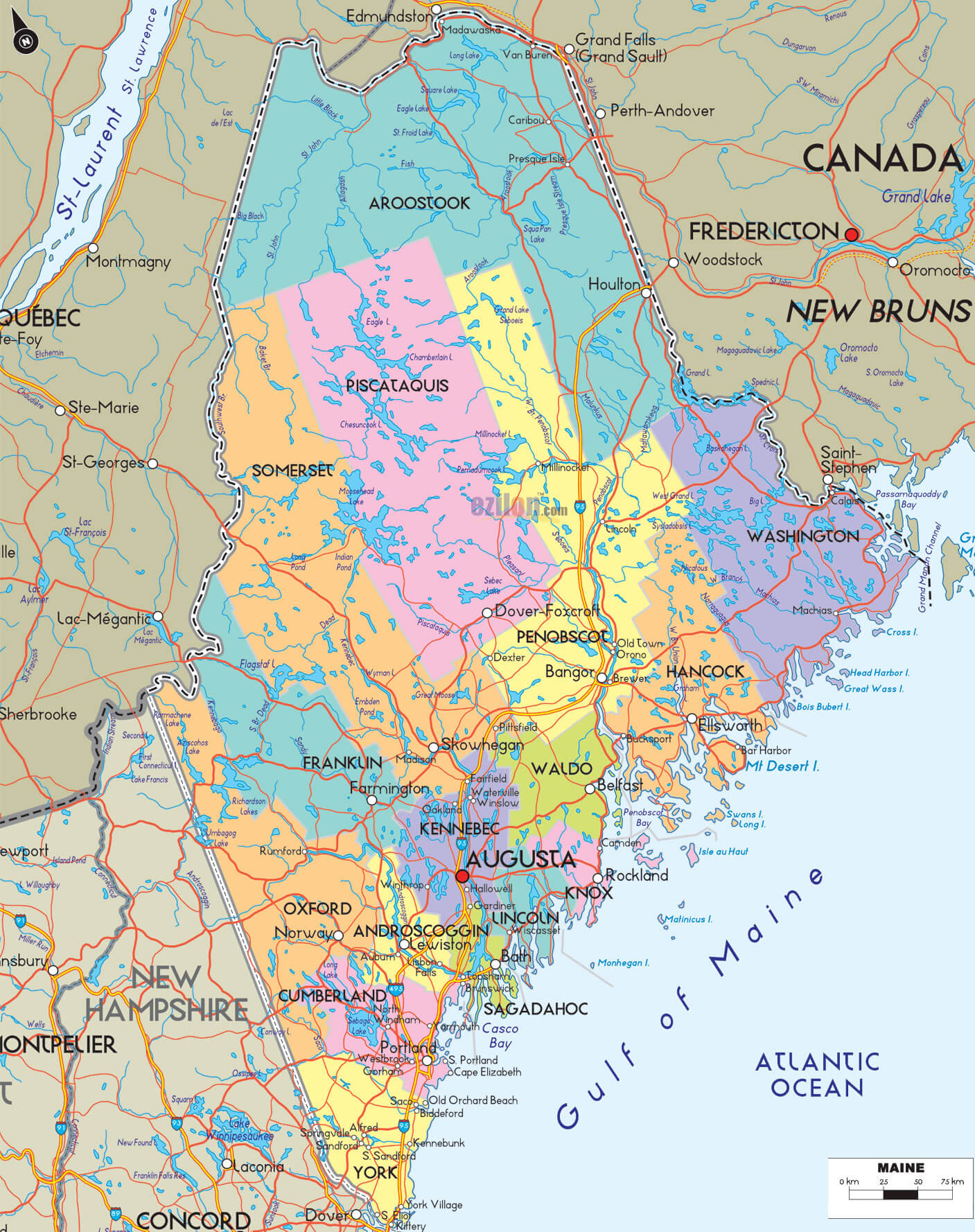
Maine Map
Navigate Maine map, Maine state map, satellite images of the Maine, Maine largest cities maps, political map of Maine, driving directions and traffic maps. Explore Maine's rich history, its 16 counties, and the major cities of Portland, Bangor, and Augusta. With our easy-to-use map, you can plan your trip to Maine or simply learn more about this beautiful state.
For all Maine Cities Map
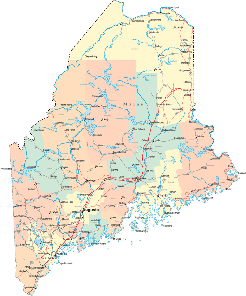
MAP OF MAINE
MAINE CITIES MAP
Brief information about Maine, US
Maine is a state located in the northeastern region of the United States. The state is known for its rocky coastline, dense forests, and abundant seafood.Area:
Maine is the 41st largest state in the United States, with a total area of 35,385 square miles (91,646 square kilometers). It is the easternmost state in the contiguous United States.Population:
As of 2020, the estimated population of Maine was 1.3 million people. The largest city in the state is Portland, with a population of approximately 66,000 people.Demographics:
Maine's population is predominantly white, with a significant Native American population as well. According to the U.S. Census Bureau, as of 2019, the racial and ethnic makeup of Maine's population was as follows:- White: 94.3%
- Black or African American: 1.4%
- American Indian and Alaska Native: 1.1%
- Asian: 1.9%
- Two or more races: 1.4%
History:
Maine was first settled by Europeans in the early 1600s, with the French and English both claiming territory in the area. Maine was part of Massachusetts until it gained statehood in 1820 as part of the Missouri Compromise. Maine played an important role in the American Civil War, with many of its soldiers fighting for the Union. The state has a rich maritime history, with fishing and shipbuilding playing important roles in its economy and culture.Economy:
Maine's economy is diverse, with industries such as tourism, manufacturing, and healthcare playing important roles. The state is a popular tourist destination, with attractions such as Acadia National Park, the Portland Head Light, and the Maine Maritime Museum drawing visitors from around the world. The manufacturing industry in Maine is focused on products such as paper, wood products, and food processing. Healthcare is also a major industry, with several large healthcare systems operating in the state. The state is also known for its lobster industry, which is a major contributor to the state's economy.A Collection of Maine Maps and Maine Satellite Images
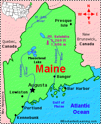
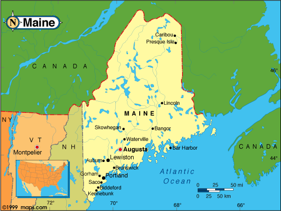
Map Of Maine
Maine Map Usa
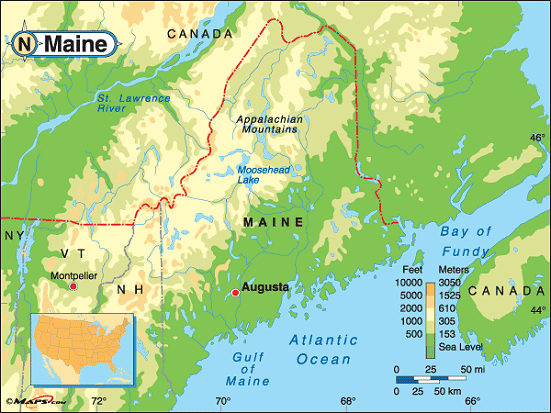
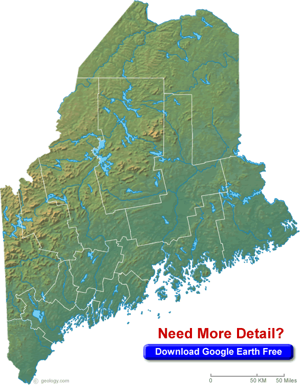
Maine Blank Physical Map
Maine Cities Map
Maine City Map
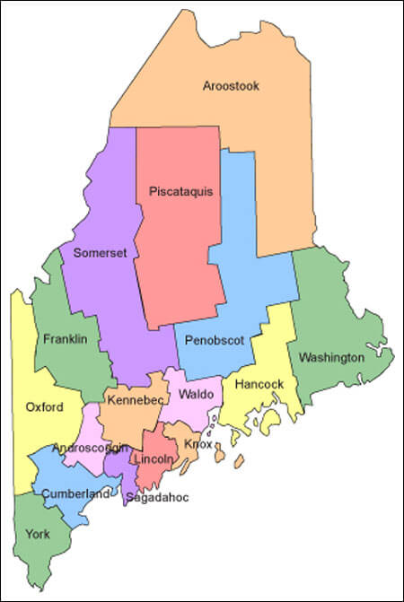
Maine Counties Map
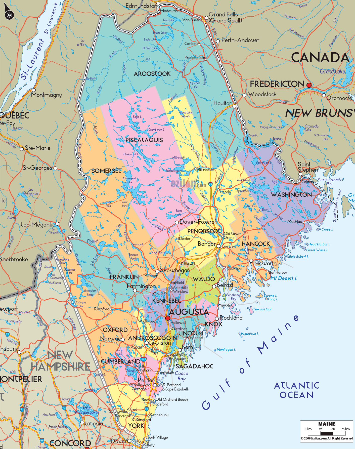
Maine County Map
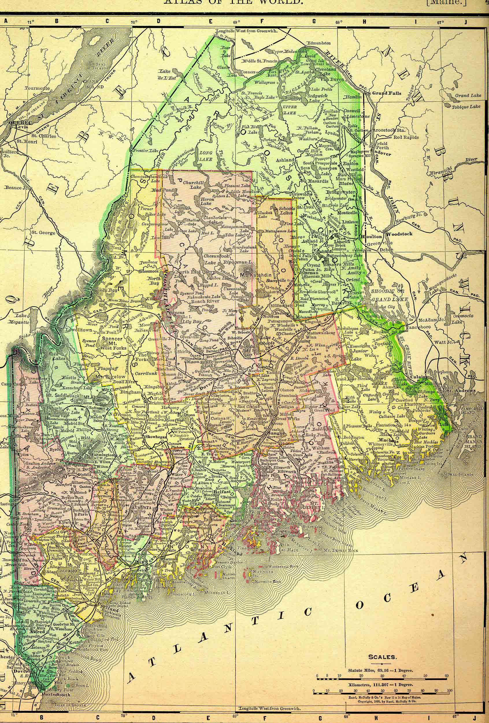
Maine Historical Map 1895
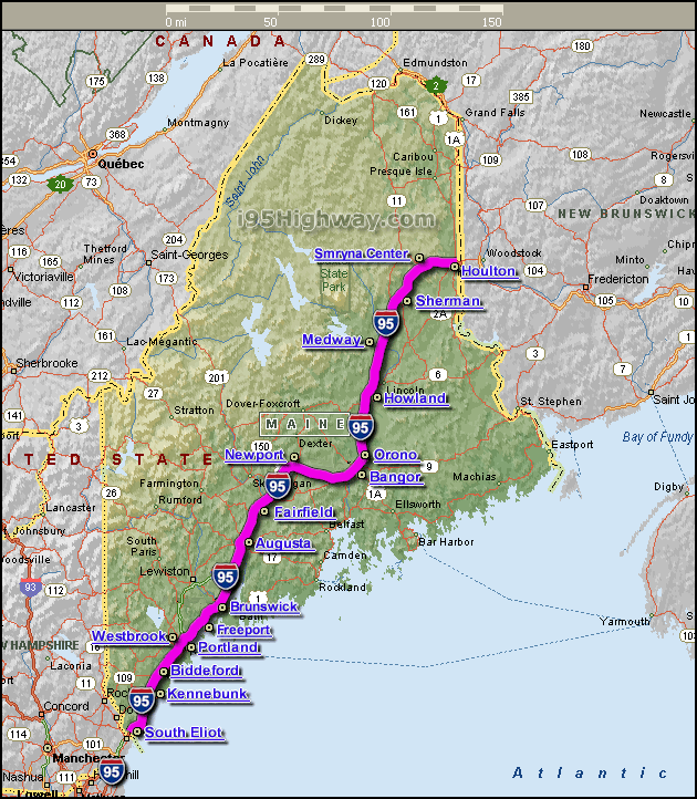
Maine Map Interstate 95
Maine Map Usa
Maine Map With Counties
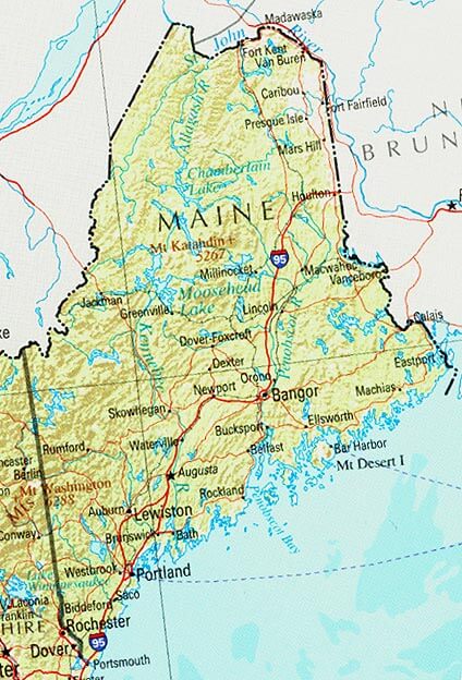
Maine Physical Map
Maine Political Map
Maine State Map
Physical Map Of Maine
State Of Maine Map

A collection of Maine Maps
Largest Cities Map of Maine and Population
Portland Map - 66,194 Lewiston Map - 36,592 Bangor Map - 33,039 South Portland Map - 25,002 Auburn Map - 23,055 Biddeford Map - 21,277 Augusta Map - 19,136 Saco Map - 18,482 Westbrook Map - 17,494 Waterville Map - 15,722 Brunswick Map - 15,175 Sanford Map - 9,761 Presque Isle Map - 9,692 Brewer Map - 9,482 Orono Map - 9,474Copyright Turkey Travel Guide - 2005 - 2026. All rights reserved. Privacy Policy | Disclaimer