Wyoming Map
Navigate Wyoming map, Wyoming state map, satellite images of the Wyoming, Wyoming largest cities maps, political map of Wyoming, driving directions and traffic maps.
For all Wyoming Cities Map
MAP OF WYOMING

WYOMING MAPS
Brief information about Wyoming, US
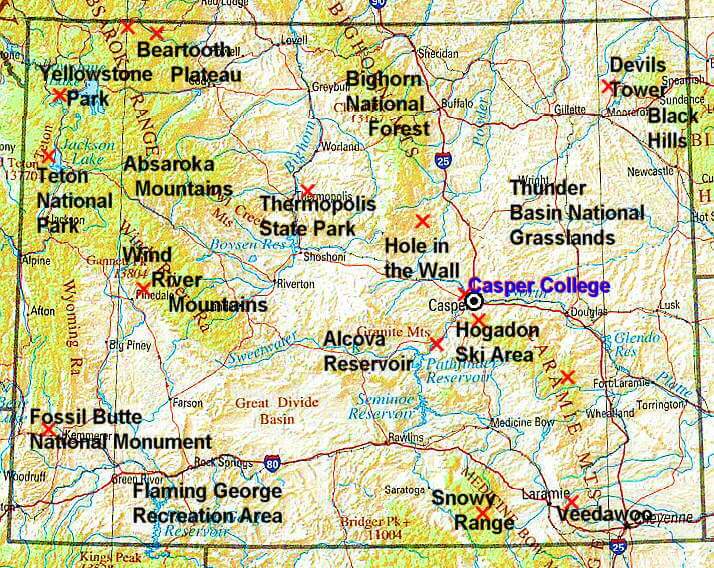
Wyoming is a state located in the western region of the United States. It is the 10th largest state by area and the least populous state in the country, with a population of just over 570,000 people. Wyoming is known for its diverse landscapes, ranging from the Rocky Mountains to high plains, deserts, and forests.A Collection of Wyoming Maps and Wyoming Satellite Images
Map Of Wyoming
Map Of Wyoming

Wyoming Map

Wyoming Maps
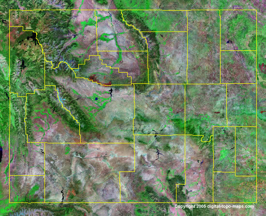
Wyoming Satellite Map
Wyoming City Map

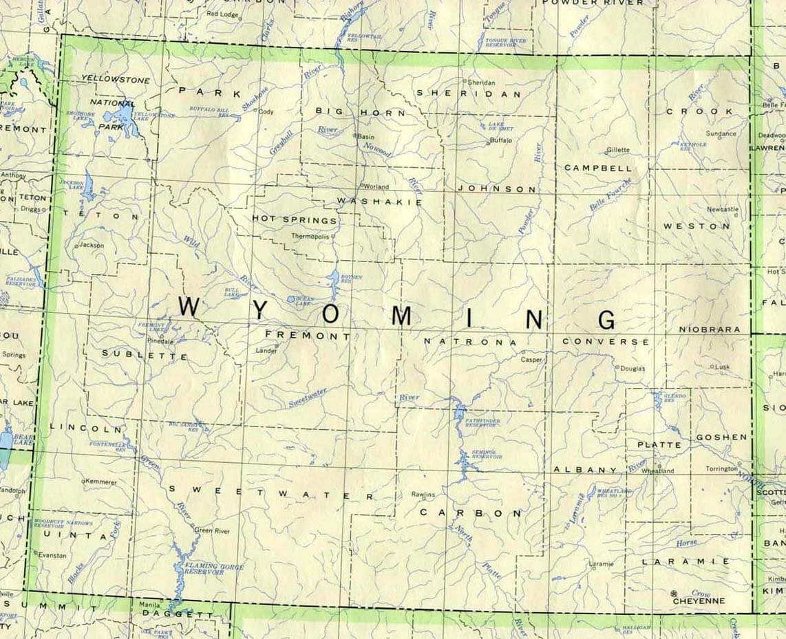
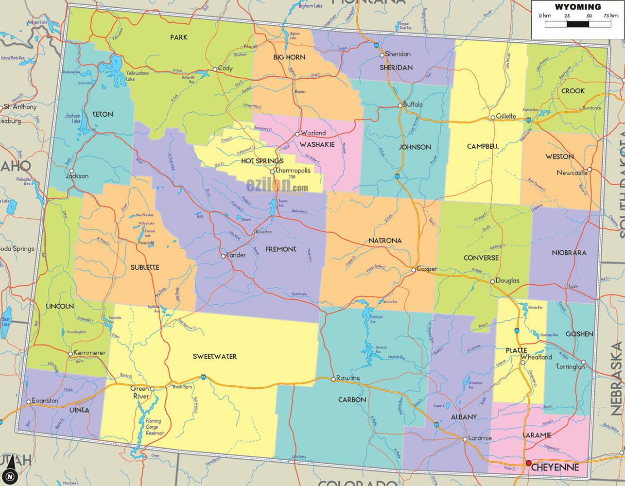
Wyoming County Map

Wyoming Elevation Map

Wyoming Historical Map
Wyoming Map

Wyoming Map Casper

Wyoming Maps
Wyoming National Park Map
Wyoming Physical Map
Wyoming Reference Map

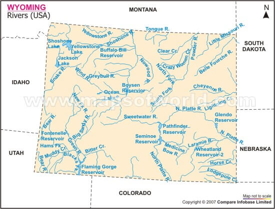
Wyoming River Map
Wyoming Road Map

A collection of Wyoming Maps
Largest Cities Map of Wyoming and Population
Cheyenne Map - 59,466 Casper Map - 55,316 Laramie Map - 30,816 Gillette Map - 29,087 Rock Springs Map - 23,036 Sheridan Map - 17,444 Green River Map - 12,515 Evanston Map - 12,359 Riverton Map - 10,615 Jackson Map - 9,577 Cody Map - 9,520 Rawlins Map - 9,259 Lander Map - 7,487 Torrington Map - 6,501 Powell Map - 6,314 Washington DC Map - 0Copyright Turkey Travel Guide - 2005 - 2026. All rights reserved. Privacy Policy | Disclaimer