Ohio Map
Navigate Ohio map, Ohio state map, satellite images of the Ohio, Ohio largest cities maps, political map of Ohio, driving directions and traffic maps. Explore Ohio's major cities like Columbus, Cleveland, and Cincinnati, or discover hidden gems like Hocking Hills State Park or the Rock and Roll Hall of Fame. Start exploring now!
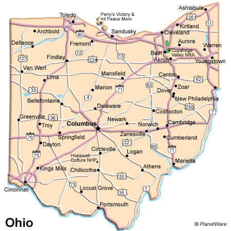
Our detailed Ohio map allows you to explore the state's cities, counties, and attractions with ease. Whether you're planning a road trip, studying geography, or simply curious about the state, our map provides a comprehensive overview of Ohio's geography. From the bustling cities of Columbus, Cleveland, and Cincinnati to the natural beauty of Hocking Hills State Park and Cuyahoga Valley National Park, Ohio has something to offer everyone. So start exploring and discover all that the Buckeye State has to offer!
For all Ohio Cities Map
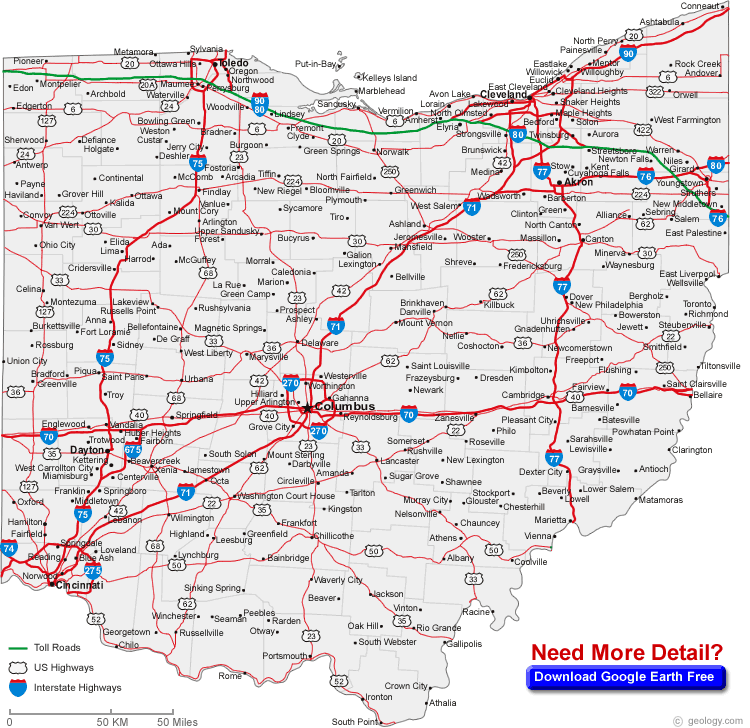
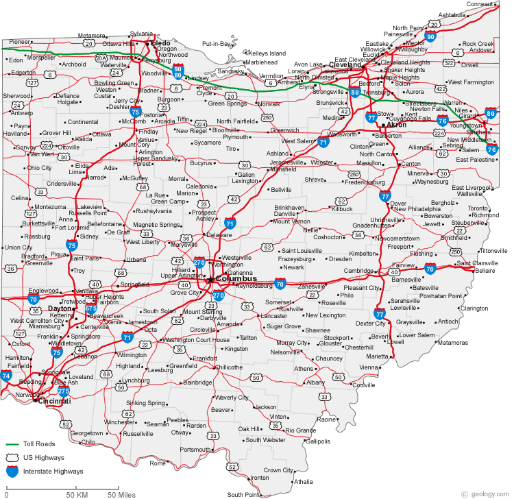
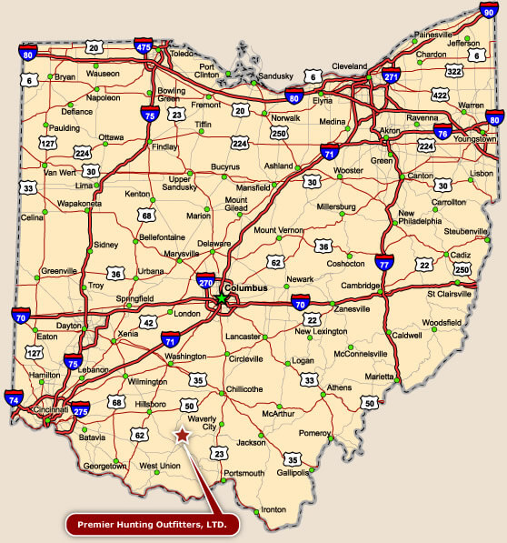
MAP OF OHIO
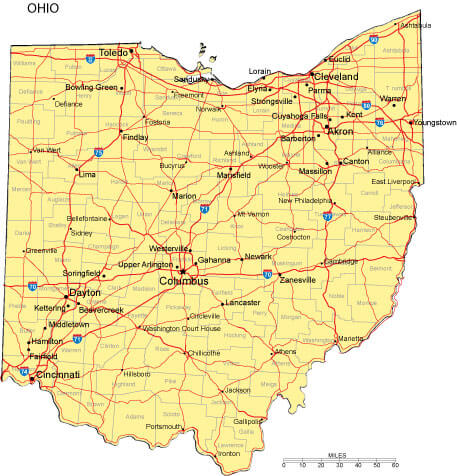
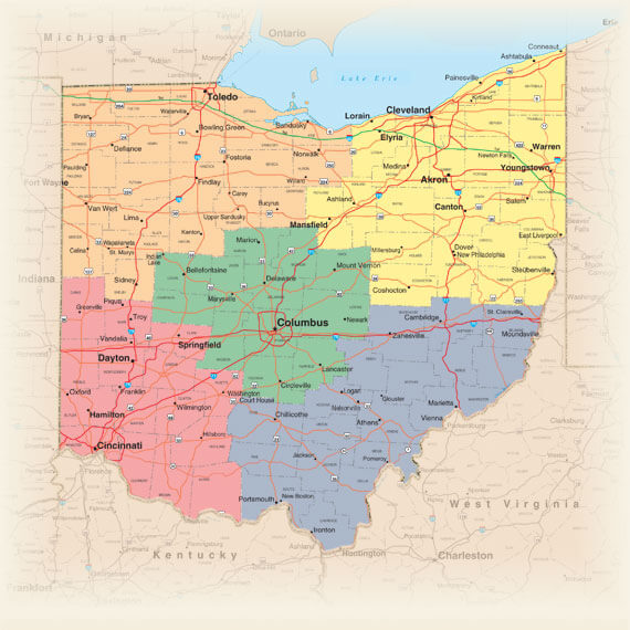
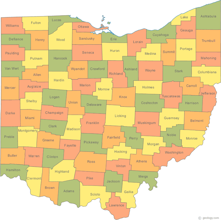
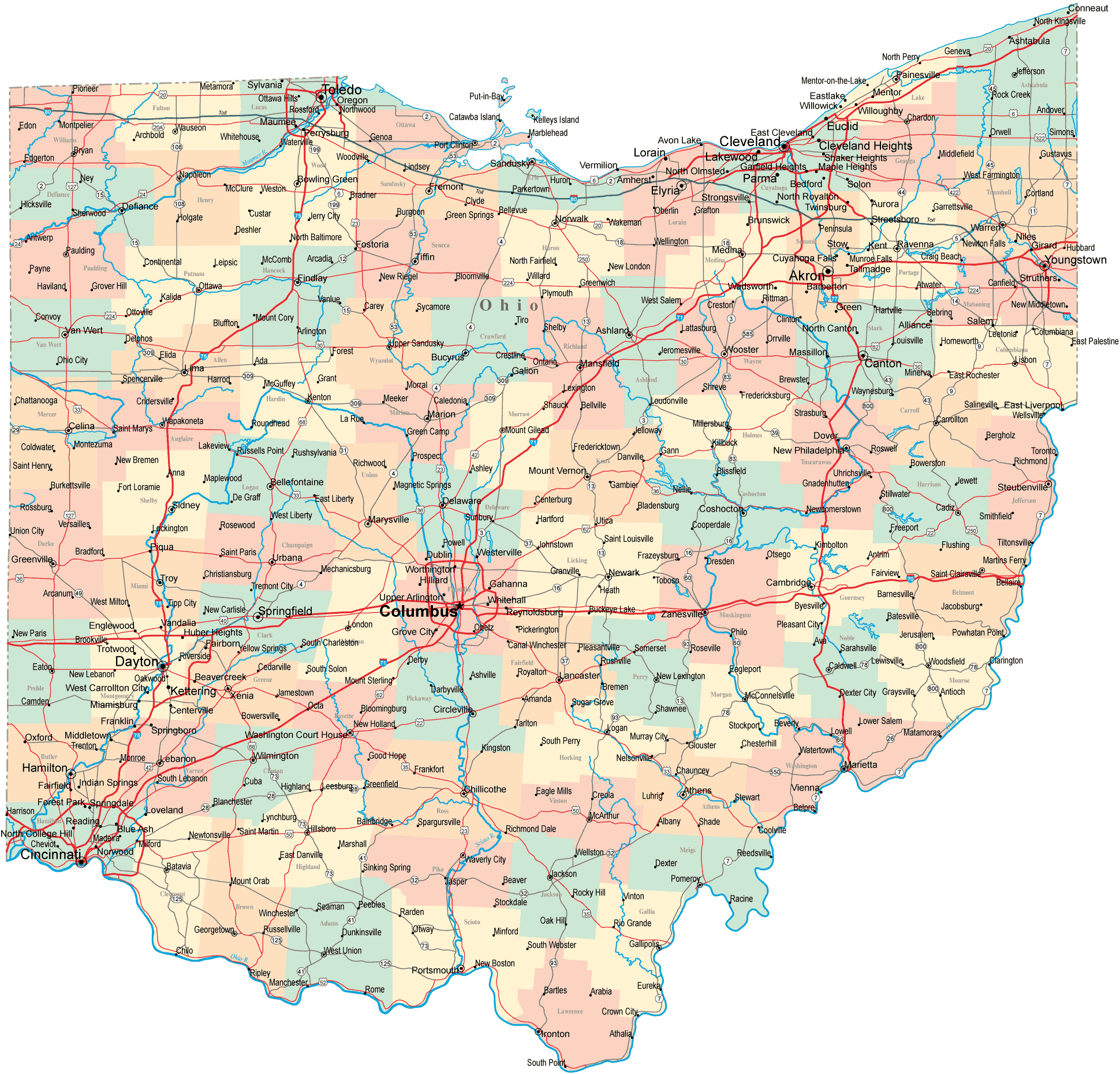
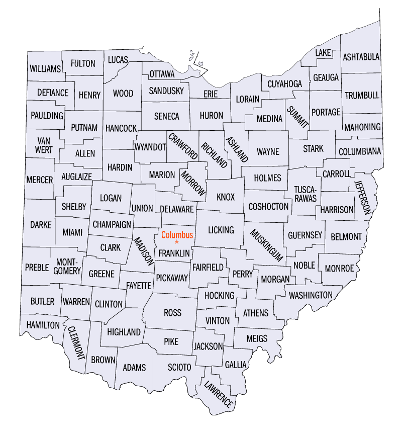
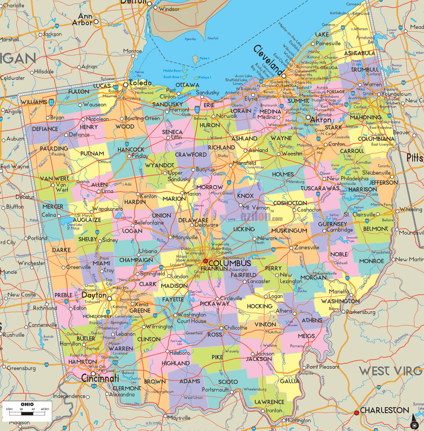
COUNTIES MAP OF OHIO
Brief information about Ohio, US
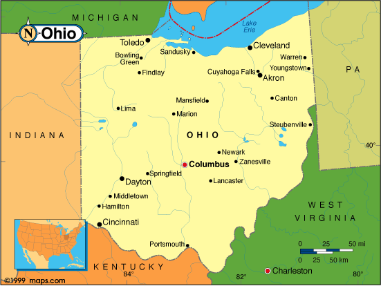
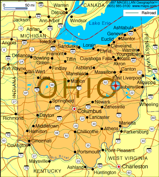
Ohio is a state located in the Midwestern region of the United States. It is bordered by Michigan to the north, Pennsylvania to the east, West Virginia to the southeast, Kentucky to the southwest, and Indiana to the west. Ohio has a diverse economy with industries including manufacturing, healthcare, education, and agriculture.A Collection of Ohio Maps and Ohio Satellite Images
Map Of Ohio
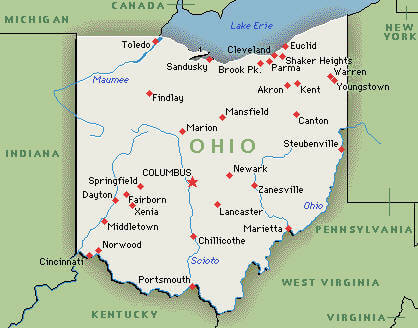
Cities Map Of Ohio
Cities Map Of Ohio
Counties Map Of Ohio
Map Of Ohio Cities
Map Ohio
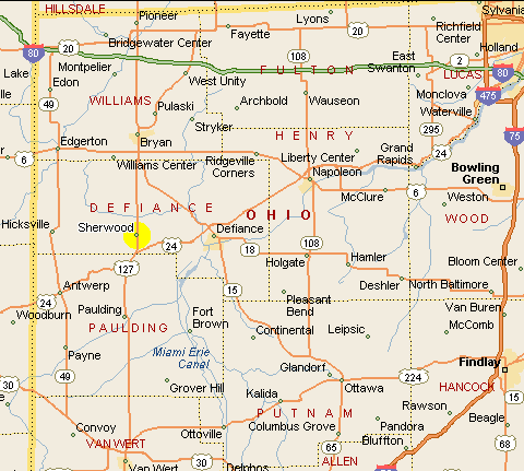
North West Ohio Map
Ohio County Map
Ohio Map
Ohio Map
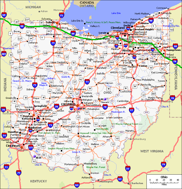
Ohio Road Map
Ohio State Map
Ohio Cities Map
Ohio Counties Map
Ohio Map
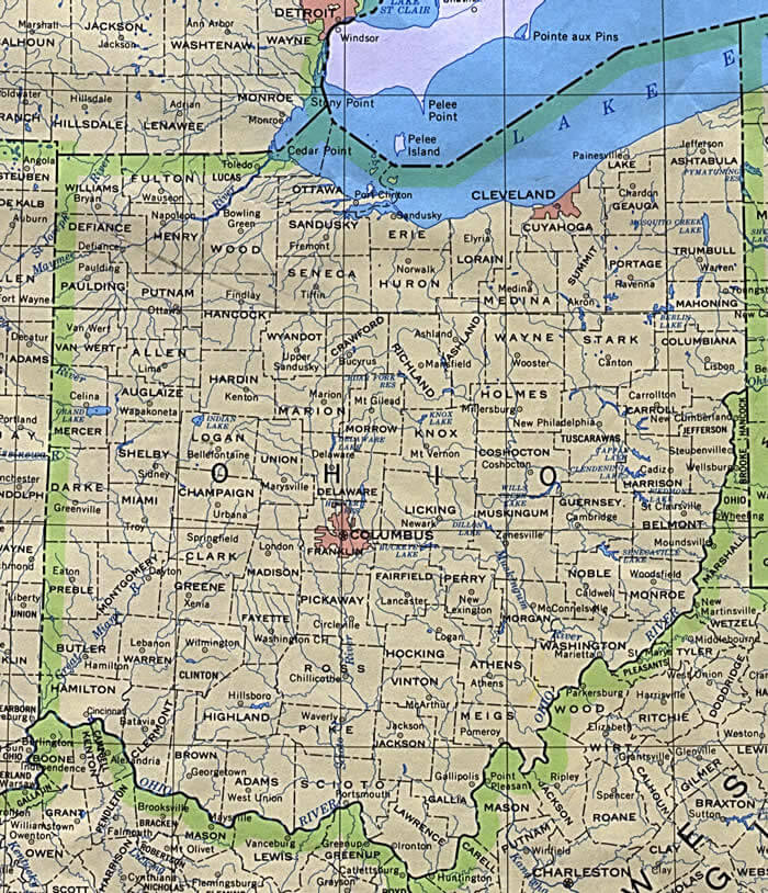
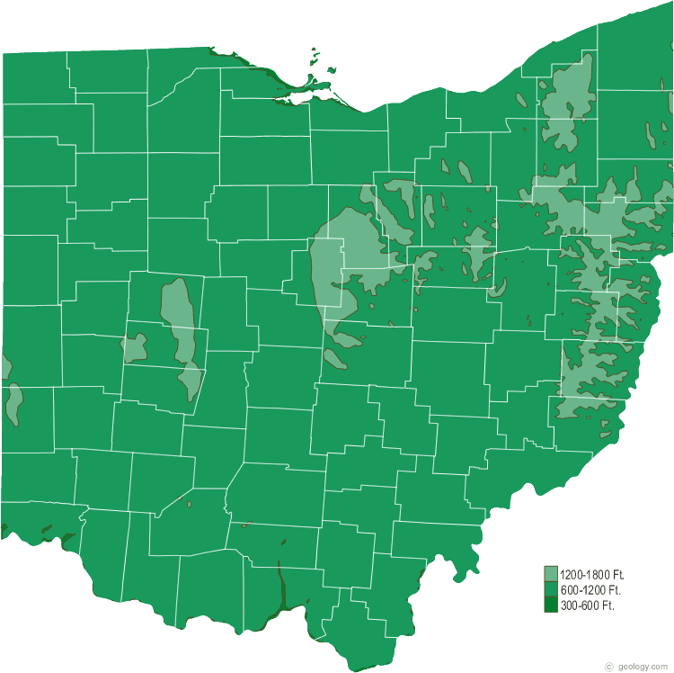
Ohio Physical Map
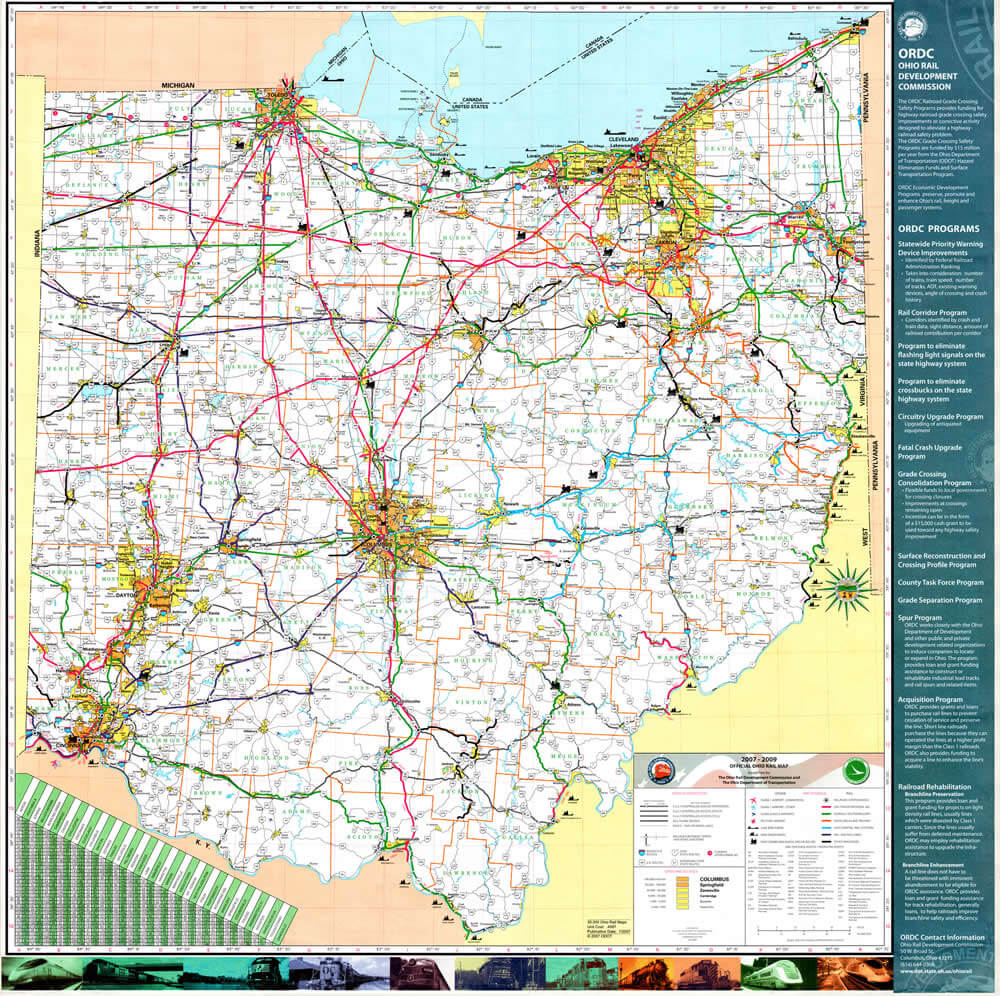
Ohio Rail Map
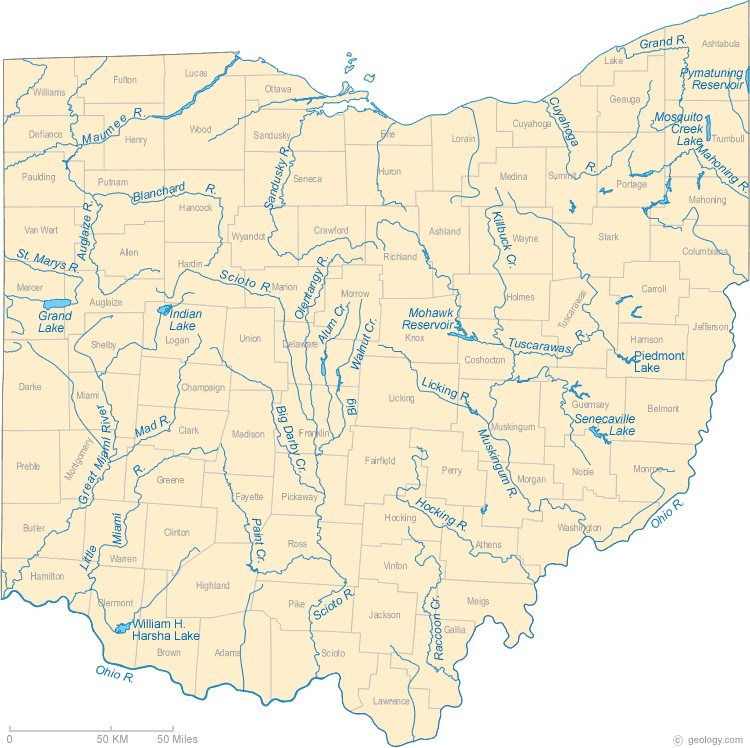
Ohio Rivers Map
Ohio Road Map
Ohio State Map
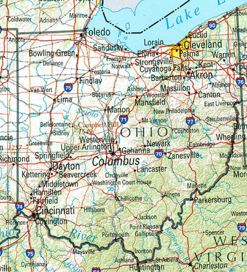
Road Map Of Ohio
A collection of Ohio Maps
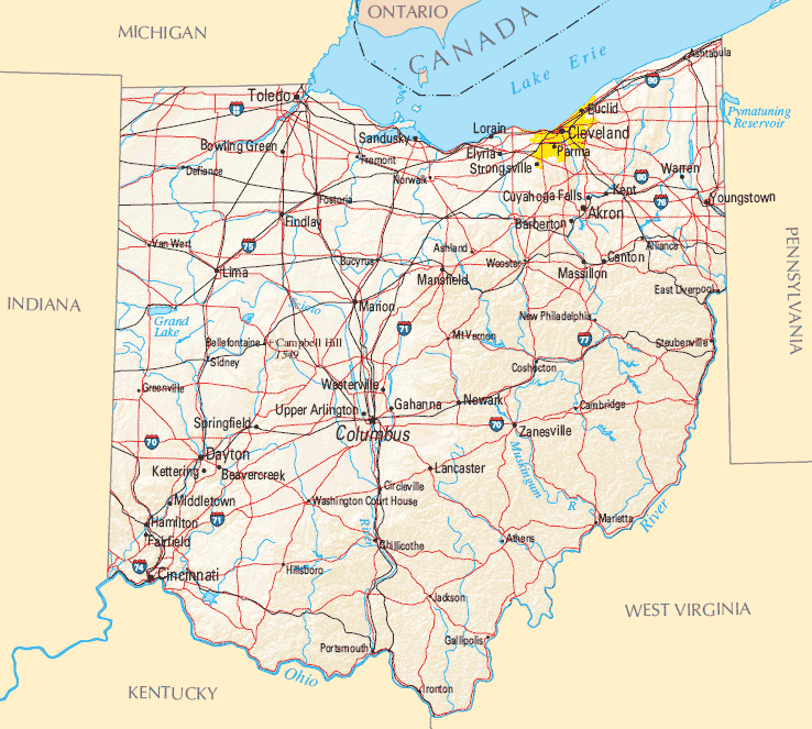
Largest Cities Map of Ohio and Population
Columbus Map - 787,033 Cleveland Map - 396,815 Cincinnati Map - 296,943 Toledo Map - 287,208 Akron Map - 199,110 Dayton Map - 141,527 Parma Map - 81,601 Canton Map - 73,007 Youngstown Map - 66,982 Lorain Map - 64,097 Hamilton Map - 62,477 Springfield Map - 60,608 Kettering Map - 56,163 Elyria Map - 54,533 Lakewood Map - 52,131 Cuyahoga Falls Map - 49,652 Euclid Map - 48,920 Middletown Map - 48,694 Mansfield Map - 47,821 Newark Map - 47,573Copyright Turkey Travel Guide - 2005 - 2026. All rights reserved. Privacy Policy | Disclaimer