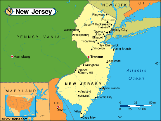
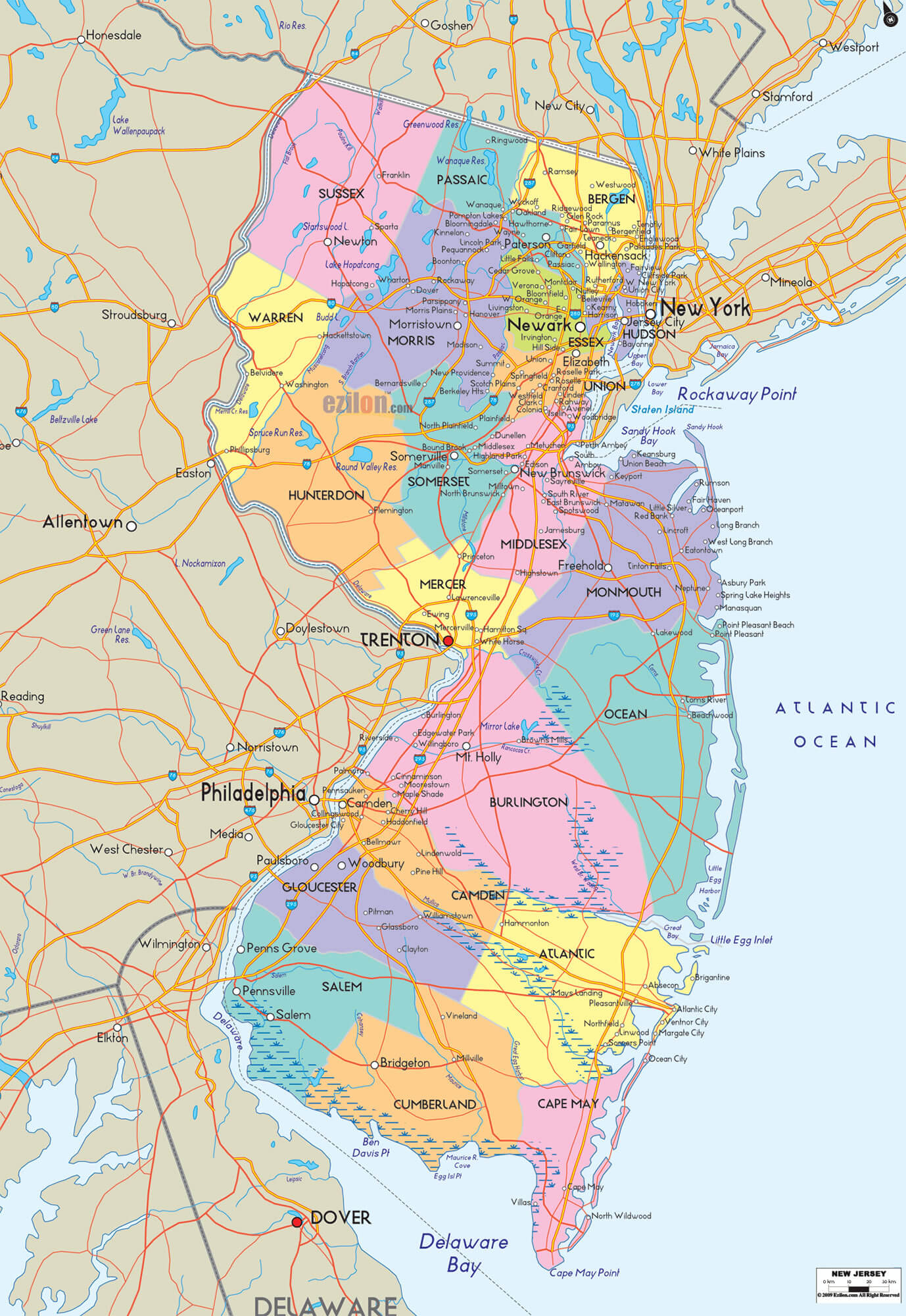
New Jersey Map
Explore the attractions and destinations of New Jersey with turkey-visit.com's comprehensive map of the Garden State. From the beaches of the Jersey Shore to the iconic sights of Atlantic City and the historic landmarks of Princeton, our interactive map provides a detailed overview of major highways, cities, and points of interest throughout New Jersey. Whether you're a tourist planning a trip or a local resident exploring your state, our map can help you discover the best of what New Jersey has to offer. Let's get started and discover the beauty and excitement of New Jersey!
For all New Jersey Cities Map
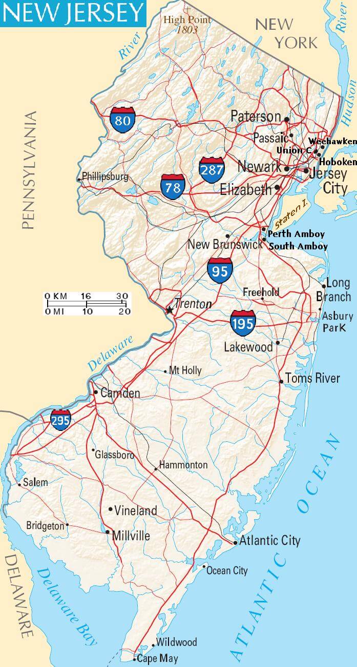
MAP OF NEW JERSEY
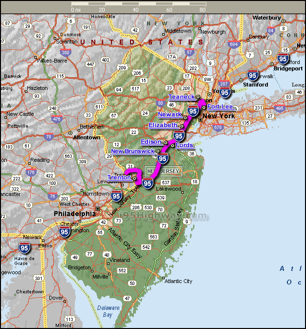
INTERSTATE 95 NEW JERSEY MAP
Brief information about New Jersey, US
New Jersey is the fourth smallest state in terms of land area, but the 11th most populous state in the country. The state's capital is Trenton, but its largest city is Newark. New Jersey is known as the "Garden State" due to its agricultural history and abundance of parks and natural areas. It is also known for its beaches, Atlantic City casinos, and proximity to New York City.A Collection of New Jersey Maps and New Jersey Satellite Images
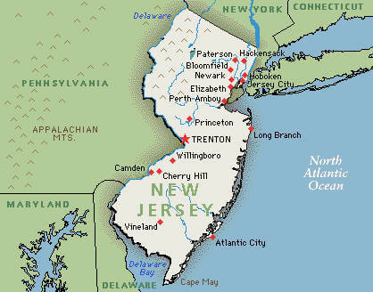
Map Of New Jersey
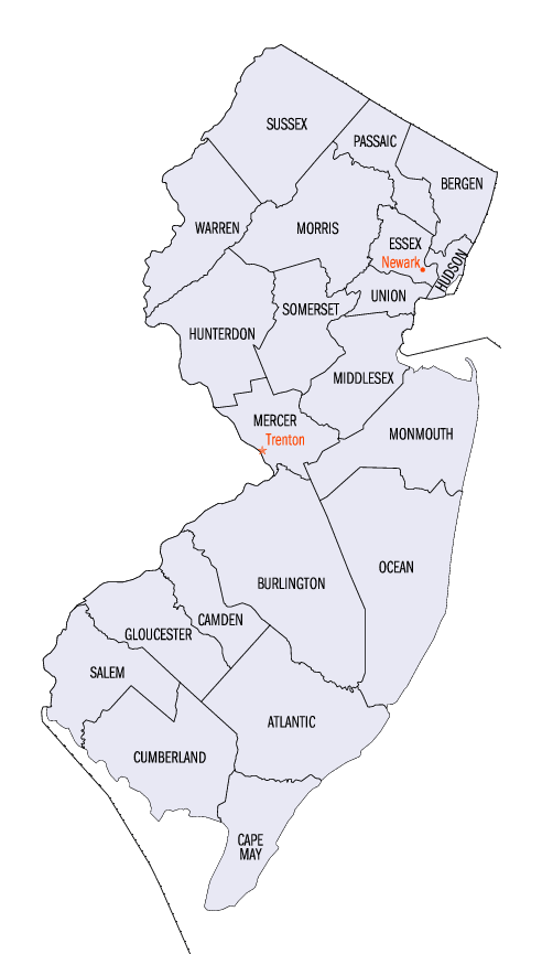
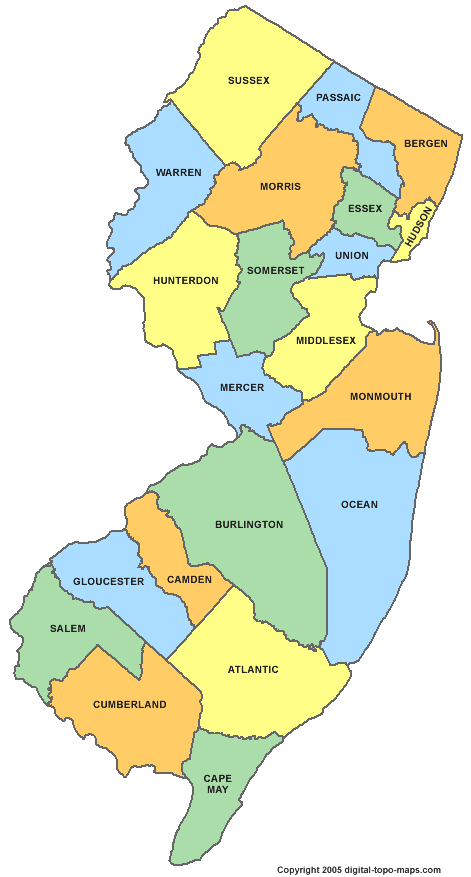
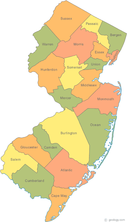
County Map Of New Jersey
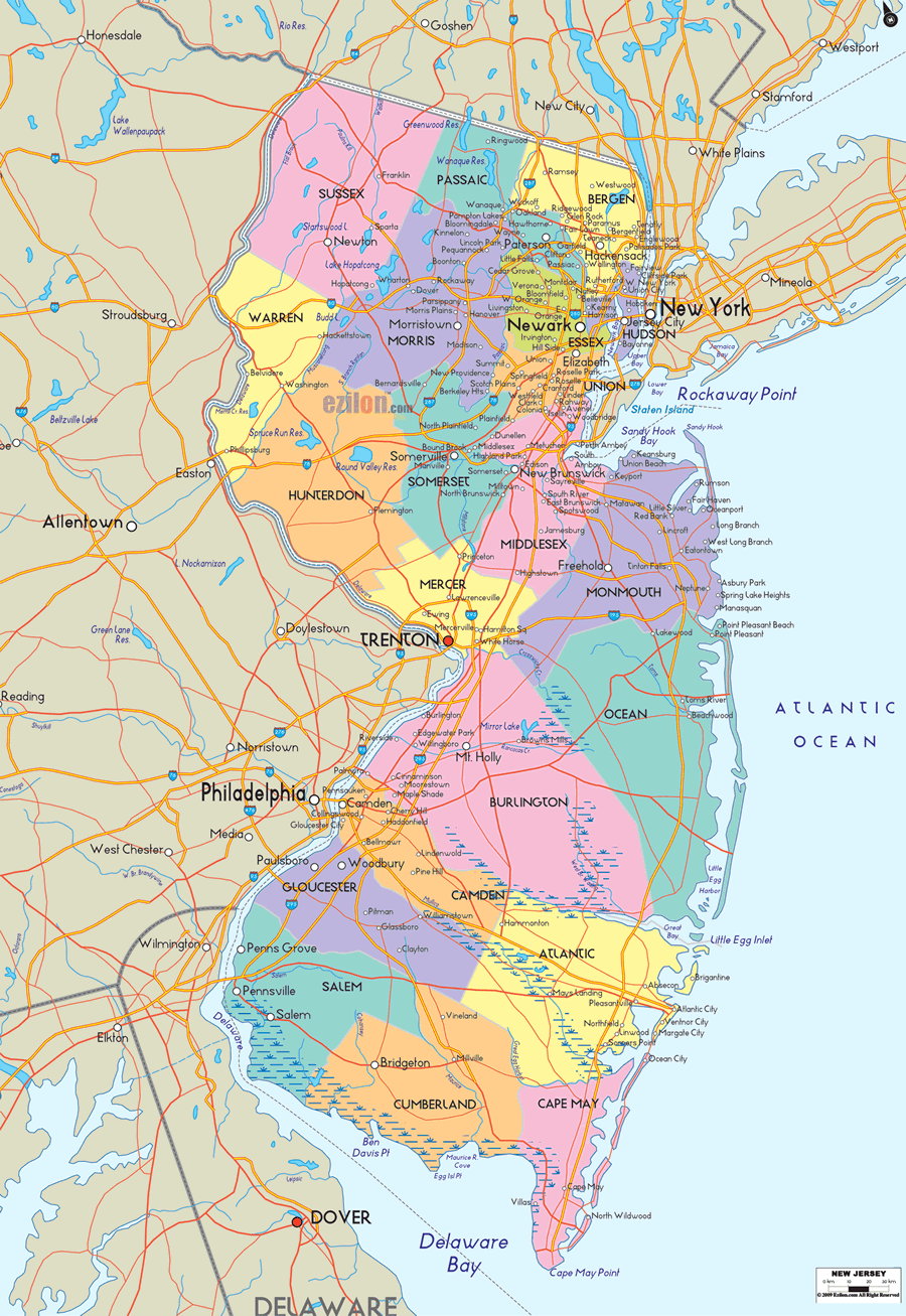
County Map Of New Jersey
Interstate 95 New Jersey Map
Map Of New Jersey
New Jersey County Map
New Jersey Map
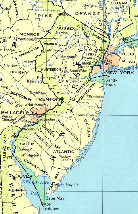
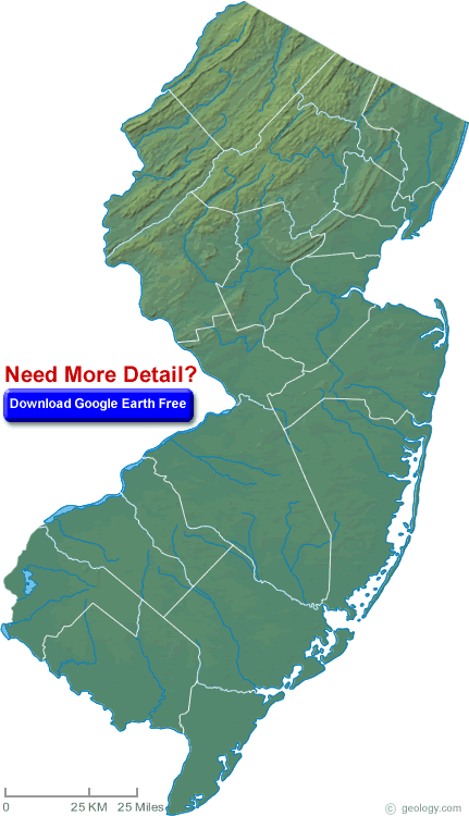
New Jersey Physical Map
New Jersey State Map

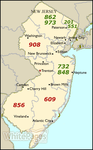
New Jersey Area Code Map
New Jersey County Map
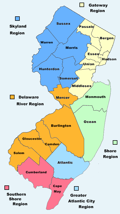
New Jersey County Region Map
New Jersey Map
New Jersey Maps
New Jersey Physical Map
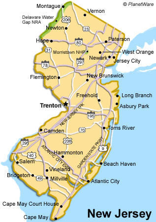
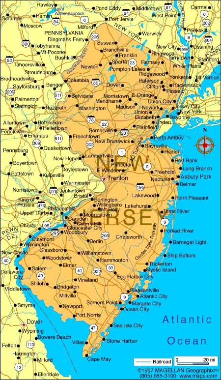
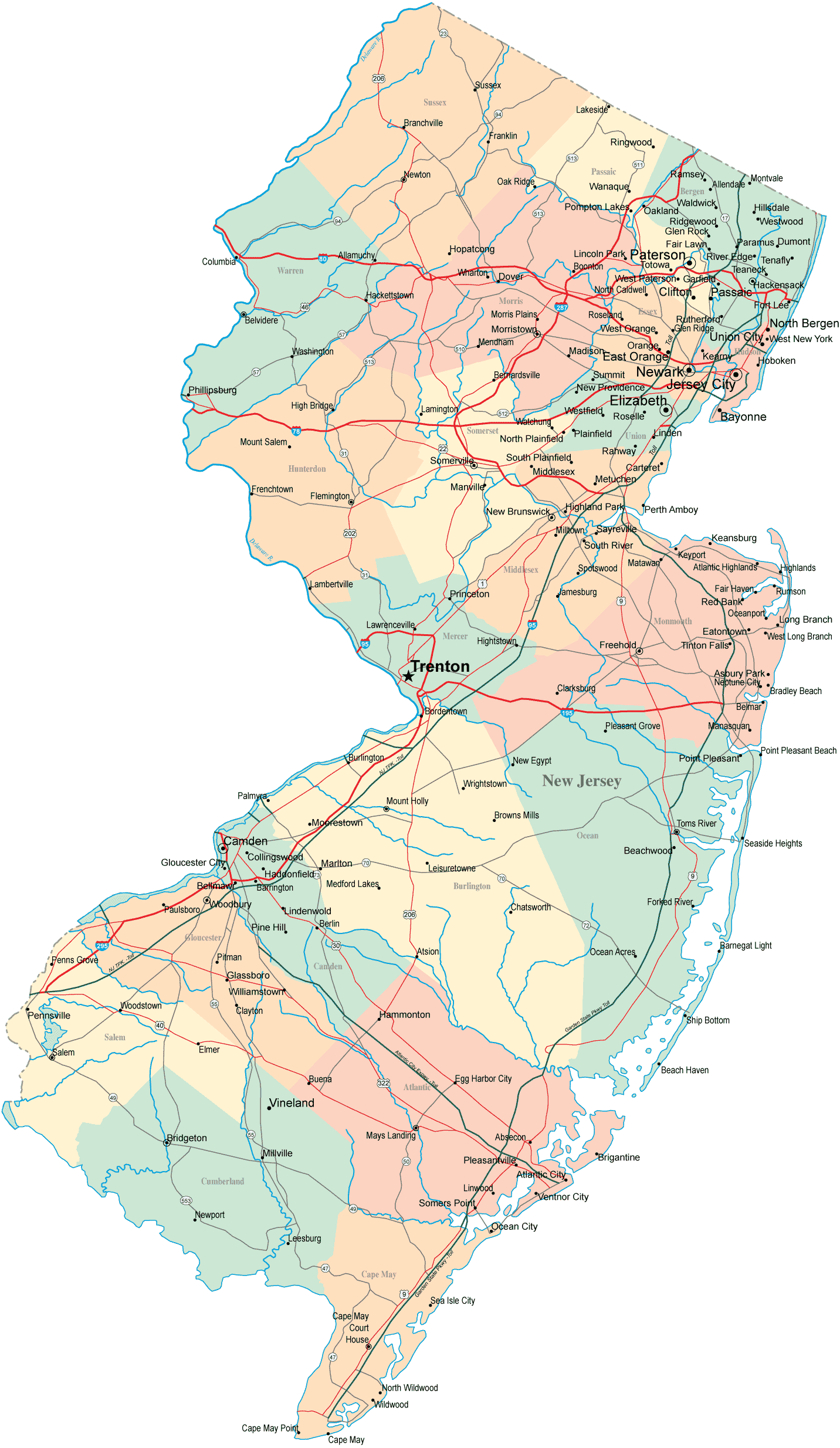
New Jersey Road Map
New Jersey State Map
A collection of New Jersey Maps
Largest Cities Map of New Jersey and Population
Newark Map - 277,140 Jersey City Map - 247,597 Paterson Map - 146,199 Elizabeth Map - 124,969 Edison Township Map - 99,967 Toms River Map - 88,791 Trenton Map - 84,913 Clifton Map - 84,136 Camden Map - 77,344 Passaic Map - 69,781 Union City Map - 66,455 East Orange Map - 64,270 Bayonne Map - 63,024 Vineland Map - 60,724 Union Township Map - 56,642 New Brunswick Map - 55,181 Wayne Township Map - 54,717 Irvington Township Map - 53,926 Lakewood Map - 53,805 Perth Amboy Map - 50,814 Hoboken Map - 50,005Copyright Turkey Travel Guide - 2005 - 2026. All rights reserved. Privacy Policy | Disclaimer