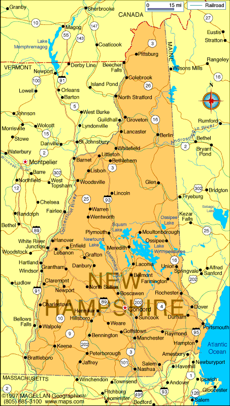
New Hampshire Map
Explore the beautiful state of New Hampshire with WorldMap1's map. From the stunning White Mountains to the bustling city of Manchester, our map has all the information you need to plan your visit. Discover top attractions, hotels, and more on our New Hampshire map today.
For all New Hampshire Cities Map
MAP OF NEW HAMPSHIRE
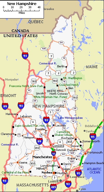
NEW HAMPSHIRE CITY MAP
Brief information about New Hampshire, US
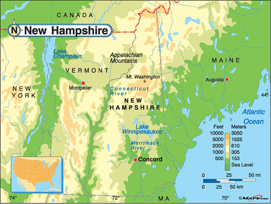
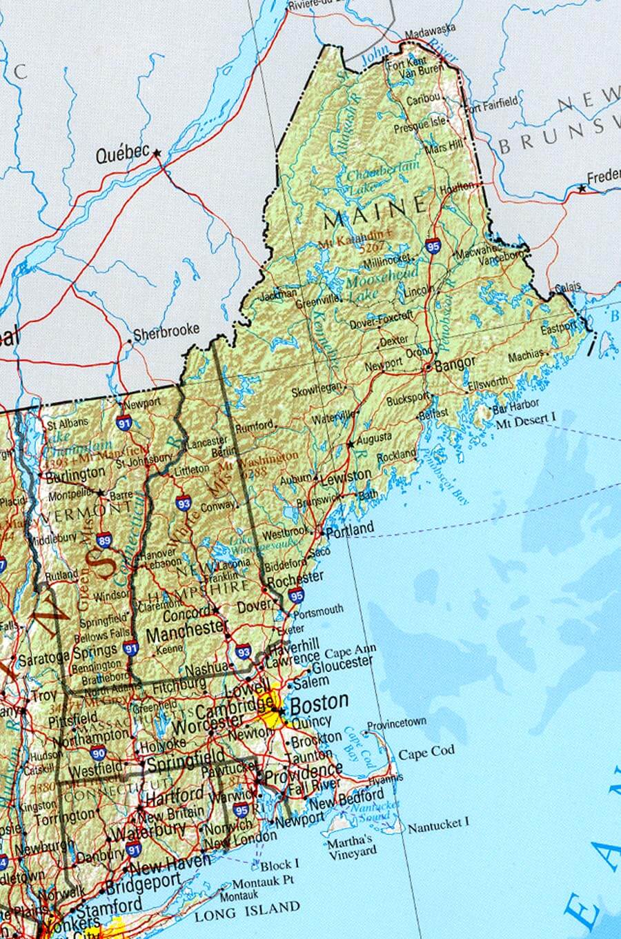
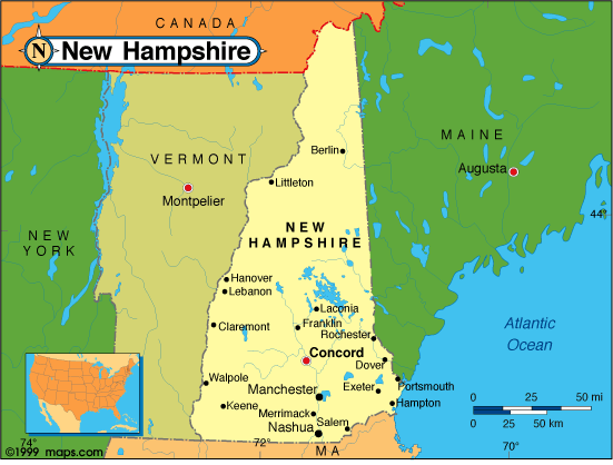
New Hampshire is a state located in the northeastern region of the United States. It is one of the six New England states, and its capital is Concord. New Hampshire is known for its beautiful natural scenery, including the White Mountains and the Lakes Region, as well as its charming small towns and rich history. The state is home to several prestigious universities, including Dartmouth College and the University of New Hampshire, and is also a popular destination for skiing and other outdoor recreational activities. New Hampshire is the 5th smallest state in terms of land area, but it has a rich cultural and political history, including being the site of the first primary in every presidential election cycle. The state motto of New Hampshire is "Live Free or Die," and it is known for its fiercely independent and self-reliant spirit.A Collection of New Hampshire Maps and New Hampshire Satellite Images
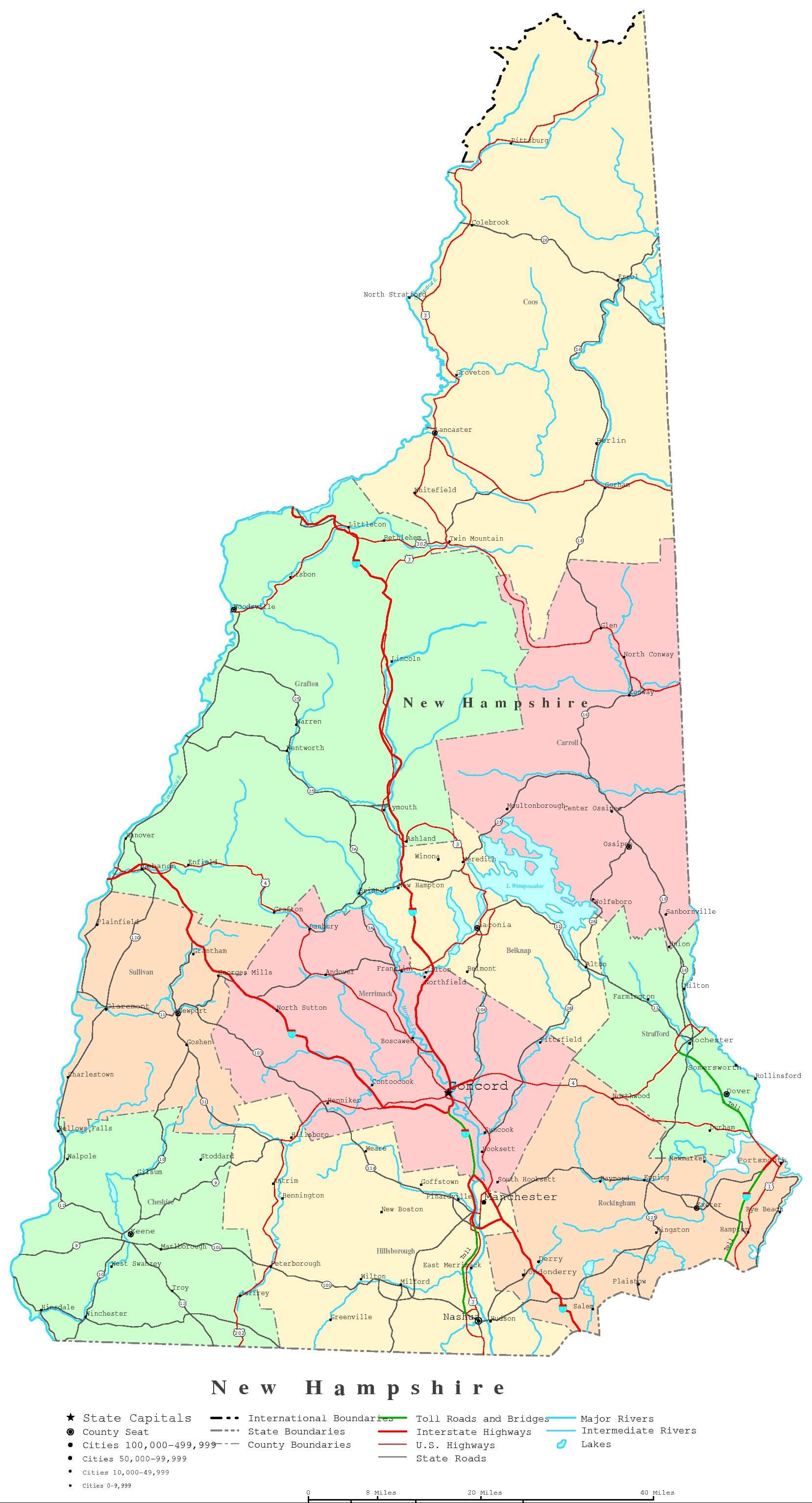
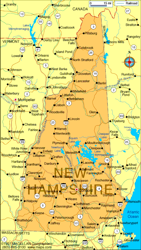
Map Of New Hampshire
New Hampshire Map
New Hampshire Boston Map
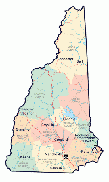
New Hampshire City Map
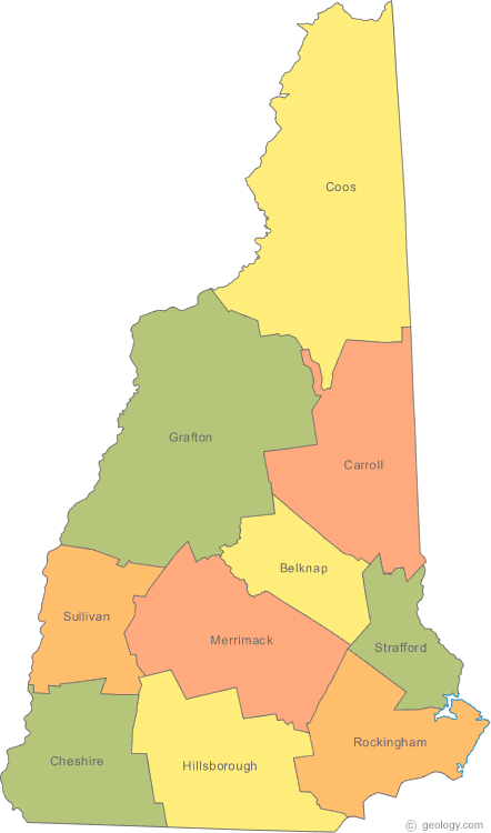
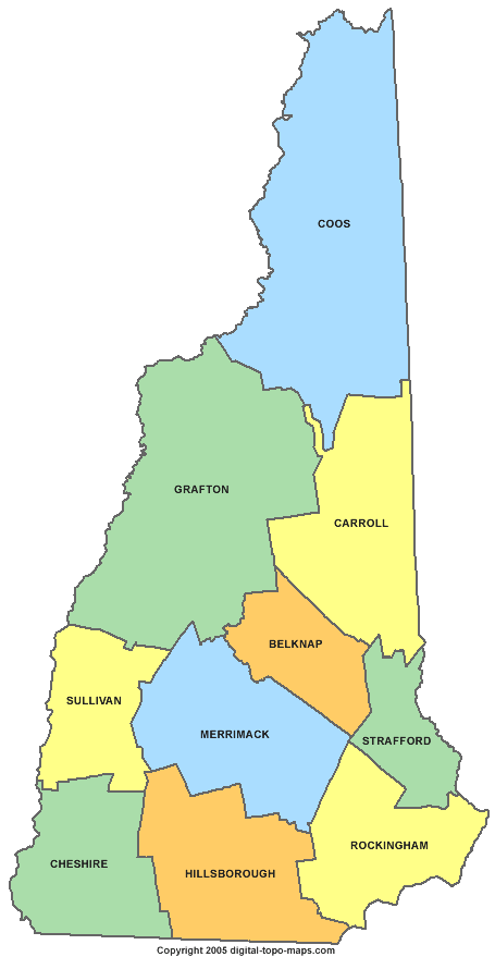
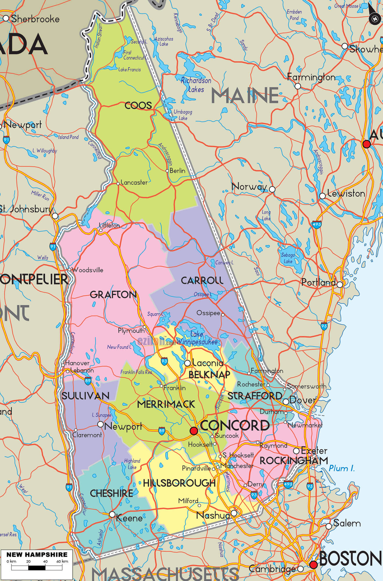
New Hampshire Counties Map
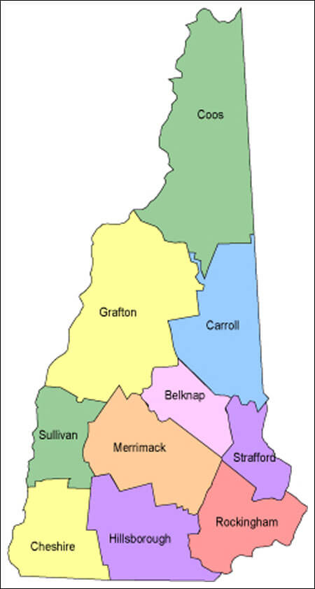
New Hampshire County Map
New Hampshire Historical Atlas
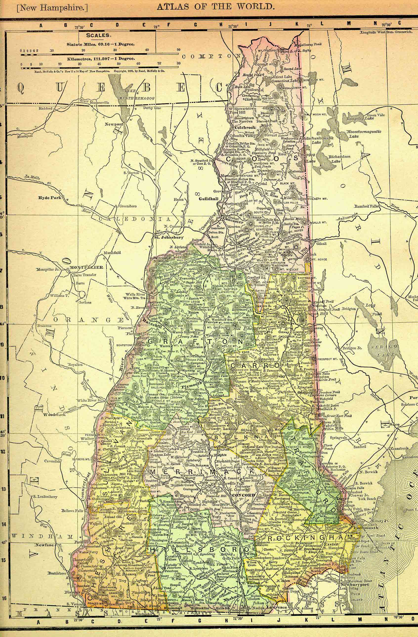
New Hampshire Historical Map
New Hampshire Map
New Hampshire Map
New Hampshire Political Map
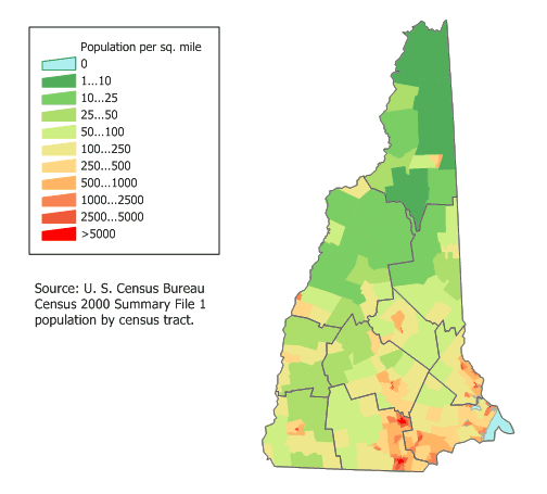
New Hampshire Population Map

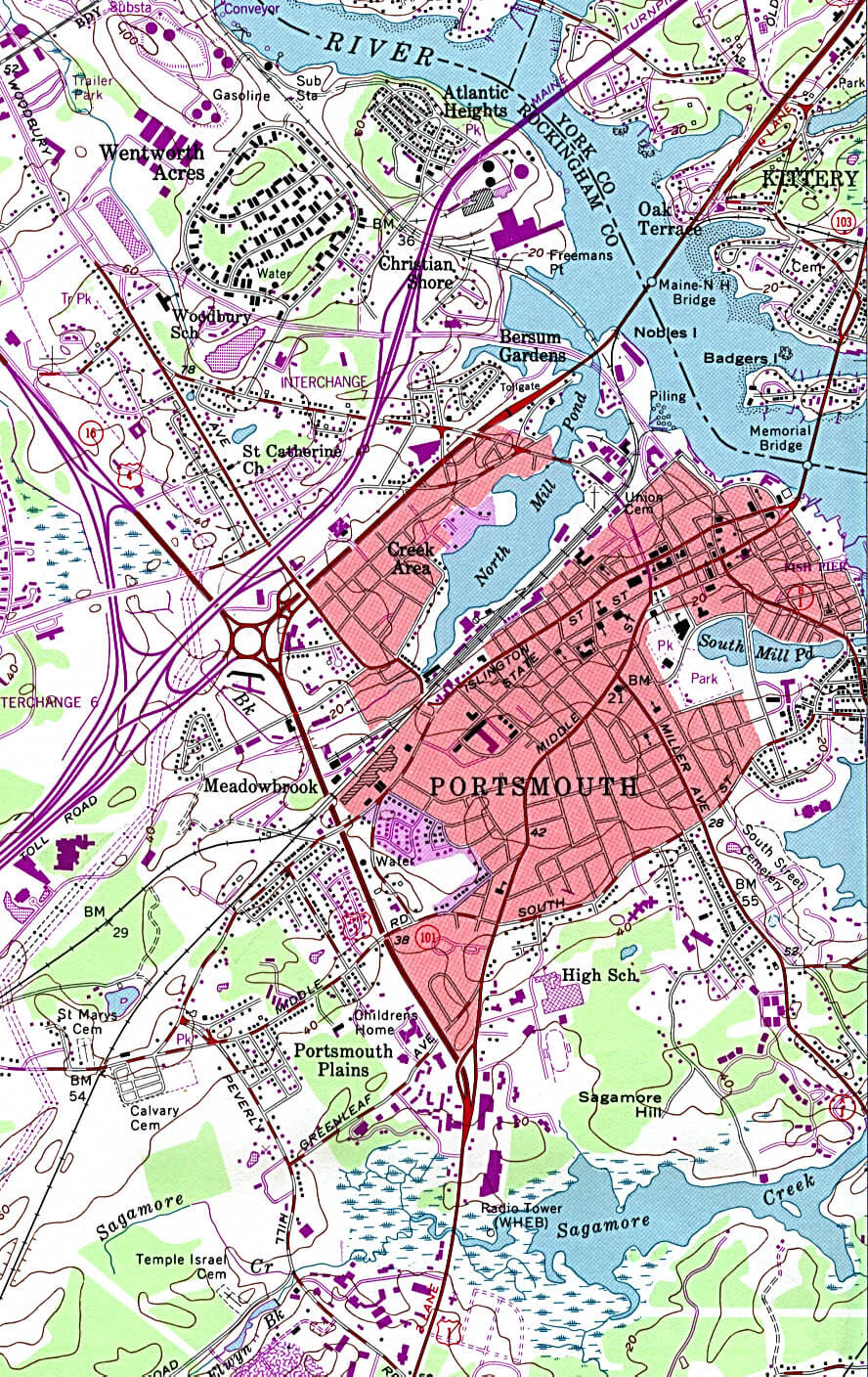
New Hampshire Portsmouth Map
New Hampshire Printable Map
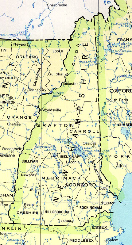
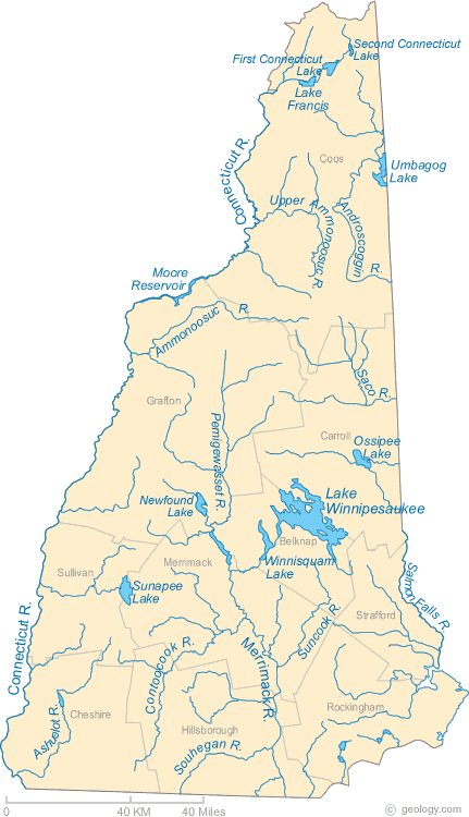
New Hampshire Rivers Map
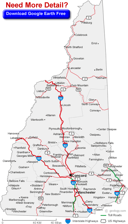
New Hampshire Road Map
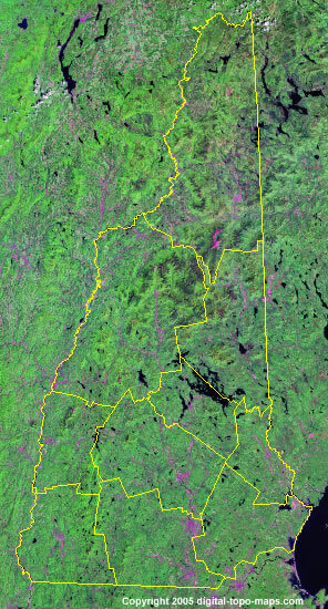
New Hampshire Satellite Image
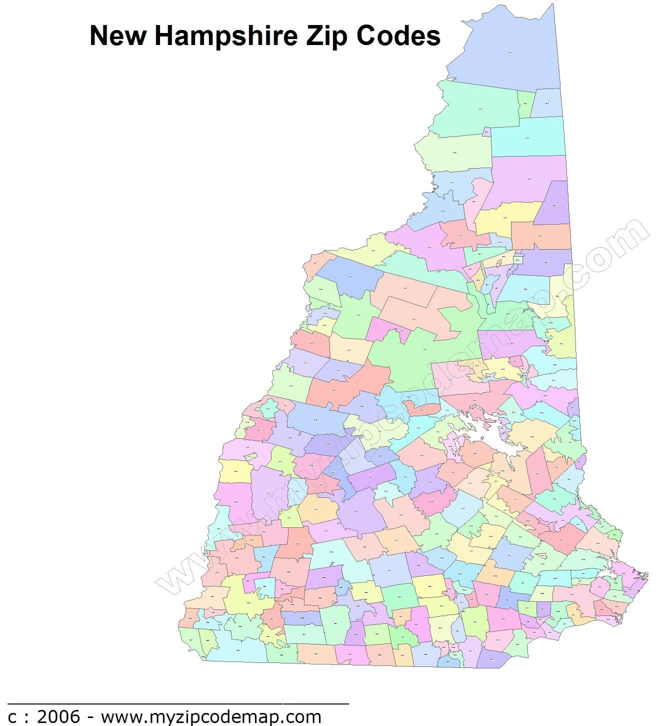
New Hampshire Zip Code Map
A collection of New Hampshire Maps
Largest Cities Map of New Hampshire and Population
Manchester Map - 109,565 Nashua Map - 86,494 Concord Map - 42,695 Dover Map - 29,987 Rochester Map - 29,752 Keene Map - 23,409 Derry Map - 22,015 Portsmouth Map - 20,779 Laconia Map - 15,951 Claremont Map - 13,355 Lebanon Map - 13,151 Somersworth Map - 11,766 Londonderry Map - 11,037 Durham Map - 10,345 Berlin Map - 10,051Copyright Turkey Travel Guide - 2005 - 2026. All rights reserved. Privacy Policy | Disclaimer