Iowa map guide to exploring the beautiful Hawkeye State! Iowa is a Midwestern state known for its rolling prairies, charming small towns, and rich agricultural heritage. From the bustling city of Des Moines to the scenic bluffs of the Mississippi River, there's something for everyone in Iowa.
With our Iowa map, you can explore the state's cities, highways, and topography with just a few clicks. Whether you're planning a road trip, researching a school project, or simply satisfying your curiosity, our map has everything you need. So join us on a virtual tour of Iowa and discover all that this vibrant state has to offer!
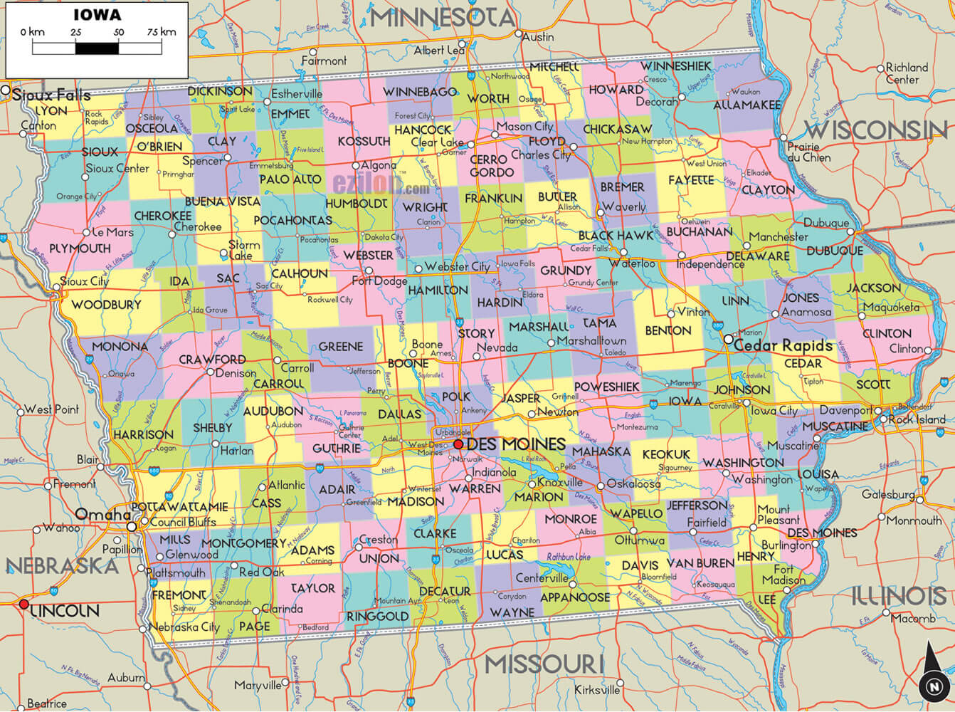
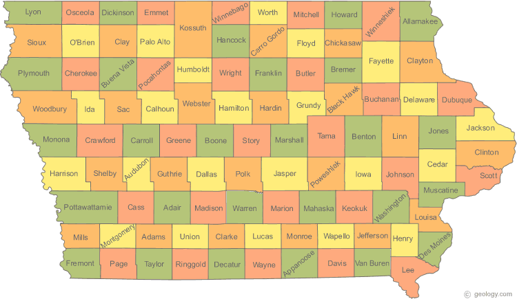
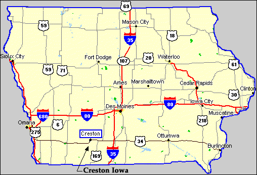
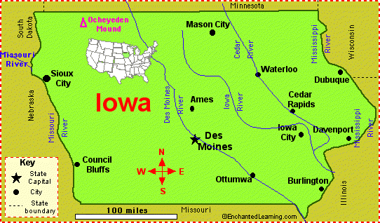
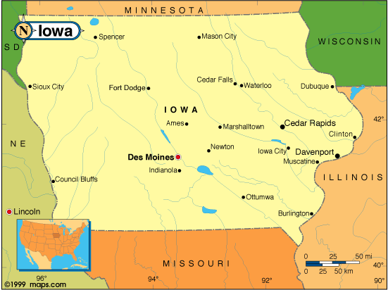
MAP OF IOWA
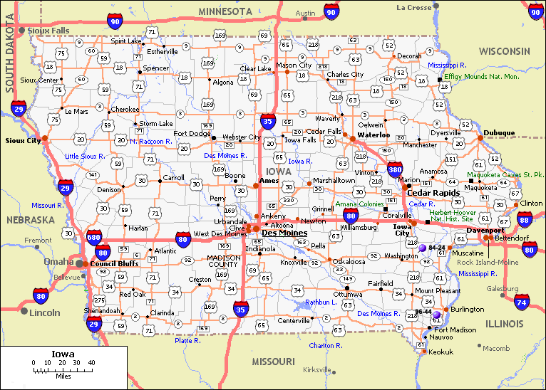
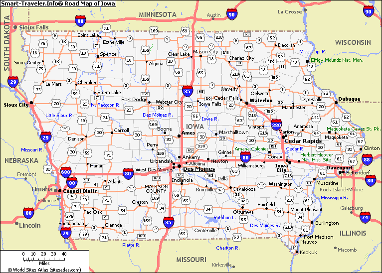
IOWA HIGHWAYS MAP
Brief information about Iowa, US
The capital and largest city of Iowa is Des Moines, which is also the economic and cultural center of the state. Iowa is known for its fertile farmland, which produces a variety of agricultural products including corn, soybeans, and pork.
Iowa has a diverse economy that includes manufacturing, finance, and healthcare, among other industries. The state is also home to several universities and colleges, including the University of Iowa and Iowa State University.
Tourism is an important industry in Iowa, with visitors coming to see attractions such as the Amana Colonies, the Iowa State Fair, and the Field of Dreams movie site. Iowa is also known for its friendly people and strong sense of community, making it a great place to live and visit.
Iowa is a state located in the Midwestern region of the United States. With an area of approximately 56,273 square miles (145,746 square kilometers), it is the 26th largest state in the country. According to the United States Census Bureau, Iowa has an estimated population of approximately 3.2 million people as of 2020.
Iowa has a diverse population, with a mix of European, African American, Asian, and Hispanic/Latino ethnicities. As of 2020, the largest ancestry group in Iowa is German, followed by Irish and English. The state has a slightly higher proportion of older adults, with a median age of 38.5 years.
Iowa has a rich history dating back to the arrival of Native American tribes such as the Meskwaki and the Sioux. European settlement of the area began in the early 1800s, and Iowa became a state in 1846. During the Civil War, Iowa played an important role in supporting the Union Army and providing troops. The state has since been known for its progressive politics, including being the first state to allow women to vote.
Iowa has a diverse economy that includes industries such as agriculture, manufacturing, and healthcare. The state is a leading producer of corn, soybeans, and pork, and is also home to several major food processing companies. Manufacturing is another important industry, with products including machinery, electrical equipment, and chemicals. Healthcare is also a growing industry in Iowa, with several major hospitals and medical centers located throughout the state. Overall, Iowa has a strong and diversified economy that provides a high quality of life for its residents.
A Collection of Iowa Maps and Iowa Satellite Images
Map Of Iowa
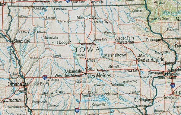
Iowa Cities Map
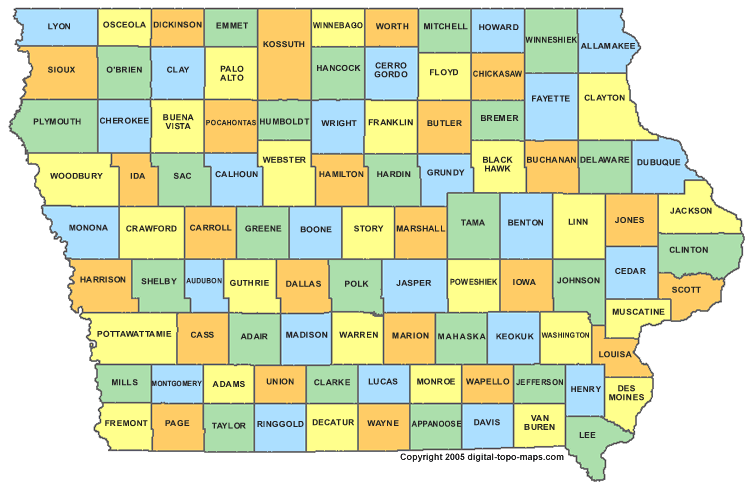
Iowa County Map
Iowa Highways Map
Iowa Physical Map
Iowa River Map
Iowa Road Map
Iowa Route Map
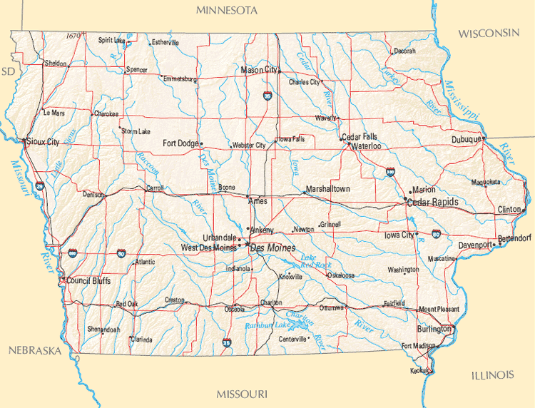
Iowa State Map
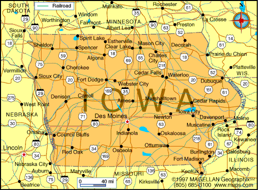
State Map Of Iowa
A collection of Iowa Maps