Idaho Map
Navigate Idaho map, Idaho state map, satellite images of the Idaho, Idaho largest cities maps, political map of Idaho, driving directions and traffic maps. Whether you're a resident or a tourist, this map is a valuable resource for planning your trip or just exploring Idaho's beautiful scenery from the comfort of your own home. Start your virtual journey today!
For all Idaho Cities Map
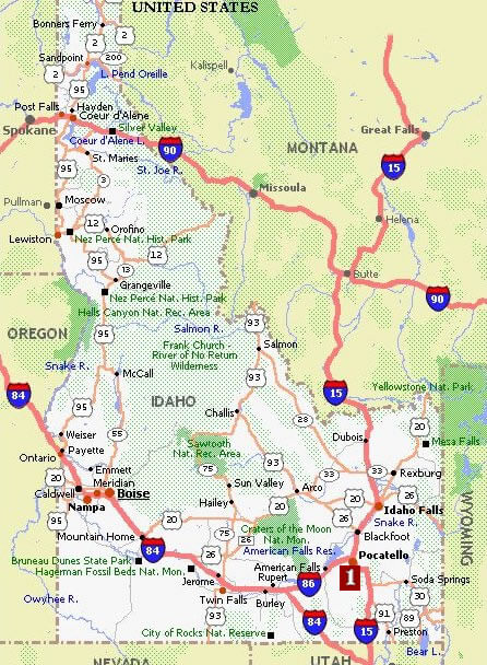
MAP OF IDAHO
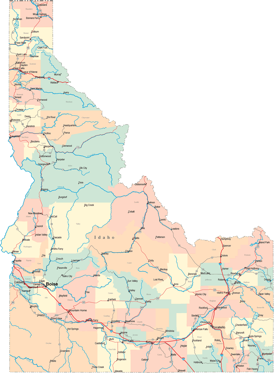
IDAHO CITIES MAP
Brief information about Idaho, US
Idaho is a state located in the northwestern region of the United States. It is bordered by Montana to the east, Wyoming to the northeast, Nevada and Utah to the south, Washington and Oregon to the west, and Canada to the north. The state is known as the "Gem State" and its capital is Boise.A Collection of Idaho Maps and Idaho Satellite Images
Map Of Idaho
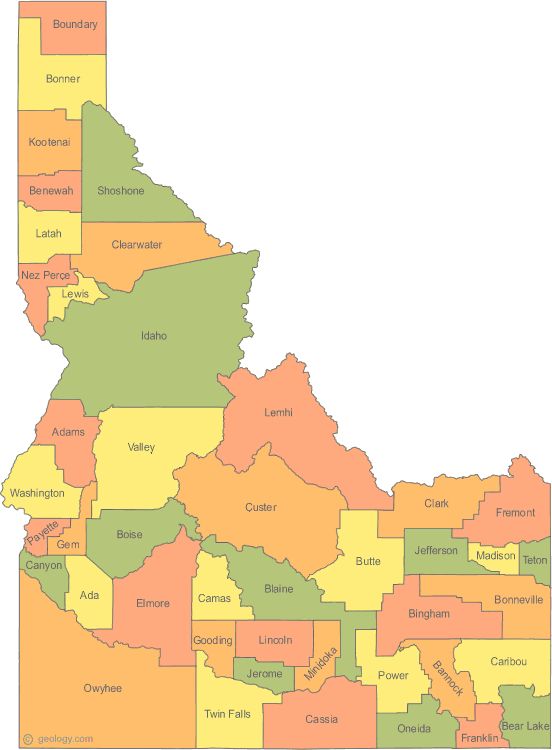
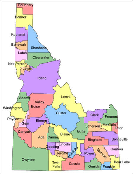
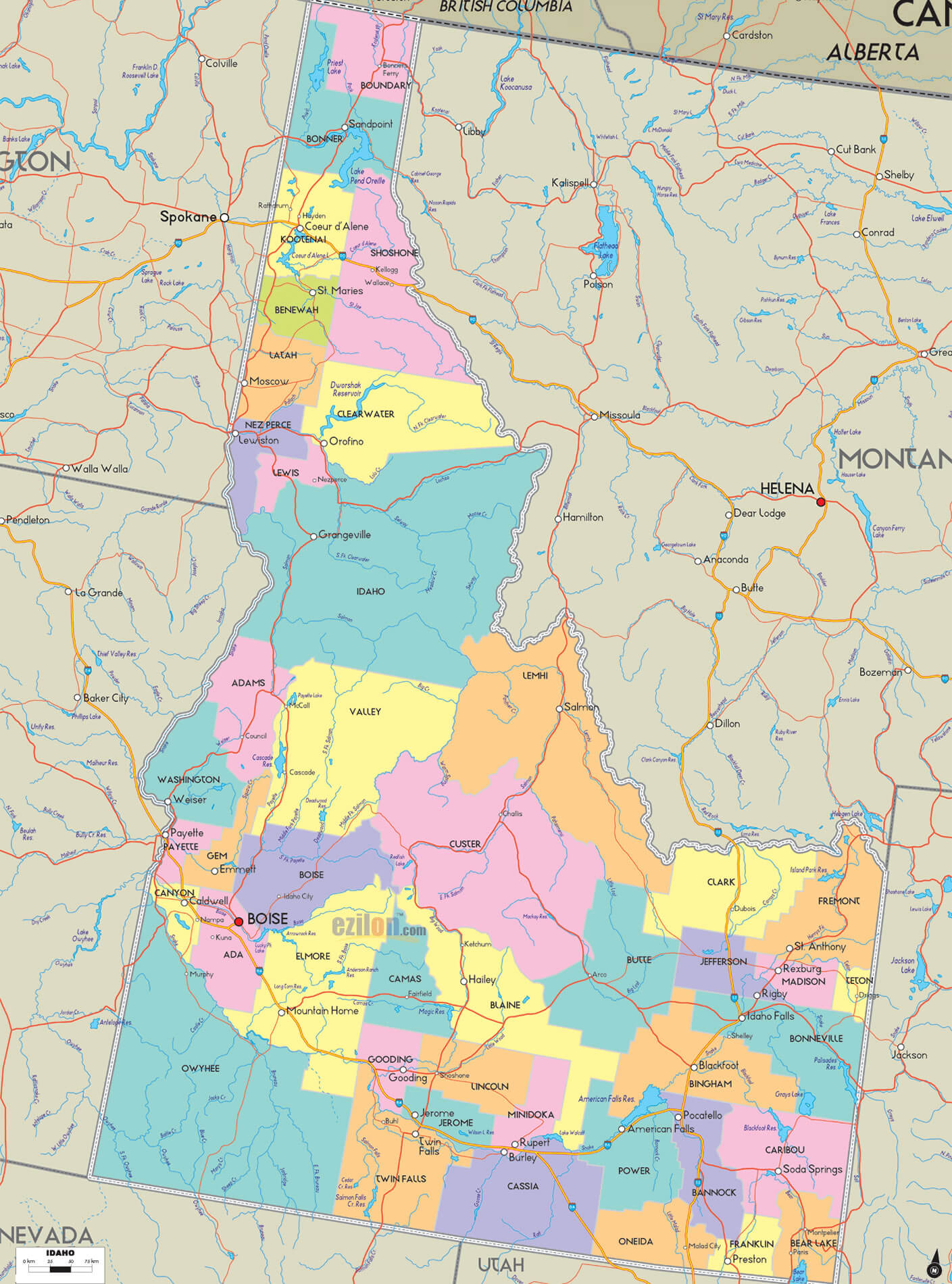
Id Counties Map

Idaho Map
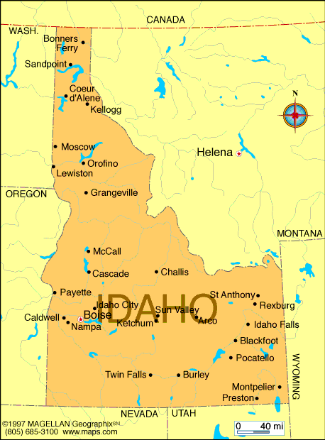
Idaho Cities Map
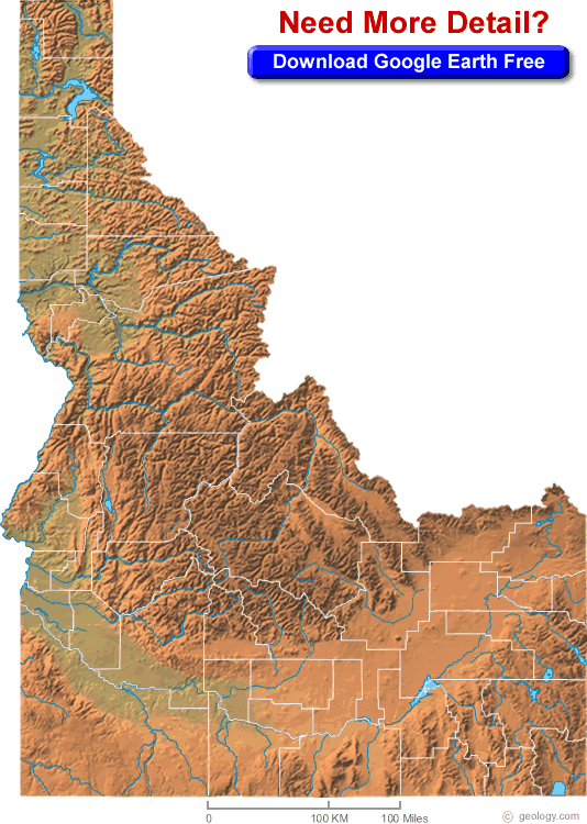
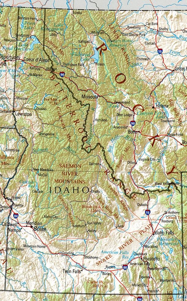
Idaho Physical Map
Idaho Political Map

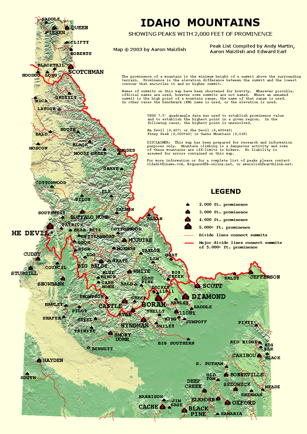
Idaho Prominence Map
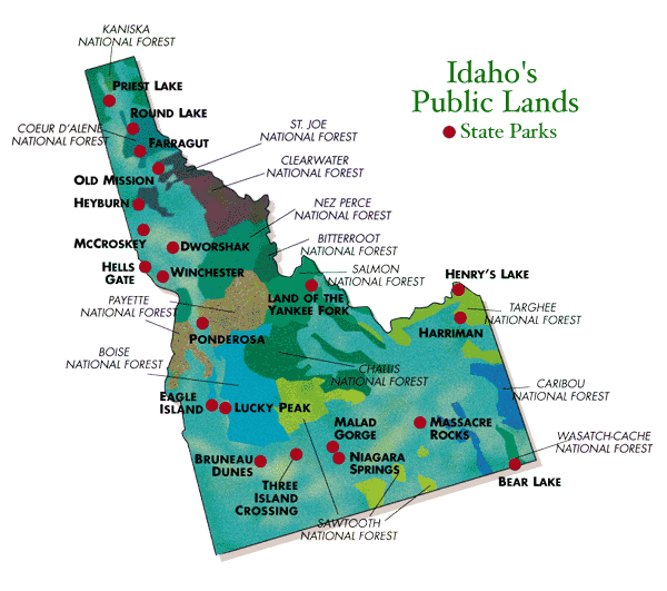
Idaho Public Lands Map
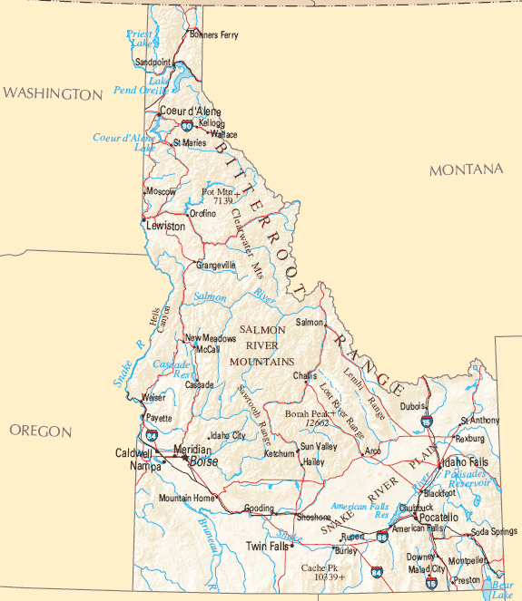
Idaho Reference Map
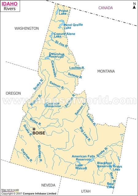
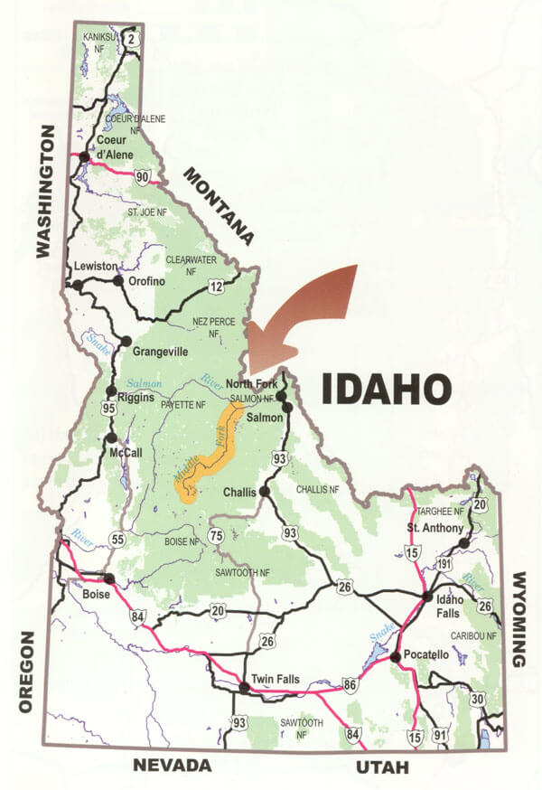
Idaho River Map
Idaho Road Map
Idaho State Map

Maps Of Idaho
Physical Map Of Idaho
A collection of Idaho Maps

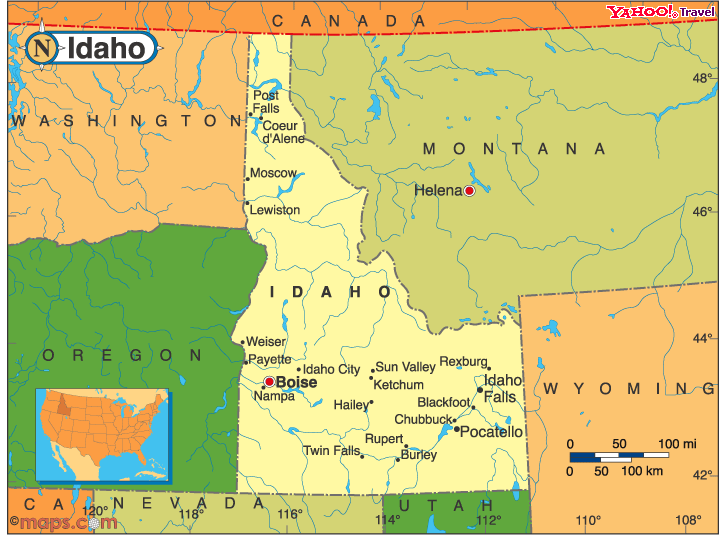

Largest Cities Map of Idaho and Population
Boise City Map - 205,671 Nampa Map - 81,557 Meridian Map - 75,092 Idaho Falls Map - 56,813 Pocatello Map - 54,255 Caldwell Map - 46,237 Coeur d'Alene Map - 44,137 Twin Falls Map - 44,125 Lewiston Map - 31,894 Post Falls Map - 27,574 Rexburg Map - 25,484 Moscow Map - 23,800 Eagle Map - 19,908 Kuna Map - 15,210 Mountain Home Map - 14,206Copyright Turkey Travel Guide - 2005 - 2026. All rights reserved. Privacy Policy | Disclaimer