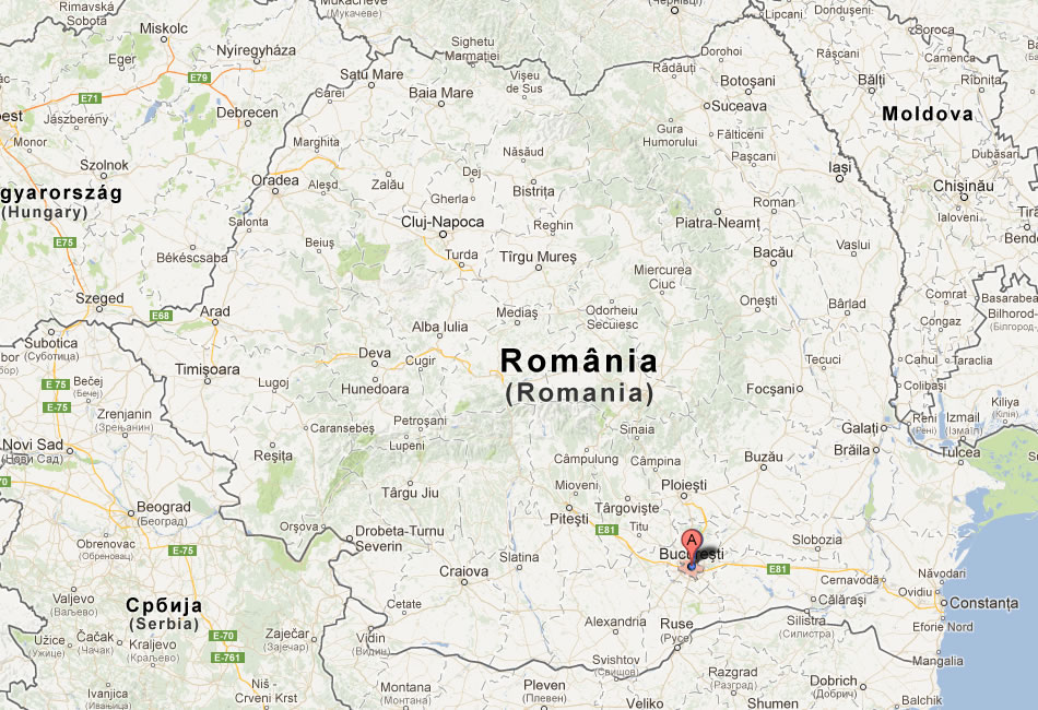
Bucharest Map
Navigate Bucharest Map, Bucharest city map, satellite images of Bucharest, Bucharest towns map, political map of Bucharest, driving directions and traffic maps.
For more >> Romania Maps
For more info >> Romania
Bucharest Map - Political, Physical, Touristic City Maps and Satellite Images
MAP OF BUCHAREST
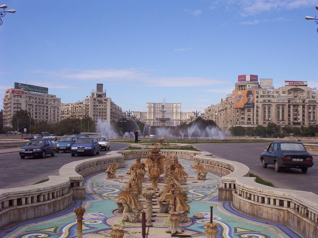
A Collection of Bucharest and Satellite Images
Map Of Bucharest
Bucharest Map
Bucharest Romania
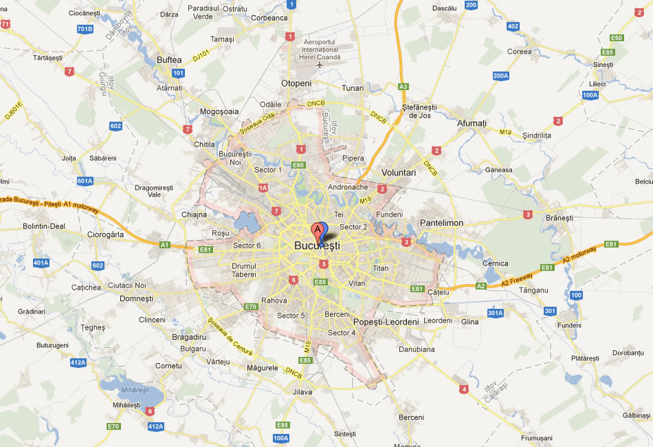
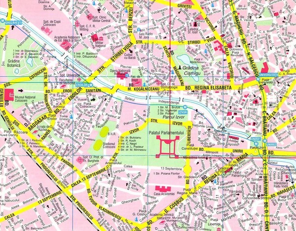
Bucharest City Map
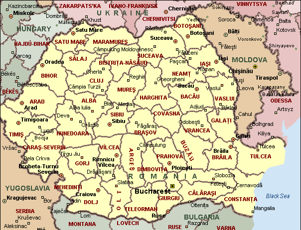
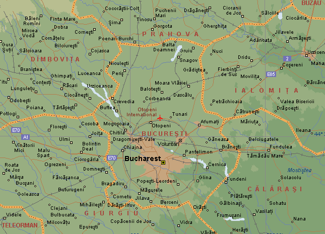
Bucharest Geographic Map
Bucharest Map
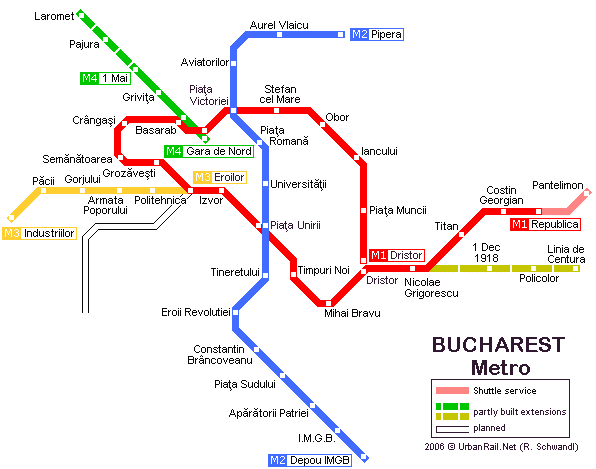
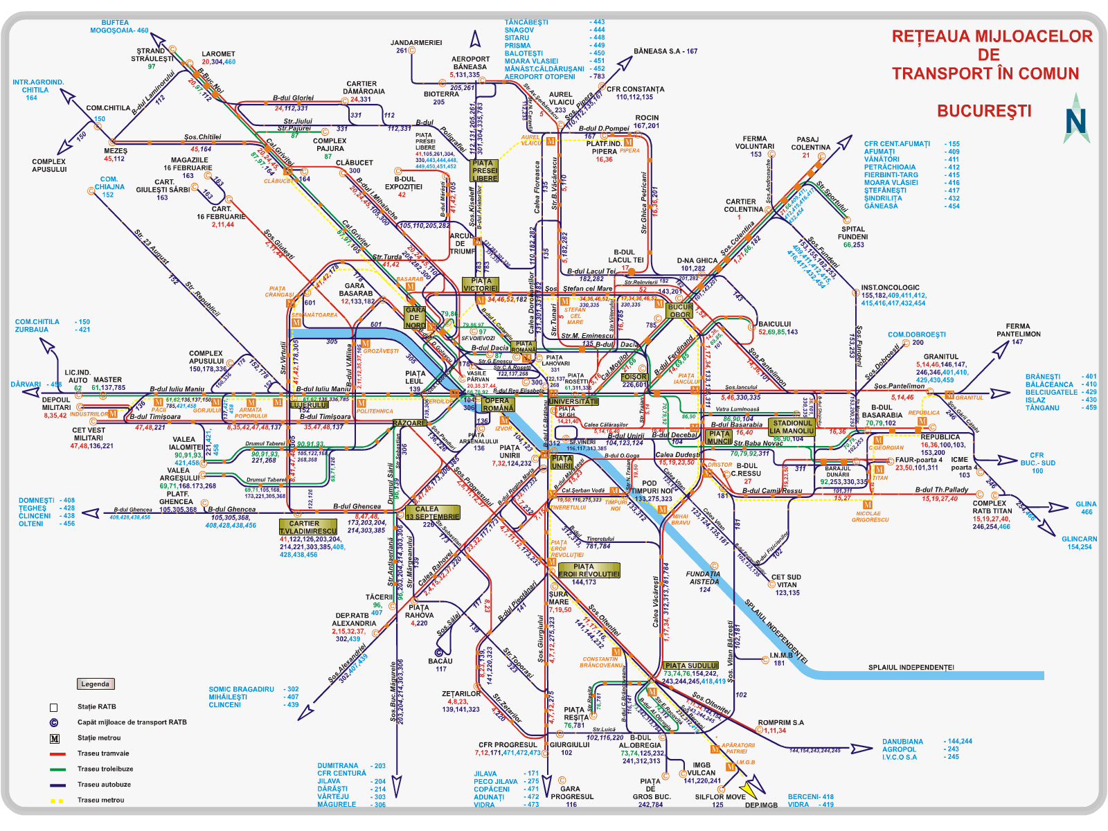
Bucharest Metro Map
Bucharest Area Map
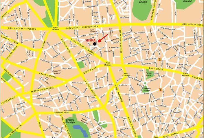
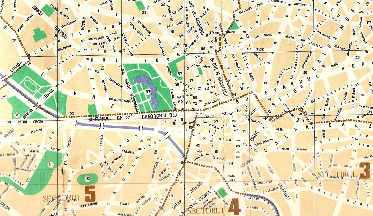
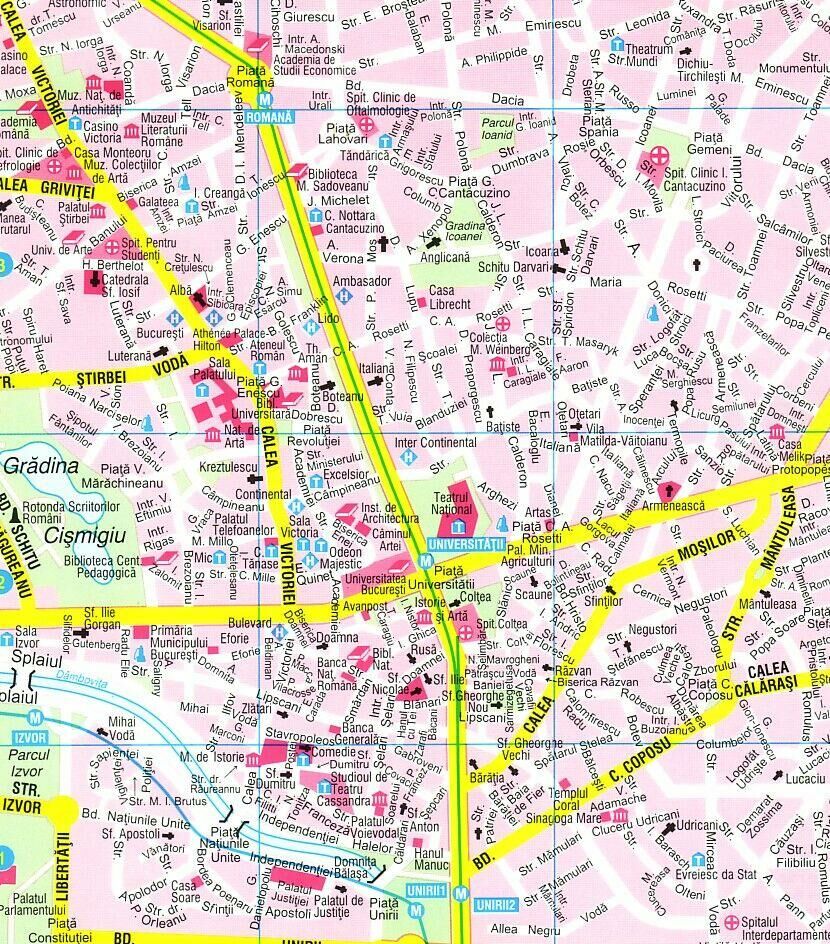
Bucharest Center Map
Bucharest Map
Bucharest Transportation Map
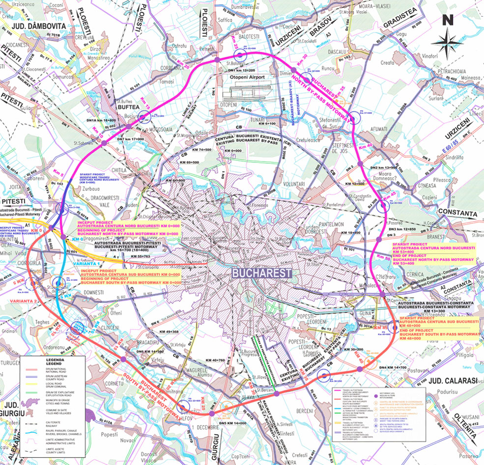
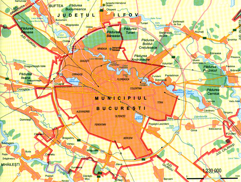
Greater Bucharest Map
Map Of Bucharest Romania
Romania Cities Map Bucharest
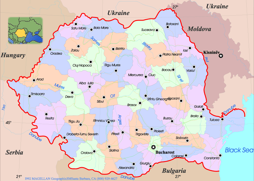
Romania Bucharest Map
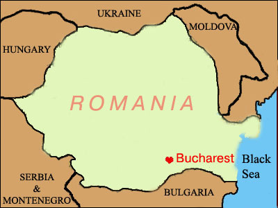
Where is Romania in Europe, Is Romania in NATO and EU
Please subscribe on "World Guide" channnel on Youtube at youtube.com/c/WorldGuide
See Also
Bucharest Google Map, Street Views, Maps Directions, Satellite Images
turkey-visit.com offers a collection of Bucharest map, google map, Bucharest atlas, political, physical, satellite view, country infos, cities map and more map of Bucharest.
Copyright Turkey Travel Guide - 2005 - 2026. All rights reserved. Privacy Policy | Disclaimer