Rhode Island Map
N avigate Rhode Island map, Rhode Island country map, satellite images of Rhode Island, Rhode Island largest cities, towns maps, political map of Rhode Island, driving directions, physical, atlas and traffic maps.
On upper left Map of Rhode Island (+) beside zoom in and (-) sign to to zoom out via the links you can visit. Rhode Island Map move the mouse over it via (left click) and clicking the image you can drag. Right upper Map, Satellite, Terrain icons via the map view, satellite, hybrid and terrain map can be switch between images.
map of Rhode Island

A Collection of Rhode Island Maps and Rhode Island Satellite Images
MAP OF RHODE ISLAND
MAP OF RHODE ISLAND


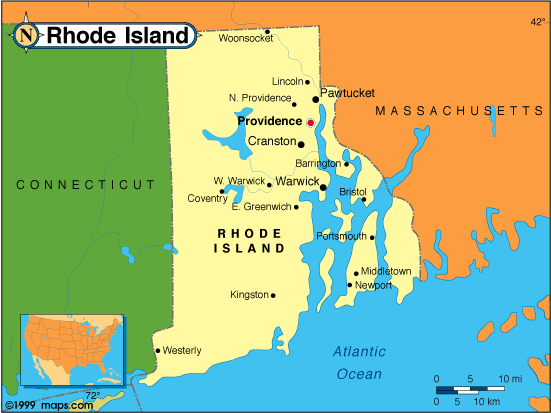
RHODE ISLAND CITY MAP

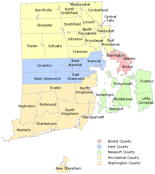
RHODE ISLAND COUNTY MAP

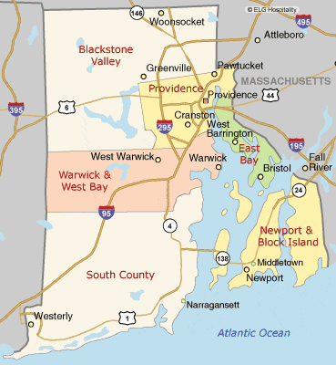
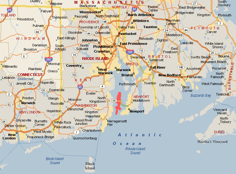
RHODE ISLAND HIGHWAYS MAP

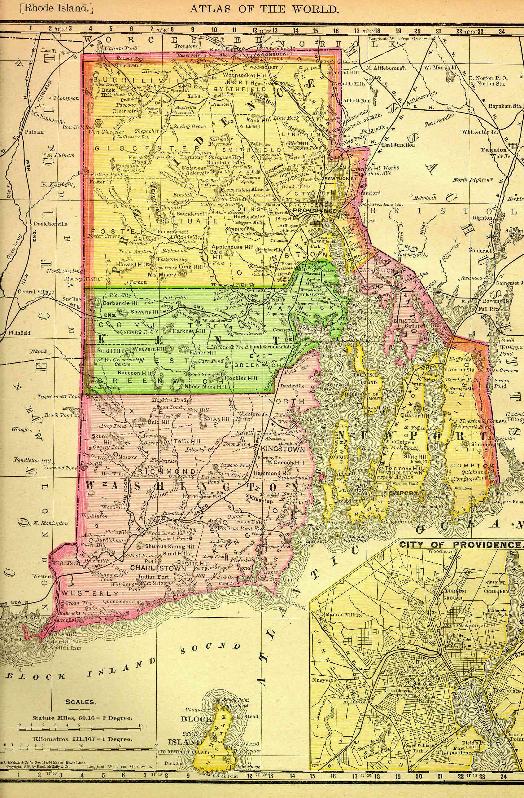
RHODE ISLAND HISTORICAL 1895

RHODE ISLAND MAP

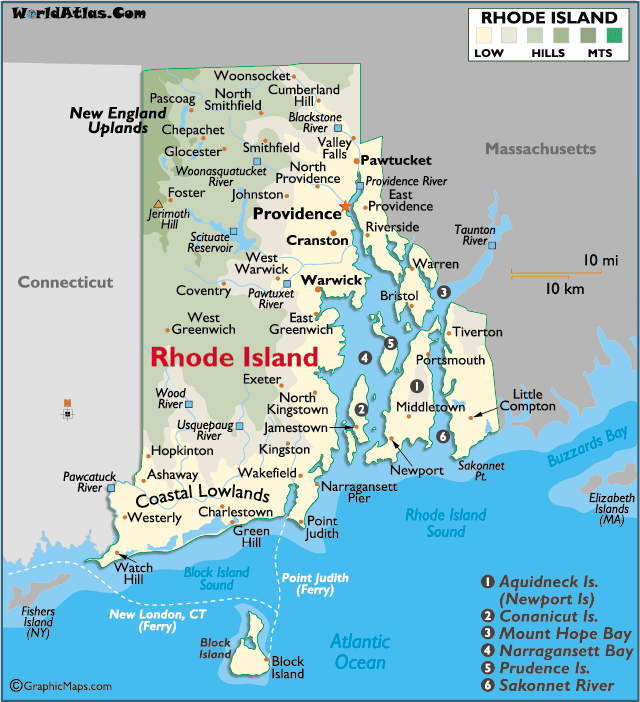
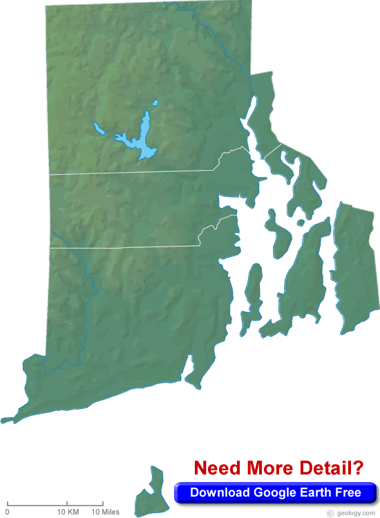
RHODE ISLAND PHYSICAL MAP

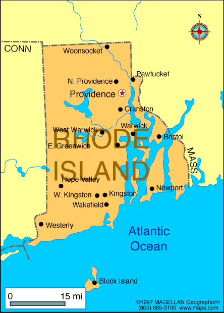
RHODE ISLAND POLITICAL MAP
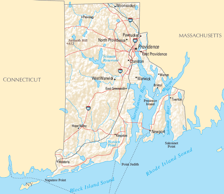

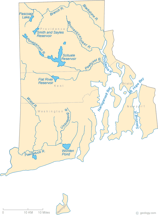
RHODE ISLAND RIVERS MAP

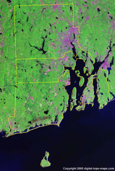
RHODE ISLAND SATELLITE MAP

RHODE ISLAND STATE MAP

RHODE ISLAND STATE MAP
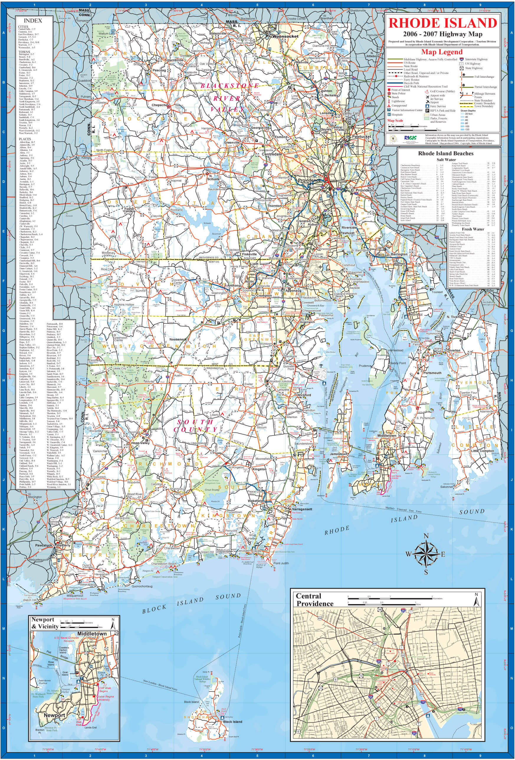

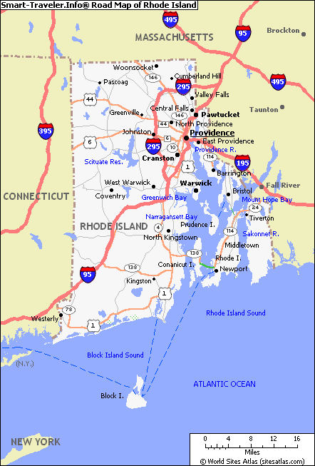
ROAD MAP OF RHODE ISLAND

Largest Cities Map of Rhode Island and Population
Providence - 178,042 Warwick - 82,672 Cranston - 80,387 Pawtucket - 71,148 East Providence - 47,037 Woonsocket - 41,186 Cumberland - 34,843 North Providence Town - 32,078 West Warwick Town - 29,191 Newport - 24,672 Bristol Town - 22,954 Central Falls - 19,376 Westerly - 17,936 Barrington Town - 16,310 Newport East - 11,769For All Rhode Island Cities Map
Cities Map of United States
New York City Map Los Angeles Map Chicago Map Brooklyn Map Houston Map Philadelphia Map Manhattan Map Phoenix Map San Antonio Map San Diego Map Dallas Map San Jose Map Jacksonville Map Indianapolis Map San Francisco Map Austin Map Columbus Map Fort Worth Map Charlotte Map Detroit MapCopyright Turkey Travel Guide - 2006 - 2023. All rights reserved. Privacy Policy | Disclaimer