Mayaguez Map
Navigate Mayaguez Map, Mayaguez city map, satellite images of Mayaguez, Mayaguez towns map, political map of Mayaguez, driving directions and traffic maps.
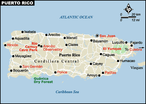
For more >> Puerto Rico Maps
For more info >> Puerto Rico
Mayaguez Map - Political, Physical, Touristic City Maps and Satellite Images
MAYAGUEZ MAP
A Collection of Mayaguez and Satellite Images
Mayaguez Map
See Also
Mayaguez Google Map, Street Views, Maps Directions, Satellite Images
turkey-visit.com offers a collection of Mayaguez map, google map, Mayaguez atlas, political, physical, satellite view, country infos, cities map and more map of Mayaguez.
Largest Cities' Map of Puerto Rico
Caguas Map Guaynabo Map Ponce Map Mayaguez Map San Juan Map Bayamon Map Carolina MapCopyright Turkey Travel Guide - 2005 - 2026. All rights reserved. Privacy Policy | Disclaimer