Map of Bahamas, Bahamas
Navigate Bahamas map, Bahamas country map, satellite images of Bahamas, Bahamas largest cities, towns maps, political map of Bahamas, driving directions, physical, atlas and traffic maps in Bahamas.
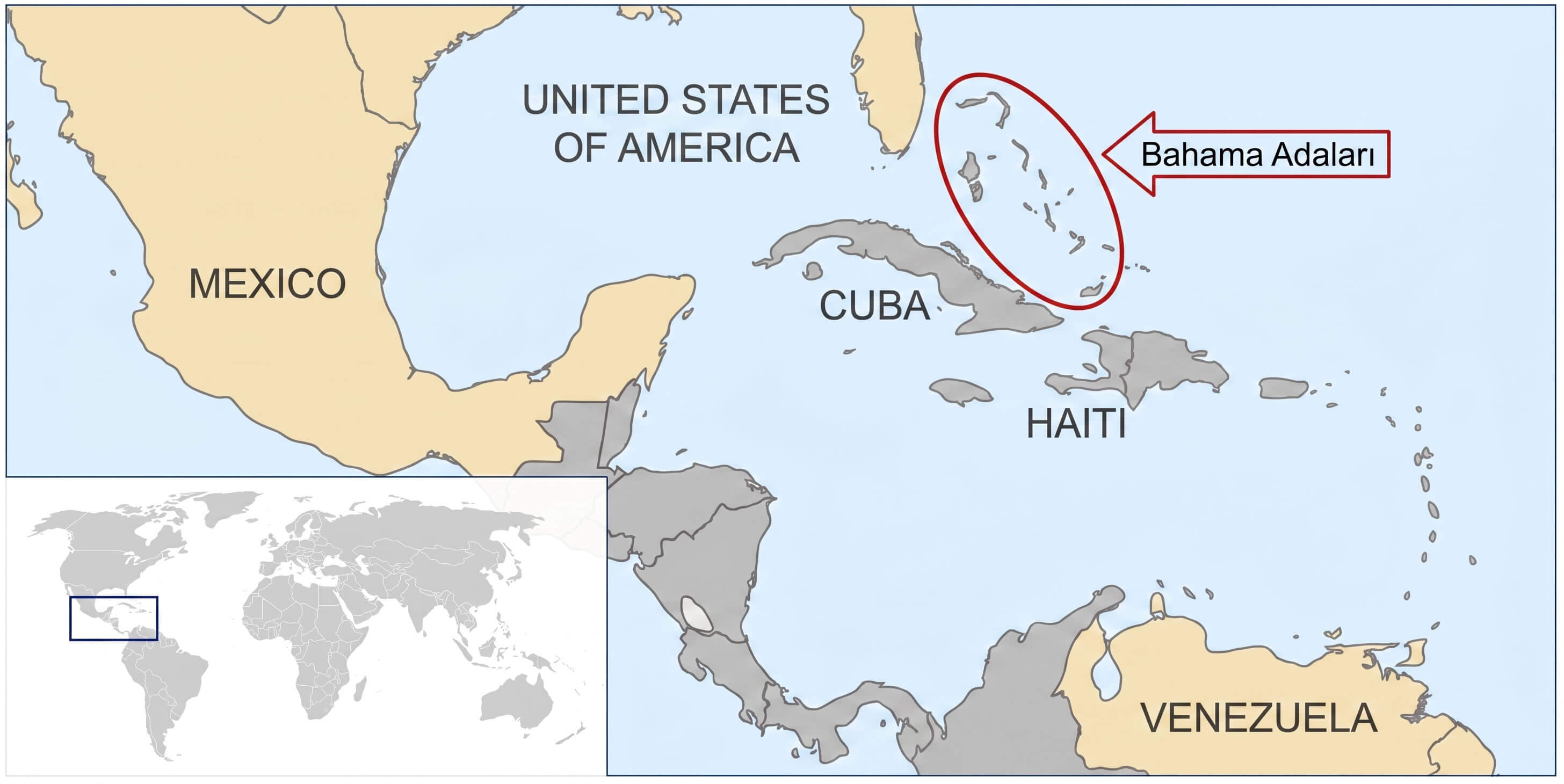
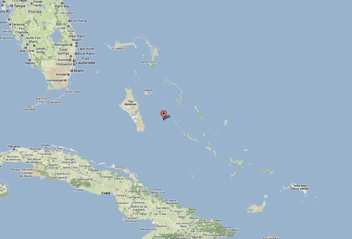
BAHAMAS MAP WITH CARIBBEAN AND CUBA
Bahamas City Maps
Nassau New Providence FreeportA Collection of Bahamas Maps and Bahamas Satellite Images
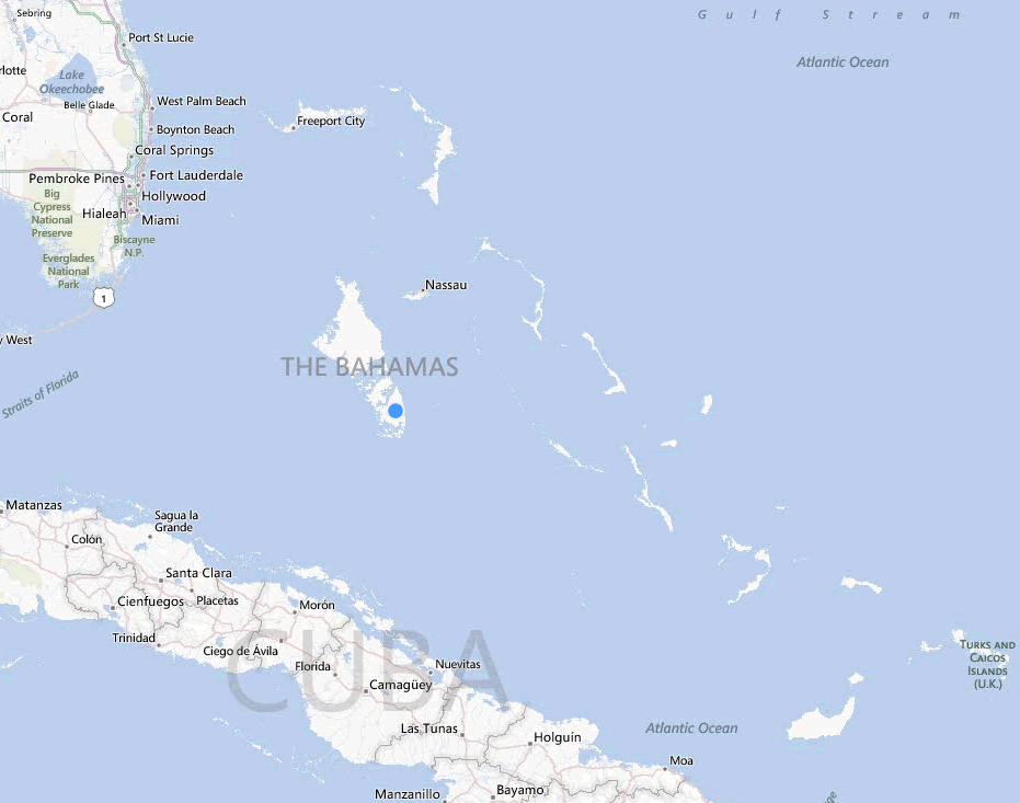
BAHAMAS MAP OF CARIBBEAN
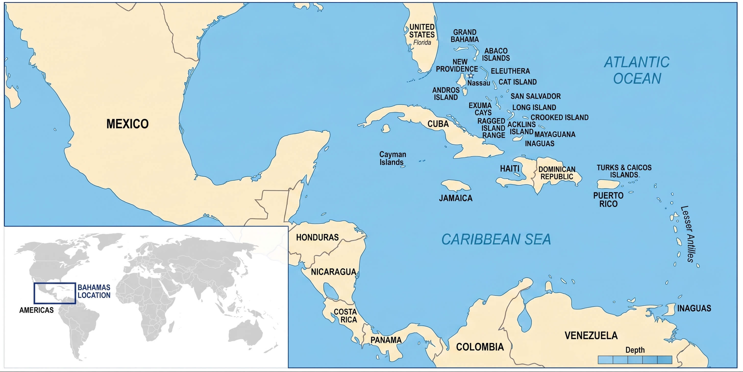
BAHAMAS MAP WITH CARIBBEAN AND CUBA
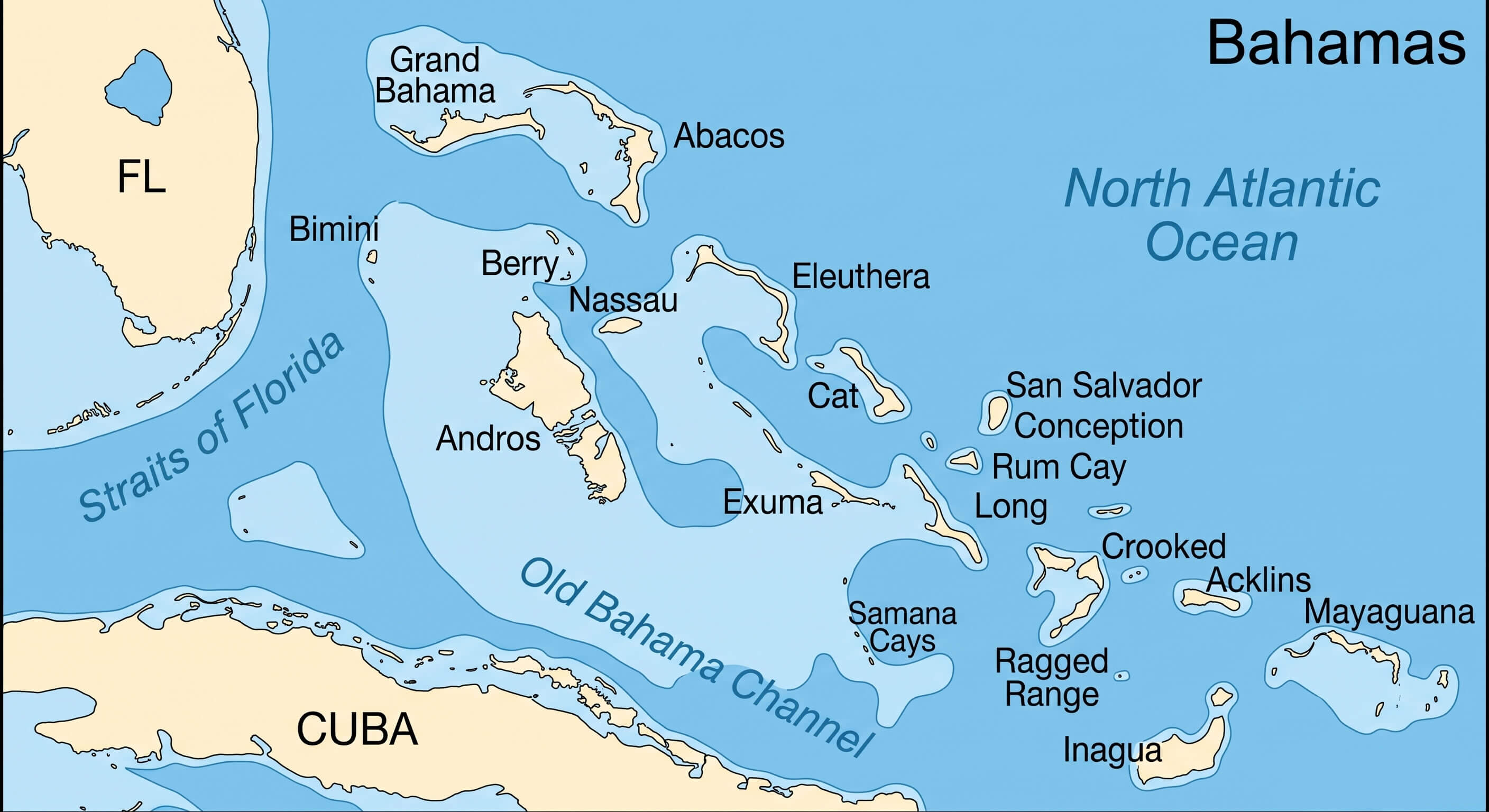
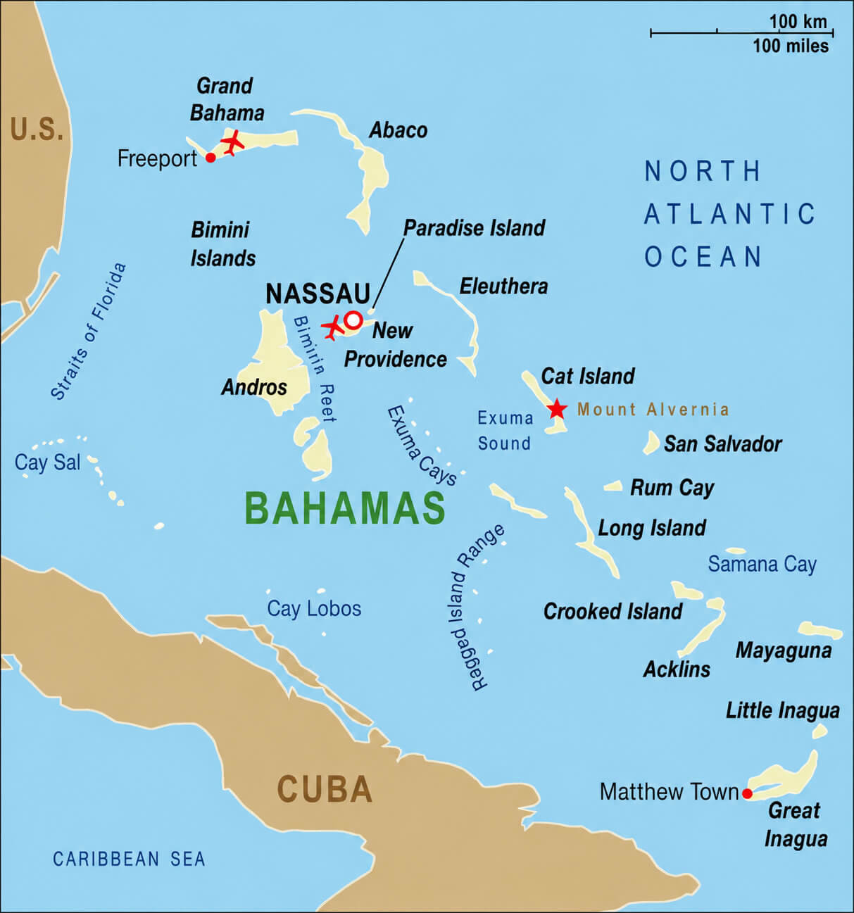
BAHAMAS AND CARIBBEAN GEOGRAPHIC MAP
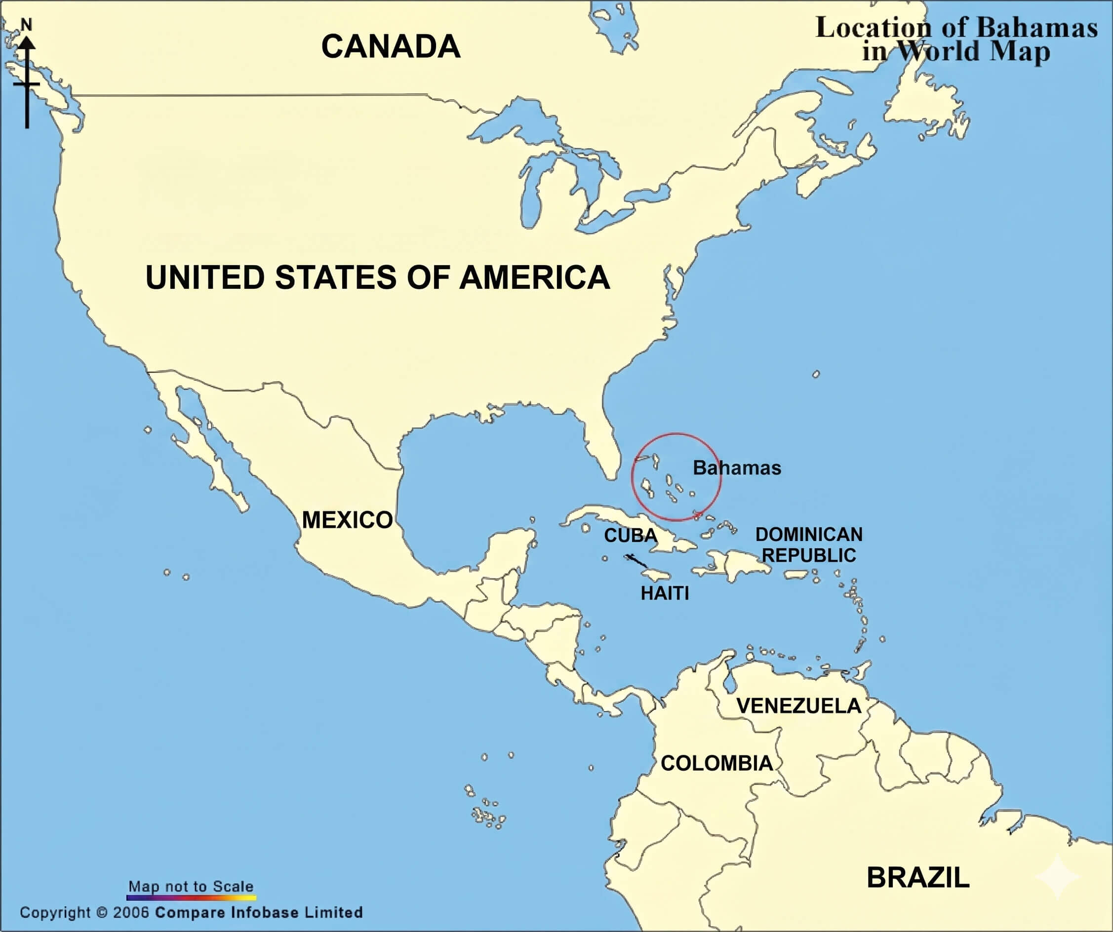
WHERE IS BAHAMAS ON THE WORLD MAP
BAHAMAS OUTLINE MAP
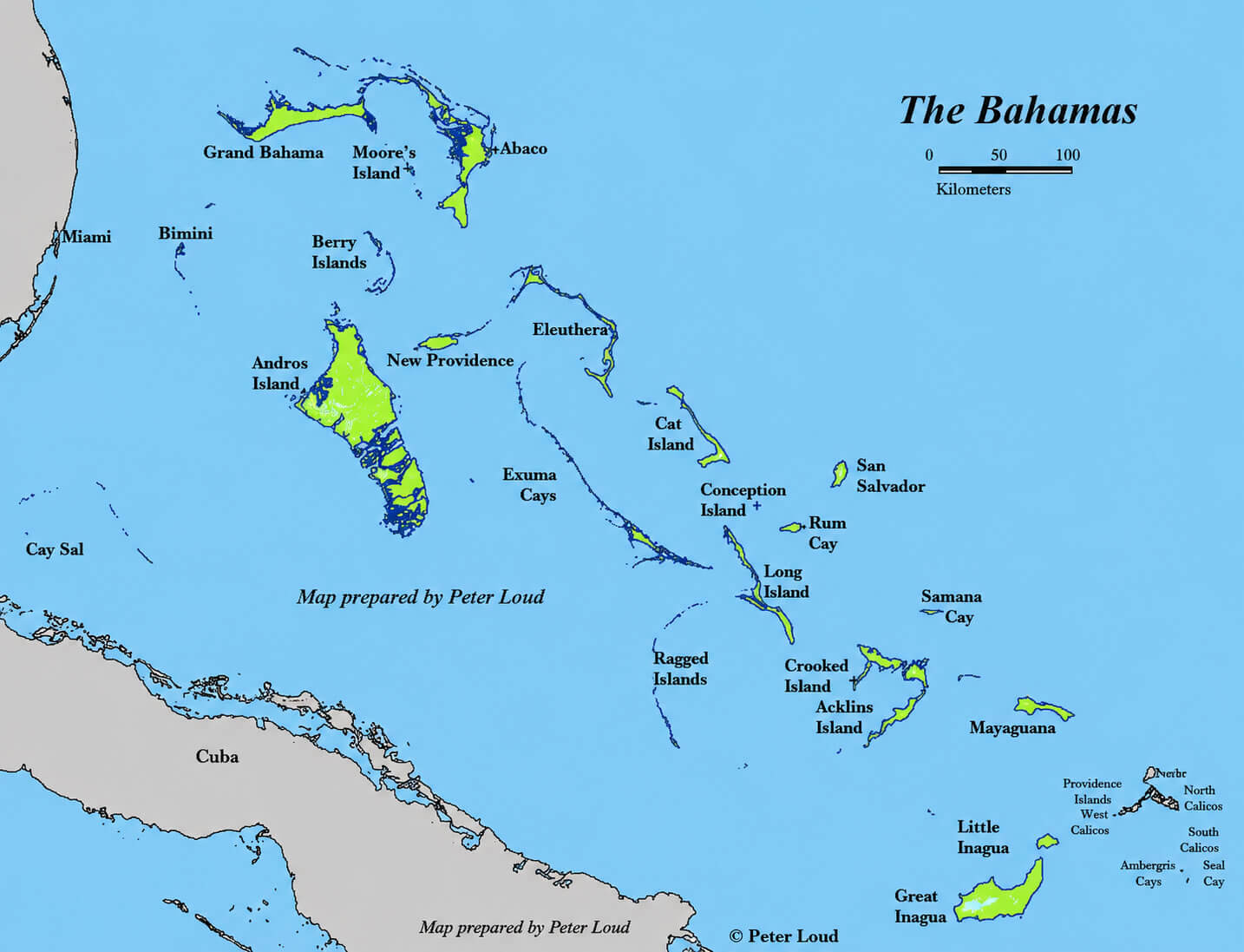
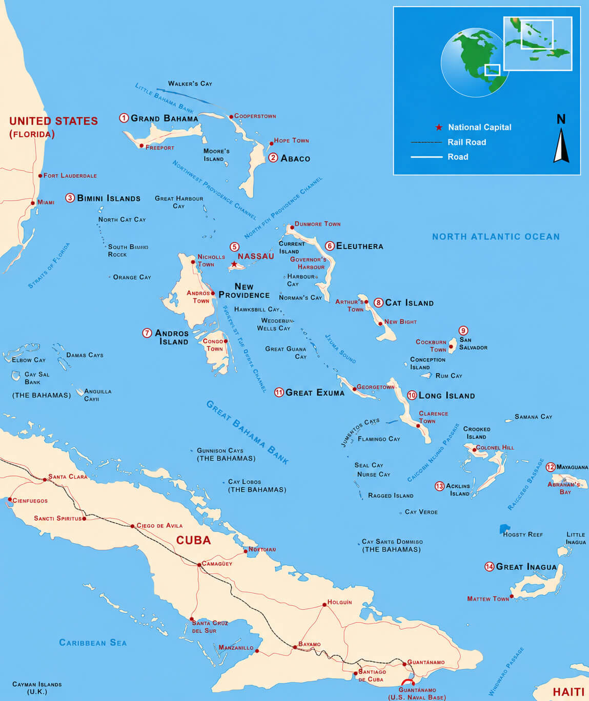
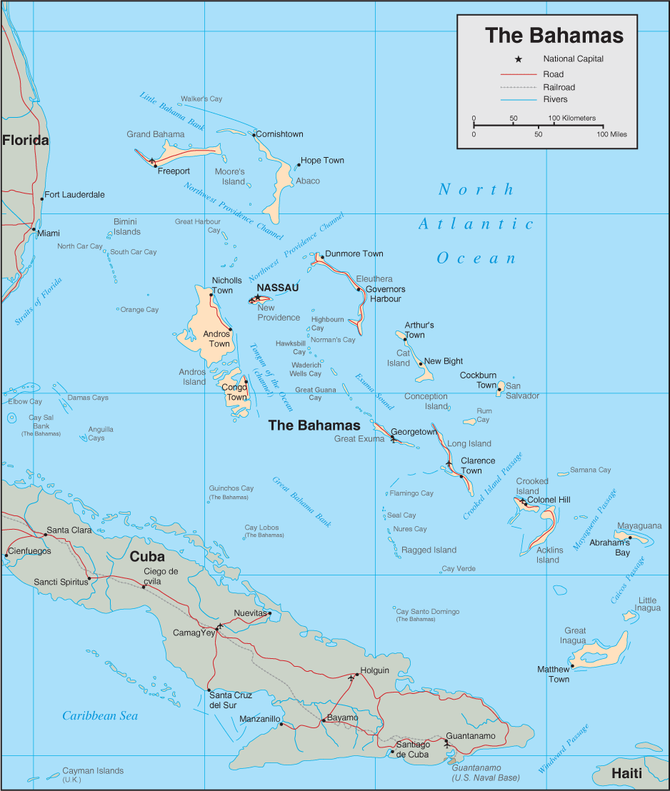
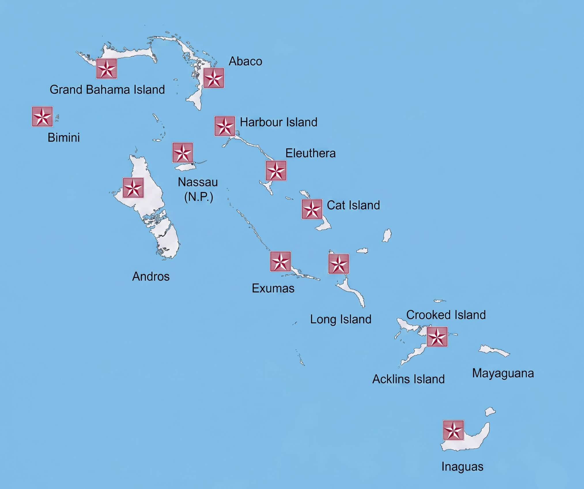
BAHAMAS REGIONS MAP
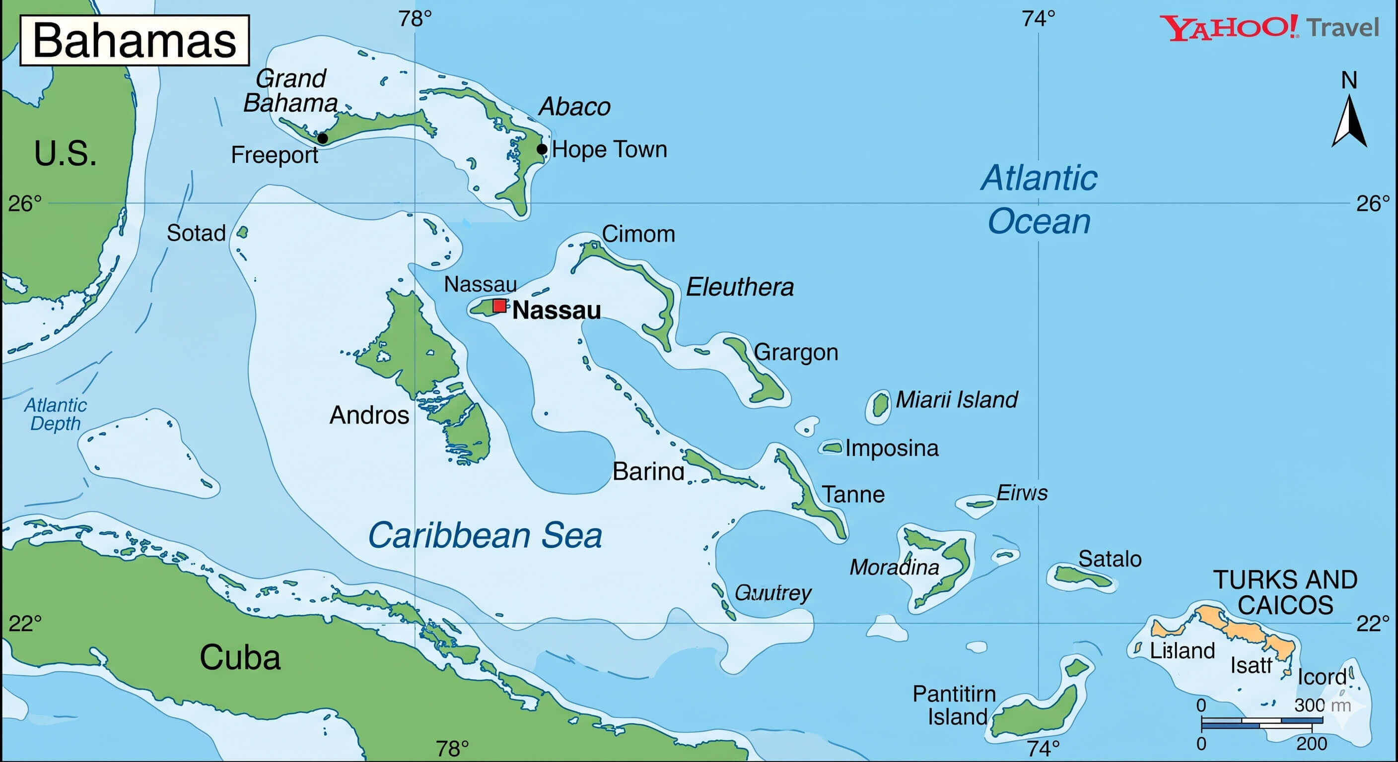
BAHAMAS CARIBBEAN MAP
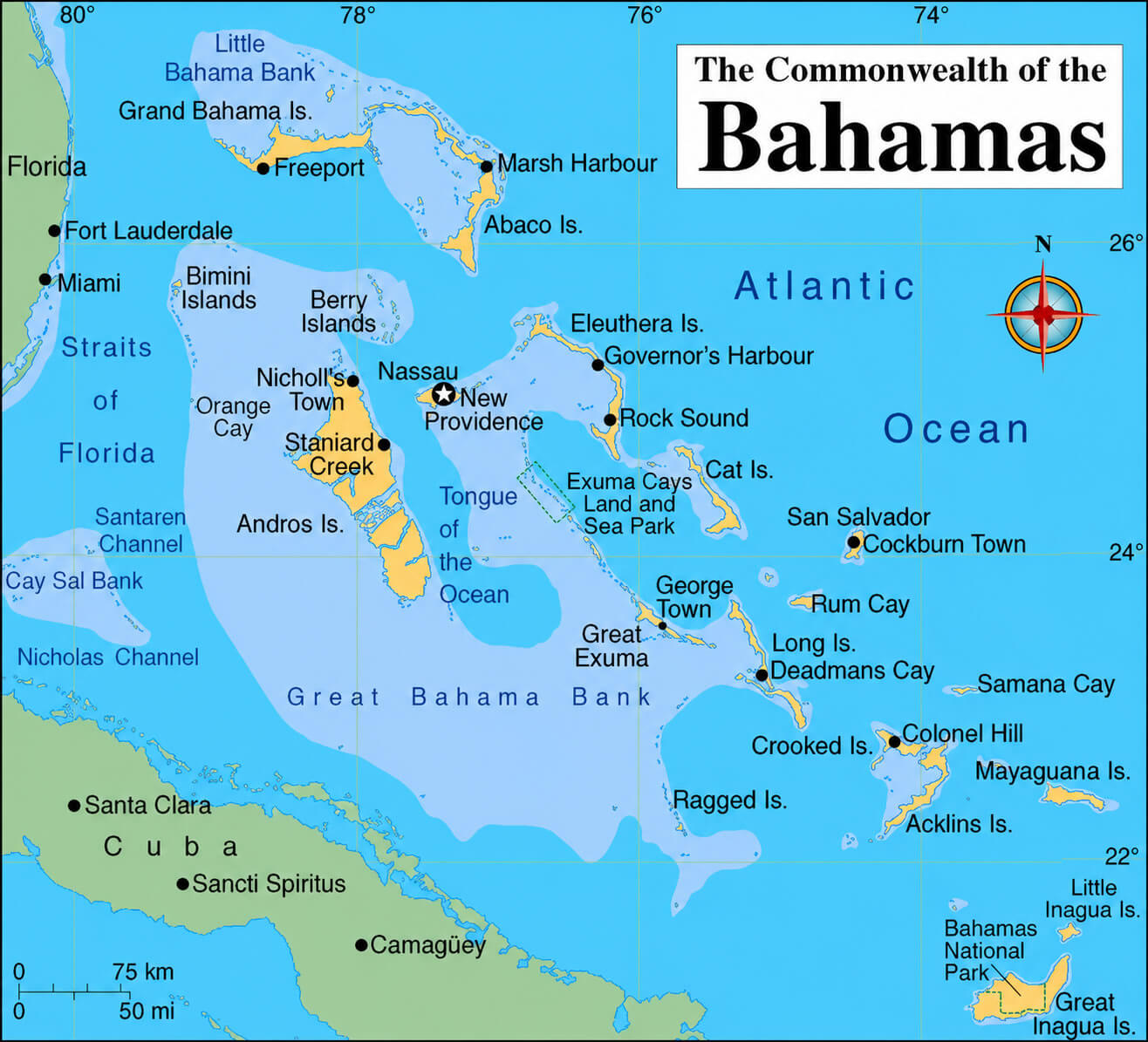
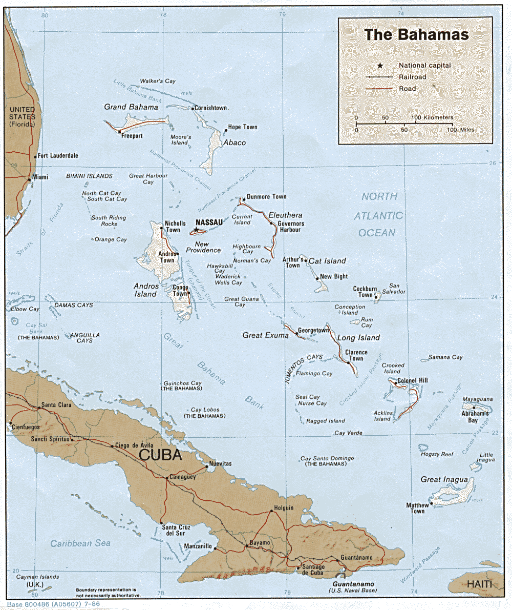
THE BAHAMAS MAP
BAHAMAS COUNTRY MAP
BAHAMAS DETAILED LOCATION MAP
BAHAMAS DETAILED MAP
BAHAMAS EARTH MAP
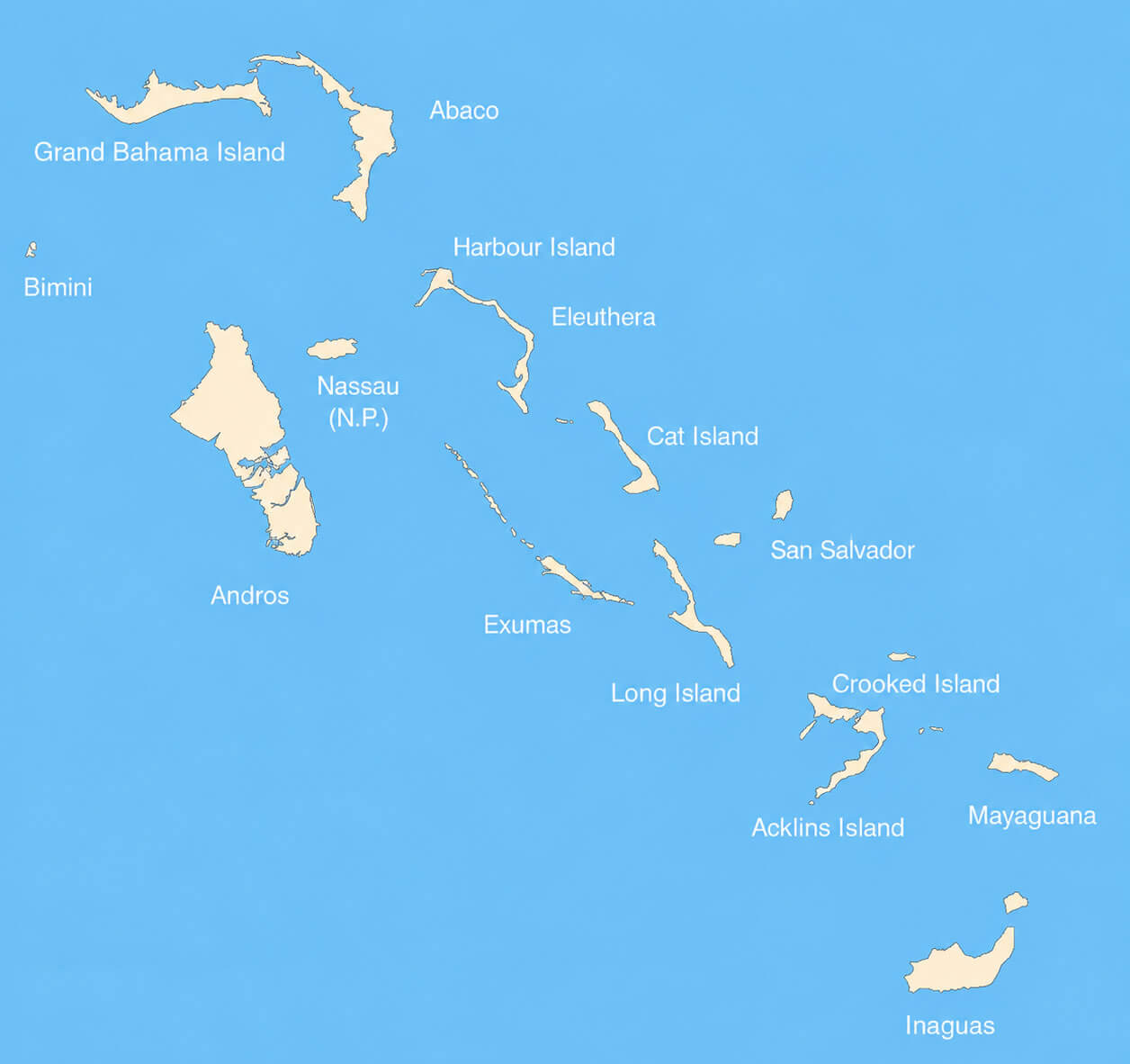
BAHAMAS ISLANDS MAP
BAHAMAS ISLANDS OVERVIEW MAP
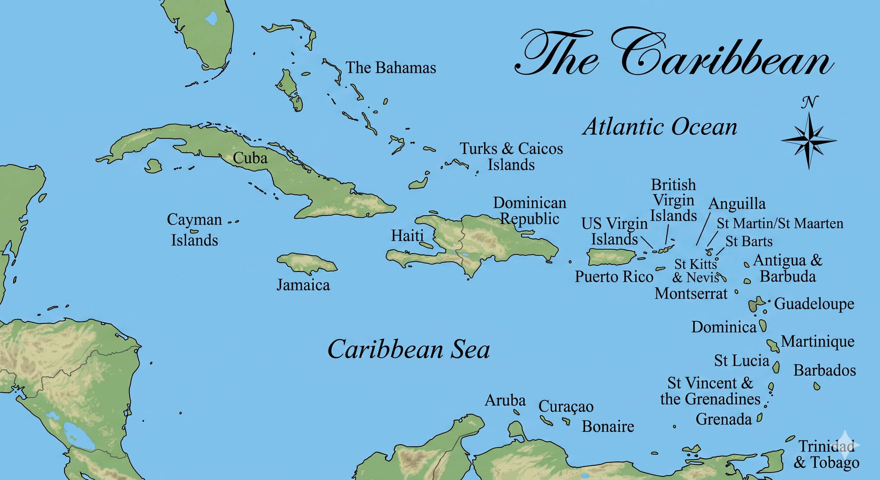
BAHAMAS MAP WITH CARIBBEAN ISLANDS
BAHAMAS POLITICAL MAP
BAHAMAS REGIONAL MAP
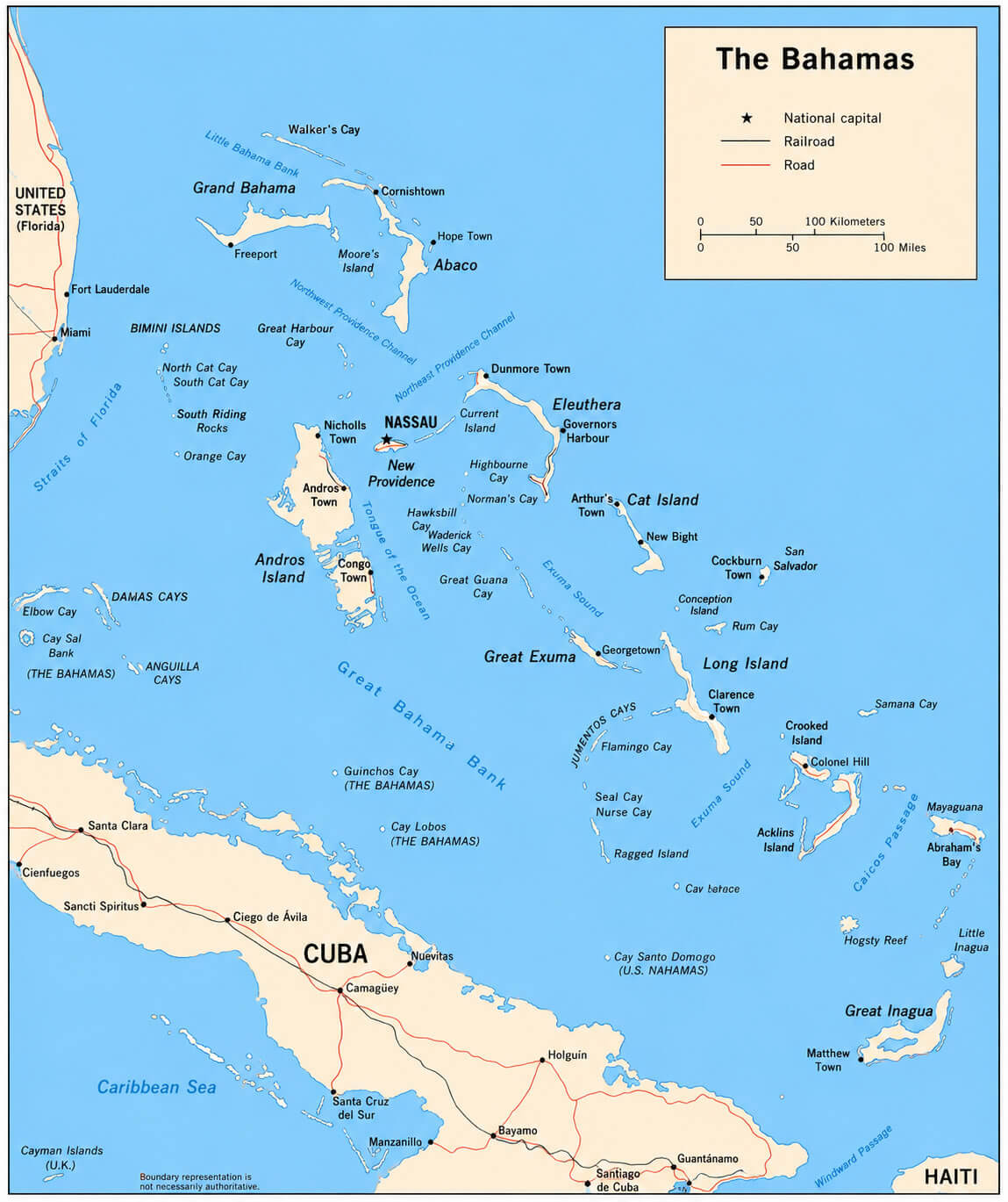
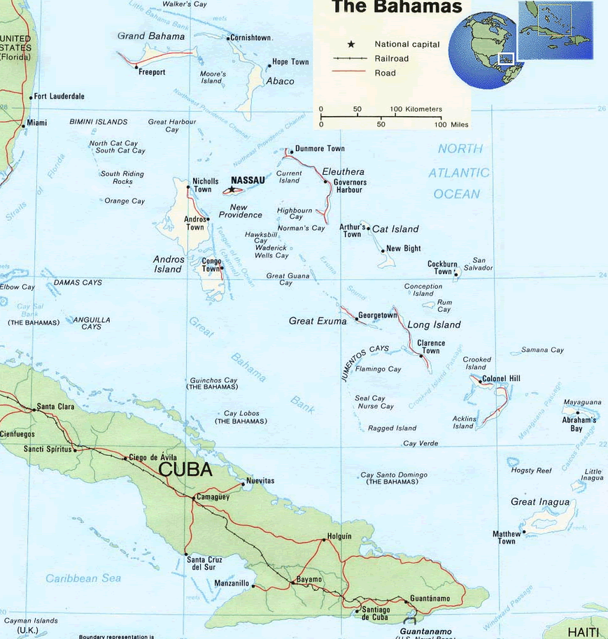
BAHAMAS ROAD MAP
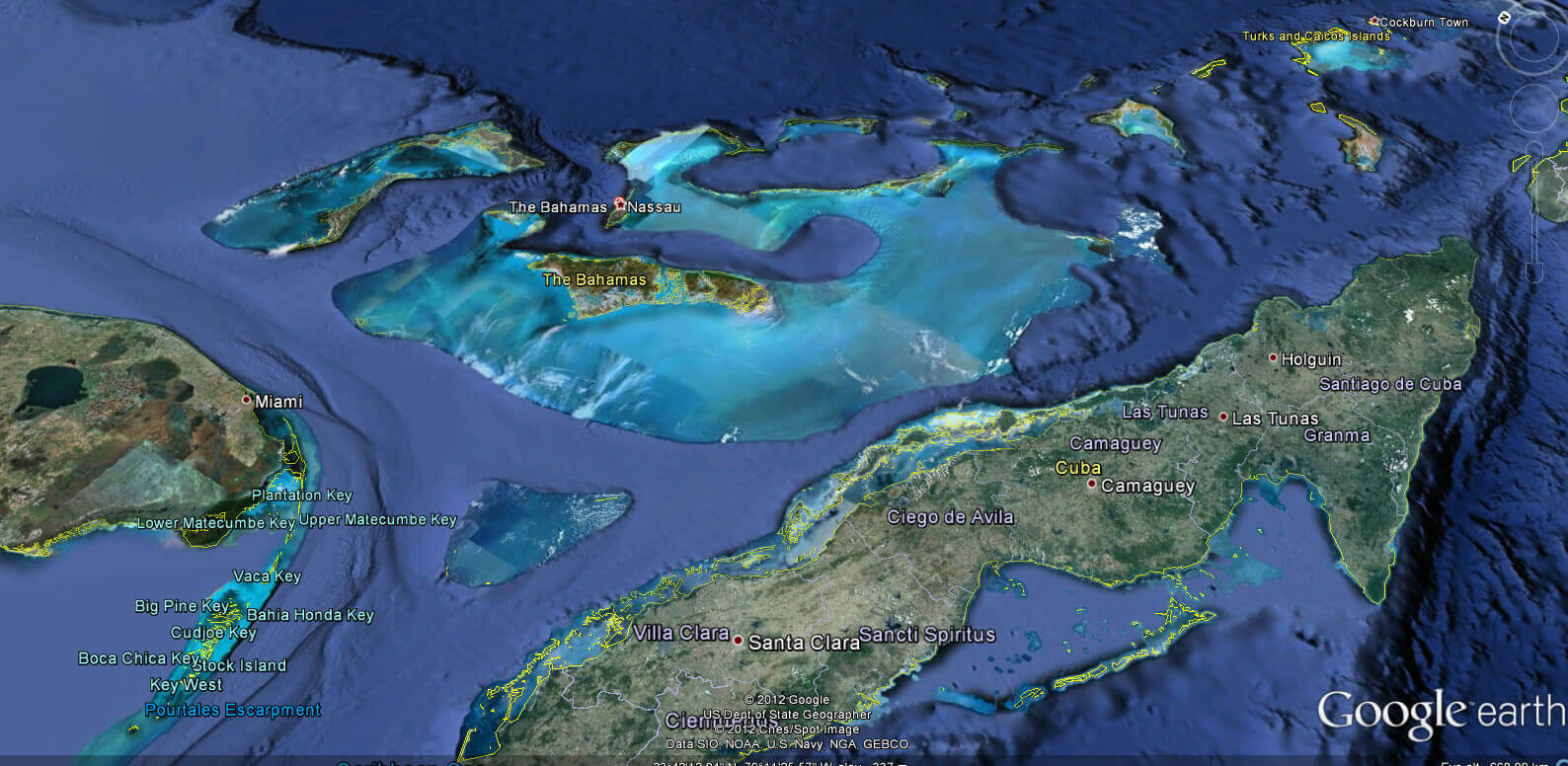
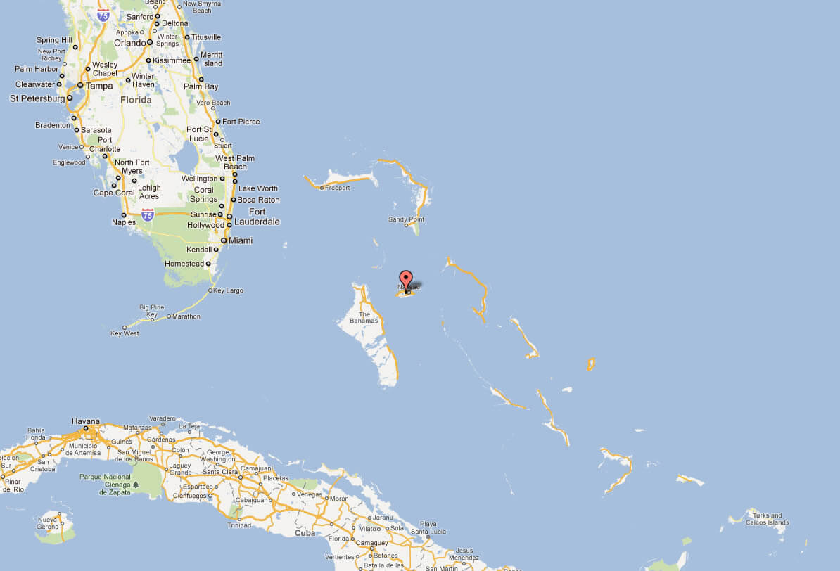
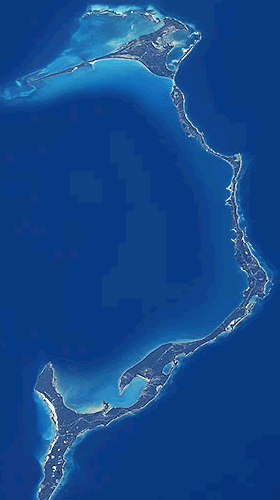
BAHAMAS SATELLITE MAP
BAHAMAS SKETCH MAP
BAHAMAS TERRAIN MAP
BAHAMAS TOURISM MAP
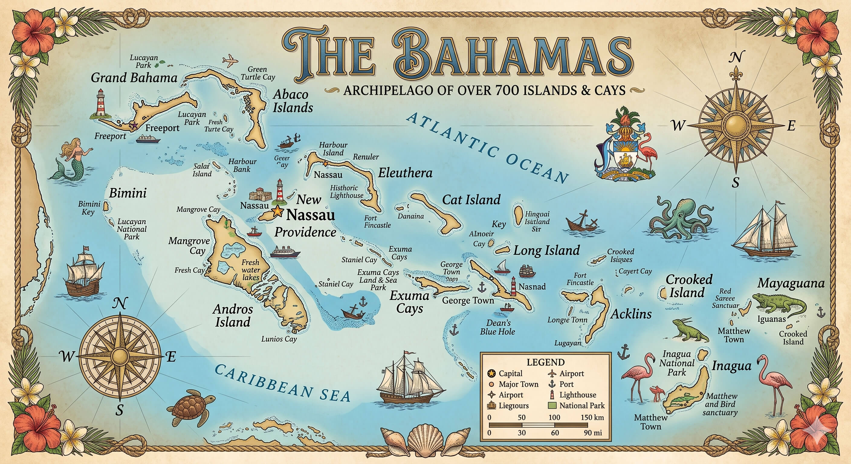
BAHAMAS TOURIST MAP
ELEUTHERA BAHAMAS MAP
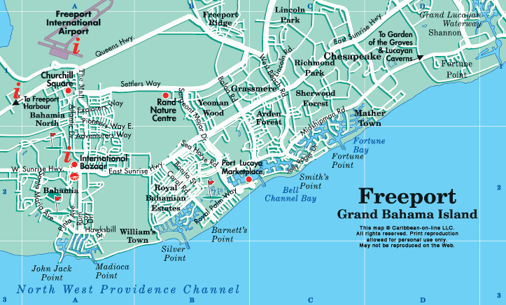
FREEPORT BAHAMAS CITY MAP
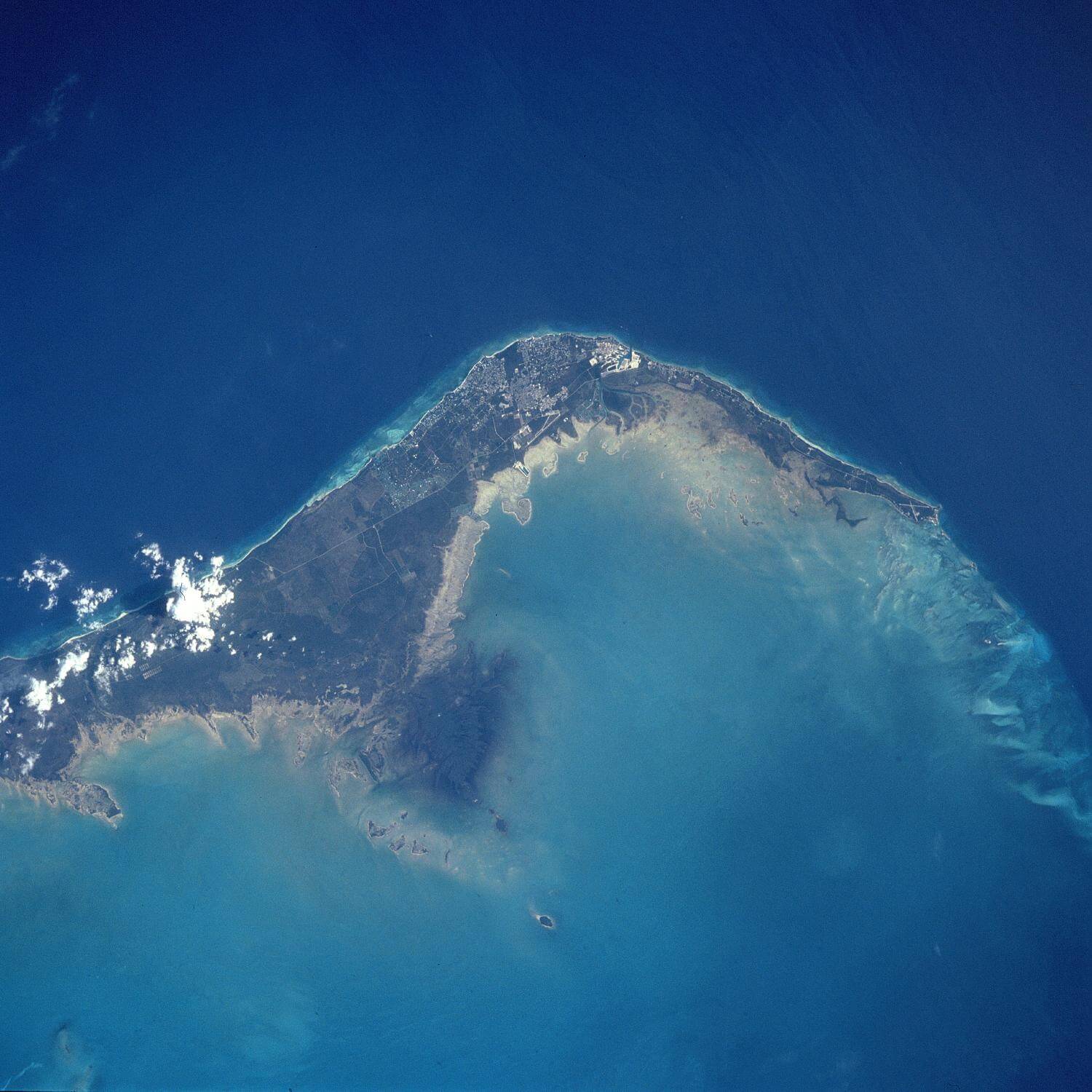
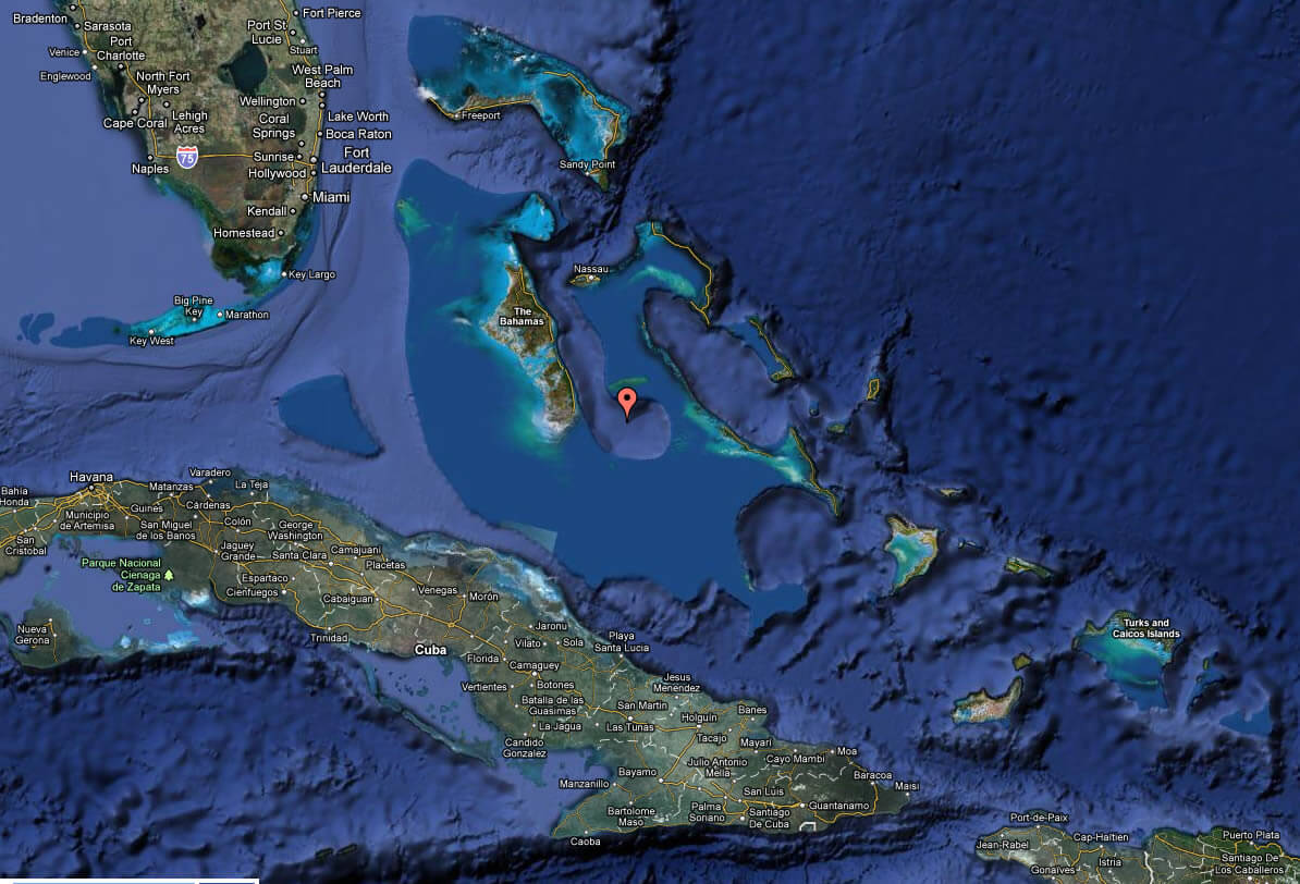
SATELLITE IMAGE OF BAHAMAS
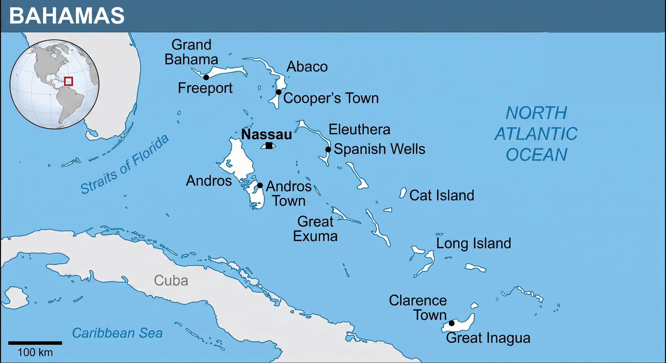
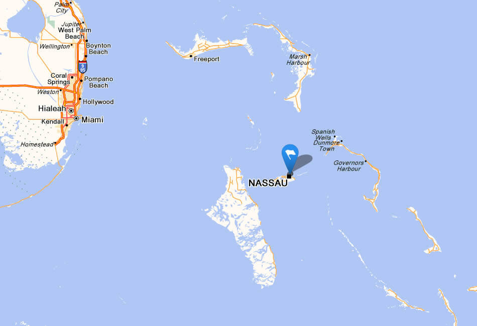
THE BAHAMAS LOCATION MAP
Bahamas Beyond the Beaches: Exploring the Hidden Depths of Island Culture
Please subscribe on "World Guide" channnel on Youtube at youtube.com/c/WorldGuide
A Collection of North America Maps: Dive into the Continent's Uncharted Stories
- Head of Performance Marketing
- Head of SEO
- Linkedin Profile: linkedin.com/in/arifcagrici
See Also
Bahamas Google Map, Street Views, Maps Directions, Satellite Images
turkey-visit.com offers a collection of Bahamas map, google map, Bahamas atlas, political, physical, satellite view, country infos, cities map and more map of Bahamas.
Copyright Turkey Travel Guide - 2005 - 2026. All rights reserved. Privacy Policy | Disclaimer