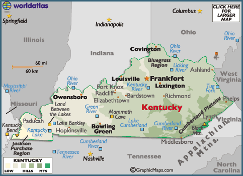
Kentucky Map
Discover the natural beauty and rich history of Kentucky with our interactive map! From the rolling hills of the Bluegrass Region to the majestic Mammoth Cave National Park, our map allows you to explore all that this state has to offer. Find information on major cities, attractions, and natural landmarks to plan your next adventure in Kentucky.
For all Kentucky Cities Map
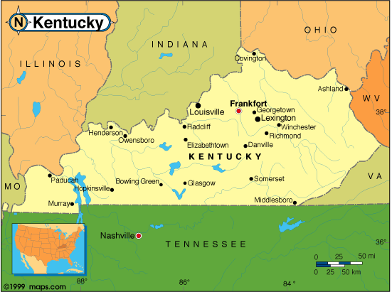
MAP OF KENTUCKY
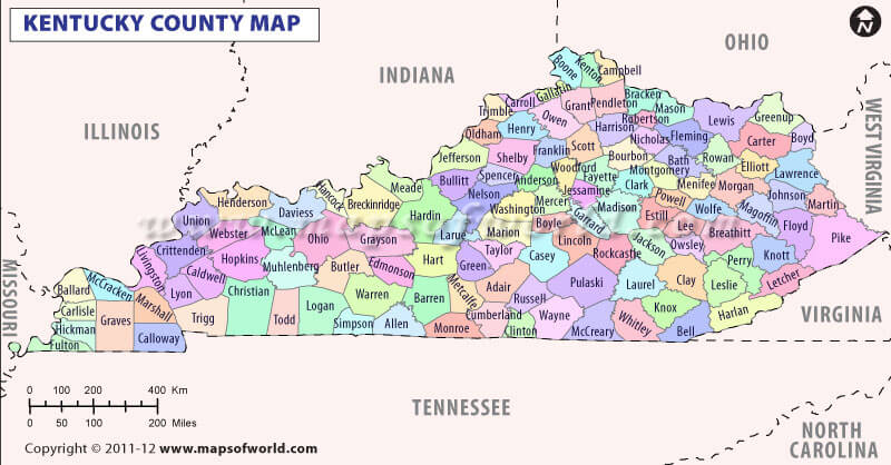
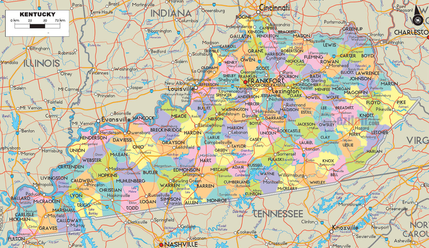
KENTUCKY COUNTY MAP
Brief information about kentucky, US
Kentucky is a state located in the southeastern region of the United States. It is known as the Bluegrass State due to the fertile soil found in the central part of the state. The capital of Kentucky is Frankfort, and its largest city is Louisville.- Area: 40,408 square miles (104,656 square kilometers)
- Population: Approximately 4.5 million people
- Largest cities: Louisville, Lexington, Bowling Green, Owensboro, Covington
Demographics:
- Race and ethnicity: White (85.6%), Black or African American (8.4%), Hispanic or Latino (4.3%), Asian (1.5%), Two or more races (1.4%), Other race (0.8%)
- Median age: 39.2 years
- Gender: Female (50.8%), Male (49.2%)
History:
- Kentucky was originally part of Virginia, but became the 15th state to join the Union on June 1, 1792.
- The state played a significant role in the Civil War, with both Union and Confederate forces battling for control.
- Kentucky is also known for the Hatfield-McCoy feud, a long-running and violent dispute between two families that began in the late 1800s.
Economy:
- Kentucky's economy is diverse, with major industries including manufacturing, agriculture, and tourism.
- Manufacturing is the largest sector of the state's economy, with major employers including Toyota, Ford, and General Electric.
- Kentucky is the leading producer of bourbon in the world, with many distilleries located throughout the state.
- Agriculture is also an important industry, with tobacco, corn, and soybeans among the top crops produced in Kentucky.
A Collection of Kentucky Maps and Kentucky Satellite Images
MAP OF KENTUCKY
CITIES MAP OF KENTUCKY
KENTUCKY COUNTY MAP
KENTUCKY COUNTY MAP
KENTUCKY MAP

KENTUCKY CITIES MAP

KENTUCKY COUNTY MAP

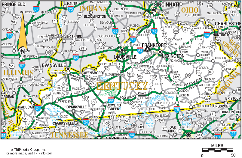
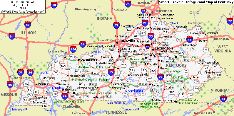
KENTUCKY HIGHWAYS MAP

KENTUCKY LAND MAP

KENTUCKY MAP LEXINGTON

KENTUCKY PHYSICAL MAP

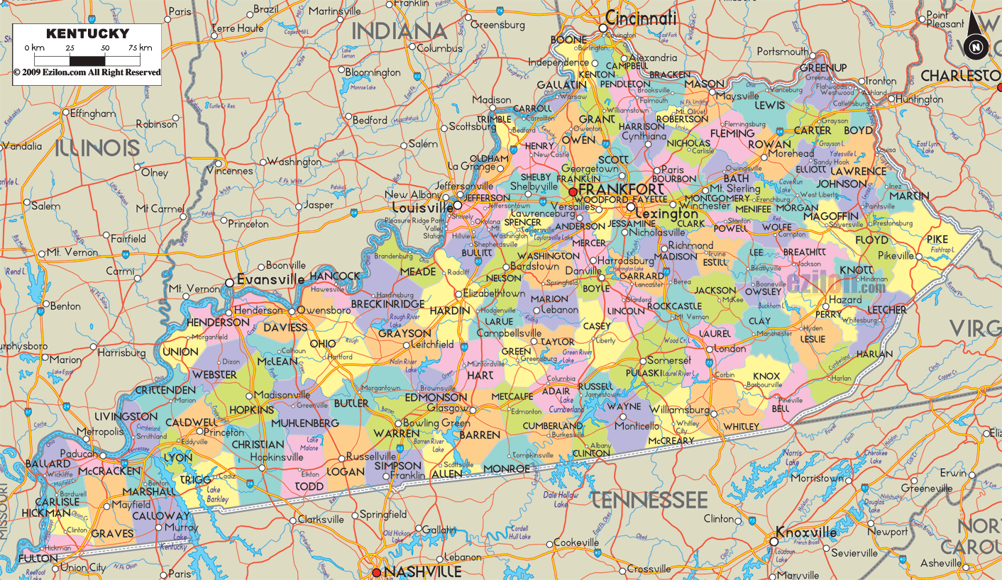
KENTUCKY REFERENCE MAP

KENTUCKY RIVERS MAP

KENTUCKY ROAD MAP

KENTUCKY STATE MAP
KENTUCKY ZIP CODE MAP

PHYSICAL MAP OF KENTUCKY

ROUTE MAP OF KENTUCKY
A collection of Kentucky Maps
- Head of Performance Marketing
- Head of SEO
- Linkedin Profile: linkedin.com/in/arifcagrici
Largest Cities Map of Kentucky and Population
Louisville Map - 597,337 Lexington Fayette Map - 295,803 Bowling Green Map - 58,067 Owensboro Map - 57,265 Covington Map - 40,640 Hopkinsville Map - 31,577 Richmond Map - 31,364 Florence Map - 29,951 Georgetown Map - 29,098 Henderson Map - 28,757 Elizabethtown Map - 28,531 Nicholasville Map - 28,015 Jeffersontown Map - 26,595 Frankfort Map - 25,527 Paducah Map - 25,024 Mayfield Map - 10,024Copyright Turkey Travel Guide - 2005 - 2025. All rights reserved. Privacy Policy | Disclaimer