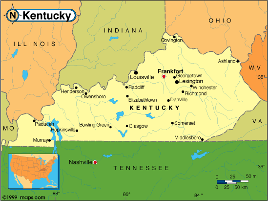
Kentucky Map
N avigate Kentucky Map, Kentucky states map, satellite images of the Kentucky, Kentucky largest cities maps, political map of Kentucky, driving directions and traffic maps.
All Kentucky Cities Maps by Population
- Louisville Map - (597,337)
- Lexington Fayette Map - (295,803)
- Bowling Green Map - (58,067)
- Owensboro Map - (57,265)
- Covington Map - (40,640)
- Hopkinsville Map - (31,577)
- Richmond Map - (31,364)
- Florence Map - (29,951)
- Georgetown Map - (29,098)
- Henderson Map - (28,757)
- Elizabethtown Map - (28,531)
- Nicholasville Map - (28,015)
- Jeffersontown Map - (26,595)
- Frankfort Map - (25,527)
- Paducah Map - (25,024)
- Independence Map - (24,757)
- Radcliff Map - (21,688)
- Ashland Map - (21,684)
- Madisonville Map - (19,591)
- Winchester Map - (18,368)
- Erlanger Map - (18,082)
- Murray Map - (17,741)
- St. Matthews Map - (17,472)
- Fort Thomas Map - (16,325)
- Danville Map - (16,218)
- Burlington Map - (15,926)
- Newport Map - (15,273)
- Shively Map - (15,264)
- Shelbyville Map - (14,045)
- Glasgow Map - (14,028)
- Fort Campbell North Map - (13,685)
- Berea Map - (13,561)
- Bardstown Map - (11,700)
- Shepherdsville Map - (11,222)
- Somerset Map - (11,196)
- Lyndon Map - (11,002)
- Lawrenceburg Map - (10,505)
- Middlesborough Map - (10,334)
- Fort Knox Map - (10,124)
- Mayfield Map - (10,024)
- Mount Washington Map - (9,117)
- Campbellsville Map - (9,108)
- Oakbrook Map - (9,036)
- Maysville Map - (9,011)
- Edgewood Map - (8,575)
- Versailles Map - (8,568)
- Paris Map - (8,553)
- Alexandria Map - (8,477)
- Elsmere Map - (8,451)
- Franklin Map - (8,408)
- Harrodsburg Map - (8,340)
- Fort Mitchell Map - (8,207)
- Hillview Map - (8,172)
- La Grange Map - (8,082)
- London Map - (7,993)
- Francisville Map - (7,944)
- Villa Hills Map - (7,489)
- Oak Grove Map - (7,489)
- Flatwoods Map - (7,423)
- Corbin Map - (7,304)
- Middletown Map - (7,218)
- Russellville Map - (6,960)
- Highland Heights Map - (6,923)
- Pikeville Map - (6,903)
- Mount Sterling Map - (6,895)
- Morehead Map - (6,845)
- Leitchfield Map - (6,699)
- Taylor Mill Map - (6,604)
- Cynthiana Map - (6,402)
- Princeton Map - (6,329)
- Monticello Map - (6,188)
- Central City Map - (5,978)
- Bellevue Map - (5,955)
- Hebron Map - (5,929)
- Cold Spring Map - (5,912)
- Buckner Map - (5,837)
- Fort Wright Map - (5,723)
- Lebanon Map - (5,539)
- Douglass Hills Map - (5,484)
- Union Map - (5,379)
- Dayton Map - (5,338)
- Williamsburg Map - (5,245)
- Westwood Map - (4,746)
- Farley Map - (4,701)
- Prospect Map - (4,698)
- Hendron Map - (4,687)
- Crestwood Map - (4,531)
- Vine Grove Map - (4,520)
- Massac Map - (4,505)
- Reidland Map - (4,491)
- Hazard Map - (4,456)
- Columbia Map - (4,452)
- Ludlow Map - (4,407)
- Benton Map - (4,349)
- Greenville Map - (4,312)
- Scottsville Map - (4,226)
- Grayson Map - (4,217)
- Hurstbourne Map - (4,216)
- Carrollton Map - (3,938)
- Williamstown Map - (3,925)
- Crittenden Map - (3,815)
- Southgate Map - (3,803)
- Crescent Springs Map - (3,801)
- Wilmore Map - (3,686)
- Walton Map - (3,635)
- Stanford Map - (3,487)
- Paintsville Map - (3,459)
- Lancaster Map - (3,442)
- West Liberty Map - (3,435)
- Beaver Dam Map - (3,409)
- Russell Map - (3,380)
- Morganfield Map - (3,285)
- Prestonsburg Map - (3,255)
- Hodgenville Map - (3,206)
- Providence Map - (3,193)
- Barbourville Map - (3,165)
- Crestview Hills Map - (3,148)
- Marion Map - (3,039)
- Wilder Map - (3,035)
- Park Hills Map - (2,970)
- Graymoor Devondale Map - (2,870)
- Indian Hills Map - (2,868)
- Dawson Springs Map - (2,764)
- Stanton Map - (2,733)
- Irvine Map - (2,715)
- Hartford Map - (2,672)
- Lakeside Park Map - (2,668)
- Flemingsburg Map - (2,658)
- Brandenburg Map - (2,643)
- Calvert City Map - (2,566)
- Cadiz Map - (2,558)
- Eddyville Map - (2,554)
- Springfield Map - (2,519)
- Eminence Map - (2,498)
- Simpsonville Map - (2,484)
- Mount Vernon Map - (2,477)
- Louisa Map - (2,467)
- Fulton Map - (2,445)
- Russell Springs Map - (2,441)
- Raceland Map - (2,424)
- Tompkinsville Map - (2,402)
- Brooks Map - (2,401)
- Hickman Map - (2,395)
- Morgantown Map - (2,394)
- Windy Hills Map - (2,385)
- Claryville Map - (2,355)
- Anchorage Map - (2,348)
- Hardinsburg Map - (2,343)
- Horse Cave Map - (2,311)
- Junction City Map - (2,241)
- Cave City Map - (2,240)
- Cumberland Map - (2,237)
- Jackson Map - (2,231)
- Jenkins Map - (2,203)
- Dry Ridge Map - (2,191)
- Falmouth Map - (2,169)
- Liberty Map - (2,168)
- Greensburg Map - (2,163)
- Whitesburg Map - (2,139)
- Breckinridge Center Map - (2,080)
- Elkton Map - (2,062)
- Albany Map - (2,033)
- Pioneer Village Map - (2,030)
- Carlisle Map - (2,010)
- Doe Valley Map - (1,931)
- Sturgis Map - (1,898)
- Salyersville Map - (1,883)
- Catlettsburg Map - (1,856)
- Lebanon Junction Map - (1,813)
- Hurstbourne Acres Map - (1,811)
- Jamestown Map - (1,794)
- North Corbin Map - (1,773)
- Harlan Map - (1,745)
- Pineville Map - (1,732)
- Coal Run Village Map - (1,706)
- Ledbetter Map - (1,683)
- Lewisport Map - (1,670)
- Midway Map - (1,641)
- Pine Knot Map - (1,621)
- Munfordville Map - (1,615)
- Warsaw Map - (1,615)
- Worthington Map - (1,609)
- Sebree Map - (1,603)
- Olive Hill Map - (1,599)
- Edmonton Map - (1,595)
- Orchard Grass Hills Map - (1,595)
- Elk Creek Map - (1,539)
- Owingsville Map - (1,530)
- Burkesville Map - (1,521)
- Vanceburg Map - (1,518)
- Jeffersonville Map - (1,506)
- Audubon Park Map - (1,473)
- Loyall Map - (1,461)
- Pewee Valley Map - (1,456)
- Verona Map - (1,455)
- St. Regis Park Map - (1,454)
- Worthington Hills Map - (1,446)
- Guthrie Map - (1,419)
- Stearns Map - (1,416)
- Earlington Map - (1,413)
- Clinton Map - (1,388)
- Livermore Map - (1,365)
- Auburn Map - (1,340)
- Owenton Map - (1,327)
- Beechwood Village Map - (1,324)
- Beattyville Map - (1,307)
- Manchester Map - (1,255)
- West Buechel Map - (1,230)
- Barbourmeade Map - (1,218)
- Brodhead Map - (1,211)
- Nortonville Map - (1,204)
- Augusta Map - (1,190)
- Greenup Map - (1,188)
- Irvington Map - (1,181)
- Clay Map - (1,181)
- Whitley City Map - (1,170)
- Cloverport Map - (1,152)
- South Shore Map - (1,122)
- Plano Map - (1,117)
- Silver Grove Map - (1,102)
- Coldstream Map - (1,100)
- Annville Map - (1,095)
- Hebron Estates Map - (1,087)
- Camargo Map - (1,081)
- Clay City Map - (1,077)
- Heritage Creek Map - (1,076)
- Ryland Heights Map - (1,022)
- Northfield Map - (1,020)
- Masonville Map - (1,014)
- La Center Map - (1,009)
- Uniontown Map - (1,002)
- Wurtland Map - (995)
- Elkhorn City Map - (982)
- Watterson Park Map - (976)
- Burgin Map - (965)
- Evarts Map - (962)
- Flat Lick Map - (960)
- Rolling Hills Map - (959)
- Muldraugh Map - (947)
- Hawesville Map - (945)
- Woodlawn Park Map - (942)
- Langdon Place Map - (936)
- Ferguson Map - (924)
- Lynnview Map - (914)
- New Castle Map - (912)
- Goshen Map - (909)
- Phelps Map - (893)
- Bellefonte Map - (888)
- White Plains Map - (884)
- Clarkson Map - (875)
- Pembroke Map - (869)
- Garrison Map - (866)
- Bellemeade Map - (865)
- Mortons Gap Map - (863)
- South Wallins Map - (859)
- Cannonsburg Map - (856)
- New Haven Map - (855)
- Adairville Map - (852)
- Crab Orchard Map - (841)
- Bloomfield Map - (838)
- Brownsville Map - (836)
- Pleasureville Map - (834)
- Plantation Map - (832)
- Fincastle Map - (817)
- Campbellsburg Map - (813)
- Lewisburg Map - (810)
- McKee Map - (800)
- West Point Map - (797)
- Millersburg Map - (792)
- Dixon Map - (786)
- McRoberts Map - (784)
- Hollow Creek Map - (783)
- Wheelwright Map - (780)
- Hindman Map - (777)
- Fleming Neon Map - (770)
- Blue Ridge Manor Map - (767)
- Calhoun Map - (763)
- Taylorsville Map - (763)
- Bromley Map - (763)
- Salem Map - (752)
- Perryville Map - (751)
- Crofton Map - (749)
- Lynch Map - (747)
- Powderly Map - (745)
- Hanson Map - (742)
- Meadow Vale Map - (736)
- Cawood Map - (731)
- Bardwell Map - (723)
- Corydon Map - (720)
- Inez Map - (717)
- East Bernstadt Map - (716)
- Green Spring Map - (715)
- Smiths Grove Map - (714)
- Loretto Map - (713)
- Seneca Gardens Map - (696)
- Woodland Hills Map - (696)
- Science Hill Map - (693)
- Beechmont Map - (689)
- Wickliffe Map - (688)
- Betsy Layne Map - (688)
- Upton Map - (683)
- Sandy Hook Map - (675)
- Barlow Map - (675)
- Auxier Map - (669)
- Spring Valley Map - (654)
- Parkway Village Map - (650)
- Kuttawa Map - (649)
- Strathmoor Village Map - (648)
- Brownsboro Farm Map - (648)
- Rolling Fields Map - (646)
- North Middletown Map - (643)
- Stamping Ground Map - (643)
- Brooksville Map - (642)
- Martin Map - (634)
- Westwood Map - (634)
- Wingo Map - (632)
- Petersburg Map - (620)
- Hardin Map - (615)
- Symsonia Map - (615)
- Butler Map - (612)
- Burnside Map - (611)
- Caneyville Map - (608)
- Ravenna Map - (605)
- South Williamson Map - (602)
- Bedford Map - (599)
- Artemus Map - (590)
- Murray Hill Map - (582)
- Milton Map - (574)
- Cecilia Map - (572)
- Summersville Map - (568)
- Wellington Map - (565)
- Whitesville Map - (552)
- Park City Map - (537)
- Hollyvilla Map - (537)
- Pippa Passes Map - (533)
- Glenview Map - (531)
- Fordsville Map - (524)
- Magnolia Map - (524)
- Drakesboro Map - (515)
- Robards Map - (515)
- Sonora Map - (513)
- Houston Acres Map - (507)
- Benham Map - (500)
- Buffalo Map - (498)
- Bancroft Map - (494)
- Mayking Map - (487)
- Frenchburg Map - (486)
- Crestview Map - (475)
- Sacramento Map - (468)
- Fancy Farm Map - (458)
- Gilbertsville Map - (458)
- Island Map - (458)
- Diablock Map - (453)
- Plum Springs Map - (453)
- Fox Chase Map - (447)
- Riverwood Map - (446)
- Forest Hills Map - (444)
- Norbourne Estates Map - (441)
- Campton Map - (441)
- Briarwood Map - (435)
- Moorland Map - (431)
- Emlyn Map - (427)
- Wayland Map - (426)
- Centertown Map - (423)
- Salvisa Map - (420)
- Chaplin Map - (418)
- Maceo Map - (413)
- Oneida Map - (410)
- Hazel Map - (410)
- Richlawn Map - (405)
- Hustonville Map - (405)
- River Bluff Map - (403)
- Melbourne Map - (401)
- Fredonia Map - (401)
- Freeburn Map - (399)
- Rockholds Map - (390)
- McHenry Map - (388)
- Hunters Hollow Map - (386)
- Trenton Map - (384)
- Grand Rivers Map - (382)
- Kingsley Map - (381)
- Pathfork Map - (379)
- Gamaliel Map - (376)
- Kevil Map - (376)
- Norwood Map - (370)
- Hyden Map - (365)
- Meadowview Estates Map - (363)
- Poplar Hills Map - (362)
- Glencoe Map - (360)
- Woodburn Map - (355)
- Old Brownsboro Place Map - (353)
- Pleasant View Map - (350)
- Belleview Map - (343)
- Strathmoor Manor Map - (337)
- Vicco Map - (334)
- Dwale Map - (329)
- Payne Gap Map - (329)
- Spottsville Map - (325)
- Arlington Map - (324)
- Sharpsburg Map - (323)
- Jeff Map - (323)
- Ghent Map - (323)
- Bellewood Map - (321)
- Glenview Hills Map - (319)
- Eubank Map - (319)
- Brownsboro Village Map - (319)
- Dunmor Map - (317)
- Rabbit Hash Map - (315)
- Cerulean Map - (314)
- Pryorsburg Map - (311)
- Waverly Map - (308)
- Druid Hills Map - (308)
- Summer Shade Map - (307)
- Creekside Map - (305)
- Sadieville Map - (303)
- Salt Lick Map - (303)
- Smithland Map - (301)
- Mount Olivet Map - (299)
- Kenvir Map - (297)
- Sedalia Map - (295)
- Bradfordsville Map - (294)
- Goose Creek Map - (294)
- Spring Mill Map - (287)
- Fairview Map - (286)
- Farmers Map - (284)
- Willisburg Map - (282)
- Virgie Map - (279)
- Water Valley Map - (279)
- Dexter Map - (277)
- St. Charles Map - (277)
- Broeck Pointe Map - (272)
- Warfield Map - (269)
- Westport Map - (268)
- Rockport Map - (266)
- Boston Map - (266)
- Ewing Map - (264)
- Berry Map - (264)
- Wildwood Map - (261)
- Burna Map - (257)
- Bonnieville Map - (255)
- Dover Map - (252)
- Farmington Map - (245)
- Beech Grove Map - (243)
- Maytown Map - (243)
- Mays Lick Map - (242)
- High Bridge Map - (242)
- Hiseville Map - (240)
- Sanders Map - (238)
- Nebo Map - (236)
- Ezel Map - (235)
- Corinth Map - (232)
- Sparta Map - (231)
- Woodlawn Map - (229)
- Hazel Green Map - (228)
- Livingston Map - (226)
- Oakland Map - (225)
- Crossgate Map - (225)
- Coldiron Map - (223)
- Mackville Map - (222)
- Marrowbone Map - (217)
- Fountain Run Map - (217)
- Slaughters Map - (216)
- Bandana Map - (203)
- Bremen Map - (197)
- Allen Map - (193)
- Mentor Map - (193)
- Glenview Manor Map - (191)
- Lakeview Heights Map - (185)
- Worthville Map - (185)
- South Carrollton Map - (184)
- Elizaville Map - (181)
- Manitou Map - (181)
- Maryhill Estates Map - (179)
- Thornhill Map - (178)
- Cambridge Map - (175)
- Crayne Map - (173)
- Columbus Map - (170)
- Mockingbird Valley Map - (167)
- LaFayette Map - (165)
- McCarr Map - (164)
- Buckhorn Map - (162)
- Prestonville Map - (161)
- Sycamore Map - (160)
- Wheatcroft Map - (160)
- Allensville Map - (157)
- Hardyville Map - (156)
- Wallins Creek Map - (156)
- Germantown Map - (154)
- Rochester Map - (152)
- Lincolnshire Map - (148)
- Lovelaceville Map - (148)
- Fairview Map - (143)
- Hills and Dales Map - (142)
- Onton Map - (141)
- Manor Creek Map - (140)
- Gracey Map - (138)
- Monterey Map - (138)
- Meadowbrook Farm Map - (136)
- Ekron Map - (135)
- Raywick Map - (134)
- New Hope Map - (129)
- Cayce Map - (123)
- Blackey Map - (120)
- Millstone Map - (117)
- Hickory Hill Map - (114)
- Fairfield Map - (113)
- Rosine Map - (113)
- Kenton Vale Map - (110)
- Smithfield Map - (106)
- Ten Broeck Map - (103)
- Sardis Map - (103)
- Lowes Map - (98)
- Woodbury Map - (90)
- Blandville Map - (90)
- California Map - (90)
- Tolu Map - (88)
- Booneville Map - (81)
- Gratz Map - (78)
- Carrsville Map - (50)
- Blaine Map - (47)
- Foster Map - (44)
- Concord Map - (35)
- Dycusburg Map - (26)
- South Park View Map - (7)
Largest Kentucky cities map
Kentucky Google Map, Street Views, Maps Directions, Satellite Images
Please Not : You can find local businesses, public places, tourist attractions via map view, satellite image, hybrid view, driving directions in Kentucky Map. You'll also find a varity map of Kentucky such as political, administrative, transportation, demographics maps following Google map.
Submit URL to Kentucky :
Click for Kentucky Direction »
Click for Kentucky Street View »
Largest Cities Map of Kentucky and Population
Louisville Map - 597,337 Lexington Fayette Map - 295,803 Bowling Green Map - 58,067 Owensboro Map - 57,265 Covington Map - 40,640 Hopkinsville Map - 31,577 Richmond Map - 31,364 Florence Map - 29,951 Georgetown Map - 29,098 Henderson Map - 28,757 Elizabethtown Map - 28,531 Nicholasville Map - 28,015 Jeffersontown Map - 26,595 Frankfort Map - 25,527 Paducah Map - 25,024 Mayfield Map - 10,024Copyright Turkey Travel Guide - 2006 - 2023. All rights reserved. Privacy Policy | Disclaimer