Maryland Map
N avigate Maryland map, Maryland country map, satellite images of Maryland, Maryland largest cities, towns maps, political map of Maryland, driving directions, physical, atlas and traffic maps.
On upper left Map of Maryland (+) beside zoom in and (-) sign to to zoom out via the links you can visit. Maryland Map move the mouse over it via (left click) and clicking the image you can drag. Right upper Map, Satellite, Terrain icons via the map view, satellite, hybrid and terrain map can be switch between images.
map of Maryland
Navigating Baltimore's Best Kept Secrets
Please subscribe on "World Guide" channnel on Youtube at youtube.com/c/WorldGuide
The Earth, North America and Countries View from Space - Day Time and in the Night
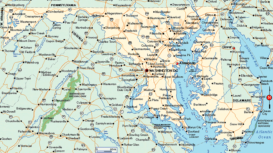
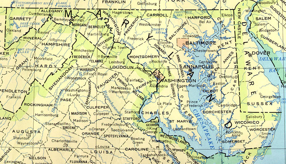
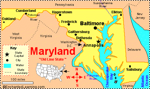
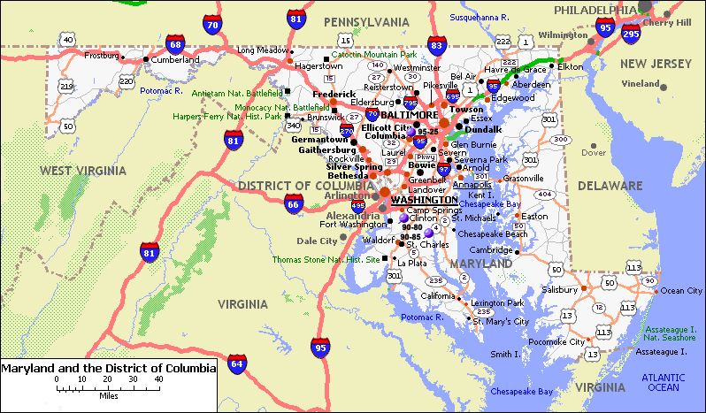
A Collection of Maryland Maps and Maryland Satellite Images
MAP OF MARYLAND

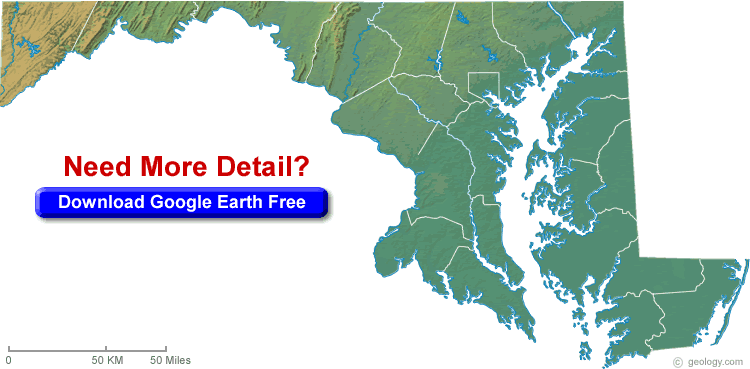
MARYLAND BLANK PHYSICAL MAP

MARYLAND CITIES MAP


MARYLAND CITY MAP


MARYLAND COUNTY MAP
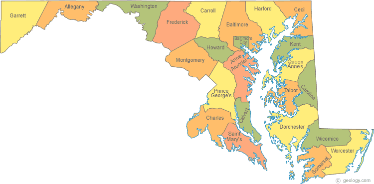

MARYLAND COUNTIES MAP
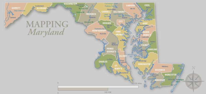

MARYLAND COUNTY MAP


MARYLAND HISTORICAL MAP

MARYLAND MAP BALTIMORE

MARYLAND MAP INTERSTATE 95


MARYLAND MAP USA


MARYLAND PRINTABLE MAP
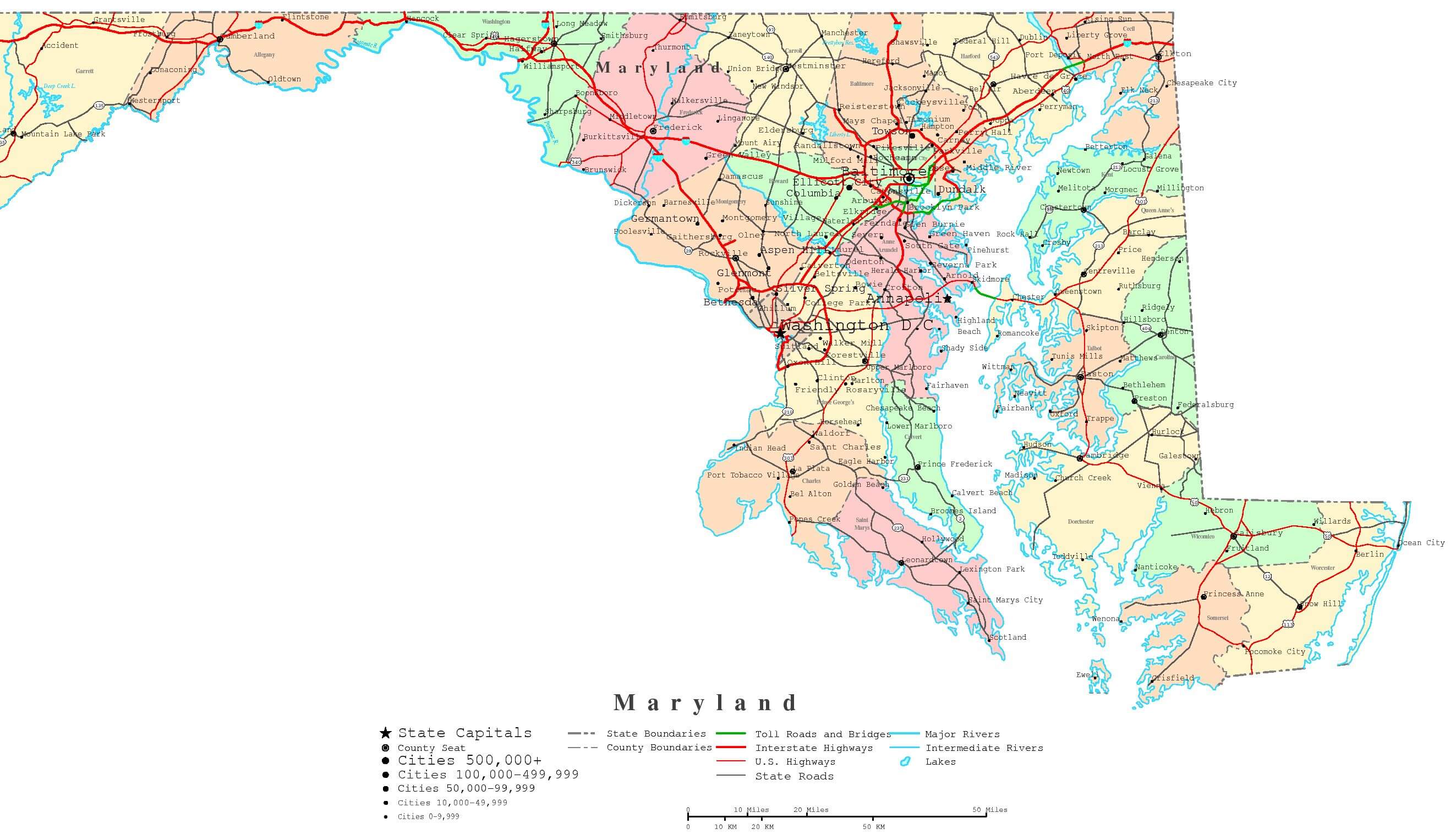

MARYLAND ROAD MAP

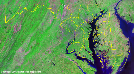
MARYLAND SATELLITE IMAGE MAP

MARYLAND STATE MAP
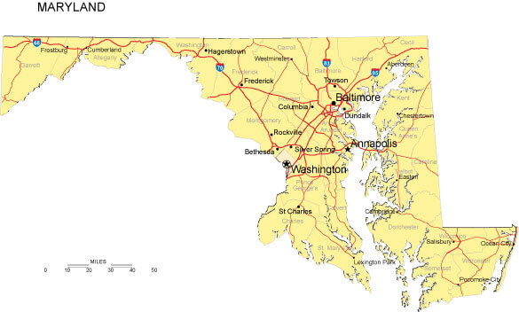

Largest Cities Map of Maryland and Population
Baltimore - 620,961 Columbia - 99,615 Germantown - 86,395 Silver Spring - 71,452 Waldorf - 67,752 Glen Burnie - 67,639 Ellicott City - 65,834 Frederick - 65,239 Dundalk - 63,597 Rockville - 61,209 Bethesda - 60,858 Gaithersburg - 59,933 Towson - 55,197 Bowie - 54,727 Aspen Hill - 48,759For All Maryland Cities Map
Cities Map of United States
New York City Map Los Angeles Map Chicago Map Brooklyn Map Houston Map Philadelphia Map Manhattan Map Phoenix Map San Antonio Map San Diego Map Dallas Map San Jose Map Jacksonville Map Indianapolis Map San Francisco Map Austin Map Columbus Map Fort Worth Map Charlotte Map Detroit MapCopyright Turkey Travel Guide - 2006 - 2023. All rights reserved. Privacy Policy | Disclaimer