Map of West Virginia, United States
Navigate West Virginia map, West Virginia country map, satellite images of West Virginia, West Virginia largest cities, towns maps, political map of West Virginia, driving directions, physical, atlas and traffic maps in United States.
MAP OF WEST VIRGINIA

A Collection of West Virginia Maps and West Virginia Satellite Images
MAP OF WEST VIRGINIA

MAP OF WEST VIRGINIA CITIES


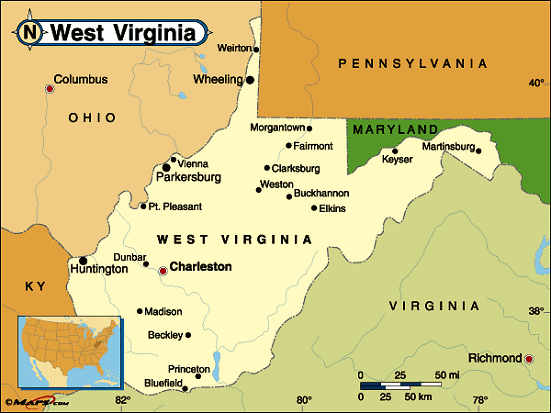
WEST VIRGINIA MAP

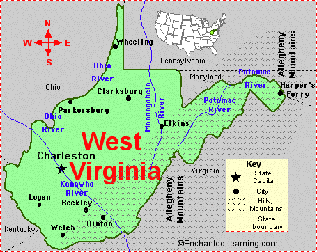
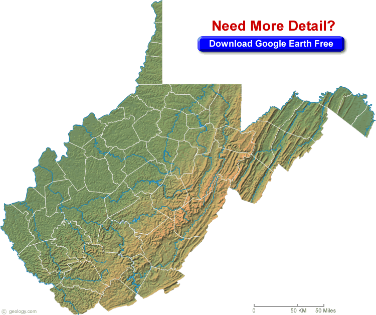
WEST VIRGINIA PHYSICAL MAP


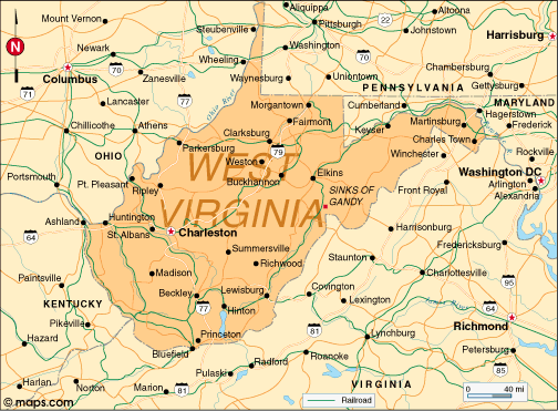
WEST VIRGINIA POLITICAL MAP

WEST VIRGINIA CITIES MAP

WEST VIRGINIA CITY MAP


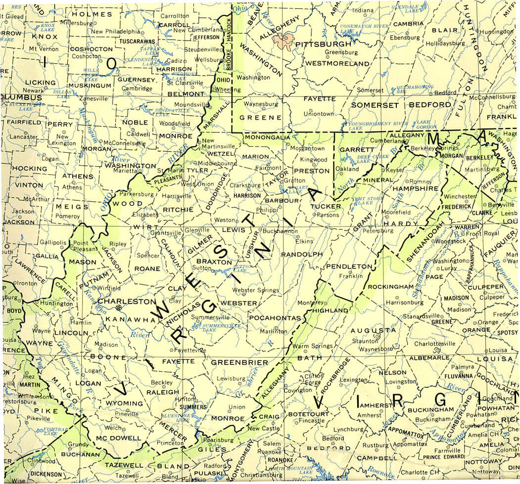
WEST VIRGINIA COUNTIES MAP


WEST VIRGINIA COUNTY SEAT MAP


WEST VIRGINIA HISTORICAL MAP

WEST VIRGINIA LAND MAP


WEST VIRGINIA MAP


WEST VIRGINIA PHYSICAL MAP

WEST VIRGINIA POLITICAL MAP


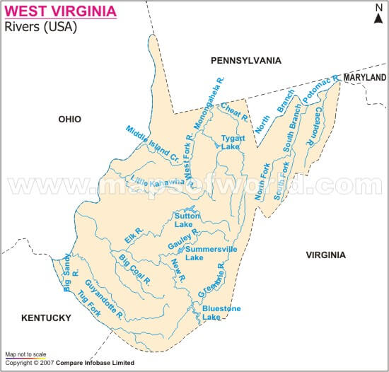
WEST VIRGINIA RIVERS MAP

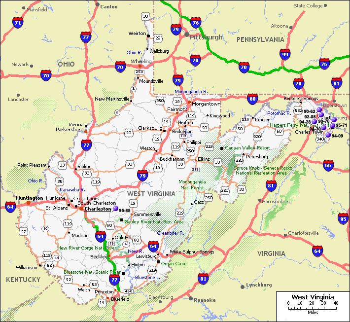
WEST VIRGINIA ROAD MAP

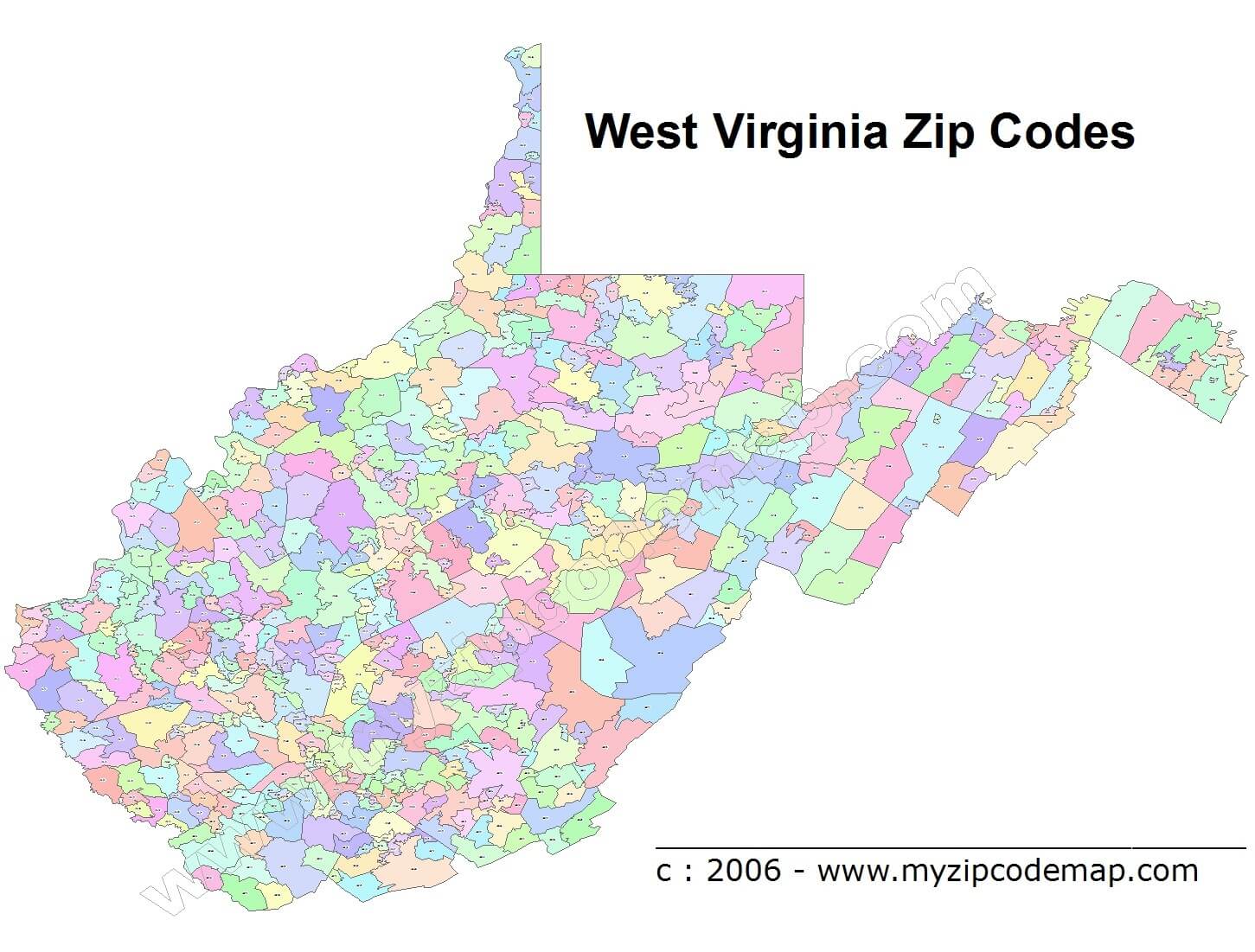
WEST VIRGINIA ZIP CODE MAP

Largest Cities Map of West Virginia and Population
Charleston - 51,400 Huntington - 49,138 Parkersburg - 31,492 Morgantown - 29,660 Wheeling - 28,486 Weirton - 19,746 Fairmont - 18,704 Beckley - 17,614 Martinsburg - 17,227 Clarksburg - 16,578 South Charleston - 13,450 Teays Valley - 13,175 St. Albans - 11,044 Vienna - 10,749 Bluefield - 10,447For All West Virginia Cities Map
- Head of Performance Marketing
- Head of SEO
- Linkedin Profile: linkedin.com/in/arifcagrici
See Also
West Virginia Google Map, Street Views, Maps Directions, Satellite Images
turkey-visit.com offers a collection of West Virginia map, google map, West Virginia atlas, political, physical, satellite view, country infos, cities map and more map of West Virginia.
United States Largest Cities Map by Population
New York City Map Los Angeles Map Chicago Map Brooklyn Map Houston Map Philadelphia Map Manhattan Map Phoenix Map San Antonio Map San Diego Map Dallas Map San Jose Map Jacksonville Map Indianapolis Map San Francisco Map Austin Map Columbus Map Fort Worth Map Charlotte Map Detroit MapCopyright Turkey Travel Guide - 2005 - 2025. All rights reserved. Privacy Policy | Disclaimer