Discover the Beauty and Diversity of Rhode Island with our Interactive Map
Explore Rhode Island like never before with our interactive map. Discover the state's breathtaking coastlines, historic landmarks, and vibrant cities. Our Rhode Island map provides detailed information and navigation, making it easy to plan your next adventure. Start exploring today!
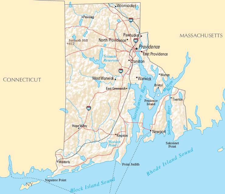
For all Rhode Island Cities Map
MAP OF RHODE ISLAND

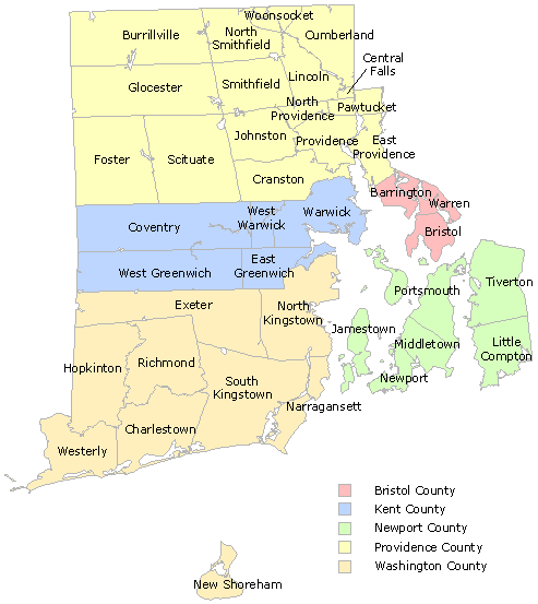
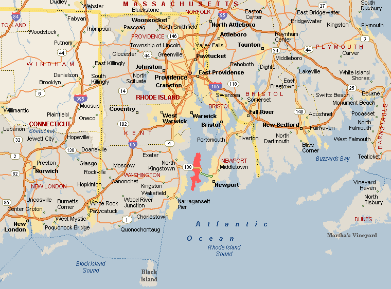
RHODE ISLAND COUNTY MAP
Brief information about Rhode Island, US
Rhode Island is the smallest state in the United States, located in the New England region of the northeastern United States. Despite its small size, Rhode Island has a rich history, including being one of the original 13 colonies and playing a significant role in the American Revolution.A Collection of Rhode Island Maps and Rhode Island Satellite Images
MAP OF RHODE ISLAND
MAP OF RHODE ISLAND
RHODE ISLAND CITY MAP

RHODE ISLAND COUNTY MAP
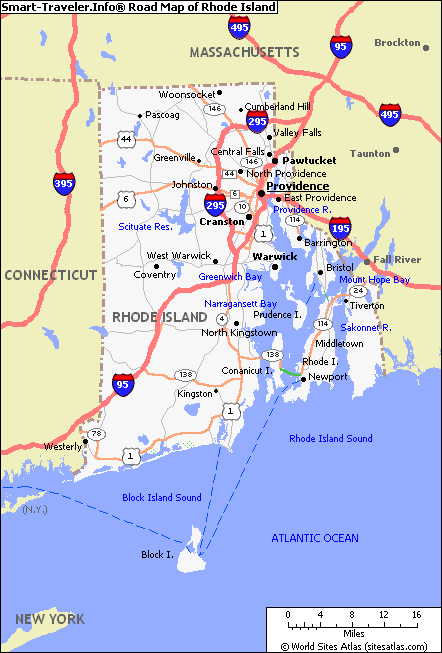
RHODE ISLAND HIGHWAYS MAP

RHODE ISLAND HISTORICAL 1895

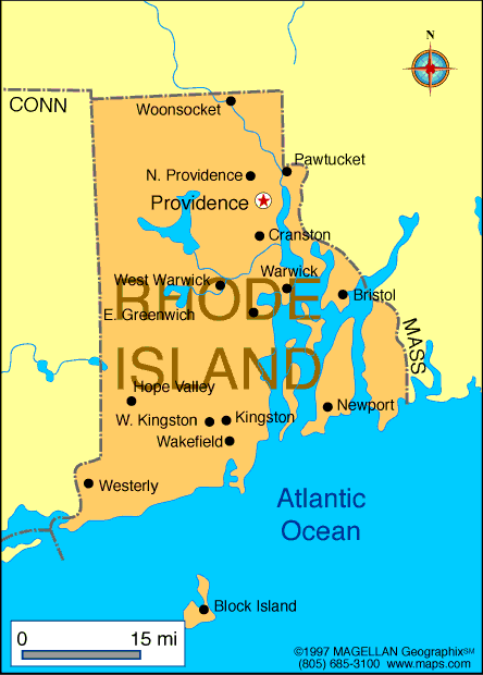
RHODE ISLAND MAP
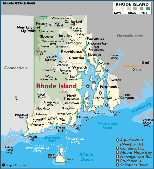
RHODE ISLAND PHYSICAL MAP

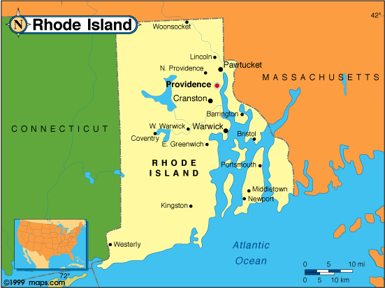
RHODE ISLAND POLITICAL MAP

RHODE ISLAND RIVERS MAP

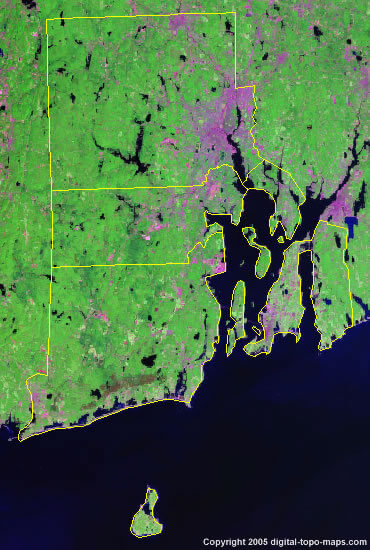
RHODE ISLAND SATELLITE MAP
RHODE ISLAND STATE MAP
RHODE ISLAND STATE MAP
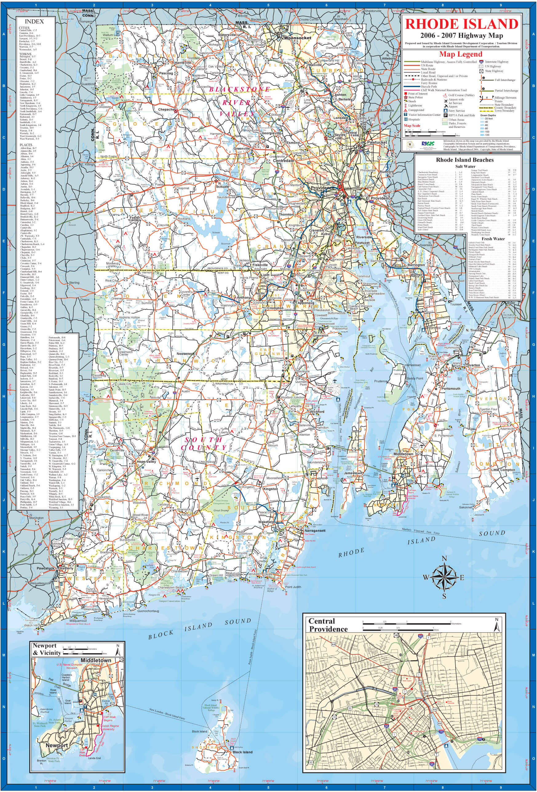
ROAD MAP OF RHODE ISLAND

A collection of Rhode Island Maps


- Head of Performance Marketing
- Head of SEO
- Linkedin Profile: linkedin.com/in/arifcagrici
Largest Cities Map of Rhode Island and Population
Providence Map - 178,042 Warwick Map - 82,672 Cranston Map - 80,387 Pawtucket Map - 71,148 East Providence Map - 47,037 Woonsocket Map - 41,186 Cumberland Map - 34,843 North Providence Town Map - 32,078 West Warwick Town Map - 29,191 Newport Map - 24,672 Bristol Town Map - 22,954 Central Falls Map - 19,376 Westerly Map - 17,936 Barrington Town Map - 16,310 Newport East Map - 11,769Copyright Turkey Travel Guide - 2005 - 2025. All rights reserved. Privacy Policy | Disclaimer