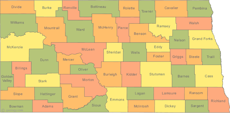
North Dakota Map
N avigate North Dakota Map, North Dakota states map, satellite images of the North Dakota, North Dakota largest cities maps, political map of North Dakota, driving directions and traffic maps.
All North Dakota Cities Maps by Population
- Fargo Map - (105,549)
- Bismarck Map - (61,272)
- Grand Forks Map - (52,838)
- Minot Map - (40,888)
- West Fargo Map - (25,830)
- Mandan Map - (18,331)
- Dickinson Map - (17,787)
- Jamestown Map - (15,427)
- Williston Map - (14,716)
- Wahpeton Map - (7,766)
- Devils Lake Map - (7,141)
- Valley City Map - (6,585)
- Minot AFB Map - (5,521)
- Grafton Map - (4,284)
- Beulah Map - (3,121)
- Rugby Map - (2,876)
- Horace Map - (2,430)
- Hazen Map - (2,411)
- Lincoln Map - (2,406)
- Grand Forks AFB Map - (2,367)
- Casselton Map - (2,329)
- Bottineau Map - (2,211)
- Lisbon Map - (2,154)
- Belcourt Map - (2,078)
- Carrington Map - (2,065)
- New Town Map - (1,925)
- Langdon Map - (1,878)
- Mayville Map - (1,858)
- Oakes Map - (1,856)
- Harvey Map - (1,783)
- Watford City Map - (1,744)
- Bowman Map - (1,650)
- Hillsboro Map - (1,603)
- Stanley Map - (1,458)
- Garrison Map - (1,453)
- Park River Map - (1,403)
- Ellendale Map - (1,394)
- New Rockford Map - (1,391)
- Larimore Map - (1,346)
- Cavalier Map - (1,302)
- Rolla Map - (1,280)
- Washburn Map - (1,246)
- Fort Totten Map - (1,243)
- Tioga Map - (1,230)
- Hettinger Map - (1,226)
- Shell Valley Map - (1,197)
- Cando Map - (1,115)
- Linton Map - (1,097)
- Kenmare Map - (1,096)
- Velva Map - (1,084)
- Crosby Map - (1,070)
- Burlington Map - (1,060)
- Beach Map - (1,019)
- Wishek Map - (1,002)
- Walhalla Map - (996)
- Thompson Map - (986)
- Cooperstown Map - (984)
- New Salem Map - (946)
- Northwood Map - (945)
- Surrey Map - (934)
- Hankinson Map - (919)
- Parshall Map - (903)
- LaMoure Map - (889)
- Enderlin Map - (886)
- Cannon Ball Map - (875)
- Drayton Map - (824)
- Glen Ullin Map - (807)
- Belfield Map - (800)
- Napoleon Map - (792)
- Mohall Map - (783)
- Underwood Map - (778)
- Hatton Map - (777)
- Dunseith Map - (773)
- Mapleton Map - (762)
- Gwinner Map - (753)
- Killdeer Map - (751)
- Ashley Map - (749)
- Hebron Map - (747)
- Mott Map - (721)
- Harwood Map - (718)
- Steele Map - (715)
- Wilton Map - (711)
- Kindred Map - (692)
- Lakota Map - (672)
- Milnor Map - (653)
- Lidgerwood Map - (652)
- Elgin Map - (642)
- Portland Map - (606)
- Minto Map - (604)
- New England Map - (600)
- Mandaree Map - (596)
- Rolette Map - (594)
- Pembina Map - (592)
- Ray Map - (592)
- Turtle Lake Map - (581)
- Green Acres Map - (575)
- Center Map - (571)
- Edgeley Map - (563)
- Towner Map - (533)
- Richardton Map - (529)
- Four Bears Village Map - (517)
- Reile's Acres Map - (513)
- Forman Map - (504)
- East Dunseith Map - (500)
- Fessenden Map - (479)
- Argusville Map - (475)
- Berthold Map - (454)
- Finley Map - (445)
- Wyndmere Map - (429)
- Westhope Map - (429)
- Leeds Map - (427)
- Emerado Map - (414)
- Strasburg Map - (409)
- Maddock Map - (382)
- McClusky Map - (380)
- Glenburn Map - (380)
- Neche Map - (371)
- Fairmount Map - (367)
- Stanton Map - (366)
- Manvel Map - (360)
- Sawyer Map - (357)
- Kulm Map - (354)
- McVille Map - (349)
- St. John Map - (341)
- Arthur Map - (337)
- Bowbells Map - (336)
- White Shield Map - (336)
- Max Map - (334)
- St. Thomas Map - (331)
- Buxton Map - (323)
- Gackle Map - (310)
- Medina Map - (308)
- Oxbow Map - (305)
- South Heart Map - (301)
- Reynolds Map - (301)
- Michigan City Map - (294)
- Carson Map - (293)
- Scranton Map - (281)
- Powers Lake Map - (280)
- Drake Map - (275)
- Abercrombie Map - (263)
- Hunter Map - (261)
- Hope Map - (258)
- Tower City Map - (253)
- Davenport Map - (252)
- Lansford Map - (245)
- Grenora Map - (244)
- Hoople Map - (242)
- Sherwood Map - (242)
- Granville Map - (241)
- Gladstone Map - (239)
- Zap Map - (237)
- Gilby Map - (237)
- Hazelton Map - (235)
- Walcott Map - (235)
- Flasher Map - (232)
- Page Map - (232)
- Anamoose Map - (227)
- Minnewaukan Map - (224)
- Leonard Map - (223)
- Alexander Map - (223)
- Aneta Map - (222)
- New Leipzig Map - (221)
- Wimbledon Map - (216)
- Frontier Map - (214)
- Fordville Map - (212)
- Munich Map - (210)
- Riverdale Map - (205)
- Sheyenne Map - (204)
- Des Lacs Map - (204)
- Tappen Map - (197)
- Mooreton Map - (197)
- Edinburg Map - (196)
- Logan Map - (194)
- Sanborn Map - (192)
- Petersburg Map - (192)
- Ruthville Map - (191)
- Halliday Map - (188)
- Buffalo Map - (188)
- Fort Yates Map - (184)
- Binford Map - (183)
- Golden Valley Map - (182)
- Edmore Map - (182)
- Grandin Map - (173)
- Litchville Map - (172)
- Plaza Map - (171)
- Streeter Map - (170)
- Rhame Map - (169)
- Tolna Map - (166)
- Rutland Map - (163)
- Kensal Map - (163)
- Willow City Map - (163)
- Reeder Map - (162)
- Selfridge Map - (160)
- Regent Map - (160)
- Carpio Map - (157)
- Lignite Map - (155)
- Makoti Map - (154)
- Wing Map - (152)
- Christine Map - (150)
- Taylor Map - (148)
- Dunn Center Map - (146)
- Porcupine Map - (146)
- Harmon Map - (145)
- Crary Map - (142)
- Crystal Map - (138)
- Marmarth Map - (136)
- Osnabrock Map - (134)
- Columbus Map - (133)
- Marion Map - (133)
- Hannaford Map - (131)
- Bowdon Map - (131)
- Upham Map - (130)
- Adams Map - (127)
- Bisbee Map - (126)
- Portal Map - (126)
- Forest River Map - (125)
- Pick City Map - (123)
- Almont Map - (122)
- Colfax Map - (121)
- Noonan Map - (121)
- Oriska Map - (118)
- Starkweather Map - (117)
- Sykeston Map - (117)
- Sheldon Map - (116)
- Arnegard Map - (115)
- Medora Map - (112)
- Newburg Map - (110)
- Wildrose Map - (110)
- Galesburg Map - (108)
- Pisek Map - (106)
- Oberon Map - (105)
- Ypsilanti Map - (104)
- Dazey Map - (104)
- Rocklake Map - (101)
- Epping Map - (100)
- Esmond Map - (100)
- Cogswell Map - (99)
- Deering Map - (98)
- Goodrich Map - (98)
- Lankin Map - (98)
- Fingal Map - (97)
- Ross Map - (97)
- Sharon Map - (96)
- Amenia Map - (94)
- Mercer Map - (94)
- Mountain Map - (92)
- Glenfield Map - (91)
- Spiritwood Lake Map - (90)
- Buchanan Map - (90)
- Montpelier Map - (87)
- Dodge Map - (87)
- Zeeland Map - (86)
- Verona Map - (85)
- Ryder Map - (85)
- Maxbass Map - (84)
- Hurdsfield Map - (84)
- Solen Map - (83)
- Cleveland Map - (83)
- Karlsruhe Map - (82)
- Driscoll Map - (82)
- Dwight Map - (82)
- Brooktree Park Map - (80)
- Lehr Map - (80)
- White Earth Map - (80)
- Tuttle Map - (80)
- Coleharbor Map - (79)
- Martin Map - (78)
- Fort Ransom Map - (77)
- East Fairview Map - (76)
- Foxholm Map - (75)
- Gardner Map - (74)
- Manning Map - (74)
- Palermo Map - (74)
- Prairie Rose Map - (73)
- Briarwood Map - (73)
- Jud Map - (72)
- Havana Map - (71)
- Hague Map - (71)
- Menoken Map - (70)
- Pekin Map - (70)
- Pettibone Map - (70)
- Wheatland Map - (68)
- Butte Map - (68)
- Ardoch Map - (67)
- Flaxton Map - (66)
- Benedict Map - (66)
- Warwick Map - (65)
- Balta Map - (65)
- Douglas Map - (64)
- Mantador Map - (64)
- Grace City Map - (63)
- Nome Map - (62)
- Hamilton Map - (61)
- Dawson Map - (61)
- Golva Map - (61)
- Pingree Map - (60)
- Great Bend Map - (60)
- Donnybrook Map - (59)
- Embden Map - (59)
- Milton Map - (58)
- Souris Map - (58)
- Brocket Map - (57)
- Alamo Map - (57)
- Sentinel Butte Map - (56)
- McHenry Map - (56)
- North River Map - (56)
- Fullerton Map - (54)
- Niagara Map - (53)
- Forbes Map - (53)
- Barney Map - (52)
- Kathryn Map - (52)
- Woodworth Map - (50)
- Nekoma Map - (50)
- Inkster Map - (50)
- Erie Map - (50)
- Auburn Map - (48)
- Hampden Map - (48)
- Tolley Map - (47)
- Fredonia Map - (46)
- Selz Map - (46)
- Rogers Map - (46)
- Canton City Map - (45)
- Courtenay Map - (45)
- Clifford Map - (44)
- Cathay Map - (43)
- Regan Map - (43)
- Bathgate Map - (43)
- Dickey Map - (42)
- Englevale Map - (40)
- Voltaire Map - (40)
- Alice Map - (40)
- Caledonia Map - (39)
- Fairdale Map - (38)
- Landa Map - (38)
- Robinson Map - (37)
- Monango Map - (36)
- Wolford Map - (36)
- Alsen Map - (35)
- Brinsmade Map - (35)
- Berlin Map - (34)
- Nash Map - (32)
- Wales Map - (31)
- Luverne Map - (31)
- De Lamere Map - (30)
- Lawton Map - (30)
- Sibley Map - (30)
- Gardena Map - (29)
- Kramer Map - (29)
- Egeland Map - (28)
- Sarles Map - (28)
- Heimdal Map - (27)
- Cayuga Map - (27)
- Springbrook Map - (27)
- Antler Map - (27)
- McLeod Map - (27)
- Bucyrus Map - (27)
- Balfour Map - (26)
- Blanchard Map - (26)
- Ambrose Map - (26)
- Jessie Map - (25)
- Knox Map - (25)
- Elliott Map - (25)
- Haynes Map - (23)
- Ludden Map - (23)
- York Map - (23)
- Conway Map - (23)
- Calio Map - (22)
- Fortuna Map - (22)
- Orrin Map - (22)
- Hamberg Map - (21)
- Braddock Map - (21)
- Denhoff Map - (20)
- Calvin Map - (20)
- Mylo Map - (20)
- Amidon Map - (20)
- Leal Map - (20)
- Barton Map - (20)
- Dahlen Map - (18)
- Overly Map - (18)
- Spiritwood Map - (18)
- Ayr Map - (17)
- Sutton Map - (17)
- Leith Map - (16)
- Loma Map - (16)
- Gascoyne Map - (16)
- Heil Map - (15)
- Hannah Map - (15)
- Bantry Map - (14)
- Kief Map - (13)
- Pillsbury Map - (12)
- Raleigh Map - (12)
- Hansboro Map - (12)
- Churchs Ferry Map - (12)
- Larson Map - (12)
- Venturia Map - (10)
- Perth Map - (9)
- Loraine Map - (9)
- Bergen Map - (7)
- Grano Map - (7)
- Ruso Map - (4)
Largest North Dakota cities map
North Dakota Google Map, Street Views, Maps Directions, Satellite Images
Please Not : You can find local businesses, public places, tourist attractions via map view, satellite image, hybrid view, driving directions in North Dakota Map. You'll also find a varity map of North Dakota such as political, administrative, transportation, demographics maps following Google map.
Submit URL to North Dakota :
Click for North Dakota Direction »
Click for North Dakota Street View »
Largest Cities Map of North Dakota and Population
Fargo Map - 105,549 Bismarck Map - 61,272 Grand Forks Map - 52,838 Minot Map - 40,888 West Fargo Map - 25,830 Mandan Map - 18,331 Dickinson Map - 17,787 Jamestown Map - 15,427 Williston Map - 14,716 Wahpeton Map - 7,766 Devils Lake Map - 7,141 Valley City Map - 6,585 Minot AFB Map - 5,521 Grafton Map - 4,284 Beulah Map - 3,121Copyright Turkey Travel Guide - 2006 - 2023. All rights reserved. Privacy Policy | Disclaimer