France Map
Navigate France Map, France countries map, satellite images of the France, France largest cities maps, political map of France, driving directions and traffic maps.

- Capital : Paris
- Population : 65,350,000
- GDP : $2.580 trillion (5th)
- Per Capita : $40,690 (20th)
- Calling Code : +33
- Jobless Rate : 10.30%
- Time Zone : +1
For more about France >>
France Google Map, Street Views, Maps Directions, Satellite Images
Please Not : You can find local businesses, public places, tourist attractions via map view, satellite image, hybrid view, driving directions in France Map. You'll also find a varity map of France such as political, administrative, transportation, demographics maps following Google map.
Submit URL to France :
France Map & France Satellite Images
Largest Cities Map of France
Paris Map - Marseille Map - Lyon Map - Toulouse Map - Nice Map - Nantes Map - Strasbourg Map - Montpellier Map - Bordeaux Map - Rennes Map - Le Havre Map - Reims Map - Lille Map - Saint Etienne Map - Toulon Map - Grenoble Map - Angers Map - Brest Map - Le Mans Map - Dijon Map - Caen Map - Rouen Map - Cholet Map - La Rochelle Map - Castres Map - Beziers Map - Perpignan Map - Amiens Map - Saint Quentin Map - Metz Map - Nancy Map - Colmar Map - Mulhouse Map - Besancon Map - Clermont Ferrand Map - Valence Map - Vienne Map - Calais Map - Antibes Map - Pau Map - Albi Map - Montauban Map - Chambery Map - Annecy Map - Annemasse Map - Cannes Map - Arles Map - Ales Map - Nimes Map - Troyes Map - Thionville Map - Versailles Map - Cergy Map - Orleans Map - Laval Map - Saint Malo Map - Tours Map - Colombes Map - Quimper Map - Asnieres sur Seine Map - Saint Nazaire Map - Blois Map - Poitiers Map - Limoges Map - Niort Map - Bressuire Map - Bourges Map - Charleville Mezieres Map - Frejus Map - Avignon Map - Aix en Provence Map -A Collection of France Maps and France Satellite Images
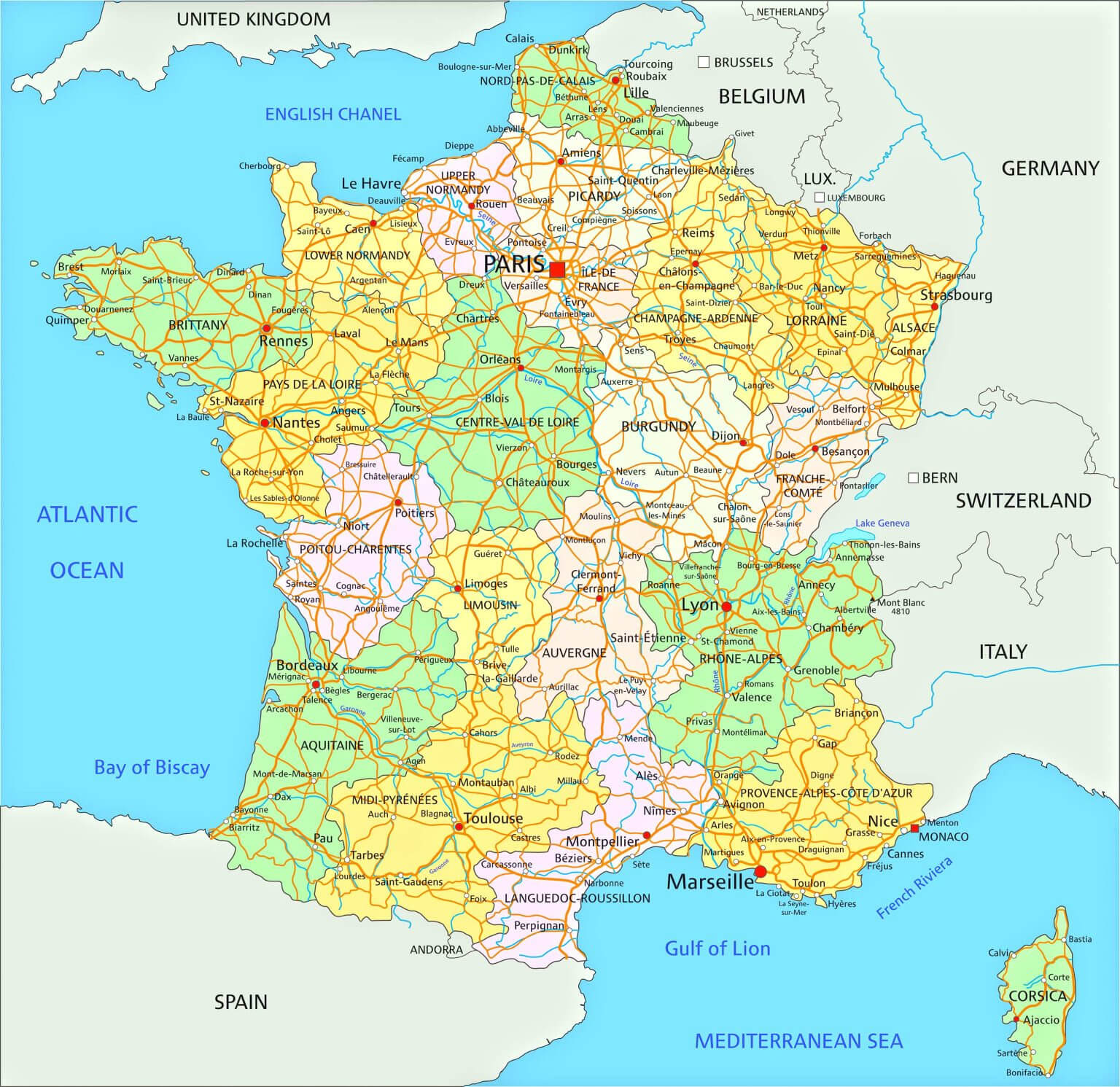
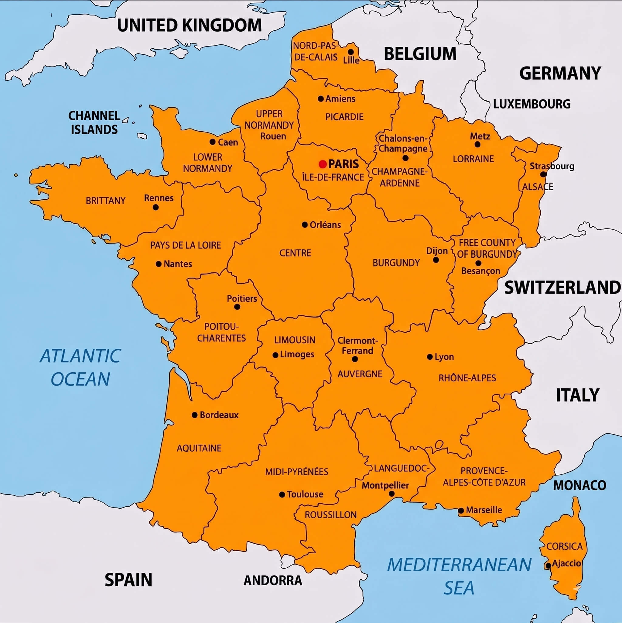
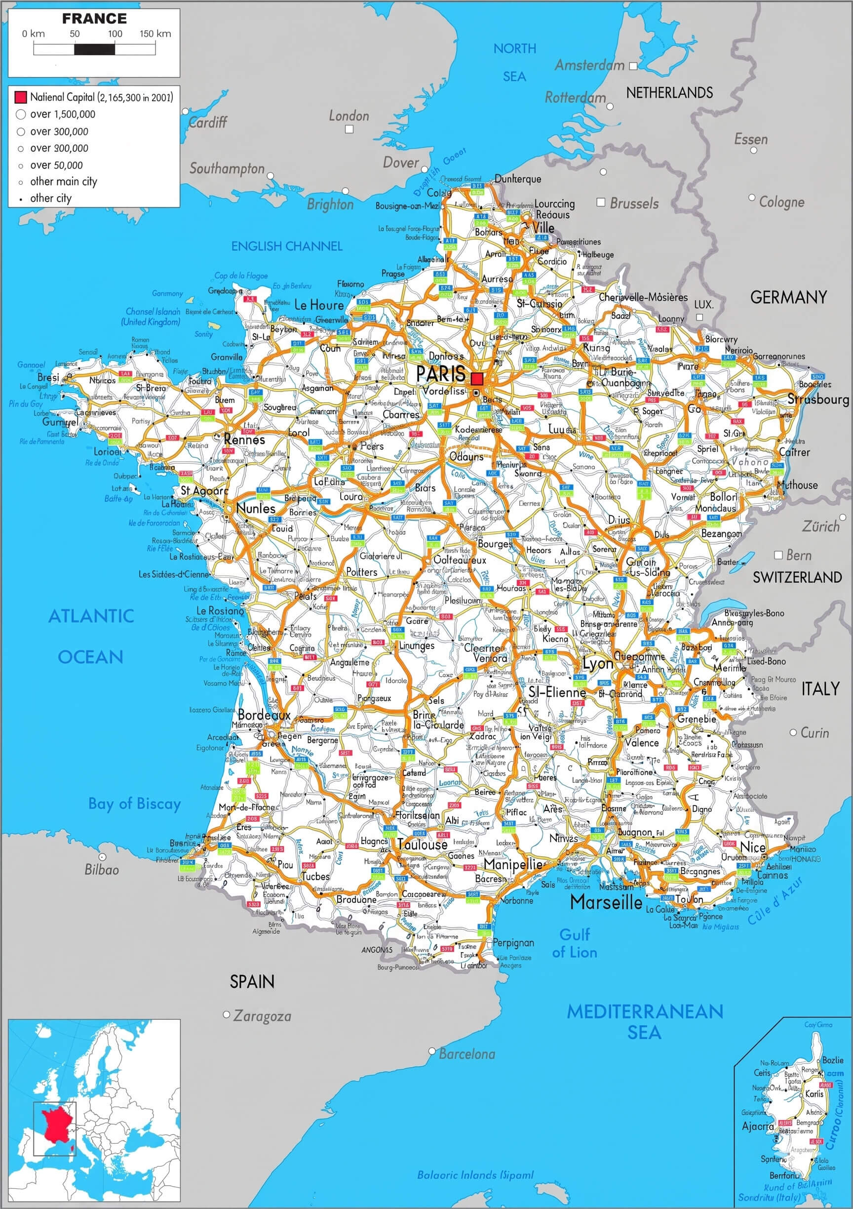
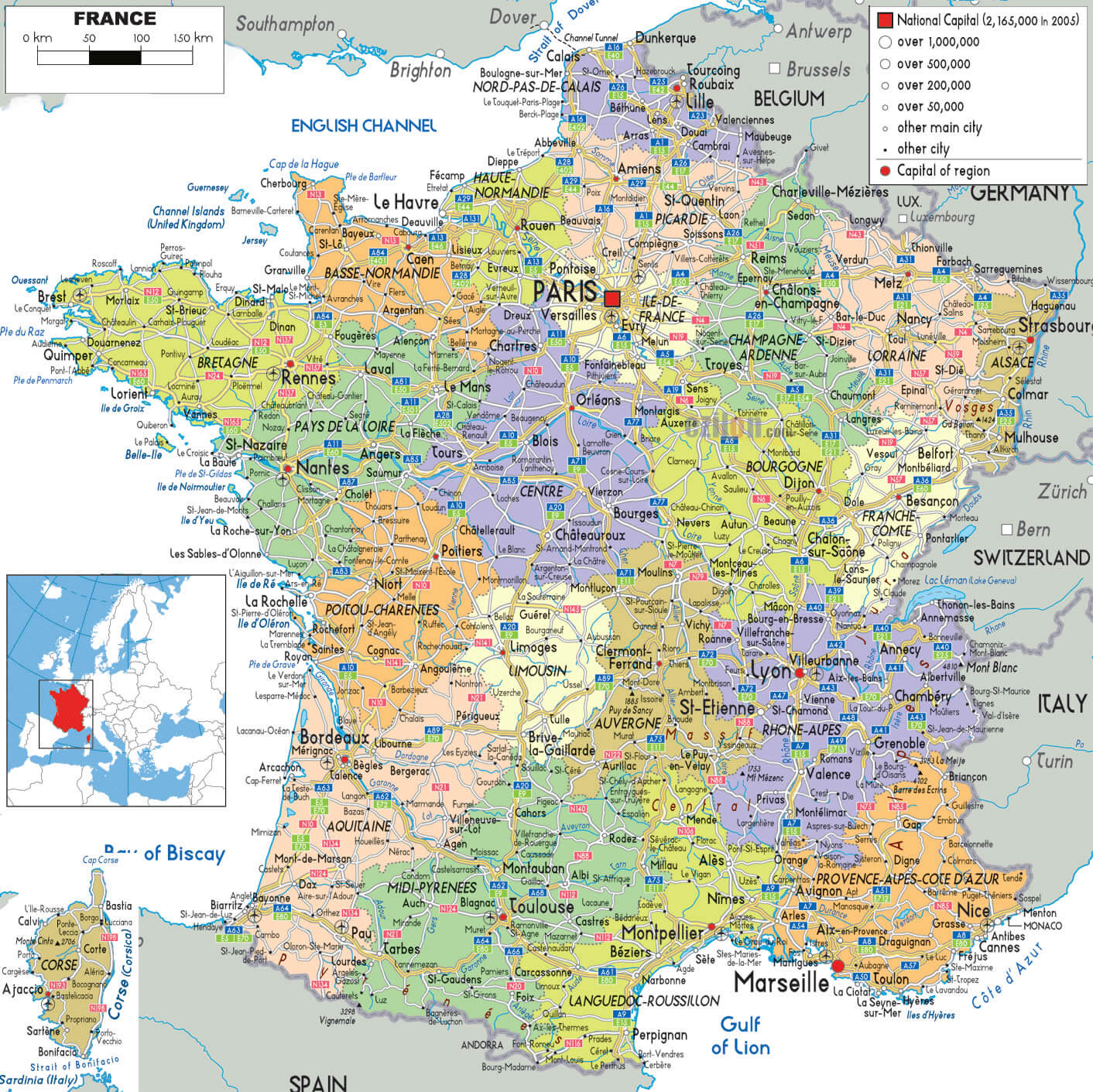
France Administrative Map With Regions And Roads
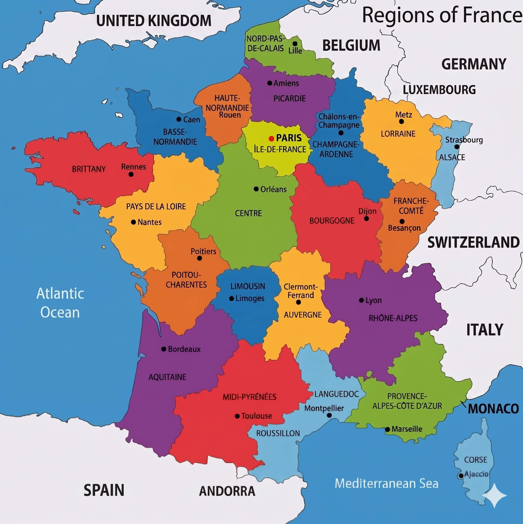
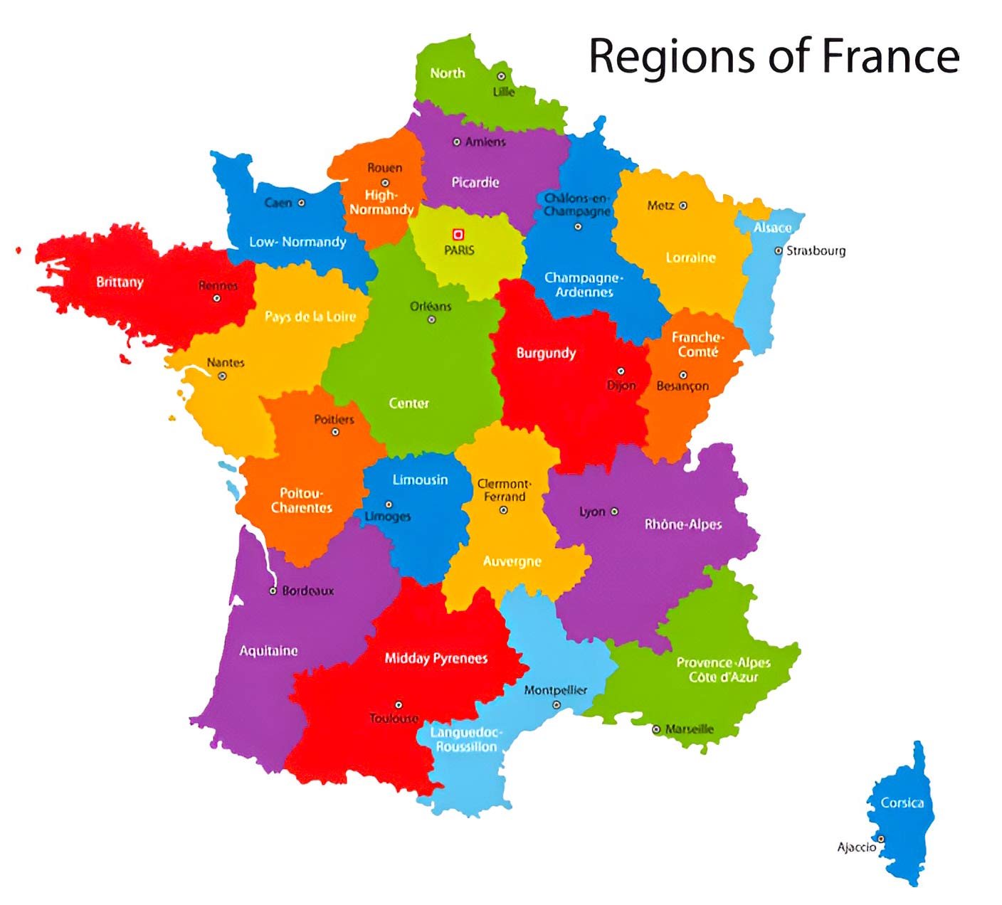
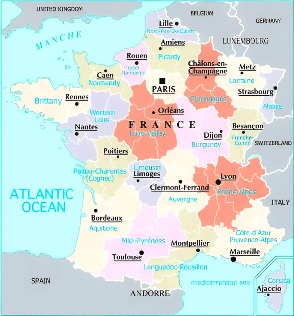
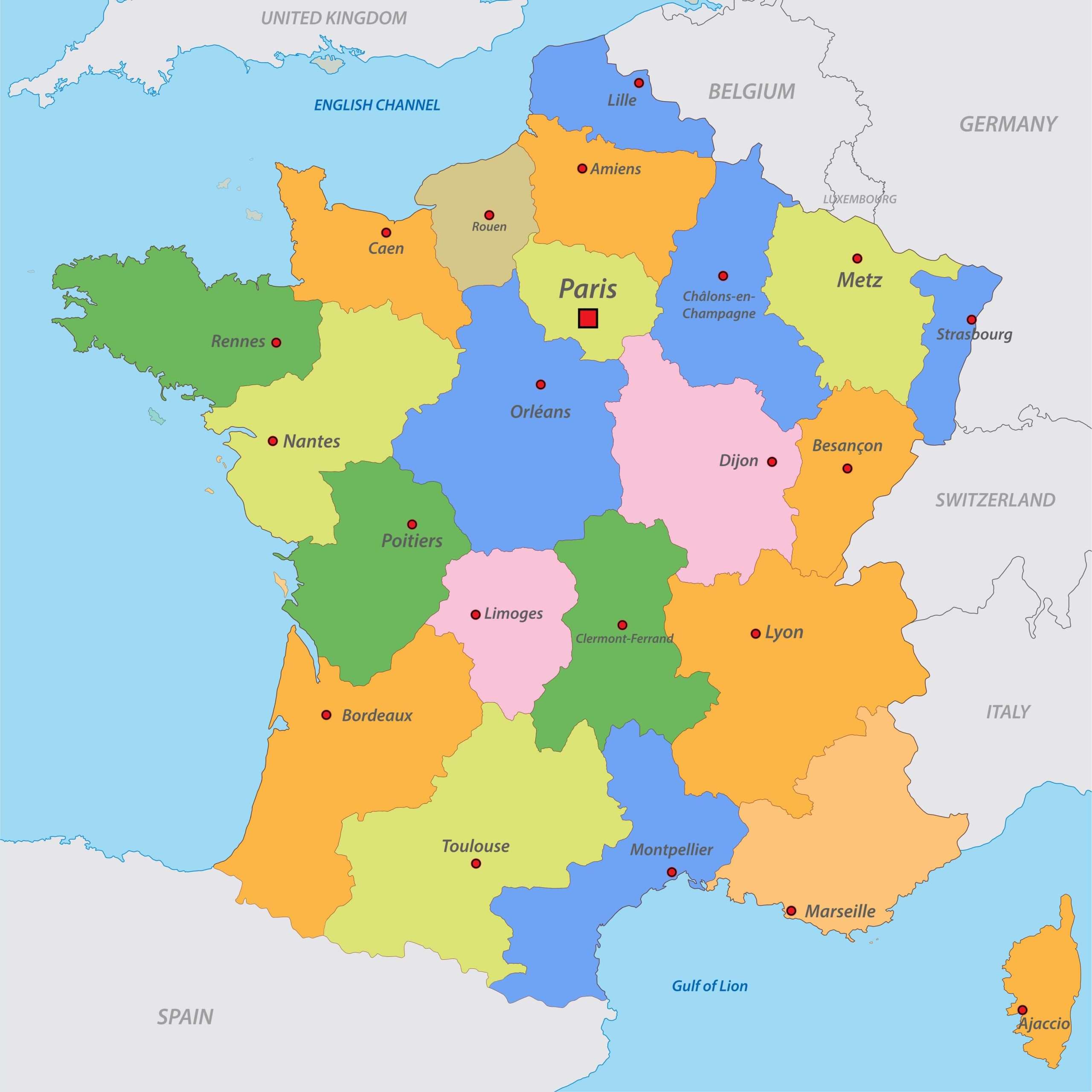
Colorful France Map With Regions

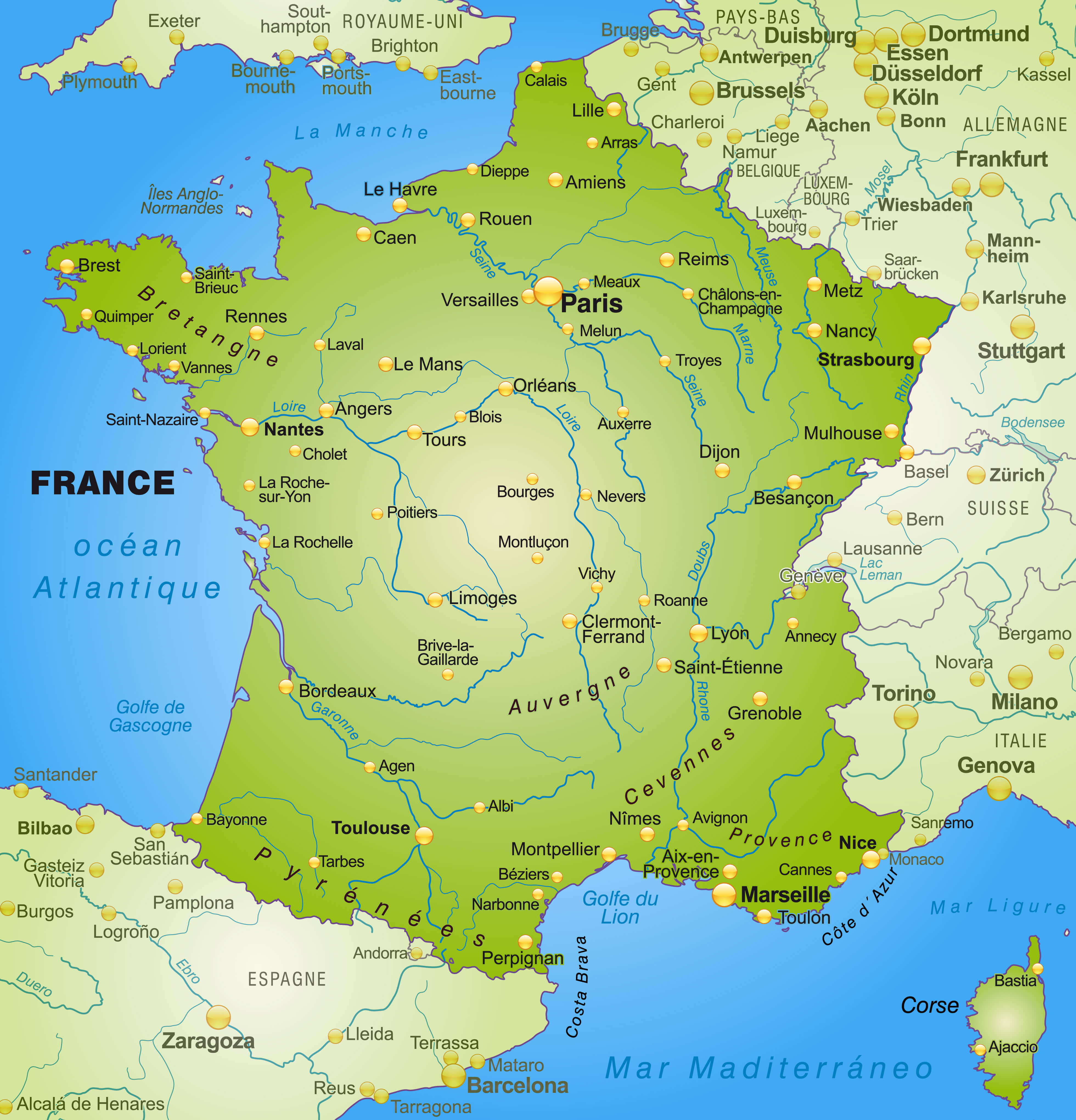
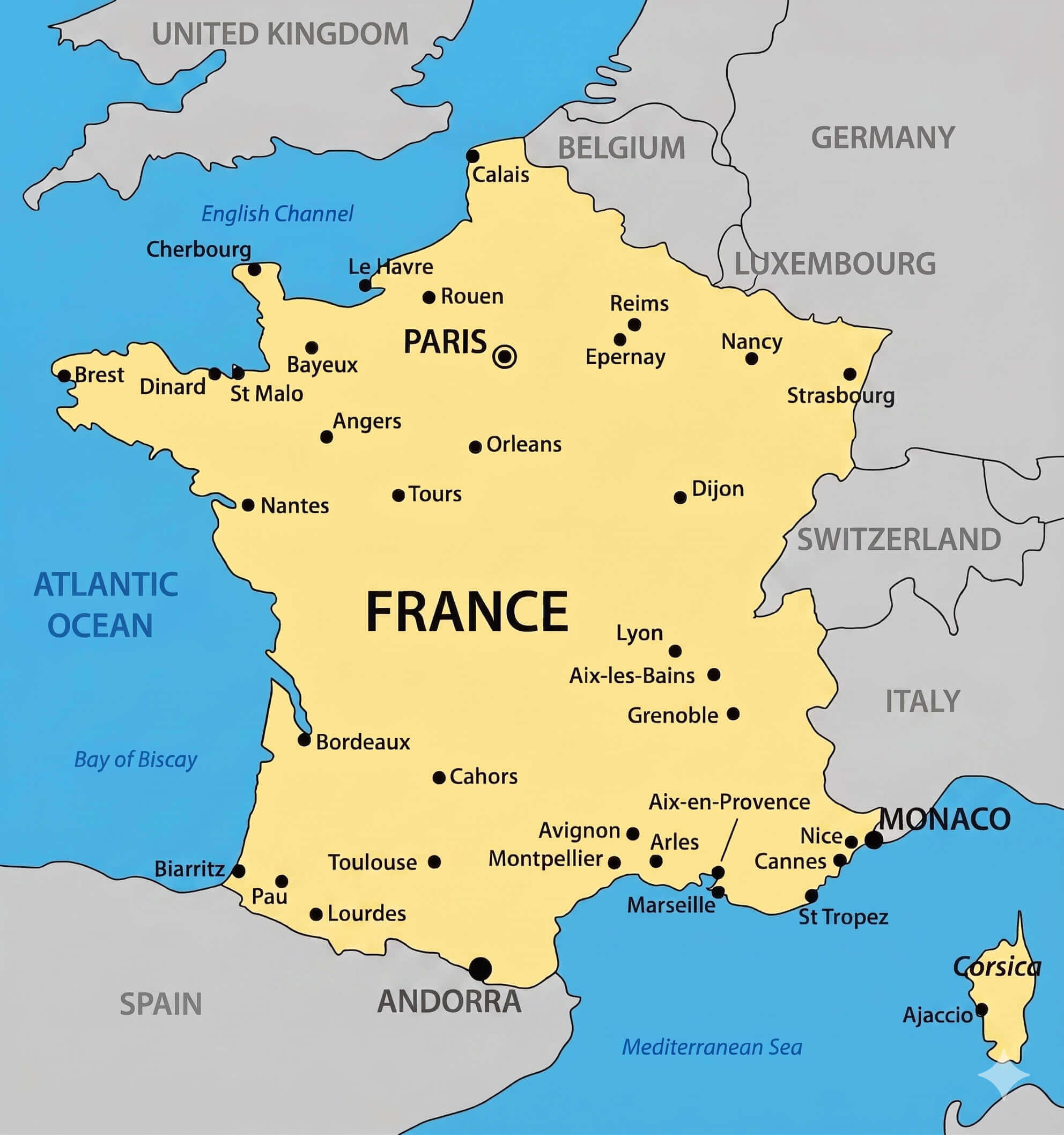
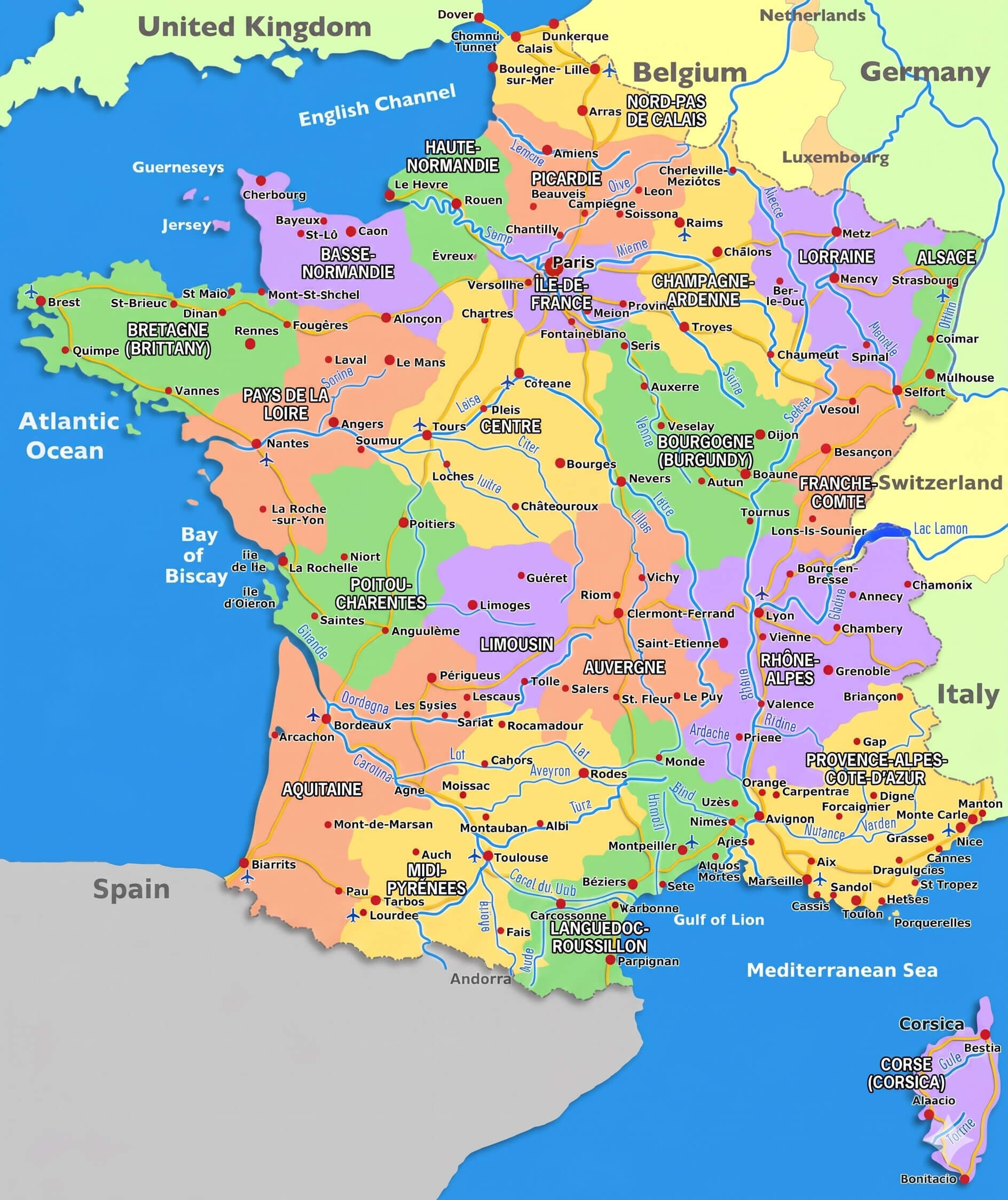
France Major Cities Map With Rivers
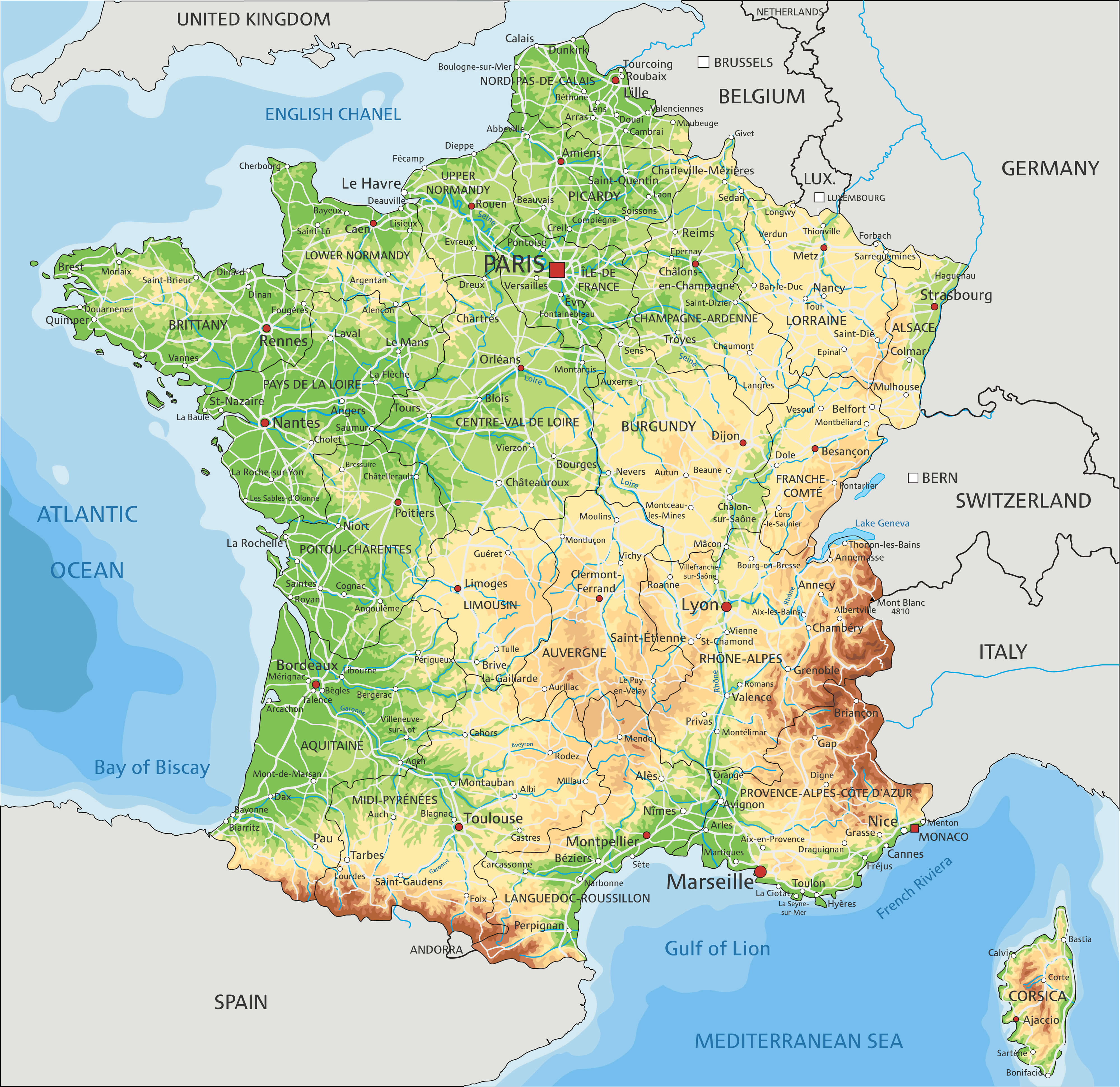
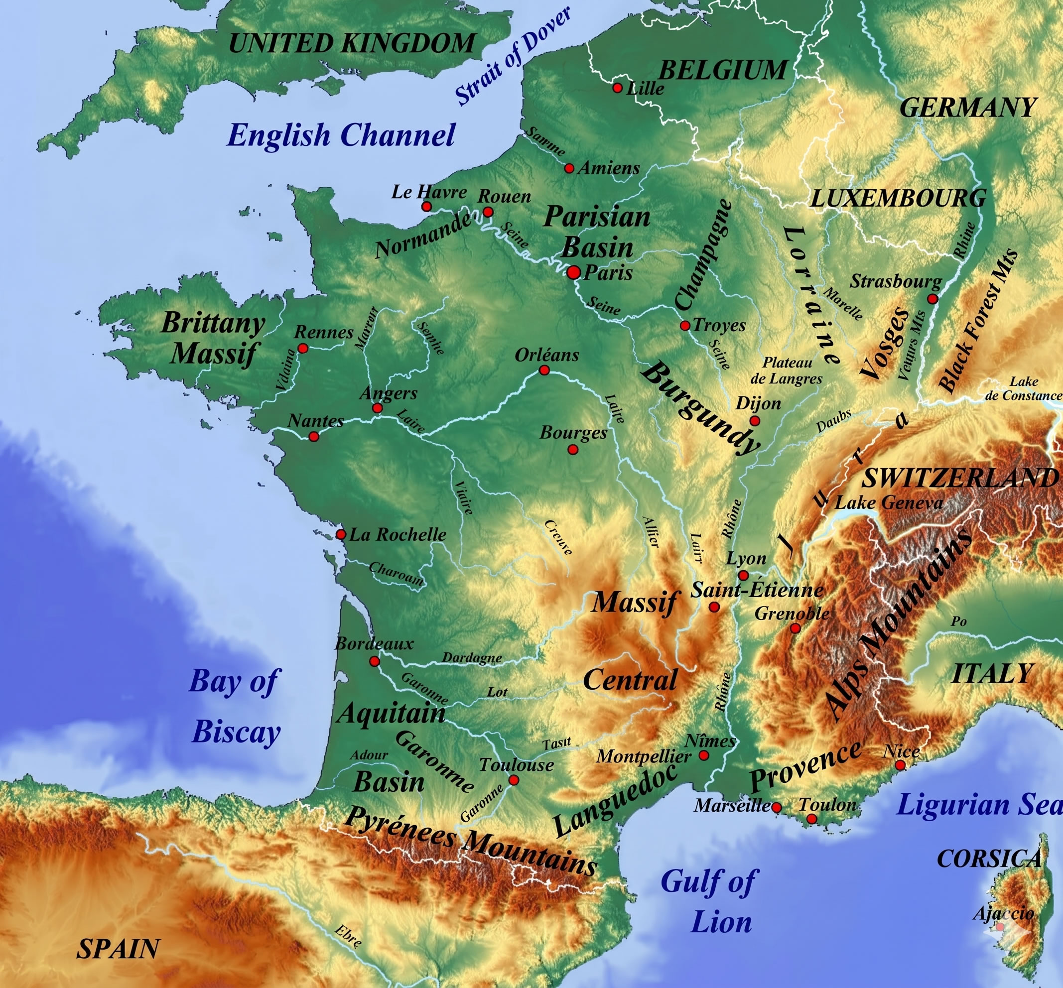
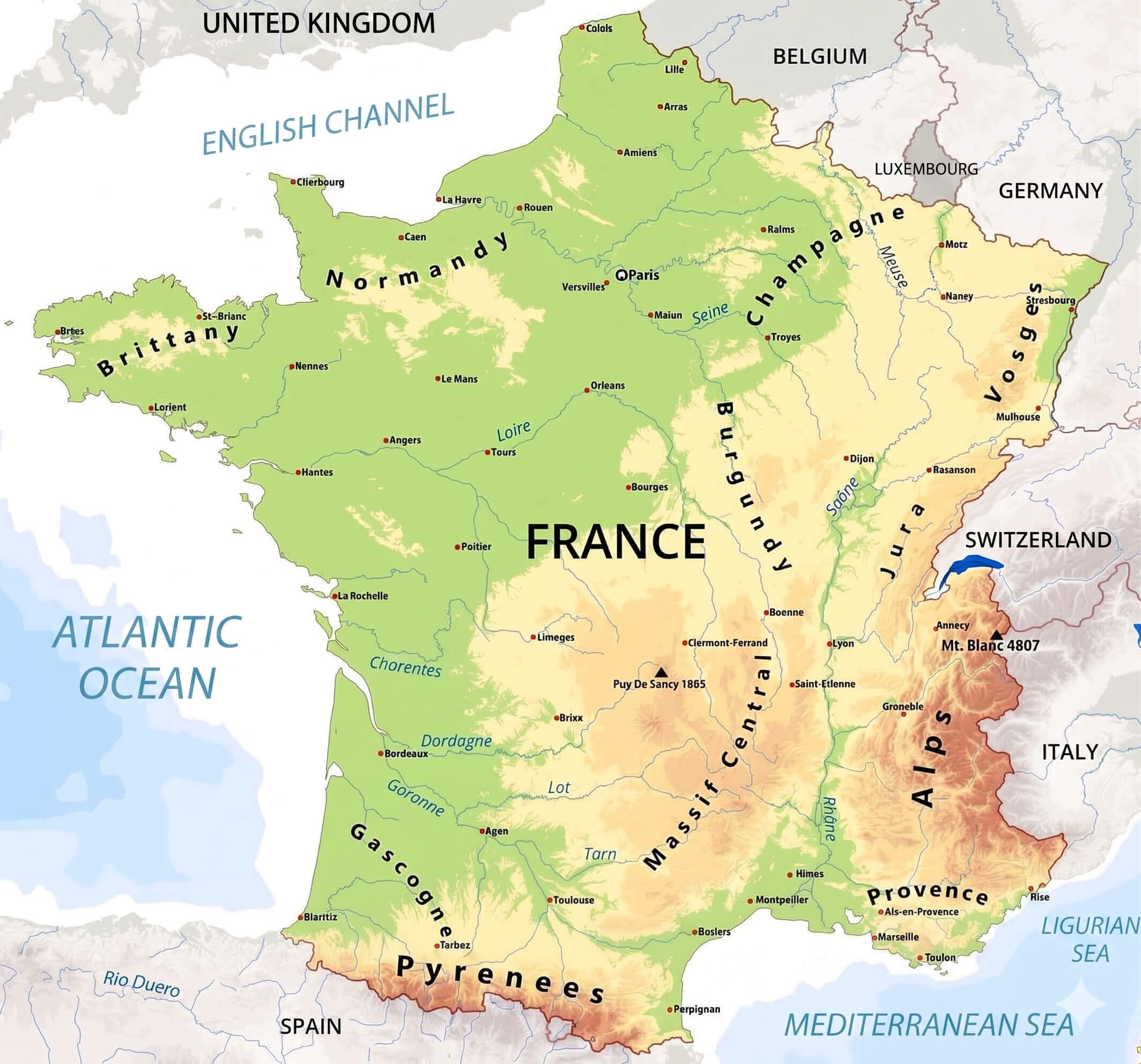
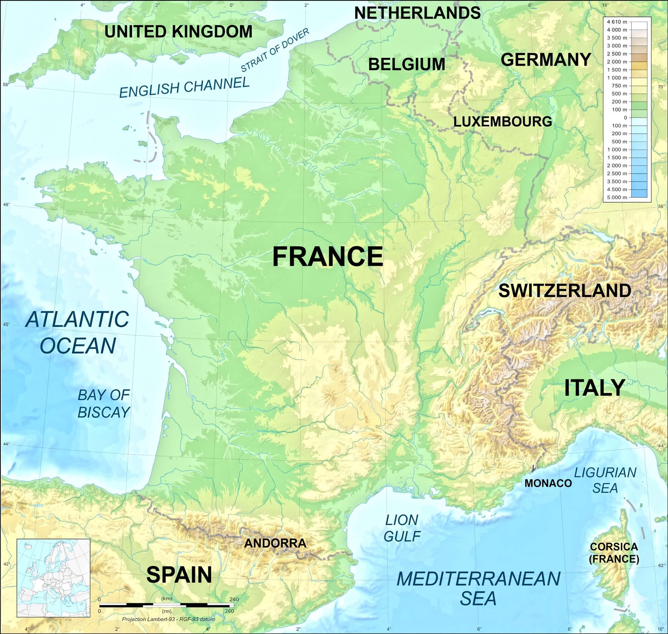
France Physical Map
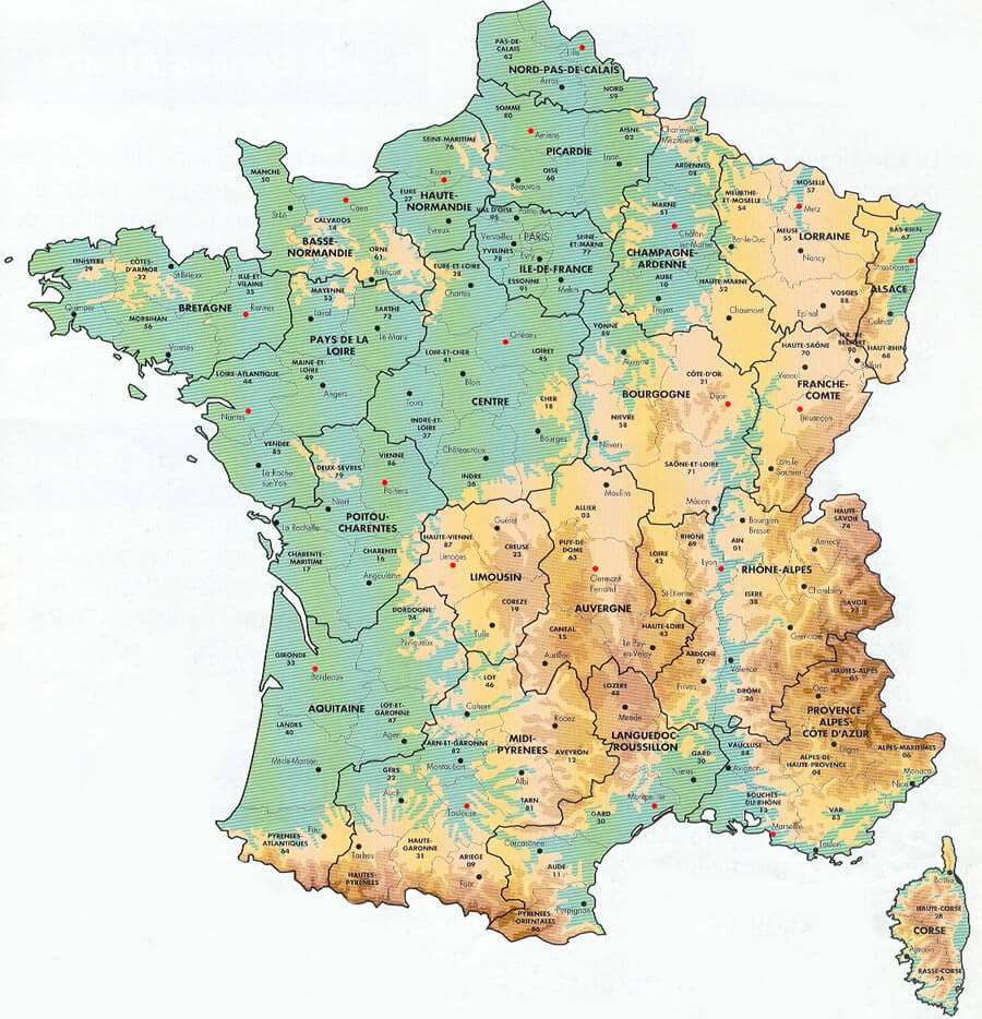
France Regions Map
France Topographic Map Mountains Rivers
France Map

France Major Cities Map
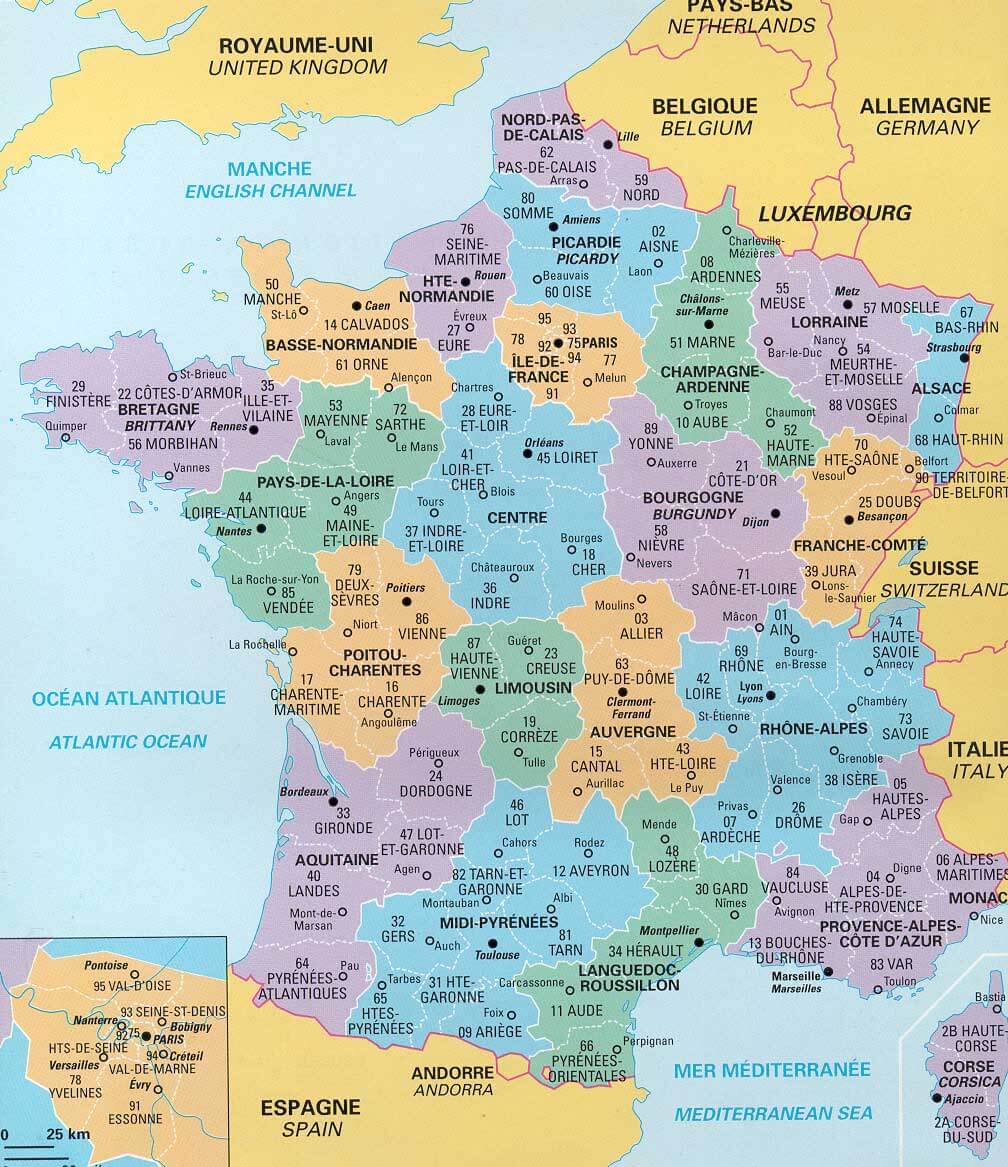
France Administrative Map
France Cantons Map With Major Cities
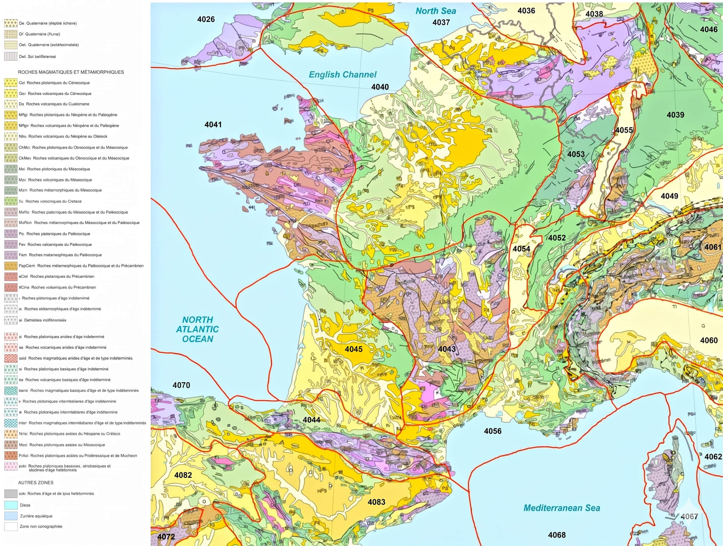
France Geologic Map
Map Of France With Rivers
Regions Of France Map

France Highways Map With Cantons
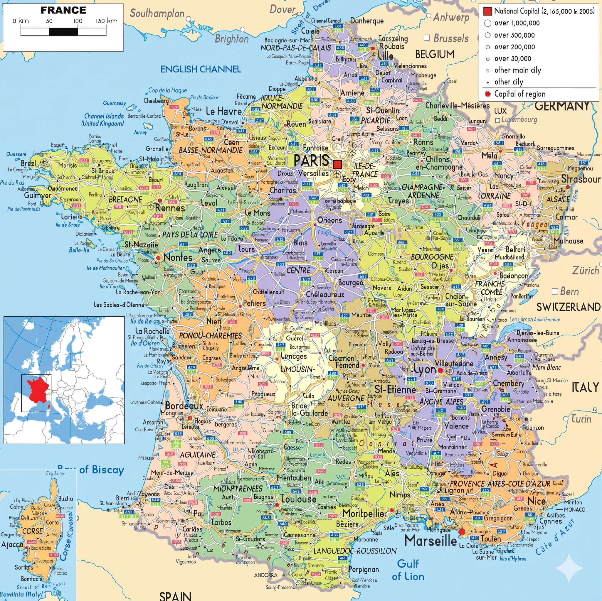
France Highways Map With Cities
Physical Map Of France Rivers And Mountains
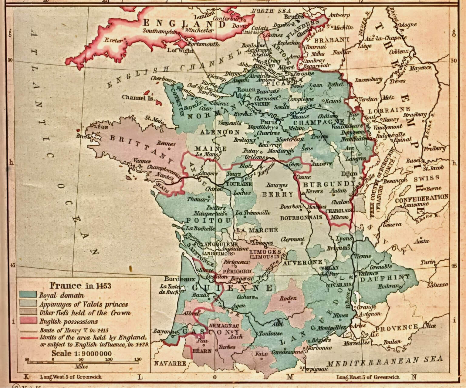
France Historical Map
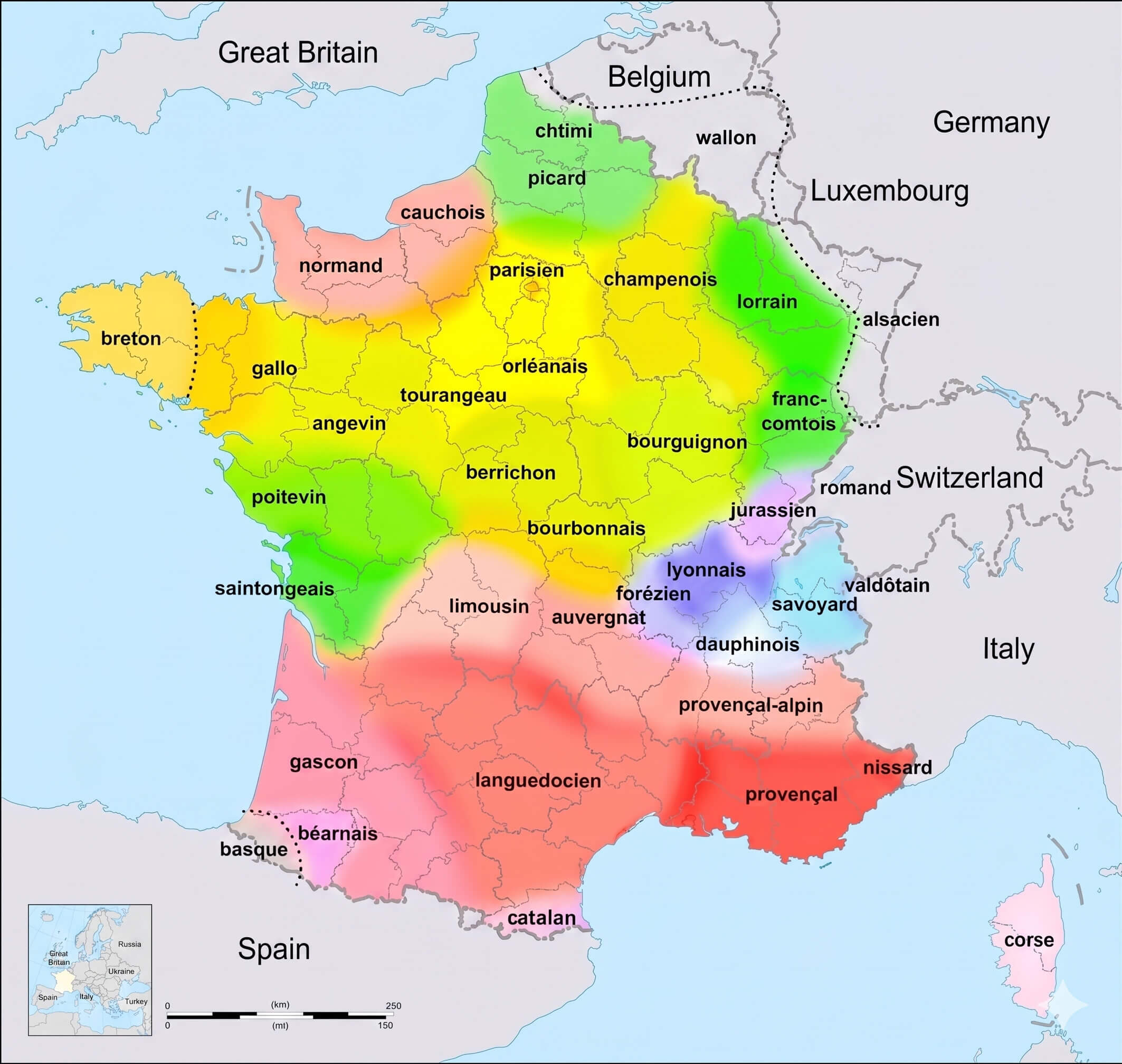
France Linguistic Map
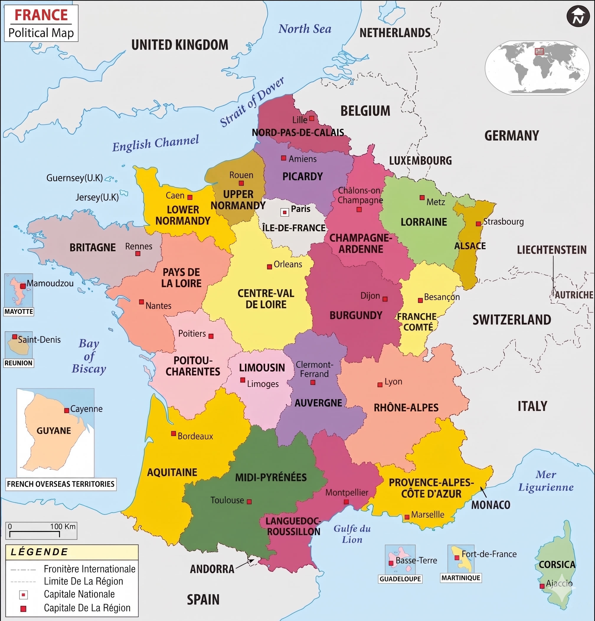
France Political Map
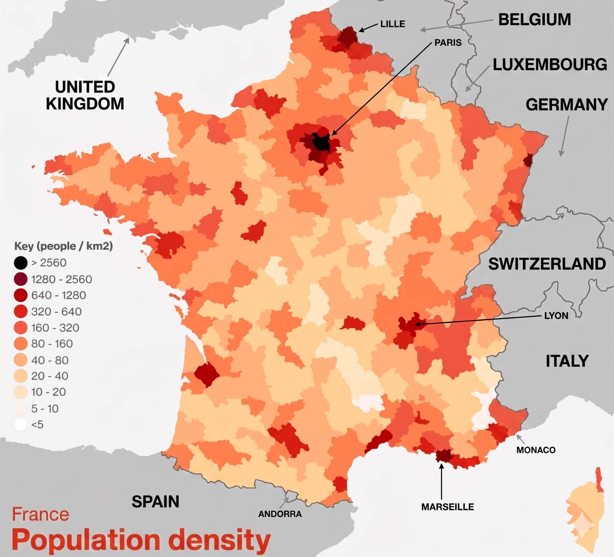
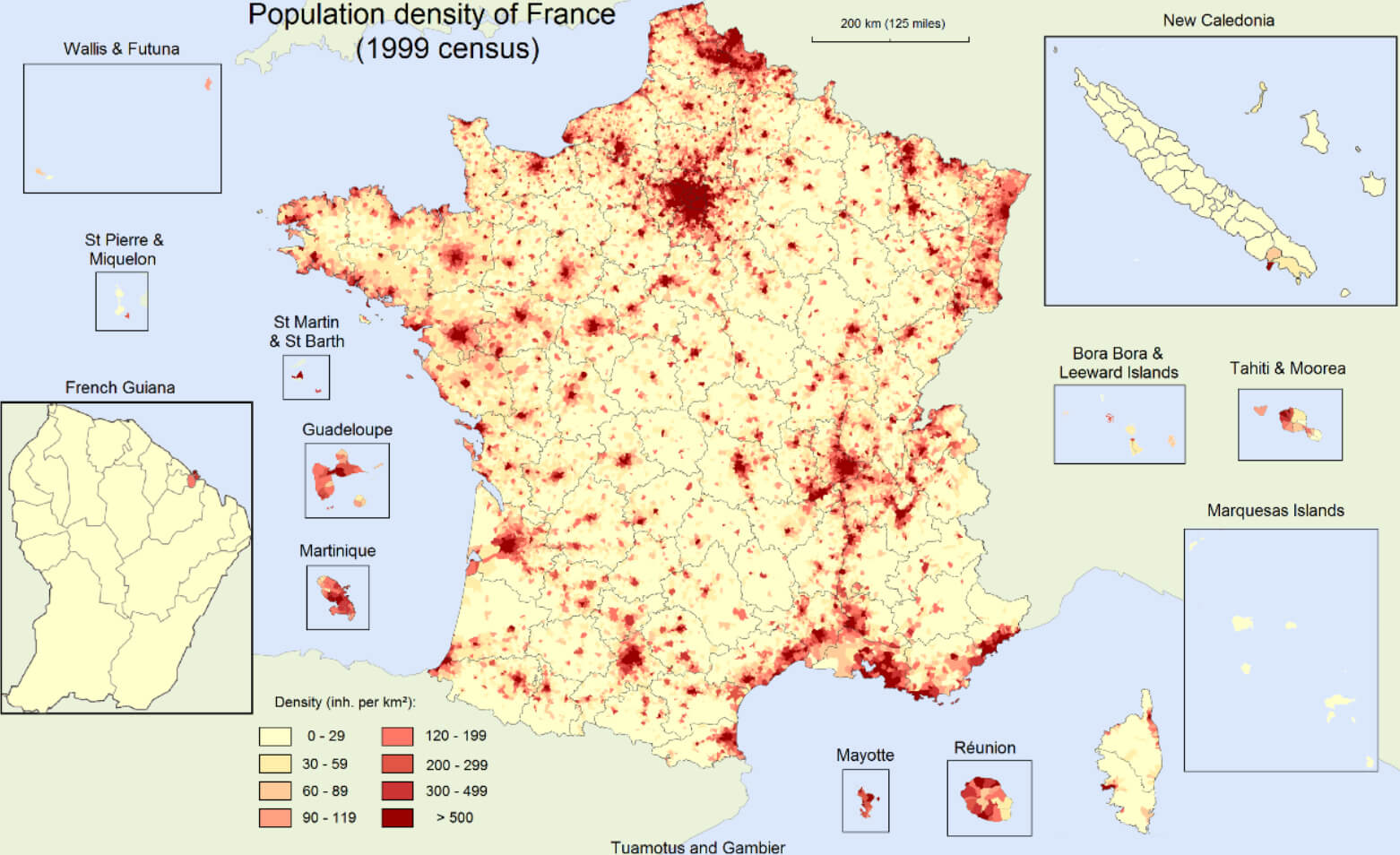
France Population Density Map
France Provinces Map

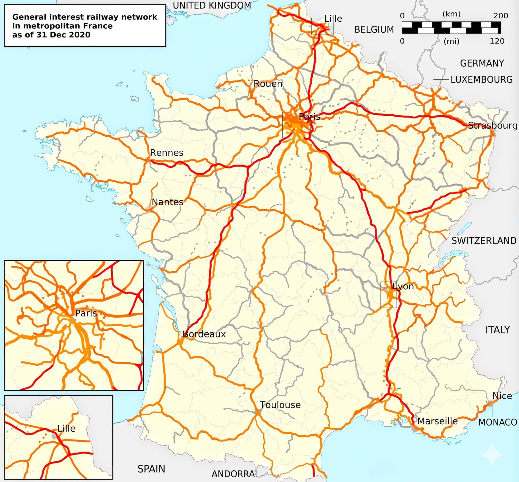
France Railway Network Map
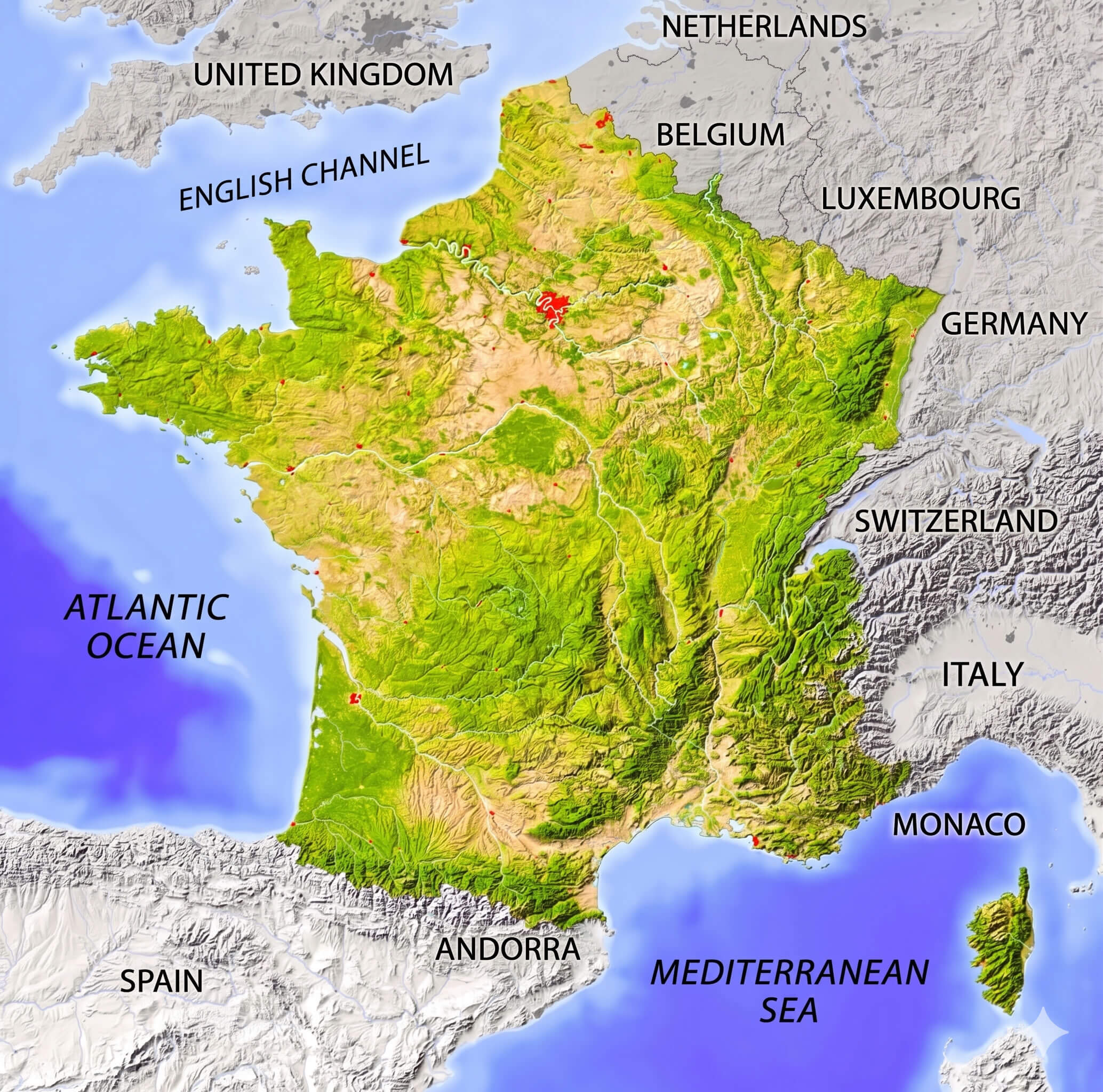
France Relief Map
France Satellite Map
France Topographic Map

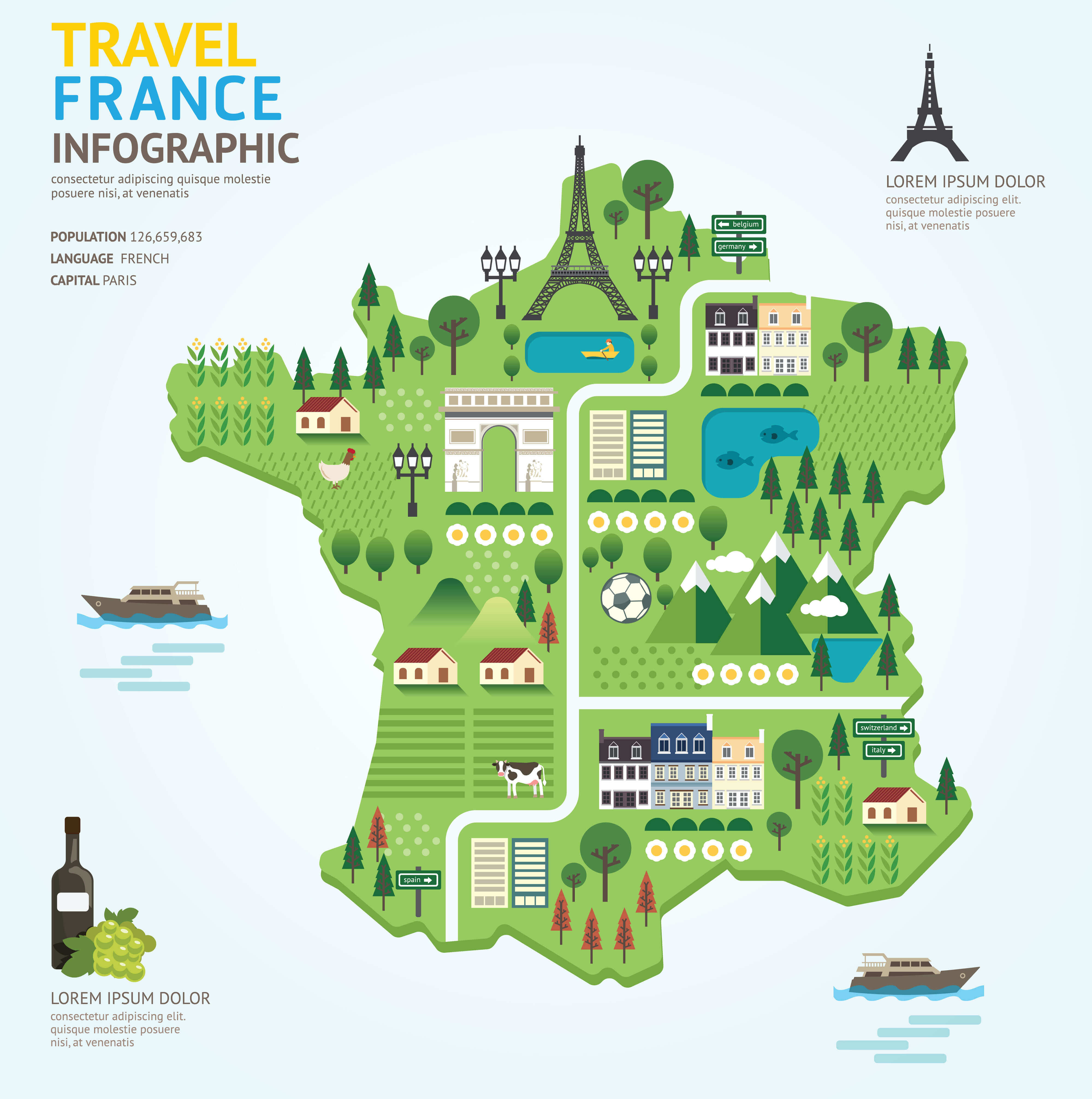
France Tourism Map
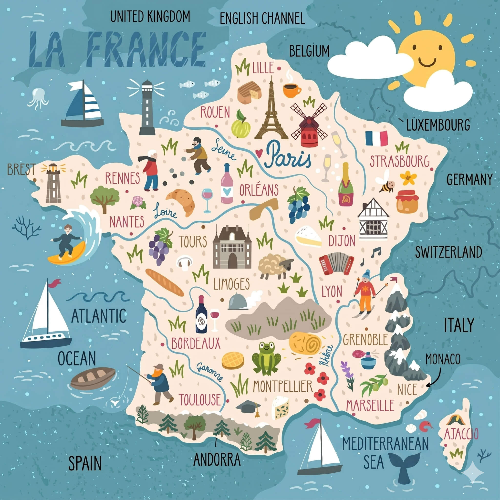
France Travel Map
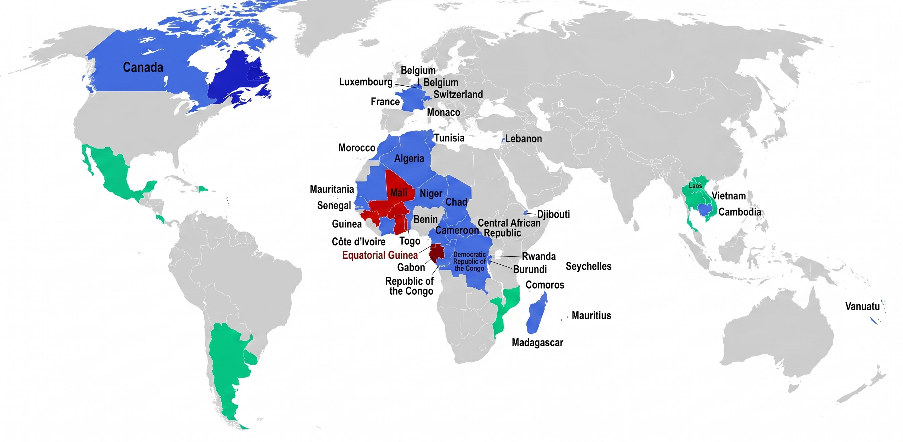
Francophone Countries Map In The World
Map Of France With Regions Labeled
Population Density Map Of France
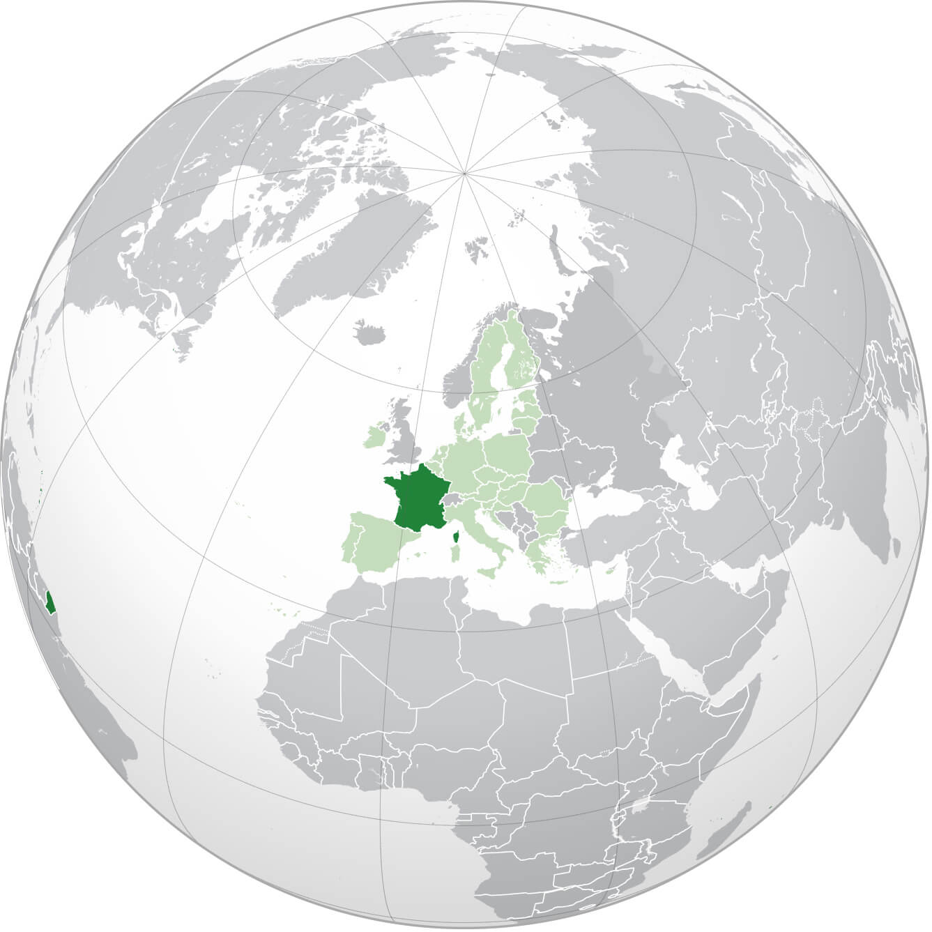
Where Is France On The World Map
Map Of France

Territories Of The French Republic In The World

Where Is France In The World

France Maps

France Map Regions

France Map

France Physical Map

France Cities Map
France Driving Distances

France Industry Map

France Map

France Political Map

France Provinces Map

France Regions Map

France Resources Map

France Travel Map

Map Of France

Map Of France

France Political Map With Cities And Rivers

Map Of France Regions
Physical Map Of France
Provinces Map Of France
Regions Map Of France

France Earth Map

Top 10 Tourist Attractions in Paris
Please subscribe on "World Guide" channnel on Youtube at youtube.com/c/WorldGuide
Nice's 10 Must-Visit Spots for Tourists
Alphabetically Cities Map of France & Population of France Cities
Paris Map - Marseille Map - Lyon Map - Toulouse Map - Nice Map - Nantes Map - Strasbourg Map - Montpellier Map - Bordeaux Map - Rennes Map - Le Havre Map - Reims Map - Lille Map - Saint Etienne Map - Toulon Map - Grenoble Map - Angers Map - Brest Map - Le Mans Map - Dijon Map - Caen Map - Rouen Map - Cholet Map - La Rochelle Map - Castres Map - Beziers Map - Perpignan Map - Amiens Map - Saint Quentin Map - Metz Map - Nancy Map - Colmar Map - Mulhouse Map - Besancon Map - Clermont Ferrand Map - Valence Map - Vienne Map - Calais Map - Antibes Map - Pau Map - Albi Map - Montauban Map - Chambery Map - Annecy Map - Annemasse Map - Cannes Map - Arles Map - Ales Map - Nimes Map - Troyes Map - Thionville Map - Versailles Map - Cergy Map - Orleans Map - Laval Map - Saint Malo Map - Tours Map - Colombes Map - Quimper Map - Asnieres sur Seine Map - Saint Nazaire Map - Blois Map - Poitiers Map - Limoges Map - Niort Map - Bressuire Map - Bourges Map - Charleville Mezieres Map - Frejus Map - Avignon Map - Aix en Provence Map -Copyright Turkey Travel Guide - 2005 - 2026. All rights reserved. Privacy Policy | Disclaimer