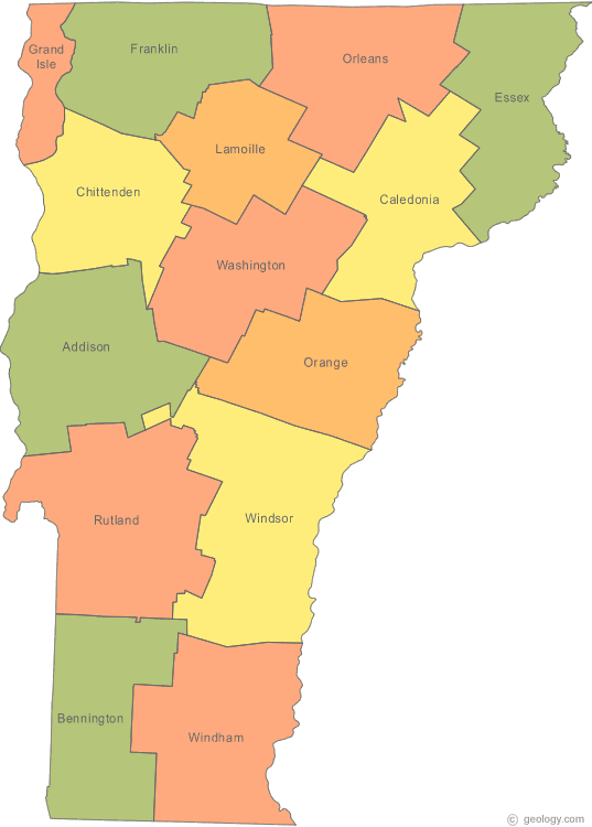
Vermont Map
N avigate Vermont Map, Vermont states map, satellite images of the Vermont, Vermont largest cities maps, political map of Vermont, driving directions and traffic maps.
All Vermont Cities Maps by Population
- Burlington Map - (42,417)
- South Burlington Map - (17,904)
- Rutland Map - (16,495)
- Essex Junction Map - (9,271)
- Bennington Map - (9,074)
- Barre Map - (9,052)
- Montpelier Map - (7,855)
- Brattleboro Map - (7,414)
- Winooski Map - (7,267)
- St. Albans Map - (6,918)
- Middlebury Map - (6,588)
- St. Johnsbury Map - (6,193)
- Newport Map - (4,589)
- Springfield Map - (3,979)
- Bellows Falls Map - (3,148)
- West Brattleboro Map - (2,740)
- Vergennes Map - (2,588)
- Swanton Map - (2,386)
- White River Junction Map - (2,286)
- Fair Haven Map - (2,269)
- Manchester Center Map - (2,120)
- Northfield Map - (2,101)
- Windsor Map - (2,066)
- Bristol Map - (2,030)
- West Rutland Map - (2,024)
- Randolph Map - (1,974)
- Morrisville Map - (1,958)
- Milton Map - (1,861)
- Waterbury Map - (1,763)
- Wilder Map - (1,690)
- Brandon Map - (1,648)
- North Bennington Map - (1,643)
- Poultney Map - (1,612)
- Castleton Map - (1,485)
- Johnson Map - (1,443)
- Richford Map - (1,361)
- Hardwick Map - (1,345)
- Enosburg Falls Map - (1,329)
- Jericho Map - (1,329)
- South Barre Map - (1,219)
- Arlington Map - (1,213)
- Lyndonville Map - (1,207)
- Williamstown Map - (1,162)
- Chester Map - (1,005)
- Woodstock Map - (900)
- Norwich Map - (878)
- Wallingford Map - (830)
- East Barre Map - (826)
- Island Pond Map - (821)
- Orleans Map - (818)
- Ludlow Map - (811)
- Bradford Map - (788)
- Graniteville Map - (784)
- Manchester Map - (749)
- Pittsford Map - (740)
- Barton Map - (737)
- Jeffersonville Map - (729)
- Richmond Map - (723)
- South Royalton Map - (694)
- South Shaftsbury Map - (683)
- Derby Line Map - (673)
- Hinesburg Map - (658)
- Quechee Map - (656)
- North Troy Map - (620)
- Derby Center Map - (597)
- Shelburne Map - (592)
- North Springfield Map - (573)
- Bethel Map - (569)
- Saxtons River Map - (565)
- Websterville Map - (550)
- Ascutney Map - (540)
- Putney Map - (523)
- Alburg Map - (497)
- Stowe Map - (495)
- Wilmington Map - (463)
- Hyde Park Map - (462)
- Proctorsville Map - (454)
- Groton Map - (437)
- East Middlebury Map - (425)
- Plainfield Map - (401)
- Wells River Map - (399)
- Wells Map - (397)
- Canaan Map - (392)
- Danville Map - (383)
- Hartland Map - (380)
- Newbury Map - (365)
- West Burke Map - (343)
- Readsboro Map - (321)
- Benson Map - (308)
- Glover Map - (303)
- North Hartland Map - (302)
- Rochester Map - (299)
- Westminster Map - (291)
- Newport Center Map - (274)
- Marshfield Map - (273)
- Concord Map - (271)
- Dorset Map - (249)
- North Westminster Map - (247)
- Troy Map - (243)
- Cambridge Map - (236)
- Cabot Map - (233)
- Greensboro Bend Map - (232)
- Lowell Map - (228)
- Jacksonville Map - (223)
- Albany Map - (193)
- Fairlee Map - (189)
- Cavendish Map - (179)
- Beecher Falls Map - (177)
- Waitsfield Map - (164)
- Irasburg Map - (163)
- Old Bennington Map - (139)
- East Burke Map - (132)
- Perkinsville Map - (130)
- Barnet Map - (129)
- Newfane Map - (118)
- Worcester Map - (112)
- Greensboro Map - (109)
- Coventry Map - (97)
- East Montpelier Map - (80)
Largest Vermont cities map
Vermont Google Map, Street Views, Maps Directions, Satellite Images
Please Not : You can find local businesses, public places, tourist attractions via map view, satellite image, hybrid view, driving directions in Vermont Map. You'll also find a varity map of Vermont such as political, administrative, transportation, demographics maps following Google map.
Submit URL to Vermont :
Click for Vermont Direction »
Click for Vermont Street View »
Largest Cities Map of Vermont and Population
Burlington Map - 42,417 South Burlington Map - 17,904 Rutland Map - 16,495 Essex Junction Map - 9,271 Bennington Map - 9,074 Barre Map - 9,052 Montpelier Map - 7,855 Brattleboro Map - 7,414 Winooski Map - 7,267 St. Albans Map - 6,918 Middlebury Map - 6,588 St. Johnsbury Map - 6,193 Newport Map - 4,589 Springfield Map - 3,979 Bellows Falls Map - 3,148Copyright Turkey Travel Guide - 2006 - 2023. All rights reserved. Privacy Policy | Disclaimer